Cannon Mountain - 8638' - NE Ridge Class 3
Enchantment Peaks HP - 8520' - Via Prussik Pass Class 3
Mount Stuart - 9415' - Cascadian Couloir Class 3
July 2011
My Cannon Mountain NE Ridge route page on SP
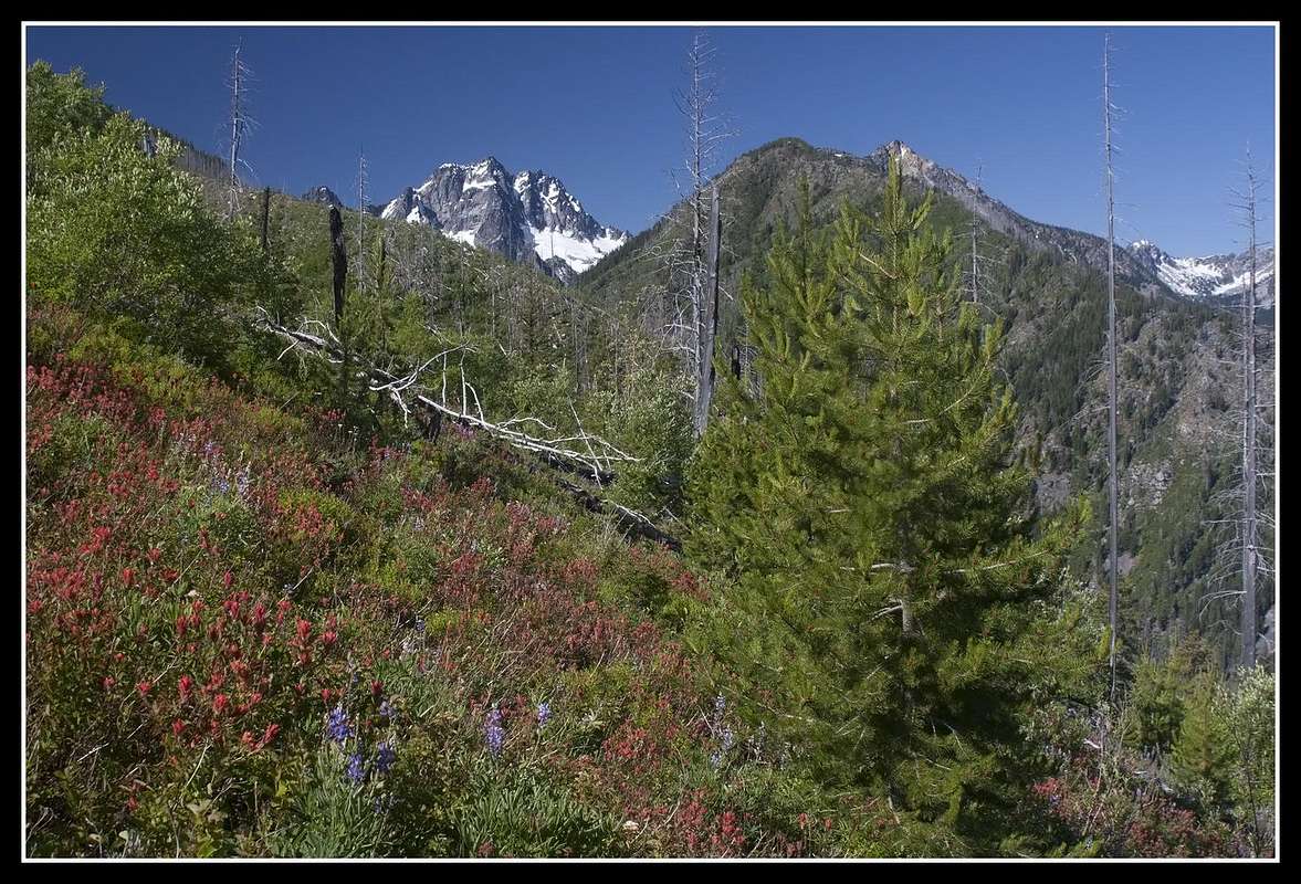
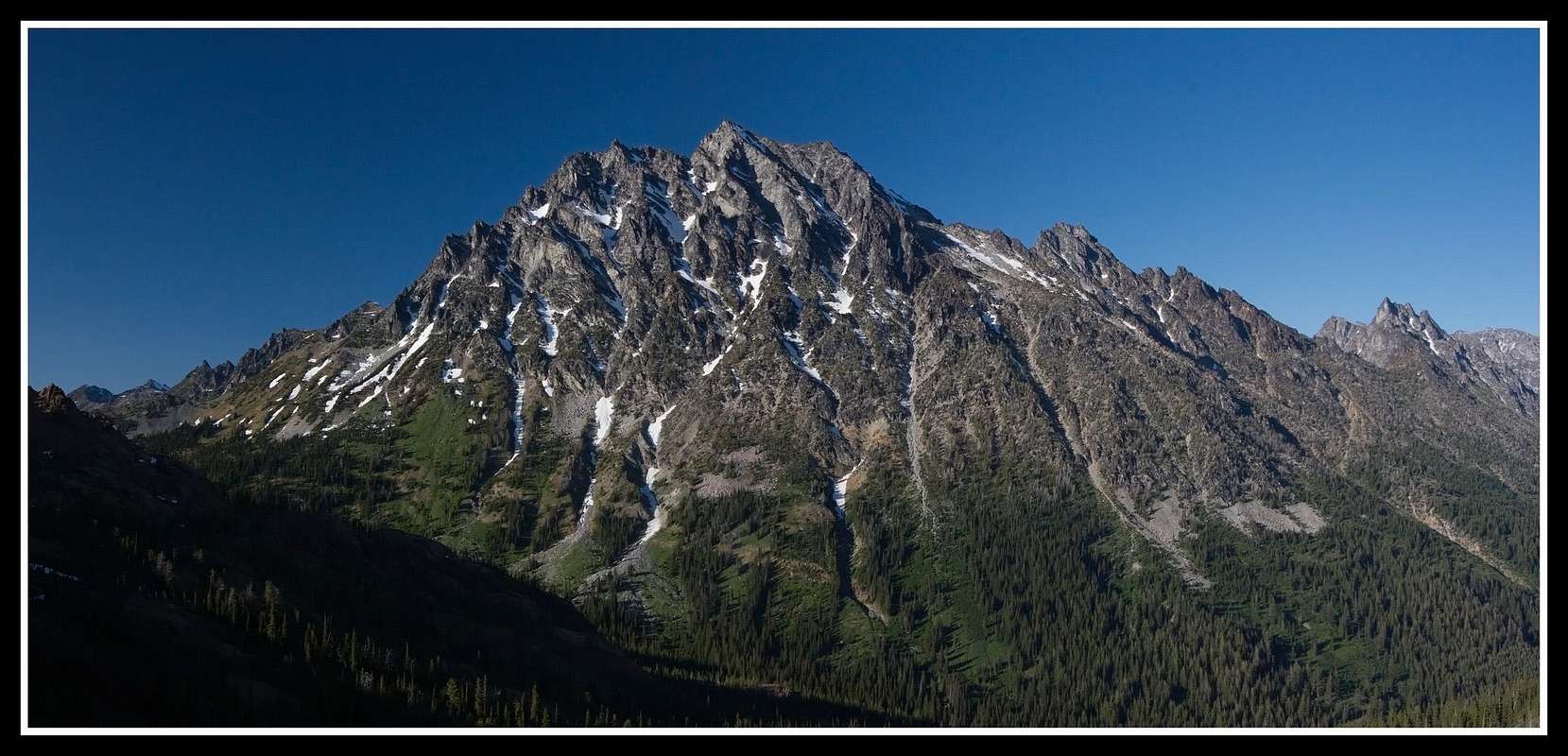
Mount Stuart from the west slopes of Cannon Mountain

Coney Lake and the NE ridge of Cannon Mountain
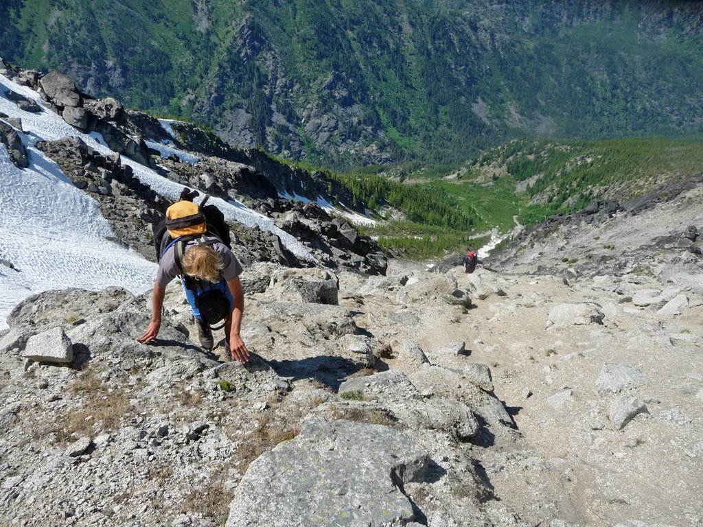
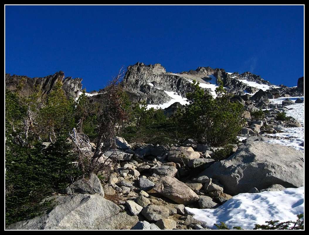
Myself scrambling up to the NE ridge
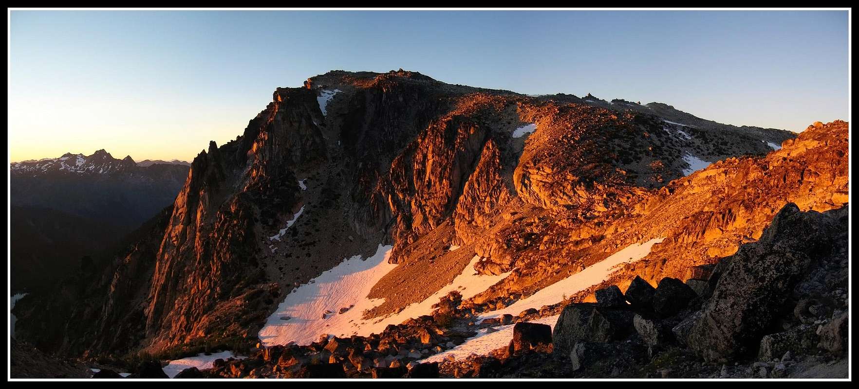
Sunset from Aasgard Pass
|
Cannon Mountain and Enchantment PeakThis trip I did with Josh and his brother. I went to Lynnwood to pick them up and we drove out to Leavenworth. We decided to climb Cannon Mountain since I had been looking at it quite a bit recently. We started at the Mountaineers Creek trailhead which is the same for Colchuck Lake. Instead of going up the trail towards Colchuck, we started up an old road heading northeast which is blocked off by a couple big rocks. It was obvious it hadn't been driven in a long time it was so overgrown. It started out very gentle though but we soon got to a huge washout where a very active avalanche chute in winter has gouged a big gully into the slope. We decided to simply turn right and head straight up the slope instead of waste time trying to traverse across the big washout So up we went through open burnout areas, through a maze of downed trees and at times weaving up and around some cliffs. We mainly headed due east straight up to the NE ridge of Cannon Mountain. Once we finally crested the NE ridge we saw Coney Lake for the first time and saw the rest of the route to Cannon Mountain. We noticed there were some spires further up the ridge we would have to traverse to the right (west) side to avoid. We scrambled on the ridge a ways with Coney Lake below us to the left and finally decided to bear off the crest to the right and began traversing below some towers on a series of ledges. As we continued the terrain became more difficult and more exposed so we had to take it slow. We crossed maybe three ribs and gullies without knowing if the route would go each time but my hunch told me to just keep traversing. I remember a brief route description I had read that said to just keep traversing. Finally we reach a large open gully after traversing for hours. We ascended this 800 foot gully which was filled with loose rocks so we had to ascend side by side. Once we hit the top of the gully, we were a short ways away and the last hundred feet was over easy talus to the summit. The summit of Cannon was interesting since there was a steep 10 foot friction slab you had to climb up to reach the true summit where only one person could fit. Views were spectacular.
From here we descended over the other side towards Prussik Pass since we decided to hike through the upper Enchantments and down Aasgard Pass back to the car. We made it easily over the Druid Plateau which is a strange flat area just below the summit where some people camp on. We continued down to a small tarn above Shield Lake and we made a traverse around to Prussik Pass. We noticed a couple climbers on the classic Prussik Peak climb. We dropped our stuff here and we all made a quick ascent of Enchantment Peak as the afternoon waned. It was an easy walk up talus and snow until the last 15 feet which was a fun little class 4 pillar to climb up with a flat top just big enough for a couple people to fit on. By now it was evening and the lighting made for beautiful views of the Temple, McClellan Peak and all the Enchantments. Looking back to Cannon Mountain was also very striking. We quickly made our way down but ran into a family of mountain goats that Josh insisted we take pictures of. Finally we were hiking back up through the upper Enchantments and we passed by all the lakes and tarns and saw quite a bit of people camping for the night. We needed to get all the way back to the trailhead! We reached the top of Aasgard Pass where we were treated with a beautiful glowing sunset with Cashmere across the valley. By now we were all getting very tired and about halfway down Aasgard Pass it got completely dark on us. We had to make the rest of the tedious descent in the dark and to add to the trouble we went too far to the left going down and missed the trail. After what felt like forever we reached Colchuck Lake and we took a much needed break. I was starving and ate anything I touched. We then walked around the lake which got very annoying since we had to go up and down a bunch of times. Once we reached the north end of the lake it was all down hill but an additional 4 miles! As we hiked down the trail both Josh and I fell asleep as we hiked. I was so tired I couldn't keep my eyes open and I had to sit a couple times ti simply rest a little. When we finally reached the car we simply put the sleeping bags on the ground and slept under the stars by the car. Later, I found the mileage of our loop to be about 14 miles. |
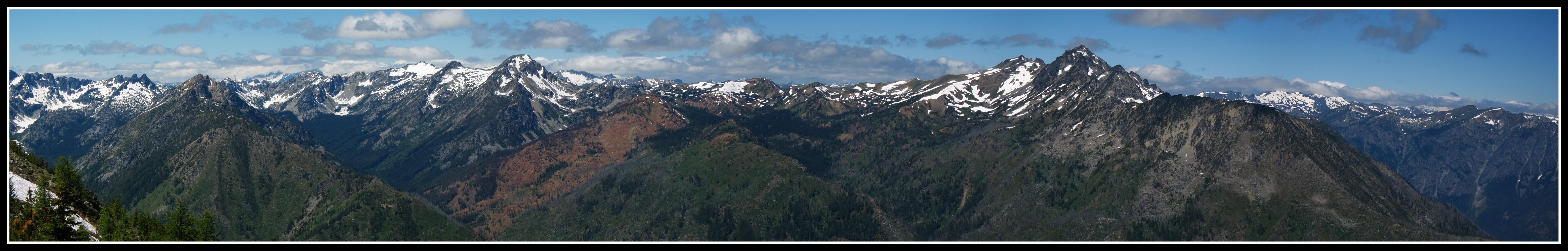
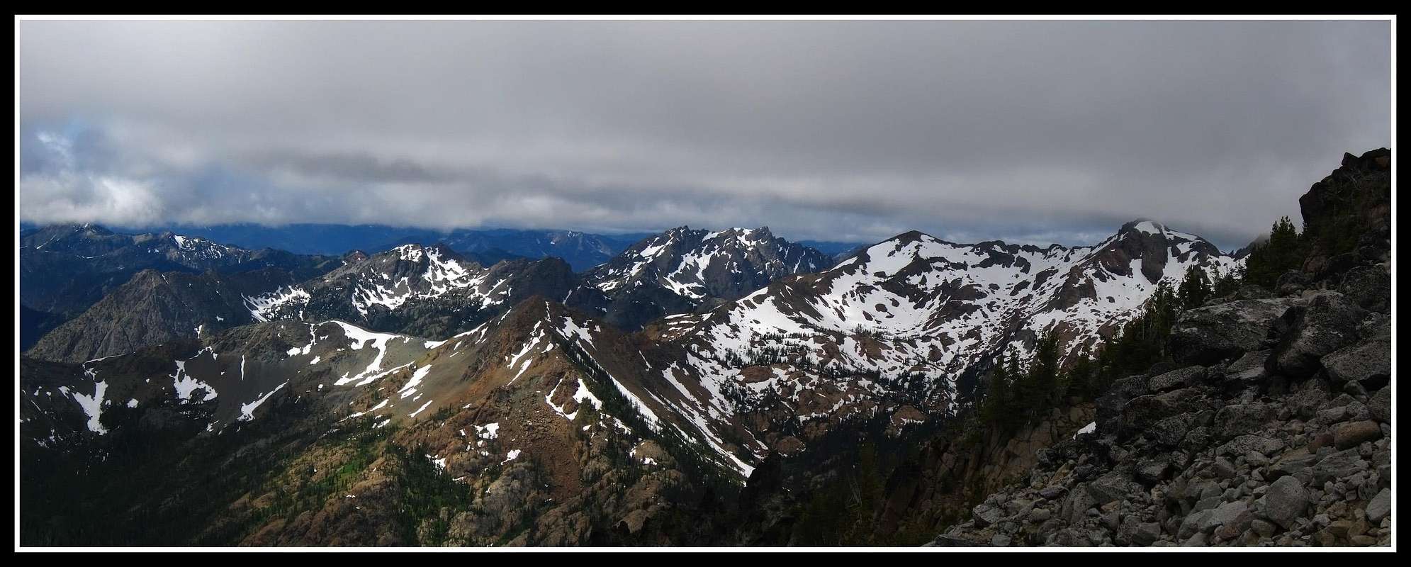
Panorama from the slopes of Cannon Mountain (Cashmere on the right)
Mount Stuart from Longs Pass
Hiking up the Cascadian Couloir
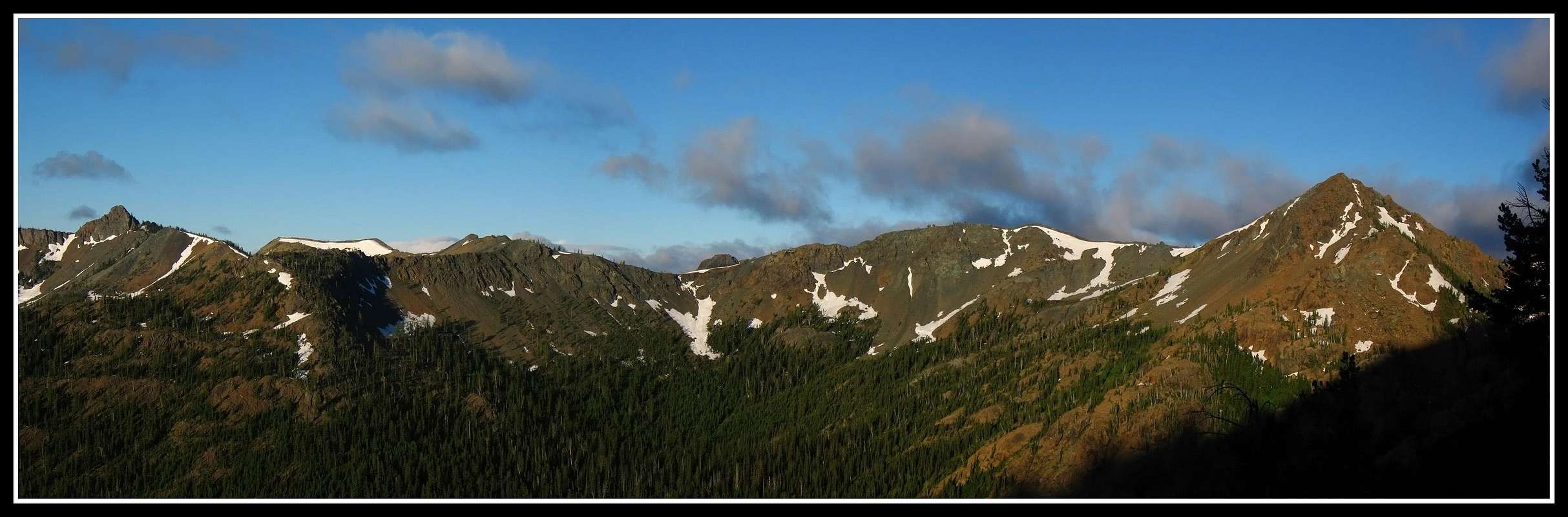
The Teanaway peaks from the couloir
|
Mount Stuart Cascadian CouloirThe next day we had planned to drive over to the Teanaway trailhead and climb the Cascadian Couloir on Mount Stuart with another friend who was going to meet us there but we were so exhausted I left him a message on his cell phone early that morning and we just slept in. It felt amazing to sleep in late after that long day. Just before noon we packed up again and drove to the Teanaway trailhead where we saw a lot of cars. We decided to hang out for the day and climb Stuart the next day. We then had the idea to start the hike in that evening heading over Longs Pass and bivy near Ingalls Creek. So after messing around near the trailhead most of the day we packed our bags real light and began hiking up to Longs Pass. We were feeling good with all the rest and made it to the pass very quickly. On the way we saw our buddy coming down after his successful Stuart climb who just went on without us that day. We told him about our insane Cannon and Enchantment Peak adventure and he was very understanding. He continued back to the trailhead and we were off to the pass. The evening lighting on Mount Stuart was beautiful from the pass and after a half hour at the pass we ran down the boot path to Ingalls Creek and located the start of the Cascadian route just before it got dark. We set up the sleeping bags on the ground in a nice forest, ate dinner and went to sleep. I was thinking about the 5000 foot ascent much of the night.
Upon waking the next morning, Josh's brother decided to sit this one out so the two of us started up the steep boot path through the grass and bushes towards the Cascadian Couloir. At first the path was easy to follow but once we reached the couloir it was a maze of loose rocks and small cliff bands....a classic Cascade dumpster-dive! We continued up the loose gully and watched as our views continued to get better. About halfway up the couloir we took a break to admire the Teanaway peaks. Luckily there was no one above us that morning. We soon reached snow and since it was firm we ascended there with our crampons on. This was much better than the loose rock and we managed to stay on snow the rest of the way up to the false summit. Only the last couple hundred feet were somewhat steep. Once on the false summit we eyed the class 3 traverse to the true summit. We cut to the left side of the jagged ridge and began traversing. The crux was an 8 foot drop with a big cliff off to the left. We carefully lowered ourselves down to the ledge below and the rest of the traverse was pretty simple. At times we were able to peer over the north face 2000 feet down to the glaciers below. The final summit slab was a friction climb to a sharp point but this wasn't all that exposed. The morning was very nice but just as we reached the summit we noticed some fog coming in from the west so we only spent about 10 minutes before heading down. We managed three great glissades down the now softened snow and apart from a small detour where Josh started to descend the wrong gully, the descent down to Ingalls Creek was almost uneventful. About 100 feet above our bivy spot I slipped on some damp grass and landed on my back. I unfortunately still had my ice axe in hand and the pick gashed open my finger as I fell. I was shocked it wasn't bleeding. Luckily it was a portion of the finger with much less nerves and blood vessels so it didn't hurt either. I washed it out in the creek very well trying to get all the dirt that had wedged in there and managed to get some tape over it. The rest of our hike out was uneventful. Getting back up to Longs Pass hurt though. The hike back down from the pass to the car also hurt my knees quite a bit but once back at the car I was able to relax. Unfortunately I had to drive Josh and his brother back to Lynnwood, then drive back to Renton! Feel free to see the rest of the photos from this trip below. There are quite a bit of them. |
Looking back to Longs Pass in the morning
Google Earth Map of Cannon Loop
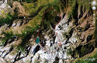
GE Image showing route