Iron Cap Mountain - 6351' - West ridge class 3
Mount Hinman - 7497' - west ridge class 2
Mount Daniel - 7959' - Lynch Glacier class 3
september 2021
Trip Stats
38 miles on foot
16,000 feet elevation gain
11.3 miles on bike
The map below shows the route we took (note the route line is approximate...not a tracked gpx).
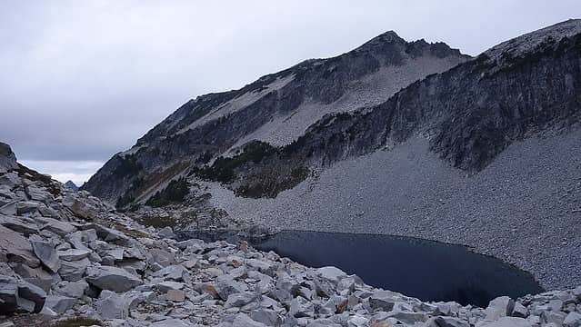
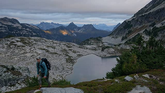
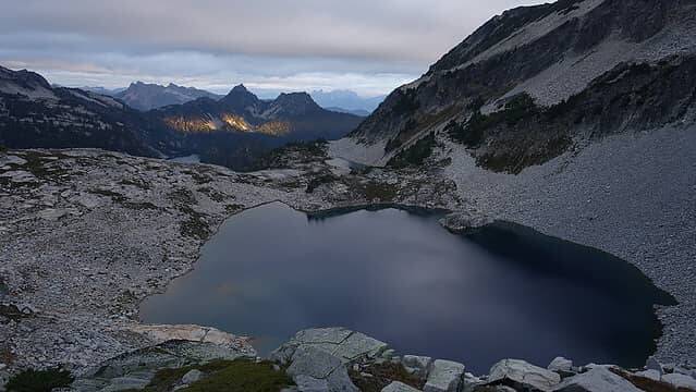
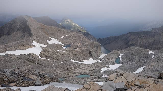
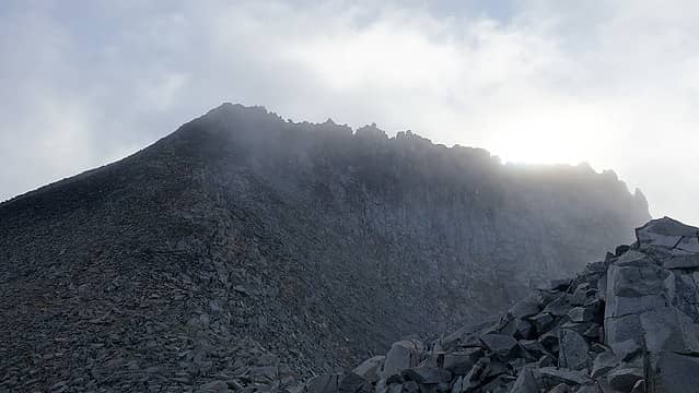
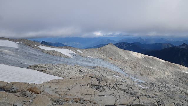
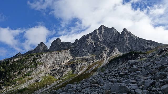
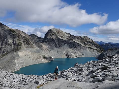
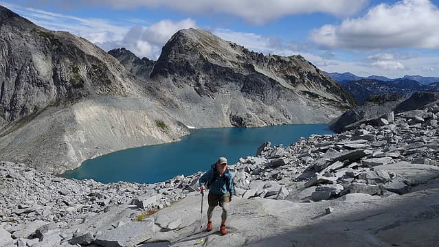
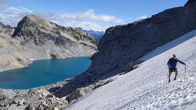
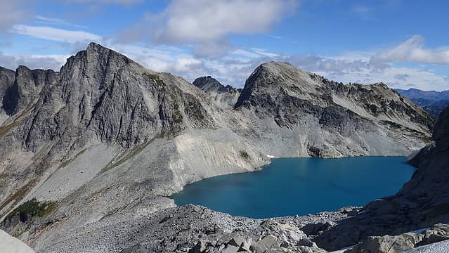
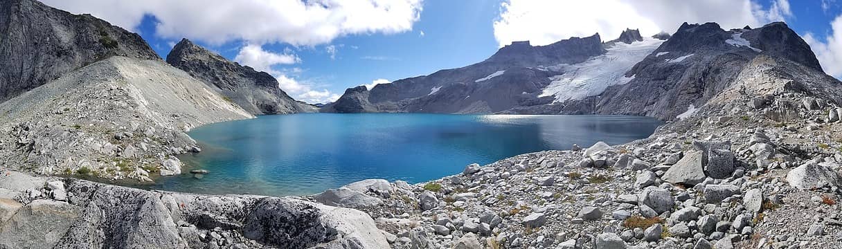
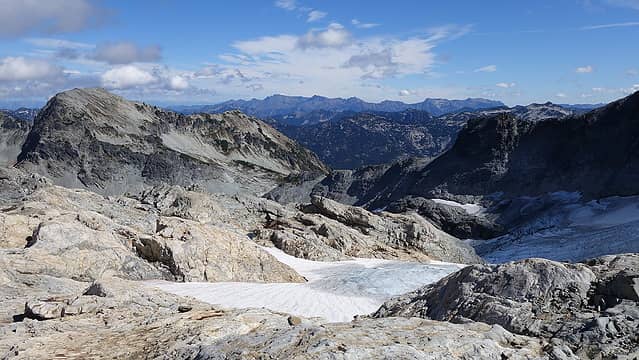
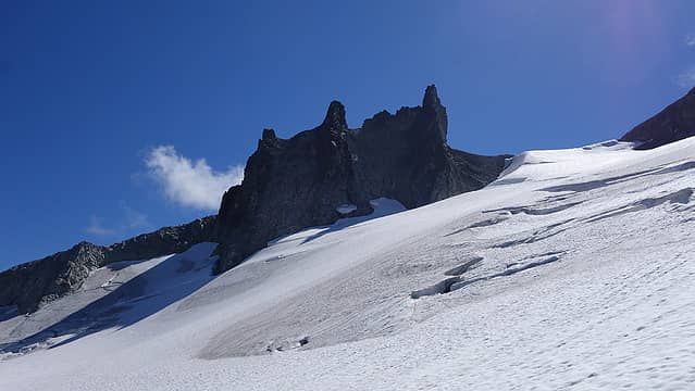
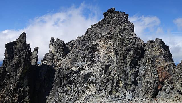
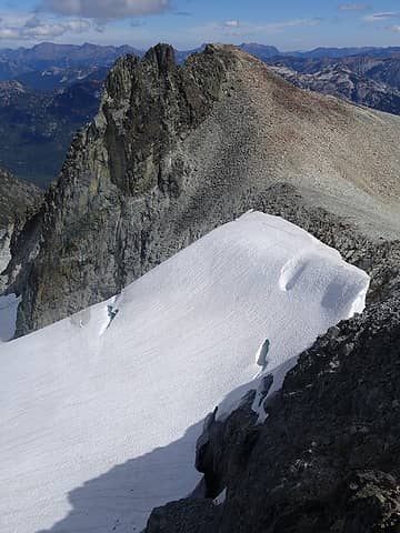
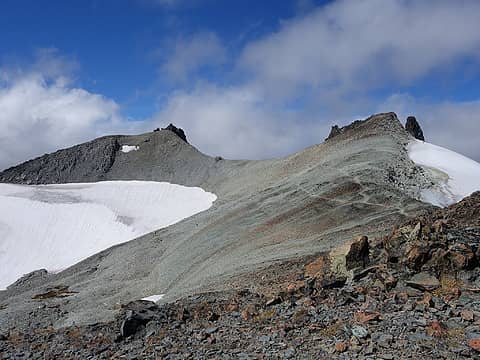
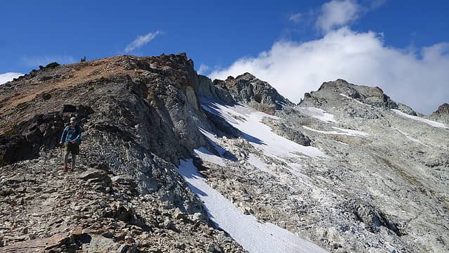
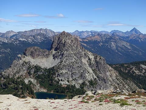
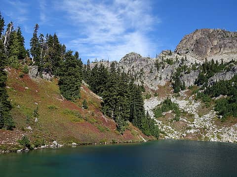
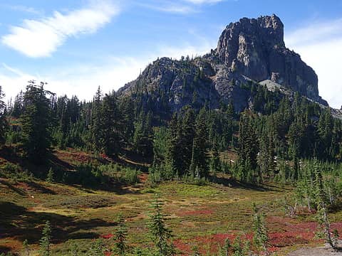
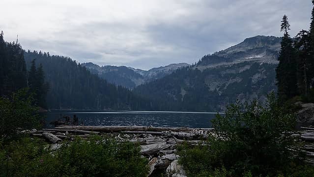
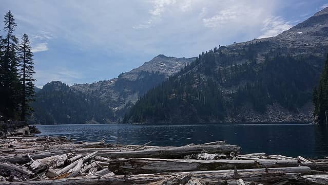
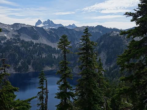
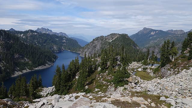
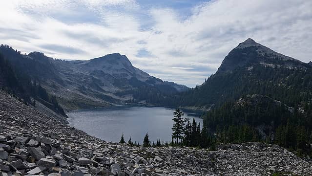
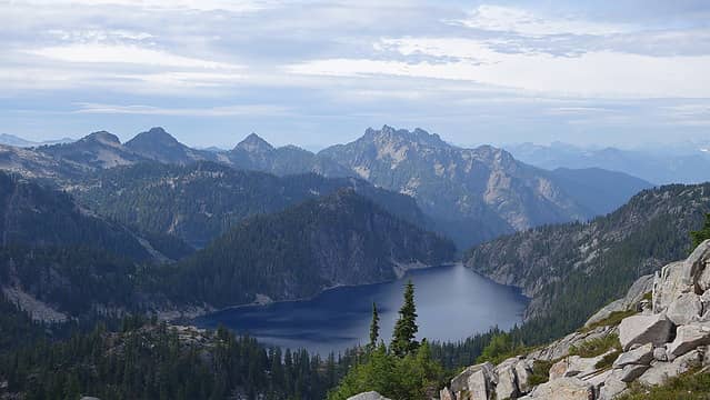
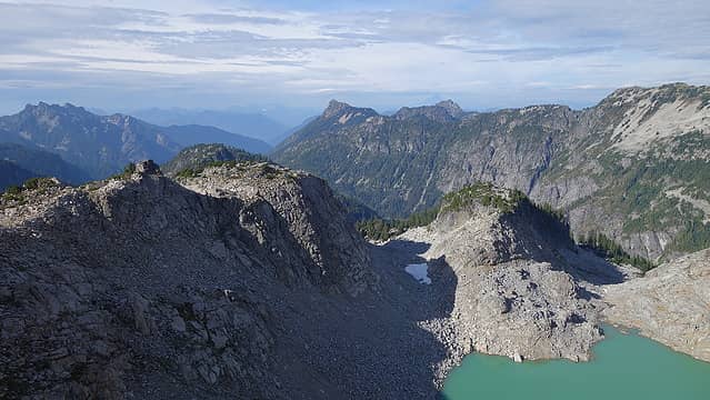
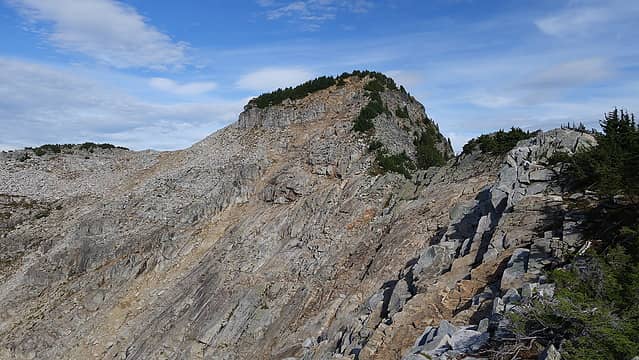
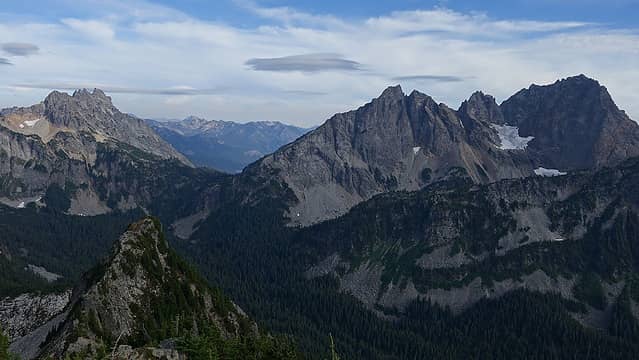
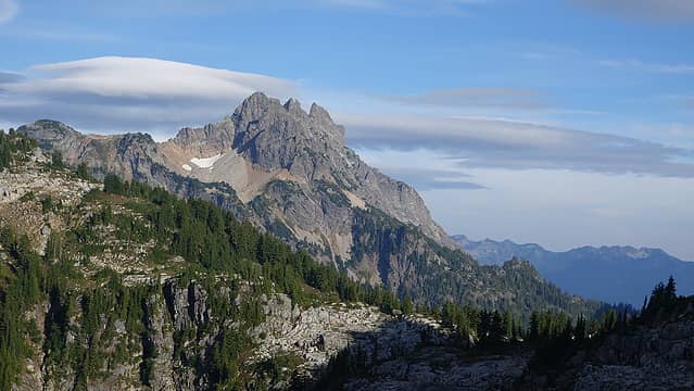
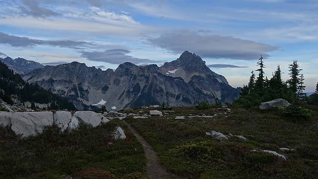
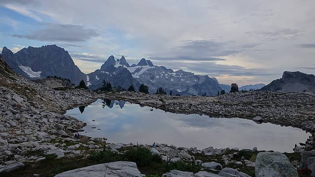
Over the Labor Day holiday weekend Austin had contacted me about a route of his that he cooked up that combines both the Alpine Lakes High Route and part of the Alpine Lakes Crest Traverse for a long but doable two day trip that would include three peaks (Iron Cap, Hinman and Daniel). After three long days working on the house I wasn't too keen on starting insanely early on Saturday so Austin picked me up at 7am and we were off to the West Fork Foss River trailhead off Highway 2. I brought a bike which we stashed up at the Tonga Ridge Trailhead, then drove back down to Foss Lakes TH and by 10am we started walking up the popular trail towards Copper Lake. We quickly made it to Copper, then past Little Heart and to Big Heart Lake in a few hours and stopped there for a quick lunch break with the rest of the Labor Day hiker masses. We then continued up the unofficial trail that heads up the ridge separating Big Heart and Angeline Lake. This trail seemed to have some extra ups and downs, but the views down to both lakes were stunning. We make it to Chetwoot Lake where we refilled some water and ran into a bunch of additional campers as we began the ascent up the talus to the west ridge of Iron Cap Mountain. This ridge was a fun scramble with excellent views down to Iron Cap Lake below and the Middle Fork Snoqualmie River Valley on the south side.
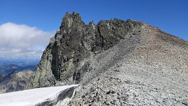
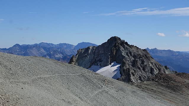
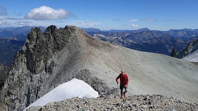
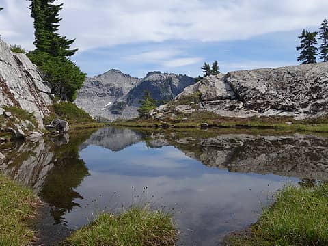
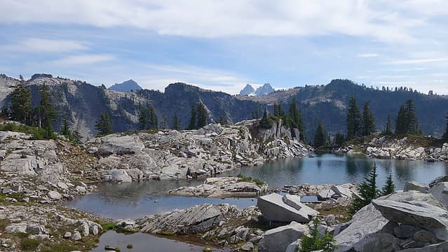
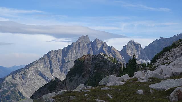
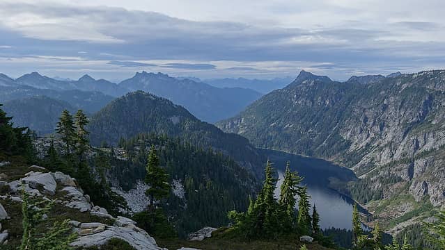
We crossed paths with a solo guy originally from Venezuela on the ridge where the crux notch is located. A 3rd class downclimb was required to get down to the notch, after which we followed a wide ramp veering left traversing below the summit and meeting up with the broad north ridge. Here we dropped our packs and quickly walked the final 150 feet to the summit. Far off in the distance to the east we could see Mount Hinman, and we realized we would not be making it to Pea Soup Lake before dark, so we changed our destination goal to La Bohn Lakes. Some lenticular clouds were visible around but they didn't worry us too much. We descended the north ridge a few hundred feet, then cut sharply back right and schwacked throguh some trees to continue in a SE direction below the cliffs on the east face of Iron Cap. A wide talus strewn ramp offers easy passage to the 5100 foot level in the basin between Iron Cap and Tank Lakes. This traverse ended up being the least enjoyable part of the day due to scraggly trees often getting in the way, and us probably being off the established path which was impossible to really follow the whole way. We continued up the next hill to Tank Lakes arriving there a bit before 7pm. The place was littered with tents with a couple dozen people there, so we didn't stay long and continued down towards the Necklace Valley on the main path up to Tank Lakes. We rounded the bottom of La Bohn Peak's north face at 5100 feet and reascended 900 feet to the uppermost La Bohn Lake where we arrived at 8:15 just in time to not need headlights. We set up Austin's awesome pyramid trekking pole tent, cooked dinner and quickly went to bed as it was a long 10 hours where we covered 14 miles and about 8000 feet of gain.
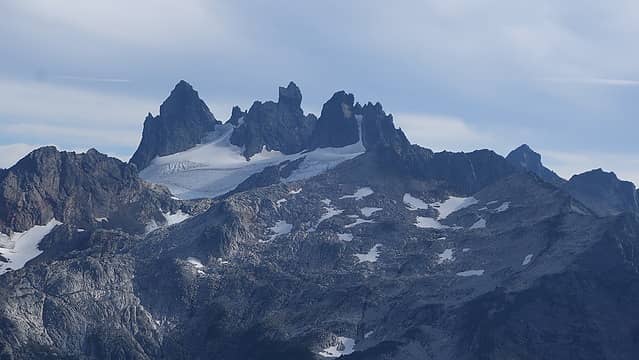
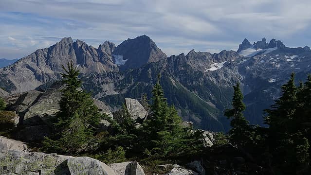
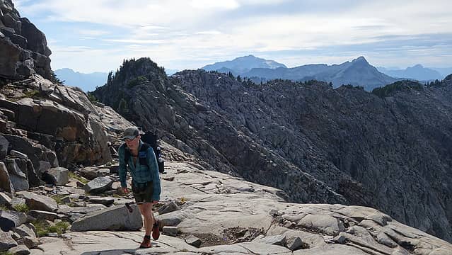
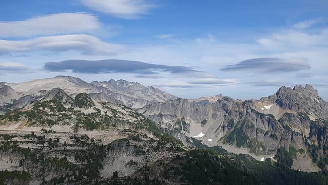
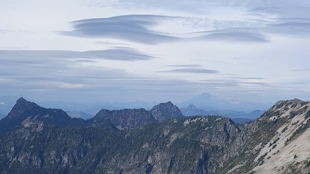
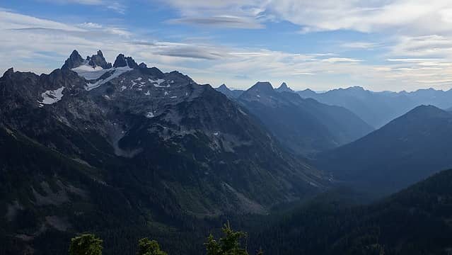
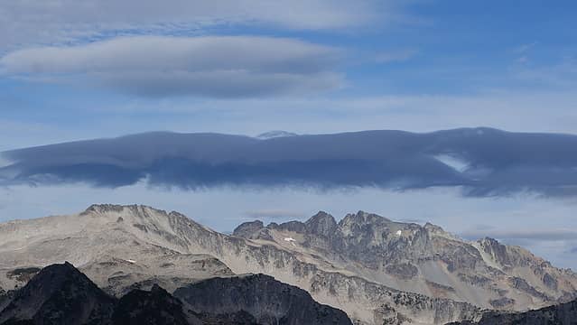
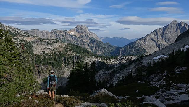
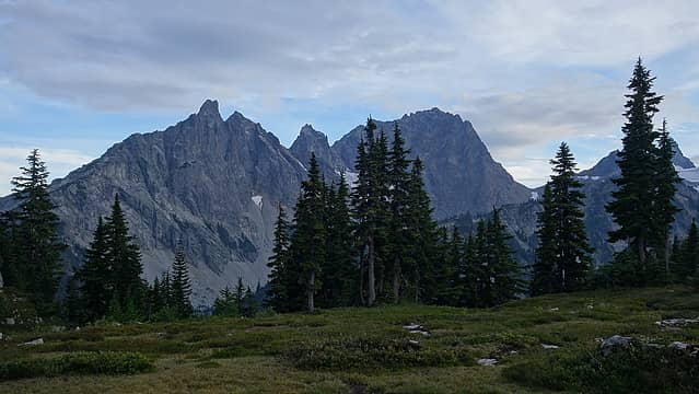
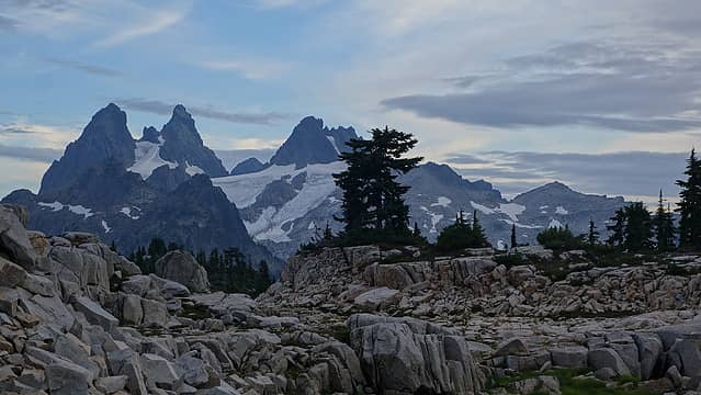
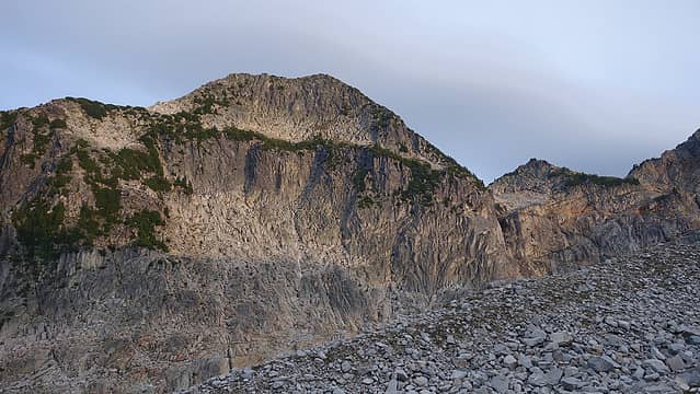
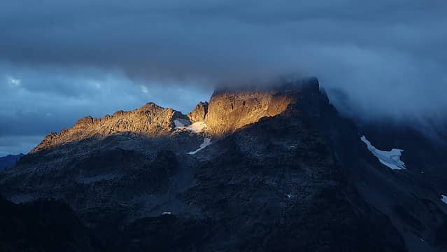
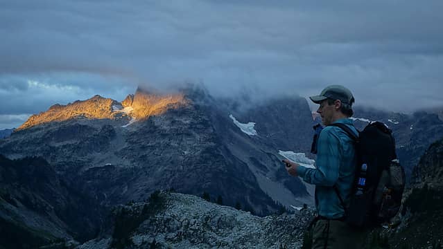
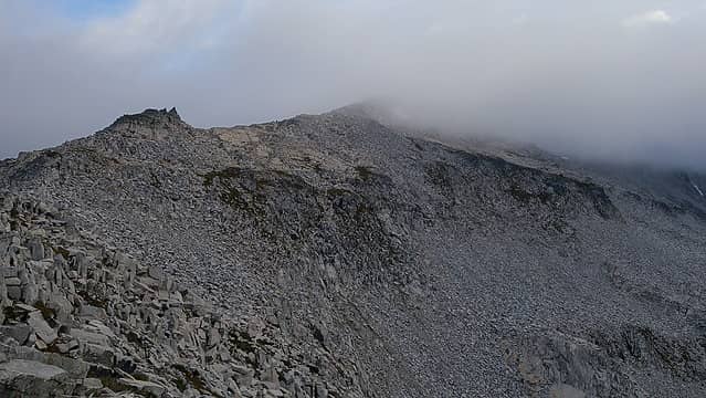
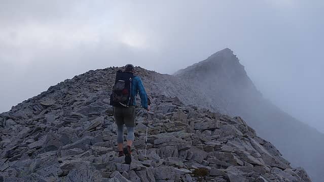
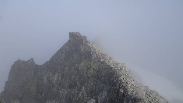
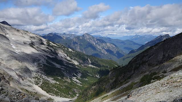
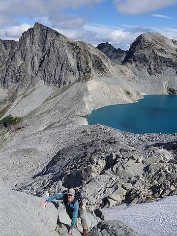
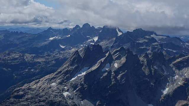
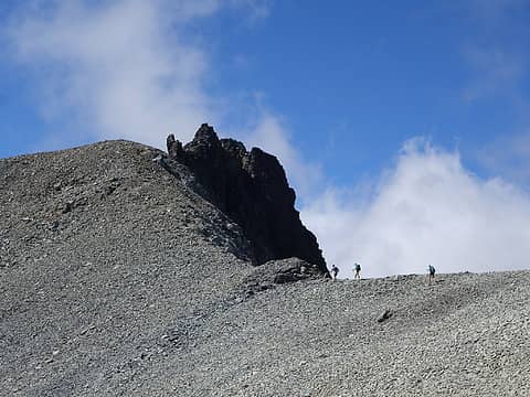
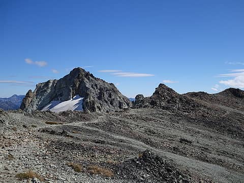
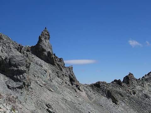
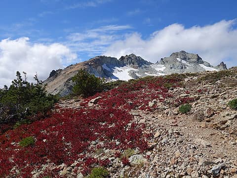
The following morning we were up early and moving by 6:30am. We quickly wasted no time making our way up the west ridge of Mount Hinman and followed the ridge to the summit towers as the clouds would envelope us, then clear over and over again. As we neared the summit towers, we passed just below most of then on the north side. The fog made it difficult to determine exactly which peak was the highest one, and I ended up topping out on three peaks, one of the steep towers, the west peak marked as Point 7492 on the USGS quad, and the east peak. I thought the west peak was the highest. We were able to see Pea Soup Lake off to the east when the clouds cleared and didn't think it looked too far away. My answer to the question "why can't we just traverse the ridge directly to Daniel" were also answered upon gazing at the chosspile of cliffs that gaurded Mount Daniel from the west.
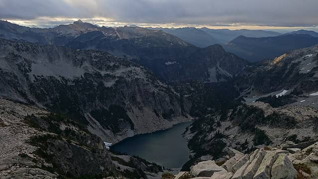
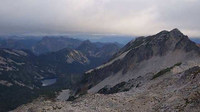
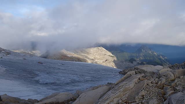
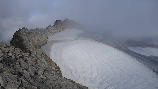
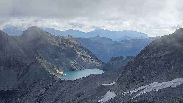
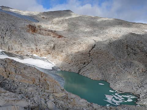
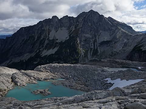
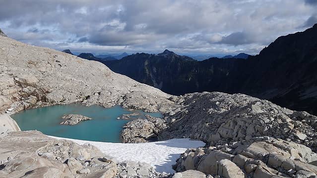
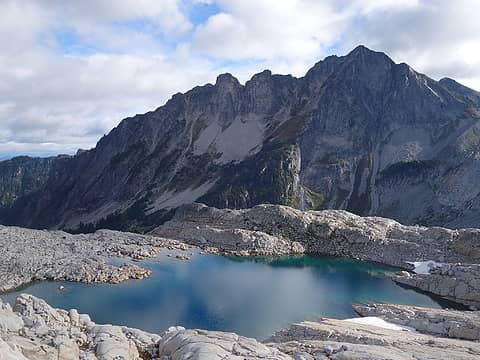
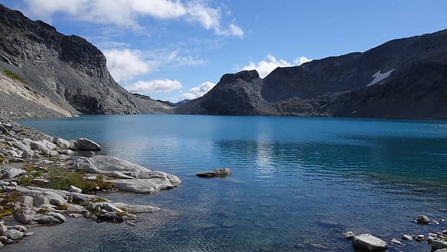
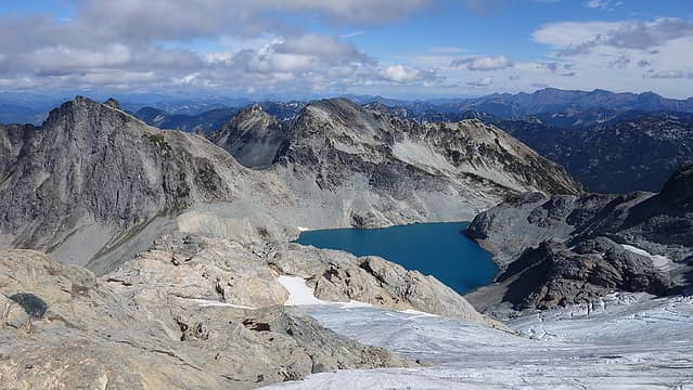
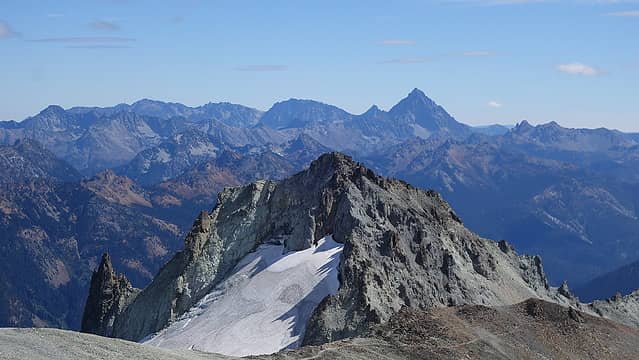
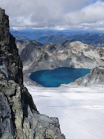
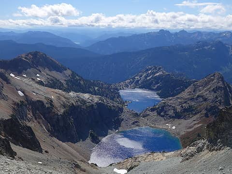
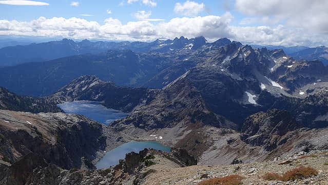
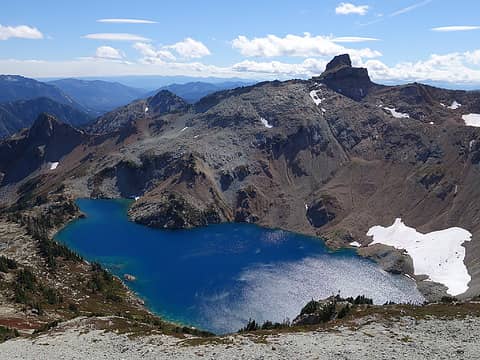
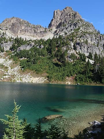
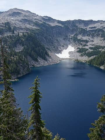
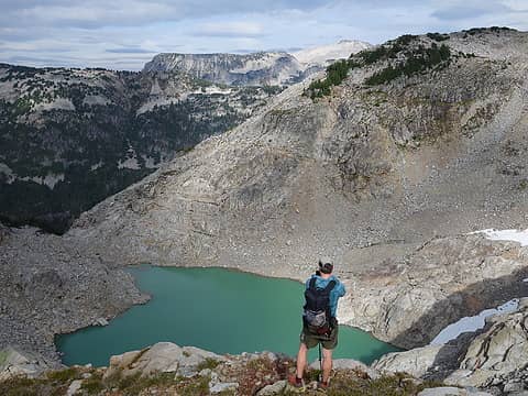
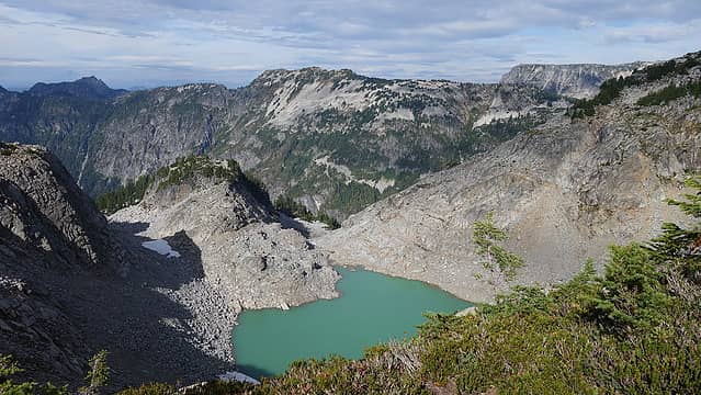
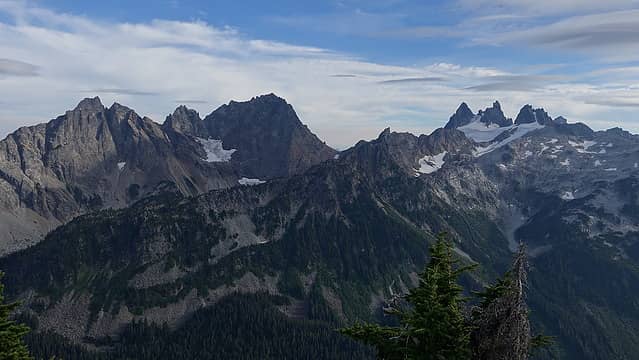
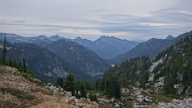
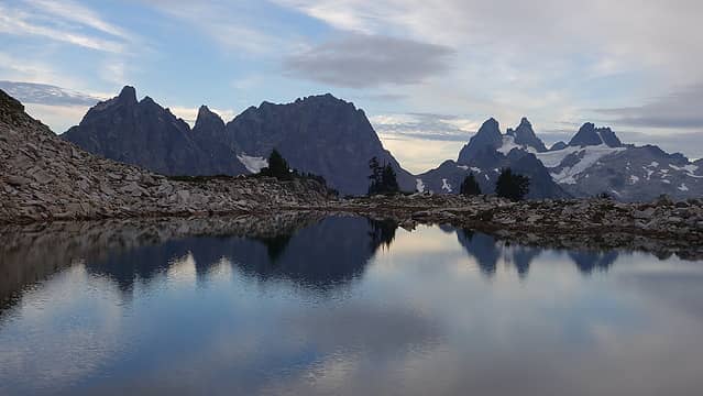
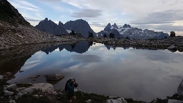
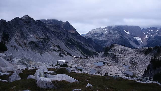
After a summit break, we descended down the NE shoulder of Hinman on glacier slabs for 1500 feet to a couple sizable alpine tarns that were just breathtaking. Here, Austin badly rolled his ankle and would have to endure the remaining 20ish miles with noticible swelling. The sidehill traversing to Pea Soup Falls on crappy talus was not too enjoyable, but once next to the falls it was fun glacier slab scrambling up to Pea Soup Lake. This lake has been a dream of mine to see ever since I saw a photo of it back in 2010 so it was great to finally visit this place. At first glance it did not appear there would be any feasible route up the north side of Mount Daniel this late in the season, but after taking a closer look at Austin's gpx track the route up follows the far right side and completely bypasses the lower Lynch Glacier, which would have required rock and ice climbing to get up that way!
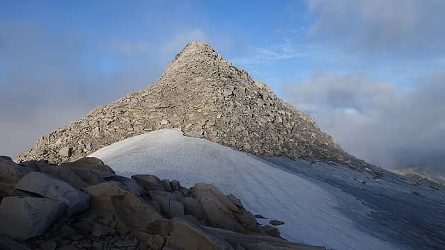
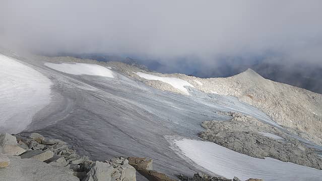
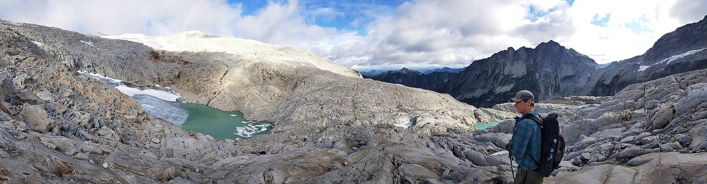
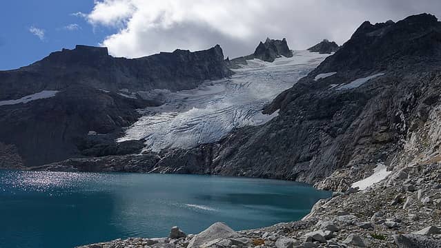
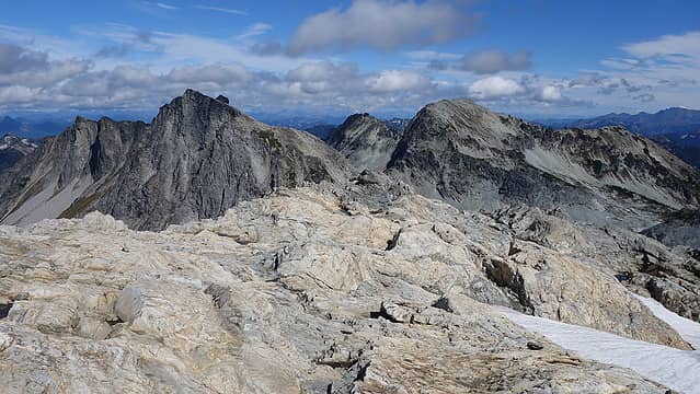
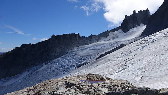
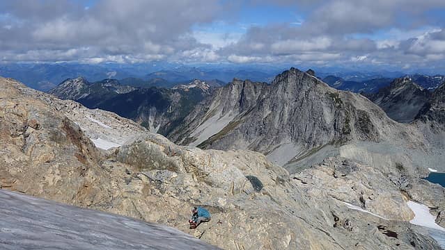
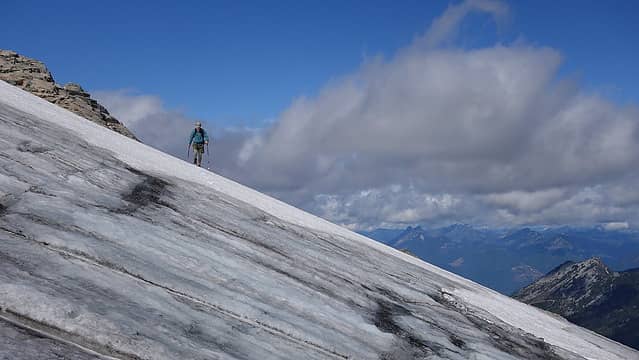
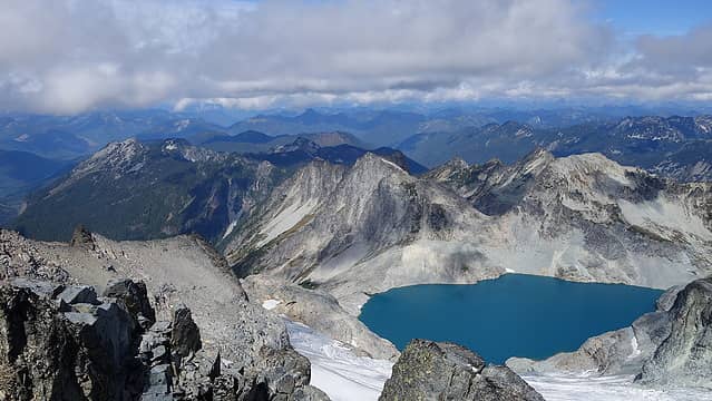
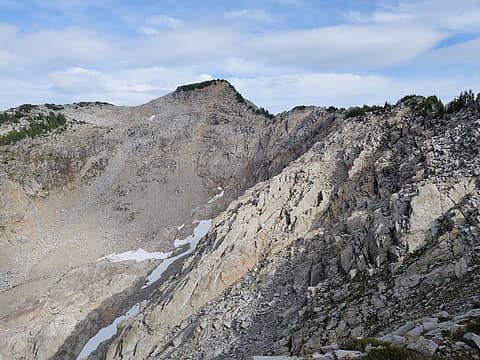
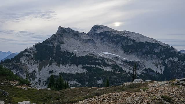
We filled water again and started up the ridge that rises above the SW side of Pea Soup Lake. Initially it was an easy walk until the terrain steepened at about 6800 feet. A late season steep (35 degree) snowfield with quite a bit of bare ice exposed almost thwarted us from continuing up any more since we I only had aluminum crampons with trail-runners, but I managed to pick my way up about 50 feet of snow trying to find areas where there was still a couple incles of snow atop the ice. I cut off the snow and onto the rock and we started class 3 and 4 scrambling up the rock right of the snow until we reached the far west side of the upper Lynch Glacier. Here we had to traverse horizontally east across the glacier to pass below the cliffs coming down from the lower west summit of Mount Daniel but gaping crevasses and bare ice made the traverse in the typical spot unfeasible. Therefore, we ascended another 100 feet or so to a less steep secton of the upper glacier where there was less ice and crevasses and began walking across. We found a spot to transition to the rocks at the base of the cliff and re-emerge onto the eastern part of the upper glacier. Hundreds of rocks had been shed off this cliff and rained down on the ice which we traversed across so I didn't dilly dally here long. Once on the easy side of the Lynch Glacier, it was a straightforward ascent to the saddle between Mount Daniel and Middle Daniel stringing together sections of the glacier with snow still covering the ice.
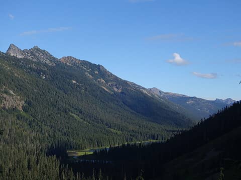
We dropped our packs at the saddle and made the final 75 feet or so to the summit and enjoyed our hard earned summit. We saw at least a dozen other people headed up and down Mount Daniel all of which coming up the normal route from Peggys Pond, which we would be grateful to have a trail to follow for the remainder of our day. After 10 minutes enjoying the summit views we started down, following the trail down the SE ridge all the way to Peggys Pond. By this point it was 3pm and we still had 15 miles to walk to get all the way back to the Tonga Ridge Trailhead, then I had to bike ride another 11 miles to get Austins car so needless to say we were likely going to be arriving after dark.
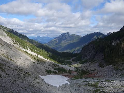
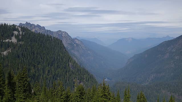
The short spur trail from Peggys Pond back to the PCT was a quick jaunt but very dusty. Once on the PCT we didn't waste time zooming down, eating many, many berries as we went, which were in full swing and provided enough extra calories to keep me going. At 5:20pm we reached Deception Pass and continued down the Deception Creek Trail for another 5 miles to where the Fisher Creek/Tonga Ridge Trail intersects. I pounded out the final 1600 feet of gain back up to Tonga Ridge as it got dark (that last hill really sucked after two long days). At 9:45pm I picked up the stashed bike and coasted down the hill back to the West Fork Foss TH, which still took me an hour to ride despite being all downhill. Picked up ustin and we drove back to Monroe, which everything was closed except Jack in the Box where I stuffed myself with greasy junk food...ohh it tasted so good. It was another 2am arrival back in Renton, but the trip was amazing and very memorable with smoke free skies and comfortable weather.