Halls Creek narrows
march 2010
My Halls Creek Narrows Page on SP
Overview
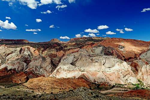
Halls Creek Narrows is probably the most dramatic canyon in Capitol Reef National Park. Located on the extreme southern end of the park, this canyon sees much less visitors making it a great trip for solitude seekers and ones seeking a walk through a canyon where the walls tower 1,200 feet above you. Early spring and late fall are particularly beautiful here and you will be guaranteed solitude at these times. It was the last week of winter in March 2010 when I went through Halls Creek Narrows and the creek was still flowing although to my surprise the water was quite warm unlike the standing water in other slots we did that same week.
There are two ways to do this canyon. One is to start at the Halls Creek Overlook trailhead, descend into Halls Creek and walk south until you get to the start of the narrows. The other way is to take the shortcut route which will be described in my route page that is added to this page. This page will describe the traditional route that most hikers take. Doing the traditional route is a 20 mile hike and is usually done as a 2 or 3 day backpack to allow optimum time for exploring. If you only have 1 day to be here, see my route page titled "Shortcut Route"
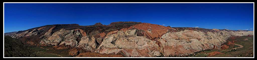
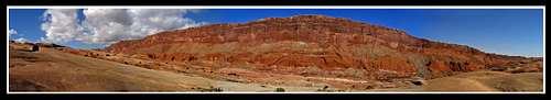
The Halls Creek Narrows is a deep gorge that cuts through Navajo Sandstone. The Navajo is the white colored rock that dominates the slopes of the Waterpocket fold that Capitol Reef is known for.
Getting There
There are a couple of ways to get to the Halls Creek Overlook trailhead and both are very scenic. The first way would be to get to Hanksville, Utah and continue on Highway 24 towards Capitol Reef. Just as you enter the National Park, turn south onto the Notom-Bullfrog Road and head south on the paved road for 10 miles until the pavement ends. Continue driving south on the dirt road for 35 more miles.
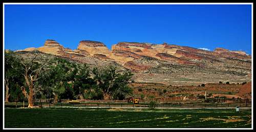 Waterpocket Fold from Notom Bullfrog Road
Go past the Burr Trail Junction, past the 4 concrete crossings of Halls Creek that very rarely have flowing water and turn right at the junction for the paved road that heads to Bullfrog. Head south on this road for about a mile and turn right on the Halls Creek Overlook road. A sign is placed indicating the trailhead. This side road can is passable to very carefully driven passenger cars when dry. It's hopeless to all vehicles when wet like it was in March 2010 when we were there.
 Notom Bullfrog Road
Keep in mind that with the exception of the short paved portion, these roads are Bentonite clay which means don't drive on it while it's wet! Although it is possible to drive all 35 miles to the Halls Creek trailhead in a raging blizzard with no visibility with a foot of snow and flowing rivers on the road in a Subaru sedan car in March (That was quite an experience), DO NOT do it!!! When dry, any car can drive these roads. Extra care should be taken on the Halls Creek spur road though.
BTW, it was on this trip that we took that Subaru all the way down the Notom Bullfrog Road. We did have to walk the final couple miles of the spur road though. Many SP users probably know how much snow and rain fell in the desert southwest in the winter of 2009/2010 making everything still snow-covered even into March.
The other way to get here would be from Boulder, Utah. Take the paved Burr trail from Boulder until it enters the National Park in which the pavement ends. Descend the Burr Trail switchbacks (very good road) and head to the junction with the Notom-Bullfrog Road and follow the directions described above to get to the trailhead.
The Hike
Starting at the trailhead descend about 800 feet down the trail to Halls Creek on a nice trail that switchbacks down through cliff bands.
 The Halls Creek Overlook
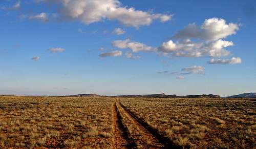
Once you reach Halls Creek, look for an old abandoned road once used for tourism and was constructed by John Powell (as was the old airstrip on Big Thompson Mesa). If you locate this road head south on it for about 7 miles as it parallels Halls Creek. If you can't locate it, no problem, just head cross country downstream along Halls Creek. If it is flowing there will be no need to cross as you hike down this beautiful valley. If it isn't flowing you could walk in the creek bed but it winds back and forth and will add many miles to the approach. Just stay on the east side, head in a straight line and enjoy the panoramic views of the Waterpocket fold to your left and Halls Mesa to your right. When I was there the road was hard to locate so I just went cross country in a straight line.
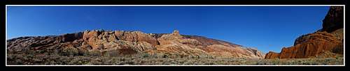 Waterpocket fold from Halls Creek
As you near the entrance for the narrows you will pass through a couple of large groves of cottonwood trees that would make for great campsites. After 7 miles down this valley the narrows begin and if it's early spring you will be wading the whole time. Otherwise, you may only see some standing water pools. The narrows themselves are about 4 miles long and will take at least 4 hours to get through. The walls tower above you making you feel very insignificant and small.
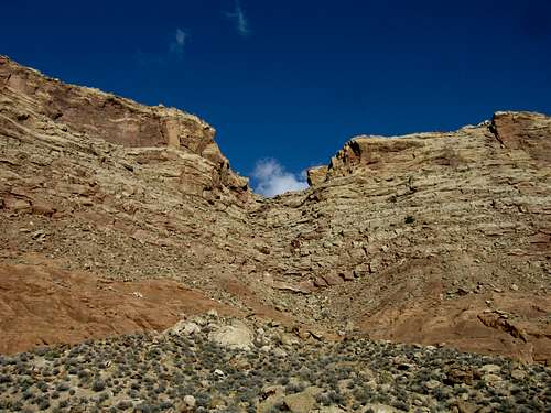
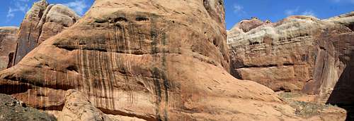 Halls Creek Narrows canyon walls
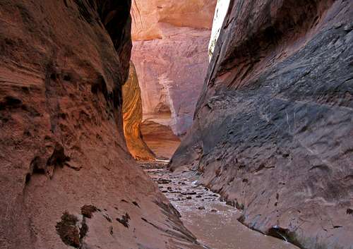 Halls Creek Narrows Halls Creek Narrows |
 Halls Creek Narrows Halls Creek Narrows |
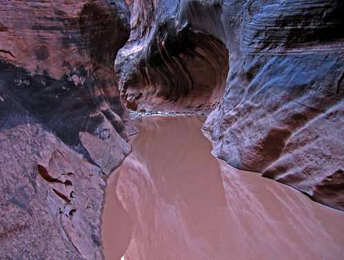
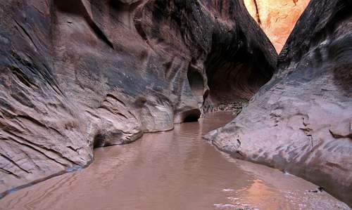 Halls Creek Narrows
After getting through the narrows make sure to climb up the Navajo sandstone of the Waterpocket fold and overlook the rim of the narrows. The views of Halls Mesa to east from high on the fold are also very impressive.
 Halls Mesa from the Waterpocket Fold
Continue walking along the fold until you reach the other end of the narrows (the end you entered) and descend back to the creek. Return back up the valley and re-ascend the trail back up to the trailhead. Be aware that this climb can be nothing short of torture in the summer heat. If you are here in the summer, try to climb this in the morning when it's still shaded. This is a spectacular canyon to hike and is rarely visited due to the time commitment. I would recommend a 2-night backpack for this trip (although I did it in one day via. shortcut, I wished I could have stayed longer). One day for the approach through the valley along Halls Creek. One day for the narrows and other exploration and one day for the return.
Camping/Red Tape
A free permit is required to have if you plan to camp anywhere in the national park. This can be obtained at the visitor center in Fruita just off Highway 24. There is no red tape but do try and stay off the cryptobiotic soil if you are going cross country..it's alive and takes many years to form and mature.
Topographic Maps
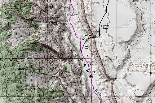
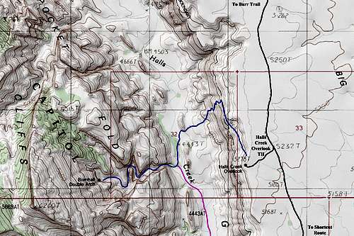 Halls Creek Topo 1
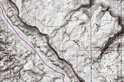
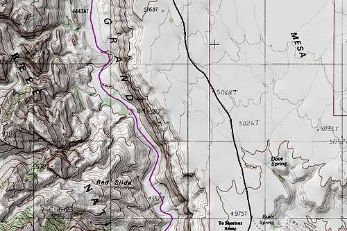 Halls Creek Topo 2
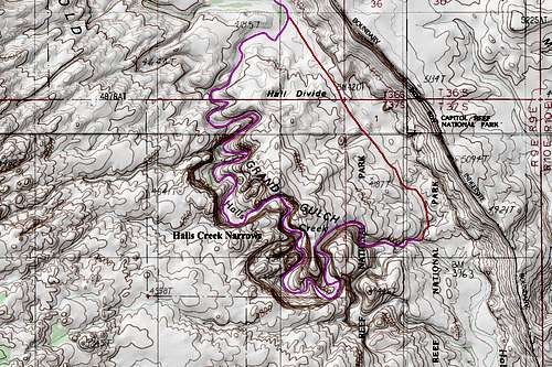
 Halls Creek Topo 3
 Halls Creek Topo 4
 Halls Creek Topo 5
External Links
Halls Creek Narrows - National Park Service
Halls Creek Narrows - Utah.com Information
Shortcut Route
This route will allow for the Halls Creek Narrows to be seen as a day hike as well as providing a nice scramble for someone looking for a little more adventure. This route involves descending a "break" in the cliffs above Halls Creek that is further south than the official trailhead making the walk down the valley 3.5 miles shorter each way. Doing the shortcut route turns the 20 mile hike into a 12 mile hike (assuming you can drive to the south end of the airstrip, more on that in the getting there section).
Halls Creek Overlook
Getting There
Instead of driving to the official Halls Creek Overlook trailhead on the spur road, continue south past the trailhead for about 2.5 miles. I don't know if passenger cars can drive this road as I have never driven this section. If it's like the part from the Burr Trail to the Halls Creek trailhead, then carefully driven cars can make it (I know Subaru cars will make it though). By this point you will come across a small fork in the road. Driving beyond here will require high clearance. Take the right fork and drive .3 miles down the old airstrip. At the end of the airstrip, continue down the old track as it turns right. It will end after another half mile (all this can be easily walked if your vehicle can't make it to the end of the old road). At the end of the road is the cliffs that tower over Halls Creek. This is where the shortcut route begins.
The old airstrip
The coordinates here are:
37 degrees 40.687 minutes North
110 degrees 54.884 minutes West
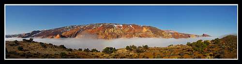
Fog in the Halls Creek Valley taken from Big Thompson Mesa
Another way to get to the airstrip that may be quicker is instead of taking the spur road turnoff from the paved Burr Trail road, go down towards Bullfrog another 6 miles where you will see another spur road on the right (these two spur roads are actually a loop and therefore the same spur road). Turn right here and head 4 miles until you get to the same fork described above except make a sharp left to get on the airstrip. This side of the loop however heads on the bentonite clay and is a particularly bad section. Impassible when wet but drivable to most cars when dry. The airstrip will come just after the transition from the bentonite clay to the flat yellow colored plateau that makes Big Thompson Mesa.
Route Description
This route from here to Halls Creek is all cross country. From the starting point described above, start descending as the slopes gradually get steeper. Enter a dry gully (wet during storms) and continue downstream this steep gully. You may see a small post in the ground marking the National Park boundary and telling people not to hunt beyond this point. If you do, you know you are on the right track. Here, at the old post you will notice the slopes turn into a series of cliffs. This is where the scramble starts. While staying on the right side of the steep set of cliffs and following a few cairins, work your way down each cliff band. There will be about 6 bands to descend and I recognized two or three class 3 moves. The exposure down each band is minimal and a fall will not be too harmful.
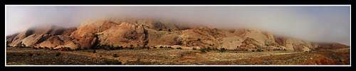
Foggy inside the Halls Creek valley
There may be a few ways down each cliff band but there will be one way down each one that doesn't exceed class 3. Once you get onto the red bentonite clays, look for an alluvial fan that forms a small ridge of red clay rocks and finish descending on that until you get to Halls Creek. Once you get to the creek, follow it downstream (left turn) until you get to the narrows. From here use the main page for more information and return the way you came.
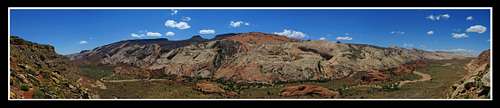
Panorama of the Waterpocket fold as the fog rises
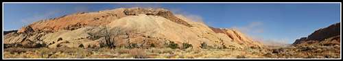
This break in the cliffs that allows a descent into Halls Creek
Essential Gear
Hiking gear (waders if the creek is flowing). Also be sure to have a water filter or enough water to last you the trip. This is the desert and everyone should drink about a gallon each day.
External Links
See Michael Kelsey's book "The non-technical guide to the Colorado plateau"
There is a set of pages for Capitol Reef National Park and one page describes the shortcut route for the Halls Creek Narrows. I wouldn't be surprised if he was the first to use this route and he built the few cairns we saw.
His books are great (if not the best) resources for canyoneering in all of Utah and Arizona. It was this book that I found out about this route and used it when I did the narrows in March 2010. I have not found any information about this route on the internet.