mount hague - 12,323' - south slopes class 2
july 2013
My Mount Hague page on SP
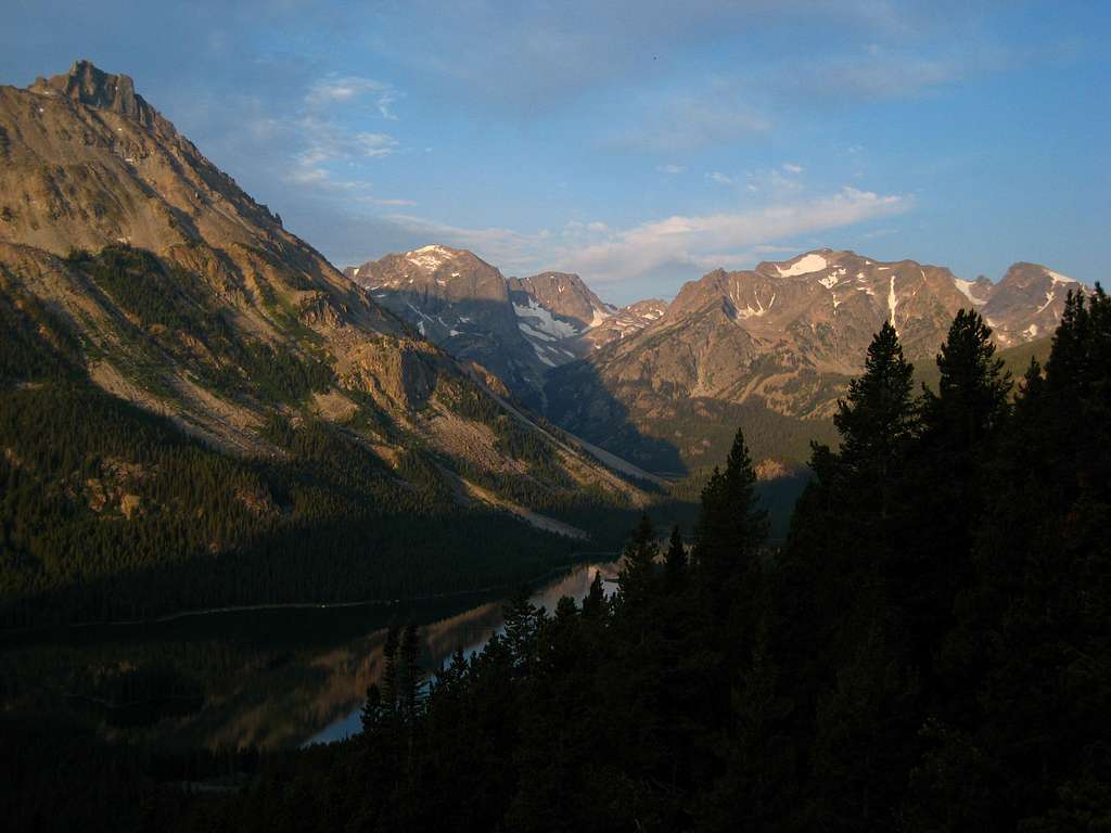
Sunrise on Wolf Mountain from the south slopes of Hague. Island Lake seen below
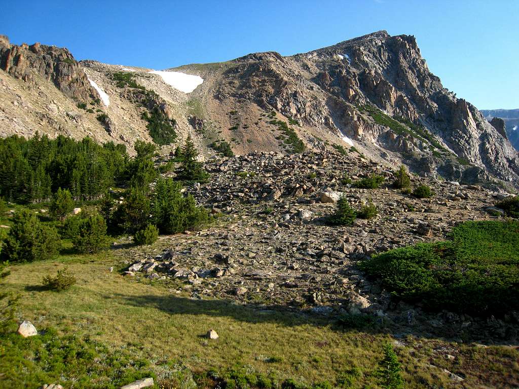
South side of Mystic Equinox Tower from the small meadow at treeline

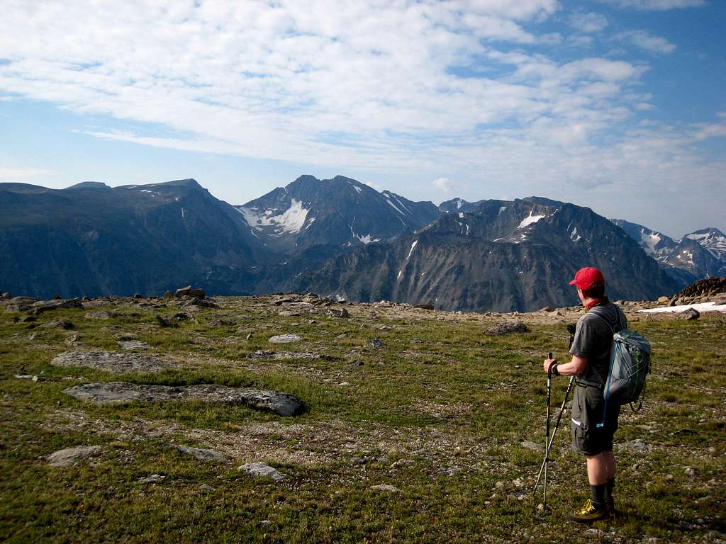
Twin Peaks from the plateau below the summit
|
Finally Vince and I were able to find a weekend where we were both open and decided to hike up one of the Montana 12ers neither of us had done. He drove from Bozeman and met me in Fishtail where we drove to the West Rosebud Trailhead. I was excited to finally get up one of the three northern 12ers in the Mount Wood Group. Our eyes were on Mount Hague, which is located NNW of Mystic lake and can be climbed in a day from the Trailhead which is at 6,557 feet in elevation. It's about eight miles one way and an elevation gain of about 5,800 feet therefore it would be a long day hike. If you want to break it up, you can camp at the large flat area between Mystic Lake and Island Lake just across the famous logjam. There is room for an army here but if you are looking for a smaller area there is also a good campsite right at the Western end of Mystic Lake just off the trail near the south shore. From camp anywhere near the logjam crossing, the summit day would be very straightforward. The east end of Mystic Lake (at the dam) is about three miles from the trailhead, at 7,673 feet and the hike around the lake along the south shore is about 2.5 miles long. There is great fishing all around Mystic and Island Lakes.
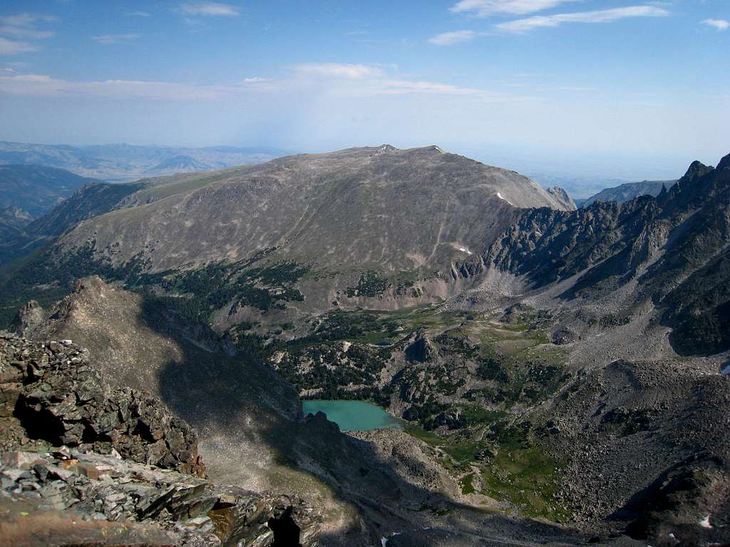
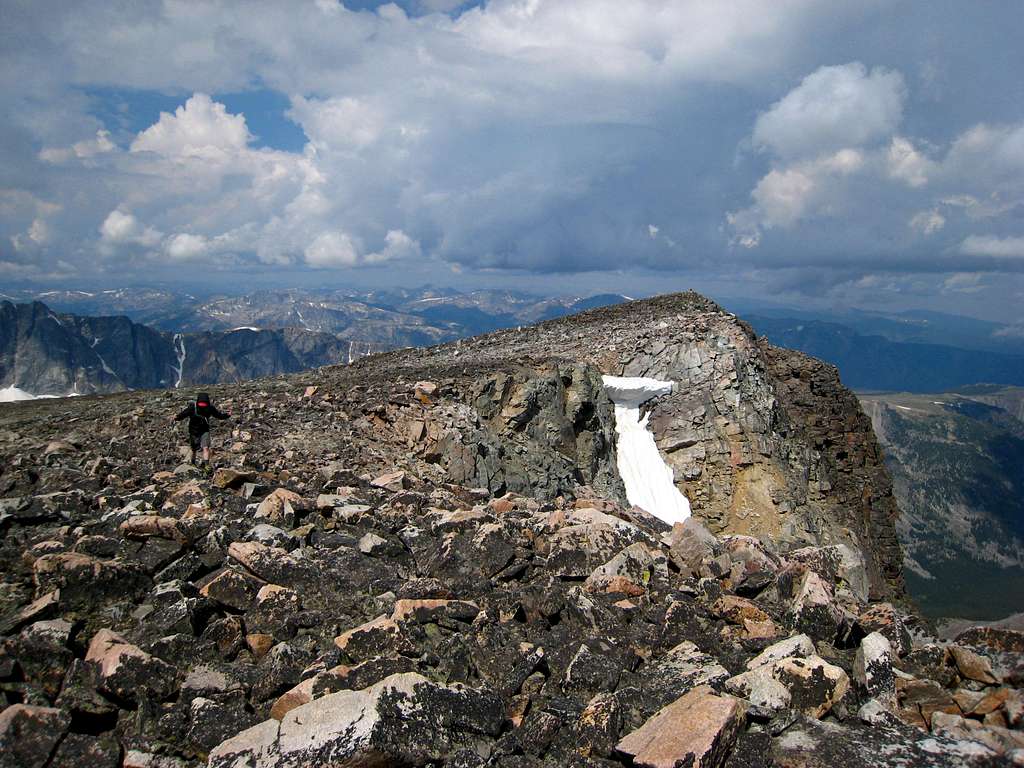
Mount Hague is similar to many Beartooth peaks in that it's the apex of a tilted plateau strewn with rocks, so travel basically involves lots of talus and rock hopping with a little bit of bush whacking on the lower slopes however compared to other 12ers in the Beartooth Range, Mount Hague isn't bad. The last 1.5 miles is a hike on the plateau with glorious views in every direction. Spectacular views to the south of Granite Peak, NW Granite, Villard, Glacier and Mystic peaks can be had. The view of the spectacular rock tower jutting above Mystic Lake is Mystic Equinox Tower. This isn't really a tower but more like a face on the east side of the plateau. It had its first ascent long ago on the autumn equinox and the route up the face is reported to be solid 5.9 with a walk off route down the plateau. The actual summit of Mount Hague cannot be seen from Mystic Lake, but once you reach the plateau you will be able to see the true summit off to the northwest. So we started up the trail on a Friday afternoon and made the long hike around Mystic Lake. The clouds were thick and I was expecting heavy rain but we got lucky and didn't get wet. The summer of 2013 so far was much wetter than 2012 and every afternoon really did bring heavy rain and big storms. We arrived at the logjam and easily walked a series of logs to the north side of the creek and set up camp in the large open area at the base of Mount Hague. Since it was quickly getting dark we went to bed shortly after arriving and planned for a very early start since the weather forecast the next day called for thunderstorms. By 5am we were up and began hiking up the moderatly steep slopes to the north. We made good time through the trees and stayed well to the left of the major drainage between Hague and Wood. Near treeline, we arrived at an east-west ridge where we first saw Mystic Equinox Tower up close. A small meadow appeared to be a great camp spot. We continued to the left aiming for the broad south ridge and emerged onto the plateau by mid-morning. It was easy hiking up gentle slopes around the top of Mystic Equinox Tower and to the summit (which is the northernmost point) where I found a summit register placed in the late 80's. It had been hidden very well and I only stumbled upon it because I was looking very close for a route down to begin a possible traverse to Mount Wood. I managed to find a potential scramble route to Mount Wood but never found a non-technical way to drop off the summit of Hague without rappelling. Anyway, the register hadn't been signed in over 10 years so I had a great time trying to read over the previous signatures dating back to the 1980's. I did my best to better protect the register, added a pencil and placed it in a better spot at the summit cairn. I admired the fantastic views all the way to Granite Peak, Whitetail Peak and Mount Cowen. Clouds were beginning to develop making the scenery stunning. After 45 minutes on top, we started down and just as we arrived back at treeline, we saw very dark clouds hovering over Mount Wood. We seemed to get lucky and the big storms surrounded us but never dumped where we were. Once back at camp we quickly packed up and hiked out. |
Granite Peak from the south ridge of Hague
|
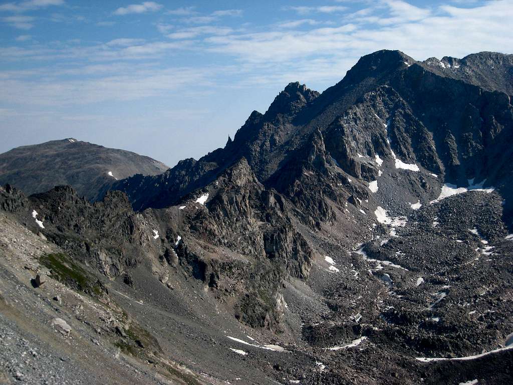
The traverse to Mount Wood
|
Stillwater Plateau from the summit
|
Arriving at the summit
|

Mystic Equinox Tower as storms engulf Mount Wood