Castle mountain - 12,612' - NE couloir class 3
june 2013
My Northeast Couloir Route page on SP
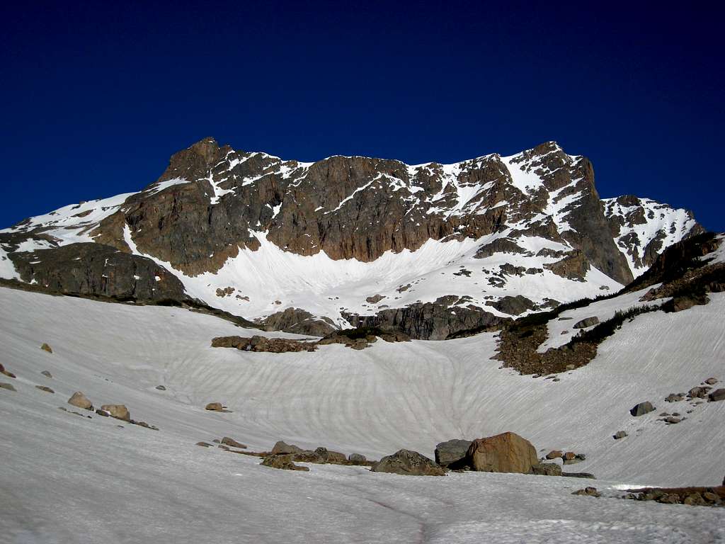
Morning on the east face of Castle Mountain. The NE couloir is still hidden to the right
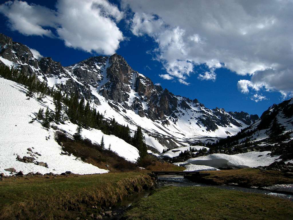
Whitetail Couloir from camp at the bridge
|
I was finally able to take Josh over to the Montana Beartooths and in the second week of June we drove over from Washington where we met Vince in Bozeman. After a quick stop at Costco, we continued to Red Lodge where we found an awesome place to camp along the West Fork of Rock Creek road. It was still chilly and windy and there was still quite a bit of snow in the high country. The winds subsided over night and the next morning we went to the trailhead and started hiking up the trail towards Quinnebaugh Meadows. I was excited to see how much snow was in the Whitetail Couloir and Josh really loved looking at it from the meadow. We continued past the Lake Mary Junction and hit snow just before reaching Sundance Lake. We put the gaiters on and continued along where I believed the trail was. We probably should have simply disregarded the trail and hiked around Sundance Lake but we managed to get to the bridge either way where we set up camp. Josh spent all evening taking photos with his new camera while I made dinner. It was quite cold but the air was crystal clear which is just how I like it.
The next morning we got a quick start to try and get into the sun as soon as possible. Shortly past Shadow Lake we got into the sun and warmed up. Silt Lakes were still covered in snow and everything above was completely covered. We saw a few avalanche remnants along the way and arrived at the base of the NE couloir around 9am. Just as we started up, we saw the lone snowboarder who passed us the day before who was just starting his ride back down the couloir after climbing halfway up. He warned us about rockfall which we were happy we had our helmets. We crossed paths right at the large bergschrund where we were able to easily walk across since it was mostly covered with thick snow bridges. We continued up the 40 degree wide couloir avoiding the center as much as we could since we did get some rock falling our way. Josh led the way as we switchbacked up and I could tell Josh was pushing the pace. Right before topping out on the summit plateau we took a long break to eat and drink. The final 100 feet I made a steeper variaton to the left exiting the couloir and kicked steps for Josh and Vince. We emerged on the summit where the views were fantastic. It was breezy and cold enough to wish I had more clothes. After 20 minutes on top admiring the views and name all the peaks we could see, we started descending towards Castle Rock Spire. The plan was to also ascend the spire between Castle Mountain and Point 12,540 (which I had climbed the summer before in 2012). However, lack of good research, route-finding issues, the approaching snowstorm and the wet rock all led me to get about halfway up the direct south face of the spire only to sling a horn and bail. I didn't realize I was on a first ascent line until researching the two main routes after the fact. One was the southwest ledges described on SP where the standard route is the east ridge. Feeling defeated, I gathered all the information I needed to be able to make a dash ascent sometime in the future. We started hiking down towards Varve Lake and along the way I spotted two more potential routes up Point 12,540 on the east and south sides, which are aspects I missed in 2012. Once we had Omega Pass in sight, we had to descend tricky slabs into the basin south of Castle Mountain, then traverse the basin to Omega Pass. By this point it was lightly snowing and visibility had dropped. Once we were at Omega Pass though, it was smooth sailing heading down easy snow back to Shadow Lake and back to camp where we quickly went to sleep. The following morning, we slept in and leisurely hiked out. |
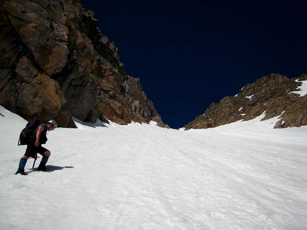
Climbing the NE Couloir
|

Looking down with Sundance Mountain
|

Castle Rock Spire from the summit
|
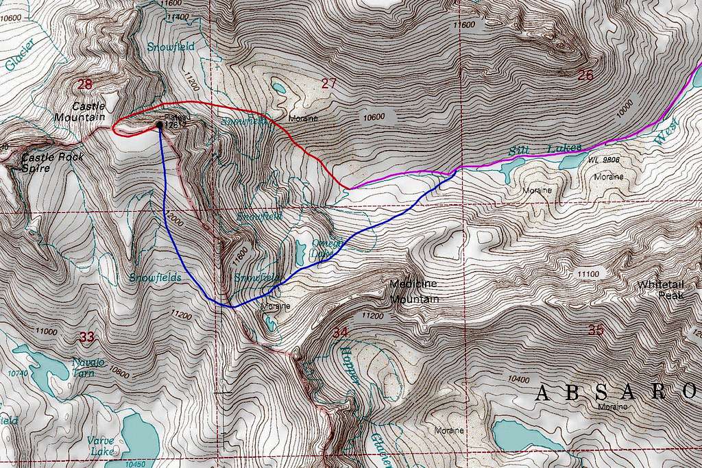
Topo Map
|