LEMKE CLIMBS
  • About
    • Whats New
    • 2019 Goals/Wishlist
    • Contact
  • Washington
    • North Cascades >
      • Sahale Peak, Boston Peak
      • Eldorado Peak, Klawatti Peak
      • Black Peak
      • Forbidden Peak West Ridge
      • Primus Peak Attempt
      • Big Snagtooth
      • Liberty Bell Beckey Route
      • Burgundy Spire North Face 5.8
      • Ragged Ridge - Katsuk, Kimtah and Cosho Peaks
      • Colfax Peak
      • South Early Winters Spire via SW Buttress
      • Chilliwack Mini-Slam
      • Mesahchie Peak
      • Inspiration Traverse
      • Mount Shuksan Ski
      • Full Pickets Traverse
      • Mount Goode NE Buttress & Storm King
      • Mount Baker North Ridge WI3
      • Snowfield Peak
      • Lincoln Peak
      • Silver Star Mountain
      • Mount Buckner & Horseshoe Peak
      • Azurite Peak
      • Tower Mountain & Golden Horn
      • Mount Logan
      • Custer Ridge & Easy Mox
      • Mazama Dome
      • Sherman Peak
      • Mount Ballard
      • Southern Pickets Traverse
      • Corteo Peak
    • Glacier Peak Wilderness >
      • Buck Creek Pass, Cloudy Peak, Spider Gap
      • Dome Peak, Spire Point
      • Mt. Maude and Seven Fingered Jack
      • Mount Formidable NE Face 5.6 Second Ascent
      • Dumbell and Greenwood Mountains
      • Glacier Peak Wilderness Mountain Massacre
      • Clark and Luahna Peaks
      • Sinister Peak
      • Chiwawa Mountain
      • Tupshin & Devore Peaks
      • Buck & Fortress Mountains
      • Glacier Peak
    • Olympic Peninsula >
      • Buckhorn Mountain
      • Flapjack Lakes Hike
      • Grey Wolf Peak, High Divide Trail
      • Mount Ellinor
      • Mount Constance West Arete
      • Mount Olympus
    • Alpine Lakes Wilderness >
      • Chikamin Peak
      • PCT - Snoqualmie to Pete Lake
      • Foss Lakes Hike
      • Necklace and Tank Lakes
      • Enchantments Day Hike
      • Granite Mountain (Snoqualmie)
      • Colchuck Peak
      • Cannon, Enchantment and Stuart
      • Ingalls Peaks
      • McClellan Peak
      • Dragontail Peak
      • Web Mountain
      • Mount Index Attempt
      • Snow Creek Wall Orbit 5.8+
      • The Tooth South Face
      • Eightmile Mountain
      • Argonaut Peak NE Couloir
      • Little Annapurna South Face 5.5
      • Snow Creek Wall Outer Space 5.9
      • Cashmere Mountain
      • Sherpa Peak North Ridge 5.8
      • Chair Peak NE Ridge
      • Lichtenburg Mountain
      • Mount Index
      • McClellan Butte
      • Chimney Rock
      • Alpine Lakes High Route
    • Pasayten Wilderness >
      • The Craggies
      • Tiffany Mountain
      • Pasayten Mini-Slam
      • Remmel Group
      • Jack Mountain
      • Robinson Mountain
      • Monument Peak Group
    • Mountain Loop Highway >
      • Vesper Peak
      • Mount Dickerman
      • Sloan Peak West Face 5.8
      • Mount Forgotten
      • Whitehorse Mountain
      • Gothic Peak
    • Lake Chelan Sawtooth Wilderness >
      • Star, Courtney, and Grey Peaks
      • Hoodoo Peak and Raven Ridge
      • Abernathy Peak
      • Mount Bigelow
      • Reynolds Peak
      • Oval Peak
      • Gardner Peaks
      • Chelan Sawtooth Trio
    • Southern WA >
      • Mount Adams
      • Mount Rainier - Emmons Route
      • Mount Saint Helens
      • Goat Peak
      • Lane Peak, Plummer Peak (Tatoosh)
      • The Unicorn (Tatoosh)
      • Little Tahoma
    • WA Rock and Ice Cragging >
      • Index Town Walls
      • Vantage
      • Mount Erie
      • Exit 38
      • Leavenworth
  • Colorado
    • San Juan Mountains >
      • Mount Sneffels Lavender Snow Climb
      • Uncompahgre, Matterhorn Peaks
      • Redcloud, Sunshine Peaks
      • San Luis Peak
      • Vermilion, Fuller Peaks
      • Stewart Peak, Baldy Alto
      • Jones, Niagara, American Peaks
      • Wetterhorn Peak, Handies Peak
      • Wilson Group
      • Arrow Peak
      • Mount Sneffels SW Ridge
      • Jagged Mountain, Chicago Basin
      • Teakettle Mountain
      • Dallas Peak
      • Vestal Peak Wham Ridge, Greystone Peak
      • Organ Mountain
      • Phoenix Peak
      • Half Peak
      • Point 13832 Group
      • Golden Horn
    • Elk Mountains >
      • Four Pass Loop
      • Castle, Conundrum Peaks
      • Snowmass Mountain
      • Cathedral Peak
      • South Maroon Peak
      • The Pyramids
      • North Maroon Peak, Sleeping Sexton
      • Capitol Peak, Mount Daly
      • Malemute Peak
      • Hagerman Peak
    • Sangre de Cristo Mountains >
      • Blanca Peak, Ellingwood Point
      • Challenger Point
      • Mount Adams
      • Spread Eagle Peak
      • Humboldt, Obstruction, Columbia Peaks
      • Mount Lindsey, Huerfano Peak
      • Little Bear Peak
      • Crestone Needle Ellingwood Arete
      • California Peak
      • Crestone Peak North Buttress
      • Operation Dark Snake
      • Kit Carson Mountain
    • Sawatch Mountains >
      • Iowa Peak
      • Point 13,618 - Hunky Dory Lake
      • Gold Dust Peak, Notch Mountain
      • Mount Jackson
      • Mount Belford
      • Shavano, Tabeguache Peaks
      • Mount Antero, Cronin Peak
      • Twining Peak
      • Mount Massive
      • Casco Peak
      • Mount Huron
      • Mount Elbert
      • Mount Oxford
      • Mount Hope
      • Mount Yale
      • Lackawanna Peak
      • Mount Columbia
      • La Plata Peak
      • Rinker and Twin Peaks
      • Bull Hill, Mount Princeton
      • Missouri Mountain
      • Mount Oklahoma
      • French Mountain
      • Mount Ouray
      • Grizzly A, Garfield Peaks
      • Mount Harvard
      • The Three Apostles
      • Emerald Peak
      • Holy Cross
    • Greater Park Range >
      • Kneeknocker Pass, Piney Lake
      • Drift Peak
      • Sherman Peak, Dyer Peak
      • Gore Range Traverse
      • Quandary Peak
      • Pacific, Atlantic Peaks
      • Clark Peak
      • Crystal Peak, Peak 10
      • Fletcher Mountain
      • The DeCaLiBron
      • Loveland Mountain
      • The Mosquito Traverse
      • Mount Arkansas
      • Clinton Group
      • Eagles Nest, Peak C
      • North Star Mountain
      • Peak X
      • Wheeler Mountain
    • Front Range >
      • Mount Evans, Spalding
      • Mount Bierstadt
      • Mount Parnassus, Bard Peak
      • Cupid, Sniktau, Grizzly D Peaks
      • James Peak
      • Mount Silverheels
      • Grays and Torreys Peaks
      • Mount Edwards
      • Mount Flora, Longs Peak
      • Square Top Mountain
      • Petit Grepon South Face 5.8
      • Mount Meeker Dreamweaver Couloir
      • Santa Fe Peak
      • The Citadel & Pettingell
    • Colorado Ice Climbing >
      • Lincoln Ice Falls
      • Ouray Ice Park
      • Avocado Gully and The Drool
      • Hidden Falls
    • Colorado Rock Climbing >
      • Eldorado Canyon
      • The Flatirons
      • North Table Mountain
      • Shelf Road
      • Colorado National Monument >
        • Independence Monument
  • Wyoming
    • Wind River Mountains >
      • Gone With the Winds
      • Union Peak - Solar Eclipse
      • Wind River Peak
      • Wind River Slam
    • Teton Range >
      • Grand Teton Owen Spalding 5.4
      • Mount Owen Attempt
    • Wyoming Absarokas and Gros Ventre Range >
      • Jackson Peak
      • Francs Peak
    • Yellowstone National Park >
      • Top Notch Peak
    • Bighorn Range and Great Divide Basin >
      • Boars Tusk
      • Loaf Mountain
      • Cloud Peak
      • Black Tooth Mountain
    • Devils Tower
    • Cody Rock and Ice Climbing
  • Montana
    • Beartooth Mountains >
      • Whitetail Peak Group
      • Beartooth Mountain
      • Spirit Mountain Group
      • Mount Peal
      • Granite Peak Group
      • Castle Rock Group
      • Castle Mountain NE Couloir
      • Mount Inabnit and Sylvan Peak
      • Mount Hague South Slopes
      • Mount Villard and The Granite Peaks Traverse - 5.4
      • Spirit Mountain NE Ridge - 5.4
      • California Ice WI 4
      • The Ramp 5.8
      • Linea Alba 5.10d
      • Iceberg Peak
      • Metcalf Mountain North Rib 5.8
      • Villard Spires HP West Ramp
      • Cairn Mountain
      • Snowbank Mountain
      • Mount Wood Group
      • Bears Tooth
      • Glacier Peak Catch-a-Sunrise FA
    • Montana Absarokas & Gallatin Range >
      • Black Mountain
    • Southwest Montana Ranges >
      • Sacajawea Peak
      • Arrow Peak
      • Koch Peak
      • Saddle Peak
      • Baldy Mountain
      • Sphinx Mountain
    • Glacier National Park >
      • A Taste of Glacier National Park
      • Divide Mountain
    • MT Rock and Ice Climbing
  • Utah
    • Uinta Mountains >
      • Kings-Emmons Ridge Run
      • Hayden Peak
      • Iron Hayden Wall Rock Climbing
    • Wasatch Range >
      • The Sundial Eleventh Hour 5.8
      • Mount Timpanogos
    • San Rafael Swell >
      • Ramp, Cistern Canyons
      • Salt Wash, Black Mountain, Moroni Slopes
      • Ding, Dang Canyons
      • Little Wild Horse, Bell Canyons
      • Quandary Canyon
      • San Rafael Knob
      • Miners Hollow (Knotted Rope Canyon)
      • Temple Mountain
      • Chimney Rock
      • Bottleneck Mesa
      • Window Blind Peak
      • Lower Baptist Draw & Upper Chute Canyon
    • Capitol Reef National Park >
      • Cathedral Valley Tour
      • Sheets Gulch
      • Halls Creek Narrows
      • Brimhall Canyon and Strike Valley Overlook
      • George Benchmark
    • Moab Area, Canyonlands, Arches >
      • Maze District
      • Needles District
      • Maze District
      • White Rim Trail Biking
      • Elephant Butte, Bullwinkle Tower and Lizard Rock
      • South Six Shooter
      • Elephant Canyon
      • Parriott Mesa
      • Ancient Art
      • Castleton Tower North Chimney 5.8
      • Klondike Bluffs
      • Mount Peale & Tukuhnikivatz
    • Robbers Roost Country >
      • Horseshoe Canyon, Goblin Valley
      • Bluejohn Canyon
      • Happy Canyon Narrows
      • Shenanigans, Leprechaun Slots
      • Larry Canyon
      • Merry Piglet Slot
      • Lower Maidenwater Canyon, Turkey Knob
      • Morocco Canyon
      • Monkey Business Slot
      • Hog Canyon Slots
      • Upper Maidenwater Canyon Slots
      • Mount Ellen
      • Buck Canyon
      • Point 4906
      • Alcatraz Canyon
      • Hard Day Harvey Slot
      • Mount Ellsworth
      • Good Day Jim Canyon
      • White Roost Canyon
      • Upper Stair Canyon
    • Escalante National Monument >
      • Phipps Canyon and Arch
      • Red Breaks Slot
      • Dry Fork Slots, Coyote Gulch
      • Little Death Hollow/Wolverine Canyons
      • Egypt 3 Slot
      • Egypt 1 Canyon
    • Zion/Bryce >
      • Ataxia Tower Ashtar Command 5.9
      • Mount Kinesava Cowboy Ridge
      • Birch Hollow
      • Aires Butte
      • West Temple
      • Mystery Canyon
      • Crazy Streak
    • Cedar Mesa Region/Valley of the Gods >
      • Eagle Plume Tower Eagle Feather 5.10b
  • California
    • High Sierras, Southern CA Ranges >
      • Telescope Peak, Manly Beacon
      • Tahquitz Rock Whodunit 5.9 - June 2016
      • Tahquitz Rock Long Route 5.9 - July 2016
      • Palisade Traverse
      • White Mountain
    • Yosemite National Park, Central CA
    • Northern CA Cascades >
      • Lava Beds National Monument - August 2015
  • Oregon
    • Oregon Volcanoes >
      • Three Fingered Jack
      • Mount Scott
    • Blue Mountains >
      • Twin Peaks
    • Trout Creek Rock Climbing
  • Alaska
    • Eagle Peak and Mount Ewe
    • Jatt Peak and Portage Pass
    • Rainbow Peak
    • Mount Brooks Attempt
    • Arrigetch Peaks Trek
    • Ab Mountain Hike
    • South Suicide Peak
    • Mount Hunter West Ridge Attempt
    • Cantata Peak Attempt
    • East Twin Peak
    • Mount Alice
    • Crow Pass and Hope Point Hikes
    • Indianhouse Mountain Attempt
    • Lynx Peak
    • Harding Icefield Hike
    • Hatcher Pass and Grapefruit Rocks Climbing
    • Mount Sanford
    • Mount Hunter West Ridge
  • Nevada
    • Ginger Cracks 5.8
    • Mescalito Dark Shadows 5.8
    • Birdland and Olive Oil
    • Frogland 5.8
    • Johnny Vegas 5.8
    • Schaeffer's Delight & Triassic Sands
    • Solar Slab - 5.6
  • British Columbia
    • Mount Matier
    • Taiya Peak
    • Bugaboo Spire NE Ridge
    • Mount Sabine Easy Honey 5.10b
    • Mount Sir Donald NW Ridge Attempt
    • Black Tusk
    • Squamish Ticks
    • Slesse Mountain NE Buttress
  • Alberta
    • Mist Ridge Hike
    • Mount Temple Attempt
    • East Wendell Peak
    • Loder Peak
    • Tower Mountain Attempt
    • The Rimwall
    • Mount Yamnuska Directissima 5.9
    • Mount Lawrence Grassi
    • Mount Lorette
    • Roche A Perdrix
    • Mount Edith Cavell East Ridge 5.3
    • Mount Louis Kain Route
    • Eiffel Peak
    • Canadian Rockies Ice Climbing
  • Other States
    • Arizona >
      • Grand Canyon Bright Angel Trail
      • Beanfest at Cochise Stronghold
      • Baboquivari Peak
      • Humphreys Peak
    • New Mexico >
      • Philmont Trek August 2008
    • Yukon >
      • Canyon Peak
  • International
    • Mexico & Central America >
      • Mexico - Pico de Orizaba, Izta - March 2012
      • Guatemala Volcanoes
    • South America >
      • An Introduction to Patagonia
      • Cordillera Blanca - Tocllaraju and Urus
      • Nahuel Huapi National Park & The Frey
      • Exploring Pucon and Lanin Volcano
      • Cordillera Blanca - Ishinca Peak and Artesonraju
      • Cordillera Blanca - Quitaraju & Alpamayo
      • Exploring Southern Peru
      • Cerro Helio Azul & Tronador Attempt
      • Aguja Guillaumet Amy Couloir
      • Cerro Puntado & Palo
      • Cerro Colorado
      • Cerro Puno & Agudo
      • Cerro Trinidad Attempt
      • Volcan Quetrupillan
      • Cerro Placas
      • Nevado de Acay
      • Pequeno Alpamayo
      • Huayna Potosi
      • Illimani
      • Chiaro de Luna
    • Oceania >
      • Exploring New Zealand's South Island
      • Puncak Jaya
      • Mount McPherson and Talbot
      • Single Cone
      • Mount Cook
      • Mount Aspiring
      • Manakau
    • Central Asia >
      • Kyrgyzstan 2021
  • Sorted by Year
    • 2008 Trip Reports
    • 2009 Trip Reports
    • 2010 Trip Reports
    • 2011 Trip Reports
    • 2012 Trip Reports
    • 2013 Trip Reports
    • 2014 Trip Reports
    • 2015 Trip Reports
    • 2016 Trip Reports
    • 2017 Trip Reports
    • 2018 Trip Reports
    • 2019 Trip Reports
    • 2020 Trip Reports
    • 2021 Trip Reports
  • Vanlife
    • Conversion Journal >
      • Floor Installation
      • Folding Bed
      • Coffee Table
      • Thinsulate Installation
      • The Couch
      • The Wardrobe
      • Bookshelf
      • Water System
      • Electrical System
      • The Pantry
      • Refrigerator
      • Tire Upgrade
      • Heating System
      • Composting Toilet
LEMKE CLIMBS

Twin Peaks & Hurricane Divide

Twin Peaks - 9673' - via legore lake class 3
​Hurricane divide north - 9600 - class 2
September 2021

When I got an invite to go to the Wallowa Mountains I didn't hesitate to join since I have never been to this area before. We had this fun ridgerun in mind to do that involved a total of 9 peaks (2 ranked and 7 unranked) along a circuitous ridge that circumnavigated completely around Frances Lake. Most of the route would run along the Hurricane Divide Ridge, one of the higher ridgecrests of the Wallowa Mountains. Since my car is still parked in Colorado, We to meet me at the train station in Vancouver and pick me up there. Then we drove east through the Columbia River Gorge and after a quick grocery run in Pendleton, we continued east to the small town of Enterprise at the northern flank of the Wallowa Mountains. We arrived at the Hurricane Creek Trailhead, elevation 5000 feet at about 1pm.

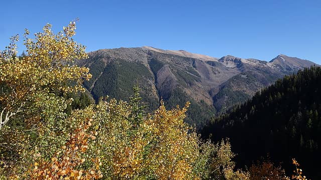
I honestly had no idea what to expect on this trip. All I knew about the Wallowa Mountains was the existence of Eagle Cap, which I thought was the only real high peak in the whole range however I was pleasently suprised as to how large of an area these mountains extend, and that they rose over 5000 feet above the surrounding terrain and had considerable alpine terrain above treeline. I always thought the mountains of northeastern Oregon were just fargone hills without any real scenic value based on the observations of my many trips driving I-84 from WA down to Utah and Colorado. After all, you don't see much along the interstate there, and I hadn't really given the Blue Mountains or the Wallowas much thought over the years. While these sentiments likely still hold some truth for the Blue Mountains, the Wallowa Range is a hidden gem that is invisible to most people unless you take the winding two lane highways well away from the interstate. The town of Enterprise actually had some charm too.

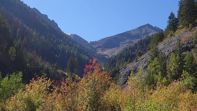
We started up the main trail, which heads up the main Hurricane Creek valley, which is the trail one would take to hike up the highpoint of the range; Sacajawea Peak (which I didn't even know existed). I thought Eagle Cap was the range high  point, but in reality, Sacajawea is and it's even an ultra prominent peak. We however only hiked on the Hurricane Creek Trail for about 3 minutes before turning right onto the Falls Creek Trail which ascended steeply and consistentely for 4000 feet to Legore Lake. This trail is a great workout! The trail ascended the slopes on the north side of Falls Creek, passing above a small waterfall and gaining elevation quickly. We apparently were far enough inland for there to be aspen trees glowing yellow, and my hopes of golden larches quickly vanished (I wasn't sure if we were in larch territory, but seeing the aspen trees answered that question with a rersounding no).

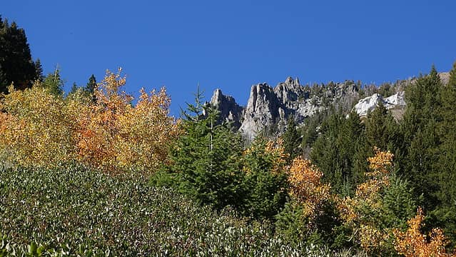
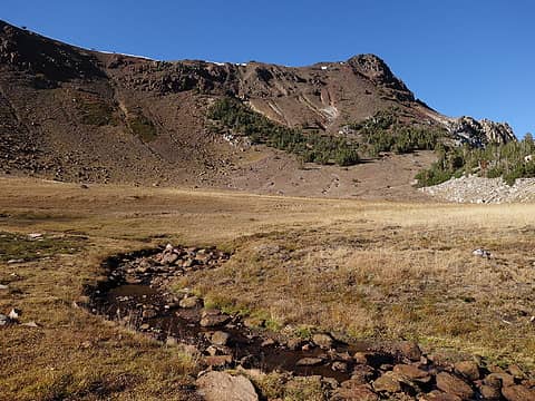
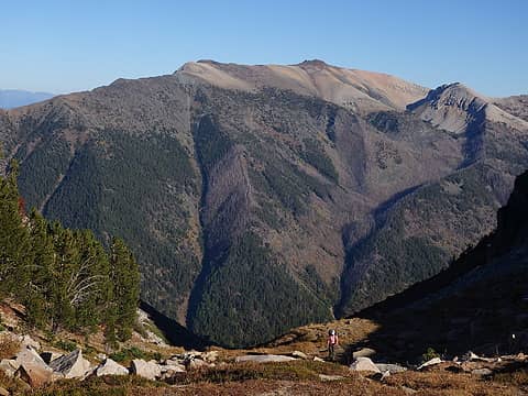
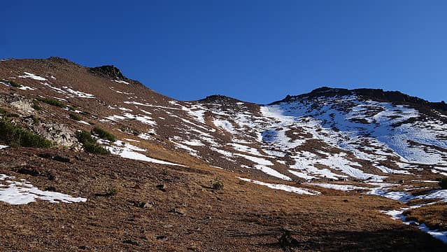
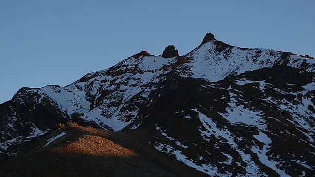
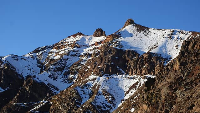
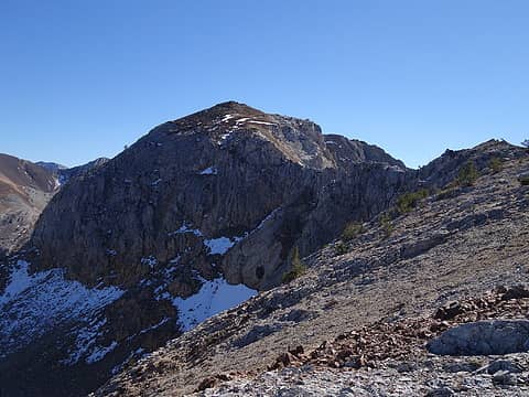
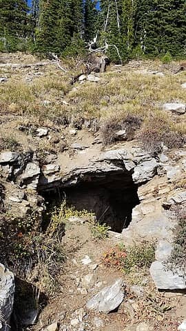
The trail steepened at about 7000 feet elevation and the ominous northeast face of the Twin Peaks demanded attention. The rock looked to be pure and utter garbage so I was thankful the route would have us ascend ridges. There were also and endless supply of spiderwebs, some strands over a hundred feet long, blowing in the wind and weaving through the bushes and trees. At 7700 feet after gaining 2700 from the trailhead we passed by the old Legore Mine, which was nothing more than a small adit dug into the hillside about 15 feet deep, then a few hundred feet higher we got to the small grassy basin at 8000 feet that offers the first good camping. Since it was still early enough in the day, we opted to continue northward up a boulderfield into the basin just below Sawtooth Peak. The trail peters out at the 8000 foot basin but there was an obvious route up, and we reached a second flat basin at 8600 feet where a beautiful grassy meadow greeted us. The north facing aspects were holding some remnant snow from the storm a couple weeks ago which made the views just divine.

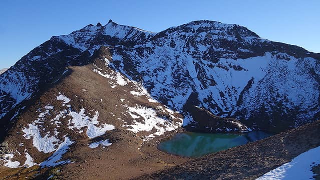
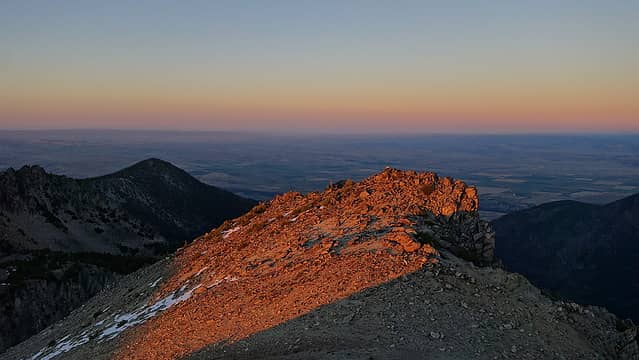
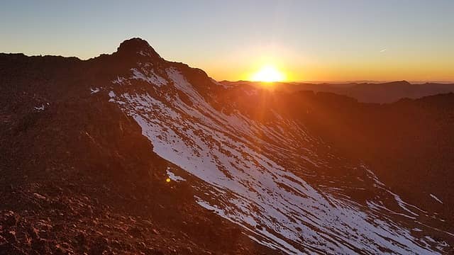
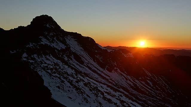
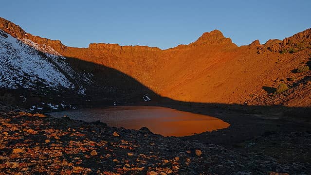
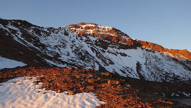
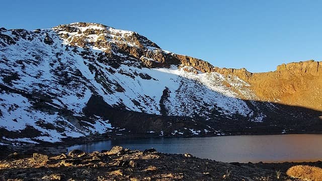
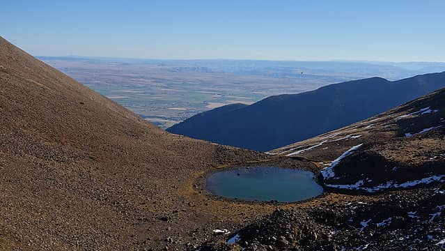
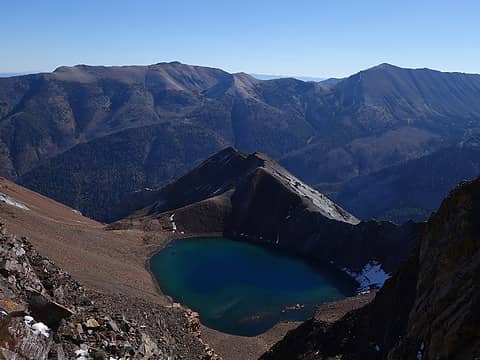
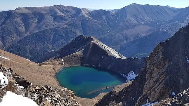
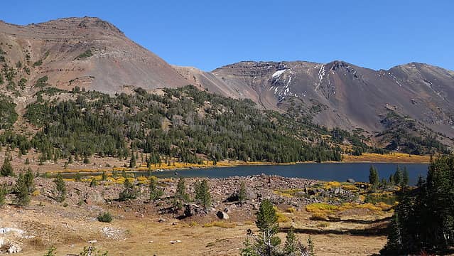
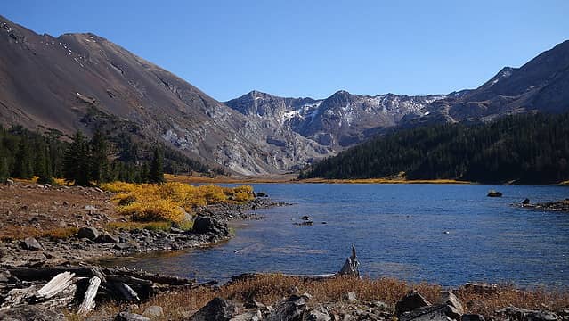
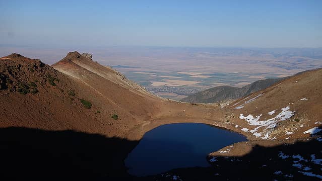
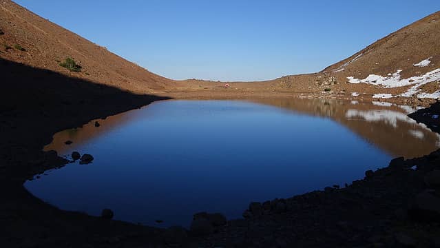
After a short rest we continued south and met back up with the trail and ascended to a small 9100 foot saddle and dropped a short ways to Legore Lake where we set up camp. The scene at Legore Lake was quaint but beautiful. The Wallowa Mountains offered a vibe of simplistic beauty that was rather calming, similar to the feeling I get when I'm in the Chelan Sawtooths. After we cooked dinner, we walked back up to the small saddle right above to watch the sunset. The sunset glow on the red colored rocks was awesome. It unfortunately gets dark too early now that it's late September so by 7:30 I went into the tent to try and sleep.

First views up Falls Creek
Sacajawea Peak
Sacajawea Peak
Fall foliage with granite cliffs
Chief Joseph Mountain
Cliffs above 8000 foot basin
Sawtooth Peak
Sawtooth Peak
 
View to saddle above Lagore Lake
Legore Lake and Twin Peaks
View east of Chief Joseph Mountain
Twin Peaks
Twin Peaks
Sunset behind unnamed peak
Sunset on Sacajawea
Sunset on Sacajawea


Last light on Twin Peaks


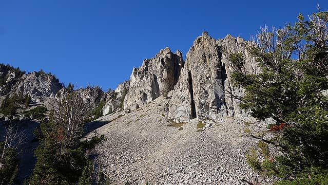
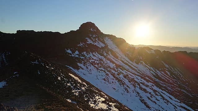
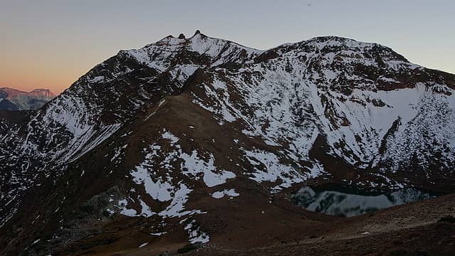
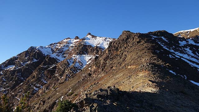
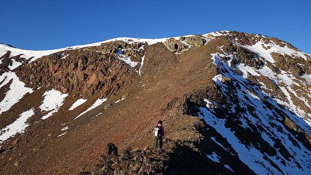
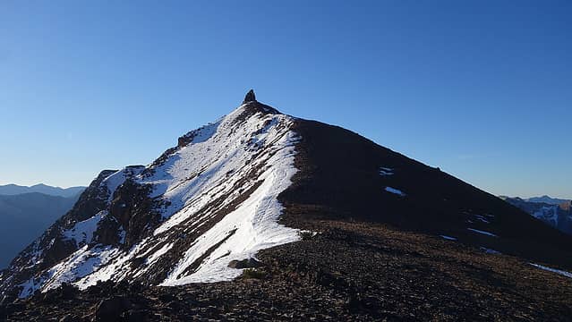
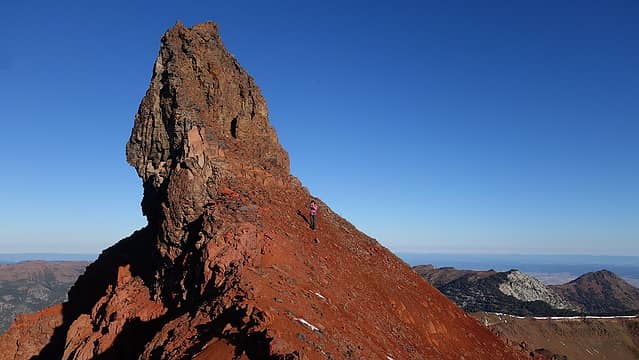
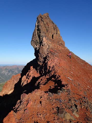
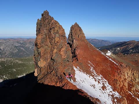
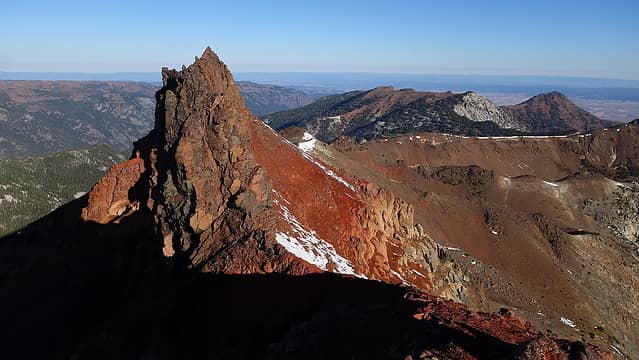
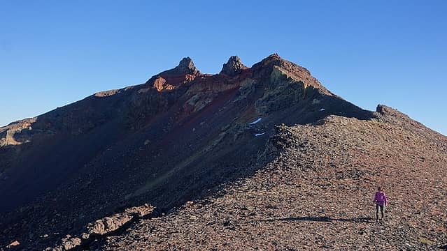
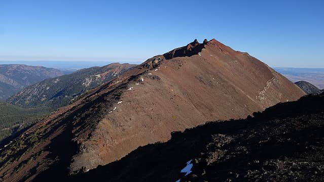
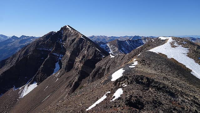
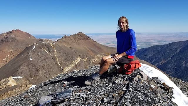
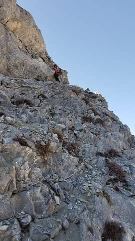
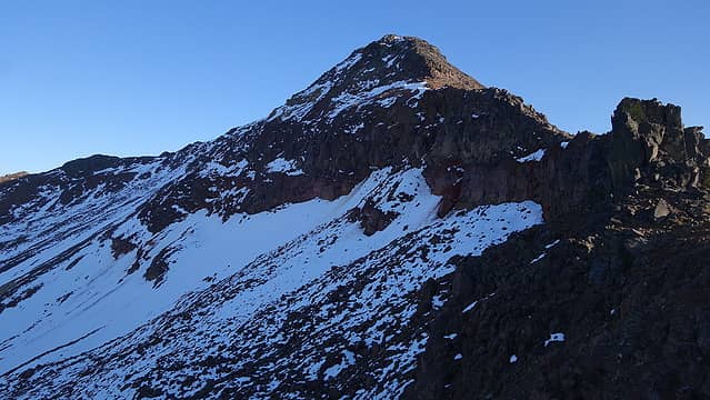
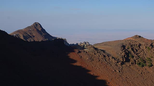
That night there was quite a bit of Wind, and as the sun rose we emerged to a chilly and breezy morning. This is probably ther last trip I do in 2021 without bringing any real insulating layer. We quickly started ascending towards the summit of Twin Peaks to keep warm and in no time, we were standing at the base of the north tower, which is the higher of the twin peaks. Along the east side of the north tower there is a class 3 ramp that can be used to attain the summit. Touching the highest point involved some exposed belly crawl or au chavel on a knife tower rock that is just far enough out of reach for most people to be able to easily touch it so pucker up and prey the rock doesn't fall off! The scramble to the top of the tower was short and only involved about 40 feet of class 3 but with the melting snow up there, the rock was slick and the bottom of our shoes holding wet mud so we had to take extra caution. After enjoying the chilly summit in the sun we continued traversing around the east side of the lower south tower, then up to the southernmost peak which I guess could be called the third "Twin Peak" however it is just an easy walk to this point. The view back to the south sides of the twin peaks, and their west faces was a scary sight. The west face of both towers is overhung, and it's only a matter of time before both of these towers end up completely falling over.

Sunrise over Legore Lake from camp
Sunrise on Twin Peaks
Legore Lake
Legore Lake
Small saddle we crossed
Hiking to north ridge of Twin Peaks
Twin Peaks rugged NE face
View north
View north
Easy ridge to Twin Peaks
 
Twin Peaks north ridge
 
View down north ridge
View southeast
View southeast
The north (higher) tower from south
 
Twin Peaks
Twin Peaks


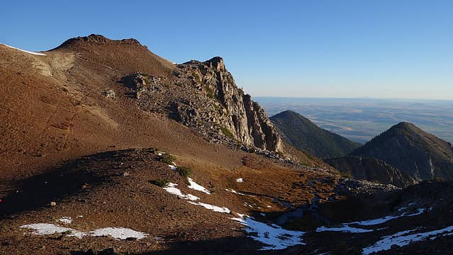
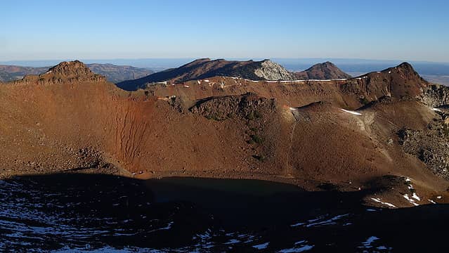
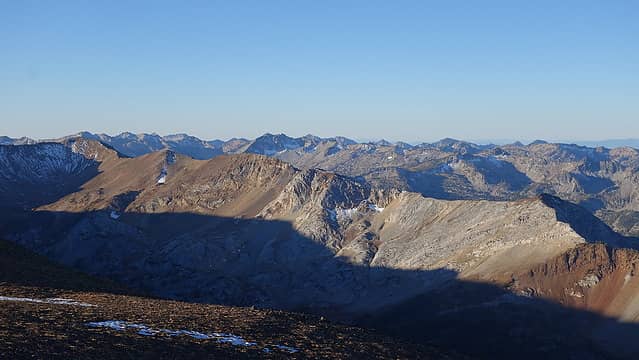
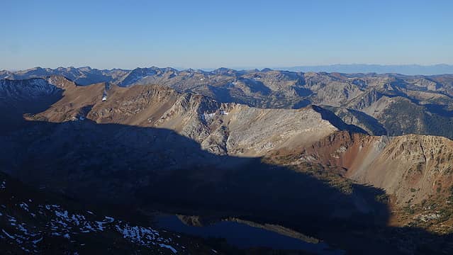
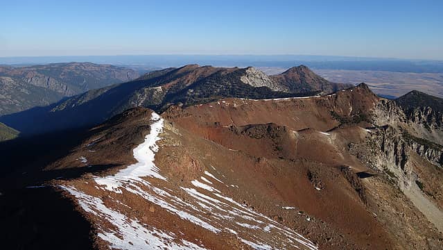
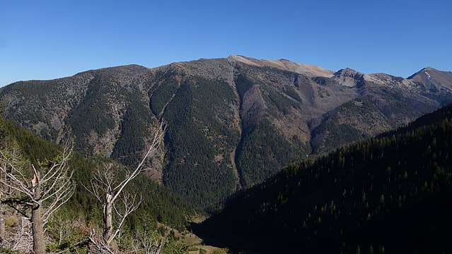
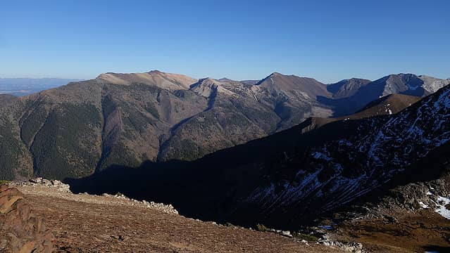
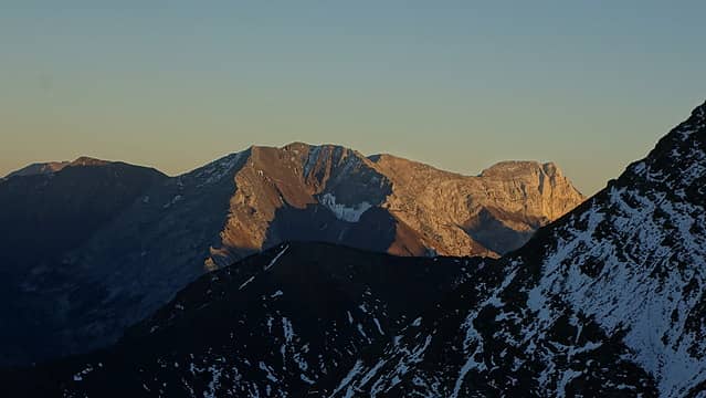
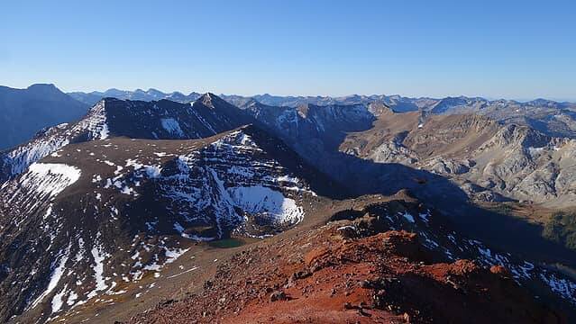
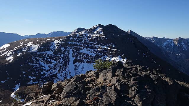
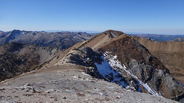
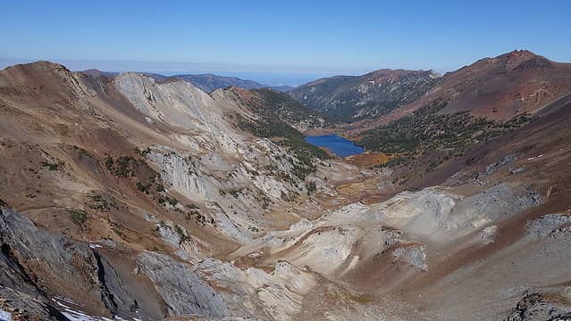
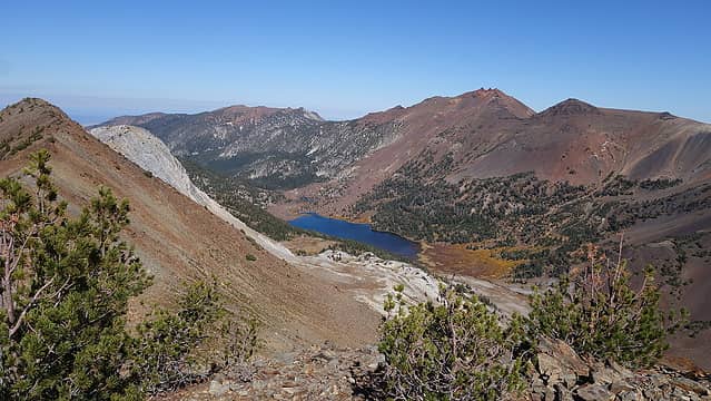
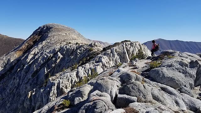
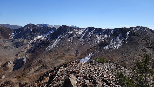
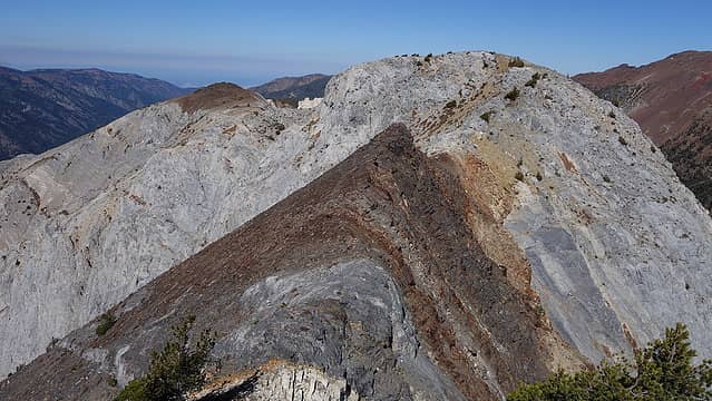
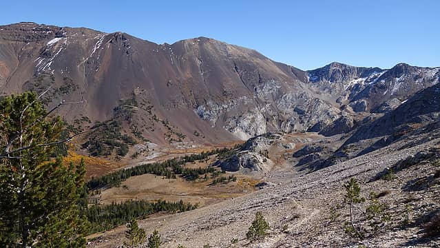
We contined hiking south along Hurricane Divide battling 20 MPH winds, however we were now on easy class 1 and 2 ridgerunning terrain. We hiked over Frances Point and The Undertaker, both unranked peaks before reaching the top of Hurricane Divide North. This ranked peak has roughly 460 feet of prominence and was our second ranked peak for the day. SInce it was still early in the morning by thispoint, we decided we would have enough time to continue the ridge around the Frances Lake basin all the way to Marble Point. So we descended to the next saddle, where the rock type changed from a reddish colored volcanic rock to a white sandstone. The contrast was very stark, and the ridge also changed from easy walking to some class 3 scrambling in order for us to summit Hinterstossier Peak (ridiculous name). I looked north and south from where the rock type changed and saw this same white sandstone was the rock found on Sacajawea Peak on the other side of the valley. The Sandstone was also steeply dipping to the northeast, the geology was so cool here!

Hurricane Divide Ridge from lower south peak
Twin Peaks from lower south peak
Twin Peaks
Twin Peaks
Frances Lake basin and The Goblin
Hurricane Divide North from Frances Point
Unnamed lake below Frances Point
View back to Twin Peaks
Frances Lake below
Frances Lake below
 
 
Twin Peaks
Twin Peaks
View north
View north
Hurricane Divide North from The Undertaker
Deadman Lake
Deadman Lake
View back at The Undertaker
Panorama of Frances Lake basn
Hinterstossier Peak from HDN
Myself on summit of HDN
Hinterstossier Peak
Hinterstossier Peak
Rock change
Rock change
Scrambling on the white sandstone
White sandstone layer
Deadman Lake
Deadman Lake
 
Frances Lake from south


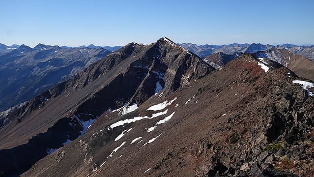
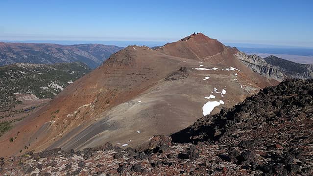
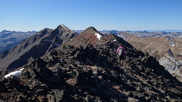
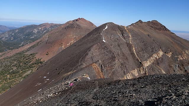
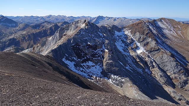
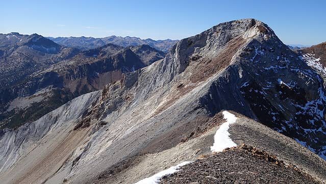
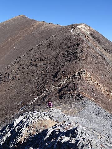
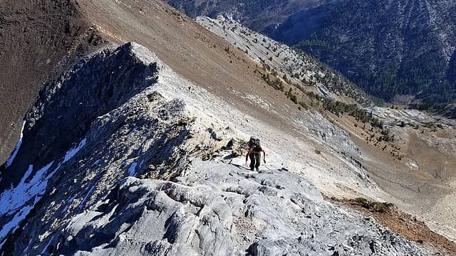
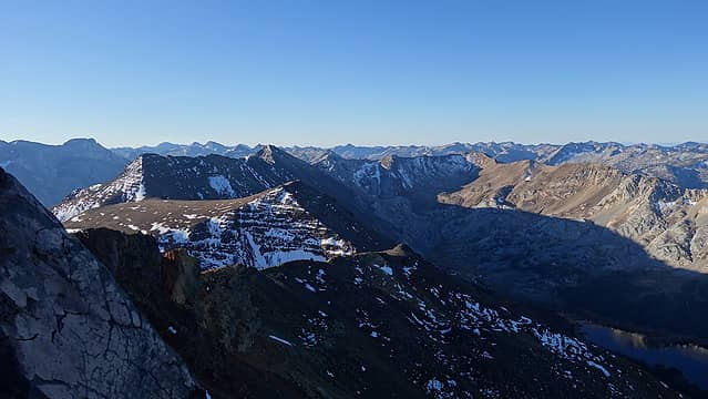
We then continued west on the ridge, passing a couple more very short class 2+ steps to Point 9280, crossing back onto darker colored volcanic rock again along the way. This peak marked the furthest away we would get from our camp. Here, the long and more rugged continuation of the Hurricane Divide Ridge went south and could be taken over 5-6 more peaks all the way to Eagle Cap if someone had more time. We turned back north though and went over The Troll and The Goblin enroute to Marble Point. There was some exposed class 3 ledge scrambling between The Troll and The Goblin, and we crossed back onto the white sandstone rock at the summit of The Goblin. Some class 3 scrambling was also done navigating around a series of small towers along the serrated ridge between The Goblin and Marble Point. Once we reached the summit of Marble Point, we were shocked to fins a large ammo box summit register. Despite this peak being unranked and virtually uninteresting to anyone looking to climb peaks in the Wallowas, there was a very nice register here. In addition to that, we were the only people to sign it in 2021...how was this possible? We would soon realize that despite the popular trail that crosses the ridge north of Marble Point and descends to Frances Lake, people cannot easily walk the ridge south to Marble Point due to a cliff that blocks easy passage along the north ridge from where the trail crests the ridge. Either way, we took a small rest here as it would be our last peak for the day.

Frances Lake and Twin Peaks from Point 9280
 
Back on white sandstone again near The Goblin
View back east
View back east
 
Scrambling towards the Goblin
Twin Peaks across the valley


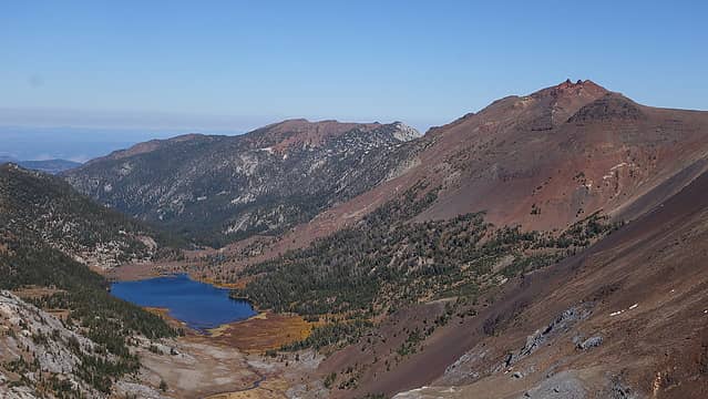
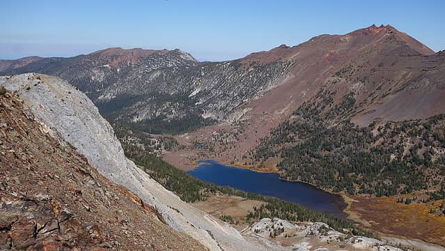
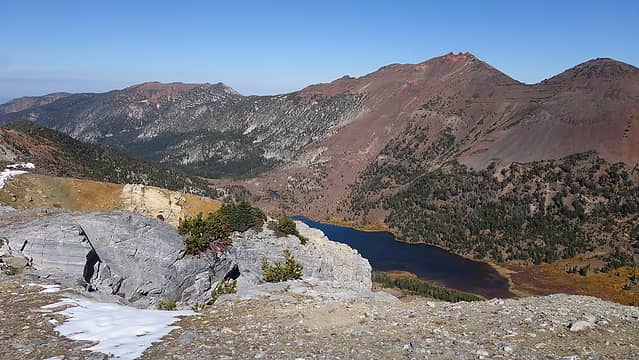
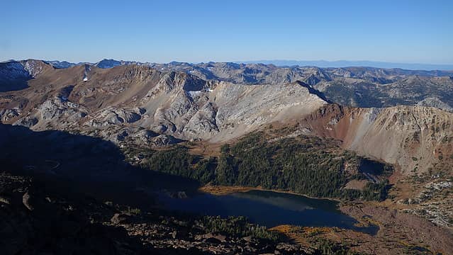
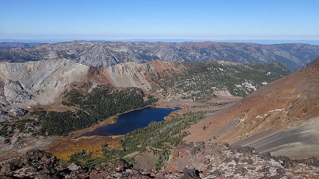
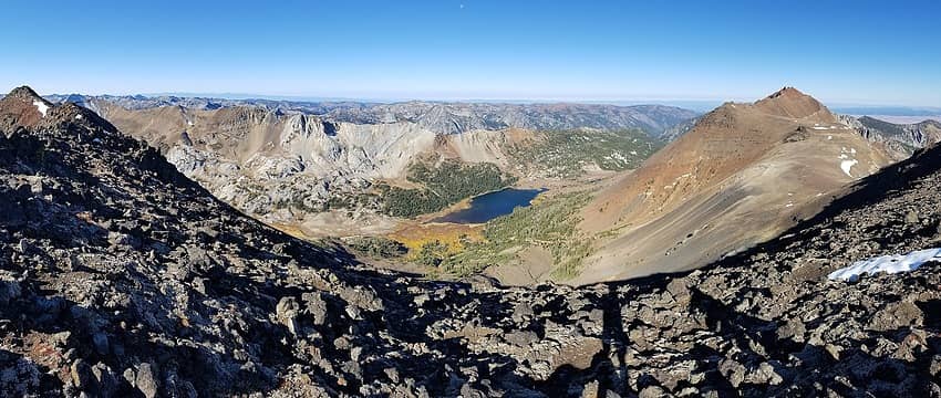
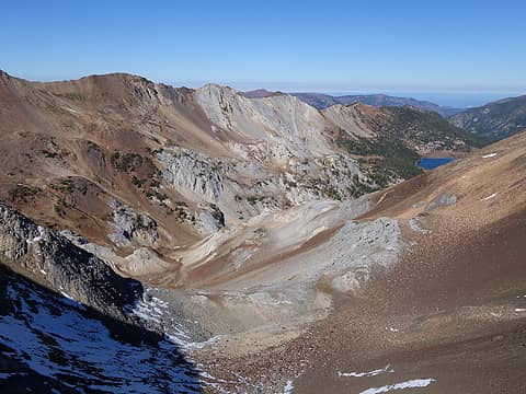
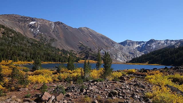
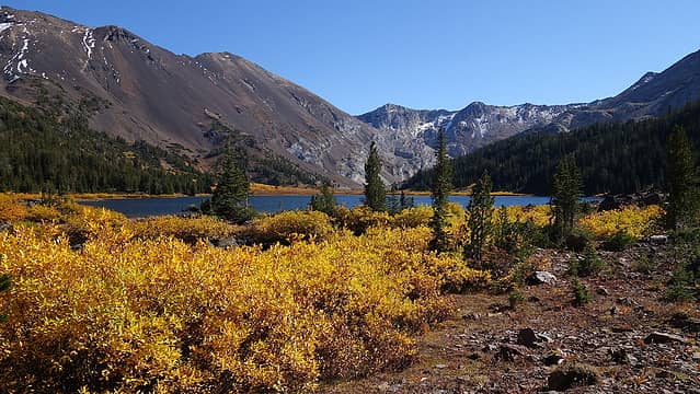
We then began descending down to Frances Lake following a more or less direct line, and we also scouted out an uphill treeless traverse on the west slopes of Twin Peaks we could ascend to get back to Legore Lake. We reached the outlet of Frances Lake at 7700 feet and took a nice long break to eat and refill water. The yellow color on the plants surrounding the lake literally gave me an eyegasm haha! It was a gorgeous afternoon and we had the entire lake to ourselves. With hesitation, we started the grueling 1500 foot ascent up the slopes of Twin Peaks towards the low saddle directly west of Legore Lake. We had to make a long ascending traverse, cutting all the way across the slopes mostly on loose talus. Occationally we were able to find goat trails which helped a lot. We reached the saddle above the lake after a bit over an hour ascending and were greeted to a new vantage point of the lake. The final 250 foot descent back to the lake from the saddle was tedius since the rock was so loose, and the hardpan dirt covered in kitty litter ball bearing garbage, but by 5:30pm we were back at camp relaxing. The lake was about 5 feet lower than normal due to the dry summer but in the evening we noticed it still has quite a bit of fish living in there. As the sun was setting we saw a couple people with a dog descending down Twin Peaks, and they were headed back to their camp at the 8000 foot level in the first basin right above the old mine. We had some tea and went to sleep once it was dark. Due to the rocky ground we were camped on it was another sleepless night for me.

Descending off Marble Point
Arriving at Frances Lake
Fall color at the lake
More fall color
More fall color
Frances Lake outlet
Frances Lake outlet
Legore Lake from the saddle
Twin Peaks from the saddle
 
Legore Lake
Legore Lake


The following morning we slept in a little and packed up camp. We started the hike out and retraced the trail back over the small ridge and down to the 8600 foot basin below Sawtooth Peak. Olga made the 550 foot ascent up the southeast slopes of Sawtooth Peak while I hung out in the basin. I wasn't too interested to go up another unranked peak so I enjoyed the morning sunshine while she made the 45 minute detour up and down. I ran into the same couple we saw the previous evening as they returned back up to also hike up Sawtooth Peak. Once she returned we made very quick work hiking down the steep Falls Creek Trail, stopping only to check out the old mine. I crawled inside the 15 foot deep tunnel to see if I can find which ore the old miners were chasing, but I quickly realized the reason the mine was so small...there was nothing of value there so whatever it was they thought existed there ended up being a quick bust. Once we got back to the trailhead, I took a bath in the river by the road and we started driving back west.

The old Legore Mine
The old Legore Mine


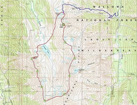
The map below shows the loop route we took from Legore Lake (red), and the location of the Falls Creek Trail (blue). The whole trip was 16.5 miles round trip and 7800 feet of elevation gain, so for a two night trip it was actually quite leisurelly.

Powered by Create your own unique website with customizable templates.