LEMKE CLIMBS
  • About
    • Whats New
    • 2019 Goals/Wishlist
    • Contact
  • Washington
    • North Cascades >
      • Sahale Peak, Boston Peak
      • Eldorado Peak, Klawatti Peak
      • Black Peak
      • Forbidden Peak West Ridge
      • Primus Peak Attempt
      • Big Snagtooth
      • Liberty Bell Beckey Route
      • Burgundy Spire North Face 5.8
      • Ragged Ridge - Katsuk, Kimtah and Cosho Peaks
      • Colfax Peak
      • South Early Winters Spire via SW Buttress
      • Chilliwack Mini-Slam
      • Mesahchie Peak
      • Inspiration Traverse
      • Mount Shuksan Ski
      • Full Pickets Traverse
      • Mount Goode NE Buttress & Storm King
      • Mount Baker North Ridge WI3
      • Snowfield Peak
      • Lincoln Peak
      • Silver Star Mountain
      • Mount Buckner & Horseshoe Peak
      • Azurite Peak
      • Tower Mountain & Golden Horn
      • Mount Logan
      • Custer Ridge & Easy Mox
      • Mazama Dome
      • Sherman Peak
      • Mount Ballard
      • Southern Pickets Traverse
      • Corteo Peak
      • Whatcom Peak
    • Glacier Peak Wilderness >
      • Buck Creek Pass, Cloudy Peak, Spider Gap
      • Dome Peak, Spire Point
      • Mt. Maude and Seven Fingered Jack
      • Mount Formidable NE Face 5.6 Second Ascent
      • Dumbell and Greenwood Mountains
      • Glacier Peak Wilderness Mountain Massacre
      • Clark and Luahna Peaks
      • Sinister Peak
      • Chiwawa Mountain
      • Tupshin & Devore Peaks
      • Buck & Fortress Mountains
      • Glacier Peak
      • Snowking Mountain
    • Olympic Peninsula >
      • Buckhorn Mountain
      • Flapjack Lakes Hike
      • Grey Wolf Peak, High Divide Trail
      • Mount Ellinor
      • Mount Constance West Arete
      • Mount Olympus
    • Alpine Lakes Wilderness >
      • Chikamin Peak
      • PCT - Snoqualmie to Pete Lake
      • Foss Lakes Hike
      • Necklace and Tank Lakes
      • Enchantments Day Hike
      • Granite Mountain (Snoqualmie)
      • Colchuck Peak
      • Cannon, Enchantment and Stuart
      • Ingalls Peaks
      • McClellan Peak
      • Dragontail Peak
      • Web Mountain
      • Mount Index Attempt
      • Snow Creek Wall Orbit 5.8+
      • The Tooth South Face
      • Eightmile Mountain
      • Argonaut Peak NE Couloir
      • Little Annapurna South Face 5.5
      • Snow Creek Wall Outer Space 5.9
      • Cashmere Mountain
      • Sherpa Peak North Ridge 5.8
      • Chair Peak NE Ridge
      • Lichtenburg Mountain
      • Mount Index
      • McClellan Butte
      • Chimney Rock
      • Alpine Lakes High Route
    • Pasayten Wilderness >
      • The Craggies
      • Tiffany Mountain
      • Pasayten Mini-Slam
      • Remmel Group
      • Jack Mountain
      • Robinson Mountain
      • Monument Peak Group
    • Mountain Loop Highway >
      • Vesper Peak
      • Mount Dickerman
      • Sloan Peak West Face 5.8
      • Mount Forgotten
      • Whitehorse Mountain
      • Gothic Peak
    • Lake Chelan Sawtooth Wilderness >
      • Star, Courtney, and Grey Peaks
      • Hoodoo Peak and Raven Ridge
      • Abernathy Peak
      • Mount Bigelow
      • Reynolds Peak
      • Oval Peak
      • Gardner Peaks
      • Chelan Sawtooth Trio
    • Southern WA >
      • Mount Adams
      • Mount Rainier - Emmons Route
      • Mount Saint Helens
      • Goat Peak
      • Lane Peak, Plummer Peak (Tatoosh)
      • The Unicorn (Tatoosh)
      • Little Tahoma
      • Liberty Cap
    • WA Rock and Ice Cragging >
      • Index Town Walls
      • Vantage
      • Mount Erie
      • Exit 38
      • Leavenworth
  • Colorado
    • San Juan Mountains >
      • Mount Sneffels Lavender Snow Climb
      • Uncompahgre, Matterhorn Peaks
      • Redcloud, Sunshine Peaks
      • San Luis Peak
      • Vermilion, Fuller Peaks
      • Stewart Peak, Baldy Alto
      • Jones, Niagara, American Peaks
      • Wetterhorn Peak, Handies Peak
      • Wilson Group
      • Arrow Peak
      • Mount Sneffels SW Ridge
      • Jagged Mountain, Chicago Basin
      • Teakettle Mountain
      • Dallas Peak
      • Vestal Peak Wham Ridge, Greystone Peak
      • Organ Mountain
      • Phoenix Peak
      • Half Peak
      • Point 13832 Group
      • Golden Horn
      • Mount Sneffels Snake Couloir
      • Pigeon, Turret Peaks
    • Elk Mountains >
      • Four Pass Loop
      • Castle, Conundrum Peaks
      • Snowmass Mountain
      • Cathedral Peak
      • South Maroon Peak
      • The Pyramids
      • North Maroon Peak, Sleeping Sexton
      • Capitol Peak, Mount Daly
      • Malemute Peak
      • Hagerman Peak
    • Sangre de Cristo Mountains >
      • Blanca Peak, Ellingwood Point
      • Challenger Point
      • Mount Adams
      • Spread Eagle Peak
      • Humboldt, Obstruction, Columbia Peaks
      • Mount Lindsey, Huerfano Peak
      • Little Bear Peak
      • Crestone Needle Ellingwood Arete
      • California Peak
      • Crestone Peak North Buttress
      • Operation Dark Snake
      • Kit Carson Mountain
    • Sawatch Mountains >
      • Iowa Peak
      • Point 13,618 - Hunky Dory Lake
      • Gold Dust Peak, Notch Mountain
      • Mount Jackson
      • Mount Belford
      • Shavano, Tabeguache Peaks
      • Mount Antero, Cronin Peak
      • Twining Peak
      • Mount Massive
      • Casco Peak
      • Mount Huron
      • Mount Elbert
      • Mount Oxford
      • Mount Hope
      • Mount Yale
      • Lackawanna Peak
      • Mount Columbia
      • La Plata Peak
      • Rinker and Twin Peaks
      • Bull Hill, Mount Princeton
      • Missouri Mountain
      • Mount Oklahoma
      • French Mountain
      • Mount Ouray
      • Grizzly A, Garfield Peaks
      • Mount Harvard
      • The Three Apostles
      • Emerald Peak
      • Holy Cross
      • Mount Aetna
    • Greater Park Range >
      • Kneeknocker Pass, Piney Lake
      • Drift Peak
      • Sherman Peak, Dyer Peak
      • Gore Range Traverse
      • Quandary Peak
      • Pacific, Atlantic Peaks
      • Clark Peak
      • Crystal Peak, Peak 10
      • Fletcher Mountain
      • The DeCaLiBron
      • Loveland Mountain
      • The Mosquito Traverse
      • Mount Arkansas
      • Clinton Group
      • Eagles Nest, Peak C
      • North Star Mountain
      • Peak X
      • Wheeler Mountain
    • Front Range >
      • Mount Evans, Spalding
      • Mount Bierstadt
      • Mount Parnassus, Bard Peak
      • Cupid, Sniktau, Grizzly D Peaks
      • James Peak
      • Mount Silverheels
      • Grays and Torreys Peaks
      • Mount Edwards
      • Mount Flora, Longs Peak
      • Square Top Mountain
      • Petit Grepon South Face 5.8
      • Mount Meeker Dreamweaver Couloir
      • Santa Fe Peak
      • The Citadel & Pettingell
    • Colorado Ice Climbing >
      • Lincoln Ice Falls
      • Ouray Ice Park
      • Avocado Gully and The Drool
      • Hidden Falls
    • Colorado Rock Climbing >
      • Eldorado Canyon
      • The Flatirons
      • North Table Mountain
      • Shelf Road
      • Colorado National Monument >
        • Independence Monument
  • Wyoming
    • Wind River Mountains >
      • Gone With the Winds
      • Union Peak - Solar Eclipse
      • Wind River Peak
      • Wind River Slam
    • Teton Range >
      • Grand Teton Owen Spalding 5.4
      • Mount Owen Attempt
    • Wyoming Absarokas and Gros Ventre Range >
      • Jackson Peak
      • Francs Peak
    • Yellowstone National Park >
      • Top Notch Peak
    • Bighorn Range and Great Divide Basin >
      • Boars Tusk
      • Loaf Mountain
      • Cloud Peak
      • Black Tooth Mountain
    • Devils Tower
    • Cody Rock and Ice Climbing
  • Montana
    • Beartooth Mountains >
      • Whitetail Peak Group
      • Beartooth Mountain
      • Spirit Mountain Group
      • Mount Peal
      • Granite Peak Group
      • Castle Rock Group
      • Castle Mountain NE Couloir
      • Mount Inabnit and Sylvan Peak
      • Mount Hague South Slopes
      • Mount Villard and The Granite Peaks Traverse - 5.4
      • Spirit Mountain NE Ridge - 5.4
      • California Ice WI 4
      • The Ramp 5.8
      • Linea Alba 5.10d
      • Iceberg Peak
      • Metcalf Mountain North Rib 5.8
      • Villard Spires HP West Ramp
      • Cairn Mountain
      • Snowbank Mountain
      • Mount Wood Group
      • Bears Tooth
      • Glacier Peak Catch-a-Sunrise FA
    • Montana Absarokas & Gallatin Range >
      • Black Mountain
    • Southwest Montana Ranges >
      • Sacajawea Peak
      • Arrow Peak
      • Koch Peak
      • Saddle Peak
      • Baldy Mountain
      • Sphinx Mountain
    • Glacier National Park >
      • A Taste of Glacier National Park
      • Divide Mountain
    • MT Rock and Ice Climbing
  • Utah
    • Uinta Mountains >
      • Kings-Emmons Ridge Run
      • Hayden Peak
      • Iron Hayden Wall Rock Climbing
    • Wasatch Range >
      • The Sundial Eleventh Hour 5.8
      • Mount Timpanogos
    • San Rafael Swell >
      • Ramp, Cistern Canyons
      • Salt Wash, Black Mountain, Moroni Slopes
      • Ding, Dang Canyons
      • Little Wild Horse, Bell Canyons
      • Quandary Canyon
      • San Rafael Knob
      • Miners Hollow (Knotted Rope Canyon)
      • Temple Mountain
      • Chimney Rock
      • Bottleneck Mesa
      • Window Blind Peak
      • Lower Baptist Draw & Upper Chute Canyon
    • Capitol Reef National Park >
      • Cathedral Valley Tour
      • Sheets Gulch
      • Halls Creek Narrows
      • Brimhall Canyon and Strike Valley Overlook
      • George Benchmark
    • Moab Area, Canyonlands, Arches >
      • Maze District
      • Needles District
      • Maze District
      • White Rim Trail Biking
      • Elephant Butte, Bullwinkle Tower and Lizard Rock
      • South Six Shooter
      • Elephant Canyon
      • Parriott Mesa
      • Ancient Art
      • Castleton Tower North Chimney 5.8
      • Klondike Bluffs
      • Mount Peale & Tukuhnikivatz
    • Robbers Roost Country >
      • Horseshoe Canyon, Goblin Valley
      • Bluejohn Canyon
      • Happy Canyon Narrows
      • Shenanigans, Leprechaun Slots
      • Larry Canyon
      • Merry Piglet Slot
      • Lower Maidenwater Canyon, Turkey Knob
      • Morocco Canyon
      • Monkey Business Slot
      • Hog Canyon Slots
      • Upper Maidenwater Canyon Slots
      • Mount Ellen
      • Buck Canyon
      • Point 4906
      • Alcatraz Canyon
      • Hard Day Harvey Slot
      • Mount Ellsworth
      • Good Day Jim Canyon
      • White Roost Canyon
      • Upper Stair Canyon
      • Dragon Canyon
    • Escalante National Monument >
      • Phipps Canyon and Arch
      • Red Breaks Slot
      • Dry Fork Slots, Coyote Gulch
      • Little Death Hollow/Wolverine Canyons
      • Egypt 3 Slot
      • Egypt 1 Canyon
    • Zion/Bryce >
      • Ataxia Tower Ashtar Command 5.9
      • Mount Kinesava Cowboy Ridge
      • Birch Hollow
      • Aires Butte
      • West Temple
      • Mystery Canyon
      • Crazy Streak
    • Cedar Mesa Region/Valley of the Gods >
      • Eagle Plume Tower Eagle Feather 5.10b
  • California
    • High Sierras, Southern CA Ranges >
      • Telescope Peak, Manly Beacon
      • Tahquitz Rock Whodunit 5.9
      • Tahquitz Rock Long Route 5.9
      • Palisade Traverse
      • White Mountain
    • Yosemite National Park, Central CA
    • Northern CA Cascades >
      • Lava Beds National Monument
      • Mount Shasta
  • Oregon
    • Oregon Volcanoes >
      • Three Fingered Jack
      • Mount Scott
    • Blue Mountains >
      • Twin Peaks
    • Trout Creek Rock Climbing
  • Alaska
    • Eagle Peak and Mount Ewe
    • Jatt Peak and Portage Pass
    • Rainbow Peak
    • Mount Brooks Attempt
    • Arrigetch Peaks Trek
    • Ab Mountain Hike
    • South Suicide Peak
    • Mount Hunter West Ridge Attempt
    • Cantata Peak Attempt
    • East Twin Peak
    • Mount Alice
    • Crow Pass and Hope Point Hikes
    • Indianhouse Mountain Attempt
    • Lynx Peak
    • Harding Icefield Hike
    • Hatcher Pass and Grapefruit Rocks Climbing
    • Mount Sanford
    • Mount Hunter West Ridge
  • Nevada
    • Ginger Cracks 5.8
    • Mescalito Dark Shadows 5.8
    • Birdland and Olive Oil
    • Frogland 5.8
    • Johnny Vegas 5.8
    • Schaeffer's Delight & Triassic Sands
    • Solar Slab - 5.6
  • British Columbia
    • Mount Matier
    • Taiya Peak
    • Bugaboo Spire NE Ridge
    • Mount Sabine Easy Honey 5.10b
    • Mount Sir Donald NW Ridge Attempt
    • Black Tusk
    • Squamish Ticks
    • Slesse Mountain NE Buttress
    • Warden Peak
    • Triple Peak
  • Alberta
    • Mist Ridge Hike
    • Mount Temple Attempt
    • East Wendell Peak
    • Loder Peak
    • Tower Mountain Attempt
    • The Rimwall
    • Mount Yamnuska Directissima 5.9
    • Mount Lawrence Grassi
    • Mount Lorette
    • Roche A Perdrix
    • Mount Edith Cavell East Ridge 5.3
    • Mount Louis Kain Route
    • Eiffel Peak
    • Canadian Rockies Ice Climbing
  • Other States
    • Arizona >
      • Grand Canyon Bright Angel Trail
      • Beanfest at Cochise Stronghold
      • Baboquivari Peak
      • Humphreys Peak
    • New Mexico >
      • Philmont Trek August 2008
    • Yukon >
      • Canyon Peak
  • International
    • Mexico & Central America >
      • Mexico - Pico de Orizaba, Izta
      • Guatemala Volcanoes
    • South America >
      • An Introduction to Patagonia
      • Cordillera Blanca - Tocllaraju and Urus
      • Nahuel Huapi National Park & The Frey
      • Exploring Pucon and Lanin Volcano
      • Cordillera Blanca - Ishinca Peak and Artesonraju
      • Cordillera Blanca - Quitaraju & Alpamayo
      • Exploring Southern Peru
      • Cerro Helio Azul & Tronador Attempt
      • Aguja Guillaumet Amy Couloir
      • Cerro Puntado & Palo
      • Cerro Colorado
      • Cerro Puno & Agudo
      • Cerro Trinidad Attempt
      • Volcan Quetrupillan
      • Cerro Placas
      • Nevado de Acay
      • Pequeno Alpamayo
      • Huayna Potosi
      • Illimani
      • Chiaro de Luna
      • Cerro Barros Arana
    • Oceania >
      • Exploring New Zealand's South Island
      • Puncak Jaya
      • Mount McPherson and Talbot
      • Single Cone
      • Mount Cook
      • Mount Aspiring
      • Manakau
    • Central Asia >
      • Kyrgyzstan 2021
  • Sorted by Year
    • 2008 Trip Reports
    • 2009 Trip Reports
    • 2010 Trip Reports
    • 2011 Trip Reports
    • 2012 Trip Reports
    • 2013 Trip Reports
    • 2014 Trip Reports
    • 2015 Trip Reports
    • 2016 Trip Reports
    • 2017 Trip Reports
    • 2018 Trip Reports
    • 2019 Trip Reports
    • 2020 Trip Reports
    • 2021 Trip Reports
    • 2022 Trip Reports
  • Vanlife
    • Conversion Journal >
      • Floor Installation
      • Folding Bed
      • Coffee Table
      • Thinsulate Installation
      • The Couch
      • The Wardrobe
      • Bookshelf
      • Water System
      • Electrical System
      • The Pantry
      • Refrigerator
      • Tire Upgrade
      • Heating System
      • Composting Toilet
LEMKE CLIMBS

gone with the winds

downs mountain - 13,355' - Class 2 via bear basin
Point 13,062 - Class 2
Yukon Peak - 12,825' - Class 2
​august 2011

My Point 13,062 page on SP

My Yukon Peak page on SP

Introduction

Trip Stats:
About 65 miles
About 20,000 feet elevation gain
5 Summits and countless lakes and tarns

This was it! I had been planning this trip since January of 2011 to be my virgin trip to the Wind River Range in Wyoming. My old roommate and I were going to spend 8 days in the northernmost part of the range. Over the course of the spring and the summer we kept in contact with one another by phone planning the route we would take and choosing which peaks to attempt. After much researching on Summitpost, guidebooks and checking with the Great Outdoor shop to see what they advised we had the route set. Now the route we ended up doing was modified greatly as we cut out some summits but hey, that's just another reason to keep heading back.

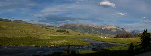
The first five days we spent cross country through some of the most beautiful and remote terrain I've ever seen with a couple days following the continental divide and topping out on five peaks. We started at the Green River Lakes and passed by many gorgeous unnamed tarns, waited through a huge thunderstorm in Bear Basin and descended the long Tourist Creek drainage before relaxing the last few days on trails out to Elkhart. 

This trip was sort of a life changing experience for me and I plan on returning here many times.
Here is a map showing the route we ended up taking.


Day 1...August 13, 2011 Green River Lakes to Roaring Fork

So I was driving back to Colorado from my home in the Seattle area. School would be starting on the 23rd of August and this was the big summer ending trip. My friend met me in Pinedale coming from Denver, he being a native to Colorado. After stopping at the Great Outdoor Shop and getting a nice big dinner at the bar just next door, we were off to the Green River Lakes. By the time we got to the trailhead the sun was setting but we planned on hiking much of the long Roaring Fork trail the first night.

The Green River
View of the Green River on the drive to the trailhead


Green River Lakes
Square Top Mountain from the Green River Lakes

We started hiking on the lesser known trail that circles around Osborn Mountain and on its way to Native Lake. After about five miles in we decided to call it a night. We started out with at least 50 pound packs each as I went very liberal with food. Just those first few hours we saw deer and heard a bear in the distance as we walked through the trees at night. We managed to find a nice grassy spot shortly after the bridge that crossed the Roaring Fork. We went straight to sleep with the excitement racing through us. I was very tired as I was up all night the previous night driving through Oregon and drove all that morning through Idaho. I really needed sleep!

Day 2...Roaring Fork to Crescent Lake

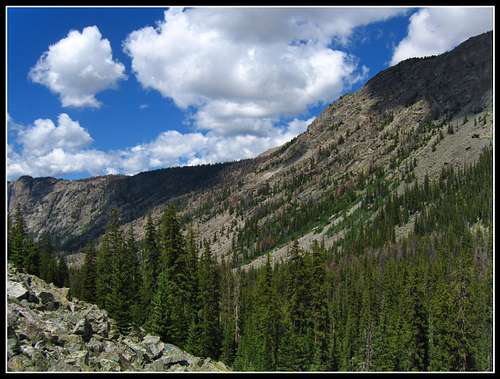
We woke to crystal clear skies and started off. We had three or four miles remaining of the trail until it ended. The Roaring Fork was very gentle as we got higher up in the valley which was very quaint and lush. 

Roaring Fork
Roaring Fork reflection


We continued up the trail until it crossed the creek which is where we stopped for a lunch break. It is here we saw our first group; a group of three that were completing their trek heading north from their start at Big Sandy. We didn't plan to go down that far as we wanted some summits, which after asking they didn't even think of climbing anything. We sat for about an hour eating and enjoying our first great views of the trip.

Roaring Fork
Roaring Fork
Thunderstorms?
Roaring Fork

Soon enough we reached the end of the trail and started cross country traveling. We started climbing steeply up the slopes to Native Lake getting higher and higher above the upper reaches of the Roaring Fork.

Looking back...
Views from the slopes to Native Lake

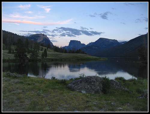
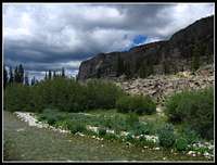
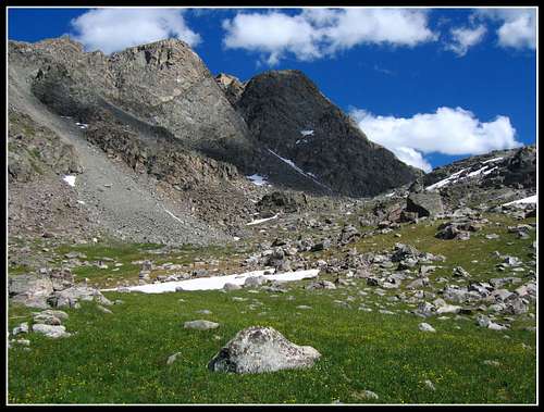
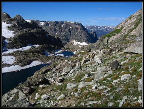
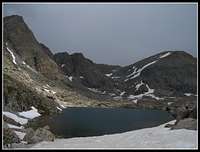
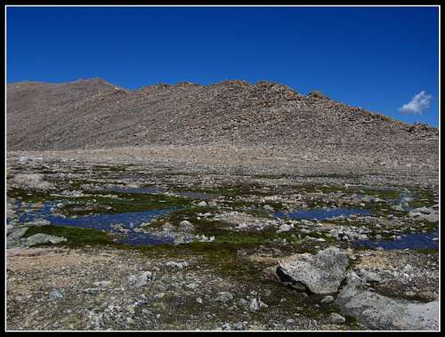
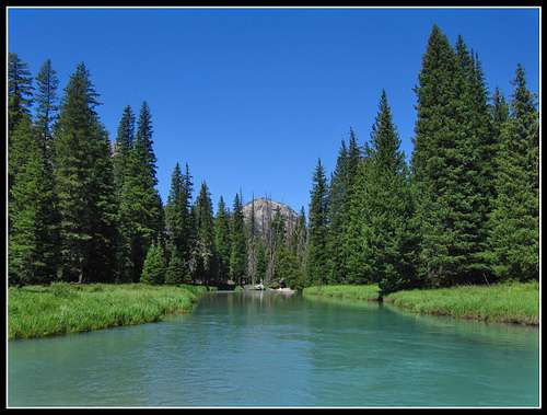
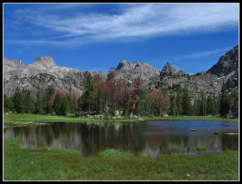
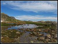
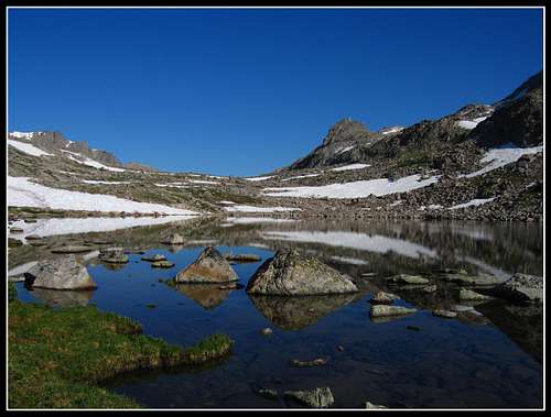
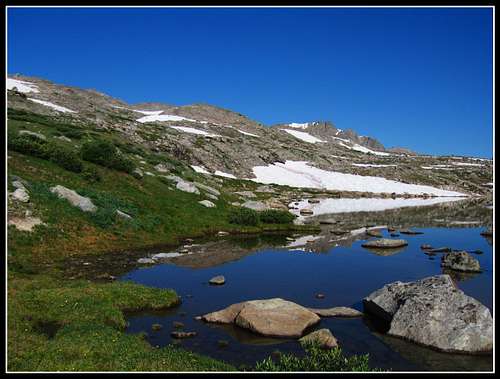
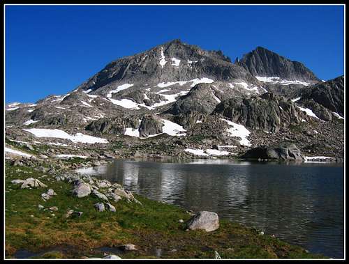
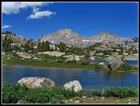
Before we knew it, after some class 2 and 3 moves up this steep slope we made it to the hanging valley that contains Native Lake. This was my first Wind River lake and it was beautiful. Even though I have seen the best of lakes in the Cascades, these lakes were truly something spectacular. 

Native Lake outlet
Native Lake Outlet

After taking a moment to take in the beauty we continued onward up to the next little valley above Native Lake before topping out just to the west of Crescent Lake. From here we finally saw the continental divide up close and personal. We continued to Crescent Lake and was absolutely stunned by how lush the area was. By now, we were way above treeline and in true alpine terrain. 

Native Lake
Native Lake
Above Native Lake
The tiny tarn above Native Lake
Crescent Lake
Crescent Lake
Crescent Lake
Crescent Lake


I have heard about how fantastic all the fishing is in the Winds and I saw fish biting in these first couple lakes all the time. If you like to fish, this is the place to go. We rounded on the north side of the pretty long lake and continued up a few hundred feet to a small pass with four small tarns just above Crescent Lake.

Near Crescent Lake
Looking up at the some unnamed 12ers. The sun was hitting the lush grass and flowers in front of me so perfectly


Even though it was still pretty early we set up camp and cooked a great dinner of pasta and mashed potatoes. We relaxed and watched the sunset hitting the continental divide to the east. The constant flow of a small waterfall was very nice with small tarns and snowfields surrounding us; it was paradise!

Sunset on Hunters Hump
Sunset over Hunters Hump
Looking Back...
The tarn we slept by
Campsite
Our tent
Hunters Hump...
Sunset from camp


Small tarns
Sunset panorama over Hunters Hump seen from camp

Day 3...Crescent Lake to Bear Basin

We woke to some clouds in the eastern sky and didn't have the sun to warm us up on this cold morning. Since the divide was to our east it would be awhile before it even rose from where we were located. The weather forecast for today called for a chance for thunderstorms and judging from the clouds we had that morning I guess I wasn't too surprised to have spent four hours waiting in a gully being hailed and rained on. More on that later. 

A cloudy morning
A cloudy morning

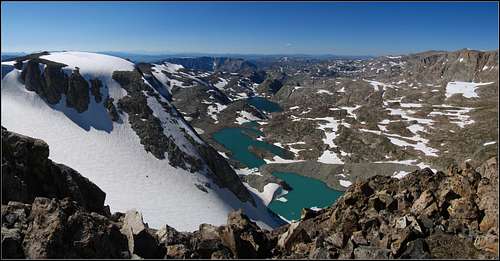
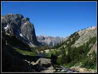
It ended up being a very nice morning once the sun came above the continental divide. The initial plan for the day was to hit the divide early and head east on a prominent ridge that led right up to Hunters Hump. I however simply told my partner we were going to stay off the divide and weave through the alpine lakes to the west and work our way into Bear Basin. I decided this for a few reasons. One, I had a hunch we would get stormed on and didn't want to be on the divide when that happened. Two, I really wanted to get to experience Bear Basin. This decision is possibly the best decision I've ever made in the outdoors. So we continued working our way over many small ridges and valleys and passing by many small unnamed tarns. 
 

Unnamed tarn...
An unnamed tarn


Unnamed tarns
An unnamed tarn


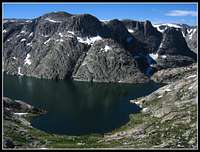
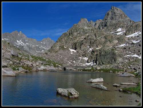
We then made it to a prominent ridge overlooking Daphne Lake. This lake is huge for its elevation, bigger than any lake I've ever seen over 12,000 feet. We decided to take a quick break atop this ridge to take in the views. 

What views...
View from the ridge


Descending off this to the west shore of the lake required some class 2+ scrambling which is much harder with 50 pound packs! After getting to the outlet stream from Daphne Lake the view across the lake was stunning.

Daphne Lake
Daphne Lake

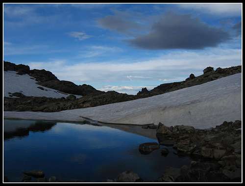
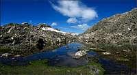
We had to get around to the south side of Daphne Lake for the best way into Bear Basin. We couldn't descent all the way to Bear Lake as there was no good way down and we would just then have to re-climb 800 feet of elevation. So we found a small ledge leaving about 400 feet up to the ridge on the south side of Daphne Lake. Atop this ridge was a small tarn, almost pond side reflecting the rocks behind perfectly.

The Green River Gorge
Bear Lake
Bear Lake
Tarns...
Small tarn near Daphne Lake
Bear Lake
Bear Lake


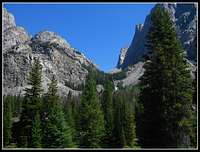
From the top of this ridge is was an easy descent to the northern half of Bear Basin where we stopped to eat lunch. We noticed some puffy clouds rapidly getting bigger...the lighting was great for photography but we knew we wouldn't get much further.

Hunters Hump
View from our lunch spot


Bear Basin
View north in Bear Basin

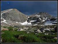
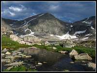
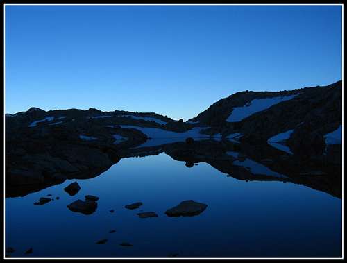
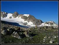
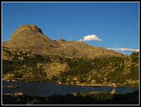
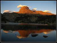
After eating we headed south and over a small ridge separating the north and south halves of Bear Basin. It was right when we topped this small ridge that we knew we were in for something big...really big.

The storm...
Looking at the approaching storm

It wasn't long after I took this photo that we started to get rained on. We quickly looked for a snow gully to hunker down in. We knew that snow doesn't conduct electricity so we decided to sit in a small gully with a pretty large rock above us. We took the rain fly out and covered the packs and just sat. 

Sitting through the marble sized hail and downpours with some very loud thunder. We never really saw any bolts up close but we saw the bright flashes. Occasionally we got a short beak and each time we hoped it was over only to see it build again...and again for four long agonizing hours.
 

Short break...
A short break in the action

We kept hoping the storm would end so we could gain more progress that afternoon but it never did. Around 5 that afternoon it finally started to let up and we unearthed ourselves and looked for a place to pitch the tent.

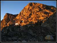
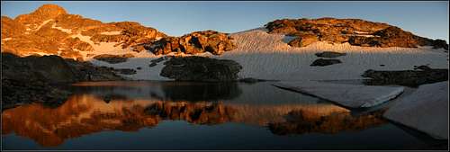
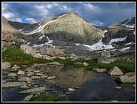
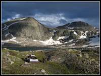
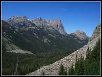
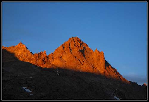
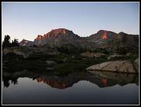
It's a good thing the storm lasted as long as it did though as the subsequent sunset was hands down, the best sunset I've ever seen. Looking towards the continental divide, with the residual dark clouds and the sun lower on the horizon casting the perfect lighting on the landscape. These three hours are three hours I will never forget and it is during this time that I got to thinking; it is moments like this that bring out the best in people. If only everyone would be content in putting in the effort to get to a place like Bear Basin and wait through a storm like we did. Although it would be miserable for a little while, if more people could experience a sunset like the one we saw I firmly believe the world would be a better place. This would however inherently degrade the place as it would be less pristine and your experience wouldn't mean as much to you as many others saw it as well. This is why I take photos, to try and share my experiences in the mountains and bring others outside from the bustle of reality and bring beautiful moments into their minds. I hope this table of photos will do that for people. Although it's a far cry from actually being there, one may be able to imagine it and forget about everyday life doing so.

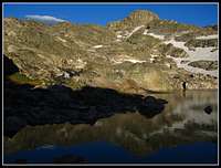
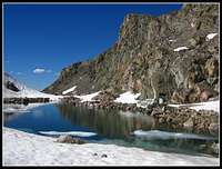
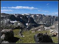
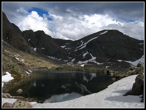
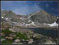
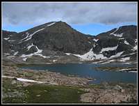
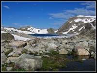
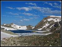
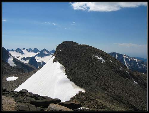
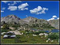
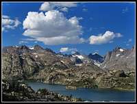
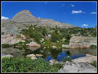
These were all taken in Bear Basin during the sunset after the thunderstorm. Many of them show Point 12,975 and Point 13,062, both of which are on the continental divide.

Bear Basin
Bear Basin
Bear Basin...
Bear Basin
At the lake in Bear Basin
Bear Basin
Campsite...
Camp in Bear Basin
Receeding clouds in Bear Basin
Bear Basin
Bear Basin
Bear Basin
Bear Basin
Bear Basin
Bear Basin
Bear Basin
Bear Basin...
Bear Basin
Bear Basin...
Storm in Bear Basin
Point 12,975
Bear Basin
Bear Basin
Bear Basin
Bear Basin views
Bear Basin
Bear Basin
Bear Basin
Alpenglow...
Bear Basin


Last alpenglow...
Panoramic view of the alpenglow seen from the tent

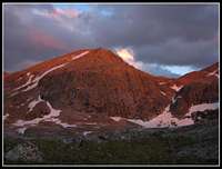
Right after the alpenglow seen in the last photo went away we went right to sleep. What a fantastic day it was!

Day 4...Bear Basin to Baker Lake

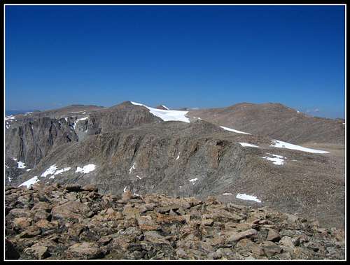
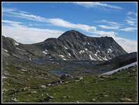
We woke pretty early since we went to bed early. The skies were completely cloudless and the sunrise was breathtaking. We packed up, ate breakfast and started out for what was to be a very big day. The plan was to climb up the waterfall on the east side of Bear Basin and ascend up to the continental Divide. We would then follow the divide to Baker Lake bagging Downs Mountain, Point 13,062, Yukon Peak, Pedestal, and Flagstone Peaks.

The day started with a flat hike around the lakes in Bear Basin as the sun rose.

Sunrise in Bear Basin


Bear Basin
Sunrise in Bear Basin

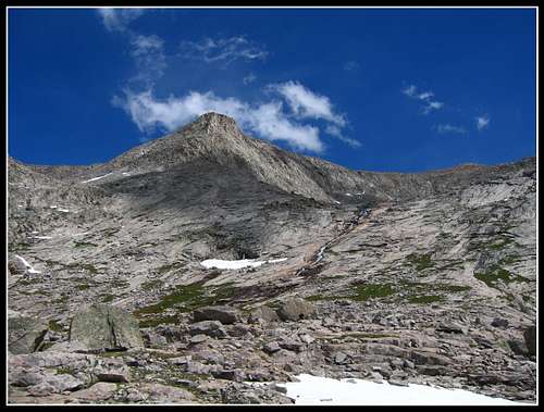
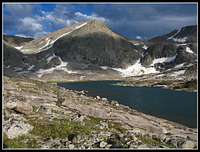
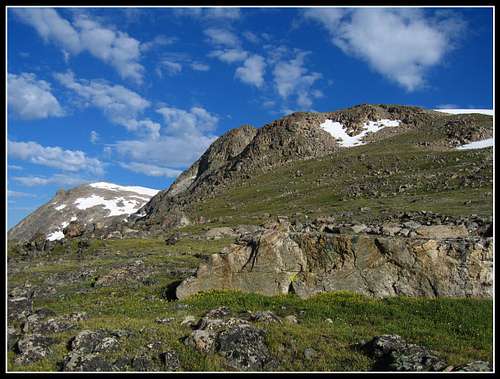
We arrived at the steep waterfall at which we climbed on its right (south) side on steep class 2+ rock that was very unstable. With careful climbing we made it up and continued ascending on solid snow until we reached the start of the final climb to the summit of Downs Mountain. This was a very tiring ascent with heavy packs but after enough pain we made our first summit of the trip which was also my first summit in the state of Wyoming.

Number 15 in the state with an elevation of 13,349; Downs Mountain.

Bear Basin
Looking down on Bear Basin


Heart of the Winds
Summit panorama from Downs Mountain

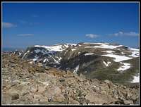
We took a long break here at the summit. On this crystal clear day we saw all the way to the Tetons and the Absorkas. Soon enough though it was time to keep going. We followed the divide down to the large saddle between Downs and Unranked Point 12,975. We saw very small ponds at this large saddle and were able to fill water here. Saw some great views of Downs Mountain from here.

Downs and Northwest Peaks
Downs Mountain from the saddle to the south


Downs Mountain
Downs Mountain from the saddle to the south

Soon we got to a good spot to drop the packs and take a quick jaunt up Point 13,062; one of the ranked 13ers in the state. The views from here were spectacular and it didn't appear that anyone had been there in a very long time. After all, we hadn't seen anyone since the small group in the Roaring Fork what appeared to be eons ago. 

Point 13,062
Summit view from Point 13,062


Point 13,062
Summit view from Point 13,062

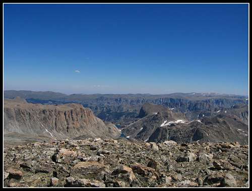
Another peak in the bag...Sweet! I was feeling great. The pack was getting lighter and after climbing in Colorado most of the summer the traveling on the continental divide felt no different than it did in July in the lower elevation Cascades. We continued and descended to the next saddle where we had great views of Point 13,062.

Point 13,062
Summit view from Point 13,062

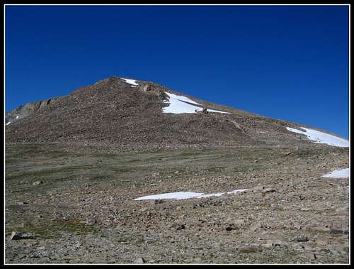
After another short break we started climbing again towards Yukon Peak. It is here, just below the summit of Yukon where we saw our next person. A couple from Europe, they were walking the entire continental divide. They told us they started in Yellowstone and were ending in Steamboat Springs, Colorado...and we thought we were roughing it! When I asked them if they were getting as many peaks as they could they said they were climbing to the top of any but bypassing them all. This made me a little sick...if you're going to be that close to a hundred summits why not bag them?

Anyway, they continued on. They also told us they were on their way up Tourist Creek the day before when the big storm hit. We told them about the sunset we saw in Bear Basin and we parted in opposite directions. I quickly ran to the summit of the ranked Yukon Peak at 12,825 feet. 

Heart of the Wind Rivers
Summit view from Yukon Peak looking north


Upper Kevin Lakes...
The upper Kevin Lakes and the Connie Glacier from near the summit of Yukon

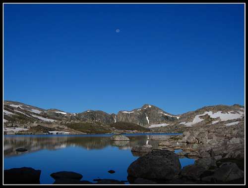
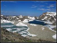
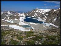
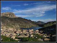
Baker Lake was only a 1000 foot descent away. It was good that it came when it did because my partner was getting tired. So we continued and descended to a low point on the divide between Yukon Peak and Klondike Peak.

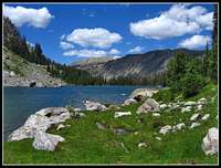
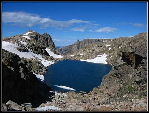
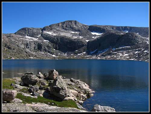
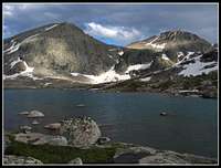
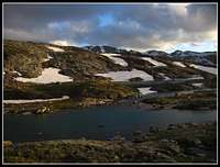
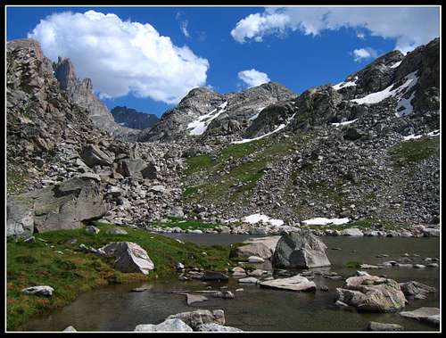
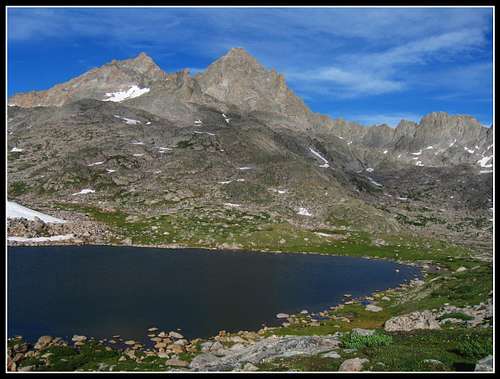
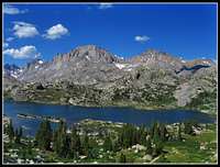
Baker Lake, along with Iceberg Lake sitting right next to it were two of the best Lakes I've ever seen. Their size given such a high elevation impressed me greatly. Baker Lake also had a deep blue color while Iceberg Lake, formed by the retreat of the still massive Sourdough Glacier had a milky emerald green color. 

We set up camp on the grass right on the saddle. Some large rocks made for some nice shelter from the wind. This was the first night I spent on the continental divide.
 

Looking back...
Looking back towards Yukon Peak

The lighting wasn't the best that evening since we were looking into the sun while looking towards Klondike Peak, the Sourdough Glacier and Baker Lake. This just got me even more excited for the next morning though since the lighting would be great with the sun of the other side! Because of this we actually went to bed before the sun set and eating a short dinner. My partner was very tired.

Day 5...Baker Lake to Halfway down Tourist Creek

Just as I predicted, the lighting that next morning was fantastic! The first thing I did after rolling out of the tent was start taking photos. Just another amazing moment in the Winds rivaling the sunset we had in Bear Basin.

Baker Lake and flowers
Sunrise over Baker Lake
Sunrise at Baker Lake
Sunrise over Baker Lake
Yukon Peak
Baker Lake and Yukon Peak
The Continental Glacier
Klondike Peak and Sourdough Glacier

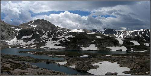
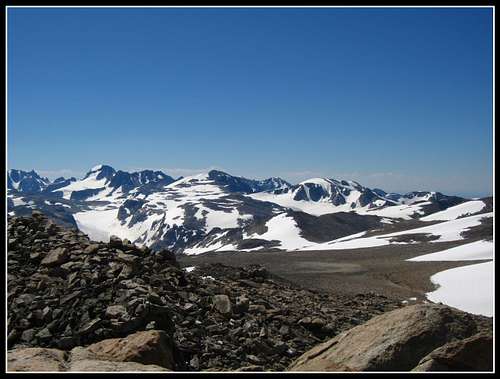
After filling the bottles and packing up we continued south and ascended up the slopes of Point 12,705 and along the divide above the Sourdough Glacier. The views of Klondike and Baker/Iceberg Lakes below us were jaw-dropping!

Baker Lake
Baker and Iceberg Lakes
Ascending Point 12,705
View of Baker Lake
Klondike Peak
Klondike Peak
Continental divide peaks
View of Point 13,062


Klondike Peak
Panorama of Klondike Peak

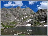
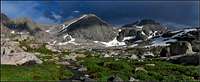
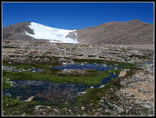
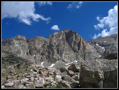
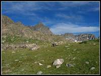
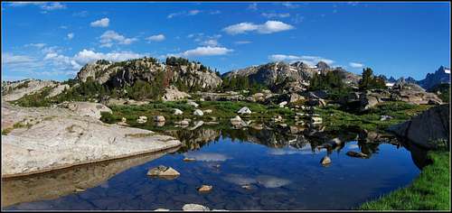
We decided not to climb Klondike Peak as it involved steep snow and ice with lots of exposure. I didn't want to end up sliding all the way down the Sourdough Glacier and dying. We continued up and over the ridge and down towards the next saddle separating Klondike Peak and Pedestal Peak. This saddle would be where we leave the divide and start the long, long descent down Tourist Creek. However we took a quick detour and left the packs here to climb Pedestal and Flagstone Peaks. It was about 1000 feet to Pedestal and another 800 round-trip on the traverse to Flagstone. Both of these peaks were my favorite as the views towards Gannett were inspiring. Flagstone is number 13 in Wyoming with an elevation of 13,450. Pedestal isn't ranked as it only rises 280 feet from the Pedestal Flagstone saddle. The only feasible route to Flagstone though is over Pedestal. These summits added just that much more good to the trip!

Flagstone Peak
Flagstone Peak from Pedestal


Pedastal Peak summit
The summit of Pedestal Peak


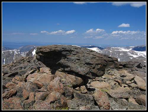
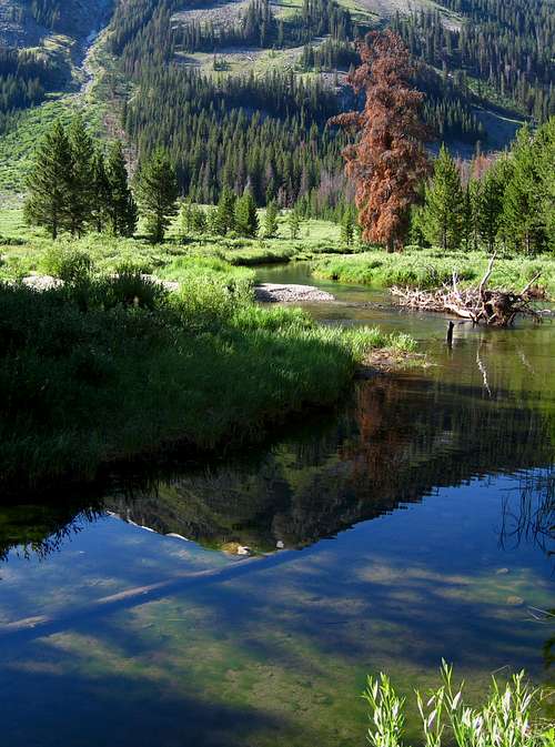
Pedestal Peak was cool as there were many rock towers at its summit with flat tops that looked like "pedestals" of which the one shown in the above photo is the highest one. We retraced our steps back to our packs and began the long descent. The first part was very steep and loose but staying to the left it wasn't as bad. Once we got down to the lake below it mellowed out a bit and we were able to walk on grass. We passed by many beautiful small tarns as we descended and found one with a perfect flat soft grassy area right next to the creek.
 

Flagstone Peak
Flagstone Peak from Tourist Creek


Tourist Creek
Small tarns in the Tourist Creek Drainage


We pitched the tent fairly early and made a big dinner. The lush scenery around us was gorgeous as the sun got lower.

Tourist Creek
Tourist Creek


We soon found us asleep with warmer temperatures since we had descended so much.

Day 6...Halfway down Tourist Creek to Upper Jean Lake

Today would be a judgement day. My partner was feeling very tired and sort of sick and he made the decision to head back to Green River Lakes on the 14 mile trail despite the car already have been shuttled to Elkhart. He figured he'd just get a ride into Pinedale and relax while I finished the trip to Elkhart. 

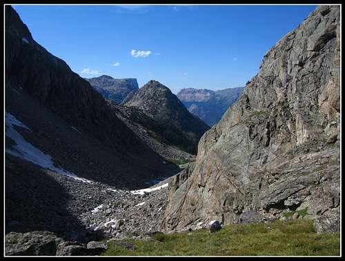
We finished the steep descent down Tourist Creek on very large boulder-talus at times and finally got to the very lush Three Forks Park. It was nice to get here and relax down low again. This really was a pretty place. We crossed the Green River, which was really green and met up with the trail the follows the Green River.

Crossing the Green River


Tourist Creek
Looking down Tourist Creek
Tourist Creek
Looking up at where we came from
Square Top
Square Top from the end of the descent
Square Top
Square Top from Three Forks Park


From here, my partner started down the trail. I let him make his own decisions without quite realizing his condition. I continued south on the trail that began switch-backing up. It wasn't until after the trip ended I realized I should have went back with him but what is done is done. The trip from here on out was by my lonesome, which wasn't bad since this was getting into the more popular part of the Wind Rivers. It didn't take me long to see a very big group. I had to however forgo Fremont and Jackson Peaks which were on our initial plan. Anyway, I continued on the trail until I got to the turnoff for Vista and Cube Rock Passes. I was making great time on the trails and made it over Vista Pass in no time.

Vista Pass
Tarn at Vista Pass


Not being all that thrilled about Vista Pass I continued onward to Cube Rock Pass. It is here I saw my first moose, a mom and calf. I was surprised how close I got before I actually saw them but they were pretty scared of me and ran away when I saw them. The trail kind of gets lost on the way up to Cube Rock Pass but right before Dale Lake I re-gained it.

Dale Lake
Dale Lake


Looking back...
The route up Cube Rock Pass


It was here at Dale Lake where I saw a group of about 10, the first people since the European couple on the divide. I briefly talked with them and continued on towards Peak Lake. This area was actually pleasant though nothing compared to the scenery I witnessed the past five days. 

Peak Lake
Peak Lake and Twin Peaks

I didn't stop here long either and continued over Shannon Pass. I was feeling amazingly good despite five hard days of cross country travel. Unfortunately, Shannon Pass wasn't what I thought it would be and I continued on to the uppermost Jean Lake where I set up camp. 

The other thing that happened that I wasn't happy with; right when I crossed Shannon Pass the mosquitoes started. I was absolutely stunned to not get bitten once or even see a mosquito for the first five days. I was even asking myself the whole time "Where are all the skeeters?" but when I crossed Shannon Pass I now realized I crossed into the less-desirable part of the range. The trails, horses, people and skeeters made this part of the Winds much less fun. It was at this time I also realized that the Winds are a range designed for cross country travel. Despite all this, I still found plenty of beauty in this area. The upper Jean Lakes were very nice both in the evening and at sunrise the next day.

Near Shannon Pass
Crossing Shannon Pass
Elbow Lake
Elbow Lake
Upper Jean Lake
Upper Jean Lake
View from camp
View from camp at Upper Jean Lake


I decided to set up camp at the uppermost Jean Lake, the one just higher than Upper Jean Lake where a nice meadow at the lake shore was. I cooked a quick dinner and was forced into the tent by the awful skeeters. I managed a nice alpenglow photo from the tent before going to sleep.

Sunset from Upper Jean Lake
Alpenglow view from the tent

Day 7...Upper Jean Lake to Island Lake

This would be a day of pleasant surprises for me. Since I don't climb summits while backpacking alone (something I don't see as a good idea), peaks like Stroud Peak, Bow Mountain, Fremont Peak and Jackson Peak had to be sacrificed. Besides, it's just another excuse to come back to climb them. Instead I took this last full day relaxing and meeting new people. I awoke to a fantastic morning reflection on the uppermost Jean Lake. Already the day is coming out better than I expected.

Upper Jean Lake
Morning reflection


Upper Jean Lake
Morning reflection


Upper Jean Lake
Morning reflection

I really enjoyed the beauty of that little tarn I camped at. After packing I continued down the trail, passing by Upper Jean Lake and then Jean Lake, which was astoundingly huge. It blew my mind! When I got to Jean Lake I saw lots of other backpackers and fisherman. My feeling of solitude by now was completely gone but I did get to talk to some pretty cool people.

Upper Jean Lake
Upper Jean Lake


Bow and Arrowhead peaks
Bow and Arrowhead Peaks above Jean Lake

Jean Lake was at least a mile long and it took me awhile to traverse around it. Eventually I got to the big bridge at the Fremont Crossing. It was here I met a couple from Lakewood...very close to Golden where I'm attending school. They were professional photographers and I talked with them for at least an hour about mountains, photography and where our current respective trips have taken us so far. We were also going in the same direction at the time although after I left them I didn't see them again.

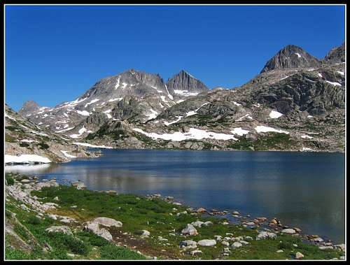
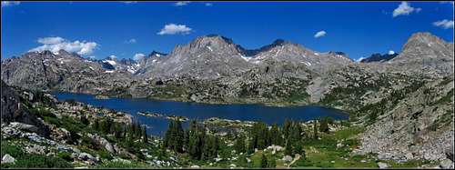
I crossed the bridge and started heading back up the trail to Island Lake. I at least wanted to see this lake as it was on the cover of the may I'd been using the whole trip. Good thing I did as Island Lake was the most beautiful thing I saw since Tourist Creek. It was still early in the day when I got there and there were a bunch of other people around, particularly fisherman but I decided to spend the rest of the day here and camp on its south shore.

I got a whole collection of photos from here as the afternoon and evening progressed right up until the last sunset alpenglow. I did some short walks around to get different angles but the photos in this table more or less depict the aging of the day seen from Island Lake. Many of the photos have Fremont and Jackson Peaks as a backdrop above Island Lake while others taken later in the evening show alpenglow on the Elephant Head; a 12er to the west of the lake.

Camp at Island Lake
Camp at Island Lake
Fremont and Jackson Peaks
Island Lake
These peaks are the real deal!
Gannett and company
Elephant Head
Elephant Head
Sunset on Elephant Head
Elephant Head turning orange
Fremont and Jackson
Fremont and Jackson
Fremont and Jackson Peaks
Fremont and Jackson
Elephant Head
Alpenglow on Elephant Head
Fremont and Jackson Peaks
Alpenglow on Fremont and Jackson
Alpenglow
Last rays hit the Elephant Head

Here are some of the panoramas I took that afternoon of Island Lake.

Near Island Lake
Island Lake panorama


This is what it s all about!
Island Lake panorama


Another classic
Island Lake panorama

Day 8...Island Lake to Elkhart Park

The last day...I awoke to less than perfect weather as high thin clouds had rolled in overnight and diffused the lighting, making photography awful. I had a long ways to hike to get out. After a late start from sleeping in, I started the long haul out. I probably couldn't have climbed Fremont and Jackson even if my partner was with me because my legs were feeling it badly now. Even the slightest little uphills hurt.

I did the short climb back to the nice viewpoint of Island Lake and made my way southwards passing Seneca Lake and beyond. I didn't bother with going into Titcomb or Indian Basins because I knew I'd be back to summit peaks in the area and these places would be on the way. Don't need to see everything on one trip. I was fortunate to catch up with a couple who camp in from Elkhart just for one night. They were on their way out as I cought up to them. They were very nice when I told them I will not have a car waiting for me at Elkhart since my partner thought I was going to spend one more day in the Winds. They were very nice to talk to for the last eight miles of the haul and offered me a ride. The entire hike out was very uneventful and not very scenic compared to what I had seen over the previous week and I don't think I even pulled the camera out. I remember seeing the big parking lot for the first time and getting excited to finally be able to sit down and rest my back and legs. 

After a long break at the car they gave me a ride to Pinedale where I was able to call my partner where we resolved an entire slough of logistical problems that I'll spare you the details before heading back to Golden to start the semester. He ended up doing fine but we still don't know what came upon him...may have been altitude sickness.

Aftermath

Overall, this trip currently stands as the best trip I've ever done. The scenery, the high route, the sunsets and sunrises, the lakes and the true wilderness feel this mountain range had really struck me and I plan on going back many, many times.

I contribute the reason for feeling so poorly the last couple days to day number six where I finished the descent of tourist creek and making the mistake of really pushing hard to the Jean Lakes in a day. Just because of the trails I pushed it harder which wore me down for the end. Lessons learned for the next 8 day trip...

Wind River Range peaks on the list in this area to do in the future include:
Fremont Peak
Jackson Peak
Gannett Peak
Stroud
Bow
Arrowhead
Mt. Febbas
Sunbeam Peak
Desolation Peak
Solitude
Split
and the Twin Peaks

Proudly powered by Weebly