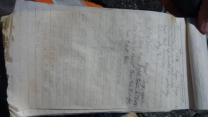
Mount Spickard - 8979' - South Face Class 2+
Mount Rahm - 8480' - SW face Class 4
Mount Redoubt - 8969' - South Face Class 4
Hard Mox - 8504' - West Ridge Class 5.6
July 2015
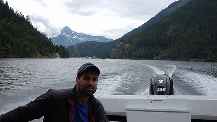
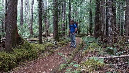
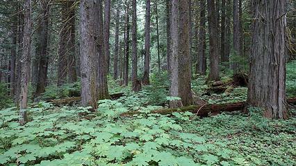
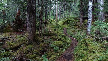
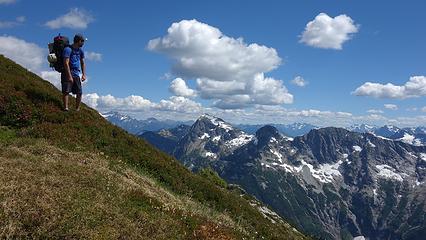
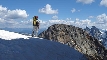
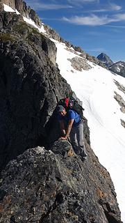
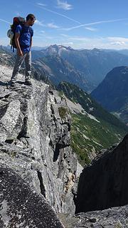
First, before I go too much into describing this amazing trip, let me first give an overview about what we (Etai and myself) did. Day 1 - Have my mom drop us off at the Ross Lake Resort Trailhead along Highway 20. Shuttle up Ross Lake to Big Beaver Trail and camp at Luna Camp. This would be the last time we see people for a week. Day 2 - Bushwhack up Access Creek, ascend south to the ridge extending SE off of Luna Peak and camp 150 feet below Luna Col. Day 3 - Ascend the standard south ridge of Luna Peak, then traverse SW, then west towards the east peak of Mount Fury. Ascend directly up the east ridge of East Fury over point 7,860 (one 5th class spot), and traverse over the flat upper part of the Fury Glacier to the south ridge which we then finished the ascent to the summit of East Fury and camped on a large flat rock. Day 4 - Traverse to West Fury and back without packs (low 5th class), then descend the south ridge of East Fury to where the Fury Glacier Steepens. Since we didn't bring boots or crampons, we were forced to climb up a small tower on the rugged ridge connecting to Outrigger Peak (solo low 5th on horrible rock from a tiny notch). Make two rappels down the face to where the glacier mellows and traverse to the low notch between Outrigger and East Fury. Ascend the NW face of Outrigger via talus/ledges and descend the ridge and camp around 7,100 feet, just above Picket Pass. Day 5 - Rest Day. Finish descent to Picket Pass and over Point 6,900 and up to Frenzel Camp. Day 6 - Descend from Frenzel Camp onto snow and traverse to the North Buttress of Mount Terror. Climb North Buttress and summit Terror and descend the standard West Ridge/South Gully. Camp at Crescent Creek Camp. Day 7 - Traverse to Chopping Block Ridge Camp and descend the Crescent Creek approach to Goodell Creek (utterly horrible bushwhacing!!). Hike out to Highway 20 on good trail along Goodell Creek. Hitchhike back to the Seattle Area. This was a real Pickets adventure for the ages and one I will never forget! Now, here's the detailed version. Day 1 The planning for this trip began in March when Etai, (who was taking a trip to the US from Israel), contacted me via SummitPost asking for someone to traverse the Pickets with. This is something I had been wanting to do for a long time so I agreed to join and we talked about ideas for a full traverse for a number of months as I was in both Alaska and Peru. We agreed on dates which would be the second week of August, right after I returned from Peru. We finally agreed to somehow get a ride to Ross Lake and take the shuttle up to Big Beaver and enter the Pickets via Access Creek to Luna Col. So when the day came, I convinced my mom to take us up, and we simply planned to hitchhike out at the end of the trip. So in the morning of Tuesday, August 9th, we went to Seattle to pick up Etai, who had just flown to Seattle the evening before from Miami, and we quickly looked over what he was bringing. I knew we would need to go ultra light for this trip to be a success, so the day before I went shopping and bought a new Big Agnes ultra light tent, a new 7.5mm 60 meter rope, and a new pair of microspikes, which we would bring rather than crampons. Unfortunately we didn't take a close enough look at all his gear and he would spend the entire trip carrying roughly 5 pounds extra weight. We drove to the Ross Lake Resort trailhead where my mom dropped us off (after a nice stop at Panara Bread for a good lunch), and hiked down to the dock where we were picked up. The boat ride was quick...maybe just 20 minutes and cost $60. We told the boat driver we didn't need a pick-up and began up the Big Beaver Trail. We were committed at this point unless we wanted to hike like 7 miles along the lake back to highway 20! The hike up the trail was uneventful and with overcast skies, the dense forest looked eerie. Etai was enjoying the Pacific Northwest forests as we made our way up the 8 miles to Luna Camp. Both the blue and red huckleberries were in full force and I didn't go more than 15 minutes without stopping to taste their sweet goodness and to get a few extra calories since I knew I wasn't carrying enough food for a trip of this size. We made camp around 5pm and had a group of 4 backpackers next to us. We briefly visited with them and I made my typical mac and cheese for dinner, while Etai had one of his 6 Mountain House freeze dried meals. That first night it rained a bit but I wasn't worried because the forecast the entire week called for excellent weather (other than the first night). Unfortunately I realized that any bushwhacking we would have to do would get us very wet!

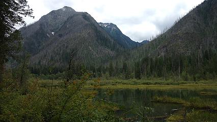
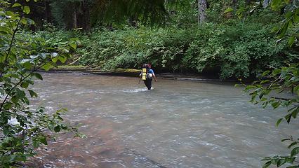
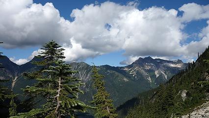
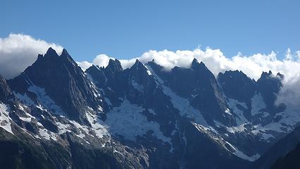
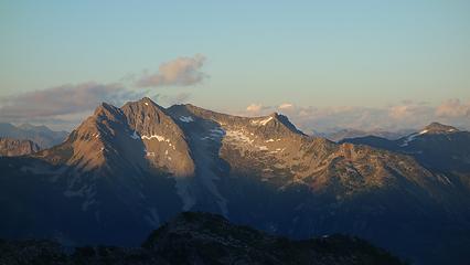
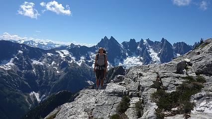
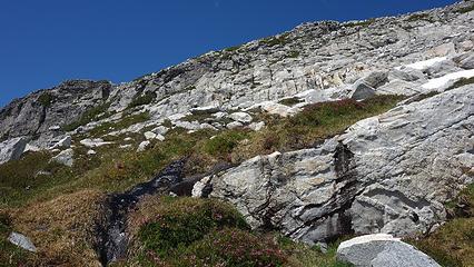
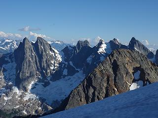
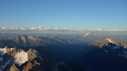
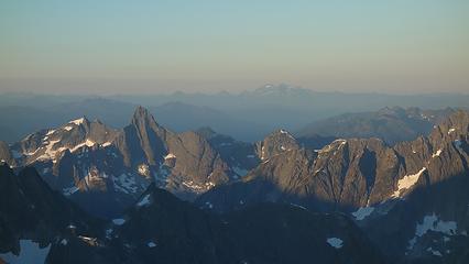
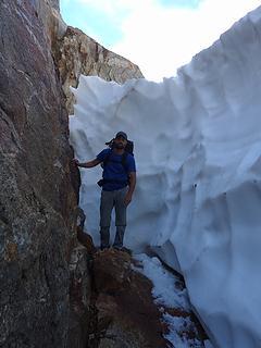
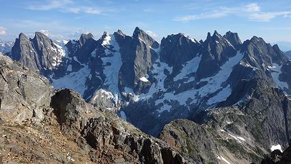
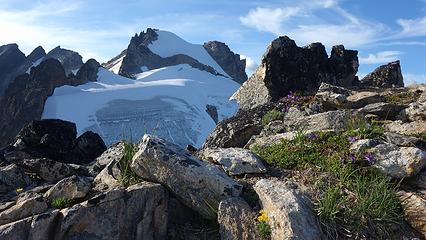
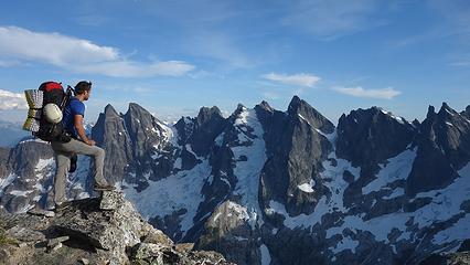
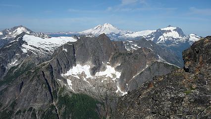
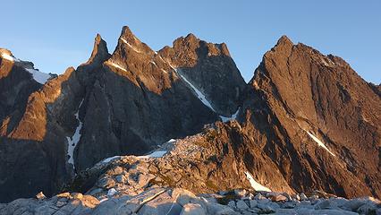
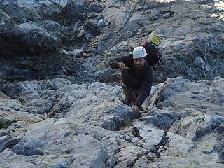
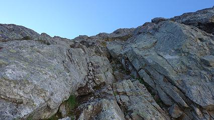
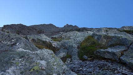
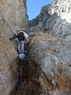
Day 2 - We awoke to damp conditions and still an overcast sky. We didn't waste time getting started though because we both knew this was going to be the longest and most difficult day as we had to gain roughly 4,800 feet with our packs to Luna Col, which would be our worse case scenario plan. Best case scenario we would continue and summit Luna the same evening. We continued up the Big Beaver Trail a mile beyond Luna Camp, and decided to turn left and leave the trail wherever it looked decent. I had read many reports of a trail heading up access creek, but we never found it. The adventure began with a 10 minute bushwhack to Big Beaver Creek, which we removed our shoes and waded across fairly easily. The water was only up to my knees or so and once across, we were already soaked! From here we endured some of the worst bushwhacking and gained 500 feet through dense trees and bushes, crossing to the north side of Access Creek just below a waterfall. Once we passed 3,000 feet in elevation, the angle of ascent, and the intensity of bushwhacking decreased and we continued walking up the valley along the north side of the creek. At times we could see what looked like game trails but nothing resembling a man made boot path. It took us around 2.5 hours to gain the next 1,000 feet elevation to the small meadow where people have camped in the past at 4,000 feet. We were forced around areas of devils club, and through some slide alder until we reached talus. Going solely off Stephs Pickets map with various traverse routes drawn in, we turned sharply south and began ascending steep talus towards the broad 5,540 saddle in the long ridge extending SE off of Luna Peak. We would later find out this route was incorrect but at the time we went for it. At about 4,400 feet, we entered into a narrow gully with what looked like two possible routes. The left side looked like it topped out in a cliff so we continued up the right side, up Class 3, then Class 4 climbing up a narrowing gully. At one point I had to climb up onto some roots and dirt above a wet, slippery slab with incredible exposure below us down the gully. Once atop the slabs, I was unable to see if this also indeed cliffed out, so I made a committing move over a small rib and continued climbing up moss covered wet Class 3-4 rock until I saw the 40 foot cliff at the very top. I could easily see that above this cliff the terrain leveled out considerably, and I questioned whether we were on route. I spotted a series of huge flakes I could climb up on lead but realized I would not be able to carry my pack through the barrage of trees at the top so we roped up and I led a short 30 meter pitch of low 5th class sh## through dirty, mossy flakes and tons of trees. I was ale to make an anchor but would not be able to haul the packs up. Etai would then try to climb the pitch with both packs on TR. He managed to get past the flakes very well with both packs (one dangling below him) but wasn't able to haul them through the trees, and I was forced to rappel down from a tree and grab them. I was able to take them both, and place them safely on a rock and put him back on belay to finish climbing through the trees. All in all, this single pitch of sh## climbing took 1.5 hours, and Etai wasted lots of energy trying to get both packs up. Once we managed to extract ourselves, the bush began thinning considerably, and we continued ascending up grassy/talus slopes stopping for water whenever we ran into a small stream. Eventually we reached the broad saddle where our first, up close views of the southern Pickets greeted us. By now the clouds had parted and the sun was out. A nice long rest was in order as we took in the rugged north faces of the southern Pickets. Elephant Butte and Mount Prophet were also easily visible, as well as Luna Peak just to our right.
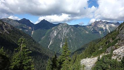
We then made easy progress west along the crest of the ridge, up and over Point 6,010 and past another small notch, which upon looking down was an easy talus gully all the way into the upper Access Creek basin!! I figured this was the correct way to go but our map, which was hand drawn by Steph, pointed us elsewhere. Once we hit 6,700 feet, we made a level to slightly descending traverse across the basin to the south of Luna Peak as the sun was getting lower in the sky. Then made a final 400 foot ascent on some snow/loose talus towards Luna Col. About 150 feet before reaching the col, figuring the camp spot at the col itself would be snow covered, I spotted an excellent grassy ledge system big enough for the tent and waited for Etai to finish the ascent. We were booth exhausted and happy to be at camp after a long 12 hour day carrying 40 pounds. A quick dinner was followed by a great night sleep.
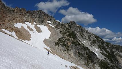
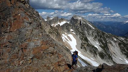
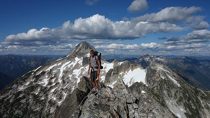
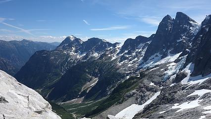
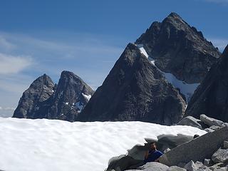
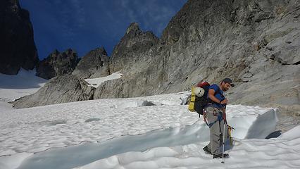
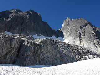
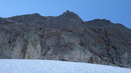
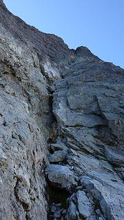
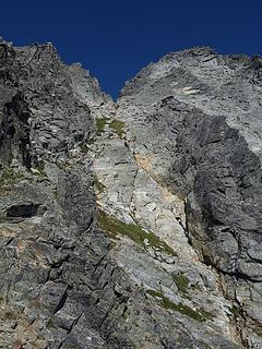
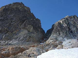
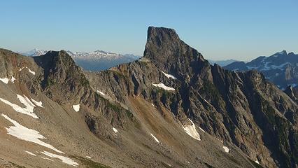
Day 3 The next morning the sun hit our tent almost instantly after rising since we were on the east side of Luna Col. We were able to get things dry before starting up Luna. By 8:30 we saddled up and finished hiking up to Luna Col, and as I suspected, the camp spot was covered in snow. We dropped the packs and began ascending up Luna Peak. The majority of the 1,000 foot ridge was easy Class 2 talus walking, but the traverse from the false to true summits was on a fun exposed third class scramble. We easily solod this scramble to the true summit and reached it just under an hour from the col. Views from the summit were daunting as we could see Mount Fury, and beyond and realized we somehow had to traverse this entire landscape that lay before us! It appeared to be a daunting task and Etai was questioning me every moment regarding how we would do it. The Cascades intuition I've gained from enough years stomping around in the rugged mountains of WA state would come in handy many times during this venture though! We signed the summit register and I noticed many of my friends names inside like Josh, Sarah etc, along with a picture of a naked girl lol. We scrambled back to the false summit and made quick work down the ridge to our packs. We then realized we didn't need to bring the packs up to the col, as we needed to begin traversing the south side of the long ridge connecting Luna and East Fury. So we descended 150 feet, then began traversing to the southwest linking ledges, and gullies at the 6,900 foot level until we hit a deep gully with a finger of snow going up and down the entire way. We carefully traversed across this 20 foot finger of 45 degree snow with our microspikes on, then scrambled down the moat about 150 feet where the terrain opened up. From this point we began traversing a large basin towards the ridge extending SE off Point 7,380. Gaining this ridge involved some solo low 5th class climbing above and right of the snow since we wanted to avoid the steep snow gully that led to the ridge just below.
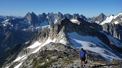


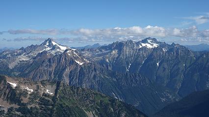

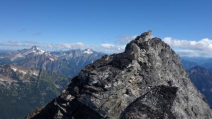
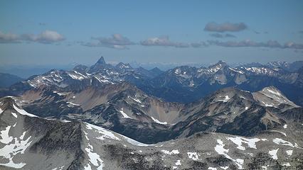
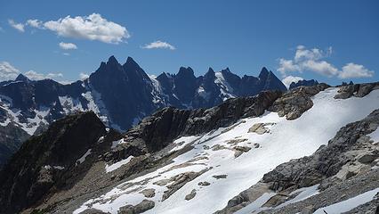
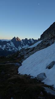
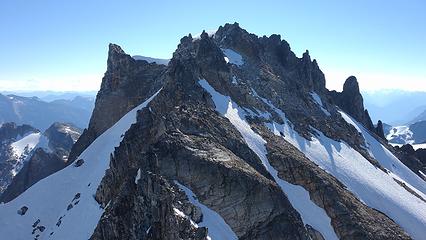
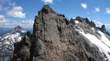
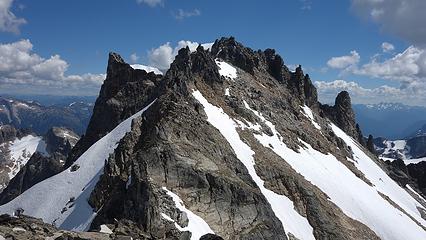
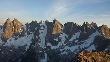
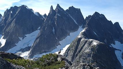
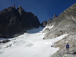
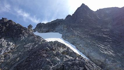
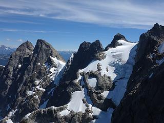
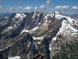
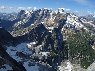
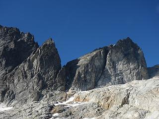
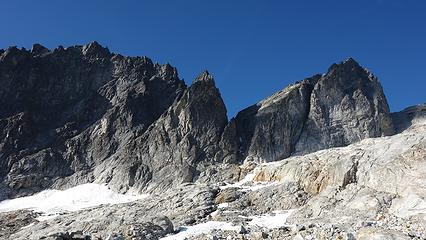
Once we reached this ridge we took a nice break and analyzed our future. Here we got a better look at the route to Mount Fury, and at first decided to traverse level across the next basin and below a series of cliffs guarding the entrance to the Fury Glacier. As we began traversing at the 6,600 foot level though Etai and I both spotted what looked like a short 5th class step above us on the ridge crest above the basin, which would lead to rock scrambling up the ridge to the north, and allow us to bypass the steep lower glacier which we likely weren't prepared to ascend. So we began ascending up this basin, only having to cross a few moderate snow patches. We reached a col at 7,040 feet which was a gorgeous sidewalk in the sky type of col with wicked exposure looking down to Luna Lake. We reached the base of the rock step we eyed from below and realized we would need to rope up as it was about 15 feet of 5.5ish terrain on questionable rock. A fall was not an option either. So I led up the pitch with my pack on, however I left my hiking shoes on, and placed a couple good cams. Once above, Etai followed up and we did one more pitch of simul-climbing on 4th class terrain until we were comfortable soloing again. We continued up the ridge until we topped out on Point 7,860. Knowing from the photos I took there would be a drop of some kind off the west side of this peaklet, I was hoping we wouldn't need to rappel. Sure enough, a steep, loose gully appeared and we dropped down 100 feet to the flat glacier below. From there we made very quick time moving across the upper Fury Glacier which at the 7,800 foot level was very level and easily traversed with our spikes on.
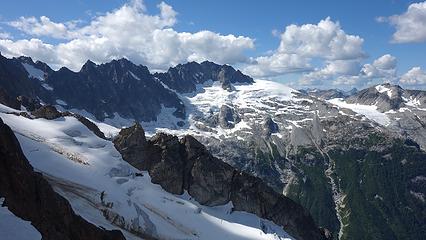
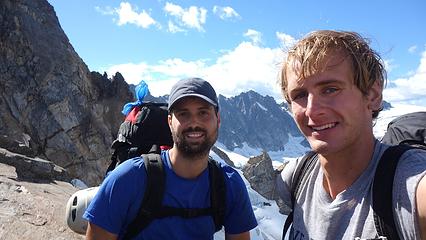
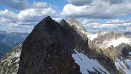
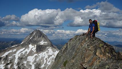
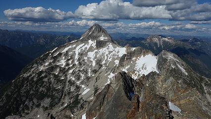
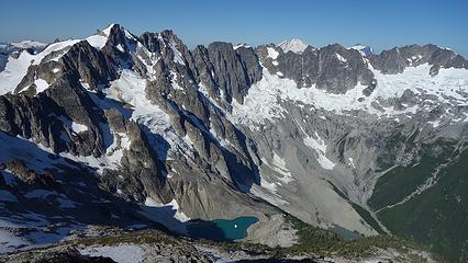
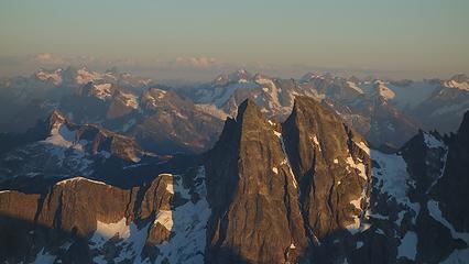
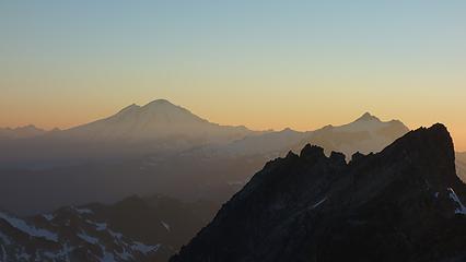
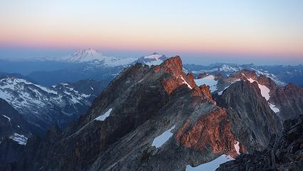
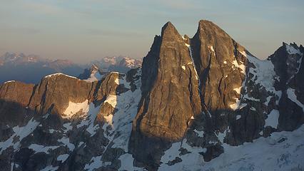
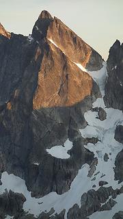
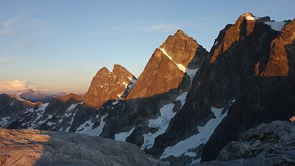
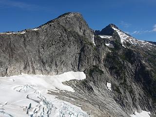
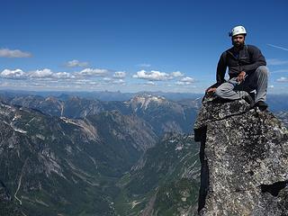
We then made an ascending traverse southwest towards the south ridge, and below a wicked tower dropping down from the slightly lower northern summit of the east peak. I recall this feature looking like the big cliff in Gondor from the LOTR movies. We then crossed a large snow bridge over a bergschrund and regained talus at about 8,000 feet below the steeper, final snowfield that led to the summit. The final 280 feet on the south ridge was on scarily loose huge boulders that seemed waiting to roll over onto our leg at any point, and weaving through various towers and rock pillars. We finally reached the summit of East Fury around 7pm and I was beginning to doubt the rumors of a camp on the summit. There was no clear flat spots and nothing indicating anyone had camped anywhere. I then noticed the steep snowfield and saw where the top of it was flat and realized that was probably the camp. Not wanting to camp on snow though, we spotted a large flat rock about 20 feet below the highest point and managed to fix it up enough to make a great tent pad. The hardest part was pushing a large boulder off the flat spot, and filling in a few cracks, but we got the tent up and we both had a comfortable place to sleep!! The sunset as we cooked dinner was superb with all the pickets visible, and the glow behind Shuksan and Baker. The traverse to West Fury was in plain sight right from the tent. We left the rain fly off that night and I was able to catch some meteors dancing across the sky before drifting off into another great night of sleep.
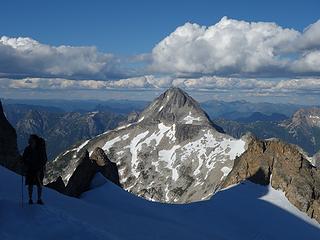
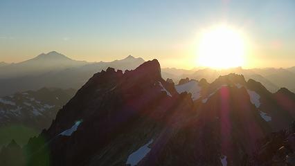
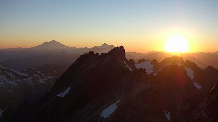
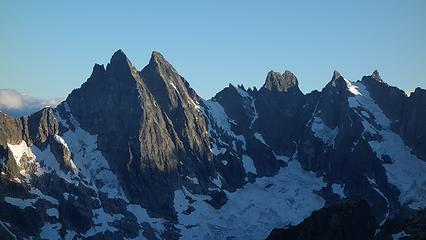
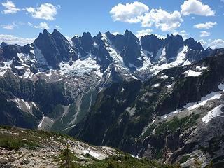
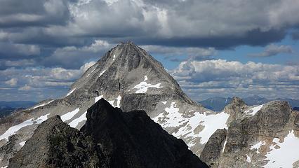
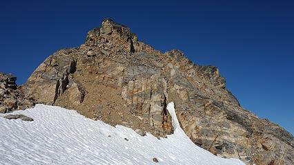
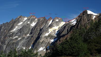
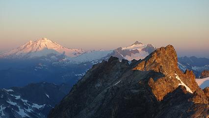
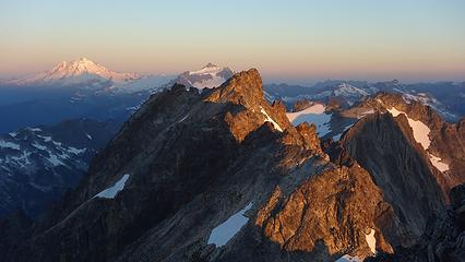
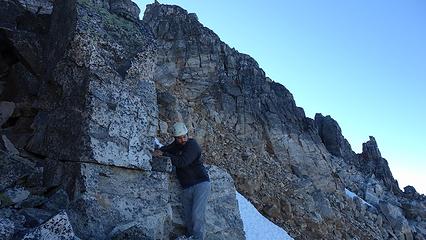
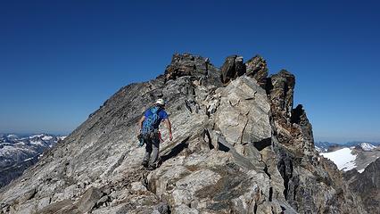
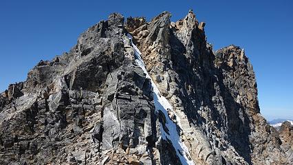
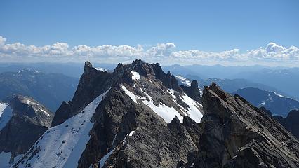
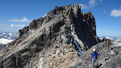
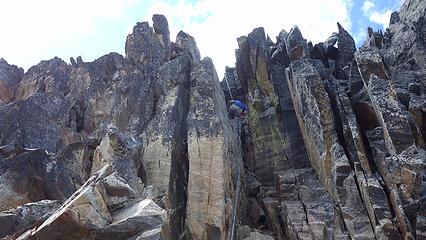
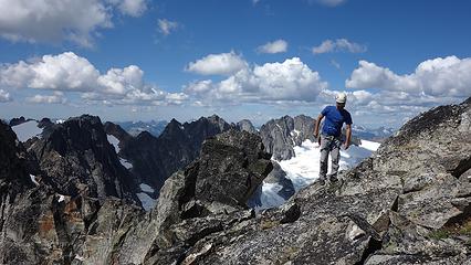
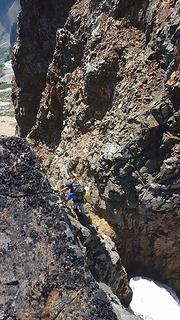
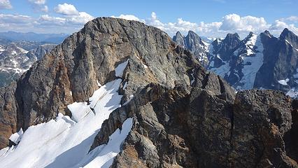
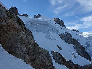
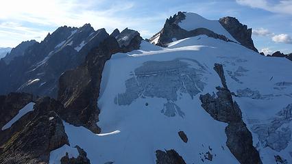
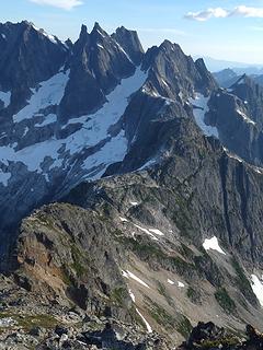
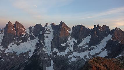
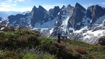
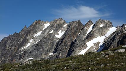
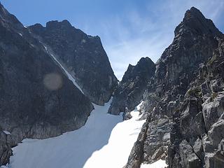
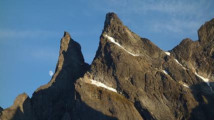
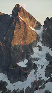
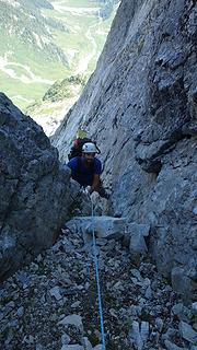
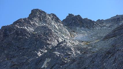
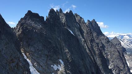
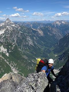
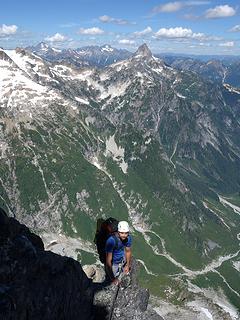
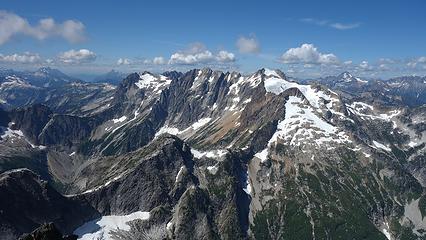
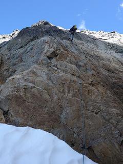
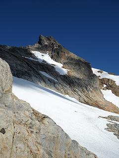
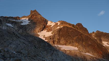
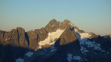
Day 4 Unfortunately, Etai didn't get the best night sleep on the summit of East Fury. Our sleeping bags also got damp without the rain fly on. I woke up roughly 30 minutes before the sunrise and was able to watch it rise, taking great photos in the process. Watching the first rays of sun hit the entire traverse to West Fury was special and got me very excited to do this traverse up what I had known to be a very coveted peak in the North Cascades. We had another batch of oatmeal (which we ate every morning), and began descending off East Fury to the low saddle between the two. This descent wasn't too fun and involved many loose boulders some the size of refrigerators. With enough care to keep all the rocks in place, we made it to the saddle and it was here I remembered hearing about a route that traverses from Picket Pass to this saddle. Looking at it though it didn't look fun. We looked up what would be our first pitch and decided to rope up. It looked low 5th but wasn't able to tell for sure. Etai led this first pitch to a large ledge where an old 0.25" bolt and a piton were found. I followed, then continued up a second pitch more or less straight above the anchor. Once at the flat bench above I anchored onto a horn and belayed Etai up this 5.6 pitch. Once he arrived, we saw a scramble route to the north a little that could have bypassed the second, harder pitch. We logged that in our mind for the descent. See the photo below for an overview of the traverse.
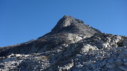
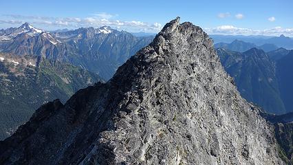
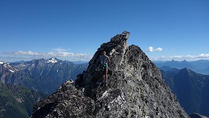
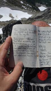
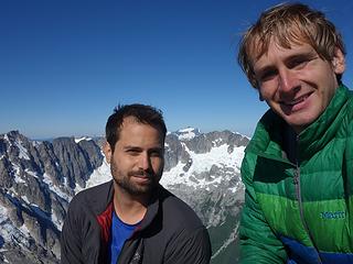
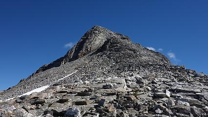
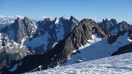
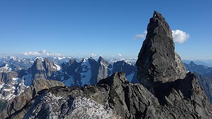
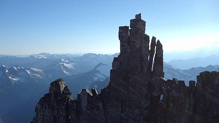
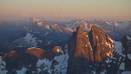
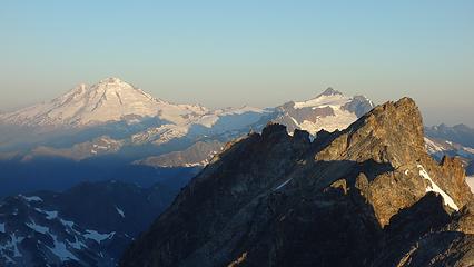
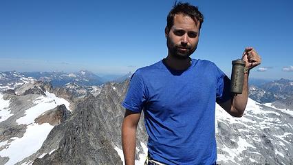
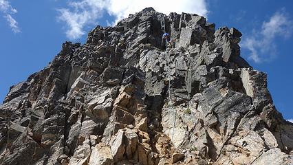
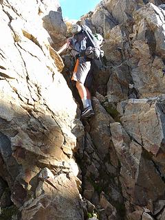
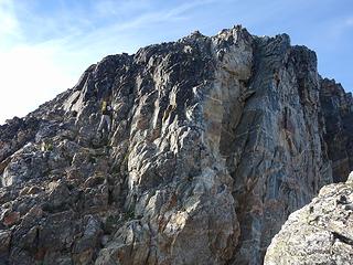
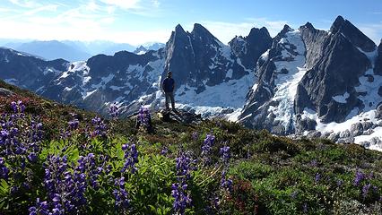
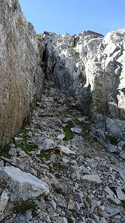
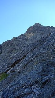
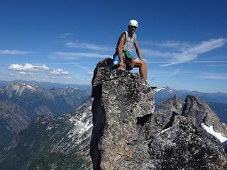
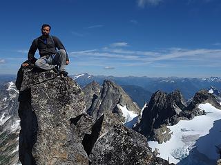
From the top of what I have labeled tower 1 where the one roped pitch we did was located, it was a fairly straightforward traverse around the south side of the ridge, past a tiny notch with a microwave size chockstone forming a small arch, and over to the west side. After crossing the rib, we traversed slabs back to the north, and entered a narrow Class 3-4 gully that took us down to the next notch. Down-climbiing this steep gully was pretty good so long as we used the solid rock on either side of it and stem down. This notch was covered in very loose dirt, so we quickly crossed and began climbing up the next tower (Tower 2 in the photo). We solod this 4th class tower up the path of least resistance up a couple small chimneys and passed to the left of its summit just a few feet below. Downclimbing the west side of the second tower was easier where we reached a second notch. From here the easiest path was up an obvious deep chimney near the ridge crest that was maybe 5.4 at most. We solod this as well and from the top of this chimney, we reached the summit of tower 3 in the photo. The remainder of the traverse was an easy scramble on the left (south) side of the ridge until easy slabs opened up allowing us to climb to the summit. Once on the summit I was ecstatic. West Fury was one I had wanted to reach for a long time, and upon looking inside the brass summit register, I noticed the original FA register from 1958 was still there, and only 17 total parties had signed it! We were the 18th party to reach this remote peak to my amazement. Well known Cascade climbers like Mr. Sjolseth had been up the thing not once but twice!

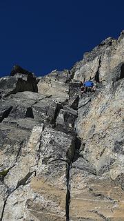
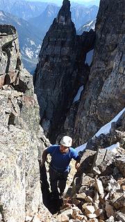

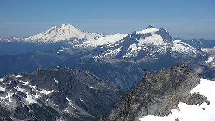
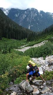
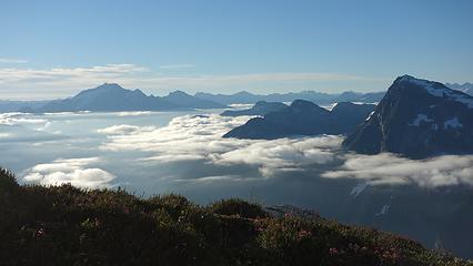
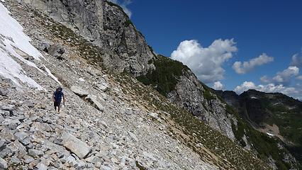
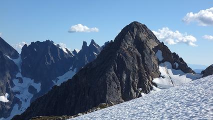
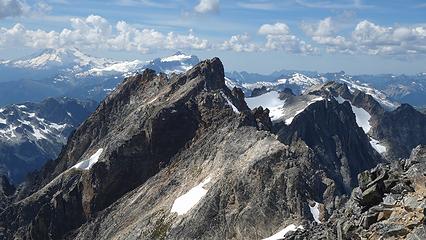
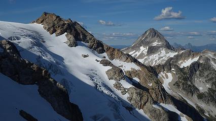
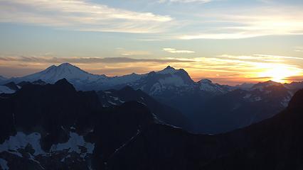
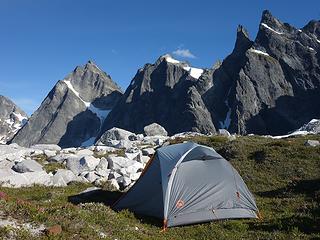
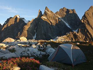
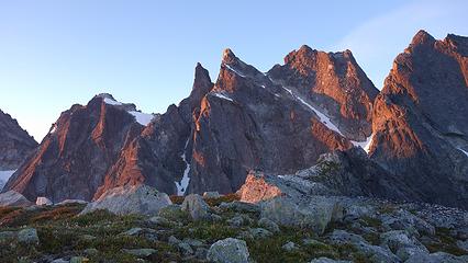
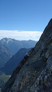
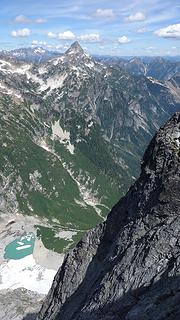
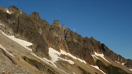
That was easily the oldest summit register I had ever seen, and we signed it with pride. After nearly an hour on the summit enjoying the views and marveling in the progress we had made so far, we began reversing the traverse. We reached the top of tower 3 again and utilized the existing rappel anchor to rappel the chimney we solod on the ascent. The climb back up tower 2 was simple but we wanted to rappel the small chimney we climbed on the ascent so we made an anchor near the top of this tower and rappelled back to the first notch. Once atop the first tower, we utilized the scramble around the north side to reach the large ledge that was atop our only roped pitch. As we fed the rope through the old bolt/piton anchor I gave the anchor a good test and I noticed the piton was moving. It was hammered into a small block that was about to break loose, so I removed it, and moved the sling already there to a bomber horn about 10 feet to climbers right of where the anchor was before. We then rappelled down to the low saddle, and re-ascended to our tent at the summit of East Fury. Upon reaching our camp, it was only 2pm so we decided after a small rest we would continue towards Picket Pass, however we didn't realize this next part of the route would involve the most shenanigans. After a quick descent back down the south ridge of East Fury, we reached the point where the Fury Glacier abruptly steepened and without crampons couldn't descend it (50 degree snow and some ice). I walked around for a potential bypass route on the rocky ridge to the skiers right and was able to reach a tiny notch in the ridge. Looking over the other side though, it was a very steep drop into an abyss of loose rubble and horrid cliffs. The only way was to climb 25 feet up from the notch and top out on the small flat-topped tower just above. So that's what we did. It was 25 feet of low 5th soloing on some really loose red colored rock, and once atop this piece of sh## tower on the ridge we wondered if anyone had ever been there before. We scrambled south on the ridge down as far as we could until we were forced to rappel back towards the glacier below us. We made a solid anchor and made one 30 meter rappel down the dead vertical face. Unfortunately the rope didn't reach the snow, but I was lucky to run across a nice horn and set up a second anchor. I even tried to back it up with the piton I carried off West Fury but drppped it while trying to hammer it into a crack with a rock (picked it up later though). Etai rapped down to meet me, then we both made a second full 30 meter rappel to a spot in the moat we could then scramble down. From this point we finally reached the low saddle between East Fury and Outrigger Peak and successfully bypassed the steep glacier. It was after 5pm now, and we still had to climb over Outrigger. Luckily, heading straight up the NW face was petty easy utilizing a series of grassy ledges and talus slopes. We reached the south ridge after some third class traversing and I dropped my pack so I could run the last 100 feet to the lonely summit of Outrigger Peak. The most impressive were the views of the Fury Glacier from this peak. Etai was getting excited to get to camp so we started hiking down the now much easier ridge towards Picket Pass. We ran into one short 30 foot rappel to a notch that was marked on the map I had and since we found some flat grass with liquid snow melt-water nearby, we decided to make camp around 7,100 feet and save the remainder of the route to Picket Pass for the next day. Once again, the sunset did not disappoint and we then set our focus on the north face of Mount Terror, which was getting ever closer.

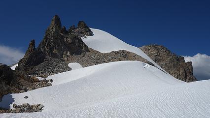
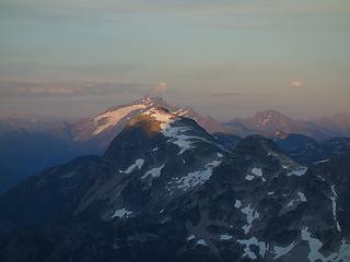

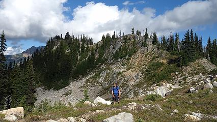
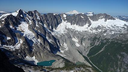
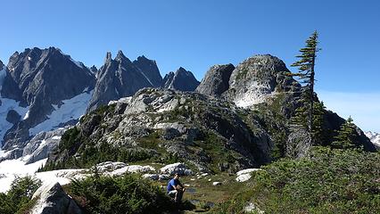
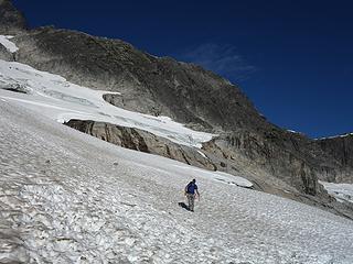
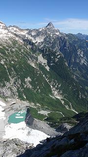
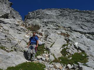
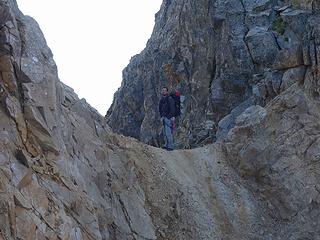
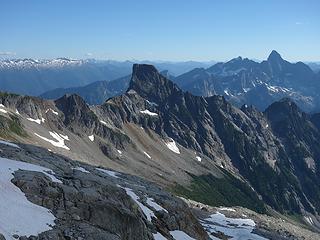
Day 5 Since the past 3 days had been 12 hours or longer each, we decided to forgo trying Inspiration Peak after doing Terror and take a rest day. We slept in and enjoyed a beautiful sunrise before finishing the descent to Picket Pass. Once we arrived at the pass, we found some large pools of water big enough to wash ourselves off and clean some clothes. We made quick work getting over Point 6,900 and back down to the even lower 6,200 foot saddle further to the south (why this lower saddle isn't Picket Pass I don't know) and took another rest here. I scouted to see if we could simply descend to the mellow snow from here but steep cliffs from this saddle and extending all the way up to Frenzel Camp blocked easy passage and rappelling wasn't too feasible. So we continued back up to Frezel Camp which involved some Class 4 scrambling up the left side of the deep gully, then crossing over to its right side. We easily solod this part and made it to camp before 1pm. The rest of the day we relaxed in the sun with incredible views of the southern pickets, including our entire route up Mount Terror. We found a snow patch nearby with some dripping water below it so we didn't have to melt snow (like we needed to do on the summit of East Fury). We discussed extensively how we were going to traverse to Terror and climb the route with our packs and made a plan. We found a route through the snowfields linking rock bands and avoiding steep snow for the most part. The only major concern I had was the last snow crossing just before the moat as I had heard that can get really hard. Just after another great sunset we went to sleep and set the alarm for 5:30am.

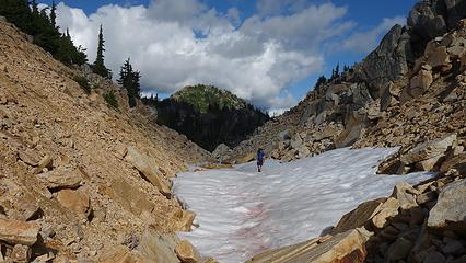
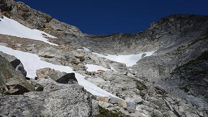
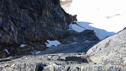
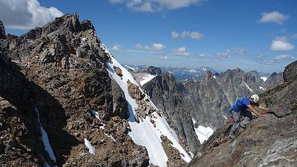
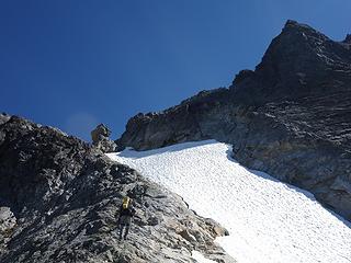
Day 6 When the alarm went off I wasn't interested in moving before twilight so we snoozed (people who have climbed with me know I hate alpine starts!). When it was light enough to see we quickly ate some snacks and skipped cooking the oatmeal. By sunrise we started moving. We rappelled down from a large boulder towards the snow below, then traversed a ledge to skiers left and made a second rappel from another boulder into the large moat. We opted to do this to bypass some of the steeper snow closer to the Otto-Himmel col. Climbing out of the moat involved my carving steps with my ice axe. Once on the snow we carefully descended, weaving through a couple crevasses (one of which we had to jump over) and reached the long rock band we spotted from camp above. We scrambled down this rock band until we could traverse onto the lower snow slopes which were very manageable. It was quick work traversing waterfall slabs and 15 degree snowfields all the way to the small knob just before the final snow crossing. It was here I had read reports of an impossible moat crossing and bullet proof ice. Luckily though, the harder snow proved easier to negotiate with the microspikes on, and the moat was small enough in one spot to safely step over.
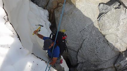
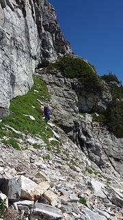
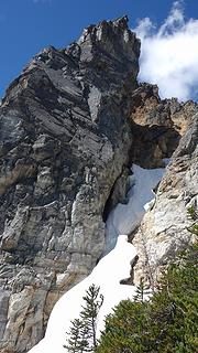
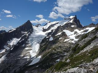
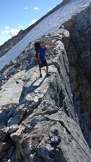
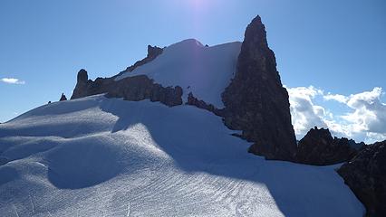
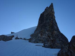
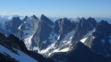
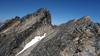
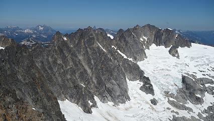
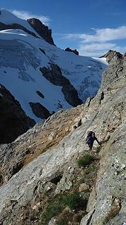
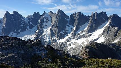
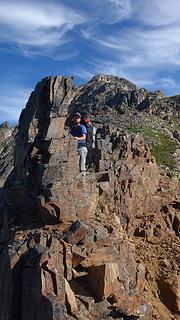
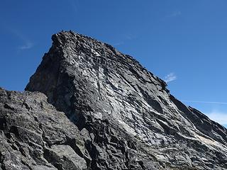
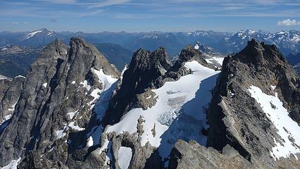
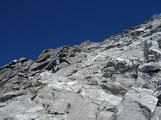
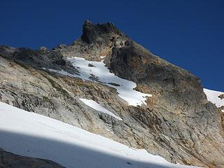
I found myself on a small ledge with 60 degree slabs above me for about 100 feet. I took my spikes off and we put the trekking poles back on Etai's pack. Once we both were safe on the slabs we realized they offered no protection, so roping up in the precarious spot we were in was not wise. Knowing there was a huge ledge above we just solod the steep slabs. There were just enough hand holds to make it doable without changing into my rock shoes...roughly 5.3ish I'd guess. Once we reached the large ledge just below the snow patch we filled water, put harnesses on and I racked up. We decided to continue soloing until we reached the upper left corner of the snow patch on the face at which point we roped up and began simul-climbing. We made two long simul pitches gradually traversing right and climbing towards the base of the large gully halfway up the face. From the base of this gully, I led three separate pitches. The first was easy 4th class, the second was in the deepest part of the gully and had one 5.6 section and the third brought me onto the original north buttress proper and offered the best climbing (5.4ish) on solid rock. Once on the buttress it was very enjoyable and we began simul-climbing once again until we reached the long diagonal snow gully near the top of the face. Just before the small col at the top of the face (AKA McMillan Spire I believe) we unroped and continued climbing the ridge crest towards the summit. The rock on the upper ridges was perfect and very enjoyable 4th class with a few low 5th class spots mixed in. The exposure was wild! Below is a topo showing the route we took.
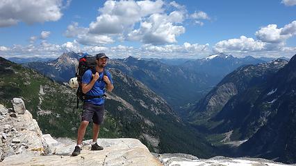
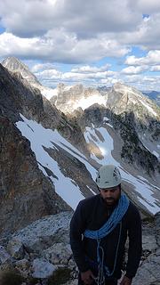
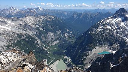
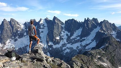
Once we reached the main crest of the southern Pickets, we made a short 60 foot rappel onto the south side of the ridge and cached our packs here. It was a short final 200 feet of Class 3 up the west ridge to the summit, where we reveled in the glory of the southern Pickets. We could easily see the entire traverse we had just accomplished to the north, and to the south we saw what remained. Since we decided against Inspiration and Degenhart, the direct route to Goodell Creek, which was clearly visible from the summit, looked more appealing, rather than descending the barrier and traversing all the way across Terror Basin. We enjoyed the summit of Terror for nearly an hour before beginning what would be an awful descent. I successfully got us down the west ridge to the first rappel anchor. It ended up taking two rappels to reach the notch at the top of the south gully and we did a third to bypass the worst of the loose dirt. The rest of the gully was a dangerous descent in a bowling alley of falling rock. We made sure to move one at a time and even threw in one more rappel. Once we exited the gully into the Crescent Creek Basin, we were relieved the worst had ended. I spotted the flattened out Crescent Creek Camp just below us and we reached it with plenty of daylight left to relax. We could now reflect on the traverse as it was completed, sans the descent which I knew would involve sh##ty bushwhacking but at least it would be downhill this time. So after a long dinner we went to bed early, and decided the next day we would just hike all the way out. This was one day earlier than we originally planned.
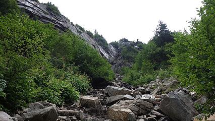
Day 7 Since we were in a more west facing basin the sun didn't hit us early. I ate the rest of the oatmeal either of us had and Etai passed on breakfast. I couldn't stop complaining how hungry I was the entire last couple days and just wanted to get out so I could eat! We traversed over somewhat unstable talus across Crescent Creek Basin to the Chopping Block Ridge camp in the shade and upon reaching the ridge, I took a good look below and informed Etai we would save so much distance if we simply descended the Crescent Creek approach. Reading Stephs comments about it though made us cringe. We were going to be in for some harrowing bushwhacking... So we started down stump hollow which was a heavenly area of beautiful slabs and small streams. We pretty quickly reached treeline though and found a decent trail we were able to stay on most of the way down the ridge. This ridge is actually the lower part of the barrier and lines the west edge of Terror Basin. When we reached 3,800 feet, we spotted a piece of flag tape and figured this was the spot to begin descending east down the steep 1,800 foot slope to Terror Creek. At first it wasn't so bad but we never found any semblance of a trail and continued straight down, schwacking our way down 50 degree slopes utilizing veggie belays copiously! Just as Steph described though, we ran into many cliff bands in the forest. We were able to bypass the first 3 by traversing to skiers right but we then hit one very large one that due to laziness we just decided to rappel off trees to get down. Two full rappels got us down to a slide alder patch that ended up taking a monumental act of congress to pass through. Once beyond that, we reached Terror Creek 40 minutes later and rinsed ourselves off. We were covered in dirt, sweat an pine needles! We found a log to cross Terror Creek on and the trail we thought would be an easy walk, ended up being a half-mile of hell bushwhacking along Goodell Creek. Apparently the good trail doesn't go much beyond the turnoff for the trail up Terror Basin (which I had been up before). There were some flagging but the trail was so non-existent it wasn't any help. We were forced to climb over huge, moss covered boulders, logs and downed trees. Sometimes the moss was hiding death holes you would sink into as well. This part of the descent was the worst because it was flat, and even uphill at times. Eventually the trail improved after enough swearing from Etai haha. We finally reached the old logging road and the remainder of the hike to Highway 20 was uneventful, albeit a painful 5 miles. Upon reaching the highway, we began hitchhiking, and after only 10 minutes an older guy who has been working for Seattle City Light in Newhalem for years picked us up and took us to Marblemount. Amazingly he knew John Roper quite well, as well as John's father, who used to be his supervisor there in Newhalem!