Iowa Peak - 13831' - Class 2
September 2009
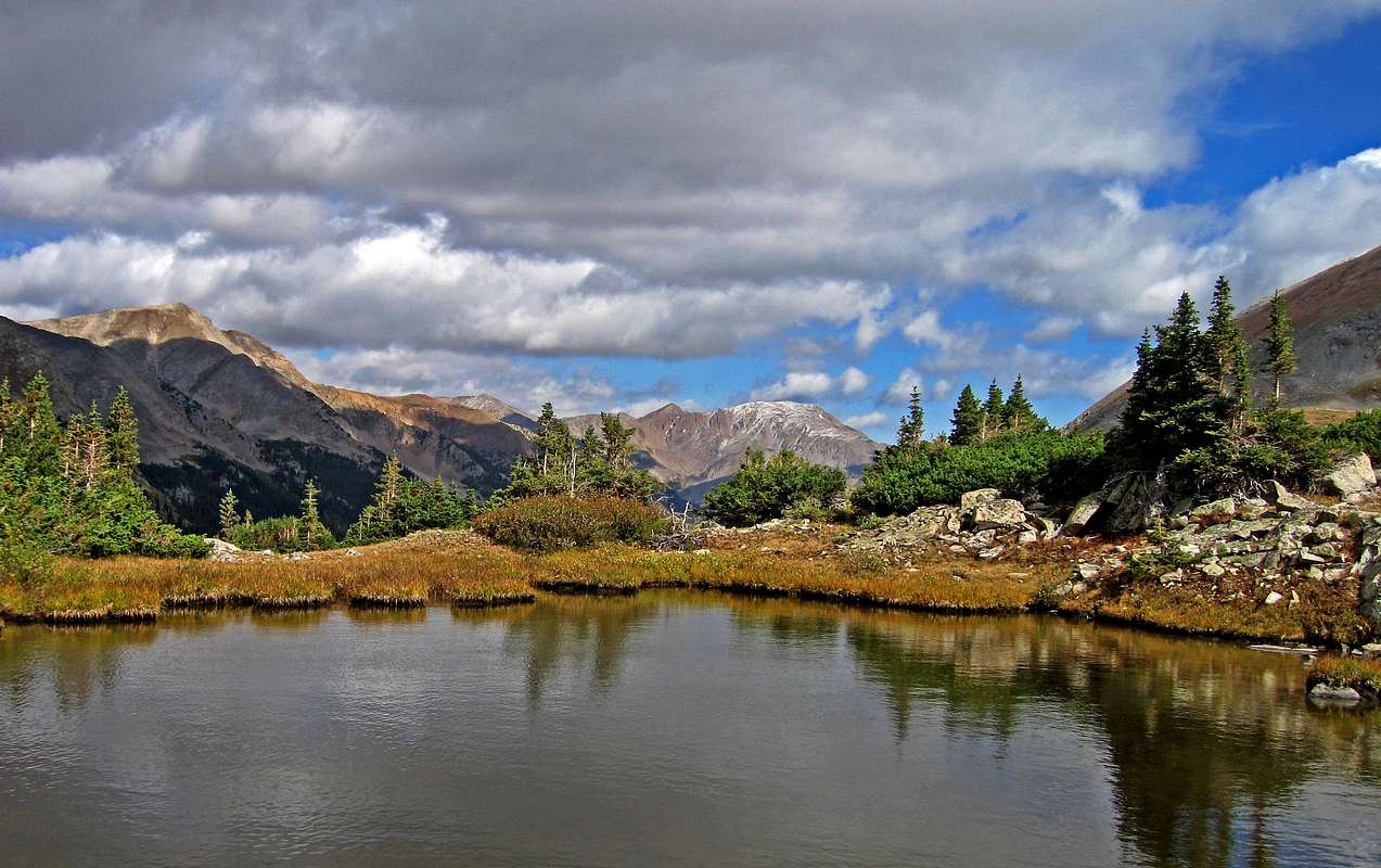
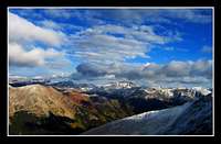
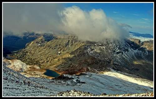
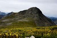
A small tarn below Emerald Peak
|
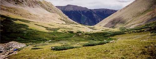
Iowa Peak was my first peak in the Sawatch and it was a great introduction to climbing in Colorado. I really have my friend Josh to thank here as this was all his idea of bringing me into Colorado's mountains. I had a great time here and it's what got me started. His dad drove us up to Clohsey Lake. I never imagined people take their vehicles up roads like that as I grew up in Washington where no one ever goes 4-wheeling. I have to admit I was scared at some points. Once we reached the end of the road and dawn hit us Josh and I started hiking up past Clohsey Lake and up the valley between Missouri Mountain and Iowa Peak. We managed to get off route in the dark and started climbing straight up the loose talus up the north slopes of Iowa Peak. There were some places here I was really worried about rock slides but we all managed to make it up to the crest of the west ridge in one piece and the rest of the walk to the summit was simple. Funny how at the time I did this climb I didn't know a single peak name surrounding me nor did I even know about prominence, the Centennials, or where we even were in relation to other parts of Colorado! What a contrast to currently. From the summit of Iowa however the views took my breath away. I was officially hooked with doing this as there was a beautiful dusting of snow on all the mountains and the bright yellow aspens were at their peak in the valleys below. It was cold and breezy so we continued the traverse to Emerald Peak and descended Emerald Peak to the small hut at the saddle just above Pear Lake. We descended down the valley back to Clohsey Lake and met Josh's dad who was relaxing in his chair by the truck.
|
Emerald and Iowa Peaks Information
Overview
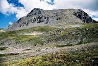
Emerald and Iowa Peaks are two Centennial 13ers on the same long ridge leading south from Missouri Mountain in the Sawatch Range of Colorado. Iowa Peak is soft ranked while Emerald Peak is hard ranked with 564 feet of clean prominence. Emerald Peak is a true monarch, with an elevation of 13,904 feet, it stands alone far enough away from Missouri Mountain that it dominates the surrounding area and towers above nearby Clohesy Lake. These mountains are almost always climbed together and often also included with the 14er Missouri Mountain. The three make for a great day climb in summer and fall. In summer, be sure to start early and be back to treeline by early afternoon - Lightning Wins! In the winter and early spring, there is often very serious avalanche danger to contend with; except of course for the winter of 2011/2012. This is however very abnormal. Expect lots of avalanche terrain in winter and go prepared.
 Emerald Peak Emerald Peak |
 View from Rockdale 4WD Road View from Rockdale 4WD Road |
 The Triple Crown from Belford The Triple Crown from Belford |
 La Plata from Iowa in fall La Plata from Iowa in fall |
Getting There
Getting to Emerald and Iowa Peaks is fairly straightforward. From Denver head west on I-70 for about 70 miles and take the Highway 91 exit south towards Leadville. Head over 11,500 foot Fremont Pass en-route. From Leadville, continue south on Highway 24. Colorado's two highest, Elbert and massive dominate the view to the west from here. Continue south past the CO 82 (Independence Pass) road and turn right onto the Winfield Road (Chaffe County 390). This turn-off is easily missed and comes into view suddenly on a short downhill stretch on the highway. This good dirt road leads west passing the Clear Creek Reservoir and continues deep into the Clear Creek Valley for a total of 12 miles until reaching the old townsite of Winfield where 2WD cars are forced to park.
Ervin and Blaurock from Winfield townsite
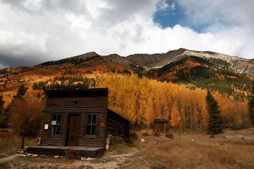
There are two main ways to access Emerald and Iowa Peaks. The first is from the Missouri Gulch Trailhead at 9,600 feet which is found on the south side of the road right after two hairpin switchbacks. The other is by continuing further up the road, passing the Sheep Gulch Trailhead on the north side and getting to the Rockdale Trailhead, again on the south side of the road only about a half mile from the Sheep Gulch Trailhead. Heading south from the Rockdale Trailhead is a very rough 4WD road that first crosses Clear Creek (impossible in high water) and climbs very steeply for three miles to the wilderness gate a short walk from Chlosey Lake. This lake is very beautiful and this 4WD road is frequently walked. Once you get to Clohesy Lake take in the beauty of the valley extending to the south above you. This area was one of my first exposures to the Colorado mountains. I loved it!
Route Options
Missouri Gulch/Elkhead Pass
If you decide to start at the Missouri Gulch Trailhead, start hiking up the steep switch backing trail for about a mile where it levels out slightly and gets to treeline around 11,500 feet. Continue straight up the valley and be sure you don't start climbing up the steep trail up Mount Belford. After another couple miles you will reach Elkhead Pass at 13,200 feet where commanding views await. With the steep cliffs of Missouri Mountain's east ridge to one side all the way to the stunning Emerald Peak to the southwest, this pass is beautiful, but a zoo in the summer. Expect to see many people. Begin descending to the other side for a half mile to a small bench at 12,700 feet where you will see a couple small tarns just ahead. Traverse southwest past these tarns for about a mile and climb up northeast slopes to a very wide saddle between Emerald and Iowa Peaks. Walk either the north ridge of Emerald and/or the south ridge of Iowa. They are both simple class 2 walks and both summits can be gained in about an hour from this saddle.
This route is 12.5 miles RT and 5,300 feet elevation gain from the Missouri Gulch Trailhead.
 Sunrise over Missouri Gulch Sunrise over Missouri Gulch |
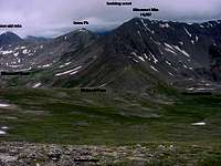 Emerald Group Annotated Photo Emerald Group Annotated Photo |
 Elkhead Pass in Winter Elkhead Pass in Winter |
Panorama from Elkhead Pass
Rockdale Trailhead/Emerald Peak South Slopes
If you decide to take the less popular route past Clohsey Lake, good choice! Get to Clohsey Lake either by driving your 4WD up to the wilderness gate and walking an easy trail for a half mile to the lake or walk 3.5 miles from a red and brown cabin at the Rockdale Trailhead to the lake. From the lake, continue south on a narrow but defined trail up the valley. The trail mostly follows the left side of the creek. Continue on the trail to treeline as it turnes slightly southeast and fizzles out. Continue southeast until you get to an old cabin at a saddle just southwest of Emerald Peak. The rest of the route is easy to see from here but it is a loose nightmare of a slope. Head northeast up a steep slope for about 800 vertical feet and beware; this slope will test your patience with scree! The slope eases and turns into a ridge and from here head due north to the summit of Emerald Peak. Traverse to Iowa if you desire.
This route is 14.5 miles RT and 4,000 feet elevation gain from the lower Rockdale Trailhead
 Clohsey Lake Frozen Clohsey Lake Frozen |
 Emerald Peak from the west Emerald Peak from the west |
 Apostle Group from Emerald Apostle Group from Emerald |
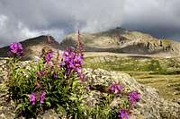 Emerald Peak and Flowers Emerald Peak and Flowers |
Rockdale Trailhead/Iowa West Ridge
This route can be seen in more detail Here
It's about 10.8 miles RT and 3,900 feet elevation gain from the lower Rockdale Trailhead.
The Triple Crown/Missouri, Emerald, and Iowa
The traverse between Missouri Mountain, Iowa Peak and Emerald Peak does not exceed class 2+ and can be done easily in both directions after a climb of Missouri Mountain via its standard route. Beware of thunderstorms as you will be high for quite a while.
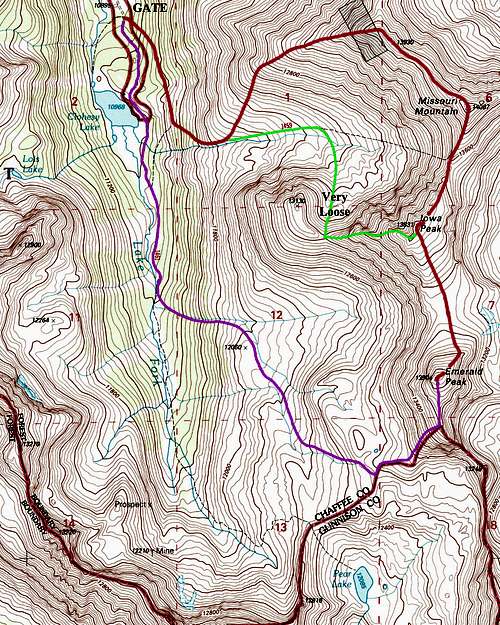
Topo map showing Routes on Emerald and Iowa Peaks
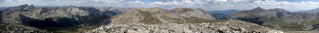
The Summit View
Camping/Red Tape
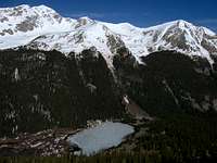
Fantastic camp sites can be found at and above treeline in Missouri Gulch. These mey be hard to get though in the summer busy season unless you arrive early. Around Clohesy Lake there are great sites that are much less known and can provide some solitude. The valley south of Chlosey Lake has a fair amount of tall grasses and shrubs that may make pitching a tent difficult. There is a small tarn around treeline due west of the summit of Emerald Peak where a tent can be pitched. Both places shown below are fantastic places. Emerald and Iowa peaks lie in a wilderness area. No motorized equipment is allowed past the gate. Please try to avoid camping on fragile tundra and practice leave no trace policies.
 Small tarn west of Emerald Peak Small tarn west of Emerald Peak |
 Looking down on Pear Lake from Emerald Peak Looking down on Pear Lake from Emerald Peak |
External Links
Emerald Peak
Also see Gerry Roach's Colorado 13ers book for very detailed descriptions about the approaches and routes to these mountains
Weather Forecast
Good Trip Report
Lists of John
Buena Vista Chamber of Commerce
Fishing Clear Lake Reservoir