Buck Mountain - 8528' - class 2+
Fortress mountain - 8760' - class 2+
September 2018
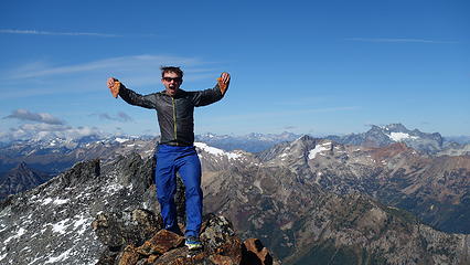
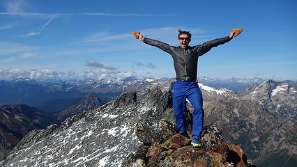
I'll try to make this short and sweet, but on Monday and Tuesday this week, Josh and I took advantage of the awesome weather and climbed Fortress and Buck. The clear, crisp, smoke free air, along with the fresh snow made this trip possibly one of the most scenic climbs I've ever done in the Cascades. Fortress and Buck were Bulger numbers 98 and 99 for me, which Josh finished number 100, and became the 71st person to complete the list, when we summitted Buck Mountain at 2:25PM on the 18th. Congrats Josh!!
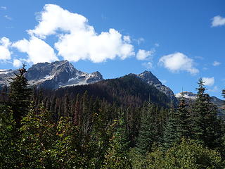
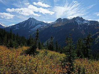
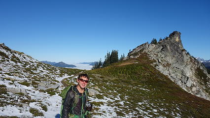
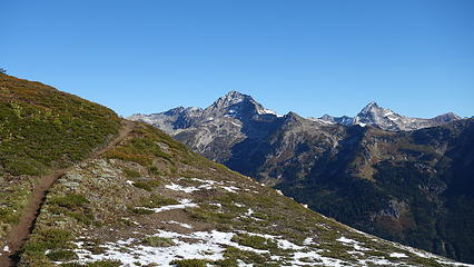
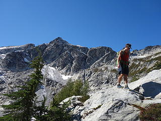
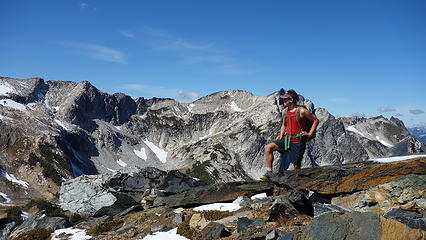
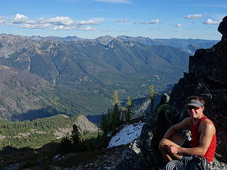
I picked Josh up in Lynnwood around 6am Monday and by 10:45 we were starting up the Buck Creek Trail from the end of the Chiwawa River Road (which is now re-opened). We made quick time getting most of the way up the trail, and when we reached the small basin eading up to Pass No Pass, we veered right and hiked 700 feet up on mostly bare grasses and heather to a flat spot only 100 feet below the pass where we dropped our packs. Here we split up, and I ascended the standard SW face of Fortress. Since Josh had done Fortress years before, he scrambled up the NE ridge of Helmet Butte while I did Fortress.
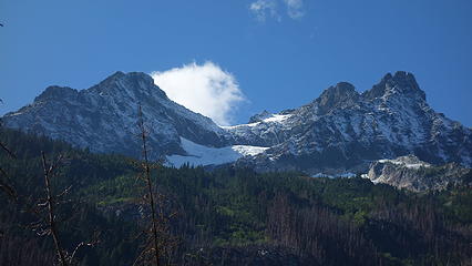
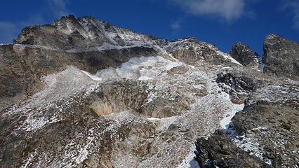
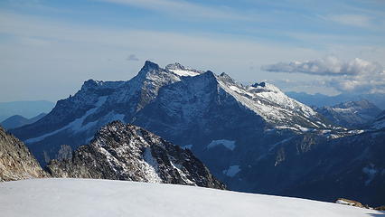
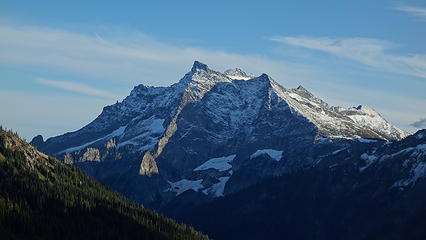
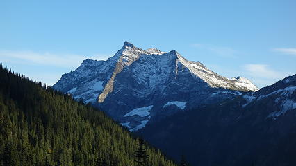
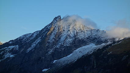
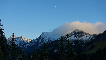
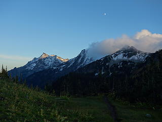
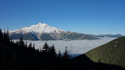
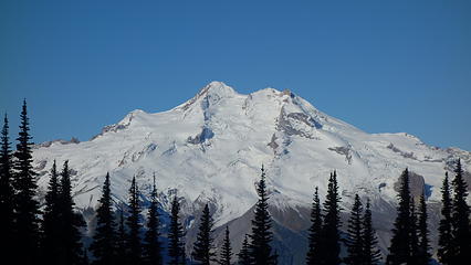
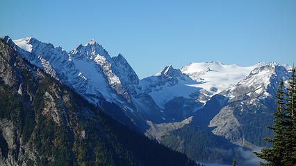
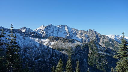
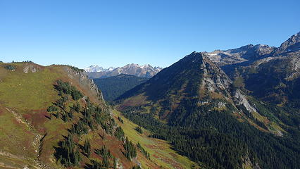
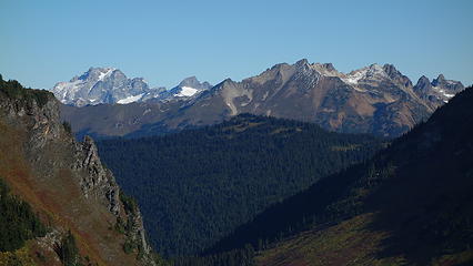
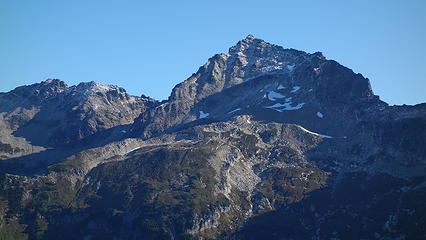
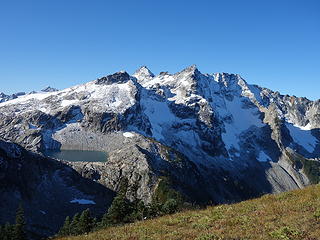
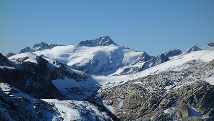
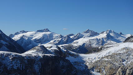
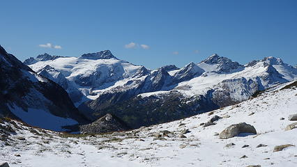
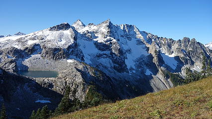
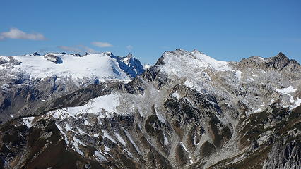
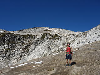
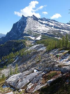
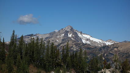
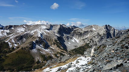
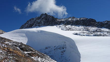
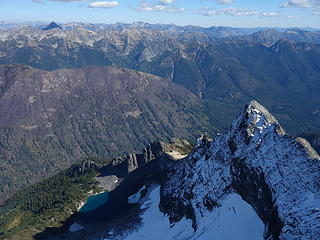
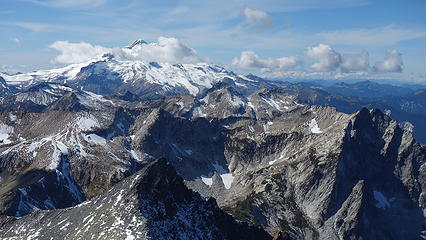
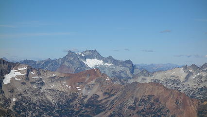
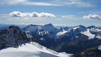
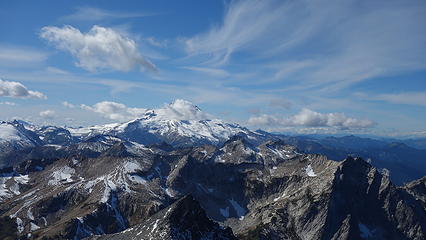
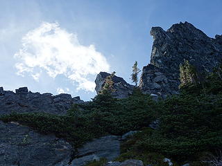
The initial ascent from the pass was up steep grass, but the angle decreased as I got higher. When I finally got my first view of Fortress, I could see how much fresh snow I had to deal with. Only wearing tennis shoes, I mentally prepared myself for wet feet and continued up the ridge. When I arrived at the base of the upper slopes, I did some class 4 slab scrambling to try and stay on dry rock in an effort to keep my feet dry, however the final 500 feet was mostly class 2 talus, and I was forced to step in the fresh snow more often. Glacier Peak was towering mightily behind Helmet Butte from my vantage and Bonanza dominating the view to the right. From the summit, I was in total awe at the beauty of the area with the fresh snow, and looking over to Buck, it appeared as if there was much more snow over yonder. I certainly hoped my shoes would hold up!
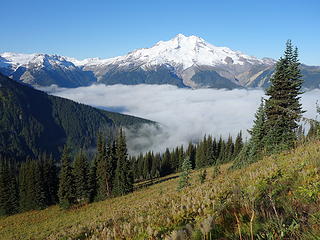
I didn't stay on the summit long as it was getting a little late and I am sure Josh was waiting, since his ascent was much shorter. I made good time down and by 5:30 we started back down to the trail. After consuming our weights worth of fresh amazing blueberries, we hiked the rest of the way to Buck Creek Pass and I was shocked to see nearly a dozen people around. Many of them were hunters. Just as we arrived at the pass, the sunset lighting on Buck and Glacier Peak were out of this world! We chatted with a guy who clearly had the best camp spot with a perfect view of Glacier, but unfortunately we had to drop into the trees about 100 feet to the actuall ,ow spot in the pass and find a clear spot to pitch the tent. We found a spot right next to the small spring, which at least allowed us close access to water. We photographed the sunset, pitched the tent and made dinner. By 8:30 I was asleep.
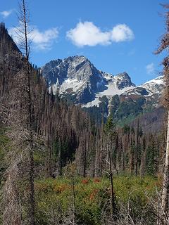
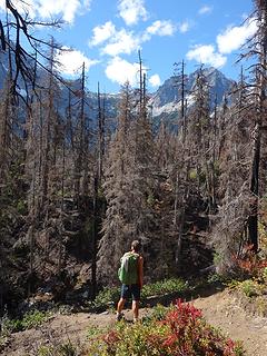
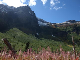
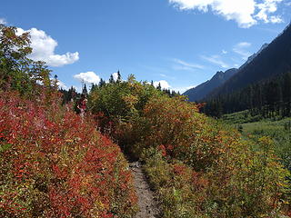
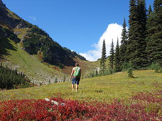
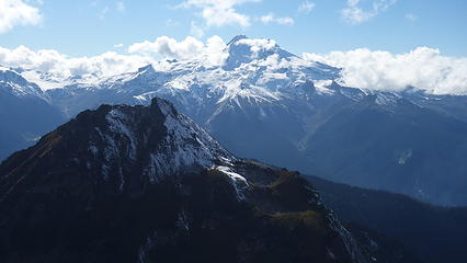
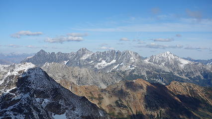
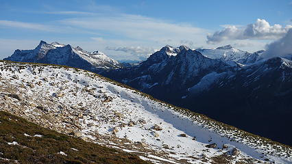

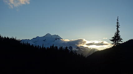
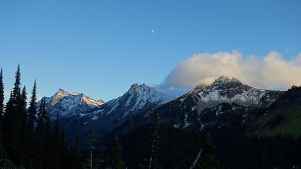
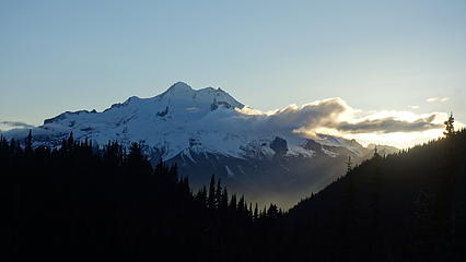
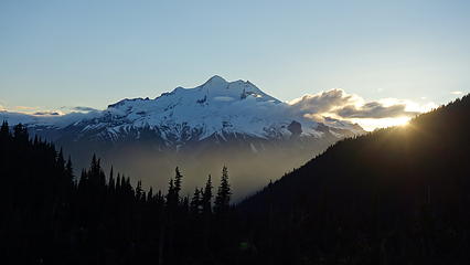
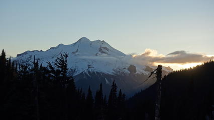
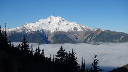
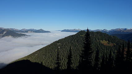
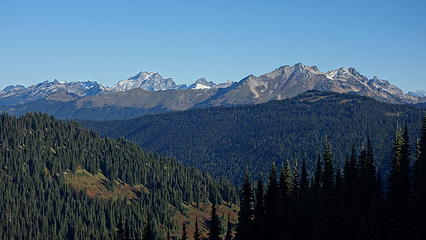
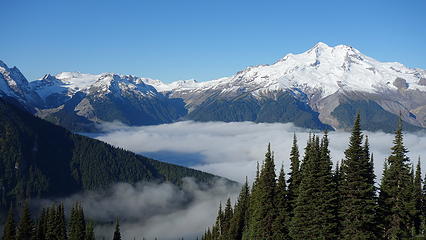
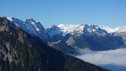
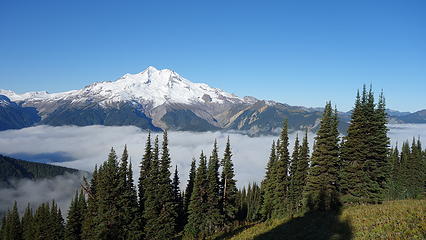
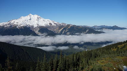
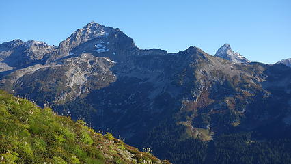
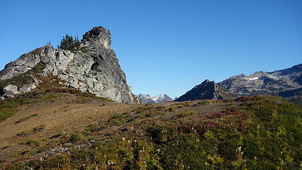
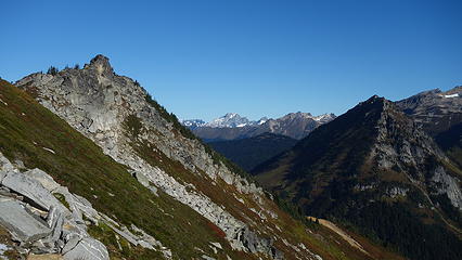
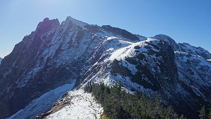
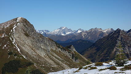
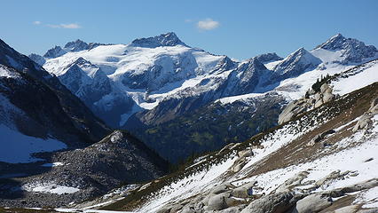
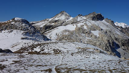
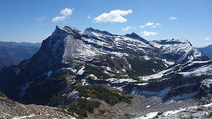
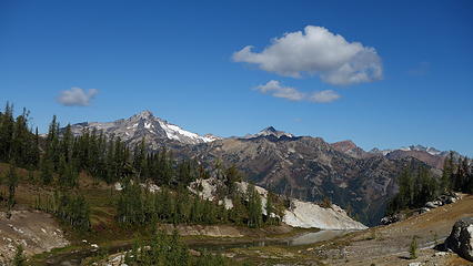
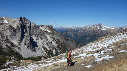
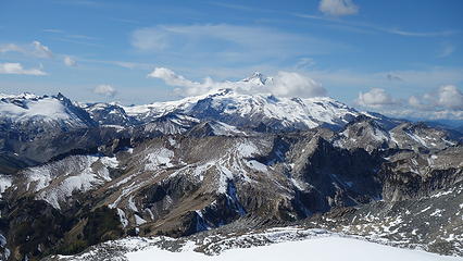
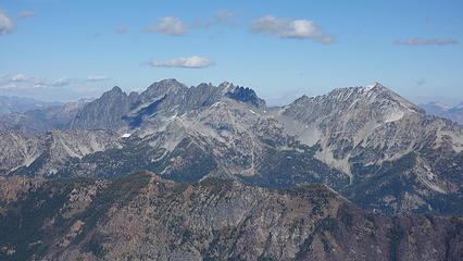
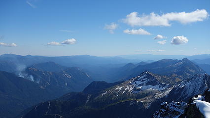
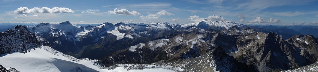
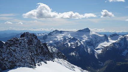
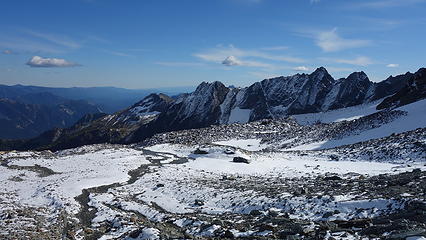
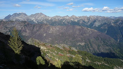
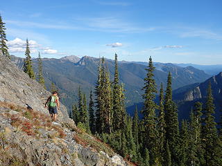
The next morning, it was a little chilly, and we didn't get moving until almost 8am. We started hiking up the trail towards High Pass, going up very mellow, borderline Cascade Pass Trail ridiculous switchbacks as a light frost covered most of the shrubs and grasses. As we neared treeline, Glacier Peak came into view in indescribably stunning fashion, as a low layer of clouds blanketed the Suiattle Valley below us, and A perfect morning light illuminated Glacier Peak with all its fresh snow. It was easily one of the best views of Glacier Peak I've ever seen. The trail continued heading in a generally southward direction going around the west side of Liberty Cap, and the east side of Rally Cap. It was this point a solo hiker caught up to us as we were taking dozens of photos and at the small rise just past Rally Cap we stopped to chat for a few minutes. He was planning to head back over and climb Fortress after a morning hike to High Pass.
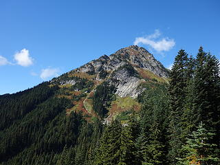
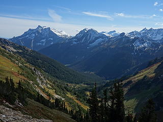
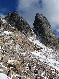
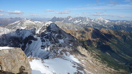
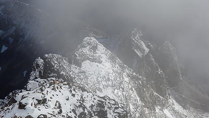
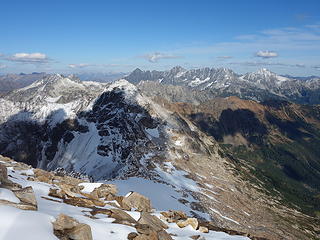
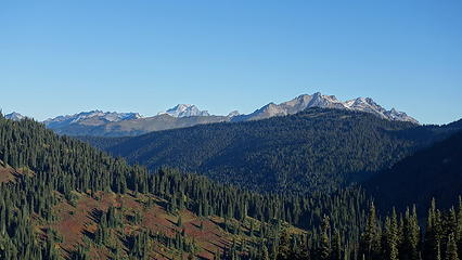
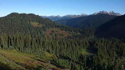
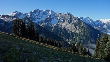
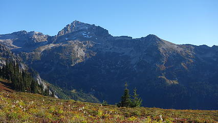
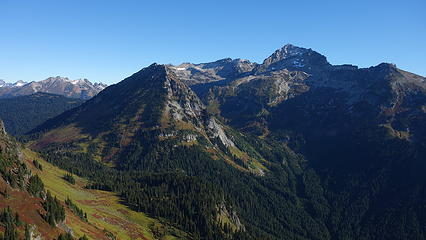
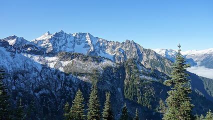
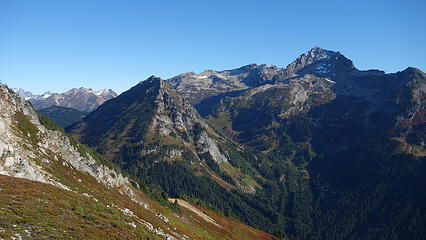
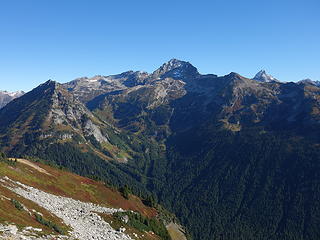
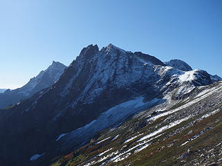
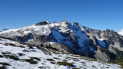
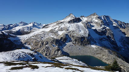
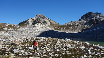
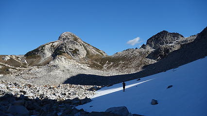
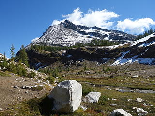
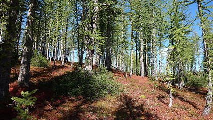
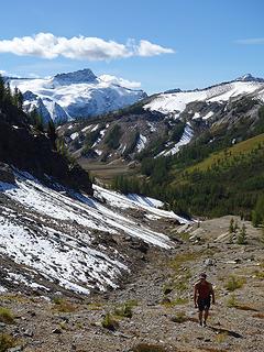
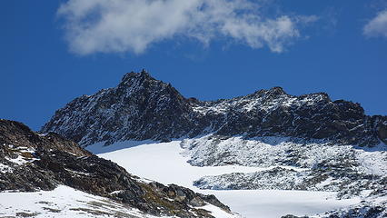
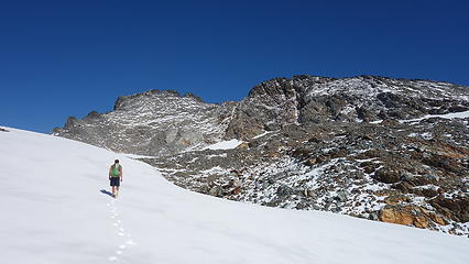
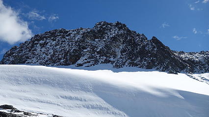
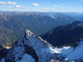
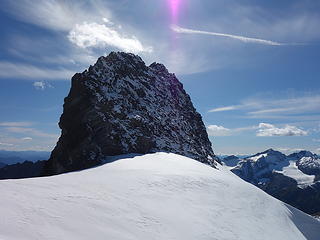
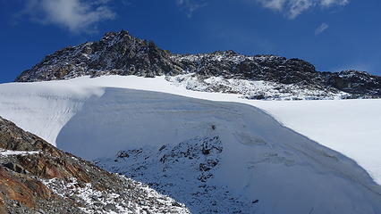
We continued on, now travelling on snow covered talus (1-3 inches coverage on north facing aspects), which slowed our progress a little, but just when we reached High Pass, an east facing smooth descent into a small basin allowed us to quicken the pace. We located the small notch to cross through on the opposite side of the basin and sidehill traversed through it until we could ascend left up to a 7600 foot saddle just south of Berge. Here we took a quick snack break, as we could now see the remainder of the route up Buck Mountain. After a little bit of arguing as to which peak was the highest, we began the 800 foot descent down into the next basin just south of Buck. It was in this basin we saw our first larches of the trip, however none of them were turning yet. We crossed the small stream and began the last 1700 feet back up to the summit via its west slopes. The route up was drying out, but still had a decent amount of snow, most of the way was scree and talus not exceeding class 2. When we reached the small glacier remnant at about 8000 feet, the snow increased. Here we were looking at the rugged 8320+ foot peak just south of the main peak, thinking that was the true summit. With the fresh snow on that, and the difficulty looking 5th class we were shocked! After consulting the map a little more we realized however that the true summit was the one to the left. I actually was a little tricky to find the true summit from below, as there are 4 peaks on Buck!
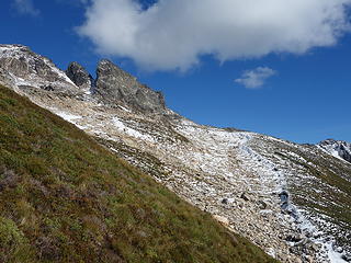
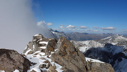
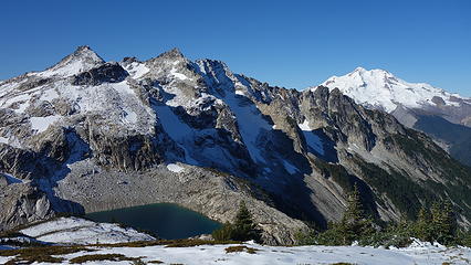
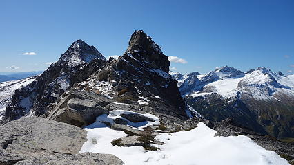
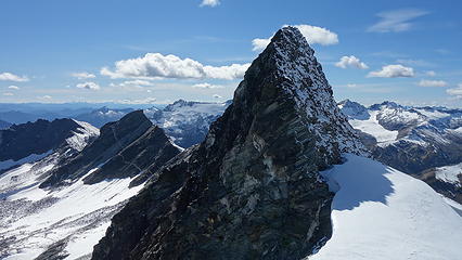
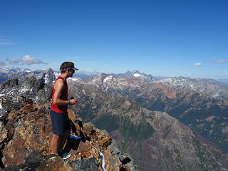
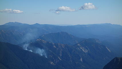
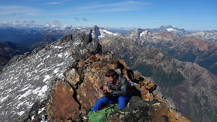
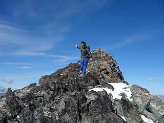
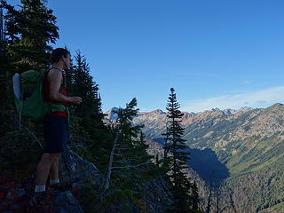
The final scramble to the summit involved some class 3 on the very exposed ridge. Peering down the steep northeast face with King Lake below was incredible. The snow just will not go away on those north aspects despite the day being quite warm. A little before 2:30 we were on the summit, and Josh had finished the Bulgers! So exciting for him, and for myself considering we did about 65 of them together. It was a journey for the ages, and I cannot wait to finish my last one on Glacier Peak shortly. Amazingly, we noticed a small plume of smoke coming from the slopes just above and east of the Chiwawa River Road down the valley! All that rain didn't completely put the fires out. I guess it is now small enough that it isn't a danger.
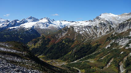
We enjoyed the moment as long as we could, but knowing we had a rough descent ahead of us we began down at 3. We utilized the direct route down to Buck Creek, first descending to the small 8100 foot saddle just south of the rugged aforementioned false summit, and descended very loose talus into the wide basin SE of Buck. We made a descending traverse to a small notch at 7140 feet in the rib dropping south off the main east ridge. This notch is critical for this route, as it's the only feasible way to cross this otherwise cliffy rib. Once through this notch, we cut left briefly and descended more talus/heather slopes, and spotted the best way to make a leftward traverse until we could get onto the lower east ridge of Buck around 6400 feet in elevation. We had to bushwhack a bit through bushes in this area as we traversed left. Once on the ridge, it was smooth sailing for awhile until the ridge petered out around 5000 feet and we were forced onto the steep bushy slopes leading more or less due east 2000 feet down to Buck Creek. I would be lying if I said this didn't suck, but it was mostly bad due to the steepness, combined with my wet feet wearing shoes that were falling apart. The moss and pine needle covered ground was also very slick and a constant use of veggie belays was required. Overall the bushwhacking was not too bad though.
Eventually we made it to Buck Creek, where we found a steep ramp dropping the final 50 feet to the creek itself. We removed shoes and easily walked across the creek, then ascended up about 100 feet to meet the trail. Just before dark we made it back to the trailhead, and my 99th, and Josh's 100th Bulger was officially complete. Dominos in Monroe on the way back was well worth it!


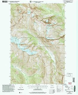
Here is a map of our route up (red) and route down (green) on Buck.