lower maidenwater canyon - Class 2
february 2013
Overview
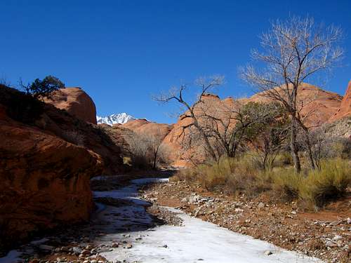
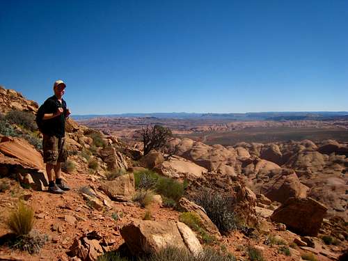
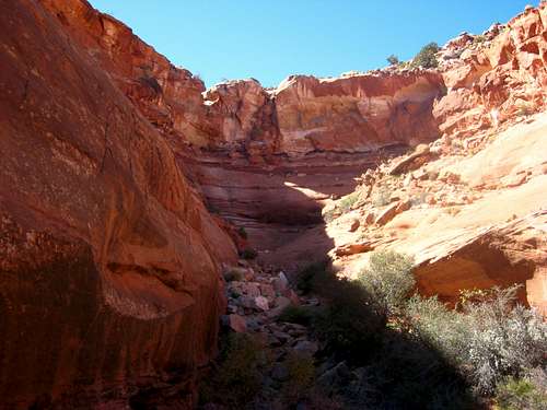
Maidenwater Canyon is a fairly major drainage system in the extreme southern section of the Robbers Roost Country which drains into Trachyte Creek from the west. These canyons, along with Trail Canyon just to the south drain the eastern flank of Mount Pennell and Mount Hillers in the southern Henry Mountains. Therefore, these canyons typically have more water in them especially during the spring snow melt. Maidenwater offers fun, technical upper forks to the west of Highway 276 and a pleasant and beautiful non-technical hike through lower section to the east of the highway. There are three technical upper forks, the North, Middle and South all of which have fun downclimbing sections, pothole wading and short rappells. The narrows in these slots are especially beautiful and photogenic and lower Maidenwater has an awesome hike through subway section shown in the profile photo above. Each fork is short only taking 3-5 hours each to complete with the South Fork being the longest. See below for information about each fork.
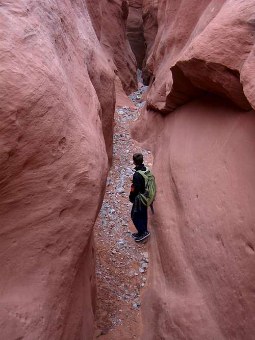
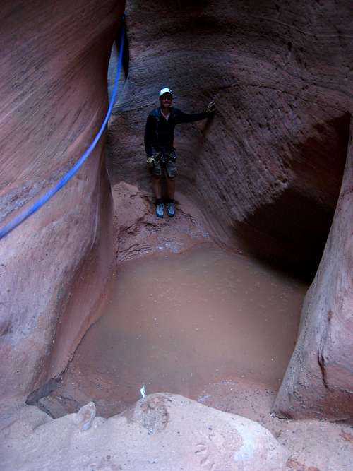
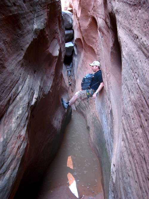
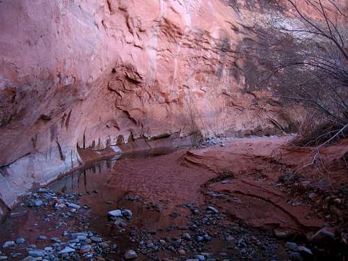
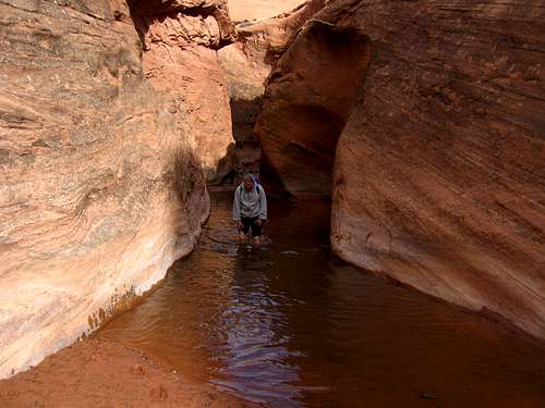 Short wade in Lower Maidenwater |
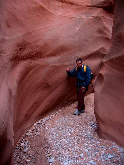
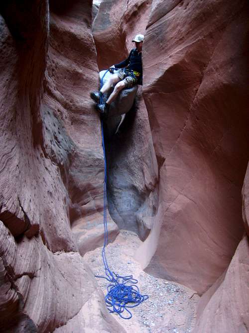
 Descending from the Highway Descending from the Highway |
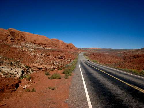 Highway 276 at Maidenwater Canyon |
Quick Facts about Maidenwater Canyon
| Name | ACA Rating | Numer of Rappells | One-Way Canyon Length |
| North Fork | 2B I | 0-1 | 1.3 Miles |
| Middle Fork | 3A II | 1-4 | 1 Mile |
| South Fork | 3B III PG+ | 4-6 | 1.7 Miles |
| Lower Maidenwater | 1B II | 0 | 3 Miles |
Getting There
From Hanksville, Utah drive south on Highway 95 for 26 miles to the junction with Highway 276 which heads towards the Bullfrog Marina. Turn south onto Highway 276 and reach the Maidenwater Canyon area between mile mark 8 and 9.4 on this highway. For the North Fork, turn east on a faint sandy double track at mile 8 and drive as far as you are comfortable going. This track quickly turns into a 4WD sandy road. For the Middle Fork, park just off the highway right past mile mark 9 a few feet after crossing the middle fork. For the South Fork, park a few feet north of the cattle guard at mile mark 9.4 where there is a decent pull off. Park at this same cattle guard if you plan to hike down Lower Maidenwater Canyon.
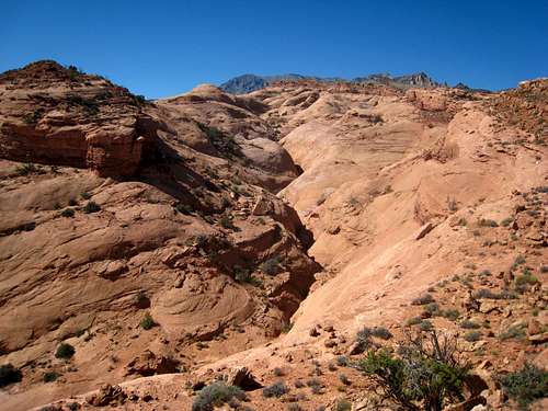
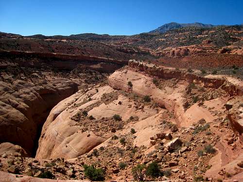
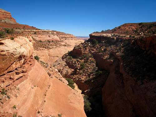
Lower Maidenwater Canyon Hike
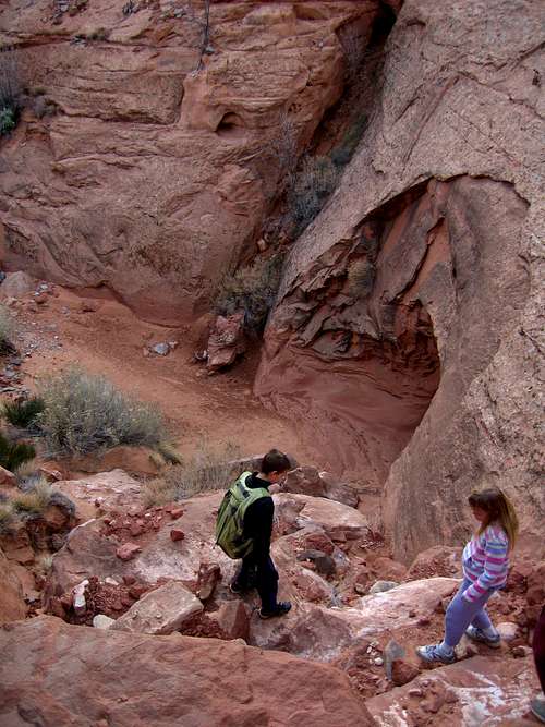
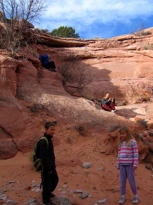
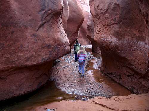
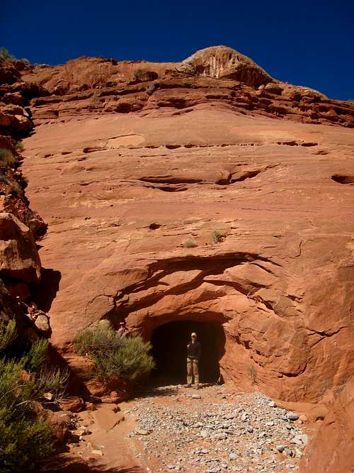
From the cattle guard, descend east off the highway down some loose talus and scree to the wash below and locate the long water tunnel heading under the highway. This is an awesome place to explore but make sure you have a headlight as there are some small potholes in the tunnel that you cannot see without one. Begin hiking down the sandy wash in the open canyon. About a quarter of the way down this 3 mile long canyon is a small drop-off that you can bypass on the left (north) side of the canyon. Just over halfway down is the first pool of water. There used to be a large chockstone here but in February 2013, it was gone and it was nothing more than a short wade. Once past this pool, the remainder of the canyon to Trachyte Creek has a little flowing water and very photogenic greenery. One short section has a beautiful subway narrows making for spectacular photos. When you get to Trachyte Creek you have two options. You can turn right and hike south for a half mile along Trachyte Creek and head west up lower Trail Canyon for 2.7 miles back to the Highway. This canyon is a very easy hike but doesn't have as many nice narrows and no water. The upper half gets very rocky as the wash is covered in large granite cobbles that have washed down from the Henry Mountains. If you take this route you will see new scenery on the return and keep your feet dry. Once you get back to the road you will have to complete the loop by hiking another half-mile north back to your car. This loop hike is nearly 7 miles long and makes a great day hike. The other option is returning back up lower Maidenwater Canyon and maybe you can spend some time exploring the North Fork on your way back. This hike is 6 miles long plus any extra you do for roaming around.
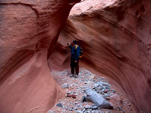
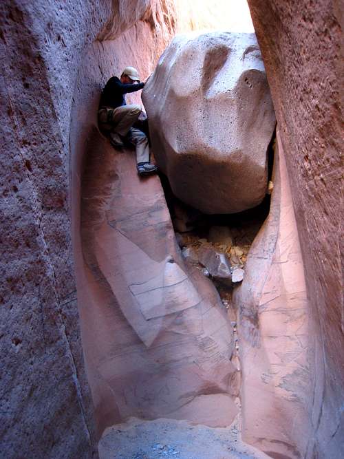
 Scrambling back in after bypassing the drop |
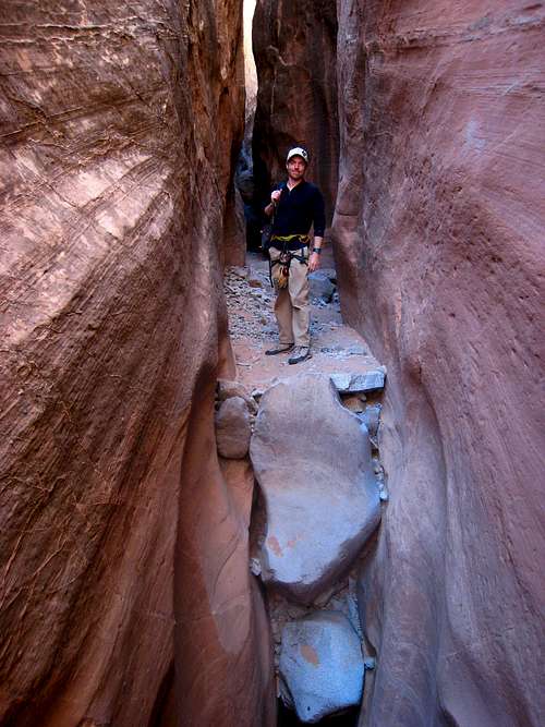
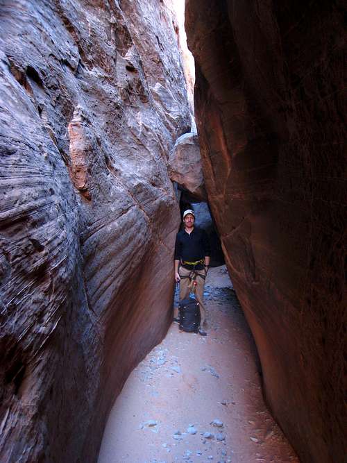
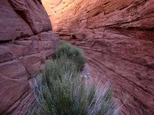
 Lower Maidenwater Canyon Narrows |
 Lower Maidenwater Canyon Narrows |
 Lower Maidenwater Canyon Narrows |
 Subway section |
 Starting up Lower Trail Canyon |
North Fork
Paraphrased from Michael Kelsey:
"From mile marker 8 on Highway 276, walk or drive east on the sandy track for 1.8 miles then hike east around the head of the norrth fork and route-find a way below the 15 foot Page Sandstone cliff. Continue southwestward into the slot which begins with a slide into a long pool. This shallow slot has 3 interesting descents and opens up to trees and brush at the end. Where the Little North Fork comes in from the left, after about a half-mile in the canyon, you can hike up steep slickrock and return back up to the rim. You could also hike the remainder of the North Fork down to where it meets Lower Maidenwater Canyon a short ways before Trachyte Creek."
Note that I have not yet done the north fork so if anyone would like to contribute information or photos let me know and I will add it here! The north fork has a very short fun section with the remainder being an easy hike. I have heard it isn't too exciting. The middle and south forks described below are much more difficult with longer narrows and more technical canyoneering involved.
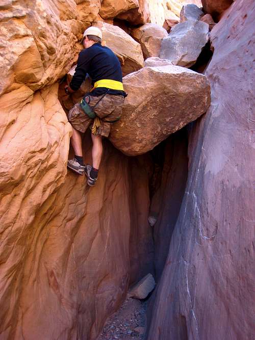
Middle Fork
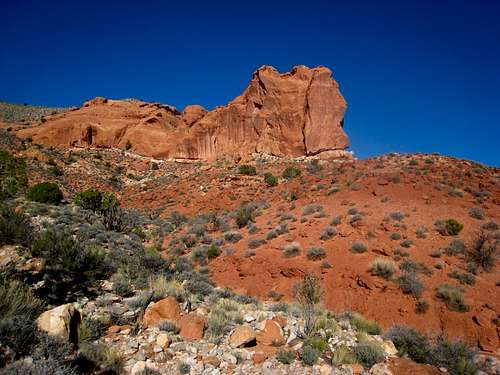
This canyon is a very fun 3 hour adventure and a great canyon for someone wanting to get an introduction to technical canyoneering. It's nearly always dry and offers a handful of easy to moderate difficulty descents. Park just south of mile marker 9 on the side of the road and hike southwest up to the rim of the canyon and hike 150 vertical feet up towards a small Carmel high point 0.2 miles from the highway. Just before reaching this highpoint, drop a few feet to the right and continue west in a small slickrock valley. Reach an awesome narrow ridge separating the Middle and South forks offering great views after 0.6 miles at 5,180 feel elevation. Continue west around the head of two side canyons and aim for the red colored tower clearly visible just to the northwest. Climb up 100 feet near the base of this tower and descend 200 feet into the open wash on the other side. This wash is the upper end of the Middle Fork. Begin hiking down the wash to the east. This approach hike takes about an hour.
 Hiking up the rim of the Middle Fork just above the highway. Notice the red tower just above and right of the canyon. |
 Aim for this tower after rounding the two side canyons |
Continue down the wash a short ways until you arrive at the big drop. Bypass this 50 foot drop by hiking around the rim to the south for a few minutes and scrambling down the 25 foot initial cliff band by using an undercling crack along a 45 degree friction slab (Class 4). Then you can walk a nice ledge back as it gently descends to the canyon floor. Continue down canyon and about a quarter of the way down you will come to a 30 foot drop with a sling wrapped around a chockstone buried in sand. Although this sling held our weight, we backed it up using a small tree just behind it. Just beyond is a section of six, 10 foot descents off chockstones, each having a small sling around them. I was able to descend each of these without using the rope however novices may want to either rappel or have a partner assist them. Each anchor looked decent in October, 2013 but always bring webbing in case floods damage existing anchors.
 Looking south at the first big drop |
 Middle Fork Middle Fork |
 Photogenic section Photogenic section |
After the six chockstone drops, the canyon eases up a bit and you go through a photogenic hike through section. Near the end as you get close to the highway, there are two more drops each about 8 feet where you can slide down a slab and land on soft sand. There were no anchors on either of these drops so beginners may need someone to spot them from below. At the end of the canyon you will arrive at the tunnel that was drilled to allow water to flow freely under the road. With a head lamp you can hike through the tunnel, but you can easily hike up loose talus and scree on either side for 50 feet or so to reach the road. For the Middle Fork, bring a 15 meter rope, rappelling gear and a handful of 10-15 foot slings.
 Going down one of the 8 foot slides |
 End of the middle fork...highway is just above |
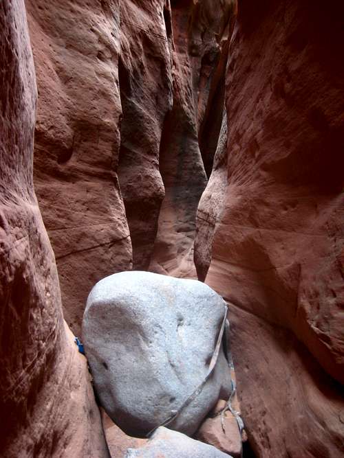
South Fork
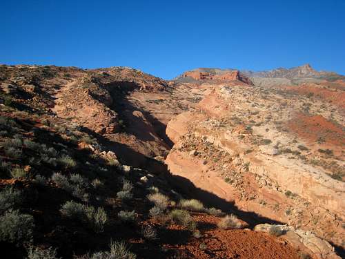
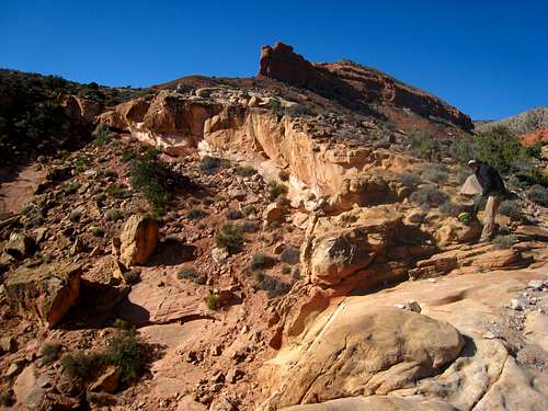
The south fork is the best and most difficult slot in the Maidenwater Canyon drainage. It typically has a few standing water sections that can be anywhere from ankle to waist deep and numerous descents between 6-12 feet. Most of the drops had webbing wrapped around chockstones and we decided to use them on a few of the drops. Begin this slot by parking next to the cattle guard at mile 9.4 in the highway at a big pull-off. Hike west up an easy slope just north of the South Fork and reach the rim. Follow the contact between the white colored Navajo Sandstone and the reddish Carmel Formation for about a mile. Along the way you will hike around a major side canyon that ends in the south fork shortly before the highway. On your way down the canyon, you will know you are almost finished when you pass the open area where this side canyon ends. As you hike along the Navajo-Carmel contact, you will gain elevation gradually following this ledge and pass very close to the ridge you hike across for the Middle Fork. There is no need to climb up to this ridge unless you want to see the view. Stay 20 feet below it and follow the contact until you get to the point where you can see the end of the south fork, then scramble 20 feet up to the Carmel rim. Do not continue on the Navajo Sandstone the final half-mile as the terrain steepens. Locate a small boot path and easily hike to the head of the south fork where you will find a 25 meter drop.
 Approaching the South Fork |
 Looking up the side canyon from the rim above |
 Nearing the head of the south fork |
You can make the rappel down this big drop if you have a 50 meter rope, otherwise continue around the head of the South Fork for a few hundred feet and descend into the drainage via a short blocky scramble, a small slickrock slide onto a ledge, then hike back on the ledge as it descends to the canyon floor near the base of the 25 meter drop. You do not need to do this first rappel and it's recommended you bypass it because carrying a 50 meter rope through this canyon would be annoying and only complicate things. Continue down the canyon which is open at first but quickly gets down to business. There are at least 15 descents each having about a 10-15 foot drop and many of them into small potholes of water filled with mud in the lower half of the canyon. I believe I saw webbing on every single drop that wasn't an easy scramble. I rappelled 5 of the drops where the canyon was too wide to chimney down and was able to simple grab the webbing with my hand to get started on a handful of others. About halfway down, there is a 15 foot drop into a pool that you will have to rappel into off a chockstone. This pool is not the permanent one Kelsey refers to in his book but it was about knee deep in October, 2013. Just beyond this is another 15 foot drop into a permanent pool with a long piece of webbing with a bunch of knots tied in it to use as a hand-line. This pool is typically knee to waist deep that you will have to wade through.
 At the head of the south fork...scramble in on the right side At the head of the south fork...scramble in on the right side |
 Looking back at the 25 meter drop Looking back at the 25 meter drop |
 The first pool we encountered |
 Descending one of the many drops |
 Photogenic section |
 Stemming over more water |
Depending on how recently it rained or if there is still snow in the Henry Mountains, this will only be the beginning of many small wading sections for the second half of the canyon. Sandals would be an awesome idea for this one as we spent a crazy amount of time taking our shoes off and putting them back on over and over again. I would bet this canyon typically has many small pools unless it has been very dry for a long period of time. The deepest pool we encountered was slightly deeper than waist deep. Plan on being in this canyon for at least 5 hours. Just past the open area where the side canyon comes in from the left (north) there is one final slide into a deeper pothole that is probably filled with water followed by the final rappel which is a 20 foot drop with webbing wrapped around a huge rock. This last obstacle is 100 feet from the highway and can be bypassed by climbing up steep slickrock slabs to the left about 30 feet and walking the ledge down to the tunnel. Don't hike through the tunnel without a headlight but you can hike up loose talus to the highway from either side.
 One of the rappels |
 Glowing light in the South Fork Glowing light in the South Fork |
 A tree in the south fork |
South Fork Video Clip
Lower Maidenwater Canyon
Camping/Red Tape
You can camp where Maidenwater Canyon meets Trachyte Creek. We actually saw tents on a sandy berm when we were there in February, 2013. There are also some nice campsites along the sandy double track above the North Fork. The entire area lies on public BLM lands so camping is free and there is no red tape. Please practice LNT policies.
Overview Map
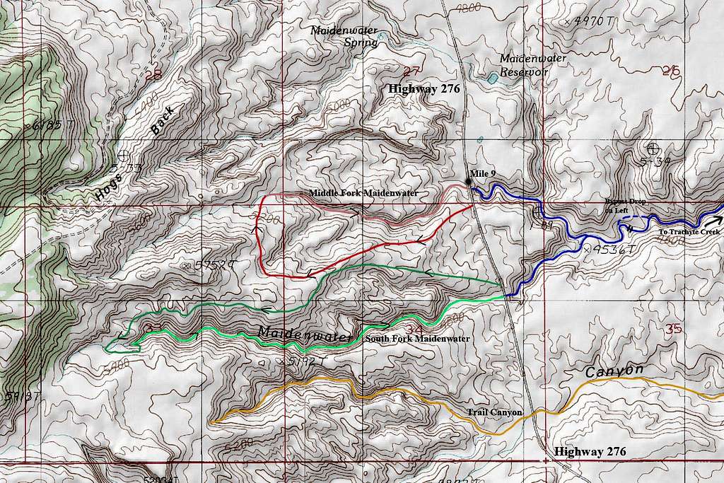
DARK GREEN-LIGHT GREEN: South Fork Maidenwater Canyon
BLUE: Lower Maidenwater Canyon
ORANGE: Trail Canyon
External Links
Lower Maidenwater Canyon on Climb-Uath
Lower Maidenwater on AmericanSouthwest
TURKEY KNOB - 5499' - CLASS 2+
February 2013
Overview
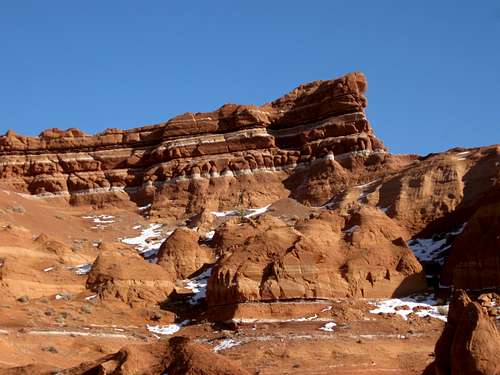
Turkey Knob is a beautiful desert peak located about 25 miles SSE of the small town of Hanksville Utah. The peak is in a fairly isolated area, but there is much to do in the region. This fantastic little peak has a wide panorama overlooking the North Wash desert country, the Dirty Devil River country, the badlands south of Hanksville, and piercing the sky to the west are the Henry Mountains. The peak is a kaleidoscope of color as well with its many banded rock layers.Although the peak looks formidable from many angles, there are a few class 3 routes (albeit loose) on the north side. The final section of the route has some exposure, but it isn't too severe, though as always one must use caution.
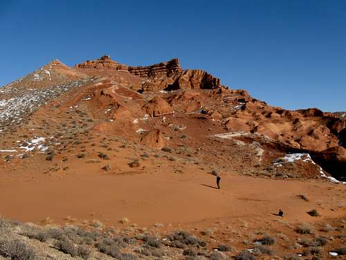 Approaching the upper slopes of Turkey Knob.
Getting There
The access road is Highway 95 between Hanksville and Hite. Turkey Knob is roughly half way between the two locations. Both Hanksville and Hite have fuel, but Hite has sporadic hours, especially off season, so be aware of this. As always, make sure to have a good road map before heading out to this isolated region.To climb Turkey Knob, park along Highway 95 anywhere between mile 24.5 and 25.4. Since we were doing Death Canyon on the same trip, we parked at mile marker 24.5.You can get slightly closer to the peak by driving the Cedar Point Road (gravel) north from mile 25.4. Since the peak is visible most places along this road, park where ever you find suitable.
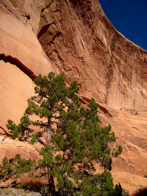
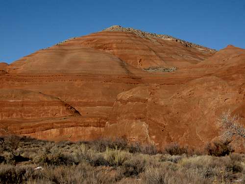 These are some of the colorful domes around the base of Turkey Knob and right at the trailhead.
Routes Overview
There are many routes available to climb Turkey Knob, but the final approach up the summit area must be from the north unless you enjoy climbing on very crumbly rock. A couple of gullies on the north side provide some class 3 routes, but be aware of loose scree and a bit of exposure for the last 20 feet or so of the climb. Other than that, there are no real difficulties other than some loose sand and steep slopes.Because of the nature of the rock, technical climbing is not recommended.This fairly short half day climb makes an excellent combination with Death Canyon or any of the North Wash canyons to make it into a full day or more. You can easily spend several days, weeks, months, years or even decades exploring this spectacular region.
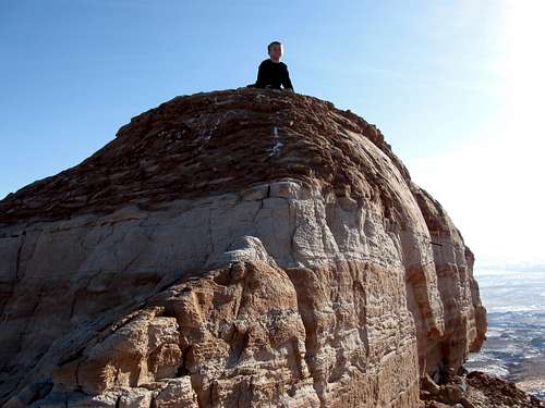 Kessler on the exposed summit of Turkey Knob on January 17 2010. It was a challenging climb to get here.
Red Tape
There is no red tape, so make sure to use LNT methods of travel.
 There is no red tape, but there is some red rock.
Camping
There aren’t any campgrounds in the area, but you can camp almost anywhere. There is no private land for miles and miles around in this area. One good campsite is around mile marker 24.4, but it’s a pretty well known one. Mile marker 28.1 has a good campsite as well and the Cedar Point Road also has countless campsite opportunities.
When to Climb
The peak can be climbed year round as Highway 95 is always open, but summer can be extremely hot. October through April is the ideal season to climb the peak. Winter is usually a good time to climb. Usually the area has very light snowfall, but if you are there after a rare snowstorm, conditions will be dangerous on the final section of the climb. If there is not much snow around (which is normal), in some ways winter is the best time to climb as wet or frozen sand is easier to walk in than dry sand.
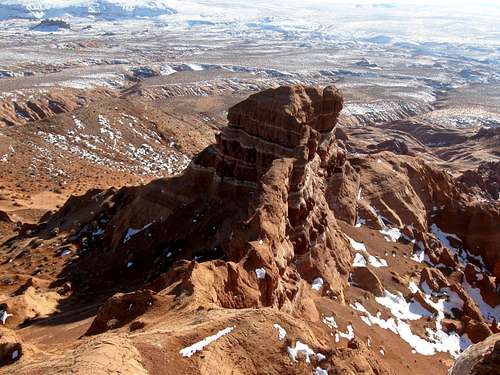 Looking at the east summit of Turkey Knob from the highest summit of Turkey Knob on January 17 2010.