mount ellsworth - 8235' - north ridge class 2
October 2021
Scott and Kessler invited me on a fun Utah weekend back to the Henry Mountains and Ticaboo area for a combination of a peak and a slot canyon. We left Grand Junction early on Saturday morning and made the still long drive (although much shorter than from Denver) out to the Henry Mountains. The drive was quiet and scenic as always until we passed the sign shortly after the turnoff onto highway 276 which stated the Halls ferry crossing was closed. It was a somber reminder of the historic low levels on Lake Powell and it is likely in the near future that Bullfrog, Hanksville, Page and many other small communities will be slowly dying out as the lake eventually dries out completely and the dam is inevitably removed. While I would be in favor of restoring the region, and the Colorado River valley back to its natural form, the future looks bleak for people living in the lower basin states. Thoughts of what may come just even in my lifetime as I settle down in Grand Junction. What will the water situation look like in 20 years? Will highway 276 even continue to be maintained once the lake is gone? Interesting questions...
Further along the road, we decided to camp at the Starr Springs campground and dropped off all the gear Scott had crammed into his Pathfinder and set up a tent so we didn't have all the stuff getting tossed around when we drove up the rough 4WD road to the start of our hike up Mount Ellsworth. Now, this access road is not marked on the USGS quads, but Google has it shown. It is a very sharp left turn off 276 almost exactly 20 miles south of the highway 276/95 junction. It is very easy to miss, but is immediately after a large roadcut, and this road is not driveable for stationwagons (I tried...didn't get more than a tenth of a mile off the highway!). Not wanting to walk the road on this earlier attempt I put Ellsworth off until someone would be willing to go with me with a 4WD. Thankfully, Scott was game to repeat Ellsworth after doing it merely a couple months after I was born.
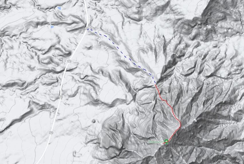
The 4WD road is only 1.7 miles long, but gains 1000 feet and is very rocky. The 4WD Pathfinder made it up without issue though and we parked where the road abruptly ended on a small point at an elevation of 6350 feet. The start of the hike descended 50 feet or so to a small saddle, then began ascending steeply up the north facing slopes of Mount Ellsworth. The route was pretty easy to follow, as we gained a ridge, and made the hike more fun by finding the class 3 solid rock slabs to scramble up, rather than staying on the loose class 2 junk. The map below shows the route we took in red, which is also the standard route on the peak. The 4WD road is marked with the blue dashed line.
Further along the road, we decided to camp at the Starr Springs campground and dropped off all the gear Scott had crammed into his Pathfinder and set up a tent so we didn't have all the stuff getting tossed around when we drove up the rough 4WD road to the start of our hike up Mount Ellsworth. Now, this access road is not marked on the USGS quads, but Google has it shown. It is a very sharp left turn off 276 almost exactly 20 miles south of the highway 276/95 junction. It is very easy to miss, but is immediately after a large roadcut, and this road is not driveable for stationwagons (I tried...didn't get more than a tenth of a mile off the highway!). Not wanting to walk the road on this earlier attempt I put Ellsworth off until someone would be willing to go with me with a 4WD. Thankfully, Scott was game to repeat Ellsworth after doing it merely a couple months after I was born.
The 4WD road is only 1.7 miles long, but gains 1000 feet and is very rocky. The 4WD Pathfinder made it up without issue though and we parked where the road abruptly ended on a small point at an elevation of 6350 feet. The start of the hike descended 50 feet or so to a small saddle, then began ascending steeply up the north facing slopes of Mount Ellsworth. The route was pretty easy to follow, as we gained a ridge, and made the hike more fun by finding the class 3 solid rock slabs to scramble up, rather than staying on the loose class 2 junk. The map below shows the route we took in red, which is also the standard route on the peak. The 4WD road is marked with the blue dashed line.
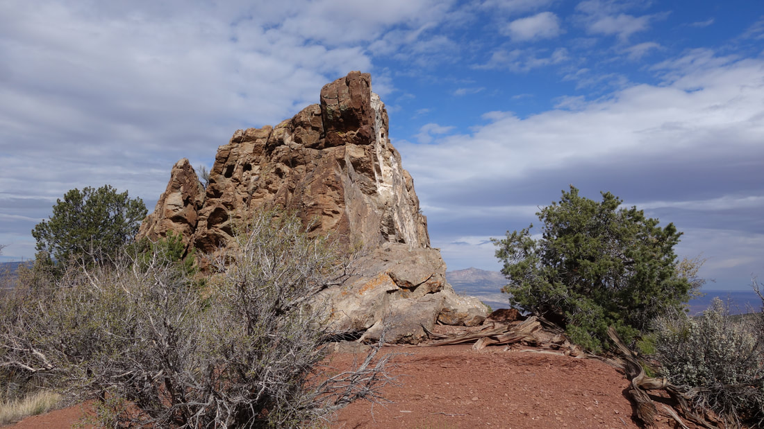
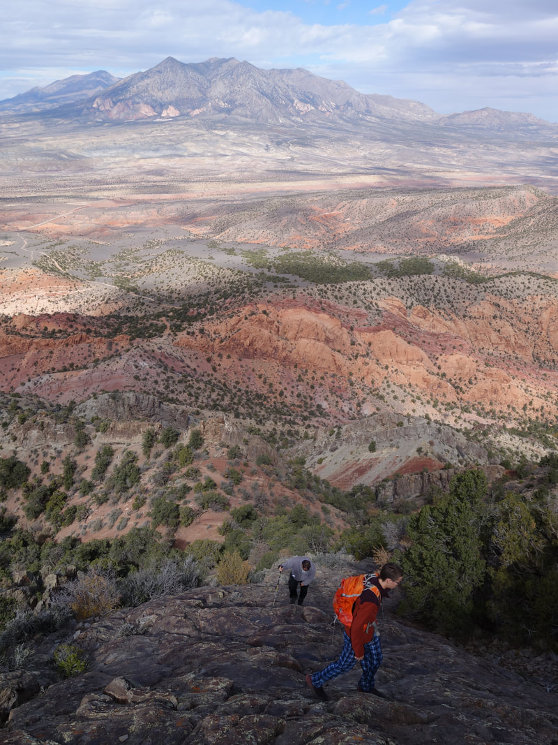
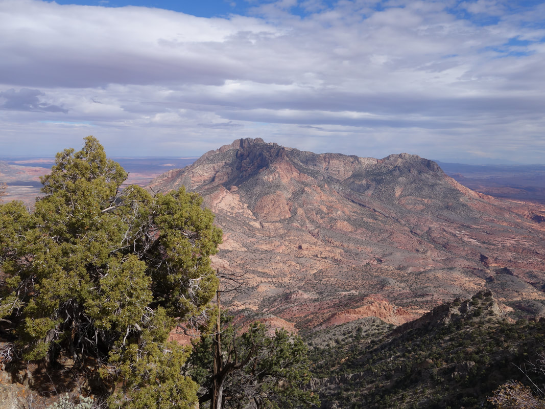
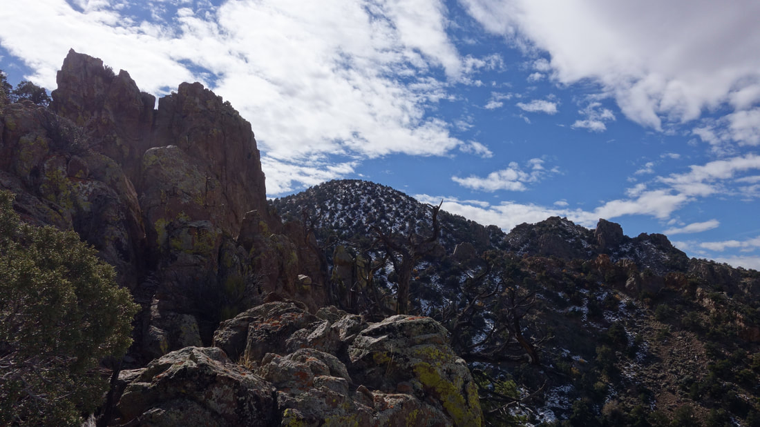
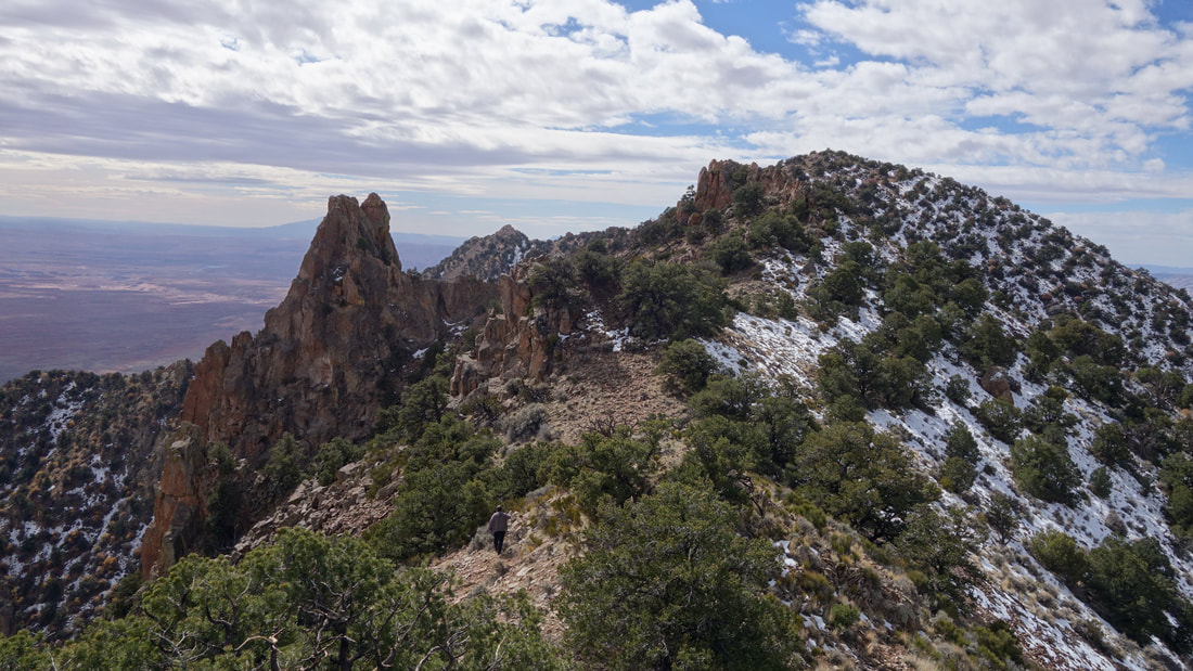
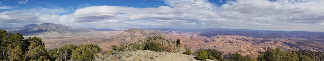
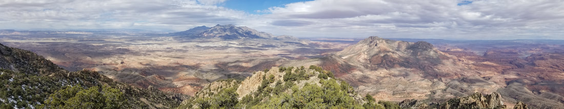
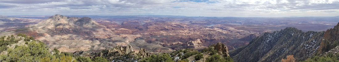
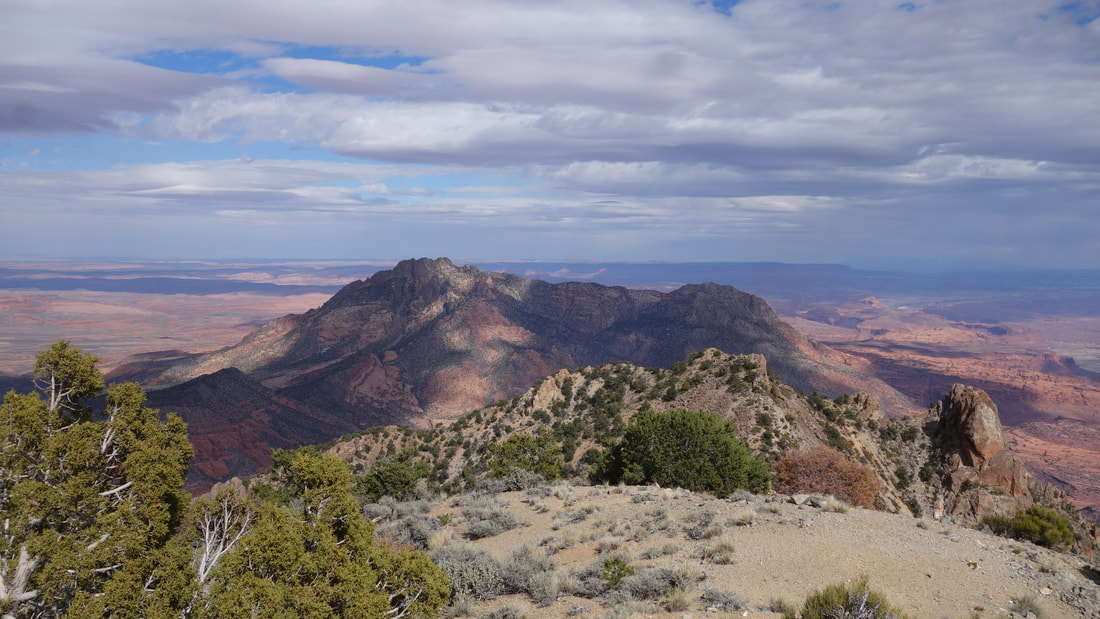
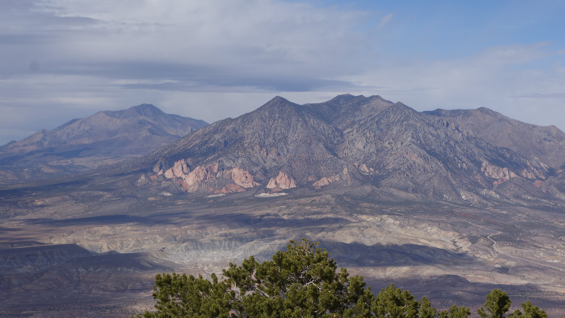
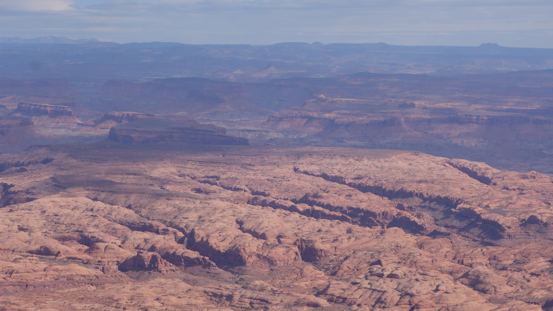
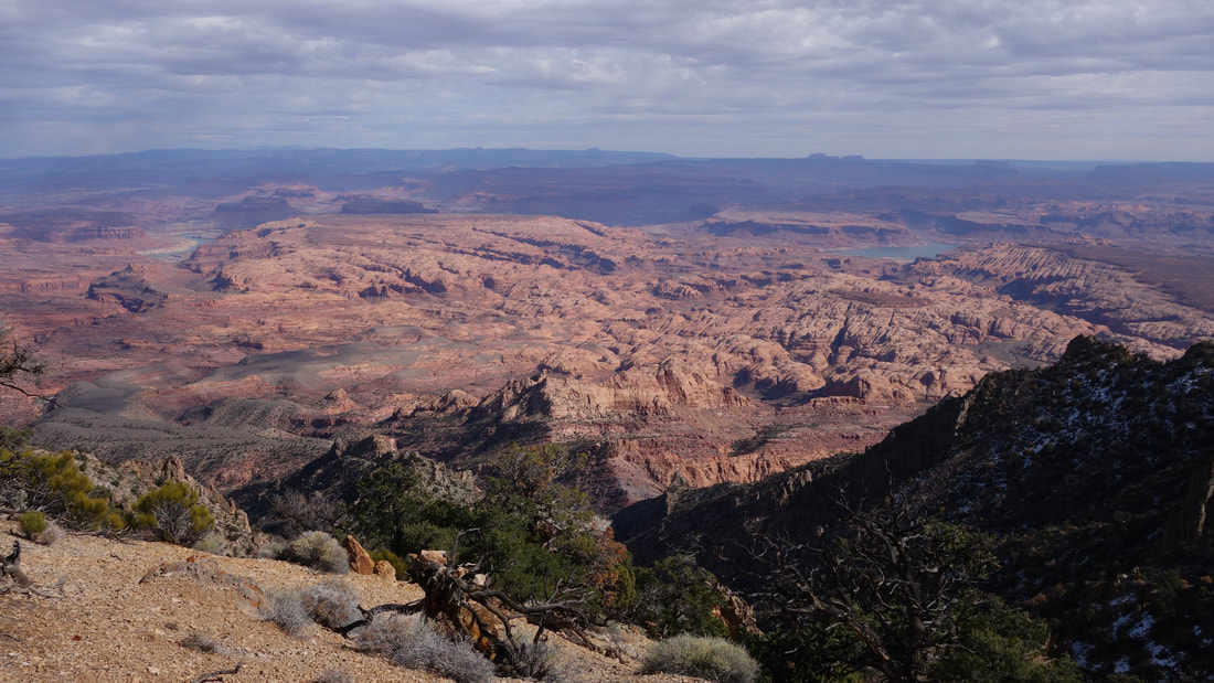
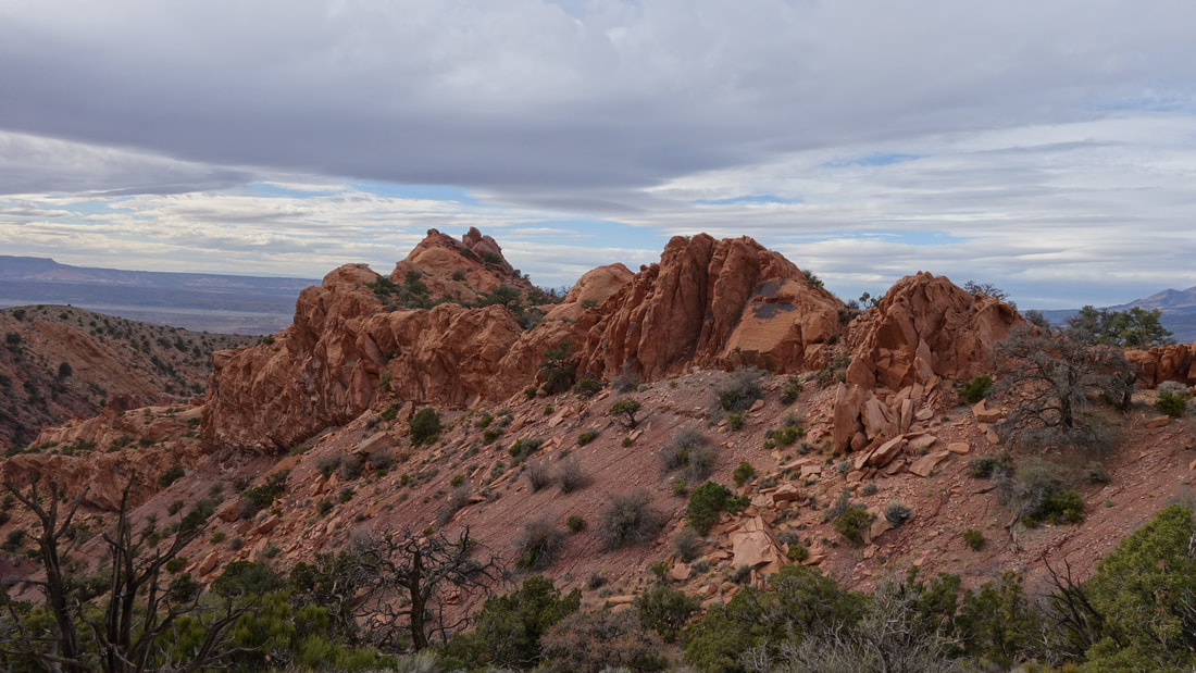
Since the elevation gain from the 4WD trailhead was only 2000 feet, we took a very leisurly pace and enjoyed the views of Mount Holmes and Hillers as we ascended. A small amount of snow covered the north and east facing aspects on the upper 1000 feet of the route, but I was able to avoid most of it and keep my feet dry. The route up had a few small drops to bypass the highly dipped sedimentary strata that was shoved up by the laccolith of granitic magma that intruded these rocks millions of years ago. To my suprise, as we went higher, we noticed the diorite/granite rocks transitioned into a quartzite, which seemed strange. At 7960 feet, the steep ridge we had been ascending joined the lower angle summit ridge and we turned southwestward. The final traverse to the summit involved going over two small sub-peaks before the final 250 foot hill to the true summit. An interesting radio station greeted us on the summit, and since I install these type of data transfer systems often for work I inspected it. Most of the electronics were locked away, but the massive Omni antennas were mounted above, transmitting a frequency somewhere between 148 - 172 MHz. After some research there are almost 900 licenses provided by the FCC with this range so I gave up trying to determine exactly what data is being transmitted here.
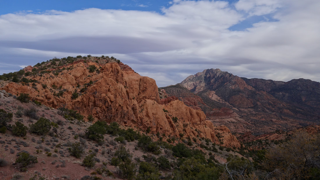
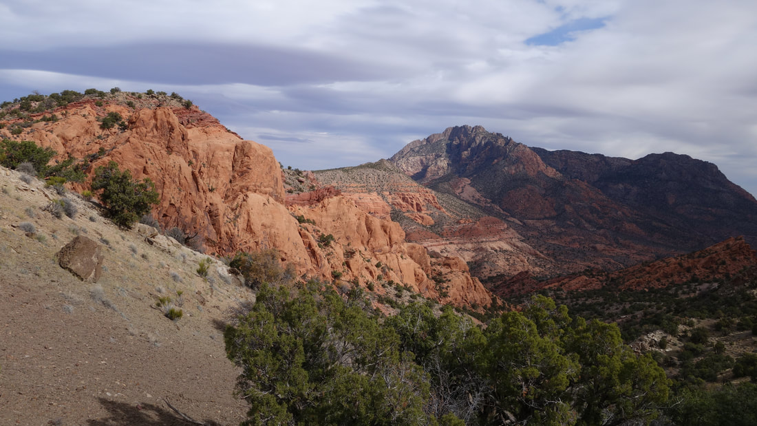
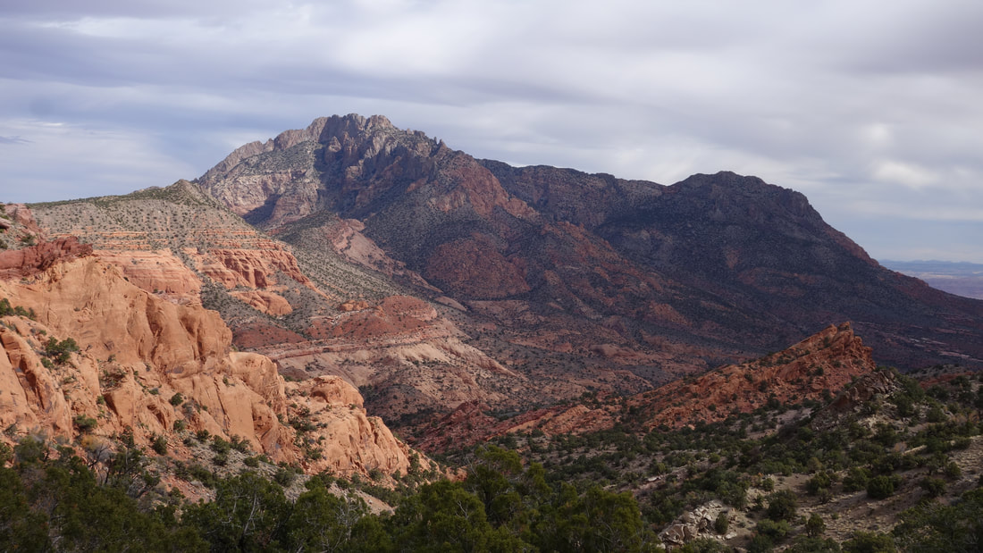
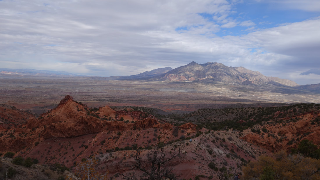
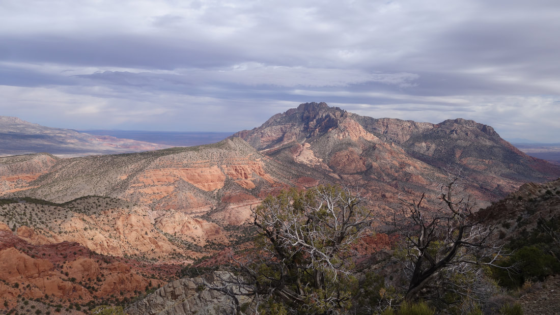
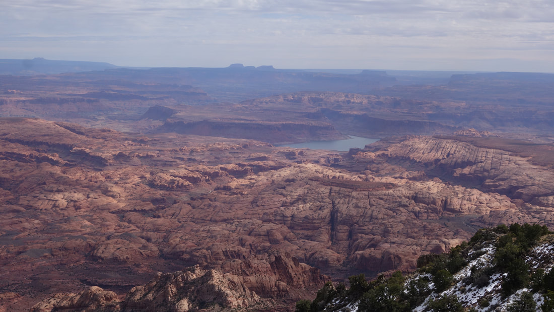

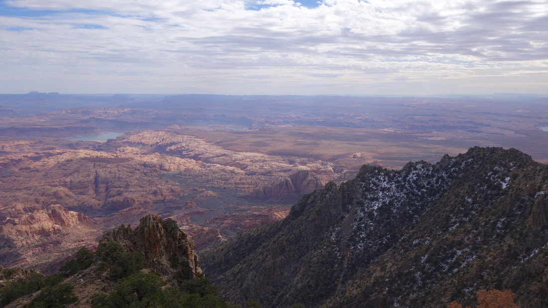

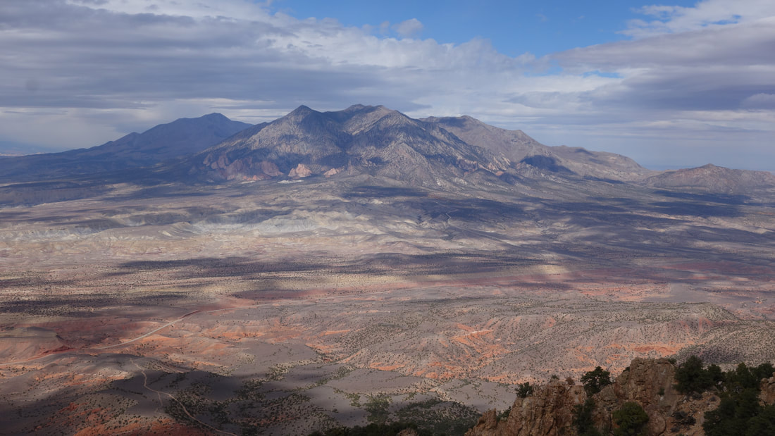

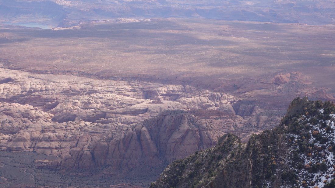
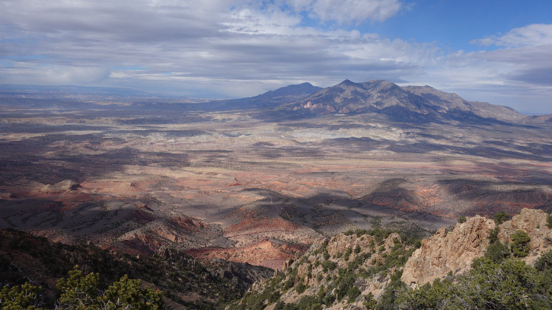
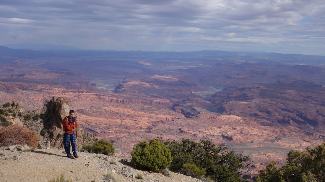
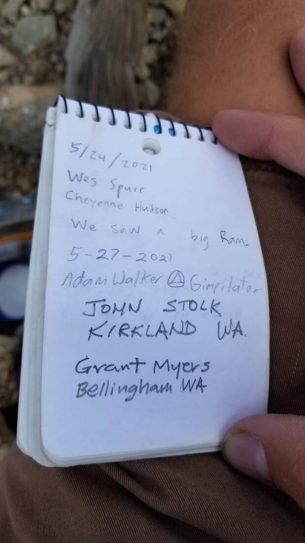
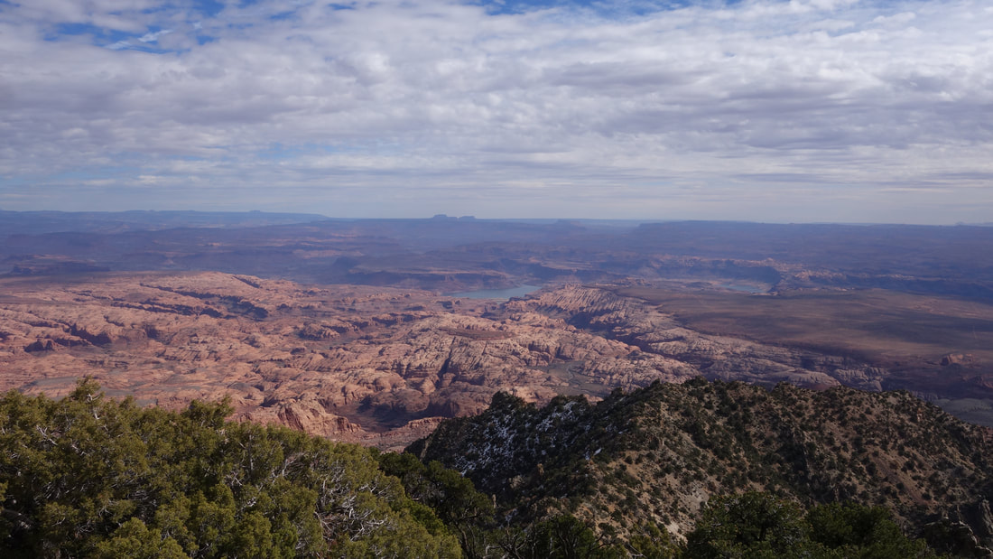
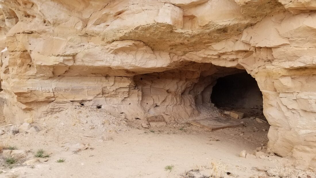
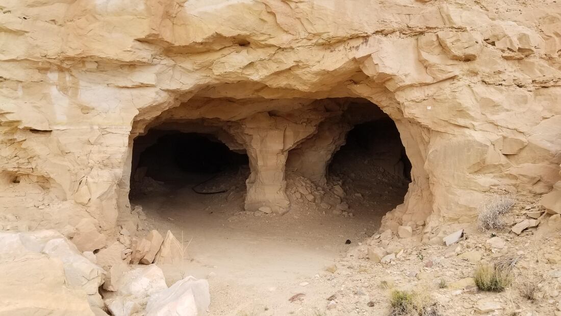
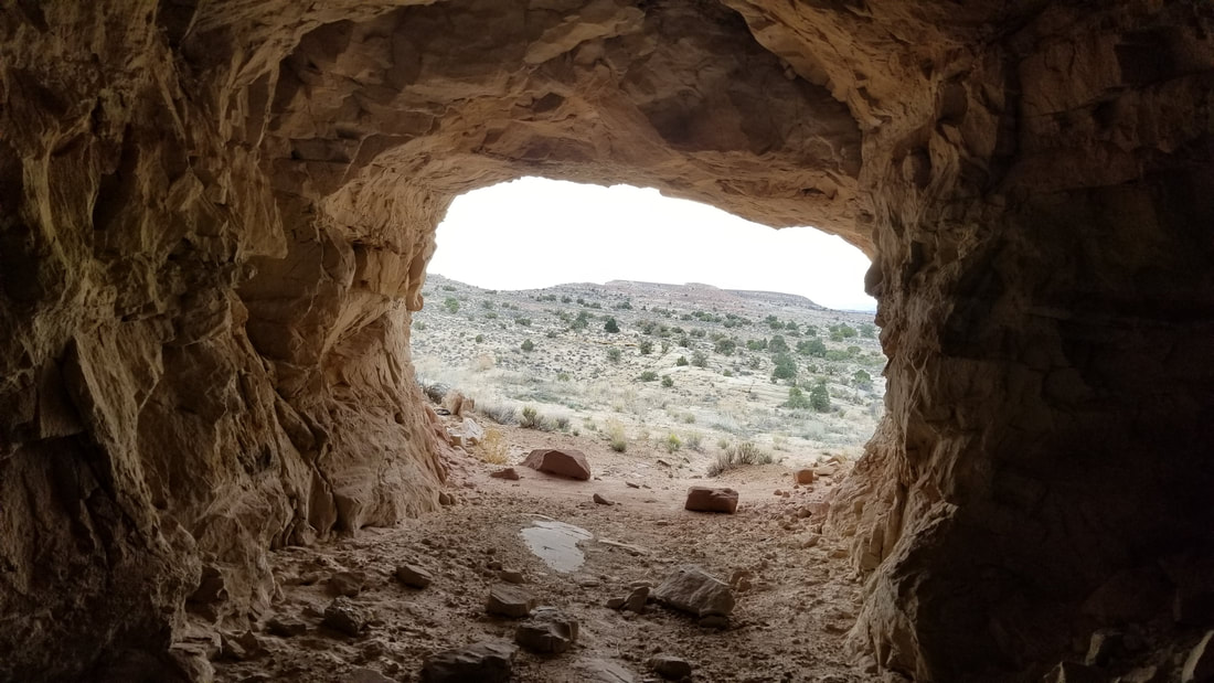
We all enjoyed the summit views a lot, and spent 45 minutes on the top. Looking down into the Ticaboo canyons to our south was what I really enjoyed the most. We were also able to clearly see Point 4906, which the three of us had climbed almost a year ago. Further south Navajo Mountain was clearly visible, and the southern part of the Waterpocket Fold was visible to the west. Upon inspecting the summit register, I saw a few familiar faces, including Gimpilator who was there in May 2021, and John Kirk who was there in May 2019. After plenty of photos including a few panoramas, and Scott eating some crackers from the large metal provisions box that expired in 2013, we began our descent. It was a quick trip down, and after getting back to the car, we decided to explore an old abandoned, but somewhat extensive uranium mine in the Morrison Formation rock layer just across the highway. A rough but flat road leads west off the highway from the same location the 4WD road towards Ellsworth heads east. After just a half mile or so, we parked and wakled to a series of mining adits into the hillside. I was shocked to find they were all inter-connected and I had never known they were there until I just noticed them on the map. I walked into each one, and while most of the adits were blocked off just a few feet from the ends, one of them extended many hundreds of feet horizontally into the rock, requiring a light to see anything. There were many side tunnels as well all of which eventually dead ended.


Since rain was threatening, we quickly returned to the Starr Spring campground and enjoyed a nice evening complete with campfire and loud hunters in the campsite across from us. I was far too lazy to put my tent up so I just slept on the picnic table and had a very nice night watching the stars.