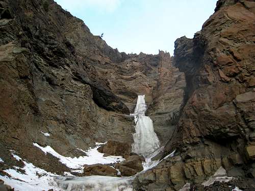
LEMKE CLIMBS
  • About
    • Whats New
    • 2019 Goals/Wishlist
    • Contact
  • Washington
    • North Cascades >
      • Sahale Peak, Boston Peak
      • Eldorado Peak, Klawatti Peak
      • Black Peak
      • Forbidden Peak West Ridge
      • Primus Peak Attempt
      • Big Snagtooth
      • Liberty Bell Beckey Route
      • Burgundy Spire North Face 5.8
      • Ragged Ridge - Katsuk, Kimtah and Cosho Peaks
      • Colfax Peak
      • South Early Winters Spire via SW Buttress
      • Chilliwack Mini-Slam
      • Mesahchie Peak
      • Inspiration Traverse
      • Mount Shuksan Ski
      • Full Pickets Traverse
      • Mount Goode NE Buttress & Storm King
      • Mount Baker North Ridge WI3
      • Snowfield Peak
      • Lincoln Peak
      • Silver Star Mountain
      • Mount Buckner & Horseshoe Peak
      • Azurite Peak
      • Tower Mountain & Golden Horn
      • Mount Logan
      • Custer Ridge & Easy Mox
      • Mazama Dome
      • Sherman Peak
      • Mount Ballard
      • Southern Pickets Traverse
      • Corteo Peak
    • Glacier Peak Wilderness >
      • Buck Creek Pass, Cloudy Peak, Spider Gap
      • Dome Peak, Spire Point
      • Mt. Maude and Seven Fingered Jack
      • Mount Formidable NE Face 5.6 Second Ascent
      • Dumbell and Greenwood Mountains
      • Glacier Peak Wilderness Mountain Massacre
      • Clark and Luahna Peaks
      • Sinister Peak
      • Chiwawa Mountain
      • Tupshin & Devore Peaks
      • Buck & Fortress Mountains
      • Glacier Peak
    • Olympic Peninsula >
      • Buckhorn Mountain
      • Flapjack Lakes Hike
      • Grey Wolf Peak, High Divide Trail
      • Mount Ellinor
      • Mount Constance West Arete
      • Mount Olympus
    • Alpine Lakes Wilderness >
      • Chikamin Peak
      • PCT - Snoqualmie to Pete Lake
      • Foss Lakes Hike
      • Necklace and Tank Lakes
      • Enchantments Day Hike
      • Granite Mountain (Snoqualmie)
      • Colchuck Peak
      • Cannon, Enchantment and Stuart
      • Ingalls Peaks
      • McClellan Peak
      • Dragontail Peak
      • Web Mountain
      • Mount Index Attempt
      • Snow Creek Wall Orbit 5.8+
      • The Tooth South Face
      • Eightmile Mountain
      • Argonaut Peak NE Couloir
      • Little Annapurna South Face 5.5
      • Snow Creek Wall Outer Space 5.9
      • Cashmere Mountain
      • Sherpa Peak North Ridge 5.8
      • Chair Peak NE Ridge
      • Lichtenburg Mountain
      • Mount Index
      • McClellan Butte
      • Chimney Rock
      • Alpine Lakes High Route
    • Pasayten Wilderness >
      • The Craggies
      • Tiffany Mountain
      • Pasayten Mini-Slam
      • Remmel Group
      • Jack Mountain
      • Robinson Mountain
      • Monument Peak Group
    • Mountain Loop Highway >
      • Vesper Peak
      • Mount Dickerman
      • Sloan Peak West Face 5.8
      • Mount Forgotten
      • Whitehorse Mountain
      • Gothic Peak
    • Lake Chelan Sawtooth Wilderness >
      • Star, Courtney, and Grey Peaks
      • Hoodoo Peak and Raven Ridge
      • Abernathy Peak
      • Mount Bigelow
      • Reynolds Peak
      • Oval Peak
      • Gardner Peaks
      • Chelan Sawtooth Trio
    • Southern WA >
      • Mount Adams
      • Mount Rainier - Emmons Route
      • Mount Saint Helens
      • Goat Peak
      • Lane Peak, Plummer Peak (Tatoosh)
      • The Unicorn (Tatoosh)
      • Little Tahoma
    • WA Rock and Ice Cragging >
      • Index Town Walls
      • Vantage
      • Mount Erie
      • Exit 38
      • Leavenworth
  • Colorado
    • San Juan Mountains >
      • Mount Sneffels Lavender Snow Climb
      • Uncompahgre, Matterhorn Peaks
      • Redcloud, Sunshine Peaks
      • San Luis Peak
      • Vermilion, Fuller Peaks
      • Stewart Peak, Baldy Alto
      • Jones, Niagara, American Peaks
      • Wetterhorn Peak, Handies Peak
      • Wilson Group
      • Arrow Peak
      • Mount Sneffels SW Ridge
      • Jagged Mountain, Chicago Basin
      • Teakettle Mountain
      • Dallas Peak
      • Vestal Peak Wham Ridge, Greystone Peak
      • Organ Mountain
      • Phoenix Peak
      • Half Peak
      • Point 13832 Group
      • Golden Horn
    • Elk Mountains >
      • Four Pass Loop
      • Castle, Conundrum Peaks
      • Snowmass Mountain
      • Cathedral Peak
      • South Maroon Peak
      • The Pyramids
      • North Maroon Peak, Sleeping Sexton
      • Capitol Peak, Mount Daly
      • Malemute Peak
      • Hagerman Peak
    • Sangre de Cristo Mountains >
      • Blanca Peak, Ellingwood Point
      • Challenger Point
      • Mount Adams
      • Spread Eagle Peak
      • Humboldt, Obstruction, Columbia Peaks
      • Mount Lindsey, Huerfano Peak
      • Little Bear Peak
      • Crestone Needle Ellingwood Arete
      • California Peak
      • Crestone Peak North Buttress
      • Operation Dark Snake
      • Kit Carson Mountain
    • Sawatch Mountains >
      • Iowa Peak
      • Point 13,618 - Hunky Dory Lake
      • Gold Dust Peak, Notch Mountain
      • Mount Jackson
      • Mount Belford
      • Shavano, Tabeguache Peaks
      • Mount Antero, Cronin Peak
      • Twining Peak
      • Mount Massive
      • Casco Peak
      • Mount Huron
      • Mount Elbert
      • Mount Oxford
      • Mount Hope
      • Mount Yale
      • Lackawanna Peak
      • Mount Columbia
      • La Plata Peak
      • Rinker and Twin Peaks
      • Bull Hill, Mount Princeton
      • Missouri Mountain
      • Mount Oklahoma
      • French Mountain
      • Mount Ouray
      • Grizzly A, Garfield Peaks
      • Mount Harvard
      • The Three Apostles
      • Emerald Peak
      • Holy Cross
    • Greater Park Range >
      • Kneeknocker Pass, Piney Lake
      • Drift Peak
      • Sherman Peak, Dyer Peak
      • Gore Range Traverse
      • Quandary Peak
      • Pacific, Atlantic Peaks
      • Clark Peak
      • Crystal Peak, Peak 10
      • Fletcher Mountain
      • The DeCaLiBron
      • Loveland Mountain
      • The Mosquito Traverse
      • Mount Arkansas
      • Clinton Group
      • Eagles Nest, Peak C
      • North Star Mountain
      • Peak X
      • Wheeler Mountain
    • Front Range >
      • Mount Evans, Spalding
      • Mount Bierstadt
      • Mount Parnassus, Bard Peak
      • Cupid, Sniktau, Grizzly D Peaks
      • James Peak
      • Mount Silverheels
      • Grays and Torreys Peaks
      • Mount Edwards
      • Mount Flora, Longs Peak
      • Square Top Mountain
      • Petit Grepon South Face 5.8
      • Mount Meeker Dreamweaver Couloir
      • Santa Fe Peak
      • The Citadel & Pettingell
    • Colorado Ice Climbing >
      • Lincoln Ice Falls
      • Ouray Ice Park
      • Avocado Gully and The Drool
      • Hidden Falls
    • Colorado Rock Climbing >
      • Eldorado Canyon
      • The Flatirons
      • North Table Mountain
      • Shelf Road
      • Colorado National Monument >
        • Independence Monument
  • Wyoming
    • Wind River Mountains >
      • Gone With the Winds
      • Union Peak - Solar Eclipse
      • Wind River Peak
      • Wind River Slam
    • Teton Range >
      • Grand Teton Owen Spalding 5.4
      • Mount Owen Attempt
    • Wyoming Absarokas and Gros Ventre Range >
      • Jackson Peak
      • Francs Peak
    • Yellowstone National Park >
      • Top Notch Peak
    • Bighorn Range and Great Divide Basin >
      • Boars Tusk
      • Loaf Mountain
      • Cloud Peak
      • Black Tooth Mountain
    • Devils Tower
    • Cody Rock and Ice Climbing
  • Montana
    • Beartooth Mountains >
      • Whitetail Peak Group
      • Beartooth Mountain
      • Spirit Mountain Group
      • Mount Peal
      • Granite Peak Group
      • Castle Rock Group
      • Castle Mountain NE Couloir
      • Mount Inabnit and Sylvan Peak
      • Mount Hague South Slopes
      • Mount Villard and The Granite Peaks Traverse - 5.4
      • Spirit Mountain NE Ridge - 5.4
      • California Ice WI 4
      • The Ramp 5.8
      • Linea Alba 5.10d
      • Iceberg Peak
      • Metcalf Mountain North Rib 5.8
      • Villard Spires HP West Ramp
      • Cairn Mountain
      • Snowbank Mountain
      • Mount Wood Group
      • Bears Tooth
      • Glacier Peak Catch-a-Sunrise FA
    • Montana Absarokas & Gallatin Range >
      • Black Mountain
    • Southwest Montana Ranges >
      • Sacajawea Peak
      • Arrow Peak
      • Koch Peak
      • Saddle Peak
      • Baldy Mountain
      • Sphinx Mountain
    • Glacier National Park >
      • A Taste of Glacier National Park
      • Divide Mountain
    • MT Rock and Ice Climbing
  • Utah
    • Uinta Mountains >
      • Kings-Emmons Ridge Run
      • Hayden Peak
      • Iron Hayden Wall Rock Climbing
    • Wasatch Range >
      • The Sundial Eleventh Hour 5.8
      • Mount Timpanogos
    • San Rafael Swell >
      • Ramp, Cistern Canyons
      • Salt Wash, Black Mountain, Moroni Slopes
      • Ding, Dang Canyons
      • Little Wild Horse, Bell Canyons
      • Quandary Canyon
      • San Rafael Knob
      • Miners Hollow (Knotted Rope Canyon)
      • Temple Mountain
      • Chimney Rock
      • Bottleneck Mesa
      • Window Blind Peak
      • Lower Baptist Draw & Upper Chute Canyon
    • Capitol Reef National Park >
      • Cathedral Valley Tour
      • Sheets Gulch
      • Halls Creek Narrows
      • Brimhall Canyon and Strike Valley Overlook
      • George Benchmark
    • Moab Area, Canyonlands, Arches >
      • Maze District
      • Needles District
      • Maze District
      • White Rim Trail Biking
      • Elephant Butte, Bullwinkle Tower and Lizard Rock
      • South Six Shooter
      • Elephant Canyon
      • Parriott Mesa
      • Ancient Art
      • Castleton Tower North Chimney 5.8
      • Klondike Bluffs
      • Mount Peale & Tukuhnikivatz
    • Robbers Roost Country >
      • Horseshoe Canyon, Goblin Valley
      • Bluejohn Canyon
      • Happy Canyon Narrows
      • Shenanigans, Leprechaun Slots
      • Larry Canyon
      • Merry Piglet Slot
      • Lower Maidenwater Canyon, Turkey Knob
      • Morocco Canyon
      • Monkey Business Slot
      • Hog Canyon Slots
      • Upper Maidenwater Canyon Slots
      • Mount Ellen
      • Buck Canyon
      • Point 4906
      • Alcatraz Canyon
      • Hard Day Harvey Slot
      • Mount Ellsworth
      • Good Day Jim Canyon
      • White Roost Canyon
      • Upper Stair Canyon
    • Escalante National Monument >
      • Phipps Canyon and Arch
      • Red Breaks Slot
      • Dry Fork Slots, Coyote Gulch
      • Little Death Hollow/Wolverine Canyons
      • Egypt 3 Slot
      • Egypt 1 Canyon
    • Zion/Bryce >
      • Ataxia Tower Ashtar Command 5.9
      • Mount Kinesava Cowboy Ridge
      • Birch Hollow
      • Aires Butte
      • West Temple
      • Mystery Canyon
      • Crazy Streak
    • Cedar Mesa Region/Valley of the Gods >
      • Eagle Plume Tower Eagle Feather 5.10b
  • California
    • High Sierras, Southern CA Ranges >
      • Telescope Peak, Manly Beacon
      • Tahquitz Rock Whodunit 5.9 - June 2016
      • Tahquitz Rock Long Route 5.9 - July 2016
      • Palisade Traverse
      • White Mountain
    • Yosemite National Park, Central CA
    • Northern CA Cascades >
      • Lava Beds National Monument - August 2015
  • Oregon
    • Oregon Volcanoes >
      • Three Fingered Jack
      • Mount Scott
    • Blue Mountains >
      • Twin Peaks
    • Trout Creek Rock Climbing
  • Alaska
    • Eagle Peak and Mount Ewe
    • Jatt Peak and Portage Pass
    • Rainbow Peak
    • Mount Brooks Attempt
    • Arrigetch Peaks Trek
    • Ab Mountain Hike
    • South Suicide Peak
    • Mount Hunter West Ridge Attempt
    • Cantata Peak Attempt
    • East Twin Peak
    • Mount Alice
    • Crow Pass and Hope Point Hikes
    • Indianhouse Mountain Attempt
    • Lynx Peak
    • Harding Icefield Hike
    • Hatcher Pass and Grapefruit Rocks Climbing
    • Mount Sanford
    • Mount Hunter West Ridge
  • Nevada
    • Ginger Cracks 5.8
    • Mescalito Dark Shadows 5.8
    • Birdland and Olive Oil
    • Frogland 5.8
    • Johnny Vegas 5.8
    • Schaeffer's Delight & Triassic Sands
    • Solar Slab - 5.6
  • British Columbia
    • Mount Matier
    • Taiya Peak
    • Bugaboo Spire NE Ridge
    • Mount Sabine Easy Honey 5.10b
    • Mount Sir Donald NW Ridge Attempt
    • Black Tusk
    • Squamish Ticks
    • Slesse Mountain NE Buttress
  • Alberta
    • Mist Ridge Hike
    • Mount Temple Attempt
    • East Wendell Peak
    • Loder Peak
    • Tower Mountain Attempt
    • The Rimwall
    • Mount Yamnuska Directissima 5.9
    • Mount Lawrence Grassi
    • Mount Lorette
    • Roche A Perdrix
    • Mount Edith Cavell East Ridge 5.3
    • Mount Louis Kain Route
    • Eiffel Peak
    • Canadian Rockies Ice Climbing
  • Other States
    • Arizona >
      • Grand Canyon Bright Angel Trail
      • Beanfest at Cochise Stronghold
      • Baboquivari Peak
      • Humphreys Peak
    • New Mexico >
      • Philmont Trek August 2008
    • Yukon >
      • Canyon Peak
  • International
    • Mexico & Central America >
      • Mexico - Pico de Orizaba, Izta - March 2012
      • Guatemala Volcanoes
    • South America >
      • An Introduction to Patagonia
      • Cordillera Blanca - Tocllaraju and Urus
      • Nahuel Huapi National Park & The Frey
      • Exploring Pucon and Lanin Volcano
      • Cordillera Blanca - Ishinca Peak and Artesonraju
      • Cordillera Blanca - Quitaraju & Alpamayo
      • Exploring Southern Peru
      • Cerro Helio Azul & Tronador Attempt
      • Aguja Guillaumet Amy Couloir
      • Cerro Puntado & Palo
      • Cerro Colorado
      • Cerro Puno & Agudo
      • Cerro Trinidad Attempt
      • Volcan Quetrupillan
      • Cerro Placas
      • Nevado de Acay
      • Pequeno Alpamayo
      • Huayna Potosi
      • Illimani
      • Chiaro de Luna
    • Oceania >
      • Exploring New Zealand's South Island
      • Puncak Jaya
      • Mount McPherson and Talbot
      • Single Cone
      • Mount Cook
      • Mount Aspiring
      • Manakau
    • Central Asia >
      • Kyrgyzstan 2021
  • Sorted by Year
    • 2008 Trip Reports
    • 2009 Trip Reports
    • 2010 Trip Reports
    • 2011 Trip Reports
    • 2012 Trip Reports
    • 2013 Trip Reports
    • 2014 Trip Reports
    • 2015 Trip Reports
    • 2016 Trip Reports
    • 2017 Trip Reports
    • 2018 Trip Reports
    • 2019 Trip Reports
    • 2020 Trip Reports
    • 2021 Trip Reports
  • Vanlife
    • Conversion Journal >
      • Floor Installation
      • Folding Bed
      • Coffee Table
      • Thinsulate Installation
      • The Couch
      • The Wardrobe
      • Bookshelf
      • Water System
      • Electrical System
      • The Pantry
      • Refrigerator
      • Tire Upgrade
      • Heating System
      • Composting Toilet
LEMKE CLIMBS

Cody Rock and ice climbing

South Fork Shoshoni River Ice Climbing

Overview

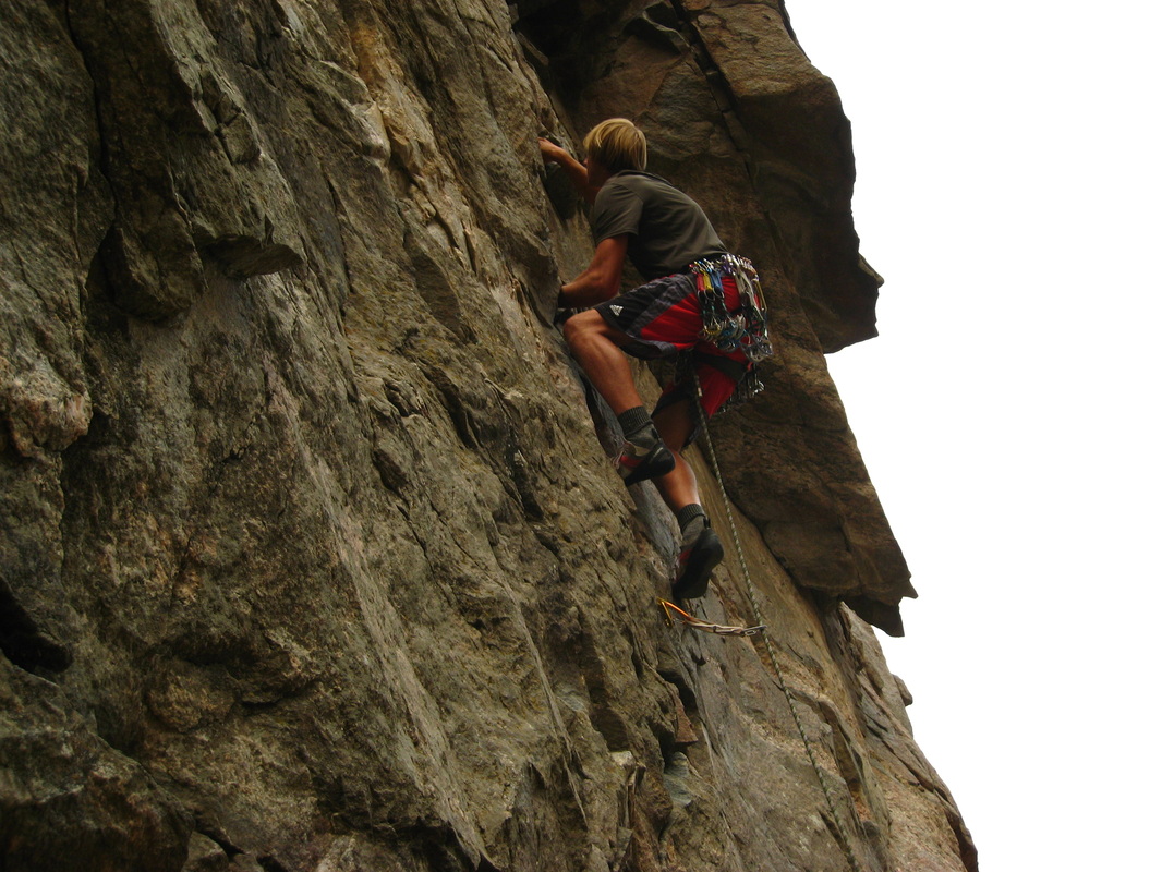
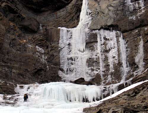
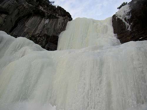
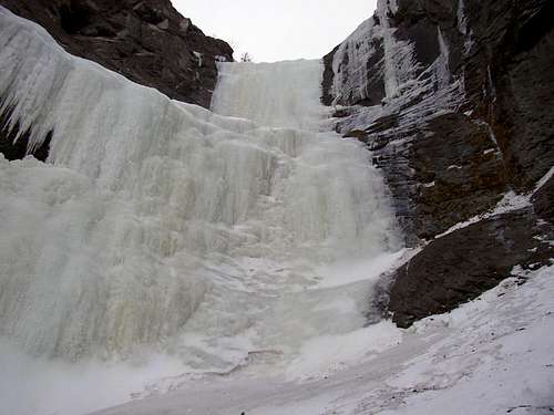
About 35 miles southwest of the unlikely town of Cody, Wyoming, in the southern Absaroka mountains, is an area sporting the highest concentration of frozen waterfall ice routes in the continental US. Among ice climbers, this place used to be a best-kept secret however the word has spread. It is said that if you can climb well here, you can climb well anywhere. There really isn't point in going unless someone in your party can lead WI4's solidly.

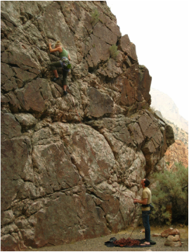
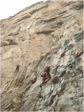
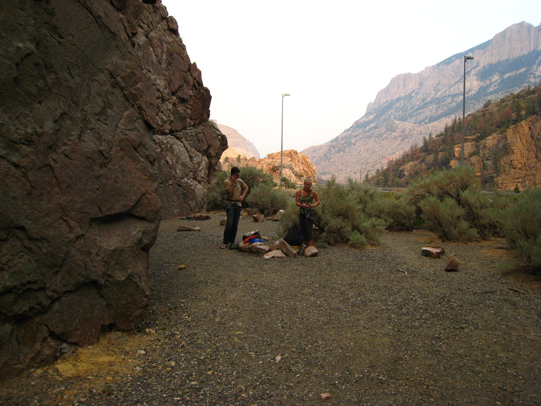
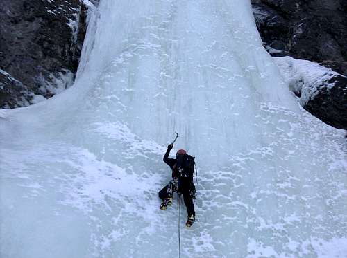
Roadside ice, short approaches and toproping are not what you will find in the South Fork area. Approaches tend to be relatively long with possible river fords and abundent elevation gain. This isn't the best place to take beginners. The classic long routes here mostly follow creek drainages where you might climb a pitch or two, then walk up snow in the drainage to the base of another pitch. Interspersed there might be sections of WI2-ish ice bouldering which you may or may not want to rope up for.

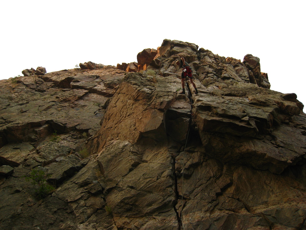
Descents tend to involve a mix of down-climbing and rappelling off bolts, slung trees, and v-threads. Definitely know how to make a v-thread and bring extra v-thread material and slings/rings to reinforce tree anchors. Be mindful that bolts have been known to shear off in summer storms which will sometimes rage down these creek drainages. Some routes have walk-offs, but these are few and far between. The area is remote, and the nearest help is a long way off, so self-sufficiency here is important.

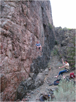
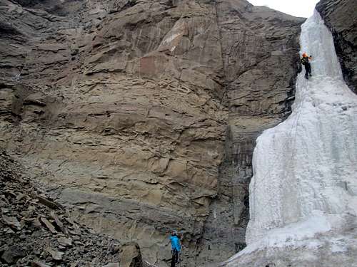
The rock is a mix between layers of volcanic conglomerate not unlike that found in the Pinnacles of central California, and a sandstone/shale units. All in all, the rock is not good! Locals say that rock gear is not of much use here, perhaps just bring a selection of pitons however most routes protect fine with ice screws unless you're going after one of the hard mixed lines. "Kitty Litter" seems to be the popular nomenclature for the rock quality here.

Broken Hearts
Broken Hearts first 2 pitches
Stringer Drainage
Hiking to Stringer
Hostile Takeover (Overview)
Hostile Takeover

Getting There

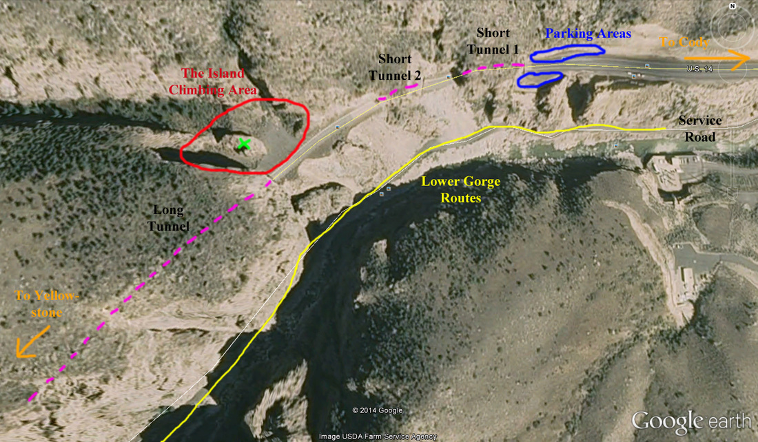
From the town of Cody drive west towards Yellowstone passing by the Sierra Trading Post and turn left on South Fork Road (State Highway 291) just after passing the Wal-Mart. There is a sign so it's impossible to miss. Drive about 45 minutes towards the southwest on this road which passes along the south of the reservoir, then ascends a bench above and to the south side of the river before descending and crossing to the north side of the river. Shortly after the bridge, you will come across the first drainages that contain ice on both sides of the valley. The pavement ends about 32 miles from town, and becomes unpaved gravel. High clearance isn't necessary, though in some very snowy/icy conditions 4WD might be useful. Cody is served by the Cody-Yellowstone Regional Airport.

South Fork Map
South Fork Map as seen in the "Winter Dance" Guidebook

Guidebook

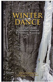
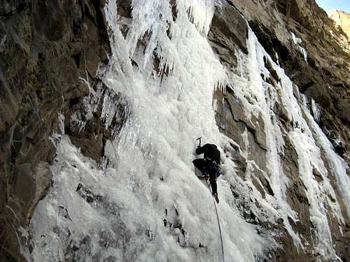
The definitive guidebook to the area is Winter Dance : Select Ice Climbs in Southern Montana & Northern Wyoming, Joe Josephson, First Ascent Press, 2004. The book has a map of the South Fork area, approach notes, first ascent stories, and lots of great photos. The old guide / map is noted for having some pretty serious sandbags which is mostly corrected in Winter Dance. It's a cool piece of history though with some of the most vague route descriptions I have ever seen. It's argued that ratings in the WI3 to WI3+ range are still a bit stiff so be prepared. Actually, the entire area still has an old-school atmosphere and all the routes are stiff. As an example, the first 3 pitches of Broken Hearts are rated WI 3 and are all in the 80-85 degree steepness range. Some WI 4 pitches here are plumb vertical!

undefined
The Guidebook

Major Routes

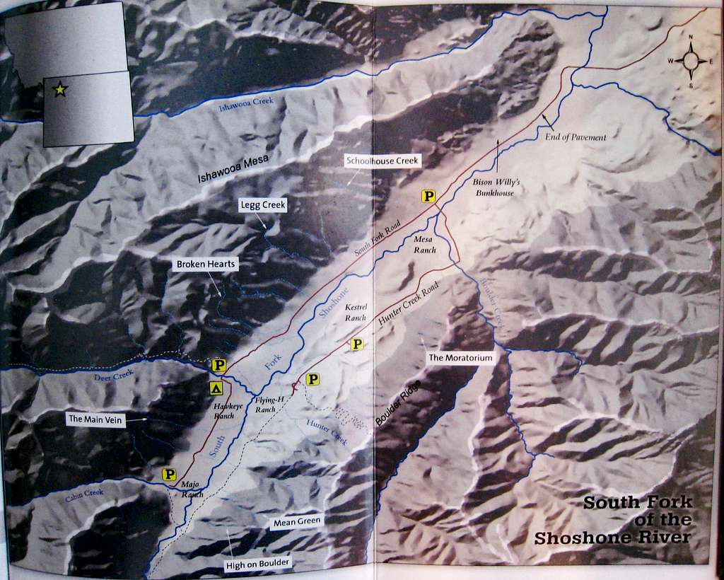
Below is a table of the main routes in the South Fork area ordered by difficulty. All these routes are great and worthy of whatever approach it may have. Now there are certainly probably 10 times as many routes in the South Fork area than what is listed here so I have only listed the classics. If you're looking to avoid the crowds, dive into the more obscure drainages or stick to the south side of the valley where there are fewer moderate routes.

Name Photo Rating Area Brief Description
Smoked Turkey
undefined
WI 3 Deer Creek A nice, 3 pitch moderate route with an hour long approach up Cabin Creek then up a side drainage to the base of the first pitch. Each pitch is about 20-30 meters high offering one of the best moderates at Cody however the avalanche danger is very high.
Stringer
undefined
WI 3 Legg Creek This route has one of the shortest approaches in the region. Hike north into the small drainage just right (east) of Legg Creek. Since this route faces south, it's often sun baked but is the best beginner route and completely bolted making rappels easy. Expect company. The first pitch is the only worthwhile pitch but the route offers two more easy pitches above.
The Main Vain
undefined
WI 3+ Cabin Creek Park a mile past the Deer Creek Campground and hike up the drainage. The route faces south and the first pitch sees a lot of sun. You will be able to see the route from the road. Shortly before the base of the route, scramble right up scree, then traverse back left on a Class 4 ledge to the base. 3-4 pitches of easier ice makes this route great for beginners however the approach is pretty long.
Smooth Emerald Milkshake
Smooth Emerald Milkshake - p2
WI 4 Deer Creek This is the best moderate ice climb in Wyoming. Hike up the Deer Creek Trail until the Bitches Brew drainage then descend to the creek. This will require a short rappel and Deer Creek must be frozen. Cross it and start up the route which dumps right into Deer Creek. 800 feet of ice up to WI 4 makes this an awesome, long route however the approach will take 2-3 hours. Beware that the avalanche danger in this drainage is bad.
Schoolhouse Route
undefined
WI 4 Schoolhouse Creek Start at the Ishawooa Mesa TH and hike up the first major drainage next to Schoolhouse Spire (north side of valley). This sustained, three pitch route is one of the most popular routes due to its accessibility and consistent good ice.
Cabin Fever
undefined
WI 4 Cabin Creek Park at the end of the road and hike up Cabin Creek to the first major drainage on the right. Hike to a big amphitheater and the base of the route. Approach takes 40-50 minutes and Cabin Creek needs to be frozen. The 60 meter pitch is a beautiful line. 
High on Boulder
High On Boulder - p1 and 2
WI 4 South Side - Majo Ranch This awesome route is one of the widest, thickest flows in the area. Park at the end of the road and cross the South Fork (hope its frozen!) Hike 45 minutes up the drainage just south of Mean Green. Three pitches of WI 3-4 takes you to the base of The Pillar of Pain WI 5 route. This is probably the best and one of the only moderates on the south side of the river.
Too Cold to Fire
undefined
WI 4 Deer Creek Park at Deer Creek Campground and hike up Deer Creek (needs to be frozen) to a deep chimney on the right. This route consists of big ice steps and bulges separated by ledges for 60-70 meters.
Sendero Iluminoso
undefined
WI 4 South Side - Hunter Creek Road Park at the Bench Parking area, which is 3.8 miles down the Hunter Creek Road. Hike up a trail heading left and continue up to the Upper Bench. This approach is long and confusing. Bring lots of beta. The route ascends a narrow ribbon of ice for 60 meters to a fixed anchor on the right. Higher pitches are rarely done. 
Hostile Takeover
Hostile Takeover First Pitch
WI 4+ Triptych Creek Two major drainages past Legg Creek on the north side of the valley is Triptych Creek. Hike up this drainage for a quarter mile and take its first left fork. This two pitch route doesn't always form as the first pitch doesn't typically touch the ground. If it does, climb the WI 4+ curtain to bolts and continue to the easier second pitch. If it doesn't touch, it's an M7 climb as well!
Mean Green
Mean Green, P3
WI 5 South Side - Majo Ranch Park at the end of the South Fork Road. Hike around the ranch, cross the South Fork (needs to be frozen) and hike up the drainage directly across the ranch. The first 4 pitches are the meat of the climb with the 4th being the WI 5 crux.
Broken Hearts
Broken Hearts
WI 5 Broken Hearts Park along the South Fork Road between Triptych Creek and Deer Creek. The Broken Hearts drainage and the first two pitches are clearly seen from the road. Hike north up the drainage to the base. The first four pitches are WI 3 with the fifth pitch being WI 5. The last two pitches rarely form and are WI 6. This is probably the most classic route in the South Fork and also has one of the shortest approaches.
Bitches Brew
undefined
WI 5+ Deer Creek Hike up the Deer Creek Trail and cross the creek for the Slogger Route. Hike up the drainage to the base. You'll know you are in the correct drainage as it's about 500 feet downstream of Smooth Emerald Milkshake across Deer Creek. This climb boasts five pitches with the third being the WI 5+ money pitch consisting of a very steep pillar. The other pitches are all WI 3.

Camping

This area is located mostly within the Shoshone National Forest's Washakie Wilderness.

Dispersed camping regulations may apply outside of established campsites (which are likely to be closed in winter). The Deer Creek Campground can be used year-round.

Washakie Ranger District
Ruth Esperance, District Ranger
333 East Main St
Lander, WY 82520-3499
phone: 307.332.5460
fax: 307.578.1204

If you're looking for lodging in Cody, a good place to go is the Robin's Nest B&B.
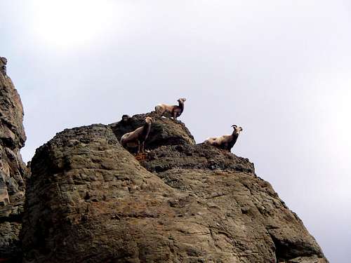
Wildlife Concerns

Bighorn Sheep - Upon entering the South Fork area you will see signs that say "Don't Stress the Sheep". This area is a crucial winter range for bighorn sheep. Stay as far clear of them as possible, don't spook them, be quiet around them. They may seem unaffected and nonchalant, but if they look frightened or nervous, walk away. These sheep can be literally "frightened to death". Also be careful about hiking below then as they are very good at knocking rocks down on you!

Grizzly Bears - During early and late season (October, November, March, April) it is said that you may see grizzlies in the area. Make plenty of noise on the approach, and carry bear spray. Don't leave lots of extra food in your pack at the base of climbs or leave food scraps around.

Access Note - Ice climbers should be aware that if wildlife concerns arise, access may be limited by the USFS.

Stringer Sheep
Bighorn Sheep

External Links

Cody Weather Forecast

South Fork Ice Climbing Festival

ColdFear.com - Aaron Mulkey's Cody ice climbing site

Cody Ice on Mountain-project

My South Fork Ice Ticklist

  • Broken Hearts WI 3+ - December 2013
  • Stringer WI 3 - December 2013

West Fork Shoshoni River Rock Climbing

There is a bunch of cragging opportunities just west of Cody along the road heading towards Yellowstone. Notable area include the Bridge Bands which are made of white limestone and offer many challenging single pitch sport routes and a few trad lines. It's a 15 minute hike from the parking area and this area always sees sun, so on mild winter days it is comfortable to climb here. The Island is an area situated between the first two short tunnels, and the long one right next to the highway. You must park off the road before reaching the first tunnel though, and walk the road through the first two short tunnels, then the climbing area will be to the right. Many sport lines on solid granite. There is also a couple nice trad routes. All single pitch with the exception of a couple routes that top out well above the tunnel.

The lower gorge (to the left of The Island) has many sport and trad lines and is accessible either from parking at the gate on the service road and walking the road right alongside the river, or paring as per The Island and hiking/rappelling down towards the river and meeting the same service road. Consult Sunlight Sports in downtown Cody for guidebooks, photos and beta for these climbing areas. I'll simply show some photos and some overview maps to show what the area looks like.
Picture
Myself climbing Bruce's Crack (5.7). This is the only good trad line in The Island
Picture
Shawna climbing one the the many 5.8 sport lines on the south wall of the Island
Picture
Looking up Bruce's Crack. The overhang is the crux. Bolts at the top
Picture
Myself on a 5.10a on the north wall (attached to the long tunnel)
Picture
Looking towards the highway (notice the street lights). The south wall is on the left
Picture
Kevin and Mike messing around on Pea Green Limousine (5.10b)
Picture
Google Image of The Island, and Lower Gorge Climbing Area. The Green "X" shows the rock formation known as "The Island" and there are routes on the south, east and north sides of this feature. The north facing wall just south of The Island (attached to the long tunnel), also has harder routes.

See These Links for more Information about the Rock Climbing up the West Fork Road (US Highway 14)

The Island
The Lower Gorge
The Bridge Bands
Powered by Create your own unique website with customizable templates.