LEMKE CLIMBS
  • About
    • Whats New
    • 2019 Goals/Wishlist
    • Contact
  • Washington
    • North Cascades >
      • Sahale Peak, Boston Peak
      • Eldorado Peak, Klawatti Peak
      • Black Peak
      • Forbidden Peak West Ridge
      • Primus Peak Attempt
      • Big Snagtooth
      • Liberty Bell Beckey Route
      • Burgundy Spire North Face 5.8
      • Ragged Ridge - Katsuk, Kimtah and Cosho Peaks
      • Colfax Peak
      • South Early Winters Spire via SW Buttress
      • Chilliwack Mini-Slam
      • Mesahchie Peak
      • Inspiration Traverse
      • Mount Shuksan Ski
      • Full Pickets Traverse
      • Mount Goode NE Buttress & Storm King
      • Mount Baker North Ridge WI3
      • Snowfield Peak
      • Lincoln Peak
      • Silver Star Mountain
      • Mount Buckner & Horseshoe Peak
      • Azurite Peak
      • Tower Mountain & Golden Horn
      • Mount Logan
      • Custer Ridge & Easy Mox
      • Mazama Dome
      • Sherman Peak
      • Mount Ballard
      • Southern Pickets Traverse
      • Corteo Peak
    • Glacier Peak Wilderness >
      • Buck Creek Pass, Cloudy Peak, Spider Gap
      • Dome Peak, Spire Point
      • Mt. Maude and Seven Fingered Jack
      • Mount Formidable NE Face 5.6 Second Ascent
      • Dumbell and Greenwood Mountains
      • Glacier Peak Wilderness Mountain Massacre
      • Clark and Luahna Peaks
      • Sinister Peak
      • Chiwawa Mountain
      • Tupshin & Devore Peaks
      • Buck & Fortress Mountains
      • Glacier Peak
    • Olympic Peninsula >
      • Buckhorn Mountain
      • Flapjack Lakes Hike
      • Grey Wolf Peak, High Divide Trail
      • Mount Ellinor
      • Mount Constance West Arete
      • Mount Olympus
    • Alpine Lakes Wilderness >
      • Chikamin Peak
      • PCT - Snoqualmie to Pete Lake
      • Foss Lakes Hike
      • Necklace and Tank Lakes
      • Enchantments Day Hike
      • Granite Mountain (Snoqualmie)
      • Colchuck Peak
      • Cannon, Enchantment and Stuart
      • Ingalls Peaks
      • McClellan Peak
      • Dragontail Peak
      • Web Mountain
      • Mount Index Attempt
      • Snow Creek Wall Orbit 5.8+
      • The Tooth South Face
      • Eightmile Mountain
      • Argonaut Peak NE Couloir
      • Little Annapurna South Face 5.5
      • Snow Creek Wall Outer Space 5.9
      • Cashmere Mountain
      • Sherpa Peak North Ridge 5.8
      • Chair Peak NE Ridge
      • Lichtenburg Mountain
      • Mount Index
      • McClellan Butte
      • Chimney Rock
      • Alpine Lakes High Route
    • Pasayten Wilderness >
      • The Craggies
      • Tiffany Mountain
      • Pasayten Mini-Slam
      • Remmel Group
      • Jack Mountain
      • Robinson Mountain
      • Monument Peak Group
    • Mountain Loop Highway >
      • Vesper Peak
      • Mount Dickerman
      • Sloan Peak West Face 5.8
      • Mount Forgotten
      • Whitehorse Mountain
      • Gothic Peak
    • Lake Chelan Sawtooth Wilderness >
      • Star, Courtney, and Grey Peaks
      • Hoodoo Peak and Raven Ridge
      • Abernathy Peak
      • Mount Bigelow
      • Reynolds Peak
      • Oval Peak
      • Gardner Peaks
      • Chelan Sawtooth Trio
    • Southern WA >
      • Mount Adams
      • Mount Rainier - Emmons Route
      • Mount Saint Helens
      • Goat Peak
      • Lane Peak, Plummer Peak (Tatoosh)
      • The Unicorn (Tatoosh)
      • Little Tahoma
    • WA Rock and Ice Cragging >
      • Index Town Walls
      • Vantage
      • Mount Erie
      • Exit 38
      • Leavenworth
  • Colorado
    • San Juan Mountains >
      • Mount Sneffels Lavender Snow Climb
      • Uncompahgre, Matterhorn Peaks
      • Redcloud, Sunshine Peaks
      • San Luis Peak
      • Vermilion, Fuller Peaks
      • Stewart Peak, Baldy Alto
      • Jones, Niagara, American Peaks
      • Wetterhorn Peak, Handies Peak
      • Wilson Group
      • Arrow Peak
      • Mount Sneffels SW Ridge
      • Jagged Mountain, Chicago Basin
      • Teakettle Mountain
      • Dallas Peak
      • Vestal Peak Wham Ridge, Greystone Peak
      • Organ Mountain
      • Phoenix Peak
      • Half Peak
      • Point 13832 Group
      • Golden Horn
    • Elk Mountains >
      • Four Pass Loop
      • Castle, Conundrum Peaks
      • Snowmass Mountain
      • Cathedral Peak
      • South Maroon Peak
      • The Pyramids
      • North Maroon Peak, Sleeping Sexton
      • Capitol Peak, Mount Daly
      • Malemute Peak
      • Hagerman Peak
    • Sangre de Cristo Mountains >
      • Blanca Peak, Ellingwood Point
      • Challenger Point
      • Mount Adams
      • Spread Eagle Peak
      • Humboldt, Obstruction, Columbia Peaks
      • Mount Lindsey, Huerfano Peak
      • Little Bear Peak
      • Crestone Needle Ellingwood Arete
      • California Peak
      • Crestone Peak North Buttress
      • Operation Dark Snake
      • Kit Carson Mountain
    • Sawatch Mountains >
      • Iowa Peak
      • Point 13,618 - Hunky Dory Lake
      • Gold Dust Peak, Notch Mountain
      • Mount Jackson
      • Mount Belford
      • Shavano, Tabeguache Peaks
      • Mount Antero, Cronin Peak
      • Twining Peak
      • Mount Massive
      • Casco Peak
      • Mount Huron
      • Mount Elbert
      • Mount Oxford
      • Mount Hope
      • Mount Yale
      • Lackawanna Peak
      • Mount Columbia
      • La Plata Peak
      • Rinker and Twin Peaks
      • Bull Hill, Mount Princeton
      • Missouri Mountain
      • Mount Oklahoma
      • French Mountain
      • Mount Ouray
      • Grizzly A, Garfield Peaks
      • Mount Harvard
      • The Three Apostles
      • Emerald Peak
      • Holy Cross
    • Greater Park Range >
      • Kneeknocker Pass, Piney Lake
      • Drift Peak
      • Sherman Peak, Dyer Peak
      • Gore Range Traverse
      • Quandary Peak
      • Pacific, Atlantic Peaks
      • Clark Peak
      • Crystal Peak, Peak 10
      • Fletcher Mountain
      • The DeCaLiBron
      • Loveland Mountain
      • The Mosquito Traverse
      • Mount Arkansas
      • Clinton Group
      • Eagles Nest, Peak C
      • North Star Mountain
      • Peak X
      • Wheeler Mountain
    • Front Range >
      • Mount Evans, Spalding
      • Mount Bierstadt
      • Mount Parnassus, Bard Peak
      • Cupid, Sniktau, Grizzly D Peaks
      • James Peak
      • Mount Silverheels
      • Grays and Torreys Peaks
      • Mount Edwards
      • Mount Flora, Longs Peak
      • Square Top Mountain
      • Petit Grepon South Face 5.8
      • Mount Meeker Dreamweaver Couloir
      • Santa Fe Peak
      • The Citadel & Pettingell
    • Colorado Ice Climbing >
      • Lincoln Ice Falls
      • Ouray Ice Park
      • Avocado Gully and The Drool
      • Hidden Falls
    • Colorado Rock Climbing >
      • Eldorado Canyon
      • The Flatirons
      • North Table Mountain
      • Shelf Road
      • Colorado National Monument >
        • Independence Monument
  • Wyoming
    • Wind River Mountains >
      • Gone With the Winds
      • Union Peak - Solar Eclipse
      • Wind River Peak
      • Wind River Slam
    • Teton Range >
      • Grand Teton Owen Spalding 5.4
      • Mount Owen Attempt
    • Wyoming Absarokas and Gros Ventre Range >
      • Jackson Peak
      • Francs Peak
    • Yellowstone National Park >
      • Top Notch Peak
    • Bighorn Range and Great Divide Basin >
      • Boars Tusk
      • Loaf Mountain
      • Cloud Peak
      • Black Tooth Mountain
    • Devils Tower
    • Cody Rock and Ice Climbing
  • Montana
    • Beartooth Mountains >
      • Whitetail Peak Group
      • Beartooth Mountain
      • Spirit Mountain Group
      • Mount Peal
      • Granite Peak Group
      • Castle Rock Group
      • Castle Mountain NE Couloir
      • Mount Inabnit and Sylvan Peak
      • Mount Hague South Slopes
      • Mount Villard and The Granite Peaks Traverse - 5.4
      • Spirit Mountain NE Ridge - 5.4
      • California Ice WI 4
      • The Ramp 5.8
      • Linea Alba 5.10d
      • Iceberg Peak
      • Metcalf Mountain North Rib 5.8
      • Villard Spires HP West Ramp
      • Cairn Mountain
      • Snowbank Mountain
      • Mount Wood Group
      • Bears Tooth
      • Glacier Peak Catch-a-Sunrise FA
    • Montana Absarokas & Gallatin Range >
      • Black Mountain
    • Southwest Montana Ranges >
      • Sacajawea Peak
      • Arrow Peak
      • Koch Peak
      • Saddle Peak
      • Baldy Mountain
      • Sphinx Mountain
    • Glacier National Park >
      • A Taste of Glacier National Park
      • Divide Mountain
    • MT Rock and Ice Climbing
  • Utah
    • Uinta Mountains >
      • Kings-Emmons Ridge Run
      • Hayden Peak
      • Iron Hayden Wall Rock Climbing
    • Wasatch Range >
      • The Sundial Eleventh Hour 5.8
      • Mount Timpanogos
    • San Rafael Swell >
      • Ramp, Cistern Canyons
      • Salt Wash, Black Mountain, Moroni Slopes
      • Ding, Dang Canyons
      • Little Wild Horse, Bell Canyons
      • Quandary Canyon
      • San Rafael Knob
      • Miners Hollow (Knotted Rope Canyon)
      • Temple Mountain
      • Chimney Rock
      • Bottleneck Mesa
      • Window Blind Peak
      • Lower Baptist Draw & Upper Chute Canyon
    • Capitol Reef National Park >
      • Cathedral Valley Tour
      • Sheets Gulch
      • Halls Creek Narrows
      • Brimhall Canyon and Strike Valley Overlook
      • George Benchmark
    • Moab Area, Canyonlands, Arches >
      • Maze District
      • Needles District
      • Maze District
      • White Rim Trail Biking
      • Elephant Butte, Bullwinkle Tower and Lizard Rock
      • South Six Shooter
      • Elephant Canyon
      • Parriott Mesa
      • Ancient Art
      • Castleton Tower North Chimney 5.8
      • Klondike Bluffs
      • Mount Peale & Tukuhnikivatz
    • Robbers Roost Country >
      • Horseshoe Canyon, Goblin Valley
      • Bluejohn Canyon
      • Happy Canyon Narrows
      • Shenanigans, Leprechaun Slots
      • Larry Canyon
      • Merry Piglet Slot
      • Lower Maidenwater Canyon, Turkey Knob
      • Morocco Canyon
      • Monkey Business Slot
      • Hog Canyon Slots
      • Upper Maidenwater Canyon Slots
      • Mount Ellen
      • Buck Canyon
      • Point 4906
      • Alcatraz Canyon
      • Hard Day Harvey Slot
      • Mount Ellsworth
      • Good Day Jim Canyon
      • White Roost Canyon
      • Upper Stair Canyon
    • Escalante National Monument >
      • Phipps Canyon and Arch
      • Red Breaks Slot
      • Dry Fork Slots, Coyote Gulch
      • Little Death Hollow/Wolverine Canyons
      • Egypt 3 Slot
      • Egypt 1 Canyon
    • Zion/Bryce >
      • Ataxia Tower Ashtar Command 5.9
      • Mount Kinesava Cowboy Ridge
      • Birch Hollow
      • Aires Butte
      • West Temple
      • Mystery Canyon
      • Crazy Streak
    • Cedar Mesa Region/Valley of the Gods >
      • Eagle Plume Tower Eagle Feather 5.10b
  • California
    • High Sierras, Southern CA Ranges >
      • Telescope Peak, Manly Beacon
      • Tahquitz Rock Whodunit 5.9 - June 2016
      • Tahquitz Rock Long Route 5.9 - July 2016
      • Palisade Traverse
      • White Mountain
    • Yosemite National Park, Central CA
    • Northern CA Cascades >
      • Lava Beds National Monument - August 2015
  • Oregon
    • Oregon Volcanoes >
      • Three Fingered Jack
      • Mount Scott
    • Blue Mountains >
      • Twin Peaks
    • Trout Creek Rock Climbing
  • Alaska
    • Eagle Peak and Mount Ewe
    • Jatt Peak and Portage Pass
    • Rainbow Peak
    • Mount Brooks Attempt
    • Arrigetch Peaks Trek
    • Ab Mountain Hike
    • South Suicide Peak
    • Mount Hunter West Ridge Attempt
    • Cantata Peak Attempt
    • East Twin Peak
    • Mount Alice
    • Crow Pass and Hope Point Hikes
    • Indianhouse Mountain Attempt
    • Lynx Peak
    • Harding Icefield Hike
    • Hatcher Pass and Grapefruit Rocks Climbing
    • Mount Sanford
    • Mount Hunter West Ridge
  • Nevada
    • Ginger Cracks 5.8
    • Mescalito Dark Shadows 5.8
    • Birdland and Olive Oil
    • Frogland 5.8
    • Johnny Vegas 5.8
    • Schaeffer's Delight & Triassic Sands
    • Solar Slab - 5.6
  • British Columbia
    • Mount Matier
    • Taiya Peak
    • Bugaboo Spire NE Ridge
    • Mount Sabine Easy Honey 5.10b
    • Mount Sir Donald NW Ridge Attempt
    • Black Tusk
    • Squamish Ticks
    • Slesse Mountain NE Buttress
  • Alberta
    • Mist Ridge Hike
    • Mount Temple Attempt
    • East Wendell Peak
    • Loder Peak
    • Tower Mountain Attempt
    • The Rimwall
    • Mount Yamnuska Directissima 5.9
    • Mount Lawrence Grassi
    • Mount Lorette
    • Roche A Perdrix
    • Mount Edith Cavell East Ridge 5.3
    • Mount Louis Kain Route
    • Eiffel Peak
    • Canadian Rockies Ice Climbing
  • Other States
    • Arizona >
      • Grand Canyon Bright Angel Trail
      • Beanfest at Cochise Stronghold
      • Baboquivari Peak
      • Humphreys Peak
    • New Mexico >
      • Philmont Trek August 2008
    • Yukon >
      • Canyon Peak
  • International
    • Mexico & Central America >
      • Mexico - Pico de Orizaba, Izta - March 2012
      • Guatemala Volcanoes
    • South America >
      • An Introduction to Patagonia
      • Cordillera Blanca - Tocllaraju and Urus
      • Nahuel Huapi National Park & The Frey
      • Exploring Pucon and Lanin Volcano
      • Cordillera Blanca - Ishinca Peak and Artesonraju
      • Cordillera Blanca - Quitaraju & Alpamayo
      • Exploring Southern Peru
      • Cerro Helio Azul & Tronador Attempt
      • Aguja Guillaumet Amy Couloir
      • Cerro Puntado & Palo
      • Cerro Colorado
      • Cerro Puno & Agudo
      • Cerro Trinidad Attempt
      • Volcan Quetrupillan
      • Cerro Placas
      • Nevado de Acay
      • Pequeno Alpamayo
      • Huayna Potosi
      • Illimani
      • Chiaro de Luna
    • Oceania >
      • Exploring New Zealand's South Island
      • Puncak Jaya
      • Mount McPherson and Talbot
      • Single Cone
      • Mount Cook
      • Mount Aspiring
      • Manakau
    • Central Asia >
      • Kyrgyzstan 2021
  • Sorted by Year
    • 2008 Trip Reports
    • 2009 Trip Reports
    • 2010 Trip Reports
    • 2011 Trip Reports
    • 2012 Trip Reports
    • 2013 Trip Reports
    • 2014 Trip Reports
    • 2015 Trip Reports
    • 2016 Trip Reports
    • 2017 Trip Reports
    • 2018 Trip Reports
    • 2019 Trip Reports
    • 2020 Trip Reports
    • 2021 Trip Reports
  • Vanlife
    • Conversion Journal >
      • Floor Installation
      • Folding Bed
      • Coffee Table
      • Thinsulate Installation
      • The Couch
      • The Wardrobe
      • Bookshelf
      • Water System
      • Electrical System
      • The Pantry
      • Refrigerator
      • Tire Upgrade
      • Heating System
      • Composting Toilet
LEMKE CLIMBS

Dragontail Peak

Dragontail Peak - 8840' - aasgard pass class 2+
​October 2012

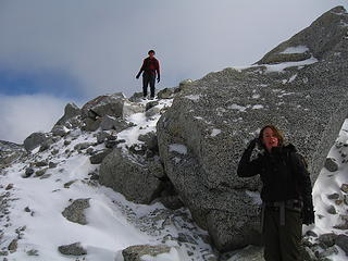
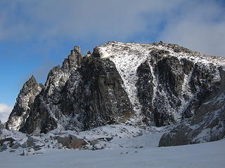
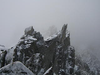
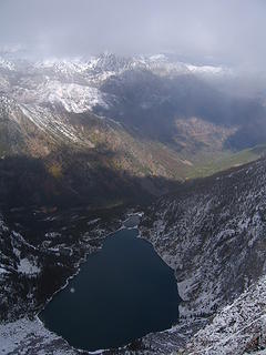
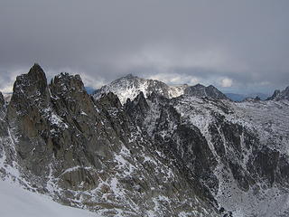
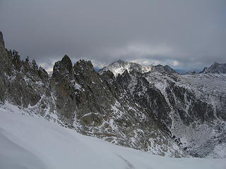
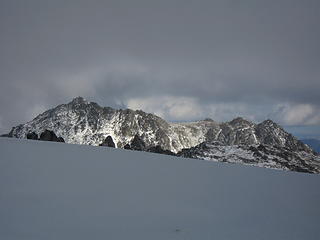
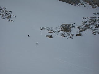
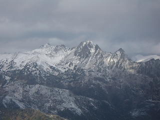
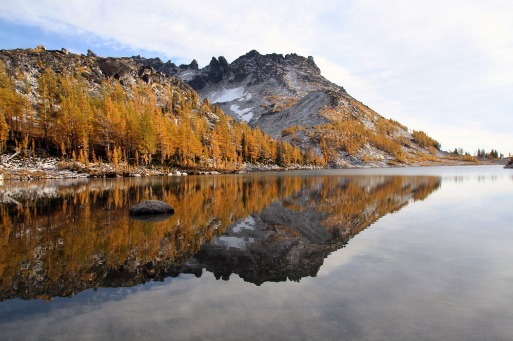
Yesterday I climbed Dragontail Peak with my friends Josh and Amy. We hiked up to Colchuck Lake Friday in the dark and camped. Woke up to a light falling snow but it soon became partly cloudy with some fantastic views that got better and better as we headed up Aasgard Pass. Upper Enchantment Basin got about 10 inches of snow Friday night and Colchuck Lake got about 2 inches. No snow fell on Sunday except for around a half inch just after dard when we hiked out.

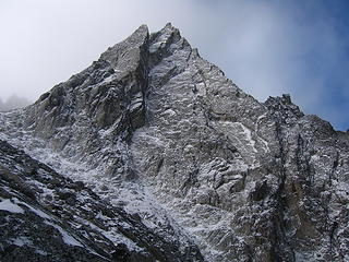
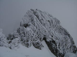
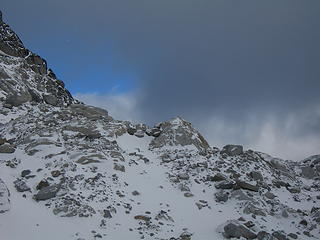
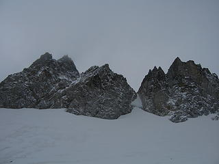
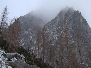
Summit of Dragontail was perfect. Not much rime yet. Some color remaining especially below Colchuck Lake. Aasgard Pass had some icy sections that required more attention otherwise just a little snow covered the rocks. Trail was easy to see the whole way up.

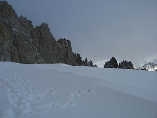
Gaitors were a huge plus  and microspikes might help but I didn't use them. About a foot of fresh snow covered the hard icy remnant snow that is the permanent snowfield on the way up Dragontail above the pass.


Dragontail Peak Beta

Overview

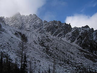
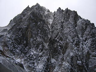
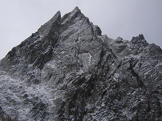
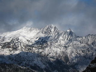
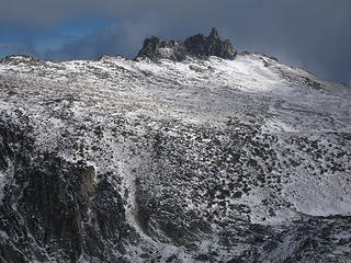
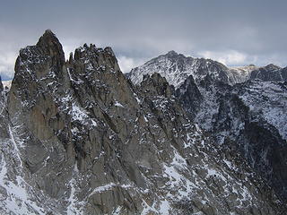
Dragontail Peak is the second highest peak in the Stuart Range, exceeded only by 9,415 foot Mt. Stuart. The name Dragontail comes from the jagged ridge of rock needles on the thin ridge crest SW of the summit resembling a long spiny trail of a dragon. Rock on this peak is unusually sound and its expansive NW face is one of the finest walls in the Cascades. The north and NE faces are also very impressive. The summit ridge extends about 1/2 mile and includes several summit towers. There is an easy walkup route on the south side of the peak. For scramblers, a climb of Dragontail is a great addition to a backpacking trip to the Enchantment Lakes.

The climbing and mountaineering potential on this mountain is huge. There are routes that will challenge the seasoned climber in both summer and winter as well as a handful of scramble routes to challenge the up and rising mountaineers. Located in one of the most popular areas in the state, solitude is hard to come by but the area is so beautiful it just has to be climbed. Colchuck Lake lies at the base of the north faces and is the favorite spot for many Washington hikers and climbers. A climb of Dragontail Peak will surely bring happiness to anyone attempting any of the many classic routes.


Dragontail Peak reflected in Freya Lake
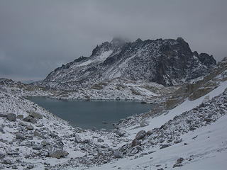
Dragontail Peak from Upper Enchantment Lakes
N Face of Dragontail
The north face of Dragontail Peak
Dragontail Peak from the trail up Aasgard Pass
The northeast face


Getting There

There are two trailheads used to climb Dragontail. The choice depends on the climbing route desired. For the rock routes on the north side of the peak, approach via Colchuck Lake. For the walk-up route on the south side of the peak, either the Colchuck Lake/Aasgard Pass approach can be used, or you can hike the Snow Creek trail and ascend to the Enchantment basin from Snow Lakes. Dragontail is situated at the high west end of the Enchantment Basin, so the Snow Lakes approach is very long with a total of over 7,200 feet elevation gain from trailhead to summit. Both approaches are reached via the Icicle Creek road south of Leavenworth. Reach Leavenworth by driving US 2 east from Everett or west from Wenatchee. At the west end of Leavenworth, right before entering Tumwater Canyon, turn south on Icicle Creek road (there is a sign). After 4 miles is the Snow Lakes trailhead parking lot on the left side of the road at 2,200 feet elevation. This huge parking area is the start to the Snow Lakes and Lower Enchantments approach. For the Colchuck Lake approach, continue up the Icicle Creek road and turn left on road no. 7601 (Eightmile Road), eight miles from Leavenworth. Drive 4 miles on this good dirt road to the Mountaineer Creek Trailhead (Colchuck Lake) with an elevation of 3540 feet.

Approaches

Colchuck Lake -

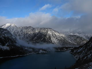
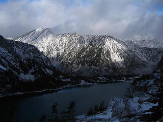
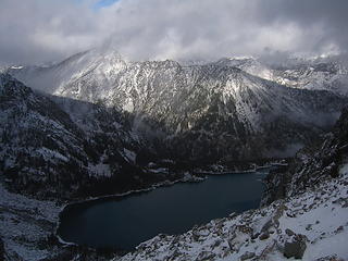
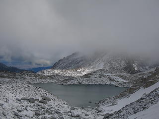
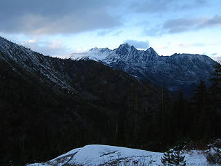
From the Mountaineer Creek trailhead at the end of the Eightmile Road, begin hiking up the trail towards Stuart and Colchuck Lakes. Cross Mountaineer Creek on a good foot bridge and reach the signed junction after a couple miles. Turn left and follow the trail to Colchuck Lake. A few minutes from the junction, cross the creek again on another log bridge and continue another couple miles switch-backing up to the lake. Upon reaching the north side of Colchuck Lake, you will see the awe inspiring north face of Dragontail Peak directly across the lake. This view is a classic Cascades scene. It is 4.5 miles one way to the lake with 2,000 feet of elevation gain. Now the fun begins. Follow the well used boot path around the west side of Colchuck Lake and then continue through the bushes around its south shore. Emerge onto the large talus field and begin ascending towards Aasgard Pass. The trail initially follows the small creek which bisects the huge talus slope on the lower half of the ascent. A few hundred feet above the lake the trail veers off to the climbers left of the creek. At 6,400 feet, make sure you stay left of the small cliff band with the waterfall and stay near the base of the huge cliffs coming down from the Enchantment Peaks. People have died here by straying too far to the right. Follow the trail as it stays well left of the waterfall and reach Aasgard Pass at 7,800 feet. This ascent from Colchuck Lake gains 2,200 feet in 3/4 of a mile! Right before reaching the pass, begin hiking southwest passing a small pond (Mist Pond) and aiming for the huge snowfield on the east face of Dragontail Peak.


Slick Ice Scramble Below Aasgard Pass
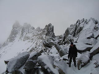
Hiking up Aasgard Pass in late fall
Dragontail and Golden Larches
Dragontail with larches on the trail to Aasgard Pass
Dragontail Peak Reflection
NF of Dragontail from Colchuck Lake. Aasgard pass route heads up and to the left.


Snow Lakes - 

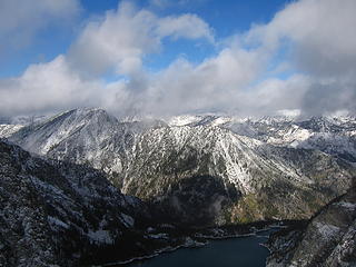
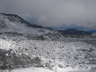
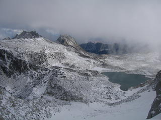
This approach is both longer and has more elevation gain. From the Snow Lakes trailhead, hike the long Snow Lakes trail passing the Snow Creek Wall, on the left, continuing around the north side of Nada Lake and reaching lower Snow Lake after about 6 miles at 5,430 feet. Cross the Snow Lake dam which could be difficult in early season and continue up the well maintained trail but steep trail and reach Lake Viviane at 6,800 feet. This section of the trail has some exposed sections so use caution if wet. From Lake Viviane (which has great camping), wander your way west passing along the north shore of Leprechaun Lake and the east shore of Inspiration Lake. Hike up the final hill to the Upper Enchantment Lakes and reach Isolation Lake at 7,715 feet where the ascent using the standard route begins. The Aasgard Pass/Colchuck Lake Approach will meet this approach about a hundred feet above Isolation Lake to the west.


04 Nada Lake
Nada Lake
Little Annapurna sticks up in...
View of Inspiration Lake
Enchantments Camp
Camping at the base of the std route


Standard East Ridge - Class 2+

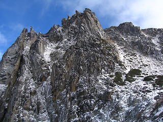
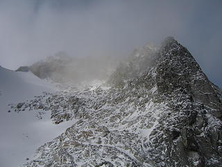
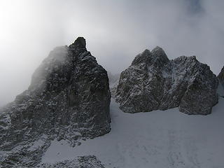
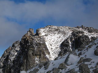
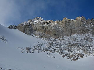
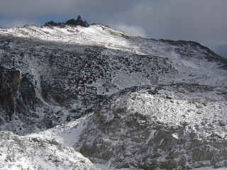
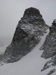
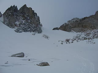
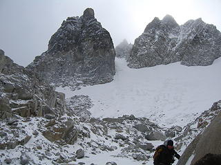
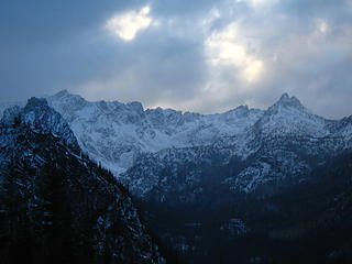
This is the standard route up Dragontail peak and involves moderate angled snow climbing and easy Class 2+ scrambling. Although this route is one of the easier routes for any high Bulger, it isn't a cakewalk and good fitness is required to make it happen. See above for approach descriptions. From the base of the east facing snowfield, begin climbing the 35 degree snow slope aiming towards the obvious saddle between the summit ridge to the right and the jagged ridge coming off Witches Tower to the left. This notch is at 8,500 feet making the snow climb roughly 700 feet. Once at the notch, continue across a short ways and turn right. You will emerge onto a talus slope on the south side of the peak. Work your way up this talus slope following faint trails when possible. 350 feet above the notch, locate the highest point on the jagged summit ridge (difficult in whiteout conditions) and hike to its base. 10-20 feet of Class 2+ scrambling gets you to the top.


Approaching Dragontail
Beginning the snow climb
Approaching the Summit of Dragontail
Fresh snow at the base of the summit block
Dragontail Peak's Summit
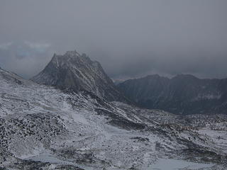
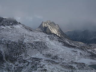
Dragontail seen near the notch


Dragontail Peak
Dragontail Peak from Aasgard Pass with the standard route heading up the large snowfield to the notch at center-right


Other Route Options

Name Photo Rating(YDS)  Brief Description
West Route
West Route
Class 3 This route is done using the Colchuck Lake approach. From the north side of the lake, follow the trail around its western shore and locate the Colchuck Glacier heading steeply up to the right upon reaching the south end of the lake. Climb either steep talus or snow depending on the time of year up the left side of the glacier to avoid any crevasses closer to the northeast face of Colchuck Peak. Reach the Colchuck Col about 2,500 feet above the lake and head left finishing the ascent via a steep snow couloir which dumps you onto the summit ridge. Traverse just below the summit ridge to its south side until you arrive at the highest point and scramble to the top.
Serpentine Arete
Serpentine Ridge
Class 5.8 "This route follows a prominent ridge for about 2000 feet on the NW face of Dragontail Peak to just below the summit block. The exact pitch count is not essential as the upper 2/3rds of the route are low 5th class (with some mid-5th steps) and belays can be had at any time. The rating of "grade IV" is from Nelson and Potterfield guidebook and is probably on the conservative side; class 5.8 rating comes from a single pitch!" - rpc
Backbone Ridge
Backbone ridge
Class 5.9 This is another classic line that climbs the 2000+ foot northwest face of Dragontail via the ridge (or “rib”) immediately left of the Serpentine Arete.
Triple Couloirs
Dragontail
Class 5.7/WI3 "A series of three couloirs, separated by short, steep rock bands, cuts up the middle of the north face of Dragontail, offering 2500 feet of great snow, ice, and/or mixed climbing. This route is somewhat popular and generally gets climbed by one variation or another several times each spring. The specific line taken, time required, and type of climbing encountered are entirely conditions dependent however, so that very few climbs of triple couloirs are the same. Triple Couloirs could and likely has been climbed in every condition imaginable, and has even been skied, and it is up to the climber to decide what sort of ice and snow coverage is acceptable for their attempt on any of the established variations." - Z-Man
Northeast Buttress
NE Buttress
Class 5.8 "This route is over 2000 feet tall and is an adventurous climb up steep rock of variable quality. The buttress rises steeply from between the start of the Triple Couloirs and the Northeast Couloir and flattens out as it meets the summit ridge at a prominent notch near 8500 feet. The route follows chimneys and corners for 150 meters to a notch in the crest of the NE Buttress proper. Expect steep, loose, and dirty, but reasonably well-protected climbing. From the notch the crest can be followed over excellent mid-fifth class cracks for about 200 meters to a distinct exposed arete. Past the arete a ledge system is gained trending Southwest, paralleling the buttress 100 meters or so below the crest. Remaining climb is easier to the summit" - Z-man
Southeast Ridge
dragontail/annapurna snow col route
Class 2+ "This is probably the easiest route up Dragontail, although indirect. This route bypasses the east face snowfield if it's late season and very icy. Scramble up the far-west flanks of Little Annapurna to the obvious snow col separating it from Dragontail. Cross over the broad snow-saddle and make for the southern skyline, scrambling up a short class 2/3 section to the ridgetop. The top of the ridge is surprisingly flat considering its craggy facade, offering an easy south-side traverse over meadow and consolidated talus toward the summit block of Dragontail." - Supermarmot


Map

Dragontail Peak Map

DARK BLUE: Colchuck Lake/Aasgard Pass Approach

GREEN: Snow Lakes Approach

YELLOW: East Slopes Standard Route - Class 3

RED: West Route - Class 3

PURPLE: Southeast Ridge - Class 3

LIGHT BLUE: Northeast Buttress - Class 5.8


Camping/Red Tape

Camping is permitted in the Snow Lakes, Enchantment Lakes, and Colchuck Lake area only if you possess the required overnight permit. See Red Tape. A number of fee forest camps can be found along the Icicle Creek road near the trailheads. If you are looking for a way around the permit system, you can camp in the Crystal Creek drainage south of the Enchantment Lakes basin by either dropping down from Perfection Lake or by approaching via Crystal Creek from the Ingalls Creek trail. For information regarding the permit system or to apply for a permit visit the Recreation.gov site linked below.

Permits

Seasonal Considerations

For current mountain conditions contact the Wenatchee National Forest, Leavenworth Ranger District - 600 Sherbourne Leavenworth, WA 98826 (509)-548-6977

Click here for recreation conditions in the Wenatchee and Okanogan National Forests.

Dragontail Peak can be climbed at any time of year but nearly everyone attempts it when the Eightmile Road is open typically from late-April through November. Spring climbing can make for awesome skiing conditions and almost always brings lots and lots of snow. Since Dragontail lies east of the crest, it tends to be warmer and have better weather in spring making it a popular peak to climb in May and June when the permit system is not yet in effect.


Dragontail and the Enchantments
Spring Snow


Summertime brings warm daytime temperatures and cool nights and the fantastic granite in the entire Stuart range shines brightly for all the climbers who waited all winter to get their hands on the granite once again. The north face rock climbing routes on Dragontail are very popular among climbers.


Dragontail Peak
Summertime Conditions


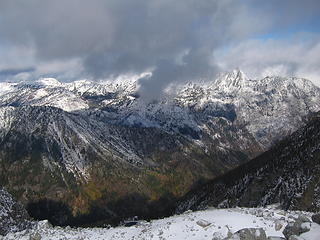
In the fall, the area becomes world famous for the larch trees that turn golden yellow beginning in early October. After a light snowfall, the air becomes clear and crisp and coupled with peak larch color, the scenery is probably the best in the country for a couple weeks in October. Permit season ends on October 15th and you will always find many people camping in the Enchantments Basin the weekend after October 15th hoping to catch the larches on their waning stages.


undefined
Larches in the fall


External Links

Weather Forecast

Dragontail Peak on MountainProject

More photos of the Enchantment Lakes

Triple Couloirs TR and pics

TR and pics of Serpentine Arete

Dragontail Peak via Colchuck Couloir

Powered by Create your own unique website with customizable templates.