LEMKE CLIMBS
  • About
    • Whats New
    • 2019 Goals/Wishlist
    • Contact
  • Washington
    • North Cascades >
      • Sahale Peak, Boston Peak
      • Eldorado Peak, Klawatti Peak
      • Black Peak
      • Forbidden Peak West Ridge
      • Primus Peak Attempt
      • Big Snagtooth
      • Liberty Bell Beckey Route
      • Burgundy Spire North Face 5.8
      • Ragged Ridge - Katsuk, Kimtah and Cosho Peaks
      • Colfax Peak
      • South Early Winters Spire via SW Buttress
      • Chilliwack Mini-Slam
      • Mesahchie Peak
      • Inspiration Traverse
      • Mount Shuksan Ski
      • Full Pickets Traverse
      • Mount Goode NE Buttress & Storm King
      • Mount Baker North Ridge WI3
      • Snowfield Peak
      • Lincoln Peak
      • Silver Star Mountain
      • Mount Buckner & Horseshoe Peak
      • Azurite Peak
      • Tower Mountain & Golden Horn
      • Mount Logan
      • Custer Ridge & Easy Mox
      • Mazama Dome
      • Sherman Peak
      • Mount Ballard
      • Southern Pickets Traverse
      • Corteo Peak
    • Glacier Peak Wilderness >
      • Buck Creek Pass, Cloudy Peak, Spider Gap
      • Dome Peak, Spire Point
      • Mt. Maude and Seven Fingered Jack
      • Mount Formidable NE Face 5.6 Second Ascent
      • Dumbell and Greenwood Mountains
      • Glacier Peak Wilderness Mountain Massacre
      • Clark and Luahna Peaks
      • Sinister Peak
      • Chiwawa Mountain
      • Tupshin & Devore Peaks
      • Buck & Fortress Mountains
      • Glacier Peak
    • Olympic Peninsula >
      • Buckhorn Mountain
      • Flapjack Lakes Hike
      • Grey Wolf Peak, High Divide Trail
      • Mount Ellinor
      • Mount Constance West Arete
      • Mount Olympus
    • Alpine Lakes Wilderness >
      • Chikamin Peak
      • PCT - Snoqualmie to Pete Lake
      • Foss Lakes Hike
      • Necklace and Tank Lakes
      • Enchantments Day Hike
      • Granite Mountain (Snoqualmie)
      • Colchuck Peak
      • Cannon, Enchantment and Stuart
      • Ingalls Peaks
      • McClellan Peak
      • Dragontail Peak
      • Web Mountain
      • Mount Index Attempt
      • Snow Creek Wall Orbit 5.8+
      • The Tooth South Face
      • Eightmile Mountain
      • Argonaut Peak NE Couloir
      • Little Annapurna South Face 5.5
      • Snow Creek Wall Outer Space 5.9
      • Cashmere Mountain
      • Sherpa Peak North Ridge 5.8
      • Chair Peak NE Ridge
      • Lichtenburg Mountain
      • Mount Index
      • McClellan Butte
      • Chimney Rock
      • Alpine Lakes High Route
    • Pasayten Wilderness >
      • The Craggies
      • Tiffany Mountain
      • Pasayten Mini-Slam
      • Remmel Group
      • Jack Mountain
      • Robinson Mountain
      • Monument Peak Group
    • Mountain Loop Highway >
      • Vesper Peak
      • Mount Dickerman
      • Sloan Peak West Face 5.8
      • Mount Forgotten
      • Whitehorse Mountain
      • Gothic Peak
    • Lake Chelan Sawtooth Wilderness >
      • Star, Courtney, and Grey Peaks
      • Hoodoo Peak and Raven Ridge
      • Abernathy Peak
      • Mount Bigelow
      • Reynolds Peak
      • Oval Peak
      • Gardner Peaks
      • Chelan Sawtooth Trio
    • Southern WA >
      • Mount Adams
      • Mount Rainier - Emmons Route
      • Mount Saint Helens
      • Goat Peak
      • Lane Peak, Plummer Peak (Tatoosh)
      • The Unicorn (Tatoosh)
      • Little Tahoma
    • WA Rock and Ice Cragging >
      • Index Town Walls
      • Vantage
      • Mount Erie
      • Exit 38
      • Leavenworth
  • Colorado
    • San Juan Mountains >
      • Mount Sneffels Lavender Snow Climb
      • Uncompahgre, Matterhorn Peaks
      • Redcloud, Sunshine Peaks
      • San Luis Peak
      • Vermilion, Fuller Peaks
      • Stewart Peak, Baldy Alto
      • Jones, Niagara, American Peaks
      • Wetterhorn Peak, Handies Peak
      • Wilson Group
      • Arrow Peak
      • Mount Sneffels SW Ridge
      • Jagged Mountain, Chicago Basin
      • Teakettle Mountain
      • Dallas Peak
      • Vestal Peak Wham Ridge, Greystone Peak
      • Organ Mountain
      • Phoenix Peak
      • Half Peak
      • Point 13832 Group
      • Golden Horn
    • Elk Mountains >
      • Four Pass Loop
      • Castle, Conundrum Peaks
      • Snowmass Mountain
      • Cathedral Peak
      • South Maroon Peak
      • The Pyramids
      • North Maroon Peak, Sleeping Sexton
      • Capitol Peak, Mount Daly
      • Malemute Peak
      • Hagerman Peak
    • Sangre de Cristo Mountains >
      • Blanca Peak, Ellingwood Point
      • Challenger Point
      • Mount Adams
      • Spread Eagle Peak
      • Humboldt, Obstruction, Columbia Peaks
      • Mount Lindsey, Huerfano Peak
      • Little Bear Peak
      • Crestone Needle Ellingwood Arete
      • California Peak
      • Crestone Peak North Buttress
      • Operation Dark Snake
      • Kit Carson Mountain
    • Sawatch Mountains >
      • Iowa Peak
      • Point 13,618 - Hunky Dory Lake
      • Gold Dust Peak, Notch Mountain
      • Mount Jackson
      • Mount Belford
      • Shavano, Tabeguache Peaks
      • Mount Antero, Cronin Peak
      • Twining Peak
      • Mount Massive
      • Casco Peak
      • Mount Huron
      • Mount Elbert
      • Mount Oxford
      • Mount Hope
      • Mount Yale
      • Lackawanna Peak
      • Mount Columbia
      • La Plata Peak
      • Rinker and Twin Peaks
      • Bull Hill, Mount Princeton
      • Missouri Mountain
      • Mount Oklahoma
      • French Mountain
      • Mount Ouray
      • Grizzly A, Garfield Peaks
      • Mount Harvard
      • The Three Apostles
      • Emerald Peak
      • Holy Cross
    • Greater Park Range >
      • Kneeknocker Pass, Piney Lake
      • Drift Peak
      • Sherman Peak, Dyer Peak
      • Gore Range Traverse
      • Quandary Peak
      • Pacific, Atlantic Peaks
      • Clark Peak
      • Crystal Peak, Peak 10
      • Fletcher Mountain
      • The DeCaLiBron
      • Loveland Mountain
      • The Mosquito Traverse
      • Mount Arkansas
      • Clinton Group
      • Eagles Nest, Peak C
      • North Star Mountain
      • Peak X
      • Wheeler Mountain
    • Front Range >
      • Mount Evans, Spalding
      • Mount Bierstadt
      • Mount Parnassus, Bard Peak
      • Cupid, Sniktau, Grizzly D Peaks
      • James Peak
      • Mount Silverheels
      • Grays and Torreys Peaks
      • Mount Edwards
      • Mount Flora, Longs Peak
      • Square Top Mountain
      • Petit Grepon South Face 5.8
      • Mount Meeker Dreamweaver Couloir
      • Santa Fe Peak
      • The Citadel & Pettingell
    • Colorado Ice Climbing >
      • Lincoln Ice Falls
      • Ouray Ice Park
      • Avocado Gully and The Drool
      • Hidden Falls
    • Colorado Rock Climbing >
      • Eldorado Canyon
      • The Flatirons
      • North Table Mountain
      • Shelf Road
      • Colorado National Monument >
        • Independence Monument
  • Wyoming
    • Wind River Mountains >
      • Gone With the Winds
      • Union Peak - Solar Eclipse
      • Wind River Peak
      • Wind River Slam
    • Teton Range >
      • Grand Teton Owen Spalding 5.4
      • Mount Owen Attempt
    • Wyoming Absarokas and Gros Ventre Range >
      • Jackson Peak
      • Francs Peak
    • Yellowstone National Park >
      • Top Notch Peak
    • Bighorn Range and Great Divide Basin >
      • Boars Tusk
      • Loaf Mountain
      • Cloud Peak
      • Black Tooth Mountain
    • Devils Tower
    • Cody Rock and Ice Climbing
  • Montana
    • Beartooth Mountains >
      • Whitetail Peak Group
      • Beartooth Mountain
      • Spirit Mountain Group
      • Mount Peal
      • Granite Peak Group
      • Castle Rock Group
      • Castle Mountain NE Couloir
      • Mount Inabnit and Sylvan Peak
      • Mount Hague South Slopes
      • Mount Villard and The Granite Peaks Traverse - 5.4
      • Spirit Mountain NE Ridge - 5.4
      • California Ice WI 4
      • The Ramp 5.8
      • Linea Alba 5.10d
      • Iceberg Peak
      • Metcalf Mountain North Rib 5.8
      • Villard Spires HP West Ramp
      • Cairn Mountain
      • Snowbank Mountain
      • Mount Wood Group
      • Bears Tooth
      • Glacier Peak Catch-a-Sunrise FA
    • Montana Absarokas & Gallatin Range >
      • Black Mountain
    • Southwest Montana Ranges >
      • Sacajawea Peak
      • Arrow Peak
      • Koch Peak
      • Saddle Peak
      • Baldy Mountain
      • Sphinx Mountain
    • Glacier National Park >
      • A Taste of Glacier National Park
      • Divide Mountain
    • MT Rock and Ice Climbing
  • Utah
    • Uinta Mountains >
      • Kings-Emmons Ridge Run
      • Hayden Peak
      • Iron Hayden Wall Rock Climbing
    • Wasatch Range >
      • The Sundial Eleventh Hour 5.8
      • Mount Timpanogos
    • San Rafael Swell >
      • Ramp, Cistern Canyons
      • Salt Wash, Black Mountain, Moroni Slopes
      • Ding, Dang Canyons
      • Little Wild Horse, Bell Canyons
      • Quandary Canyon
      • San Rafael Knob
      • Miners Hollow (Knotted Rope Canyon)
      • Temple Mountain
      • Chimney Rock
      • Bottleneck Mesa
      • Window Blind Peak
      • Lower Baptist Draw & Upper Chute Canyon
    • Capitol Reef National Park >
      • Cathedral Valley Tour
      • Sheets Gulch
      • Halls Creek Narrows
      • Brimhall Canyon and Strike Valley Overlook
      • George Benchmark
    • Moab Area, Canyonlands, Arches >
      • Maze District
      • Needles District
      • Maze District
      • White Rim Trail Biking
      • Elephant Butte, Bullwinkle Tower and Lizard Rock
      • South Six Shooter
      • Elephant Canyon
      • Parriott Mesa
      • Ancient Art
      • Castleton Tower North Chimney 5.8
      • Klondike Bluffs
      • Mount Peale & Tukuhnikivatz
    • Robbers Roost Country >
      • Horseshoe Canyon, Goblin Valley
      • Bluejohn Canyon
      • Happy Canyon Narrows
      • Shenanigans, Leprechaun Slots
      • Larry Canyon
      • Merry Piglet Slot
      • Lower Maidenwater Canyon, Turkey Knob
      • Morocco Canyon
      • Monkey Business Slot
      • Hog Canyon Slots
      • Upper Maidenwater Canyon Slots
      • Mount Ellen
      • Buck Canyon
      • Point 4906
      • Alcatraz Canyon
      • Hard Day Harvey Slot
      • Mount Ellsworth
      • Good Day Jim Canyon
      • White Roost Canyon
      • Upper Stair Canyon
    • Escalante National Monument >
      • Phipps Canyon and Arch
      • Red Breaks Slot
      • Dry Fork Slots, Coyote Gulch
      • Little Death Hollow/Wolverine Canyons
      • Egypt 3 Slot
      • Egypt 1 Canyon
    • Zion/Bryce >
      • Ataxia Tower Ashtar Command 5.9
      • Mount Kinesava Cowboy Ridge
      • Birch Hollow
      • Aires Butte
      • West Temple
      • Mystery Canyon
      • Crazy Streak
    • Cedar Mesa Region/Valley of the Gods >
      • Eagle Plume Tower Eagle Feather 5.10b
  • California
    • High Sierras, Southern CA Ranges >
      • Telescope Peak, Manly Beacon
      • Tahquitz Rock Whodunit 5.9 - June 2016
      • Tahquitz Rock Long Route 5.9 - July 2016
      • Palisade Traverse
      • White Mountain
    • Yosemite National Park, Central CA
    • Northern CA Cascades >
      • Lava Beds National Monument - August 2015
  • Oregon
    • Oregon Volcanoes >
      • Three Fingered Jack
      • Mount Scott
    • Blue Mountains >
      • Twin Peaks
    • Trout Creek Rock Climbing
  • Alaska
    • Eagle Peak and Mount Ewe
    • Jatt Peak and Portage Pass
    • Rainbow Peak
    • Mount Brooks Attempt
    • Arrigetch Peaks Trek
    • Ab Mountain Hike
    • South Suicide Peak
    • Mount Hunter West Ridge Attempt
    • Cantata Peak Attempt
    • East Twin Peak
    • Mount Alice
    • Crow Pass and Hope Point Hikes
    • Indianhouse Mountain Attempt
    • Lynx Peak
    • Harding Icefield Hike
    • Hatcher Pass and Grapefruit Rocks Climbing
    • Mount Sanford
    • Mount Hunter West Ridge
  • Nevada
    • Ginger Cracks 5.8
    • Mescalito Dark Shadows 5.8
    • Birdland and Olive Oil
    • Frogland 5.8
    • Johnny Vegas 5.8
    • Schaeffer's Delight & Triassic Sands
    • Solar Slab - 5.6
  • British Columbia
    • Mount Matier
    • Taiya Peak
    • Bugaboo Spire NE Ridge
    • Mount Sabine Easy Honey 5.10b
    • Mount Sir Donald NW Ridge Attempt
    • Black Tusk
    • Squamish Ticks
    • Slesse Mountain NE Buttress
  • Alberta
    • Mist Ridge Hike
    • Mount Temple Attempt
    • East Wendell Peak
    • Loder Peak
    • Tower Mountain Attempt
    • The Rimwall
    • Mount Yamnuska Directissima 5.9
    • Mount Lawrence Grassi
    • Mount Lorette
    • Roche A Perdrix
    • Mount Edith Cavell East Ridge 5.3
    • Mount Louis Kain Route
    • Eiffel Peak
    • Canadian Rockies Ice Climbing
  • Other States
    • Arizona >
      • Grand Canyon Bright Angel Trail
      • Beanfest at Cochise Stronghold
      • Baboquivari Peak
      • Humphreys Peak
    • New Mexico >
      • Philmont Trek August 2008
    • Yukon >
      • Canyon Peak
  • International
    • Mexico & Central America >
      • Mexico - Pico de Orizaba, Izta - March 2012
      • Guatemala Volcanoes
    • South America >
      • An Introduction to Patagonia
      • Cordillera Blanca - Tocllaraju and Urus
      • Nahuel Huapi National Park & The Frey
      • Exploring Pucon and Lanin Volcano
      • Cordillera Blanca - Ishinca Peak and Artesonraju
      • Cordillera Blanca - Quitaraju & Alpamayo
      • Exploring Southern Peru
      • Cerro Helio Azul & Tronador Attempt
      • Aguja Guillaumet Amy Couloir
      • Cerro Puntado & Palo
      • Cerro Colorado
      • Cerro Puno & Agudo
      • Cerro Trinidad Attempt
      • Volcan Quetrupillan
      • Cerro Placas
      • Nevado de Acay
      • Pequeno Alpamayo
      • Huayna Potosi
      • Illimani
      • Chiaro de Luna
    • Oceania >
      • Exploring New Zealand's South Island
      • Puncak Jaya
      • Mount McPherson and Talbot
      • Single Cone
      • Mount Cook
      • Mount Aspiring
      • Manakau
    • Central Asia >
      • Kyrgyzstan 2021
  • Sorted by Year
    • 2008 Trip Reports
    • 2009 Trip Reports
    • 2010 Trip Reports
    • 2011 Trip Reports
    • 2012 Trip Reports
    • 2013 Trip Reports
    • 2014 Trip Reports
    • 2015 Trip Reports
    • 2016 Trip Reports
    • 2017 Trip Reports
    • 2018 Trip Reports
    • 2019 Trip Reports
    • 2020 Trip Reports
    • 2021 Trip Reports
  • Vanlife
    • Conversion Journal >
      • Floor Installation
      • Folding Bed
      • Coffee Table
      • Thinsulate Installation
      • The Couch
      • The Wardrobe
      • Bookshelf
      • Water System
      • Electrical System
      • The Pantry
      • Refrigerator
      • Tire Upgrade
      • Heating System
      • Composting Toilet
LEMKE CLIMBS

Sloan Peak

Sloan Peak - 7835' - West Face Class 5.8
August 2015

Last Thursday was the last nice day for what looked like over a week so when I got a call from a contact on CascadeClimbers looking for someone to climb with, I wasn't going to say no, and we agreed on the west face of Sloan Peak. The trip began at 4am when I picked Taylor up in West Seattle and we drove out the Mountain Loop Highway. As we headed over Barlow Pass and continued down the gravel side of the loop, we reached the bridge over Bedal Creek, we couldn't find the FS road leading to the Bedal Creek TH. Google Maps on my phone said the road intersects the MLH next to the bridge but in reality, that wasn't true.

We spent the next 15 minutes driving back and forth near the Bedal Creek bridge looking for the road. We finally found it nearly 1 mile past the bridge! I should have looked in more depth where the road was rather than just relying on my phone but we made it up the steep switchbacking road to its end and parked. We were the only ones there, and after quickly grabbing our packs, we started hiking up the continuation of the old, overgrown road. Needless to say, we spent the next hour looking for the actual Bedal Creek Trail. Heading up the old road, any resemblance of a path quickly disappeared, and even hiking up either side of Bedal Creek where the old road crossed it, we could not find a trail. Just before we decided to begin bushwhacking up the creek, I ran back to the car, since it was only a few minutes away and checked to see if the trail started ascending in a different direction from where we parked, and sure enough that was the case. For whatever reason, I have done this multiple times and took the wrong direction from a trailhead. It was now 7:45 am when we started up the actual trail and I was already concerned about making the summit since we had hoped to start up the trail by 6am.

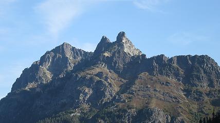
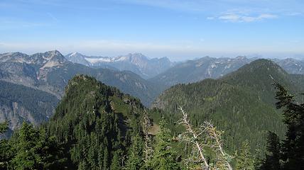
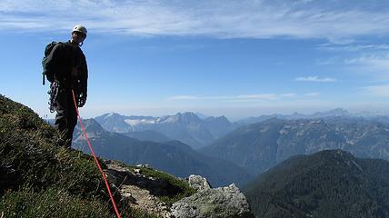
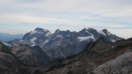
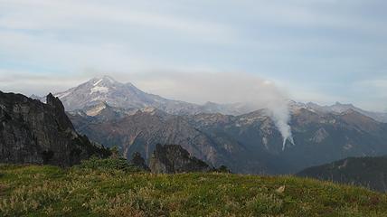
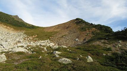
Luckily, the trail was in fact in good condition and our faith in our beta we had brought along was restored. We quickly made it all the way up to the east-west ridge dropping off the west face of Sloan at the head of the Bedal Creek Valley. The view of the stunning NW face on the hike up was incredible, and one of the trip reports we were using as beta mentioned that face hasn't been climbed!

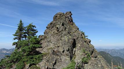
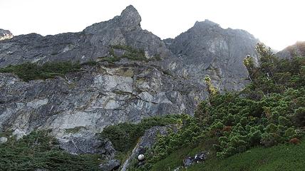
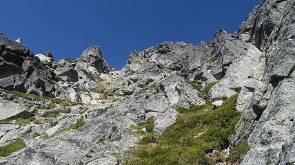
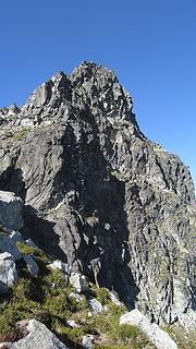
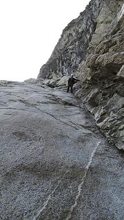
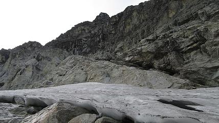
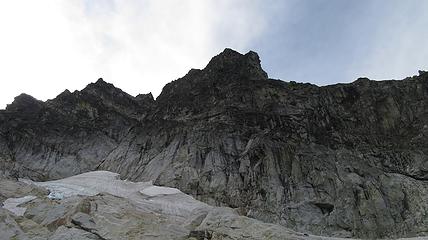
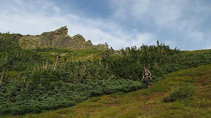
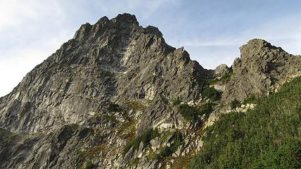
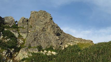
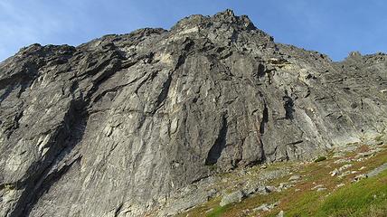
Once on the small ridge, at about 5,700 feet I had hoped the trees and bushes would disappear but walking along the crest towards the west face proved more annoying due to many small trees. We reached the base of a small rocky crag and some class 3 scrambling ensued as we continued a couple hundred feet and over the small tower. A 15 foot drop brought us to a broad saddle directly at the base of the now very steep west face. From this saddle, the first two pitches of the most common way up the west face began just off to our right, heading up to a large ledge covered partly by trees. Our goal was to climb the awesome right trending dihedral that most people labeled 5.8 however since I left my C3 in the car I was a little worried about it.

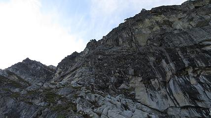
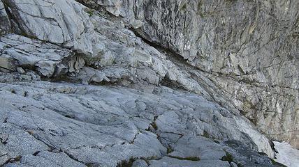
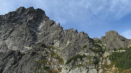
We ended up bypassing the first 2 dirty pitches and stayed off to the left, more or less heading up the ridge as it slowly merged into the west face. We made some low 5th class moves and continued solo until we reached the large ledge, and racked up. I led a short overhang and continued up an easy slab for 20 meters or so to the very base of the awesome looking dihedral. Taylor followed up and we decided he would lead the dihedral. Most of the climbing was face climbing on the 70-80 degree slab and the entire pitch had to be run out as good protection was few and far between. Taylor did excellent making his was up the long pitch and upon reaching the top, belayed me up. Most of the pitch was fairly secure climbing, but with the exposure, and lack of good pro (since the crack was 4" or bigger) it was a bit scary.


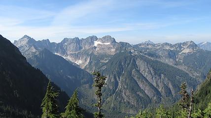
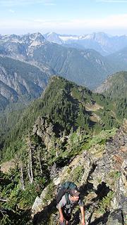
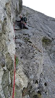
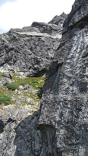
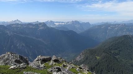
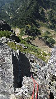
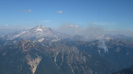
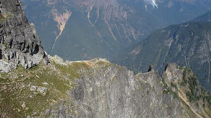
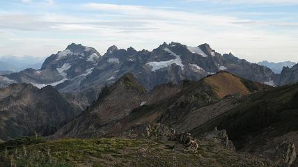
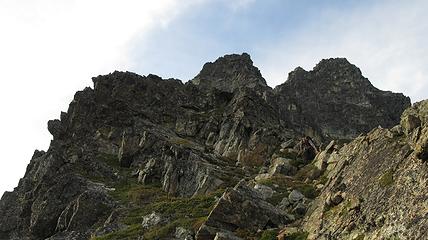
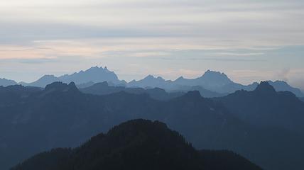
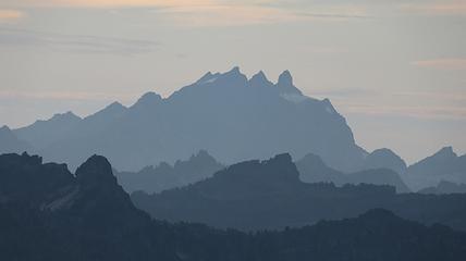
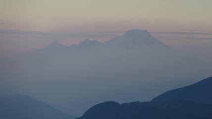
I then led up the continuation of the large crack another 30 meters or so. This pitch was pretty dirty and offered little pro. The hardest section being a large pod that required a couple overhanging moves. Once on the large ledge above, I slung some webbing around a large rock and belayed Taylor up. From here, we traversed slightly leftward on this ledge and then made a short simul-climbing pitch up a 4th class slab and onto a second, larger ledge. From here we decided to continue well off to the left, per the beta we had but we quickly realized that probably wasn't correct. I led up another awesome crack about 25 meters to get above the next cliff band. This pitch proved to be the best climbing on the route I thought. Once on the next ledge, which was massive, we traversed right towards the south side of the mountain. We never ended up finding the standard corkscrew route, but we reached the southwest ridge and the remainder of the route (final 400 feet) was class 3 or less following s nice boot path with cairns. From the summit we had excellent views of Glacier Peak and the Monte Cristo group.

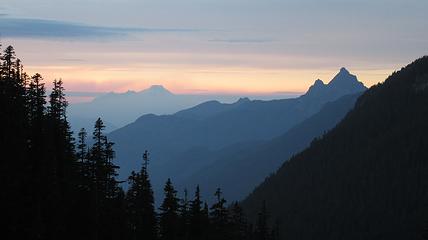
The amount of individual fires we saw was astounding, but luckily the air was fairly clear. Three Fingers, and Mount Pugh off to the north looked impressive. Glacier Peak was incredibly dry as well...so dry I barely even saw any glaciers!


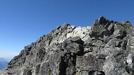
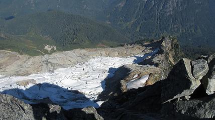
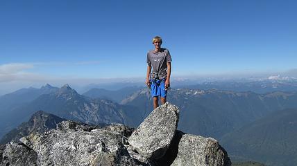
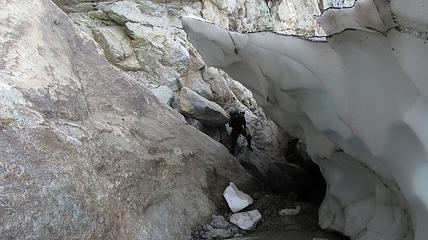
It took us about 4.5 hours to reach the summit from the base of the west face (which we reached at 10:30am). We spent about 45 minutes on the summit and signed the summit register. Unfortunately there wasn't any real register panel in the brass tube. Looking down the northeast side of the summit, the glacier well below us that is crossed on the standard route was broken up like I never could have imagined! No wonder I have read of parties having issues on the corkscrew route.

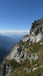
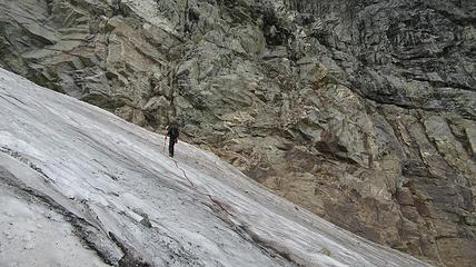
We started down at 3:45pm to give us plenty of time to make the descent since we didn't really know how hard it would be. We read the best way was going down the south face which included anywhere between 1-3 rappels. We located the "super-highway" which was a perfect looking trail heading around a large buttress on the southwest side of the mountain roughly 300 feet below the summit. We retraced our steps back to this trail that we saw from near the summit. We followed it around a ridge and along a large ledge. Below us we saw an additional ledge that we had to get to. I looked around for what was supposed to be an established rap anchor and after descending about 50 feet down a broad gully, found it. A 25 meter rappel took us to the next ledge down. We then headed skiers left and descended this ledge all the way down to the small snowfields below the south face. The final 100 feet was steep polished slabs that some people rappel. I actually found a 30 meter rope that someone had set up as a single line rappel because someone didn't want to downclimb the slabs. Their rope was just left there though as it wasn't long enough. I ended up scrambling up to the top and packed it up, then descended to the moat below the slabs. It wasn't any harder than 3rd class I didn't think, plus that rope was in good condition, and appeared to have been left this summer sometime.


Upon reaching the snow, it was unfortunately hard as a rock and very slick. We both left our axes, and were only wearing tennis shoes without any traction because we didn't think we would have much snow to deal with. I tried climbing around the moat and onto the 20 degree snow but quickly realized I would quickly start sliding uncontrollably down towards the rocks below, despite being only 20 degrees. So we set up a rappel by slinging a large rock inside the moat, then rapping down the snow utilizing the full 60 meter rope. It took us right to the rocks at the lower end of the snowfield and from that point we were able to continue hiking along the slabs below the snow. By this point it was 6:30 and we still had to cross the south ridge, where the great bivy site is, then continue a descending traverse back to the east-west oriented ridge we started the climb on. This however wasn't very bad and we made it to the awesome bivy spot on the south ridge at 6,550 feet in only 20 minutes from where we finished the rappel across the snowfield.

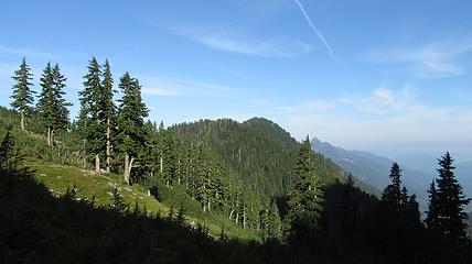
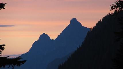
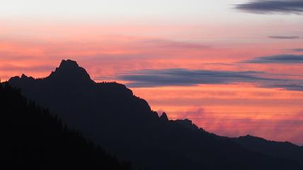
From the bivy spot, we started down easy tundra and grass towards the northwest. Instead of descending down an awful looking gully, we traversed above it and eventually reached 5,700 feet along the ridge and quickly made our way down, finally meeting the trail as the sun was setting. I took a nice photo of the red glow and we made the hike out down the easy trail in the dark reaching the car just before 10pm, about 14 hours after we started (not including time we were lost looking for the trail).


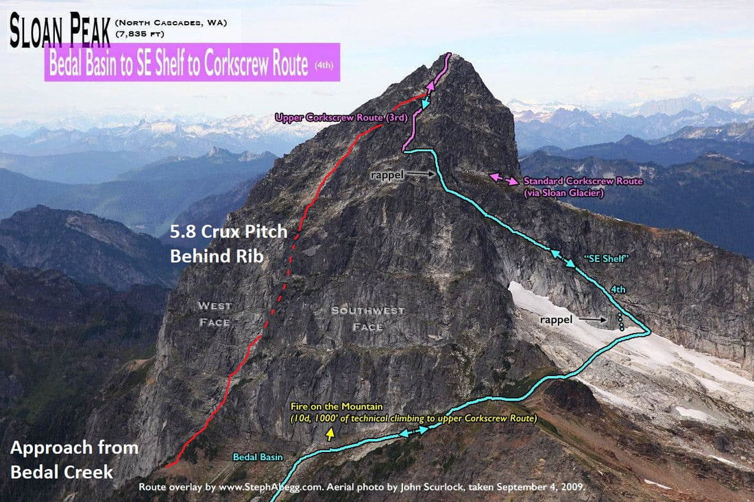
Here is a map of our ascent route (orange) and our descent (red):
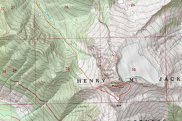

Route Topo

Picture
Aerial photo by John Scurlock, and route overlay by Steph Abegg, with our west face ascent route added by myself in red. Our descent shown in blue as the SE shelf
Powered by Create your own unique website with customizable templates.