baboquivari peak - 7734' - forbes route class 5.4
march 2021
After Josh and I completed Hard Day Harvey slot canyon in the Ticaboo area of far southern Uath, I drove all the way out back to highway 276 and we decided we would head even further south...like almost to Mexico and climb Baboquivari Peak. Our friend Fletcher told me about this peak the year before and after looking it up, i knew it was worthy of a trip to climb it. The drive down to Baboquivari Peak from Ticaboo took an entire day to do and initially had us going back north to Highway 95, then south through Mexican Hat, Monument Valley, Kayenta, and on to Flagstaff where we got a good look at Mount Humphreys, which would be our last objective we'd do on our way back.
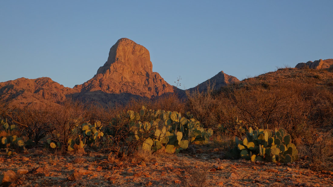
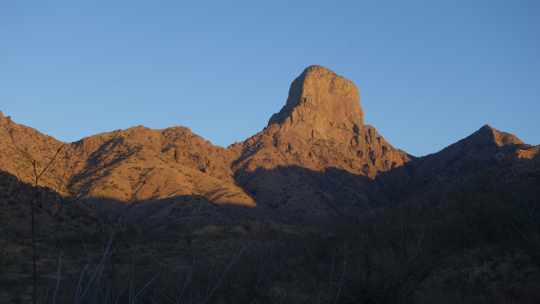
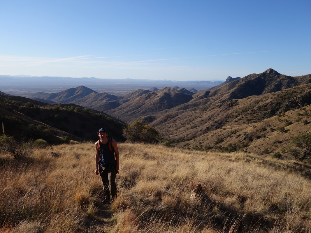
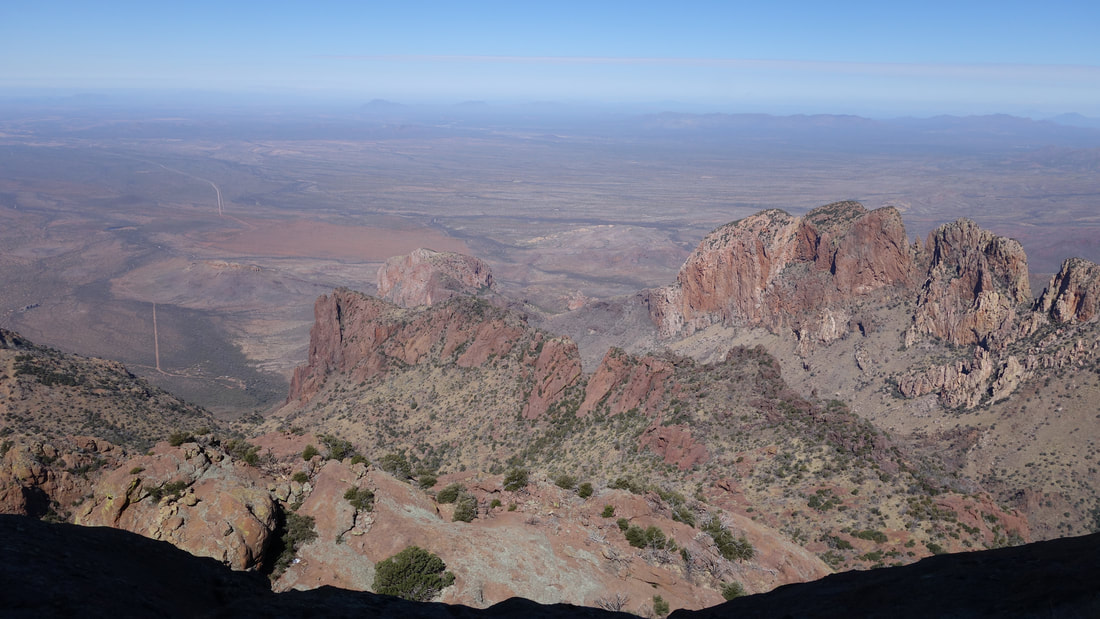
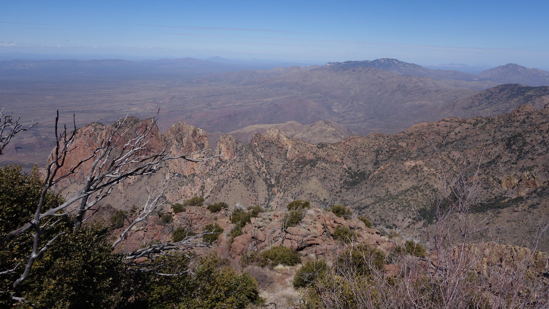
We continued driving south to Phoenix, then Tucson, and then further south on AZ highway 286 towards Sasabe. At a point 16 miles away from the mexican border, we turned right on the first road immediately past mile post 16. This approach is for the eastern approach to Baboquivari, which was the only one open at the time. The beta we had indicated this road that headed west off the highway was a 6.9 mile long 4WD road which ended at a gate where people park and pass around a small private ranch home to access a trail that ascends towards the towering peak above. However, as with many roads that people say 4WD is required, I was able to drive over half of this road in my stationwagon, before being stopped by a steep and loose section of the road right where it crosses a dry wash just past Black Tank. I actually parked next to the tank after turning around and as twilight began to turn into dawn we started walking the remainder of the road to the gate, about 3 miles of easy walking. Baboquivari Peak was glowing bright red when the sun rose as we walked the road and was very stunning.
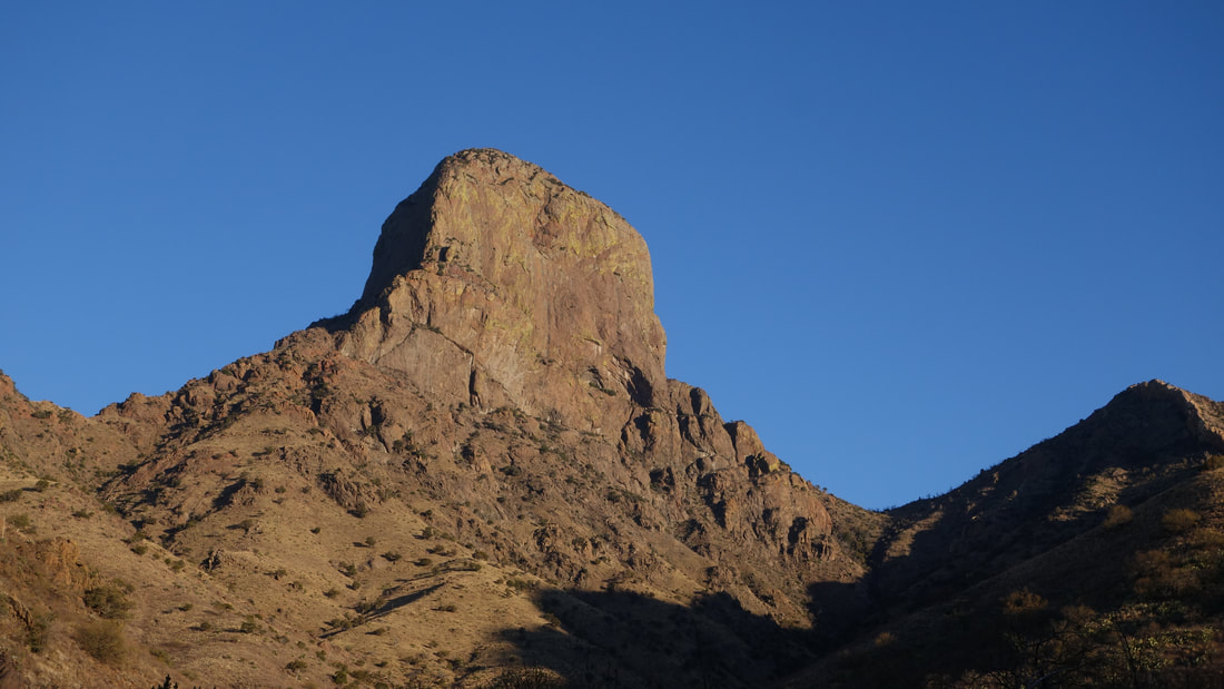
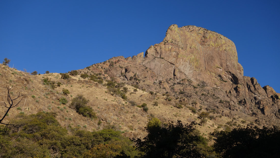
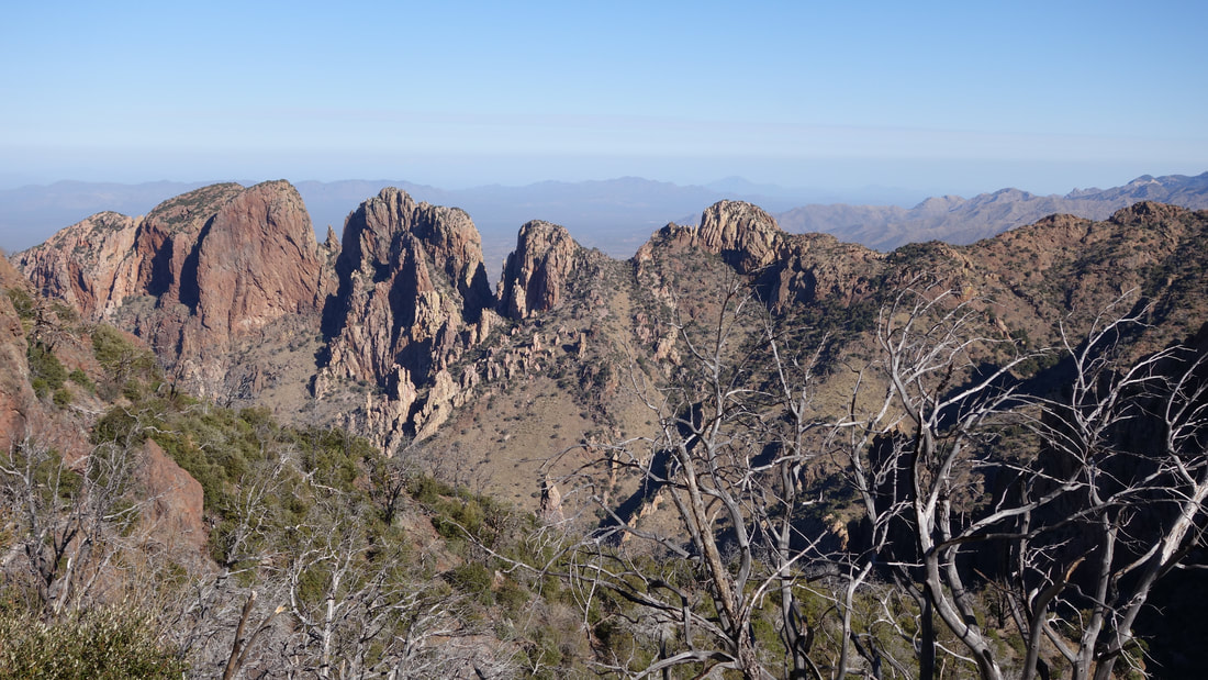
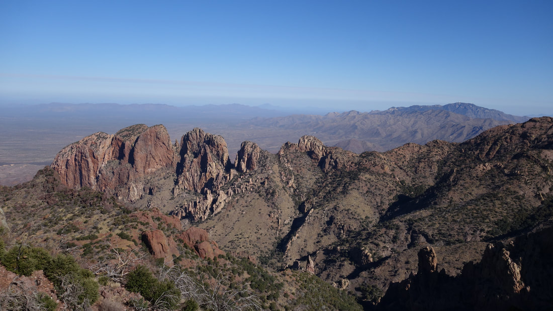
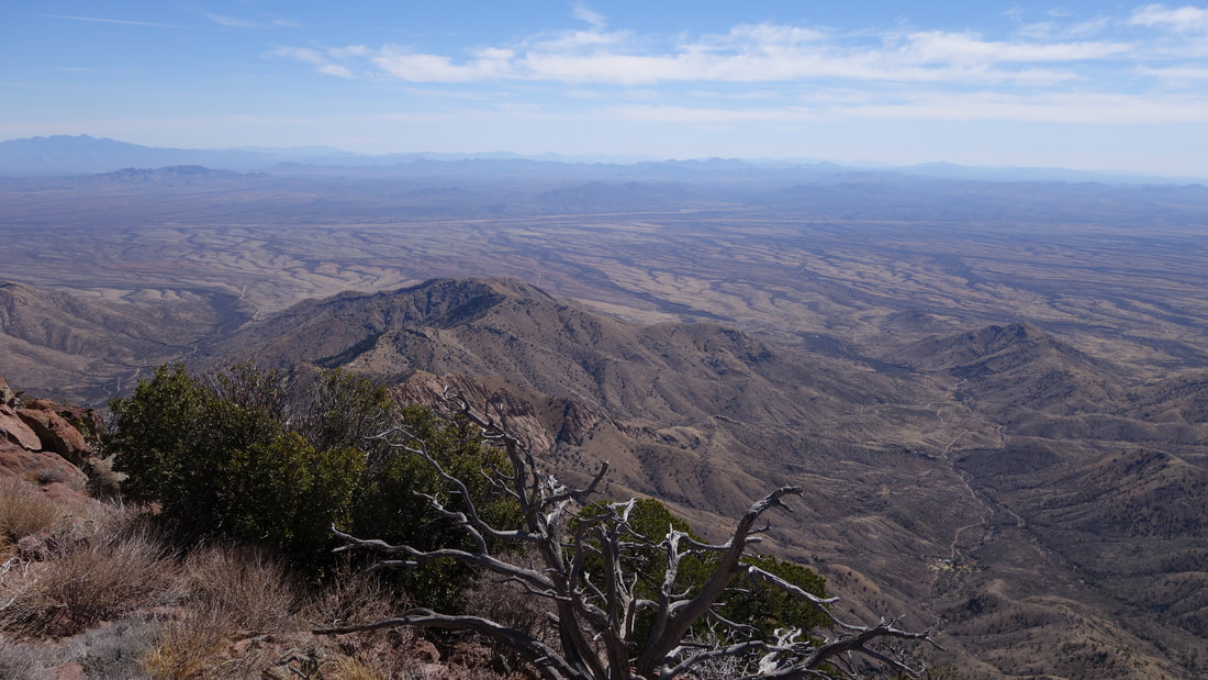
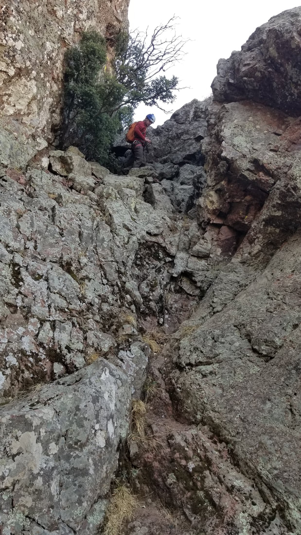
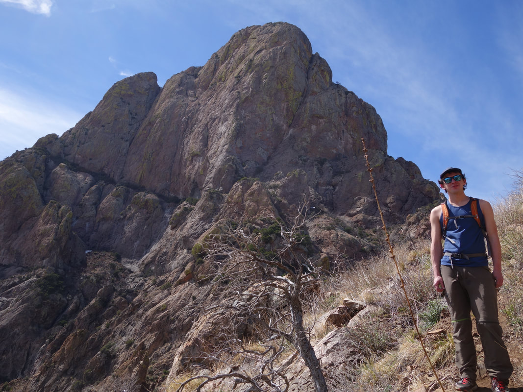
Once we reached the gate, we proceeded through and found the property completely empty. I guess it was still too cold for southern Arizona and the owner was at their winter home in Phoenix. We followed the signed path around the property, and easily located the trail continuing up Thomas Canyon. We had read repots of a ton of razor sharp plants that people had to bushwhack through along this "trail" but we found it very easy to follow with virtually zero bushwhacking. The trail more or less followed the dry creek bed for quite a ways, crossing it a few different times, then began ascending up the west facing slopes to the right side of the dry creek bed. The trail switchbacks a few times ascending steeply, with the final traverse towards the saddle crossing a rocky stretch where the trail is a little less defined. Ascend more or less straight up to the saddle for this final 350 feet. The map below depicts the entire approach and route. As we ascended up the slopes, the huge cliffs of the east face of Baboquivari towered above us beckoning. We located the more difficult SE arete and we contemplated climbing this beautiful line, however given the late start we got and the still short days we opted for the standard Forbes Route.
We continued driving south to Phoenix, then Tucson, and then further south on AZ highway 286 towards Sasabe. At a point 16 miles away from the mexican border, we turned right on the first road immediately past mile post 16. This approach is for the eastern approach to Baboquivari, which was the only one open at the time. The beta we had indicated this road that headed west off the highway was a 6.9 mile long 4WD road which ended at a gate where people park and pass around a small private ranch home to access a trail that ascends towards the towering peak above. However, as with many roads that people say 4WD is required, I was able to drive over half of this road in my stationwagon, before being stopped by a steep and loose section of the road right where it crosses a dry wash just past Black Tank. I actually parked next to the tank after turning around and as twilight began to turn into dawn we started walking the remainder of the road to the gate, about 3 miles of easy walking. Baboquivari Peak was glowing bright red when the sun rose as we walked the road and was very stunning.
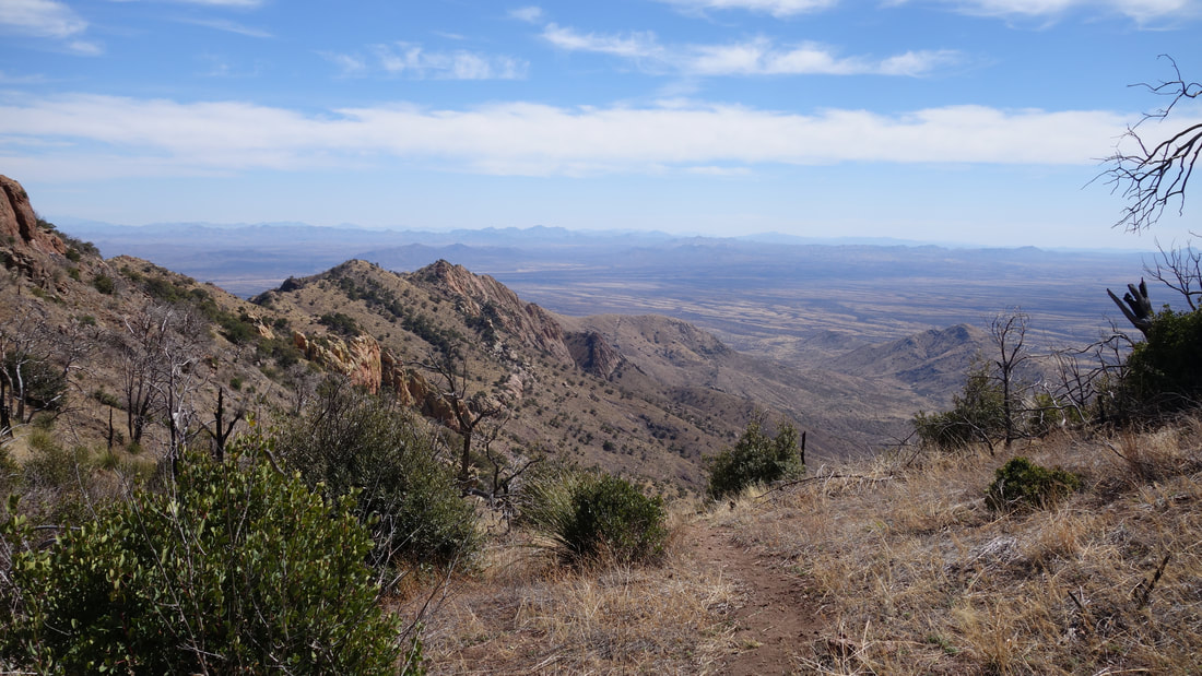
Once we reached the gate, we proceeded through and found the property completely empty. I guess it was still too cold for southern Arizona and the owner was at their winter home in Phoenix. We followed the signed path around the property, and easily located the trail continuing up Thomas Canyon. We had read repots of a ton of razor sharp plants that people had to bushwhack through along this "trail" but we found it very easy to follow with virtually zero bushwhacking. The trail more or less followed the dry creek bed for quite a ways, crossing it a few different times, then began ascending up the west facing slopes to the right side of the dry creek bed. The trail switchbacks a few times ascending steeply, with the final traverse towards the saddle crossing a rocky stretch where the trail is a little less defined. Ascend more or less straight up to the saddle for this final 350 feet. The map below depicts the entire approach and route. As we ascended up the slopes, the huge cliffs of the east face of Baboquivari towered above us beckoning. We located the more difficult SE arete and we contemplated climbing this beautiful line, however given the late start we got and the still short days we opted for the standard Forbes Route.
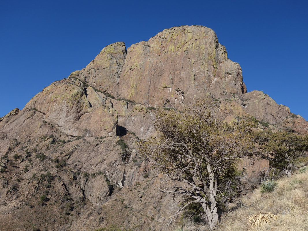
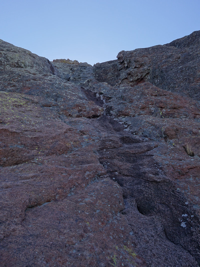
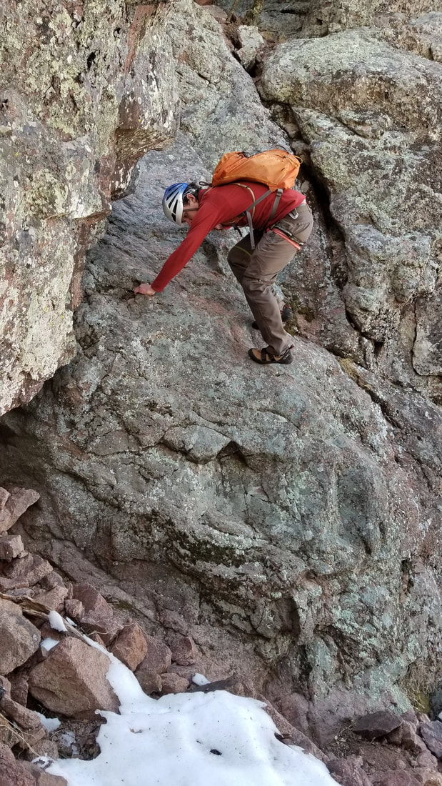
Once we were at the saddle, we took a short break for a snack, and ditched the machete and hedge trimmers, which we carried up in case we needed to bushwhack through thorny bushes, however these were not needed. From the saddle, it was easy to locate the deep notch with the big chimney and overhanging chockstone, so we started left up towards the shady northeast cliff face. We strayed quite close to the base of these cliffs which turned out to be a mistake as we were then forced to bushwhack into thick slide alder type bushes to cut right back towards the fall line below the huge overhang at the bottom of the true north side of the mountain. We wasted about 30 minutes forcing our way laterally through these plants. A better way would have been to traverse horizontally from the saddle instead of going up right away, and enter a loose gully, then turn left and ascend up this gully that leads directly to the massive overhang.
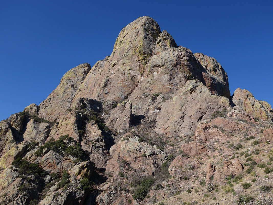
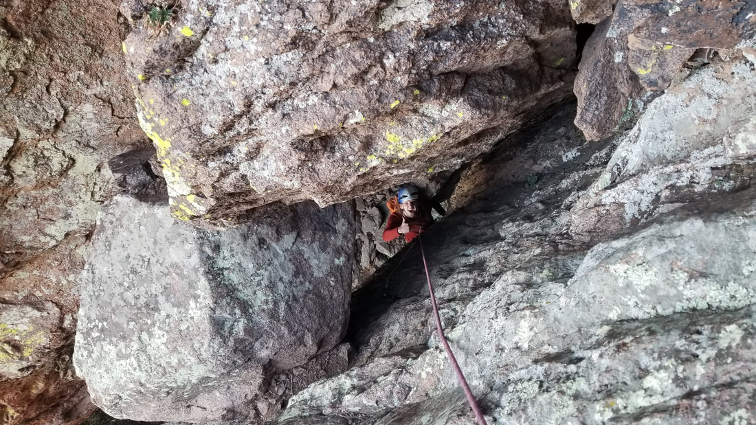
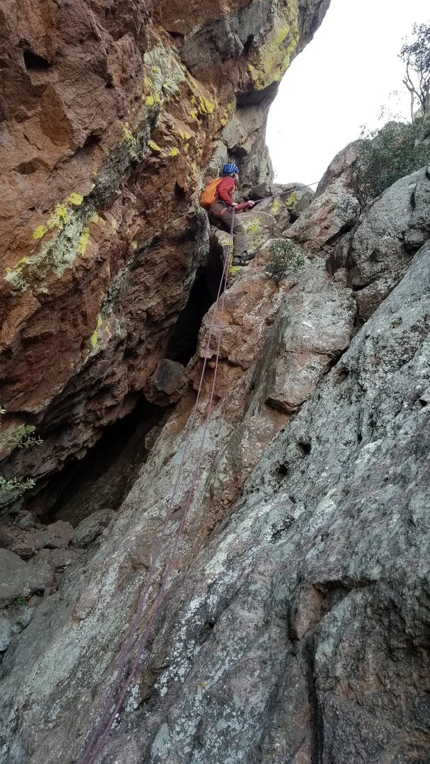
Once at the top of the gully, you will be directly underneath a gigantic chockstone wedged into the deep overhanging chimney. This is the50 foot first pitch so we put our harnesses on here and prepared the rope. I led up the right wall, initially starting directly under the huge chockstone, then climbing around the left side of it, squeezing through the hole and ending on a ledge where a nice bolted anchor was located. The protection was not necessairly plentiful, but there were some holes in the rock for some interesting cam placements. I rated this pitch about 5.4 and since it's shaded it was chilly. Josh followed up and we continued up a few more feet to a very large flat ledge, which we traversed leftward along the base of a clean angled slab. We continued up to the highest point we could walk before starting to climb up this slab. A narrow black water streak is easily spotted here which marks the second pitch.
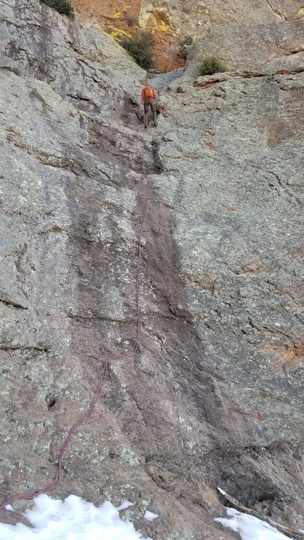
Once at the top of the gully, you will be directly underneath a gigantic chockstone wedged into the deep overhanging chimney. This is the50 foot first pitch so we put our harnesses on here and prepared the rope. I led up the right wall, initially starting directly under the huge chockstone, then climbing around the left side of it, squeezing through the hole and ending on a ledge where a nice bolted anchor was located. The protection was not necessairly plentiful, but there were some holes in the rock for some interesting cam placements. I rated this pitch about 5.4 and since it's shaded it was chilly. Josh followed up and we continued up a few more feet to a very large flat ledge, which we traversed leftward along the base of a clean angled slab. We continued up to the highest point we could walk before starting to climb up this slab. A narrow black water streak is easily spotted here which marks the second pitch.


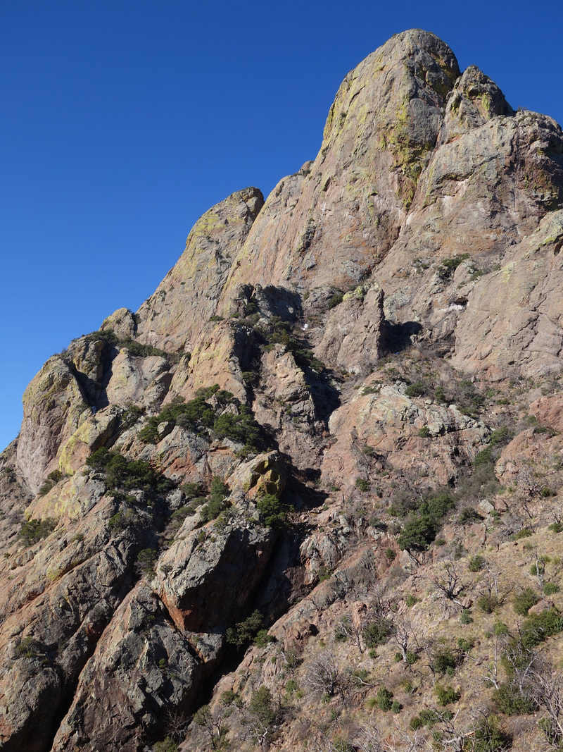

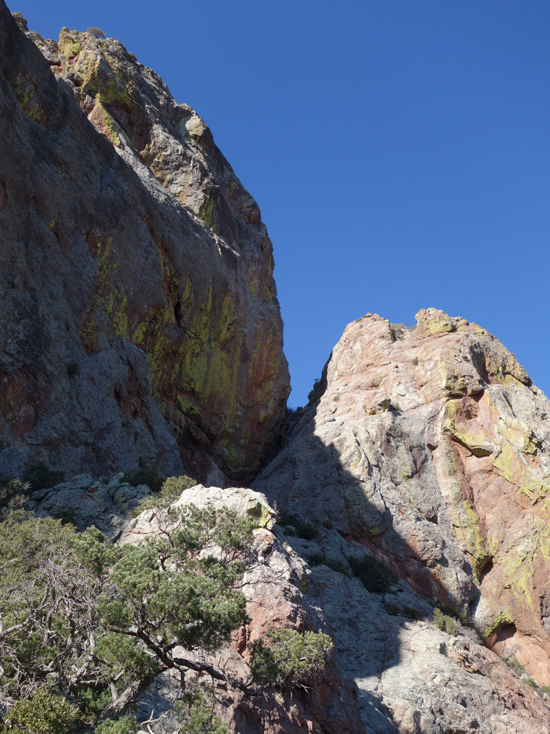
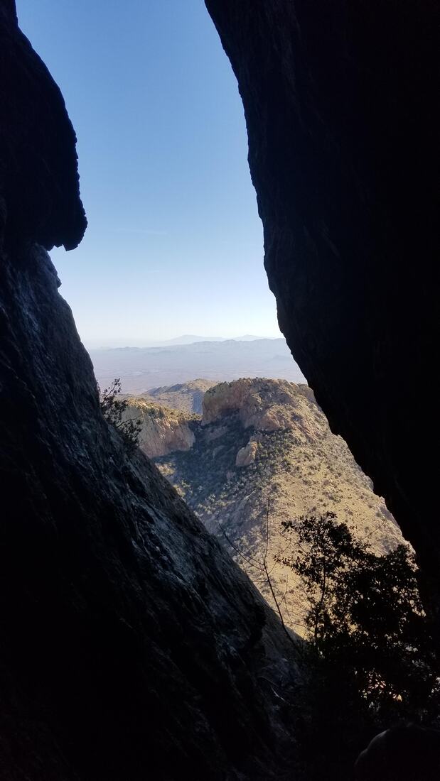
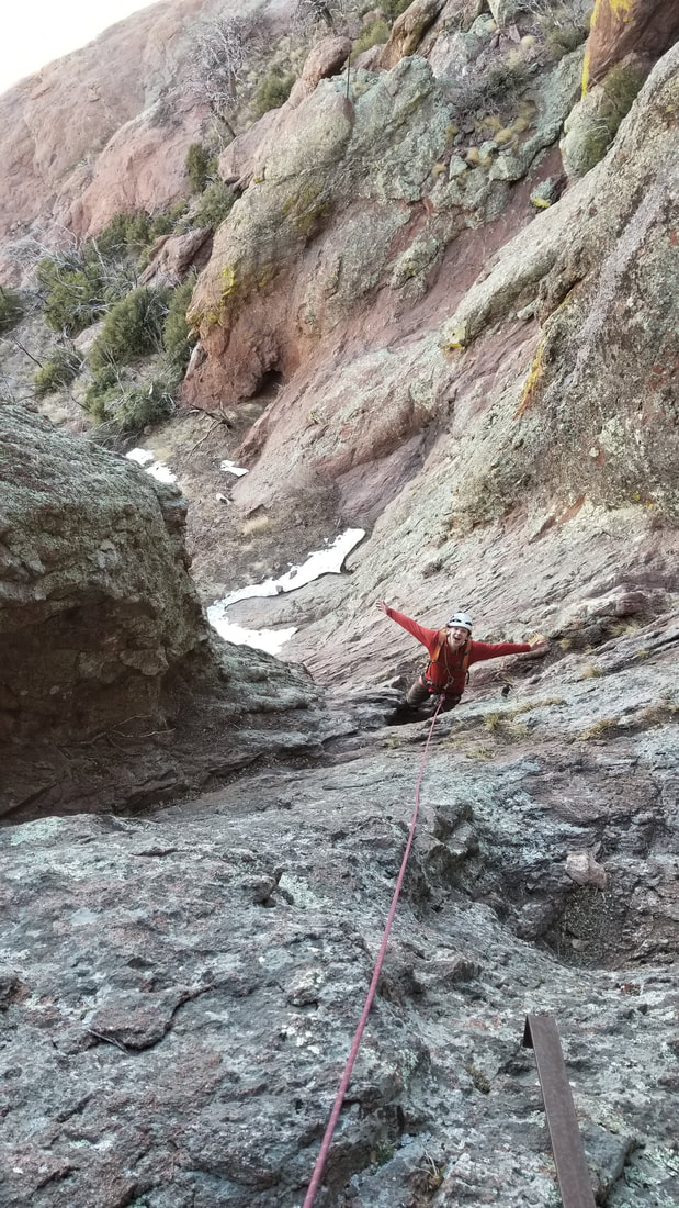
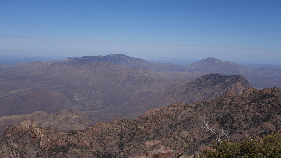
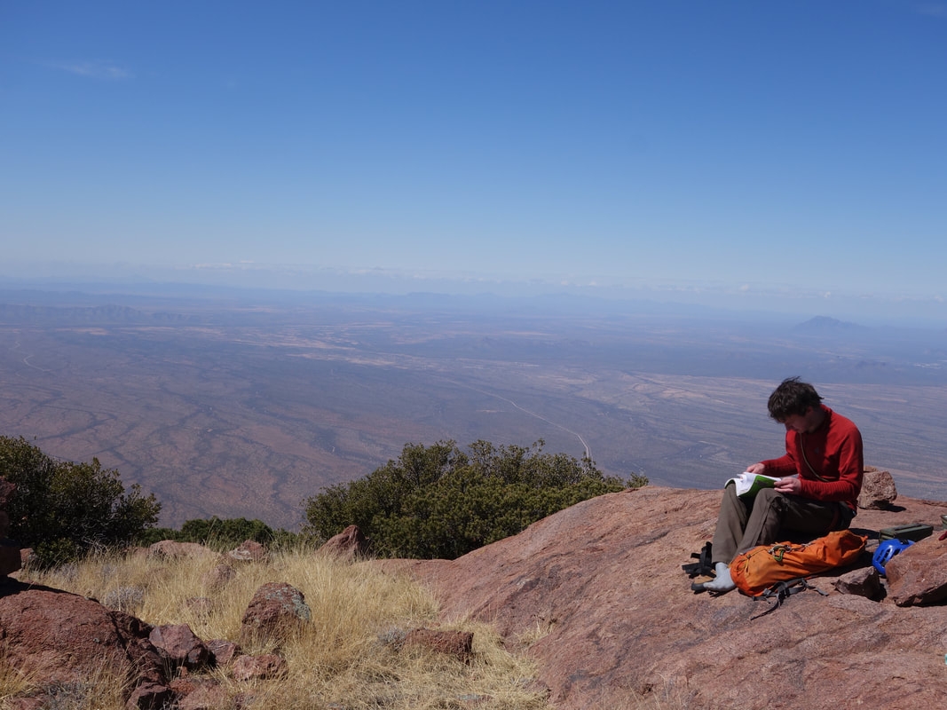
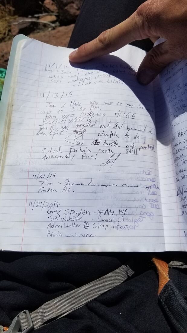
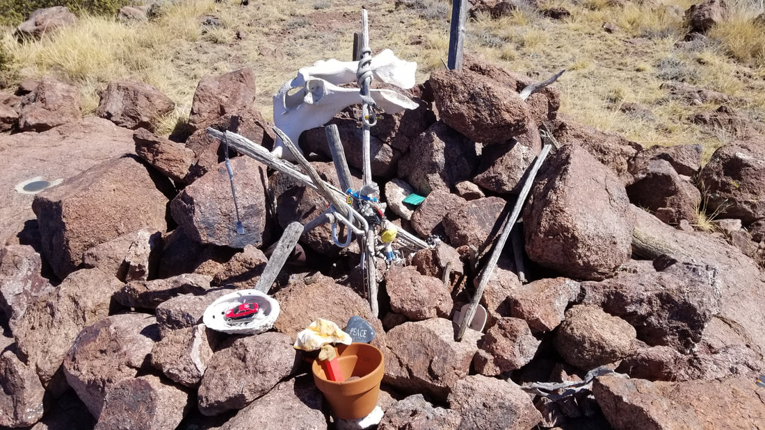
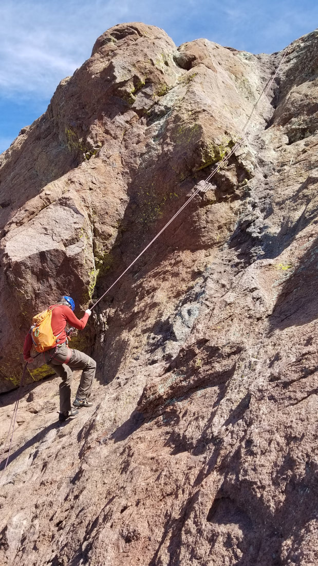
I started up the second pitch which was mainly a lower angle slab with huecos and small ledges that made it easy to climb. After about 30 meters of low 5th class climbing on easy crimps got me to another huge ledge at the base of a vertical cliff. I set an anchor on another pair of bolts most of the way up the slab, right as the angle eased. Had I climbed a little further to the left, closer to the edge of the slab, another set of bolts is available closer to the top of the pitch. This is the anchor to use to rappel the second pitch on the descent, as the bolts further to climbers right are hard to access on descent. Once Josh made it up, we traversed right along the long ledge, then we descended about 50 feet down around the base of a jutting rib and then scrambled up a class 4 step getting to the base of the final pitch. This pitch was a full 30 meters and the crux was the first 15 feet. Pro was sparse, but the climbing was easy. A great bolted anchor was found at the top and I belayed Josh up. The remaining ascent was just a scramble, initially trending up to the right from the top of the third pitch, then cutting back left on a tree covered ledge. We then emerged above the trees and walked the final 150 feet or so to the summit. We were greeted with stunning views of the desert landscape, and a nice summit book dating back nearly 10 years. Some familiar names like Adam and Greg. The summit was scattered with various items that people have left as a token to the gods believed to reside on the summit by the naive groups who live in the area. To the south we could look at the lands in Mexico and to the north the edge of Tucson was barely visible. We looked through the summit logs and added our own singature.
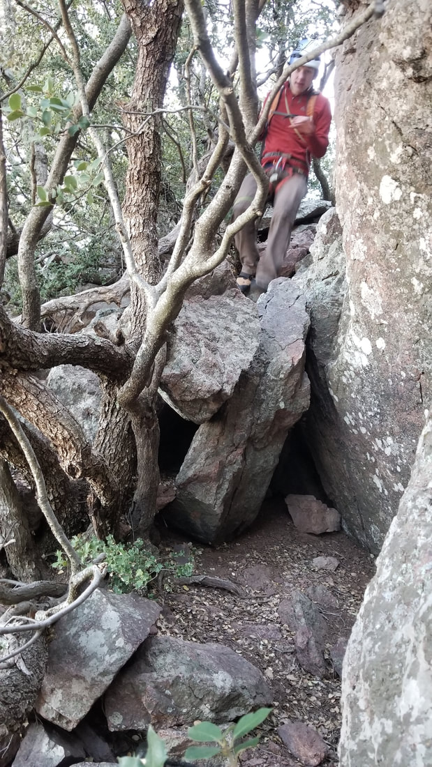


After a while, we started our descent, retracing our route back down doing three single rope rappells down each of the three pitches off bolted anchors. There are two bolted stations near the top of the second pitch, and the better one to use is the one on skiers right, closer to the edge. We returned to the saddle, then followed the trail back to the gate, and the final 2.5 miles to the car. It was a relaxing day up an amazing peak with great views.


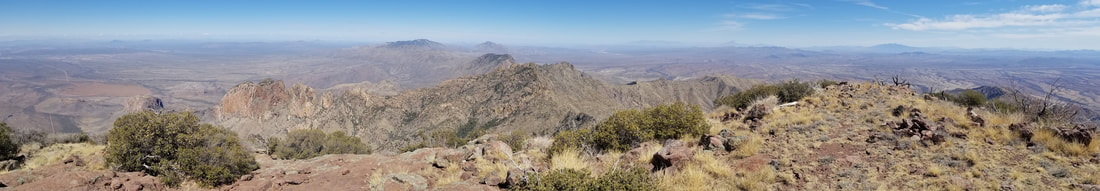
Summit Panorama