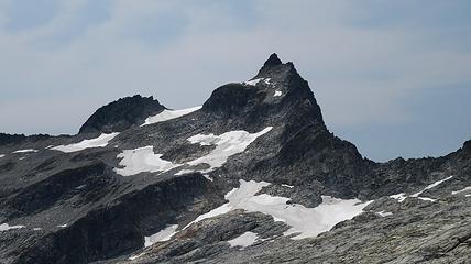
Dorado Needle - 8440' - NW Ridge Class 5.3
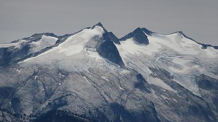
Austera Peak - 8334' - South Face class 4
Primus Peak - 8508' - West Ridge Class 2
August 2015
NOTE: If you haven't seen part 1, 2, and 3 yet, see them here:
Part 1 - Oval Peak and the Gardners
Part 2 - Mesahchie Peak
Part 3 - Spickard, Rahm, Redoubt and Hard Mox
This is the final installment of reports describing our North Cascades Bulger Blast, which we did in place of our originally planned Mount Waddington trip but due to storms dumping feet of snow in the Waddington Range, we opted for this instead.
For the final 3 days of our trip, we were set on doing the Inspiration Traverse, where we would climb Dorado Needle, Austera Peak and Primus Peak. Since Josh and I had already done Klawatti and Eldorado back in 2012, we would bypass those on this trip. This trip was nothing short of crazy.
Day 1
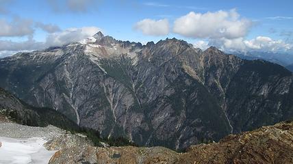
Since we had my car, and John's, the night before we drove my car to the Thunder Creek Trailhead and parked it there. We then piled in John's Jeep and drove all the way to the Eldorado Trailhead where we crashed for the rest of the night. Early in the morning, we started up the steep Eldorado trail. It was already hot though and I knew this was going to be a very hot and humid hike up. Considering the fact we were carrying decent sized packs, we slowly made our way up the steep trail trying to not think of the heat. We spoke with a handful of parties who were returning from Eldorado.
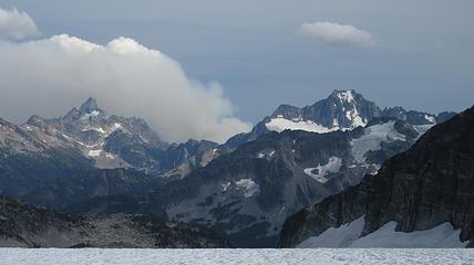
At the small waterfall roughly halfway to the Eldorado Glacier we cooled off and filled our bottles. It was full sunshine the rest of the way. We reached the crossover ridge where views of the Eldorado glacier opened up. It is amazing how much receding has occurred since 2012. We hiked for a long time up the granite slabs before finally reaching the glacier, which seemed like it was a couple hundred feet higher than it was a few years ago. We roped up and continued to where the glacier flattened out, and reached the standard Eldorado camp on the east ridge of Eldorado Peak. Here we saw a couple going for a route on the west face of Eldorado, who we would later run into again in Marblemount!
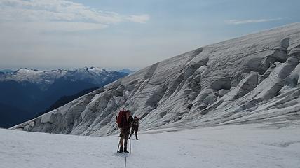
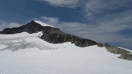
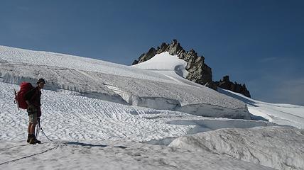
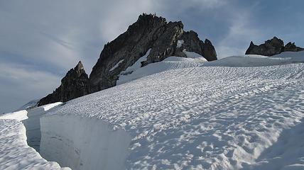
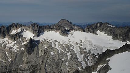
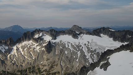
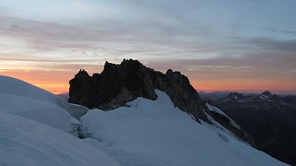
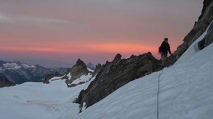
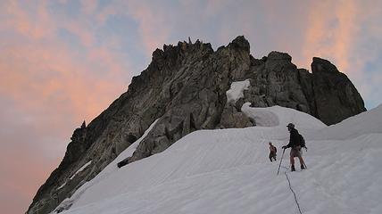
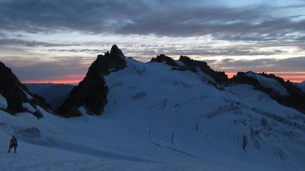
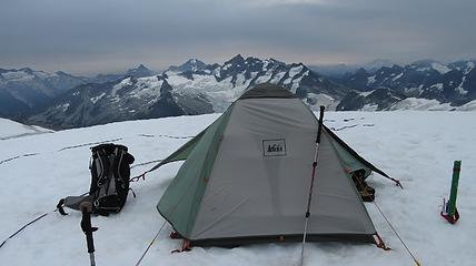
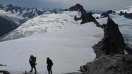
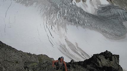
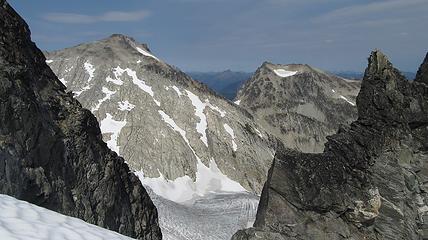
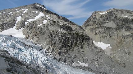
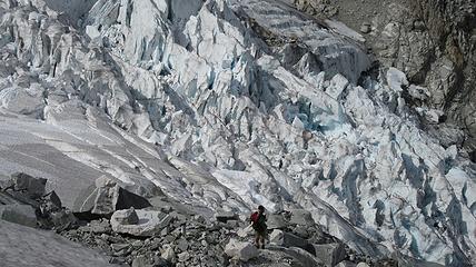
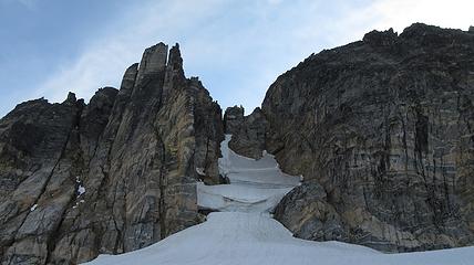
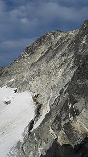
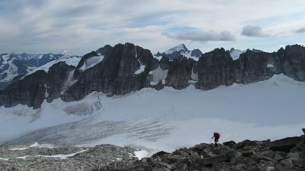
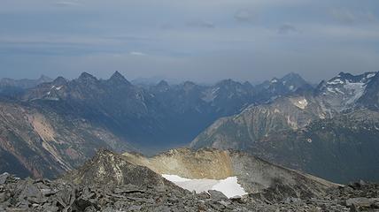
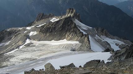
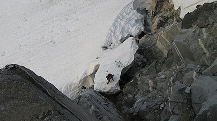
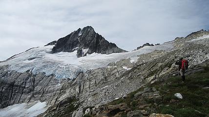
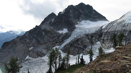
We wasted no time beginning the traverse of the Inspiration Glacier, which had a couple tricky spots where we had to delicately cross over a few large crevasses. I even punched through at one point as did Josh. After careful route finding and weaving our way through the cracks, we reached the 8,000 foot notch in the Tepeh Towers at about 4pm I believe. This notch separates the Inspiration and McAllister glaciers. Here we set up camp and donned our day packs. It was a 400 foot descent over the other side down the McAllister where we then ascended the glacier leading up the NE flank of Dorado Needle. At 8,200 feet the glacier ended and we were forced to navigate a huge moat. After searching for a bit, I located a spot where we could climb over and safely traverse into the moat and get onto a rock ledge. This didn't come without the possibility of a large chunk of ice falling underneath our feet though.
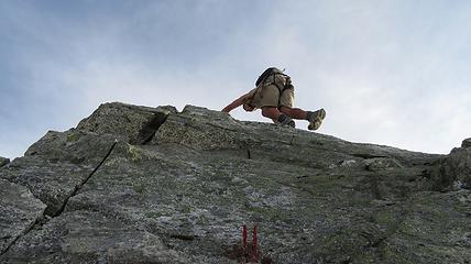
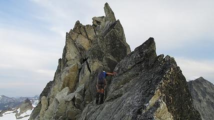
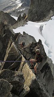
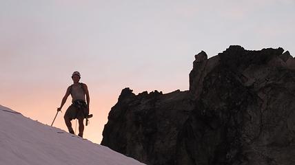
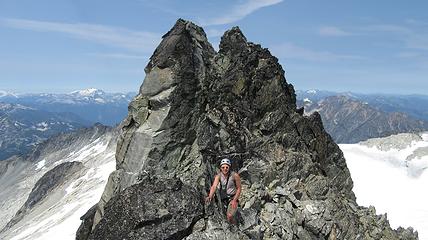
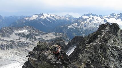
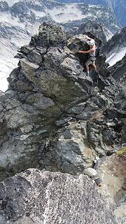
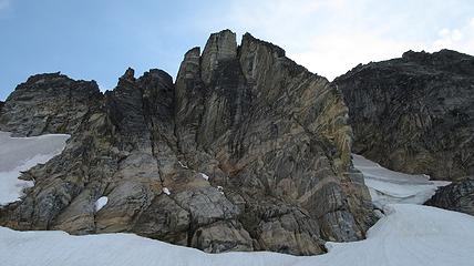
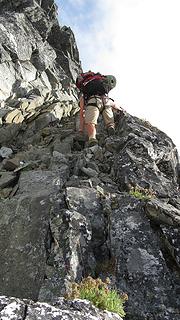
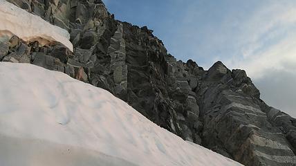
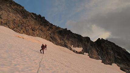
Once on the rock, we began climbing nice solid granite. I led a full 30 meter low 5th class pitch up mostly slabs but with enough cracks to offer good protection. This led me to the NW ridge, at which point we realized the exposure was huge! Our route description simply said follow the ridge over a couple knife edges to the summit. Here we unroped and all soloed the remainder of the ridge to the summit. There were indeed two knife edges to cross which got our adrenaline going!
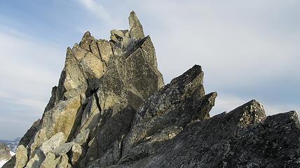
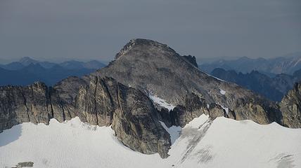
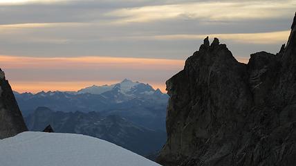
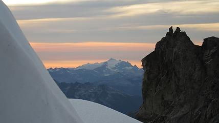
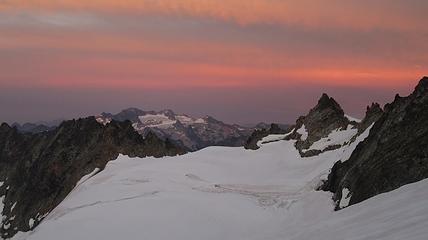
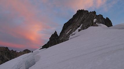
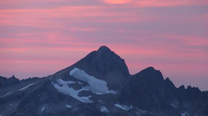
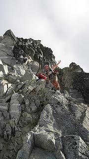
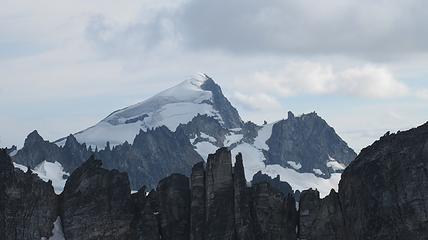
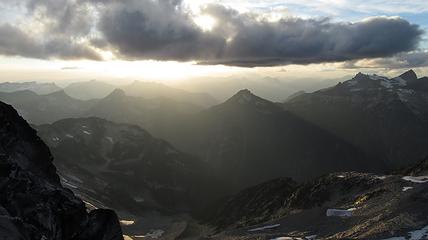
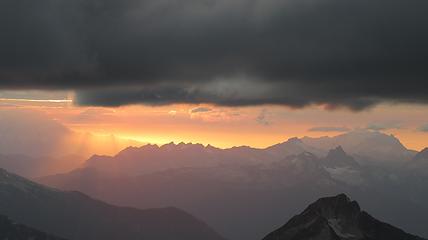
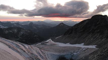
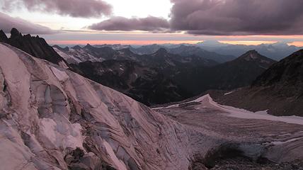
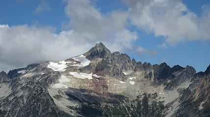
Once on the summit, which was barely big enough for the 3 of us, we saw the west face of Eldorado up close and I remember wondering where the west face route goes. All the North Cascade peaks were visible and the sun was getting low in the sky, offering excellent lighting. After some summit photos, we started down. We made a few rappels to more safely descent, including a swinging rappel to get back across the knife edge ridge. Just as the sun was setting we reached the moat where we grabbed our stashed gear and started down the glacier.
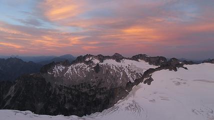
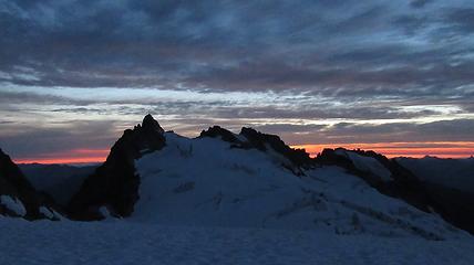
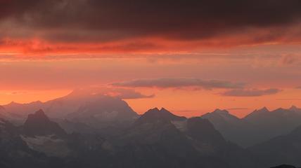
The sunset was incredible...absolutely beautiful and the little bit of smoke enhanced the colors. By the time we made the last 400 foot ascent back to the Tepeh Towers notch it was just getting completely dark, so needless to say we timed it perfectly. Hiking from the parking lot to the summit of Dorado Needle and back to camp is pretty long! After a quick dinner we went to sleep pretty tired.

Day 2
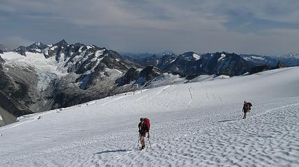
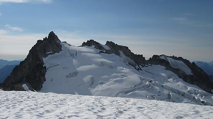
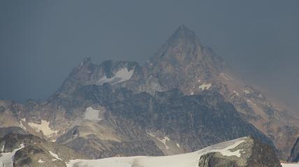
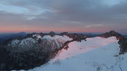
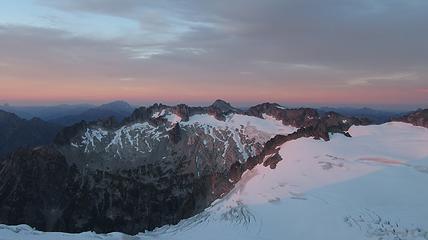
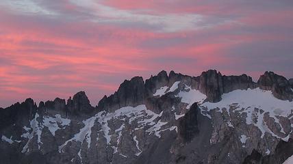
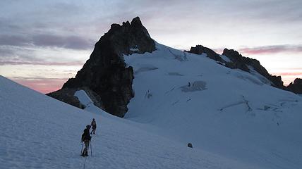
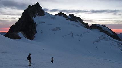
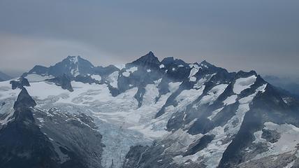
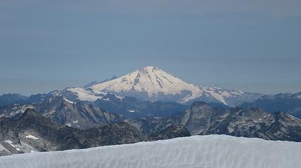
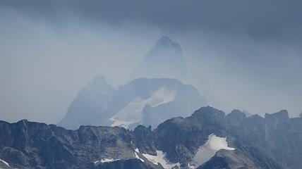
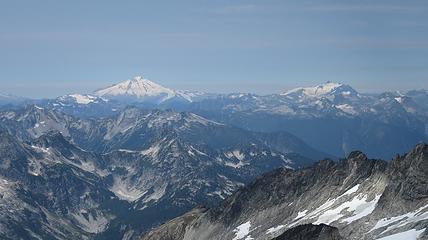
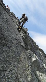
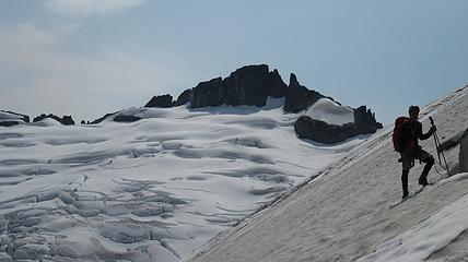
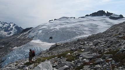
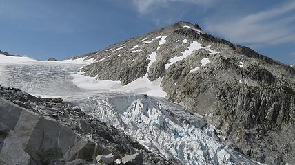
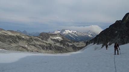
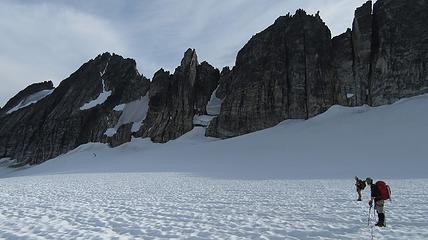
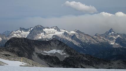
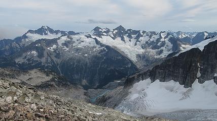
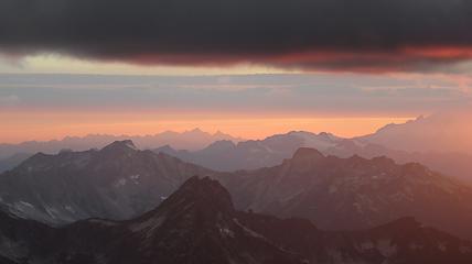
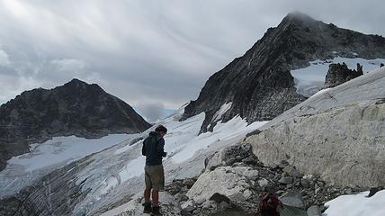
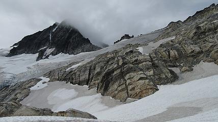
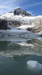
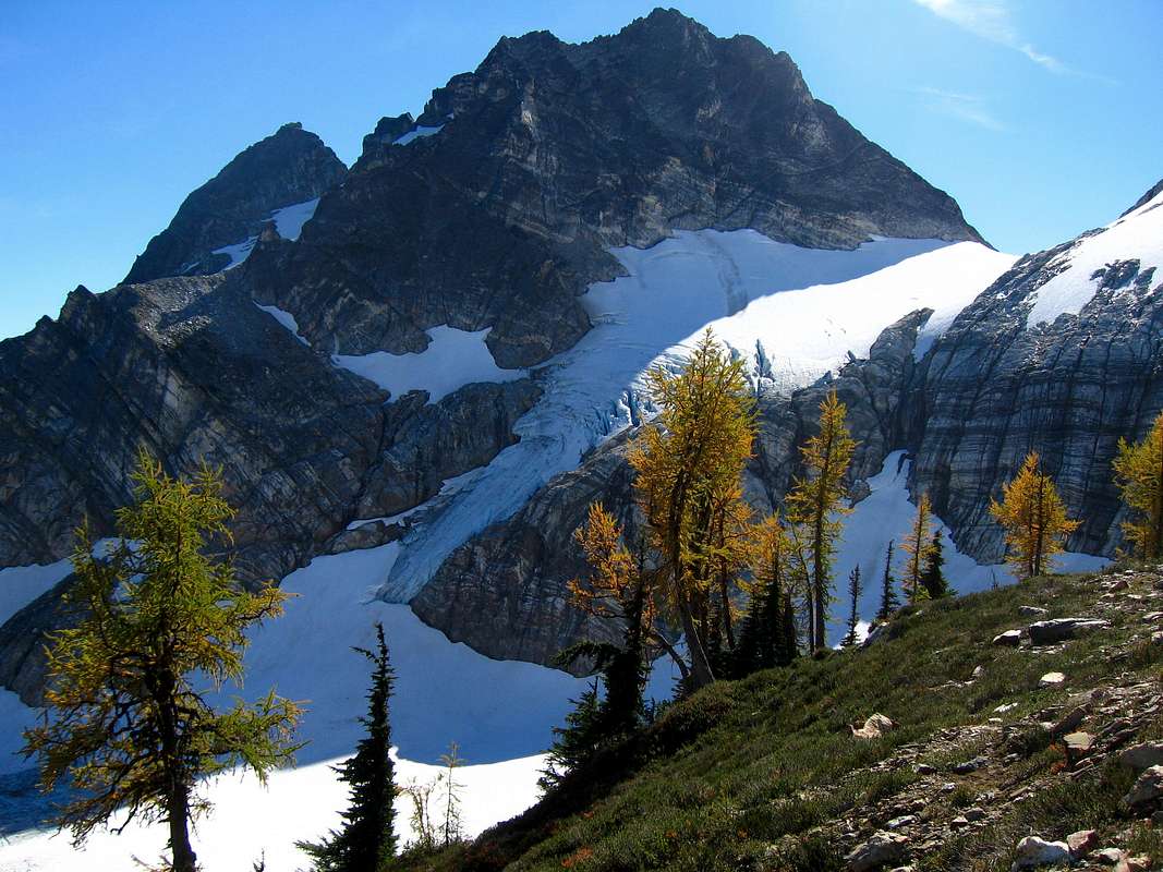
The next morning, we awoke to breezy conditions and since I didn't notice the sun hitting the tent, I looked out and saw very dense smoke covering the landscape with eerie looking grey layers! It was one of the strangest sights I've seen for sure. Forbidden Peak was hiding behind a mask of multiple layers of smoke and Mount Goode was hiding under a dark grey doomsday looking cloud. The wind was coming out of the west though so we figured we would be ok. I wasn't too keen on breathing thick smoke all day. We packed up camp and continued the traverse across the Inspiration Glacier to Klawatti Col, where Josh and I commented how awesome our last visit to Klawatti Col was. This time around it looked a lot different! There was much less snow this time around and much more crevasses were opened up. We took a short break at the col and I reviewed the routes on Klawatti. The SW face route, although class 4 according to Beckey just looks to be getting harder and harder as the glaciers melt.
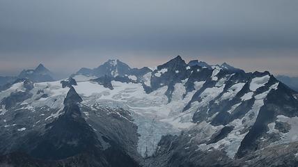

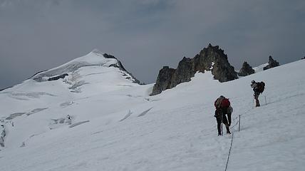
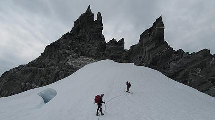
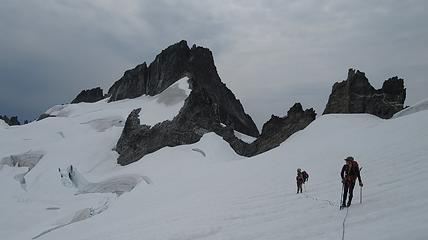

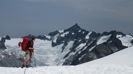
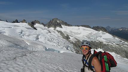
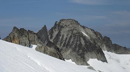
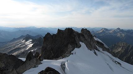
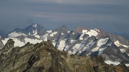
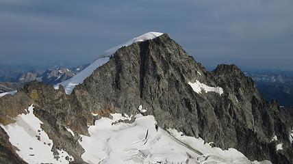
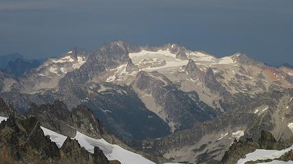
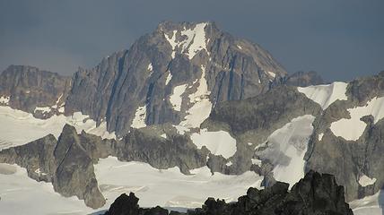
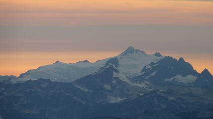
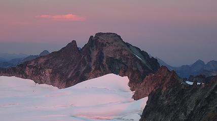
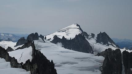
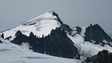
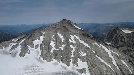
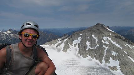
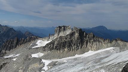
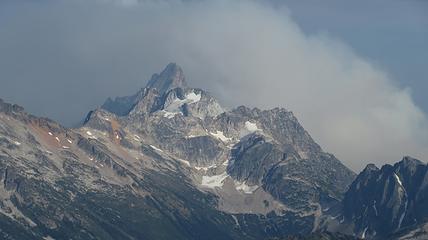
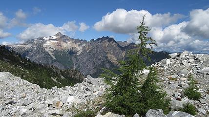
We then traversed a short ways to the north ridge of Klawatti and crossed over, which required a small rappel to reach the Klawatti Glacier. We then continued traversing north along the Klawatti Glacier towards Austera Peak trying to stay around 7,700 feet. In no time, we reached the east ridge of Austera where the Klawatti Glacier ended on a rugged ridge. We ascended 400 more feet to the top of the snow. From there it was a short scramble to the false summit, which we decided to avoid the chockstone gully and traverse right and up the east side of the false summit. We then made an exposed 4th class down climb to the tiny notch between the false and true summits, where the chockstone gully ends at. From here it was an exposed 25 foot climb up a 75 degree slab, however the holds were plentiful so we all were comfortable soloing it. We reached the summit around noon and were in awe at where we were. Austera Peak really is very, very far from any roads or trails! We saw absolutely no evidence of humanity whatsoever. Views of Primus Peak, with its relatively gentle south side inspired confidence that we were headed to easier terrain but I knew that despite the easy appearance of Primus Peak, it is a hard one to get around. We were in a land completely surrounded by huge glaciers perched atop a rock spire that was carved out and left behind by these glaciers. Such an awesome place to be!
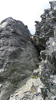
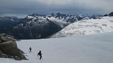
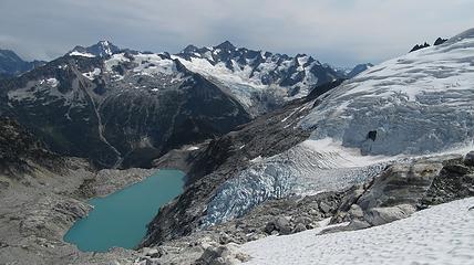
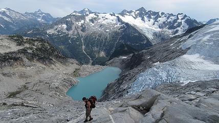
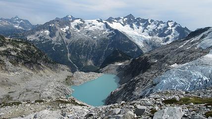
We all safely rappelled Austera Peak in 2 raps. We decided to just use the anchors already in place at the top of the chockstone gully rather than re-ascent the false summit. We quickly reached the snow again and began the 1,200 foot descent down the snow along the east ridge of Austera. Since the north side of this ridge drops so abruptly, people are forced to go around the ridge all the way at the 6,900 foot contour. We ended up on some slabs as we traversed around the base of the ridge, at which point the emerald green Klawatti Lake came into view below us to the SE.
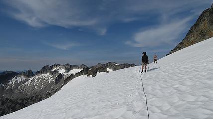
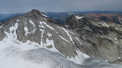
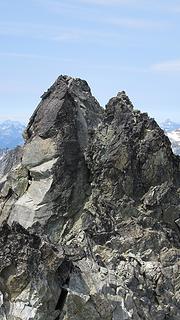
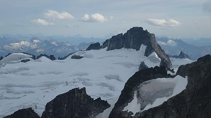
Once we got to the north side of the ridge, we entered a huge bowl being carved out by the North Klawatti Glacier. I stayed high and traversed the slabs until I reached the glacier. Josh ended up going lower but we all met at the same place to rope up once again. We stayed on the southern edge of the N Klawatti Glacier to keep as far away from the large icefall as possible. There were still a couple large crevasses that we crossed with less than desirable snow bridges. Once we reached a point where we were directly below the summit of Austera (which was really hard to determine actually), the glacier eased up. From here we made a bee line to the north across the flat glacier aiming for the 7,760 foot notch in the west ridge of Primus.
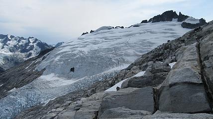
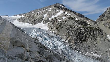
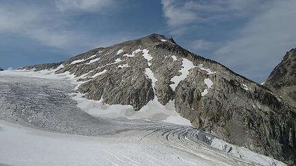
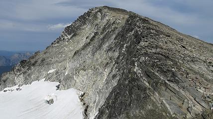
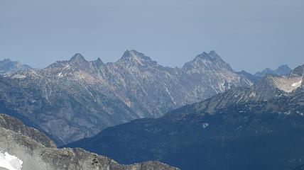
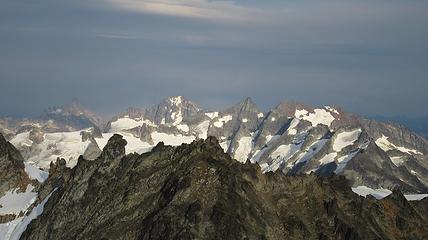
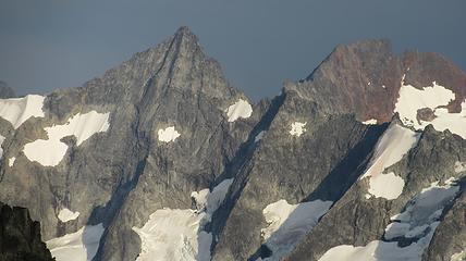
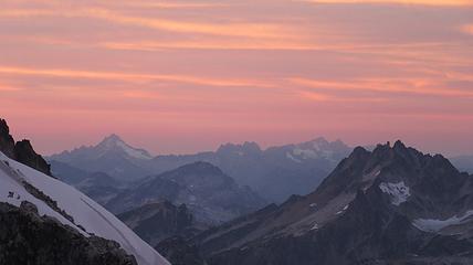
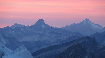
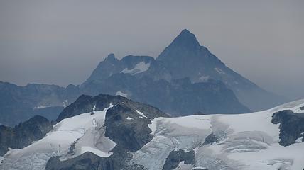
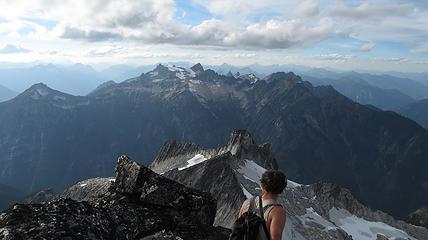
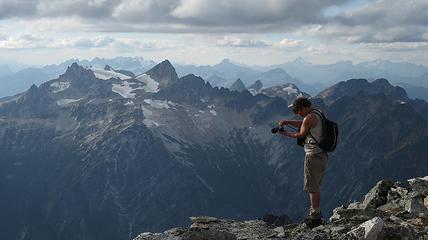
From this notch it was an easy hike up the gentle west ridge to the summit of Primus Peak. We left our packs at a second, smaller notch a few hundred feet higher, where I had heard of a route down onto the unnamed glacier on the NW side of Primus Peak. At the top, we had more awesome views of the North Cascades including Mount Logan, Ragged Ridge and the entire Inspiration Traverse we had done so far.
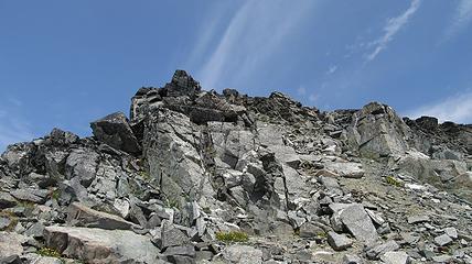
We explored a little and descended the north ridge a few feet so I could get a glimple of Borelis Lake below the NE side of the peak, but since it was getting late in the day, we didn't stay long and returned to our packs. As we started down 8,160 feet where we left the packs, we soon realized this 200 foot descent to the small glacier below was not going to go easily. The first bit wasn't so bad, which consisted of a nice ledge traverse (although very loose) to the top of a steep gully, with a dozen or so large rocks wedged in at the top. It was only 50 feet or so down to the snow but it was 75-80 degree hard pan dirt in the gully, and all other potential scramble routes did not go.
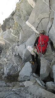
I was forced to look for a rappel anchor, however the only horn I found (right next to the steep gully above steep slabs) would not hold a sling. Since it was getting late and I had already wasted a half hour looking for an anchor, I held the sling in the horn while Josh rappelled. Knowing there was no way this would hold due to the amount of force I had to employ while Josh weighted it, I reluctantly hopped over the top of the gully testing each of the refrigerator sized boulders that all appeared to want to fall at any second. Josh went to a safe spot near the moat and I kicked all the rocks to test them, then gingerly stepped on the first one. Luckily it held and they all were wedged against one another quite well. One of the boulders had a huge horn on it that made an excellent anchor...so long as the rock held.
I threw a sling up and John went down next. Before I went I made sure they both started to cross the moat and get onto the snow. I quickly rapped the 50 feet and followed them across the most as fast as I could. There were rocks flying everywhere as I pulled the rope (that gully was heinous!) We then realized the snow finger we were all standing on was very sketchy. It wasn't held up by much despite being the size of a semi truck and had it broke would have tumbled into the very wide moat. Now that I think about it, had that snow finger not been there, there was no way we could have crossed the moat and this route would have been a no go.
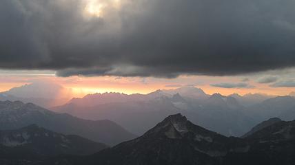
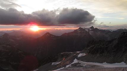
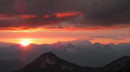
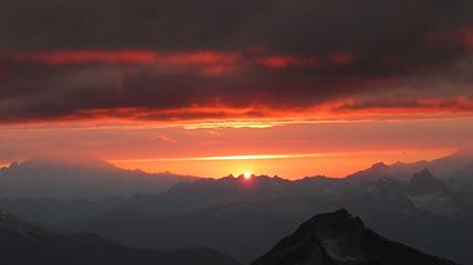
Finally, at just under 8,000 feet, we reached the small glacier where it was a short jog down to the 7,500 foot notch in the north ridge of Primus Peak where I had been back in October 2012 on my last Primus attempt. At this point we were awarded another fantastic sunset and in between taking lots of photos, I started thinking of places we would be able to camp because I knew we would not make it to the bivy site by Borelis Lake.
Fun fact: There was LESS snow on this trip (August 2015) than there was in October 2012 especially on the descent from this notch to Borelis Lake.
Just as it got dark, we got around all the bullet ice on the east side of Point 7,720, which was all soft snow back in October 2012! We found a small flat area among the talus fields at 7,300 feet that was big enough for our two tents. After almost an hour throwing rocks down to make it sleep-able, we put up the tents and had an awesome tasting dinner. Even though we didn't quite make it to Borelis Lake, I knew the worst was over and I could easily get us back from this point. It was a peaceful night, sans a huge icefall in the Borelis Glacier below and off to the south of us that tumbled down the slabs towards Borelis Lake.
Day 3
The next morning we slept in a little and wasted no time starting the hike down to Borelis Lake. I had fun comparing the area to what I saw back in 2012. This time around, the larches weren't golden and the air not as clear but it was still beautiful.
NOTE: To see the trip report of my Primus attempt in October 2012, click HERE
We reached the shore of the emerald lake around 10am and passed by the nice bivy site I used the last time. Just moments later, we reached treeline and started down the long and steep lower north ridge of Tricouni Peak. Since I had been here before, I knew how to not get us lost haha. We made it to the McAllister Creek camp in one piece, but not after drowning in pine needles, which I would find in my pack months later.
The bridge over Thunder Creek was thankfully still there and the 8 mile hike out was uneventful. Getting to my car was a nice feeling, especially since we had completed what we set out to do! I then drove us back to the Eldorado TH and dropped John off, where we went separate ways. I finally went back to the peoples republic of Seattle and dropped Josh off and returned home to my parents house for a visit. Our 2 week North Cascade Bulger Blast 2015 was complete! This is a series of trips I will never forget...just like the one Josh and I did in August 2012 where I first climbed Eldorado and Klawatti, which was my first ever visit to the N Cascades.

Inspiration Traverse Map South Side
|
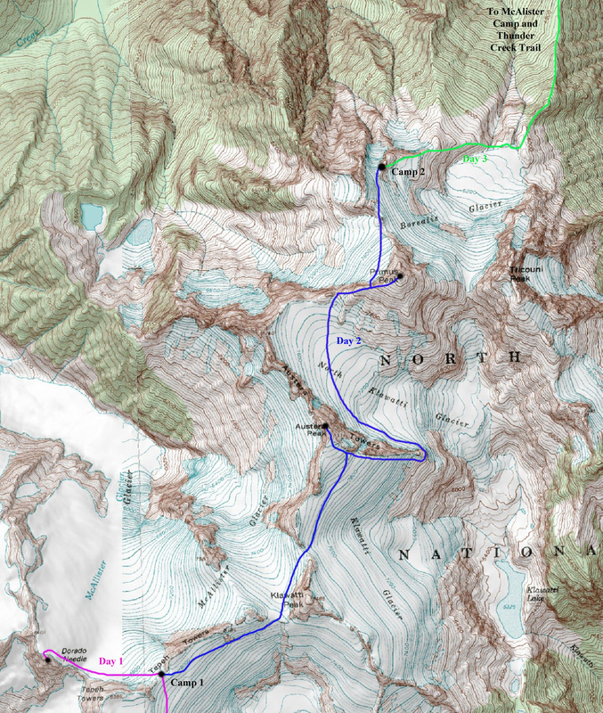
Inspiration Traverse Map North Side
|
Lucky Pass Photo Comparison
The first one was taken in October 2012, when I hiked up that steep ridge separating Thunder and McAllister creeks but was forced to turn around on the north ridge of Primus 500 feet shy of the summit as the terrain became too difficult for me to solo at the time.
The second photo was taken in August 2015...almost two months earlier in the season...during our Inspiration Traverse trip. The difference in snow/ice on the route to Lucky Pass is stark. Even Borelis Lake was still partly covered in ice in October 2012, which wasn't the case at all in August last year.
Tricouni Peak and Lucky Pass October 2012
|

Tricouni Peak and Lucky Pass August 2015
|