Cashmere Mountain - 8501' - North slopes Class 3
April 2015
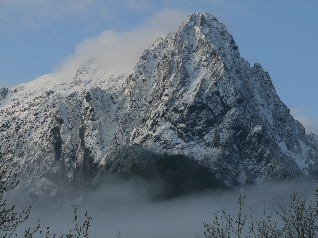
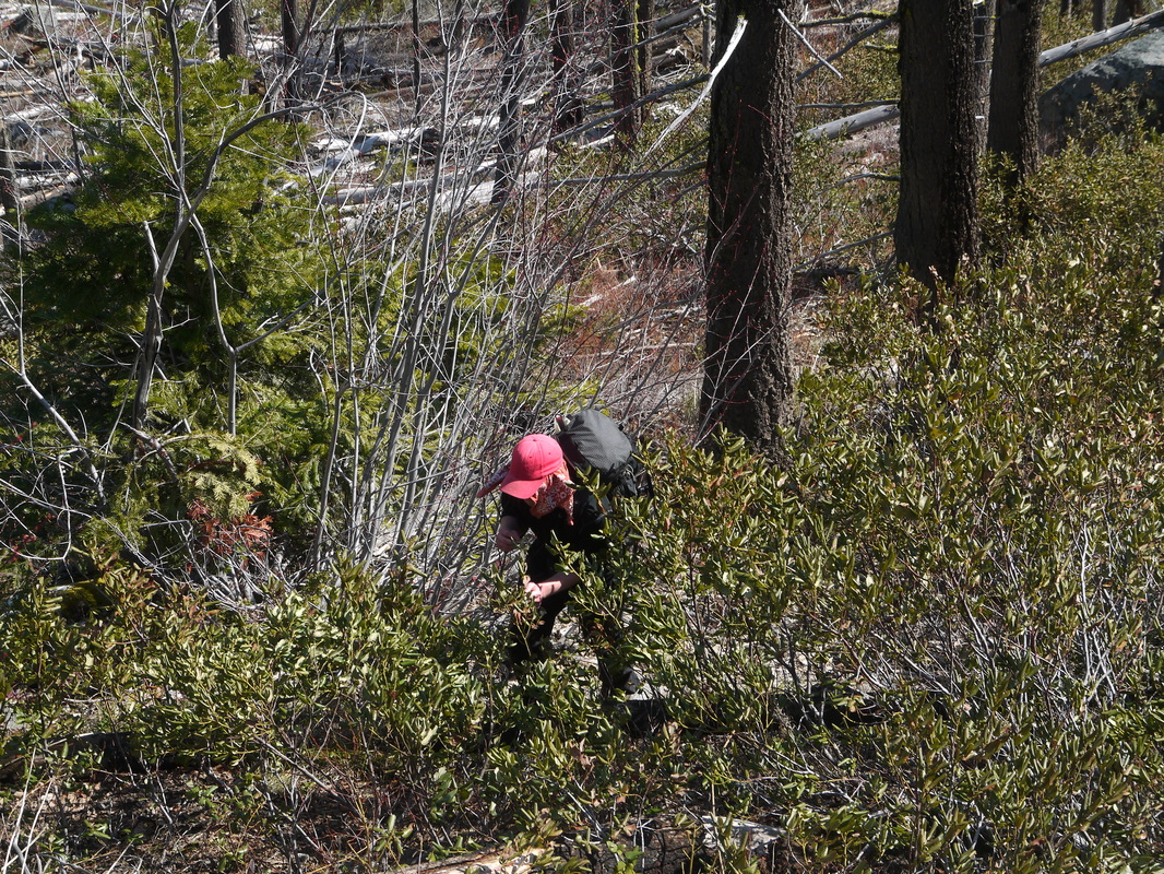
Josh, Mike and I did this climb in one long day from the Icicle Creek Road, actually ascending the Lake Victoria Route. Since it was early spring, Eightmile Creek Road was still gated when we arrived early in the morning. We ran into a decent amount of snow but the weather was incredible and the views breathtaking. The drive to Leavenworth was uneventful, and I parked at the closed gate blocking vehicle access to the dirt road that runs parallel to Icicle Creek opposite the Icicle Creek Road. This spot if found a few miles past Eightmile Creek Road where a bridge crosses the Creek and leads to three dirt roads, all gated, that take property owners to their stoops. We started hiking east paralleling Icicle Creek. As soon as I determined we hiked far enough up the road (which was technically private property), we started hiking straight up the steep, bushy slopes towards Lake Victoria. It was a slow, meager hike through down logs, thick bushes and the hot sunshine. Views of the Icicle Creek Valley slowly opened up though, and when we reached 5,700 feet (3,000 feet above where we left the road), we found ourselves on a broad ridge to the north of the outlet stream draining Lake Victoria.
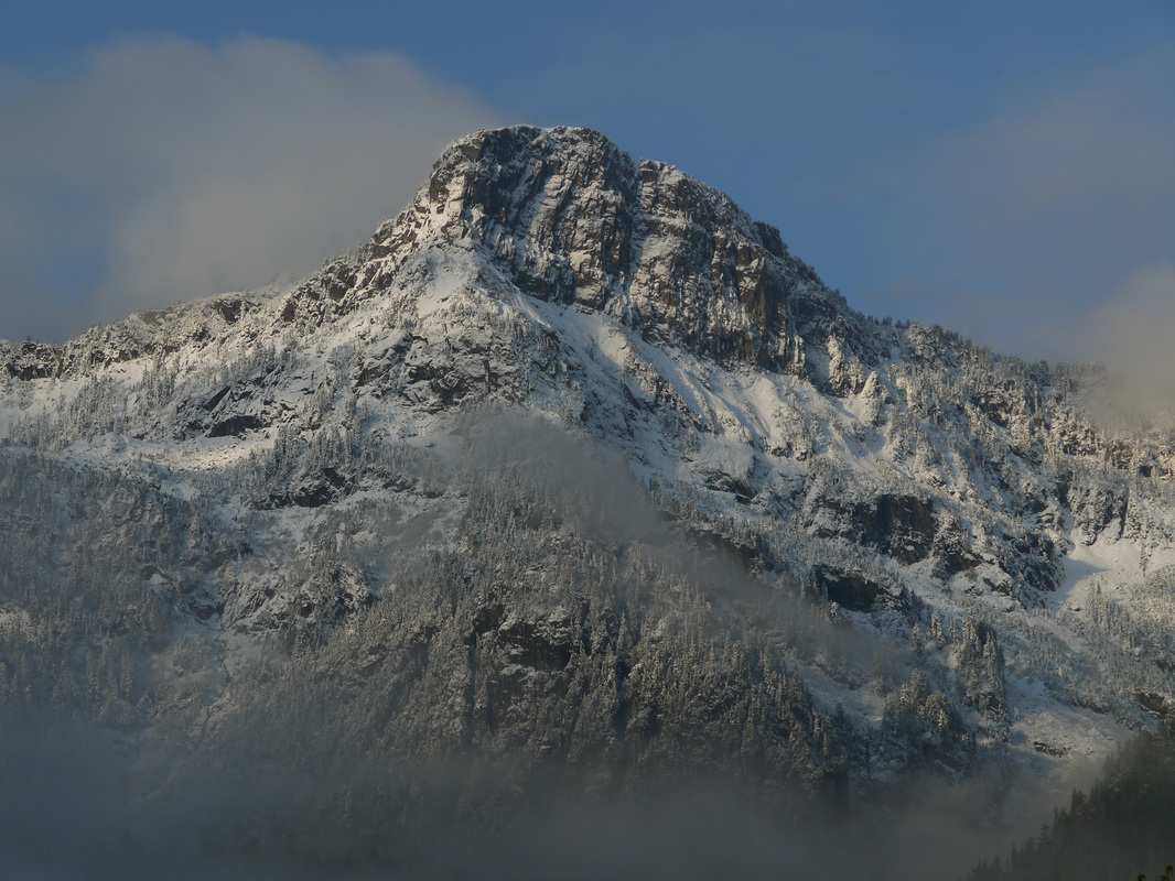
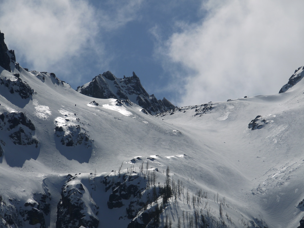
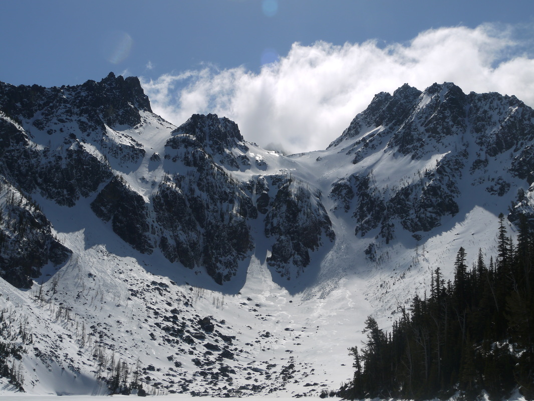
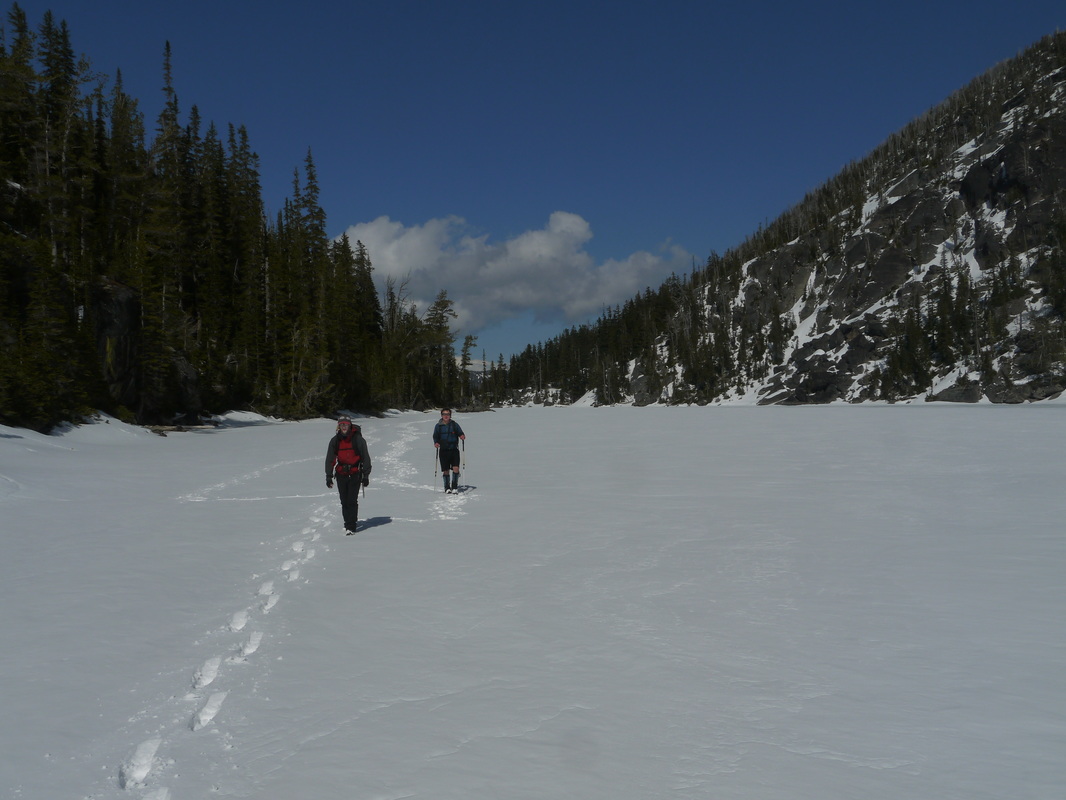
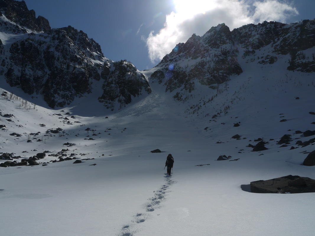
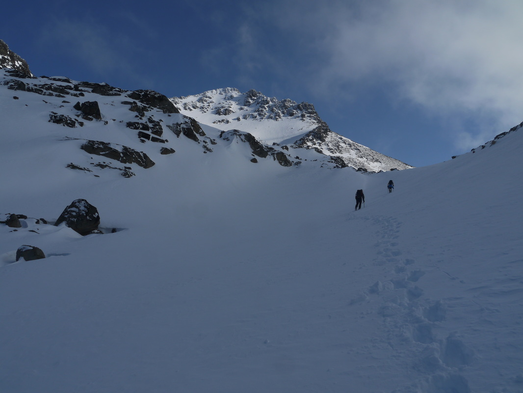
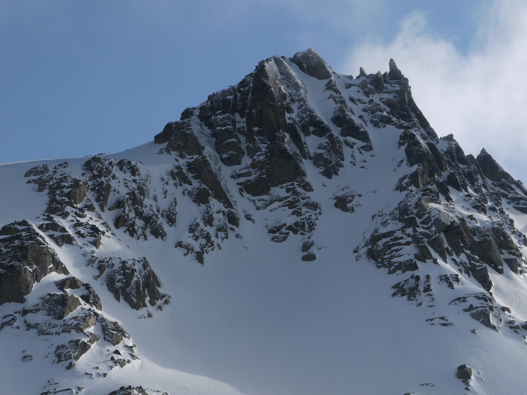
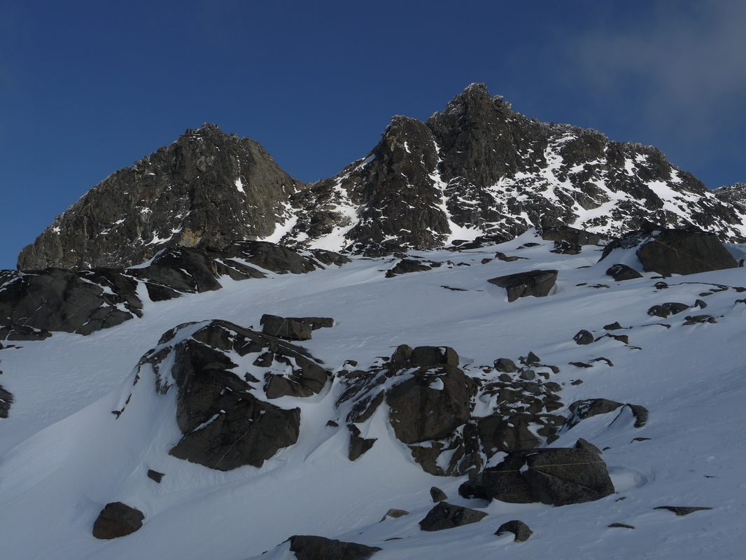
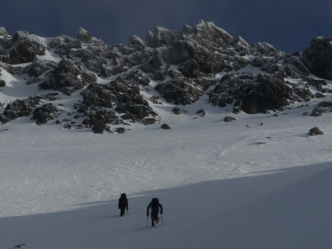
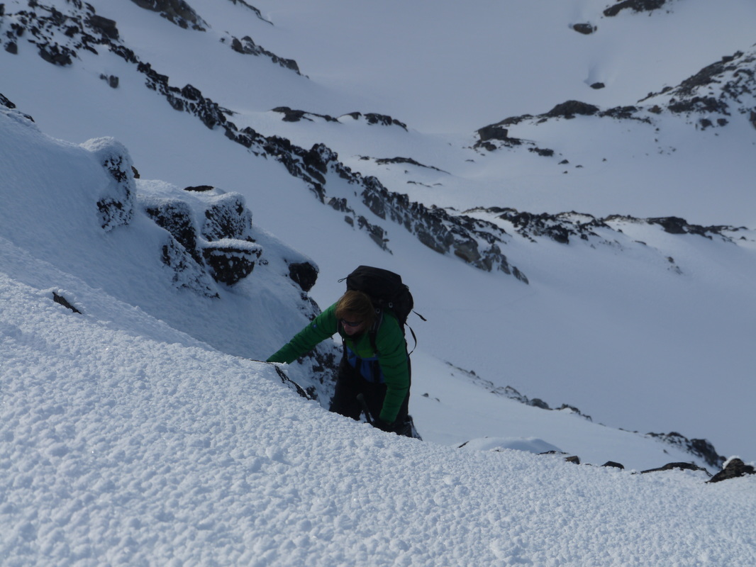
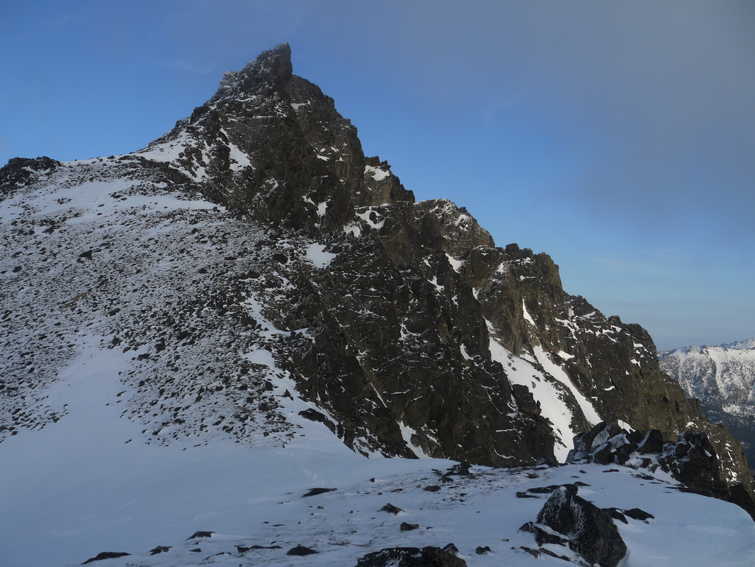
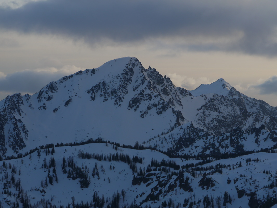
We made a sidehill traverse into the basin where we then entered more old growth forest. Here the snow began and we hiked through the trees and up to Lake Victoria. The lake was completely frozen over and still snow covered. Only the edges were beginning to thaw out. We hiked across the frozen lake aiming for the large gully leading steeply up to the SSW into the basin NW of Cashmere. This 1,500 foot ascent included hiking up steep, somewhat firm snow with only my microspikes. Josh and Mike had their crampons though. At about 7,100 feet we entered the upper basin at which point we saw the final ascent towards the summit. It involved traversing to the SE and ascending directly up the gully on the north side of the mountain. It was beginning to get late and I questioned if we would have time to finish. I knew we still had a long ways to go as we needed to exit via Lake Caroline and out the Eightmile Creek Trail.
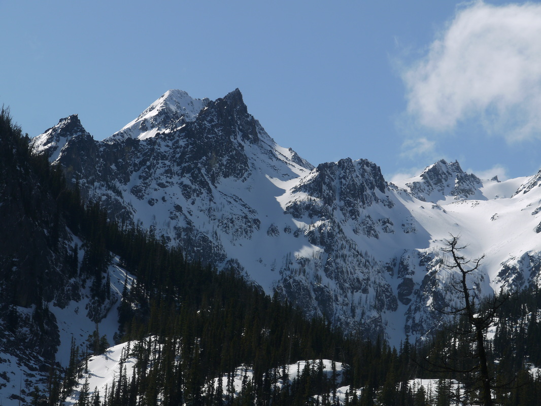
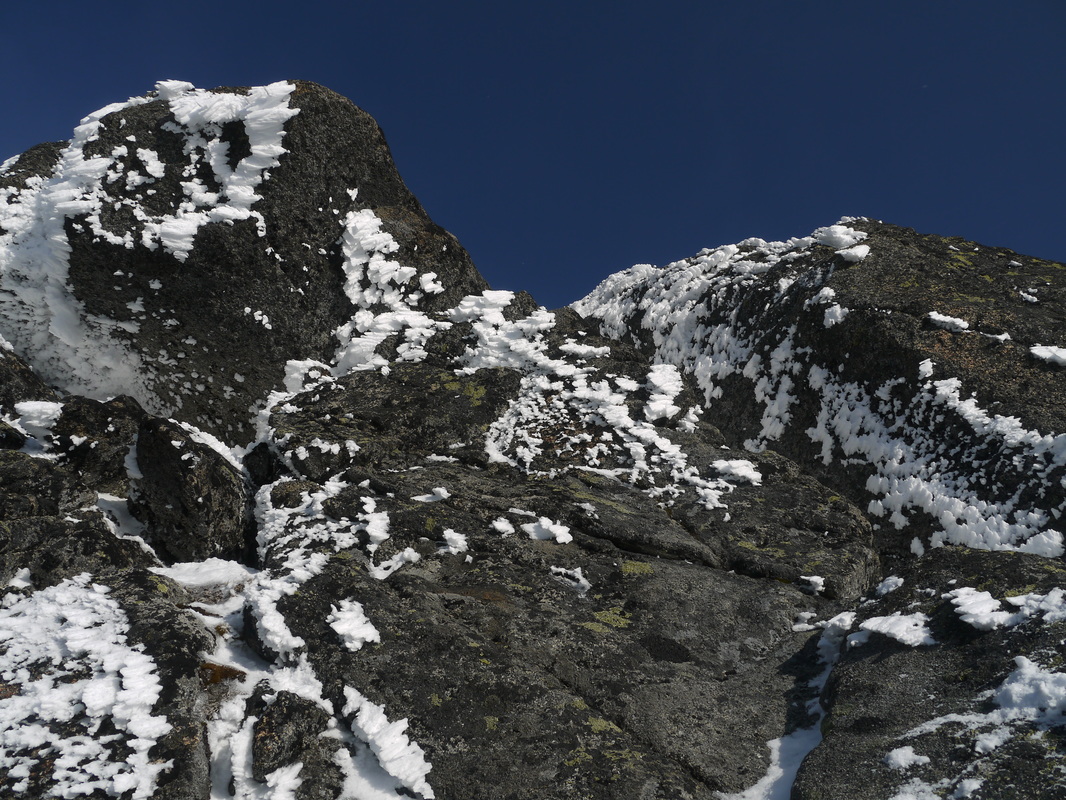
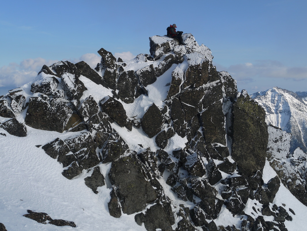
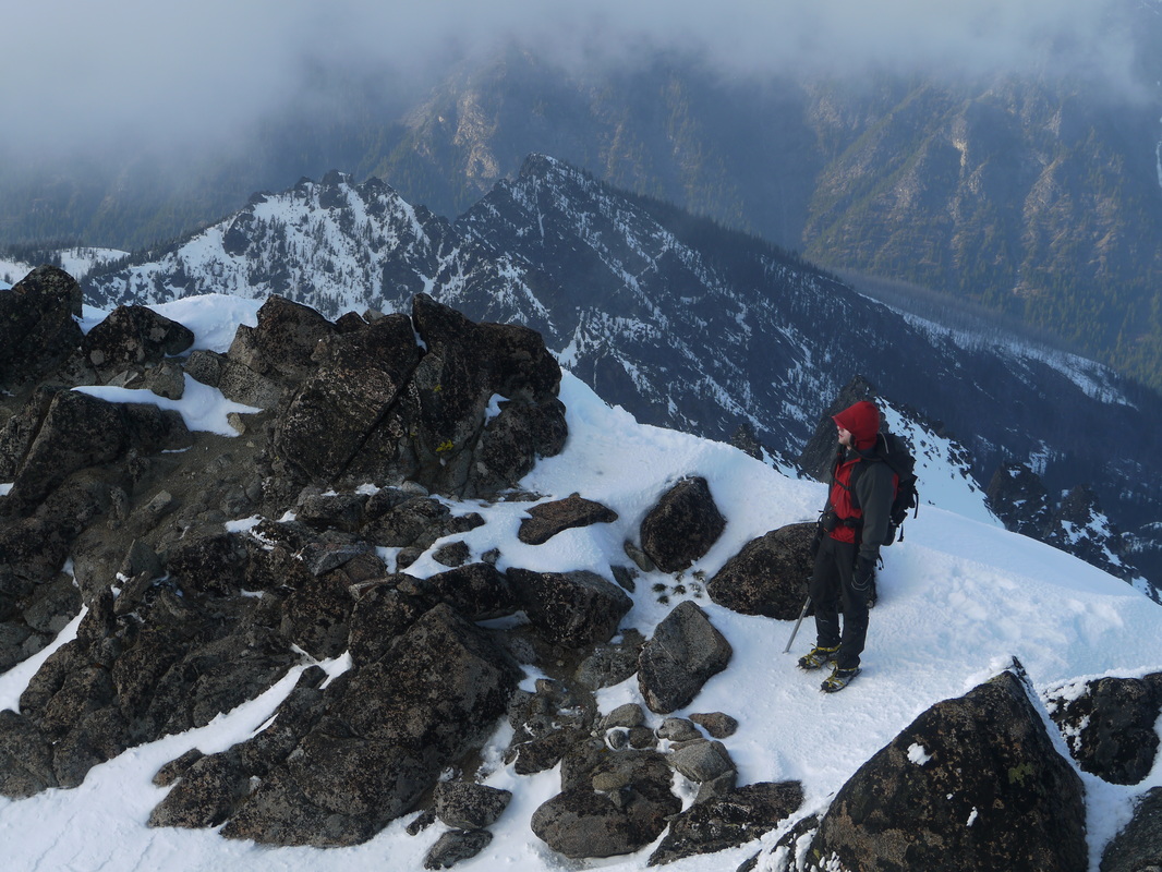
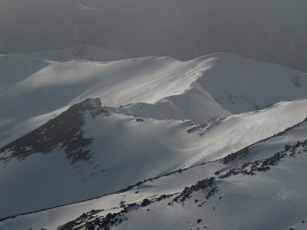
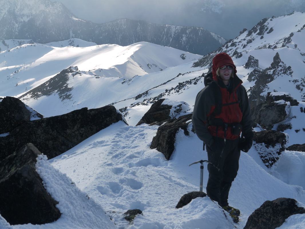
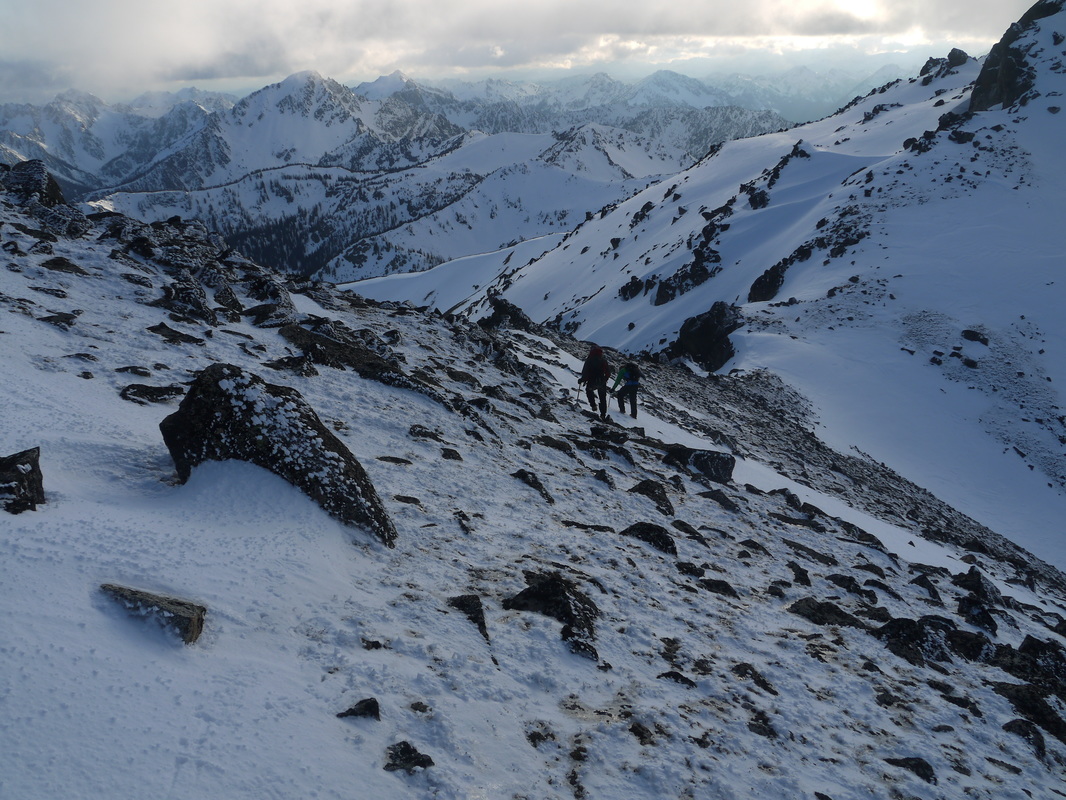
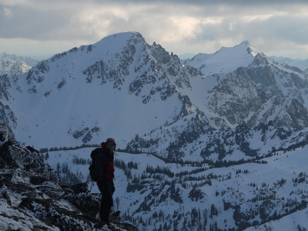
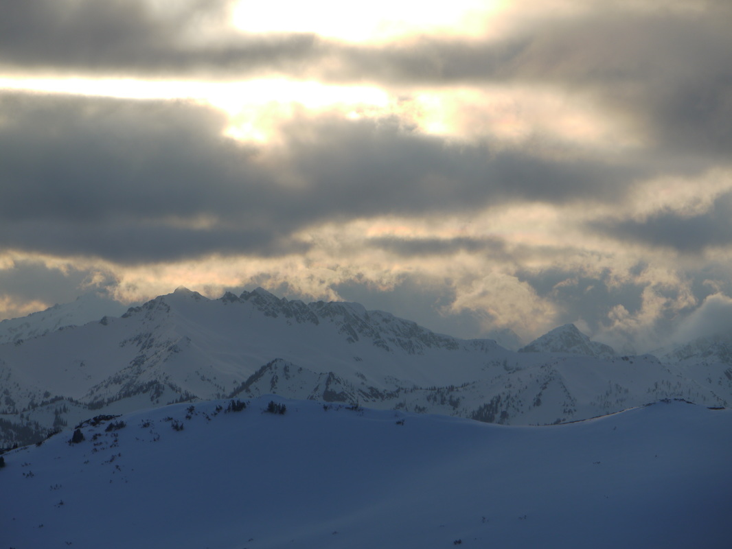
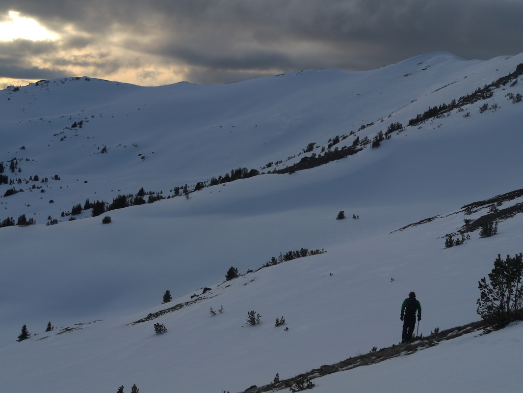
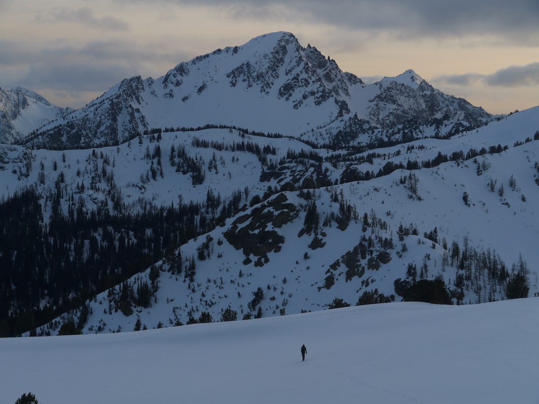
At about 5:30pm we reached the ridge crest and a short scramble later we were on the summit. The views of the entire Stuart Range off to the south was spectacular. I certainly had fun naming them all off and looking at the various routes. The wind picked up and the temperature dropped on the summit to the point we were quite cold. We made fairly quick work descending the final steep gully. Apart from the steepest section at the upper 50 feet where we downclimbed facing in and one at a time, we descended quickly, and traversed west to the broad 8,120 foot saddle just west of Cashmere. From here we walked south down a gentle ridge to treeline, where we returned to postholing. The sun set just before we got to Caroline Lake, which involved deep postholing traversing around a slope to get into the small basin where the lake was located. Surprisingly the hike around the lake and up the 200 foot slope to meet the Eightmile Creek Trail wasn't too bad, however there was still too much snow to find the trail. We all swapped the batteries in our headlights in the dark and took a break on the small ridge just above the lake.
Confident since I had been there before, I led us in the direction I believed the trail to be, and about 15 minutes later we spotted it as the snow cover slowly diminished. For awhile we continued straight down a steep ridge leading directly to Little Eightmile Lake and when the snow mostly disappeared at about 5,500 feet, we followed the trail through the burn area to the signed junction. At this point it was nearly 11pm and we rested on the large log everyone stops at upon reaching Little Eightmile Lake. My feet were soaked!
Just after midnight we reached the Eightmile trailhead and sat at the nice picnic table for another break, then walked down the Eightmile road, only to see the gate open at the bottom! I could not believe they leterally opened it for the season while we were on Cashmere! As I planned to drop my pack and run back up the Little Icicle Creek Road to fetch my car, we saw a group of campers near the Eightmile Campground. Mike asked if one of them could give me a ride to my car and they nicely agreed! That saved me at least 3 more miles of road walking. The drive home from then on was partially done by me then sometime around Stevens Pass Mike took over. I was quite exhausted! I didn't get back to Renton until around 3am.
We made a sidehill traverse into the basin where we then entered more old growth forest. Here the snow began and we hiked through the trees and up to Lake Victoria. The lake was completely frozen over and still snow covered. Only the edges were beginning to thaw out. We hiked across the frozen lake aiming for the large gully leading steeply up to the SSW into the basin NW of Cashmere. This 1,500 foot ascent included hiking up steep, somewhat firm snow with only my microspikes. Josh and Mike had their crampons though. At about 7,100 feet we entered the upper basin at which point we saw the final ascent towards the summit. It involved traversing to the SE and ascending directly up the gully on the north side of the mountain. It was beginning to get late and I questioned if we would have time to finish. I knew we still had a long ways to go as we needed to exit via Lake Caroline and out the Eightmile Creek Trail.
At about 5:30pm we reached the ridge crest and a short scramble later we were on the summit. The views of the entire Stuart Range off to the south was spectacular. I certainly had fun naming them all off and looking at the various routes. The wind picked up and the temperature dropped on the summit to the point we were quite cold. We made fairly quick work descending the final steep gully. Apart from the steepest section at the upper 50 feet where we downclimbed facing in and one at a time, we descended quickly, and traversed west to the broad 8,120 foot saddle just west of Cashmere. From here we walked south down a gentle ridge to treeline, where we returned to postholing. The sun set just before we got to Caroline Lake, which involved deep postholing traversing around a slope to get into the small basin where the lake was located. Surprisingly the hike around the lake and up the 200 foot slope to meet the Eightmile Creek Trail wasn't too bad, however there was still too much snow to find the trail. We all swapped the batteries in our headlights in the dark and took a break on the small ridge just above the lake.
Confident since I had been there before, I led us in the direction I believed the trail to be, and about 15 minutes later we spotted it as the snow cover slowly diminished. For awhile we continued straight down a steep ridge leading directly to Little Eightmile Lake and when the snow mostly disappeared at about 5,500 feet, we followed the trail through the burn area to the signed junction. At this point it was nearly 11pm and we rested on the large log everyone stops at upon reaching Little Eightmile Lake. My feet were soaked!
Just after midnight we reached the Eightmile trailhead and sat at the nice picnic table for another break, then walked down the Eightmile road, only to see the gate open at the bottom! I could not believe they leterally opened it for the season while we were on Cashmere! As I planned to drop my pack and run back up the Little Icicle Creek Road to fetch my car, we saw a group of campers near the Eightmile Campground. Mike asked if one of them could give me a ride to my car and they nicely agreed! That saved me at least 3 more miles of road walking. The drive home from then on was partially done by me then sometime around Stevens Pass Mike took over. I was quite exhausted! I didn't get back to Renton until around 3am.


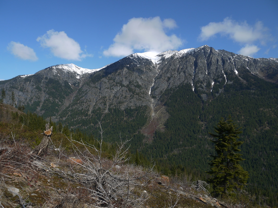


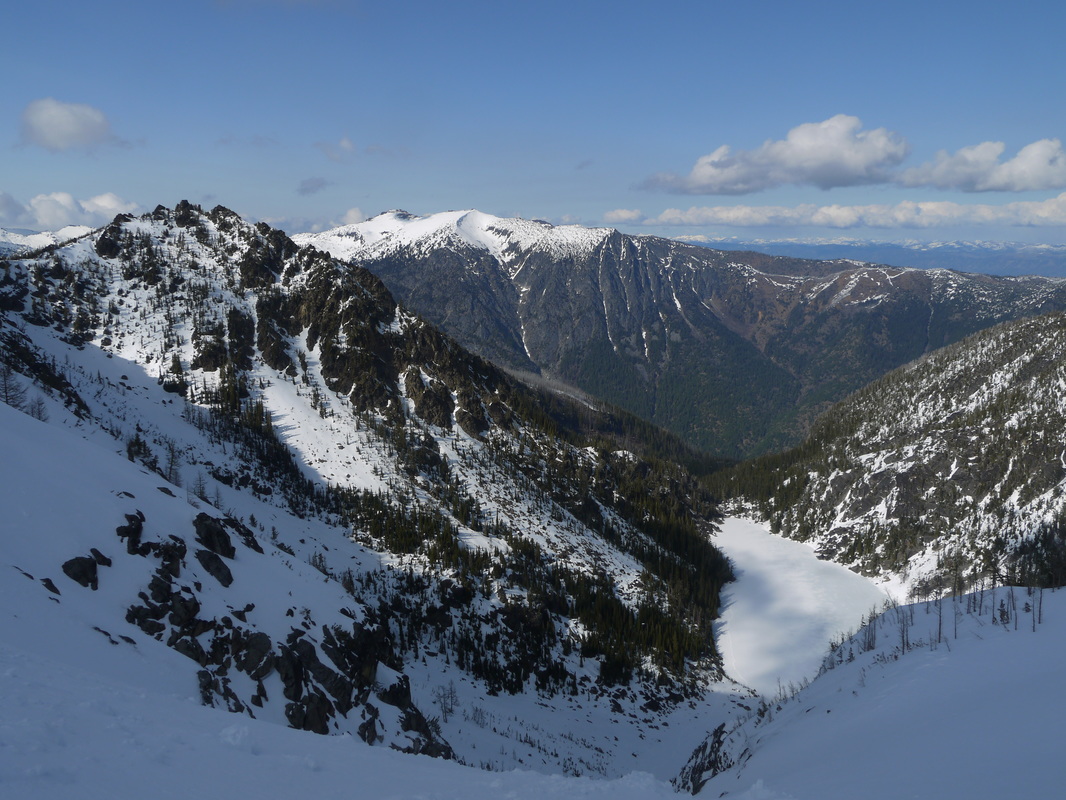

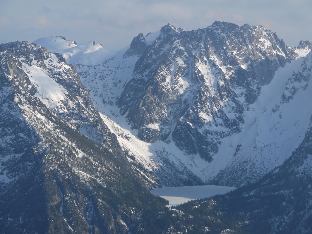
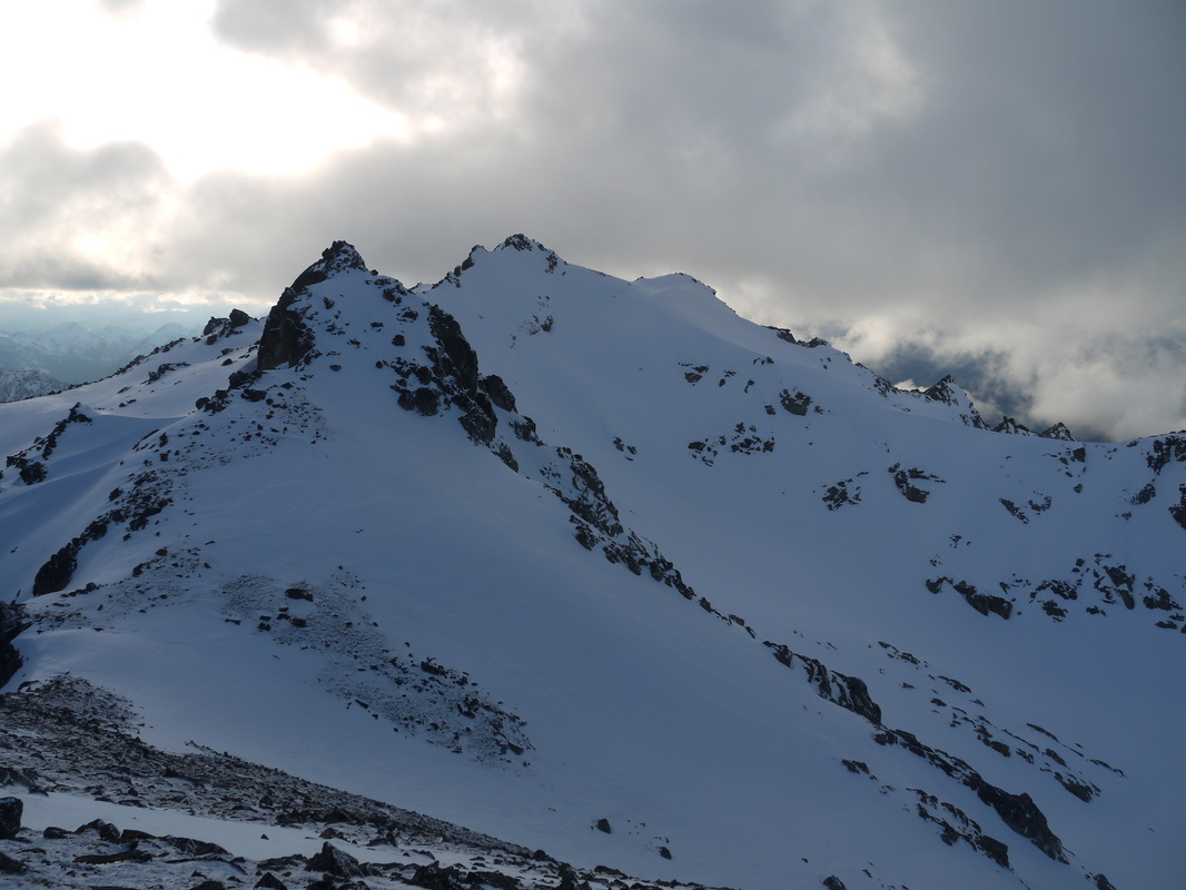
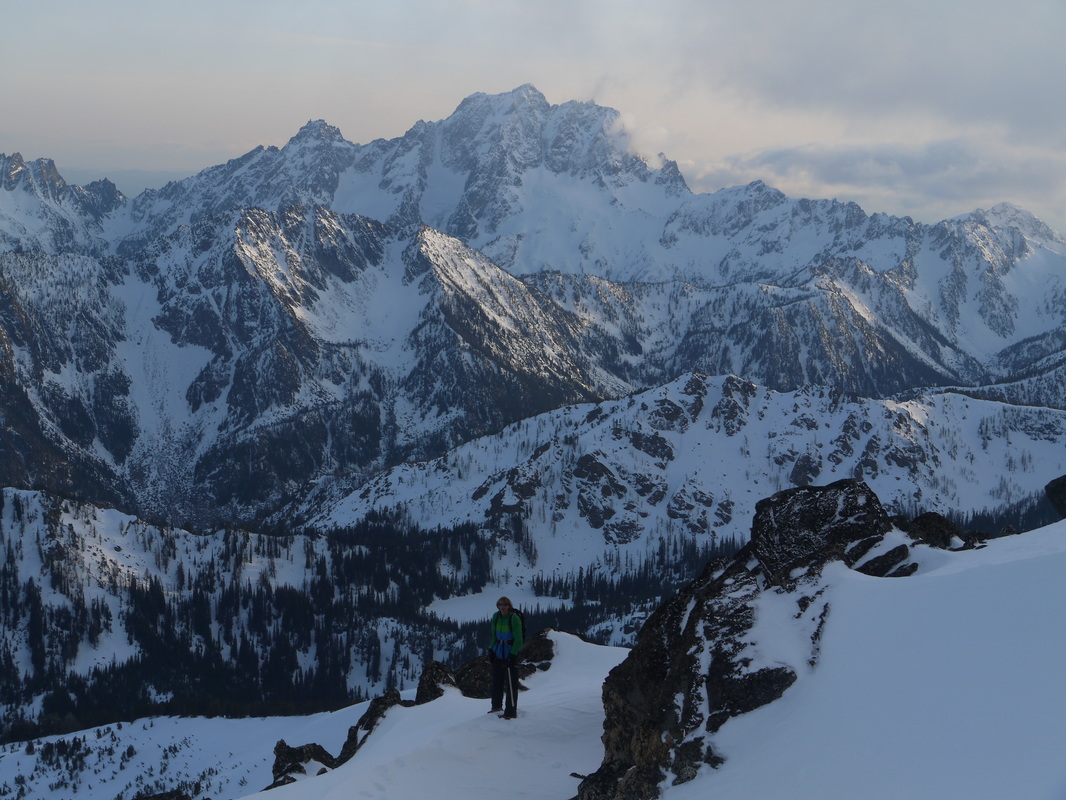
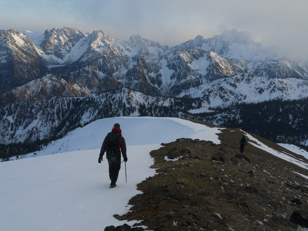
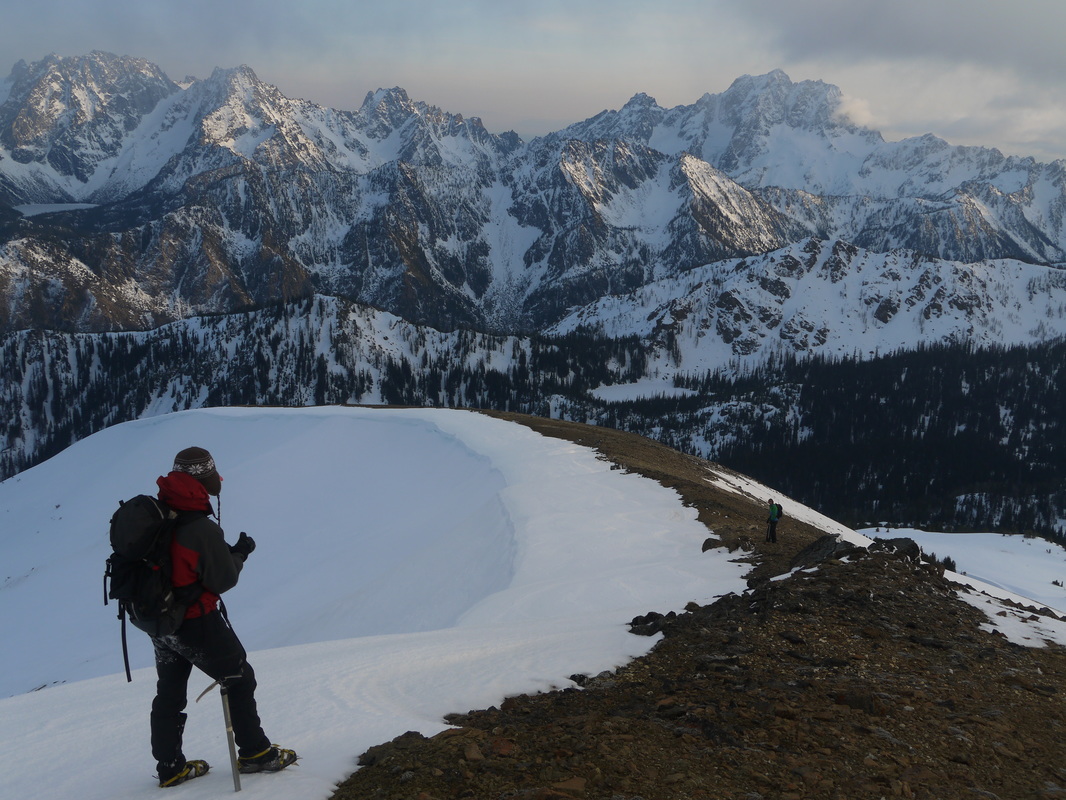
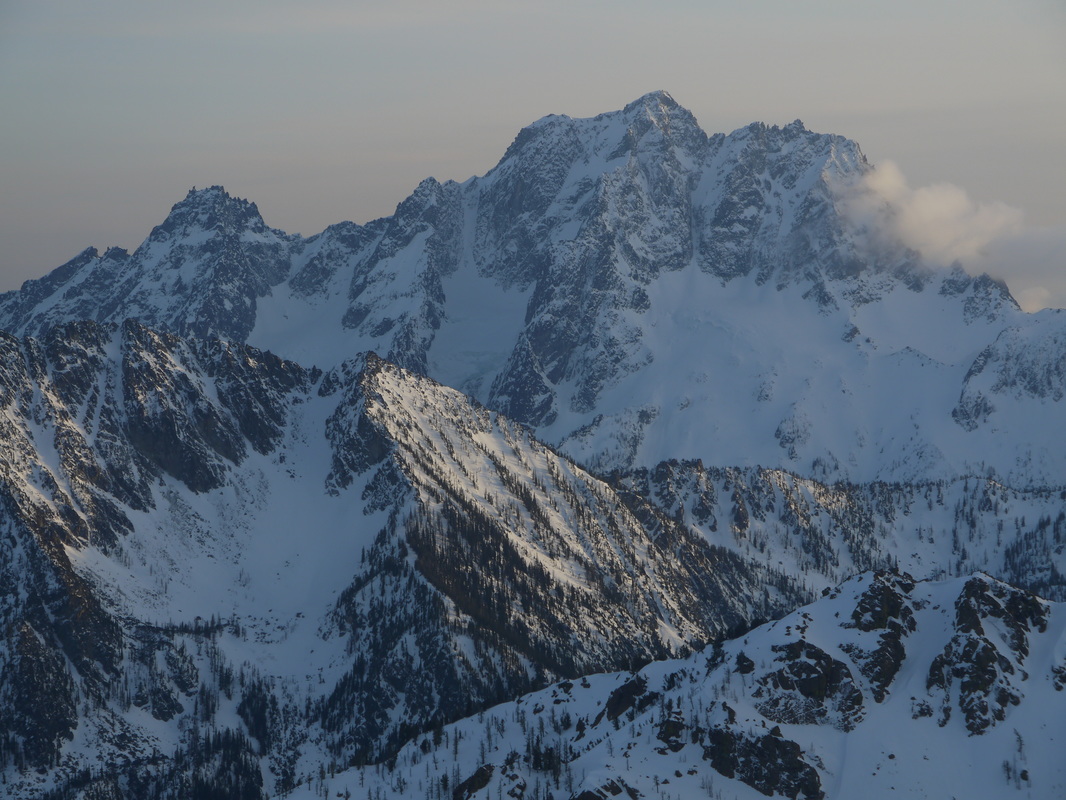

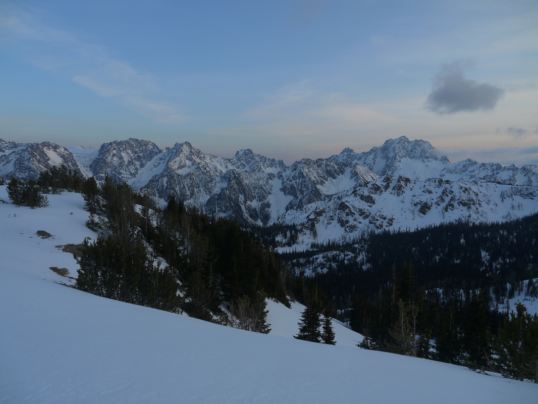
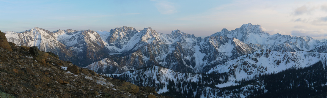
Stuart Range panorama from the slopes of Cashmere Mountain