LEMKE CLIMBS
  • About
    • Whats New
    • 2019 Goals/Wishlist
    • Contact
  • Washington
    • North Cascades >
      • Sahale Peak, Boston Peak
      • Eldorado Peak, Klawatti Peak
      • Black Peak
      • Forbidden Peak West Ridge
      • Primus Peak Attempt
      • Big Snagtooth
      • Liberty Bell Beckey Route
      • Burgundy Spire North Face 5.8
      • Ragged Ridge - Katsuk, Kimtah and Cosho Peaks
      • Colfax Peak
      • South Early Winters Spire via SW Buttress
      • Chilliwack Mini-Slam
      • Mesahchie Peak
      • Inspiration Traverse
      • Mount Shuksan Ski
      • Full Pickets Traverse
      • Mount Goode NE Buttress & Storm King
      • Mount Baker North Ridge WI3
      • Snowfield Peak
      • Lincoln Peak
      • Silver Star Mountain
      • Mount Buckner & Horseshoe Peak
      • Azurite Peak
      • Tower Mountain & Golden Horn
      • Mount Logan
      • Custer Ridge & Easy Mox
      • Mazama Dome
      • Sherman Peak
      • Mount Ballard
      • Southern Pickets Traverse
      • Corteo Peak
      • Whatcom Peak
      • Castle Peak
    • Glacier Peak Wilderness >
      • Buck Creek Pass, Cloudy Peak, Spider Gap
      • Dome Peak, Spire Point
      • Mt. Maude and Seven Fingered Jack
      • Mount Formidable NE Face 5.6 Second Ascent
      • Dumbell and Greenwood Mountains
      • Glacier Peak Wilderness Mountain Massacre
      • Clark and Luahna Peaks
      • Sinister Peak
      • Chiwawa Mountain
      • Tupshin & Devore Peaks
      • Buck & Fortress Mountains
      • Glacier Peak
      • Snowking Mountain
    • Olympic Peninsula >
      • Buckhorn Mountain
      • Flapjack Lakes Hike
      • Grey Wolf Peak, High Divide Trail
      • Mount Ellinor
      • Mount Constance West Arete
      • Mount Olympus
    • Alpine Lakes Wilderness >
      • Chikamin Peak
      • PCT - Snoqualmie to Pete Lake
      • Necklace and Tank Lakes
      • Enchantments Day Hike
      • Granite Mountain (Snoqualmie)
      • Colchuck Peak
      • Cannon, Enchantment and Stuart
      • Ingalls Peaks
      • McClellan Peak
      • Dragontail Peak
      • Web Mountain
      • Mount Index Attempt
      • Snow Creek Wall Orbit 5.8+
      • The Tooth South Face
      • Eightmile Mountain
      • Argonaut Peak NE Couloir
      • Little Annapurna South Face 5.5
      • Snow Creek Wall Outer Space 5.9
      • Cashmere Mountain
      • Sherpa Peak North Ridge 5.8
      • Chair Peak NE Ridge
      • Lichtenburg Mountain
      • Mount Index
      • McClellan Butte
      • Chimney Rock
      • Alpine Lakes High Route
    • Pasayten Wilderness >
      • The Craggies
      • Tiffany Mountain
      • Pasayten Mini-Slam
      • Remmel Group
      • Jack Mountain
      • Robinson Mountain
      • Monument Peak Group
    • Mountain Loop Highway >
      • Vesper Peak
      • Mount Dickerman
      • Sloan Peak West Face 5.8
      • Mount Forgotten
      • Whitehorse Mountain
      • Gothic Peak
    • Lake Chelan Sawtooth Wilderness >
      • Star, Courtney, and Grey Peaks
      • Hoodoo Peak and Raven Ridge
      • Abernathy Peak
      • Mount Bigelow
      • Reynolds Peak
      • Oval Peak
      • Gardner Peaks
      • Chelan Sawtooth Trio
    • Southern WA >
      • Mount Adams
      • Mount Rainier - Emmons Route
      • Mount Saint Helens
      • Goat Peak
      • Lane Peak, Plummer Peak (Tatoosh)
      • The Unicorn (Tatoosh)
      • Little Tahoma
      • Liberty Cap
    • WA Rock and Ice Cragging >
      • Index Town Walls
      • Vantage
      • Mount Erie
      • Exit 38
      • Leavenworth
  • Colorado
    • San Juan Mountains >
      • Mount Sneffels Lavender Snow Climb
      • Uncompahgre, Matterhorn Peaks
      • Redcloud, Sunshine Peaks
      • San Luis Peak
      • Vermilion, Fuller Peaks
      • Stewart Peak, Baldy Alto
      • Jones, Niagara, American Peaks
      • Wetterhorn Peak, Handies Peak
      • Wilson Group
      • Arrow Peak
      • Mount Sneffels SW Ridge
      • Jagged Mountain, Chicago Basin
      • Teakettle Mountain
      • Dallas Peak
      • Vestal Peak Wham Ridge, Greystone Peak
      • Organ Mountain
      • Phoenix Peak
      • Half Peak
      • Point 13832 Group
      • Golden Horn
      • Mount Sneffels Snake Couloir
      • Pigeon, Turret Peaks
      • Trinity Peaks
    • Elk Mountains >
      • Four Pass Loop
      • Castle, Conundrum Peaks
      • Snowmass Mountain
      • Cathedral Peak
      • South Maroon Peak
      • The Pyramids
      • North Maroon Peak, Sleeping Sexton
      • Capitol Peak, Mount Daly
      • Malemute Peak
      • Hagerman Peak
    • Sangre de Cristo Mountains >
      • Blanca Peak, Ellingwood Point
      • Challenger Point
      • Mount Adams
      • Spread Eagle Peak
      • Humboldt, Obstruction, Columbia Peaks
      • Mount Lindsey, Huerfano Peak
      • Little Bear Peak
      • Crestone Needle Ellingwood Arete
      • California Peak
      • Crestone Peak North Buttress
      • Operation Dark Snake
      • Kit Carson Mountain
    • Sawatch Mountains >
      • Iowa Peak
      • Point 13,618 - Hunky Dory Lake
      • Gold Dust Peak, Notch Mountain
      • Mount Jackson
      • Mount Belford
      • Shavano, Tabeguache Peaks
      • Mount Antero, Cronin Peak
      • Twining Peak
      • Mount Massive
      • Casco Peak
      • Mount Huron
      • Mount Elbert
      • Mount Oxford
      • Mount Hope
      • Mount Yale
      • Lackawanna Peak
      • Mount Columbia
      • La Plata Peak
      • Rinker and Twin Peaks
      • Bull Hill, Mount Princeton
      • Missouri Mountain
      • Mount Oklahoma
      • French Mountain
      • Mount Ouray
      • Grizzly A, Garfield Peaks
      • Mount Harvard
      • The Three Apostles
      • Emerald Peak
      • Holy Cross
      • Mount Aetna
      • Deer Mountain
    • Greater Park Range >
      • Kneeknocker Pass, Piney Lake
      • Drift Peak
      • Sherman Peak, Dyer Peak
      • Gore Range Traverse
      • Quandary Peak
      • Pacific, Atlantic Peaks
      • Clark Peak
      • Crystal Peak, Peak 10
      • Fletcher Mountain
      • The DeCaLiBron
      • Loveland Mountain
      • The Mosquito Traverse
      • Mount Arkansas
      • Clinton Group
      • Eagles Nest, Peak C
      • North Star Mountain
      • Peak X
      • Wheeler Mountain
    • Front Range >
      • Mount Evans, Spalding
      • Mount Bierstadt
      • Mount Parnassus, Bard Peak
      • Cupid, Sniktau, Grizzly D Peaks
      • James Peak
      • Mount Silverheels
      • Grays and Torreys Peaks
      • Mount Edwards
      • Mount Flora, Longs Peak
      • Square Top Mountain
      • Petit Grepon South Face 5.8
      • Mount Meeker Dreamweaver Couloir
      • Santa Fe Peak
      • The Citadel & Pettingell
    • Colorado Ice Climbing >
      • Lincoln Ice Falls
      • Ouray Ice Park
      • Avocado Gully and The Drool
      • Hidden Falls
    • Colorado Rock Climbing >
      • Eldorado Canyon
      • The Flatirons
      • North Table Mountain
      • Colorado National Monument >
        • Independence Monument
  • Wyoming
    • Wind River Mountains >
      • Gone With the Winds
      • Union Peak - Solar Eclipse
      • Wind River Peak
      • Wind River Slam
    • Teton Range >
      • Grand Teton Owen Spalding 5.4
      • Mount Owen Attempt
    • Wyoming Absarokas and Gros Ventre Range >
      • Jackson Peak
      • Francs Peak
    • Yellowstone National Park >
      • Top Notch Peak
    • Bighorn Range and Great Divide Basin >
      • Boars Tusk
      • Loaf Mountain
      • Cloud Peak
      • Black Tooth Mountain
    • Devils Tower
    • Cody Rock and Ice Climbing
  • Montana
    • Beartooth Mountains >
      • Whitetail Peak Group
      • Beartooth Mountain
      • Spirit Mountain Group
      • Mount Peal
      • Granite Peak Group
      • Castle Rock Group
      • Castle Mountain NE Couloir
      • Mount Inabnit and Sylvan Peak
      • Mount Hague South Slopes
      • Mount Villard and The Granite Peaks Traverse - 5.4
      • Spirit Mountain NE Ridge - 5.4
      • California Ice WI 4
      • The Ramp 5.8
      • Linea Alba 5.10d
      • Iceberg Peak
      • Metcalf Mountain North Rib 5.8
      • Villard Spires HP West Ramp
      • Cairn Mountain
      • Snowbank Mountain
      • Mount Wood Group
      • Bears Tooth
      • Glacier Peak Catch-a-Sunrise FA
    • Southwest Montana Ranges >
      • Madison Range >
        • Koch Peak
        • Sphinx Mountain
        • Beehive Peak
        • South Sheep Mountain
      • Gallatin Range
      • Bridger Range >
        • Sacajawea Peak
        • Saddle Peak
        • Baldy Mountain
        • Ross Peak
      • Montana Absorakas >
        • Arrow Peak
        • Black Mountain
        • Mount Cowen
      • Tobacco Root Mountains >
        • Hollowtop Mountain
        • Belle Point
        • Noble Peak
        • Leggat Mountain
      • Crazy Mountains >
        • Crazy Peak
    • Glacier National Park >
      • A Taste of Glacier National Park
      • Divide Mountain
    • MT Rock and Ice Climbing
  • Utah
    • Uinta Mountains >
      • Kings-Emmons Ridge Run
      • Hayden Peak
      • Iron Hayden Wall Rock Climbing
    • Wasatch Range >
      • The Sundial Eleventh Hour 5.8
      • Mount Timpanogos
    • San Rafael Swell >
      • Ramp, Cistern Canyons
      • Salt Wash, Black Mountain, Moroni Slopes
      • Ding, Dang Canyons
      • Little Wild Horse, Bell Canyons
      • Quandary Canyon
      • San Rafael Knob
      • Miners Hollow (Knotted Rope Canyon)
      • Temple Mountain
      • Chimney Rock
      • Bottleneck Mesa
      • Window Blind Peak
      • Lower Baptist Draw & Upper Chute Canyon
    • Capitol Reef National Park >
      • Cathedral Valley Tour
      • Sheets Gulch
      • Halls Creek Narrows
      • Brimhall Canyon and Strike Valley Overlook
      • George Benchmark
    • Moab Area, Canyonlands, Arches >
      • Maze District
      • Needles District
      • Maze District
      • White Rim Trail Biking
      • Elephant Butte, Bullwinkle Tower and Lizard Rock
      • South Six Shooter
      • Elephant Canyon
      • Parriott Mesa
      • Ancient Art
      • Castleton Tower North Chimney 5.8
      • Klondike Bluffs
      • Mount Peale & Tukuhnikivatz
    • Robbers Roost Country >
      • Horseshoe Canyon, Goblin Valley
      • Bluejohn Canyon
      • Happy Canyon Narrows
      • Shenanigans, Leprechaun Slots
      • Larry Canyon
      • Merry Piglet Slot
      • Lower Maidenwater Canyon, Turkey Knob
      • Morocco Canyon
      • Monkey Business Slot
      • Hog Canyon Slots
      • Upper Maidenwater Canyon Slots
      • Mount Ellen
      • Buck Canyon
      • Point 4906
      • Alcatraz Canyon
      • Hard Day Harvey Slot
      • Mount Ellsworth
      • Good Day Jim Canyon
      • White Roost Canyon
      • Upper Stair Canyon
      • Dragon Canyon
    • Escalante National Monument >
      • Phipps Canyon and Arch
      • Red Breaks Slot
      • Dry Fork Slots, Coyote Gulch
      • Little Death Hollow/Wolverine Canyons
      • Egypt 3 Slot
      • Egypt 1 Canyon
    • Zion/Bryce >
      • Ataxia Tower Ashtar Command 5.9
      • Mount Kinesava Cowboy Ridge
      • Birch Hollow
      • Aires Butte
      • West Temple
      • Mystery Canyon
      • Crazy Streak
    • Cedar Mesa Region/Valley of the Gods >
      • Eagle Plume Tower Eagle Feather 5.10b
  • California
    • High Sierras, Southern CA Ranges >
      • Telescope Peak, Manly Beacon
      • Tahquitz Rock Whodunit 5.9
      • Tahquitz Rock Long Route 5.9
      • Palisade Traverse
      • White Mountain
    • Yosemite National Park, Central CA
    • Northern CA Cascades >
      • Lava Beds National Monument
      • Mount Shasta
  • Oregon
    • Oregon Volcanoes >
      • Three Fingered Jack
      • Mount Scott
    • Blue Mountains >
      • Twin Peaks
    • Trout Creek Rock Climbing
  • Alaska
    • Eagle Peak and Mount Ewe
    • Jatt Peak and Portage Pass
    • Rainbow Peak
    • Mount Brooks Attempt
    • Arrigetch Peaks Trek
    • Ab Mountain Hike
    • South Suicide Peak
    • Mount Hunter West Ridge Attempt
    • Cantata Peak Attempt
    • East Twin Peak
    • Mount Alice
    • Crow Pass and Hope Point Hikes
    • Indianhouse Mountain Attempt
    • Lynx Peak
    • Harding Icefield Hike
    • Hatcher Pass and Grapefruit Rocks Climbing
    • Mount Sanford
    • Mount Hunter West Ridge
    • Mount Fairweather
  • Nevada
    • Ginger Cracks 5.8
    • Mescalito Dark Shadows 5.8
    • Birdland and Olive Oil
    • Frogland 5.8
    • Johnny Vegas 5.8
    • Schaeffer's Delight & Triassic Sands
    • Solar Slab - 5.6
  • British Columbia
    • Mount Matier
    • Taiya Peak
    • Bugaboo Spire NE Ridge
    • Mount Sabine Easy Honey 5.10b
    • Mount Sir Donald NW Ridge Attempt
    • Black Tusk
    • Slesse Mountain NE Buttress
    • Warden Peak
    • Triple Peak
    • Gimli Peak
    • Mount Waddington
  • Alberta
    • Mist Ridge Hike
    • Mount Temple Attempt
    • East Wendell Peak
    • Loder Peak
    • Tower Mountain Attempt
    • The Rimwall
    • Mount Yamnuska Directissima 5.9
    • Mount Lawrence Grassi
    • Mount Lorette
    • Roche A Perdrix
    • Mount Edith Cavell East Ridge 5.3
    • Mount Louis Kain Route
    • Eiffel Peak
    • Mount Alberta
    • Canadian Rockies Ice Climbing
  • Other States
    • Arizona >
      • Grand Canyon Bright Angel Trail
      • Beanfest at Cochise Stronghold
      • Baboquivari Peak
      • Humphreys Peak
    • New Mexico >
      • Philmont Trek August 2008
    • Yukon >
      • Canyon Peak
  • International
    • Mexico & Central America >
      • Mexico - Pico de Orizaba, Izta
      • Guatemala Volcanoes
    • South America >
      • Chile >
        • An Introduction to Patagonia
        • Exploring Pucon and Lanin Volcano
        • Cerro Puntado & Palo
        • Cerro Colorado
        • Cerro Puno & Agudo
        • Cerro Trinidad Attempt
        • Volcan Quetrupillan
        • Cerro Placas
        • Volcan Puyehue
        • Cerro Conico
        • Cerro Barros Arana
        • Cerro Cordillerano
        • Ojos del Salado
      • Argentina >
        • Nahuel Huapi National Park & The Frey
        • Cerro Helio Azul & Tronador Attempt
        • Aguja Guillaumet Amy Couloir
        • Nevado de Acay
        • Chiaro de Luna
      • Peru >
        • Cordillera Blanca - Tocllaraju and Urus
        • Cordillera Blanca - Ishinca Peak and Artesonraju
        • Cordillera Blanca - Quitaraju & Alpamayo
        • Exploring Southern Peru
      • Bolivia >
        • Pequeno Alpamayo
        • Huayna Potosi
        • Illimani
    • Oceania >
      • Exploring New Zealand's South Island
      • Puncak Jaya
      • Mount McPherson and Talbot
      • Single Cone
      • Mount Cook
      • Mount Aspiring
      • Manakau
      • Mount Wilhelm
    • Central Asia >
      • Kyrgyzstan 2021
    • Europe >
      • Iceland & Faroe >
        • Snaefellsjokull
        • Kaldbakur
        • Slaettaratindur
  • Sorted by Year
    • 2008 Trip Reports
    • 2009 Trip Reports
    • 2010 Trip Reports
    • 2011 Trip Reports
    • 2012 Trip Reports
    • 2013 Trip Reports
    • 2014 Trip Reports
    • 2015 Trip Reports
    • 2016 Trip Reports
    • 2017 Trip Reports
    • 2018 Trip Reports
    • 2019 Trip Reports
    • 2020 Trip Reports
    • 2021 Trip Reports
    • 2022 Trip Reports
    • 2023 Trip Reports
  • Vanlife
    • Conversion Journal >
      • Floor Installation
      • Folding Bed
      • Coffee Table
      • Thinsulate Installation
      • The Couch
      • The Wardrobe
      • Bookshelf
      • Water System
      • Electrical System
      • The Pantry
      • Refrigerator
      • Tire Upgrade
      • Heating System
      • Composting Toilet
LEMKE CLIMBS

mount aspiring

mount aspiring - 9931' - SW ridge ai4
​november 2019

After returning to Queenstown after climbing Mount Cook and dropping off Graeme at the airport for his return flight to Auckland, I took a look a the weather forecast and was amazed to see a two day window of perfect weather in just a couple days time! So I began the climbing partner search and found a previous correspondence with Luca on Facebook, who messaged me a few weeks prior about wanting to climb. I responded again asking if he wanted to climb the SW ridge of Aspiring and he replied with a resounding yes! He is half English and half Finnish living in New Zealand so he drove over from Dunedin right away and we met Andreas and Brad, who had climbed the east ridge on Mount Cook, met up with us for dinner to discuss plans and ideas for the four of us to climb it. The weather window was going to be for Friday and Saturday November 29-30, however Brad unfortunately had an early morning flight leaving from Christchurch Sunday morning so he contemplated getting a helicopter access. Due to the strict regulations in Aspiring National Park, helicopters can only land at Bevan Col, which is not too practical for an ascent of the SW ridge.

Luca and I made our own separate plan leaving them to hopefully find a way to make it work before Brad had to leave. Coincidentelly, my new friend Eva who lives in Wanaka invited both Luca and I to her friendsgiving party to celebrate Thanksgiving which happened to fall on the day before the weather window began. I was thrilled to be able to join as Thanksgiving dinner is my favorite holiday. We had a lovely time with about 20 people crammed into her shared home everyone having made a dish. I made a cornbread casserole. The looks on the faces of the Europeans in attendance at some of the traditional american Thanksgiving dishes (candied yams in particular) was quite funny. I don't think they were a fan!

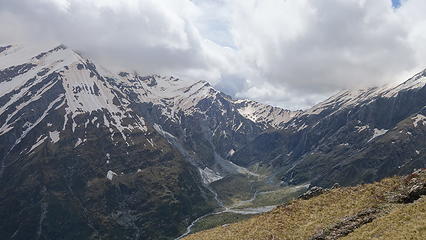
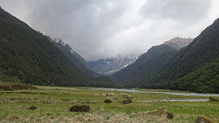
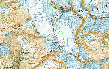
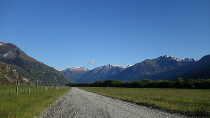
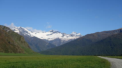
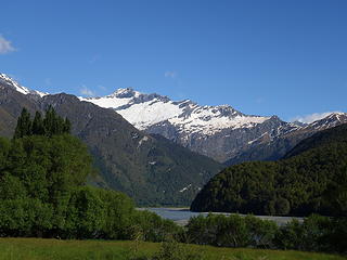
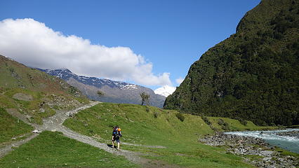
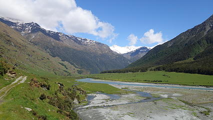
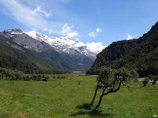
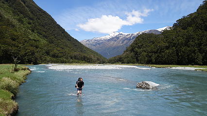
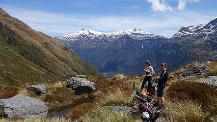
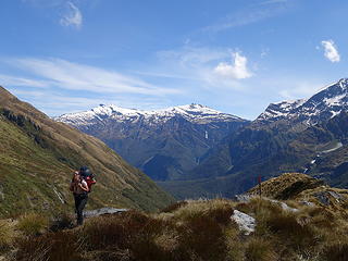
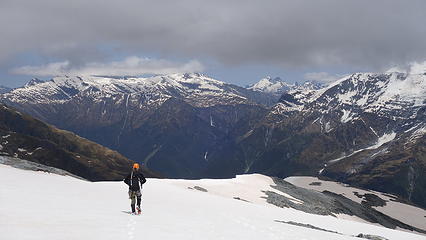
Eva was nice enough to let me crash at her place as well, and in the morning, Luca and I drove to the Raspberry Flat trailhead in our own cars and met there at 8:30am. We organized our gear and loaded up our packs, which were heavy with my huge mountaineering boots, rope, climbing gear and food. Under clear skies and beautiful warm weather we started hiking up the Matukituki River Valley, having collected Amelia who we ran into at the parking lot who recognized me from the Plateau hut. She joined us for the hike into French Hut as she was meeting up with a couple other of her friends at the hut. The Matukituki valley is a spectacle of greenery and rugged mountainous landscapes that is also neatly cultivated with sheep farming. It's a cross between untouched raw alpine splendor and cleared grasslands with enough sheep to warm an army. The trail up the valley heads up 9 kilometers of flat valley through the privately owned farmlands, dodging sheetshit the entire way to the Aspiring Hut. Mount Aspiring briefly becomes visible from the trail, but Mount Rob Roy really dominates the view from the bottom. Side stream crossings without bridges were plentiful however I was able to jump or boulder hop across them all. Most people just accept wet feet and walk through them in their shoes. Once we arrived at the Aspiring Hut, I realized it's more like a hostel with an array of flush toilets, a full kitchen and comfortable bunks managed by the New Zealand DOC. We stopped for a brief rest here before continuing an additional 6 kilometers up the valley, as it curves from west to north until we reached the base of French Ridge. A few swing cable bridges were encountered to cross over otherwise impossible rivers. Here, we were able to ford across the Matukituki River, having hiked far enough upstream for it to be less than knee deep which saved us about a kilometer of walking to take the bridge further upstream. Once across, we dried out our feet and had a lunch break in the pleasant green grass.

Clear skies on the drive to Raspberry Flat trailhead
Matukituki Valley
Matukituki Valley
 
 
Starting up the trail
 
A brief spot where the trail rises above the valley floor
 
Luca fording the Matukituki River at base of French Ridge


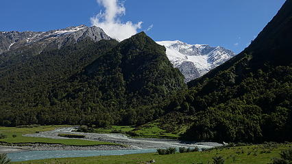
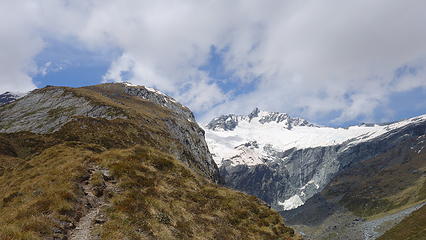
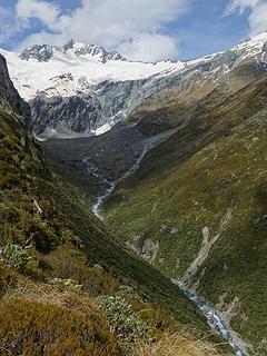
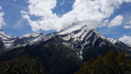
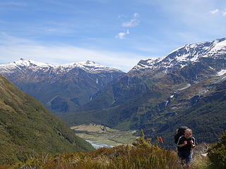
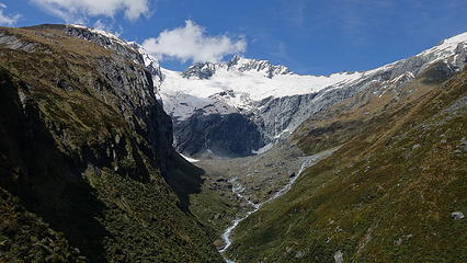
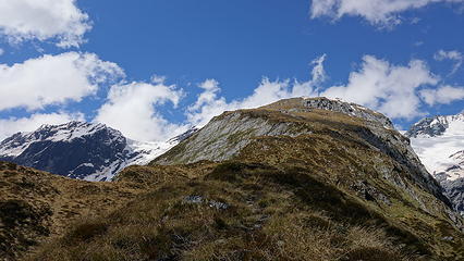
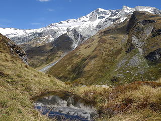
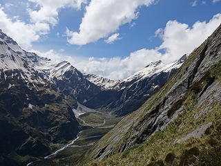
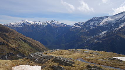
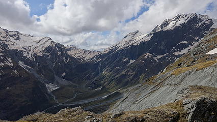
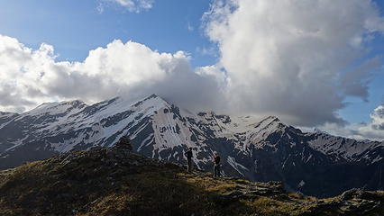
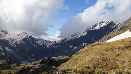
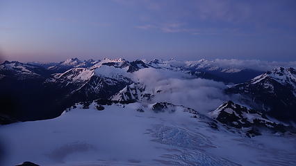
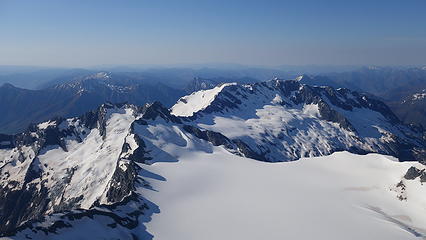
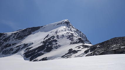
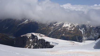
We started up the track to French hut, which immediately became very steep. Root climbing was the name of the game here, and with my heavy pack, and my mountaineering boots carried in my hand, combined with the heat and humidity it was a fairly slow ascent for my standards. Nonetheless, we made steady progress gaining the 850 meters of elevation gain. The first 500 meters was in the forest where at times a 6-8 foot vertical step would be encountered that you had to literally climb the tree roots to ascend. The humidity in the trees was noticeable causing me to sweat, which I usually never sweat! Once we reached treeline, we were greeted with views of the ultra rugged west face of Mount Avalanche, with Gloomy Gorge dropping steeply below us to the right. The waterfalls that dump into the entire Matukituki valley are otherworldly and the term gigantic doesn't do them justice. One particular one we saw seemed to have a volume of water twice that of Snoqualmie Falls at it's highest flow, free falling down a 600 meter cliff!! Looking west directly across the valley from treeline we saw the Liverpool Hut, and looking north at the head of the valley we spotted the route up to Bevan Col, the "normal" way to approach Mount Aspiring if you plan to climb the NW ridge from Colin Todd Hut. However in winter and spring conditions, the slabby ascent to Bevan Col is very dangerous with very slick steep rocks complete with flowing water having killed numerous people when they slide to their deaths. The French Ridge route is much better in early season, before the Quarterdeck becomes to crevassed.

We slowed our pace a little for the last 350 meters to the French Hut enjoying the views. Interestingly enough, the French hut and ridge was named after a French member of one of the early expeditions to Mount Aspiring who hated every moment of the expedition. After it was all said and done the Kiwis, being the cheeky pranksters they are named the approach after the negative nancy  embarassedlaugh.gif
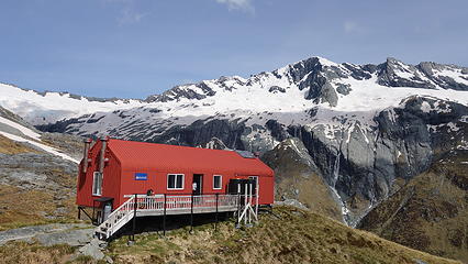
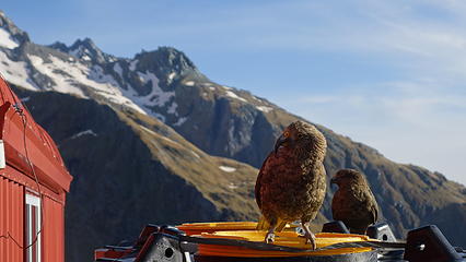
We arrived at the hut at an elevation of 1480 meters (1100 meters up and 17 kilometers from the trailhead) and were greeted by a handful of other hikers, and Amelia's two friends who were also planning to climb the SW ridge the following morning. It was great to drop the pack and parse out things not needed for the climb and chat about the route and plan of attack. Luca and I agreed to wake up at 12:30am and be on the move by 1 in the morning. With that settled, we made dinner and I took some photographs of the Kea who never gave up trying to steal anything left out on the porch. At one point one made off with someones boot sole, and almost made away with one of my socks. Eva and Josh (hosts of the friendsgiving party) also arrived an hour after we did with intentions to climb French Mountain. Amelia was happy to join them the following morning. By 8pm I was asleep.

Mount Barff from French Ridge
View down the Matukituki from treeline
West face of Mount Avalanche
Taking a break on French Ridge
Looking up French Ridge above treeline
Rob Roy Peak from French Ridge
Distant Mount Tyndall
View to the head of the Matukituki with the slabby ramp to Bevan Col visible complete with waterfall
Mount Liverpool across the valley
 
 
View up French Ridge from the hut
French Hut
French Hut
 
 
Scenic potty
Scenic potty
 
Evening light over Rob Roy Peak
 
 
Kea at the French hut


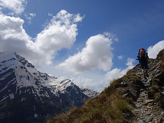
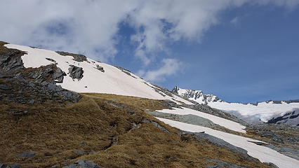
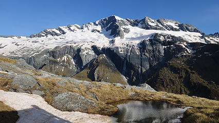
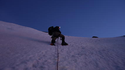
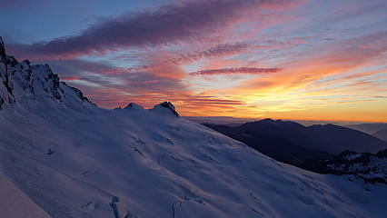
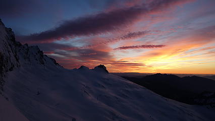
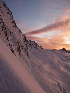
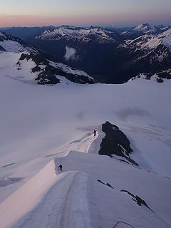
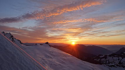
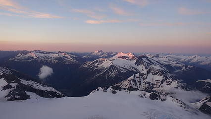
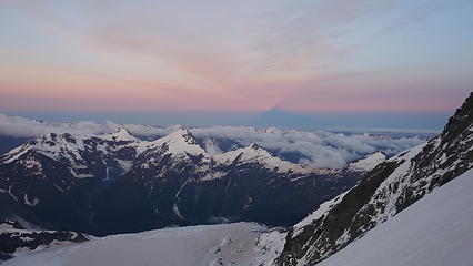
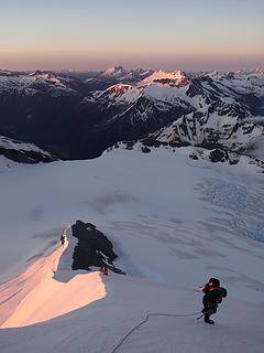
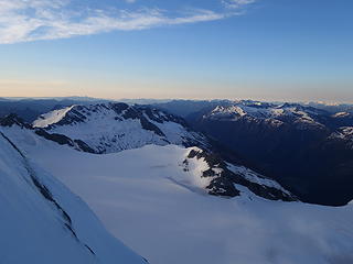
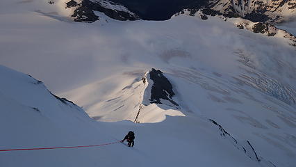
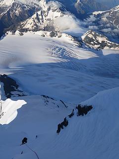
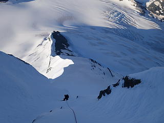
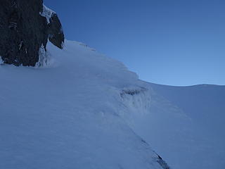
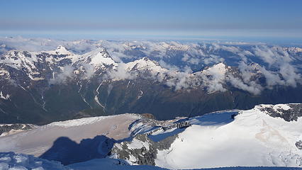
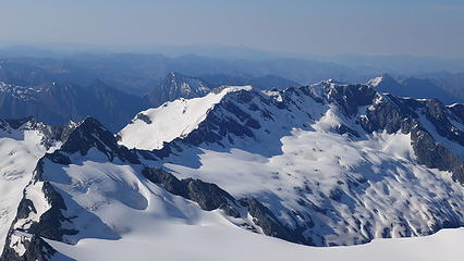
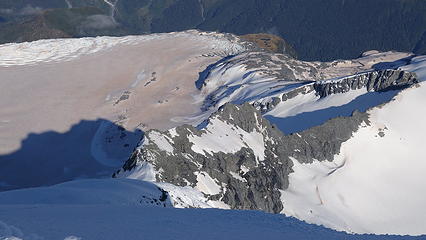
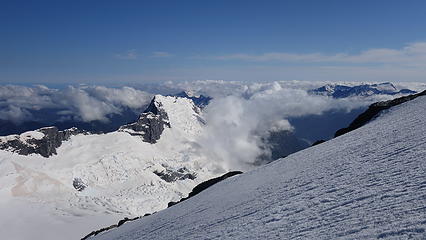
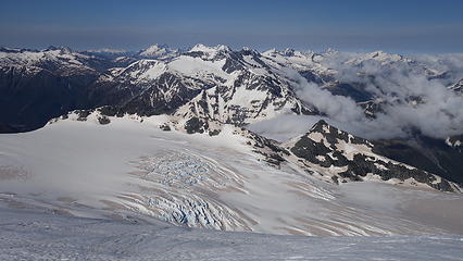
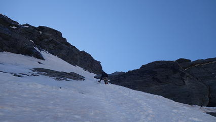
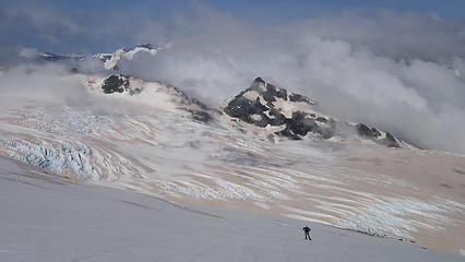
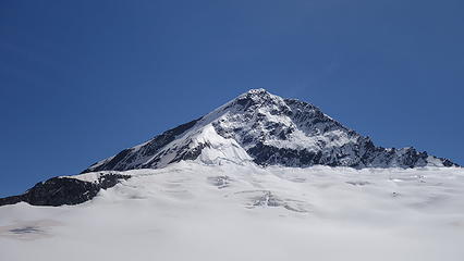
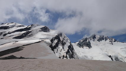
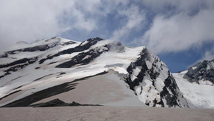
With a full hut (people even sleeping on the floor in the dining area), we tried to keep quiet as we got up and finished packing up our gear. We ate a quick breakfast and started up the remainder of French Ridge at 1:15am. It an 800 meter ascent from the hut to the Quarterdeck, which is a flat section on the south ridge of Mount French above the low saddle connecting to Mount Avalanche. It was excellent travel on the snow slopes at night up the ridge, with the final bit crossing through a couple small seracs and crevasses. The snow maxed out at 35 degrees or so and we reached the Quarterdeck in a little under two hours. We continued on, dropping down 200 meters and onto the upper Bonar Glacier which we quickly crossed with firm snow. While we were checking on which route to take to cross the Bonar and reach the base of the SW ridge, the other two guys caught up to us and we leapfrogged a couple times crossing the glacier and aiming for the western flank of the lower SW ridge. With just enough starlight, we were able to make out the silhouette of Mount Aspiring against the moonless sky. We traversed around the west side of the rocky lower ridge until reaching a small depression where the real climbing would begin. Here we took a small break while the other two guys continued on up the initial slope to meet the ridgecrest. We continued on up the slope and upon reaching the ridge we saw them starting up a steep rocky section of the crest. Knowing that would take considerably longer, Luca and I decided to climb directly up a steep 50-55 degree neve/snow face just left of the ridge where we could overtake the other two again, and hopefully reach the base of the crux gully first. So up we went, with Luca in lead up this beautiful snow face perfect for front points and ice tools. As we ascended, the colors of twilight increased, and upon reaching a short mellow section where we regained the ridgecrest, I snapped some photos of twilight.

Luca ascending perfect snow slopes on the SW ridge
Twilight view of the mountains around Aspiring
View of the remaining route up the SW ridge with the crux gully visible
Twilight colors
Twilight colors
Looking down the SW ridge


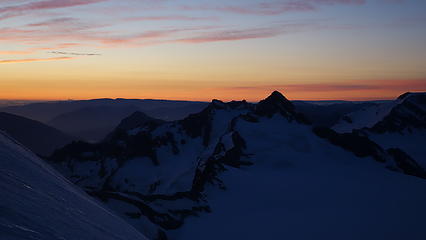
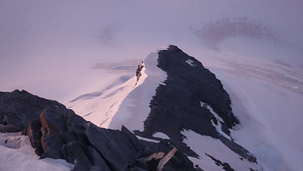
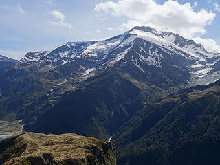
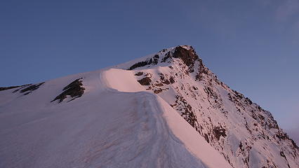
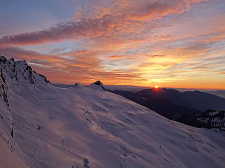
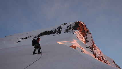
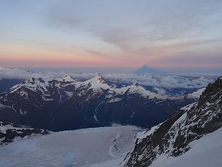
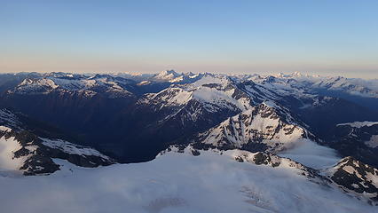
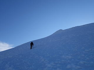
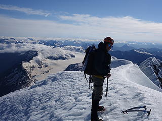
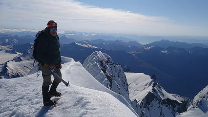
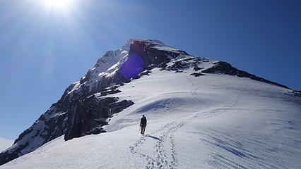
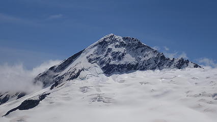
My hunch was correct, and we indeed passed the other two as they took longer getting up the rocky segments. Luca and I then continued on a non-stop push up the now 40-45 degree neve, which was trending into more solid ice on the ridgecrest towards the base of the crux gully. As we were ascending this section of the route the sun rose, and provided a spectacle I will never soon forget. With the steep south face of Mount Aspiring lit up by the glowing first rays of sunlight, I had to snap a few more photos!


South face dropping steeply to the right
Luca climbing up just below me on the ridge
 
First glimpse of the sun
 
Getting closer to the crux pitch; this section seemed to drag on for awhile
My favorite shot of the trip


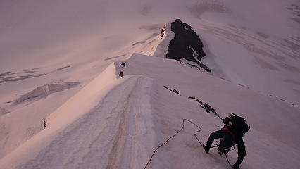
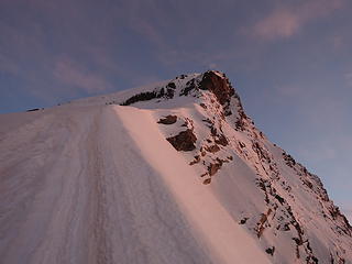
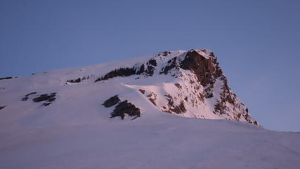
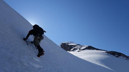
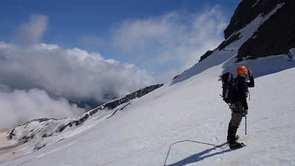
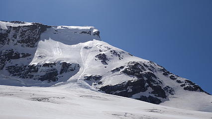
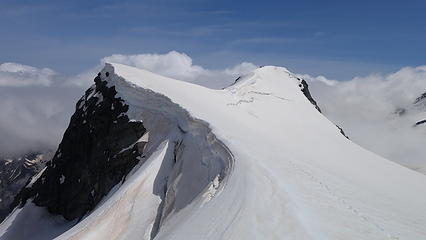
Eventually, about 20 minutes after sunrise we reached the base of the ice crux and along a rocky outcrop just to the right of the ice I set up a two-cam anchor and we racked up, took a small rest and I mentally prepared myself. It looked steep, possibly even vertical in a short spot. I grabbed the ice screws and assisted the other two clip into our anchor. Shortly after that I was off. Initially the pitch started out in the 60 degree range, but quickly steepened to dead vertical for a 2 meter stretch before easing a little. The ice was not great, but was good enough for solid pick and crampon placements. I was not able to find any solid ice to hold good screw placements though, and resided to running the whole thing out a full 60 meters without any pro  eek.gif

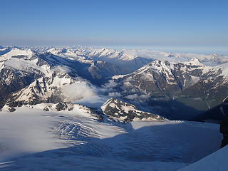
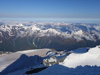
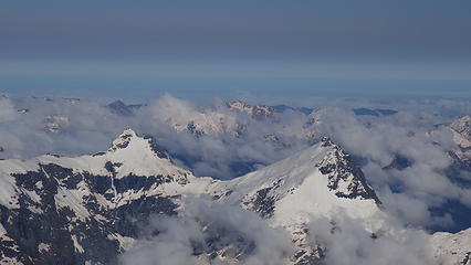
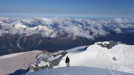
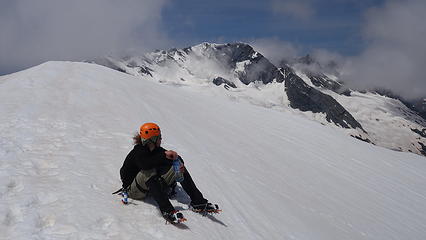
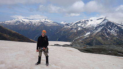
When I ran out of rope, I pounded a picket into the hard snow which worked as an excellent anchor to belay up Luca. He enjoyed the pitch. I then led up a second full 60 meter pitch up easier 60 degree neve/snice and was able to get one bomber cam placement in an exposed rock outcrop to my left halfway up. I reached the top of the gully where the terrain flattened significantly and placed another picket anchor to belay. In two pitches we had efficiently climbed through the crux, and a simple final 300 foot walk ascent on icy snow less than 30 degrees in steepness brought us to the summit at about 8am. I was elated to have been successful on both Mount Cook and Aspiring within a one week timeframe. I couldn't have asked for more on my trip to New Zealand, and as I write this, I might actually get another climb in before I leave for South America on Monday the 9th. We enjoyed completely calm and clear summit conditions for almost 30 minutes. I was hoping the other two would meet us on top so we could celebrate together, but we wanted to get down before the snow on the Bonar Glacier got too soft for easy travel on the 200 meter ascent back up to the Quarterdeck.

 
Shadow of Mount Aspiring visible off to the west
Alpenglow on Aspiring
 
 
View of the Bonar Glacier below
 
Reaching the base of the crux
Luca climbing up the first pitch
 
 
Looking up our second pitch; I climbed the ice just right of the rock
On easier slopes near the summit
 
Luca admiring the views
View east from the summit
 
View south from the summit
Upper Bonar Glacier and Mt Avalanche from the summit
Mount Earnslaw at center left
Mount Tutoko at center right; highest peak in Fjordland and next on my New Zealand goals!
 
View down our descent route; the NW ridge
Some clouds slowly starting to make their presence known
 
 
View north with the lake below the Volta Glacier


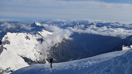
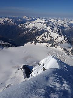
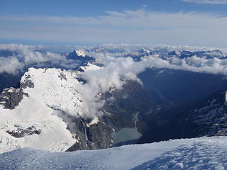
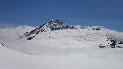
Down we went, making quick work of the upper NW ridge passing by three pairs of climbers (all guided) coming up from the Colin Todd hut. They had all flown in via helicopter the day before to Bevan Col. We reached the spot in the ridge where we had to decide to either descend the ramp or the north buttress, which would consist of some rocky traverses and likely some rappels. With our boots and crampons still on, and the snow still very firm it made sense to simply downclimb the bucket steps already in place on the ramp. The ramp is not to be taken lightly though, as there have been people killed slipping here and falling 200 meters over the cliff below. So we took it slow, carefully face-in downclimbing the 45-50 degree upper snow slopes following a descending leftward traverse utilizing excellent bucket steps. Eventually, the exposure and angle eased and we were able to walk down. The final part was another steeper section with a short rock step down. At the base of the ramp we were once again on the fringes of the Bonar Glacier. We rested a bit and roped back together for the horizontal glacier walk south back towards the SW ridge. Upon crossing below the base of the ridge and reaching the large flat upper glacier we unroped and went at our own paces 200 meters back up to the Quarterdeck. Luckily the snow was still decently firm underfoot, but with the sun out strong, it was softening quickly. In what felt like an eternity (only maybe an hour) we reached the Quarterdeck once again and took another rest. From here it was all downhill, 800 meters back to the hut on perfect plunge stepping snow. Just before 2pm we returned to French hut where Amelia greeted us. She had successfully climbed Mount French with Eva and Josh that morning. Celebratory talks and some food were had all around!

Luca descending the NW ridge


Downclimbing the ramp
More ramp escapades
More ramp escapades
Lower Bonar Glacier below
 
SW ridge profile; our route ascending the lower snow slope at lower right corner then up ridge to the crux
More direct view of the SW ridge as we traverse below it on return
Mount Aspiring from the upper Bonar Glacier
MOunt French summit ridge from the Quarterdeck
Mount Aspiring from the Quarterdeck
View down French Ridge from Quarterdeck
Luca resting at the Quarterdeck
Last view of Aspiring
 
Descending French Ridge as clouds roll in
 
Looking back at the Quarterdeck; the flat section of ridge at center-right above the steep drop
The hut visible again!


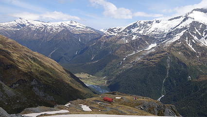
I took a couple hours to rest and pack up my gear and had decided I wanted to hike back down to at least the Aspiring hut to avoid hiking down the steep trail through the woods in the rain that was coming the following morning. Luca opted to stay at the French Hut though. It worked out in the end because the other two guys had a couple of my cams that we needed to grab from them. At 3:30, I started down solo and returned to the valley floor, opted to take the bridge across the Matukituki this go around and hike 6 kilometers to the Aspiring hut. With my boots tied to my pack this time my shoulders hurt by the time I arrived. I also occationally looked back up the valley towards French Ridge to see darkening clouds which re-affirmed I made the right choice to hike down. When I arrived at the Aspiring hut I was greeted by a large group of girl scouts (over 20!) making plenty of noise. Some of the adults in their group were impressed with my feat but being thoroughly exhausted I went right to sleep at about 7pm.

By the time I woke up, 11 hours later it was pouring rain. I had secretly hoped the rain would hold out for a few hours in the morning to allow me to hike out the final 9km dry but no dice. I decided to wait at the hut until the rest of our group made it from French hut so I was able to get a confirmation they were all ok. Around 10:30am they all arrived, soaked, cold and dreary wishing they made the same decision I made the afternoon prior. I briefly corresponded and prepared myself to become as wet as they were. My flimsy nylon windbreaker didn't protect against much rain, but at least I was able to hike with the mountaineering boots on, and the hut ranger was nice enough to give me a plastic bag to cover my pack with. The hike out wasn't so bad, however all the creek crossings had risen a lot, and all the normal muddy spots were indeed very muddy! With my big boots and gaiters on though I didn't really worry about getting too wet. A couple hours of misery later I arrived at the car, and threw all my wet clothes in and drove back to Wanaka where burritos, burgers, and beers were all consumed.

Final view from the French Hut before hiking down
Last view of Mount Avalanche
Gloomy Gorge below Mount Avalanche
Thickening clouds behind as I hike back to the Aspiring Hut
Map of our ascent route (red) and descent route (green)
Proudly powered by Weebly