LEMKE CLIMBS
  • About
    • Whats New
    • 2019 Goals/Wishlist
    • Contact
  • Washington
    • North Cascades >
      • Sahale Peak, Boston Peak
      • Eldorado Peak, Klawatti Peak
      • Black Peak
      • Forbidden Peak West Ridge
      • Primus Peak Attempt
      • Big Snagtooth
      • Liberty Bell Beckey Route
      • Burgundy Spire North Face 5.8
      • Ragged Ridge - Katsuk, Kimtah and Cosho Peaks
      • Colfax Peak
      • South Early Winters Spire via SW Buttress
      • Chilliwack Mini-Slam
      • Mesahchie Peak
      • Inspiration Traverse
      • Mount Shuksan Ski
      • Full Pickets Traverse
      • Mount Goode NE Buttress & Storm King
      • Mount Baker North Ridge WI3
      • Snowfield Peak
      • Lincoln Peak
      • Silver Star Mountain
      • Mount Buckner & Horseshoe Peak
      • Azurite Peak
      • Tower Mountain & Golden Horn
      • Mount Logan
      • Custer Ridge & Easy Mox
      • Mazama Dome
      • Sherman Peak
      • Mount Ballard
      • Southern Pickets Traverse
      • Corteo Peak
      • Whatcom Peak
    • Glacier Peak Wilderness >
      • Buck Creek Pass, Cloudy Peak, Spider Gap
      • Dome Peak, Spire Point
      • Mt. Maude and Seven Fingered Jack
      • Mount Formidable NE Face 5.6 Second Ascent
      • Dumbell and Greenwood Mountains
      • Glacier Peak Wilderness Mountain Massacre
      • Clark and Luahna Peaks
      • Sinister Peak
      • Chiwawa Mountain
      • Tupshin & Devore Peaks
      • Buck & Fortress Mountains
      • Glacier Peak
      • Snowking Mountain
    • Olympic Peninsula >
      • Buckhorn Mountain
      • Flapjack Lakes Hike
      • Grey Wolf Peak, High Divide Trail
      • Mount Ellinor
      • Mount Constance West Arete
      • Mount Olympus
    • Alpine Lakes Wilderness >
      • Chikamin Peak
      • PCT - Snoqualmie to Pete Lake
      • Foss Lakes Hike
      • Necklace and Tank Lakes
      • Enchantments Day Hike
      • Granite Mountain (Snoqualmie)
      • Colchuck Peak
      • Cannon, Enchantment and Stuart
      • Ingalls Peaks
      • McClellan Peak
      • Dragontail Peak
      • Web Mountain
      • Mount Index Attempt
      • Snow Creek Wall Orbit 5.8+
      • The Tooth South Face
      • Eightmile Mountain
      • Argonaut Peak NE Couloir
      • Little Annapurna South Face 5.5
      • Snow Creek Wall Outer Space 5.9
      • Cashmere Mountain
      • Sherpa Peak North Ridge 5.8
      • Chair Peak NE Ridge
      • Lichtenburg Mountain
      • Mount Index
      • McClellan Butte
      • Chimney Rock
      • Alpine Lakes High Route
    • Pasayten Wilderness >
      • The Craggies
      • Tiffany Mountain
      • Pasayten Mini-Slam
      • Remmel Group
      • Jack Mountain
      • Robinson Mountain
      • Monument Peak Group
    • Mountain Loop Highway >
      • Vesper Peak
      • Mount Dickerman
      • Sloan Peak West Face 5.8
      • Mount Forgotten
      • Whitehorse Mountain
      • Gothic Peak
    • Lake Chelan Sawtooth Wilderness >
      • Star, Courtney, and Grey Peaks
      • Hoodoo Peak and Raven Ridge
      • Abernathy Peak
      • Mount Bigelow
      • Reynolds Peak
      • Oval Peak
      • Gardner Peaks
      • Chelan Sawtooth Trio
    • Southern WA >
      • Mount Adams
      • Mount Rainier - Emmons Route
      • Mount Saint Helens
      • Goat Peak
      • Lane Peak, Plummer Peak (Tatoosh)
      • The Unicorn (Tatoosh)
      • Little Tahoma
      • Liberty Cap
    • WA Rock and Ice Cragging >
      • Index Town Walls
      • Vantage
      • Mount Erie
      • Exit 38
      • Leavenworth
  • Colorado
    • San Juan Mountains >
      • Mount Sneffels Lavender Snow Climb
      • Uncompahgre, Matterhorn Peaks
      • Redcloud, Sunshine Peaks
      • San Luis Peak
      • Vermilion, Fuller Peaks
      • Stewart Peak, Baldy Alto
      • Jones, Niagara, American Peaks
      • Wetterhorn Peak, Handies Peak
      • Wilson Group
      • Arrow Peak
      • Mount Sneffels SW Ridge
      • Jagged Mountain, Chicago Basin
      • Teakettle Mountain
      • Dallas Peak
      • Vestal Peak Wham Ridge, Greystone Peak
      • Organ Mountain
      • Phoenix Peak
      • Half Peak
      • Point 13832 Group
      • Golden Horn
      • Mount Sneffels Snake Couloir
      • Pigeon, Turret Peaks
    • Elk Mountains >
      • Four Pass Loop
      • Castle, Conundrum Peaks
      • Snowmass Mountain
      • Cathedral Peak
      • South Maroon Peak
      • The Pyramids
      • North Maroon Peak, Sleeping Sexton
      • Capitol Peak, Mount Daly
      • Malemute Peak
      • Hagerman Peak
    • Sangre de Cristo Mountains >
      • Blanca Peak, Ellingwood Point
      • Challenger Point
      • Mount Adams
      • Spread Eagle Peak
      • Humboldt, Obstruction, Columbia Peaks
      • Mount Lindsey, Huerfano Peak
      • Little Bear Peak
      • Crestone Needle Ellingwood Arete
      • California Peak
      • Crestone Peak North Buttress
      • Operation Dark Snake
      • Kit Carson Mountain
    • Sawatch Mountains >
      • Iowa Peak
      • Point 13,618 - Hunky Dory Lake
      • Gold Dust Peak, Notch Mountain
      • Mount Jackson
      • Mount Belford
      • Shavano, Tabeguache Peaks
      • Mount Antero, Cronin Peak
      • Twining Peak
      • Mount Massive
      • Casco Peak
      • Mount Huron
      • Mount Elbert
      • Mount Oxford
      • Mount Hope
      • Mount Yale
      • Lackawanna Peak
      • Mount Columbia
      • La Plata Peak
      • Rinker and Twin Peaks
      • Bull Hill, Mount Princeton
      • Missouri Mountain
      • Mount Oklahoma
      • French Mountain
      • Mount Ouray
      • Grizzly A, Garfield Peaks
      • Mount Harvard
      • The Three Apostles
      • Emerald Peak
      • Holy Cross
      • Mount Aetna
    • Greater Park Range >
      • Kneeknocker Pass, Piney Lake
      • Drift Peak
      • Sherman Peak, Dyer Peak
      • Gore Range Traverse
      • Quandary Peak
      • Pacific, Atlantic Peaks
      • Clark Peak
      • Crystal Peak, Peak 10
      • Fletcher Mountain
      • The DeCaLiBron
      • Loveland Mountain
      • The Mosquito Traverse
      • Mount Arkansas
      • Clinton Group
      • Eagles Nest, Peak C
      • North Star Mountain
      • Peak X
      • Wheeler Mountain
    • Front Range >
      • Mount Evans, Spalding
      • Mount Bierstadt
      • Mount Parnassus, Bard Peak
      • Cupid, Sniktau, Grizzly D Peaks
      • James Peak
      • Mount Silverheels
      • Grays and Torreys Peaks
      • Mount Edwards
      • Mount Flora, Longs Peak
      • Square Top Mountain
      • Petit Grepon South Face 5.8
      • Mount Meeker Dreamweaver Couloir
      • Santa Fe Peak
      • The Citadel & Pettingell
    • Colorado Ice Climbing >
      • Lincoln Ice Falls
      • Ouray Ice Park
      • Avocado Gully and The Drool
      • Hidden Falls
    • Colorado Rock Climbing >
      • Eldorado Canyon
      • The Flatirons
      • North Table Mountain
      • Shelf Road
      • Colorado National Monument >
        • Independence Monument
  • Wyoming
    • Wind River Mountains >
      • Gone With the Winds
      • Union Peak - Solar Eclipse
      • Wind River Peak
      • Wind River Slam
    • Teton Range >
      • Grand Teton Owen Spalding 5.4
      • Mount Owen Attempt
    • Wyoming Absarokas and Gros Ventre Range >
      • Jackson Peak
      • Francs Peak
    • Yellowstone National Park >
      • Top Notch Peak
    • Bighorn Range and Great Divide Basin >
      • Boars Tusk
      • Loaf Mountain
      • Cloud Peak
      • Black Tooth Mountain
    • Devils Tower
    • Cody Rock and Ice Climbing
  • Montana
    • Beartooth Mountains >
      • Whitetail Peak Group
      • Beartooth Mountain
      • Spirit Mountain Group
      • Mount Peal
      • Granite Peak Group
      • Castle Rock Group
      • Castle Mountain NE Couloir
      • Mount Inabnit and Sylvan Peak
      • Mount Hague South Slopes
      • Mount Villard and The Granite Peaks Traverse - 5.4
      • Spirit Mountain NE Ridge - 5.4
      • California Ice WI 4
      • The Ramp 5.8
      • Linea Alba 5.10d
      • Iceberg Peak
      • Metcalf Mountain North Rib 5.8
      • Villard Spires HP West Ramp
      • Cairn Mountain
      • Snowbank Mountain
      • Mount Wood Group
      • Bears Tooth
      • Glacier Peak Catch-a-Sunrise FA
    • Montana Absarokas & Gallatin Range >
      • Black Mountain
    • Southwest Montana Ranges >
      • Sacajawea Peak
      • Arrow Peak
      • Koch Peak
      • Saddle Peak
      • Baldy Mountain
      • Sphinx Mountain
    • Glacier National Park >
      • A Taste of Glacier National Park
      • Divide Mountain
    • MT Rock and Ice Climbing
  • Utah
    • Uinta Mountains >
      • Kings-Emmons Ridge Run
      • Hayden Peak
      • Iron Hayden Wall Rock Climbing
    • Wasatch Range >
      • The Sundial Eleventh Hour 5.8
      • Mount Timpanogos
    • San Rafael Swell >
      • Ramp, Cistern Canyons
      • Salt Wash, Black Mountain, Moroni Slopes
      • Ding, Dang Canyons
      • Little Wild Horse, Bell Canyons
      • Quandary Canyon
      • San Rafael Knob
      • Miners Hollow (Knotted Rope Canyon)
      • Temple Mountain
      • Chimney Rock
      • Bottleneck Mesa
      • Window Blind Peak
      • Lower Baptist Draw & Upper Chute Canyon
    • Capitol Reef National Park >
      • Cathedral Valley Tour
      • Sheets Gulch
      • Halls Creek Narrows
      • Brimhall Canyon and Strike Valley Overlook
      • George Benchmark
    • Moab Area, Canyonlands, Arches >
      • Maze District
      • Needles District
      • Maze District
      • White Rim Trail Biking
      • Elephant Butte, Bullwinkle Tower and Lizard Rock
      • South Six Shooter
      • Elephant Canyon
      • Parriott Mesa
      • Ancient Art
      • Castleton Tower North Chimney 5.8
      • Klondike Bluffs
      • Mount Peale & Tukuhnikivatz
    • Robbers Roost Country >
      • Horseshoe Canyon, Goblin Valley
      • Bluejohn Canyon
      • Happy Canyon Narrows
      • Shenanigans, Leprechaun Slots
      • Larry Canyon
      • Merry Piglet Slot
      • Lower Maidenwater Canyon, Turkey Knob
      • Morocco Canyon
      • Monkey Business Slot
      • Hog Canyon Slots
      • Upper Maidenwater Canyon Slots
      • Mount Ellen
      • Buck Canyon
      • Point 4906
      • Alcatraz Canyon
      • Hard Day Harvey Slot
      • Mount Ellsworth
      • Good Day Jim Canyon
      • White Roost Canyon
      • Upper Stair Canyon
      • Dragon Canyon
    • Escalante National Monument >
      • Phipps Canyon and Arch
      • Red Breaks Slot
      • Dry Fork Slots, Coyote Gulch
      • Little Death Hollow/Wolverine Canyons
      • Egypt 3 Slot
      • Egypt 1 Canyon
    • Zion/Bryce >
      • Ataxia Tower Ashtar Command 5.9
      • Mount Kinesava Cowboy Ridge
      • Birch Hollow
      • Aires Butte
      • West Temple
      • Mystery Canyon
      • Crazy Streak
    • Cedar Mesa Region/Valley of the Gods >
      • Eagle Plume Tower Eagle Feather 5.10b
  • California
    • High Sierras, Southern CA Ranges >
      • Telescope Peak, Manly Beacon
      • Tahquitz Rock Whodunit 5.9
      • Tahquitz Rock Long Route 5.9
      • Palisade Traverse
      • White Mountain
    • Yosemite National Park, Central CA
    • Northern CA Cascades >
      • Lava Beds National Monument
      • Mount Shasta
  • Oregon
    • Oregon Volcanoes >
      • Three Fingered Jack
      • Mount Scott
    • Blue Mountains >
      • Twin Peaks
    • Trout Creek Rock Climbing
  • Alaska
    • Eagle Peak and Mount Ewe
    • Jatt Peak and Portage Pass
    • Rainbow Peak
    • Mount Brooks Attempt
    • Arrigetch Peaks Trek
    • Ab Mountain Hike
    • South Suicide Peak
    • Mount Hunter West Ridge Attempt
    • Cantata Peak Attempt
    • East Twin Peak
    • Mount Alice
    • Crow Pass and Hope Point Hikes
    • Indianhouse Mountain Attempt
    • Lynx Peak
    • Harding Icefield Hike
    • Hatcher Pass and Grapefruit Rocks Climbing
    • Mount Sanford
    • Mount Hunter West Ridge
  • Nevada
    • Ginger Cracks 5.8
    • Mescalito Dark Shadows 5.8
    • Birdland and Olive Oil
    • Frogland 5.8
    • Johnny Vegas 5.8
    • Schaeffer's Delight & Triassic Sands
    • Solar Slab - 5.6
  • British Columbia
    • Mount Matier
    • Taiya Peak
    • Bugaboo Spire NE Ridge
    • Mount Sabine Easy Honey 5.10b
    • Mount Sir Donald NW Ridge Attempt
    • Black Tusk
    • Squamish Ticks
    • Slesse Mountain NE Buttress
    • Warden Peak
    • Triple Peak
  • Alberta
    • Mist Ridge Hike
    • Mount Temple Attempt
    • East Wendell Peak
    • Loder Peak
    • Tower Mountain Attempt
    • The Rimwall
    • Mount Yamnuska Directissima 5.9
    • Mount Lawrence Grassi
    • Mount Lorette
    • Roche A Perdrix
    • Mount Edith Cavell East Ridge 5.3
    • Mount Louis Kain Route
    • Eiffel Peak
    • Canadian Rockies Ice Climbing
  • Other States
    • Arizona >
      • Grand Canyon Bright Angel Trail
      • Beanfest at Cochise Stronghold
      • Baboquivari Peak
      • Humphreys Peak
    • New Mexico >
      • Philmont Trek August 2008
    • Yukon >
      • Canyon Peak
  • International
    • Mexico & Central America >
      • Mexico - Pico de Orizaba, Izta
      • Guatemala Volcanoes
    • South America >
      • An Introduction to Patagonia
      • Cordillera Blanca - Tocllaraju and Urus
      • Nahuel Huapi National Park & The Frey
      • Exploring Pucon and Lanin Volcano
      • Cordillera Blanca - Ishinca Peak and Artesonraju
      • Cordillera Blanca - Quitaraju & Alpamayo
      • Exploring Southern Peru
      • Cerro Helio Azul & Tronador Attempt
      • Aguja Guillaumet Amy Couloir
      • Cerro Puntado & Palo
      • Cerro Colorado
      • Cerro Puno & Agudo
      • Cerro Trinidad Attempt
      • Volcan Quetrupillan
      • Cerro Placas
      • Nevado de Acay
      • Pequeno Alpamayo
      • Huayna Potosi
      • Illimani
      • Chiaro de Luna
      • Cerro Barros Arana
    • Oceania >
      • Exploring New Zealand's South Island
      • Puncak Jaya
      • Mount McPherson and Talbot
      • Single Cone
      • Mount Cook
      • Mount Aspiring
      • Manakau
    • Central Asia >
      • Kyrgyzstan 2021
  • Sorted by Year
    • 2008 Trip Reports
    • 2009 Trip Reports
    • 2010 Trip Reports
    • 2011 Trip Reports
    • 2012 Trip Reports
    • 2013 Trip Reports
    • 2014 Trip Reports
    • 2015 Trip Reports
    • 2016 Trip Reports
    • 2017 Trip Reports
    • 2018 Trip Reports
    • 2019 Trip Reports
    • 2020 Trip Reports
    • 2021 Trip Reports
    • 2022 Trip Reports
  • Vanlife
    • Conversion Journal >
      • Floor Installation
      • Folding Bed
      • Coffee Table
      • Thinsulate Installation
      • The Couch
      • The Wardrobe
      • Bookshelf
      • Water System
      • Electrical System
      • The Pantry
      • Refrigerator
      • Tire Upgrade
      • Heating System
      • Composting Toilet
LEMKE CLIMBS

Cerro Puntado & Cerro Palo

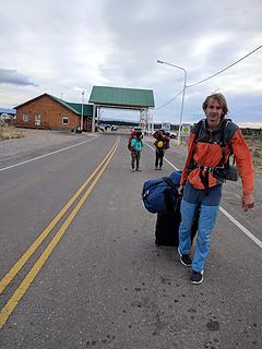
Continuing my long, drawn out series of trip reports from last years Patagonia vacation, after Elaine, Itai and I climbed Aguja Guillaumet, we waited around in El Chalten for about a week without any luck in a return to the amazingly nice weather we had. We killed time by bouldering at the local rocks with a great crew of other climbers from all over North America, sport climbing on the cliffs along the river, and eating empanadas! Not wishing to wait any longer though, we decided to return back northward and head to the Cerro Castillio area of Patagonia, where the forecast called for better weather. We took the 12 hour bus ride north to the Argentina border town of Los Antiguos, and then had to exit Argentina, and walk over a mile on the road into Chile. Carrying all our gear and walking on the pavement was a chore! Luckily I had a roller bag for all my heavy climbing gear, but the wheels were about to break. Just as they broke, we were able to find someone taxiing other people around, and he agreed to come back for us in 15 minutes to take us the rest of the way to the Chilean entry station. 


Walking to the border crossing

Once we officially entered Chile, we had the border agent call a taxi for us from Chile Chico and we entered town and using the recommendation of a climber we met in Chalten we found a great hostel where the owner caters to climbers. They were kind enough to assist us with planning our travel to the tiny town of Villa Cerro Castillio, across the Lago General Carrera, which a daily ferry crosses and takes you to Rio Ibanez on the north end of the lake. This 2 hour ferry is one hell of a ride as the boat rocks over the huge wind waves. This lake is so big it's almost like an inland sea, and would take an entire day to make the drive around if driving from Chile Chico to Rio Ibanez. 


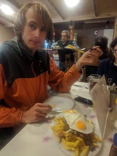
Upon exiting the ferry, a plethora of vans and buses were there to take anyone who came off whereever they close. We were lucky to find a free ride from a really nice guy in a pickup who took us north to the intersection with the Carratera Austral, which he continued right towards Coyhaique. We wanted to go a short distance left to the town of Villa Cerro Castillio, so we got off at the intersection and hitched a ride the ten miles to the small village, which only exists because of Mammut, who sponsors the town and all the recently developed climbing in the surrounding area! We had a nice dinner at the only place open in town and I got steak and eggs! 


Dinner in Villa Cerro Castillio
Sunset from the campground
Sunrise over Cerro Castillio
 
Cerro Castillio from the namesake town

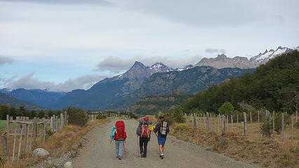
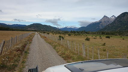
We managed to find an awesome campground walking on an unpaved road just north of town along the Estero del Bosque called Rustika Patagonia. This was on the road that led us towards Cerro Palo and Puntado. We got there pretty late as it was getting dark, but we did run into a few people looking to start on the Cerro Castillio trek the next morning so we had people to chat with. We pitched the tent in the open field along the creek and went to sleep. The next morning we scored a hitchhike partway down the gravel road by a local farmer to reduce our 8km road walk along the north side of Rio Ibanez to where the trail towards Campo New Zealand starts. We all piled into the back of his empty hay truck and were on our way! 


Road walking for awhile
Hitching in the back of a hay truck
 
Cerro Palo from the start of the trail

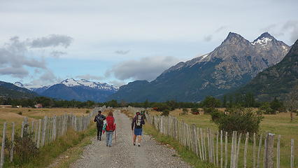
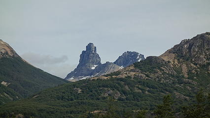
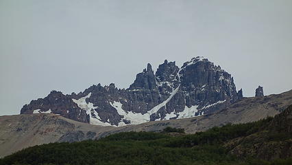
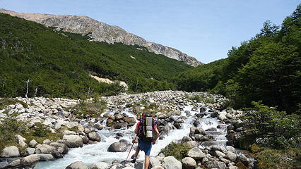
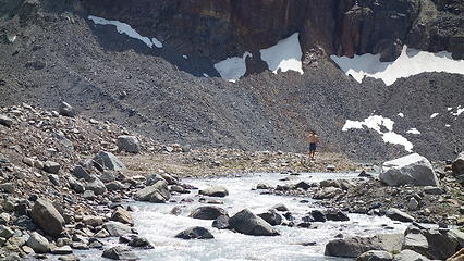
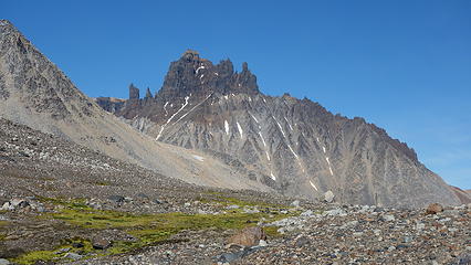
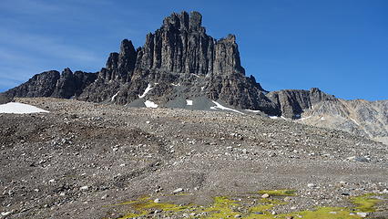
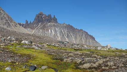
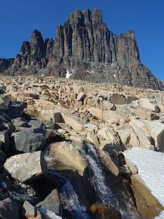
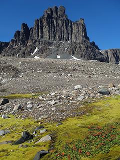
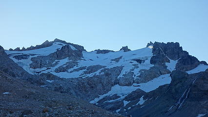
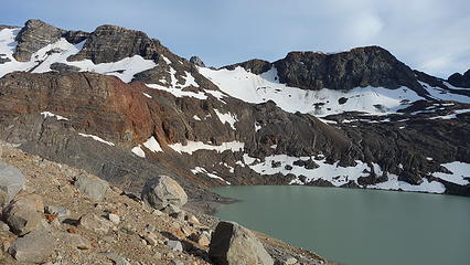
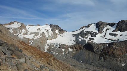
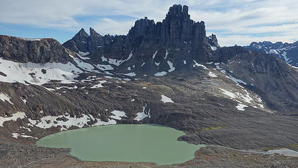
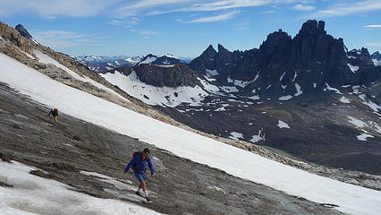
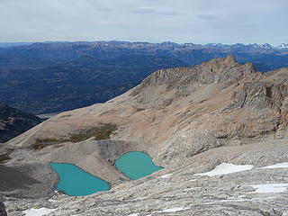
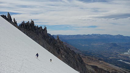
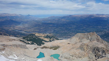
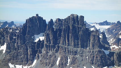
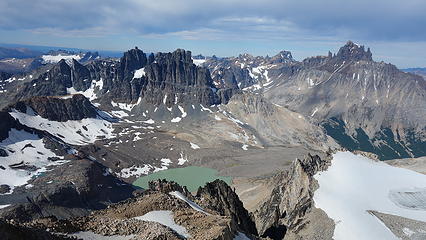
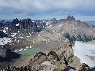
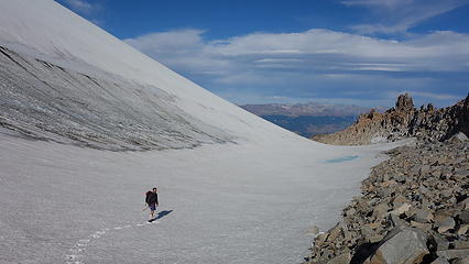
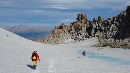
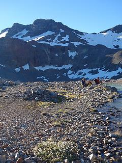
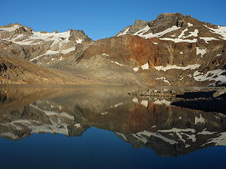
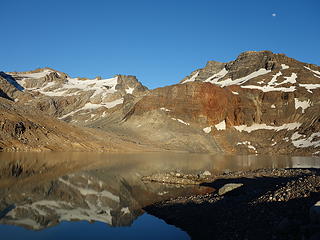
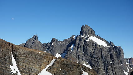
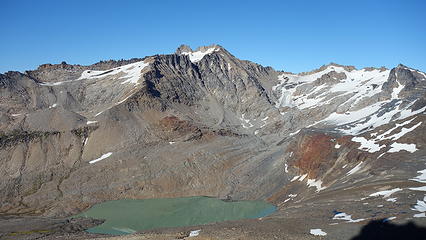
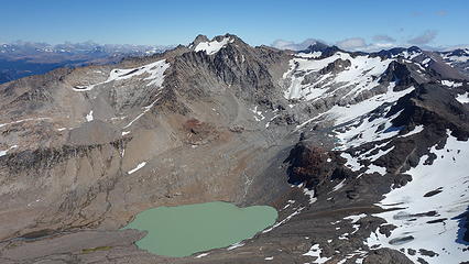
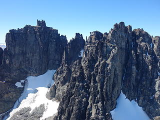
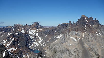
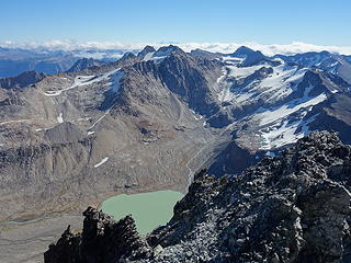
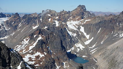
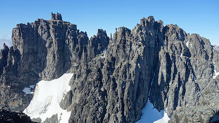
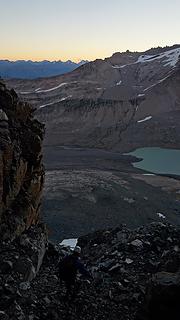
We located the correct start to the trail heading towards the New Zealand camp along the Estero Parada river valley. The trail was surprisingly in great shape as this is part of the popular Cerro Castillio circuit trek for hikers. In no time at all we reached the junction where most hikers hike up and east over the pass. We however continued on the lesser hiked path further north until we came to where a valley drained in from the northwest. We forded across Estero Parada and hiked up along the shore of this side stream for awhile before entering the mildly dense woods until we reached treeline. From treeline we easily bee lined it to the large alpine lake at 1400 meters elevation immediately southeast of the impressive Cerro Palo, which is seen the whole way up the approach hike. 


Fording Estero Parada
Entering the upper basin with Palo standing tall

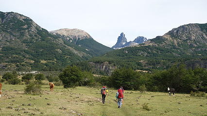
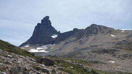
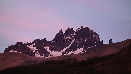
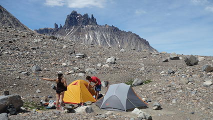
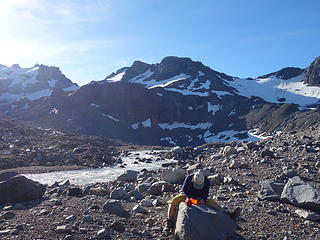
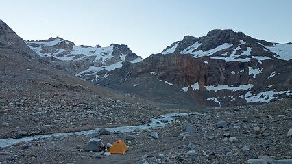
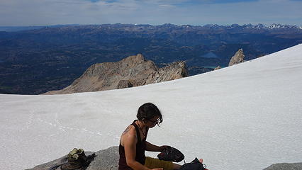
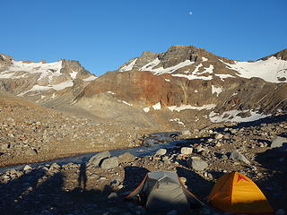
We arrived at the lake as the sun was shining strong over the landscape, and we found a great sandy spot by the outlet to pitch our tents. I spent the afternoonexploring up the slopes above the lake towards Cerro Palo looking for a potential route up the west side of Palo. I saw potential, but nothing definitive, nonetheless, we agreed to climb Puntado the next day, then Palo the following day. A gorgeous evening and sunset was followed by a great night sleep. 


Cerro Castillio behind our new home
 
View from near camp
View from near camp
Cerro Castillio; I'll have to come back another year to climb this one!
 
 
Looking across to Puntado, our objective the next day
 
Cerro Palo looking scary!

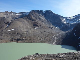
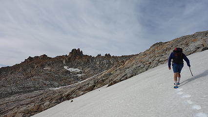
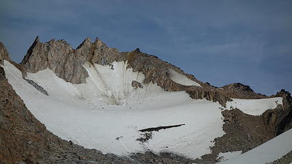
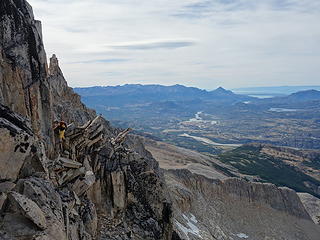
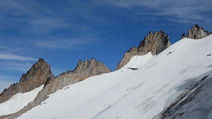
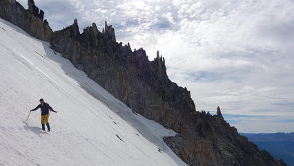
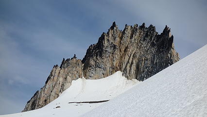
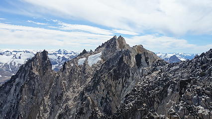
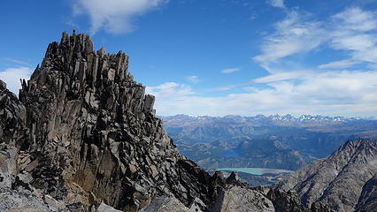
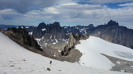
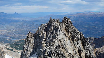
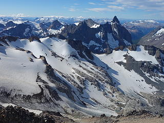
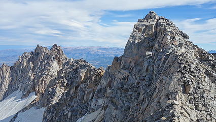
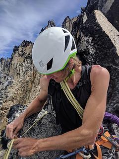
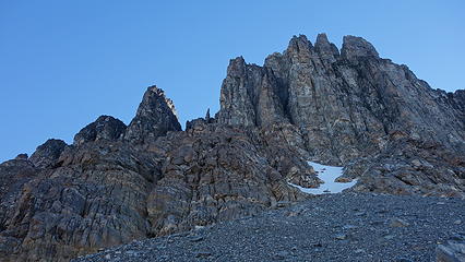
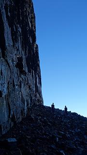
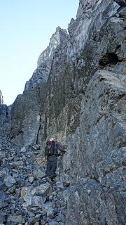
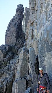
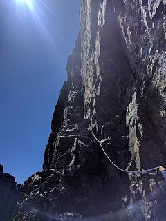
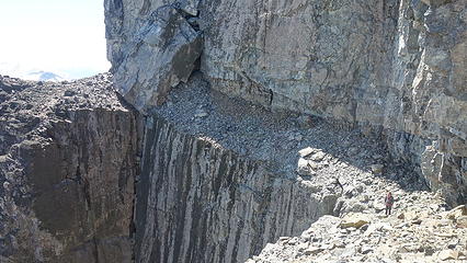
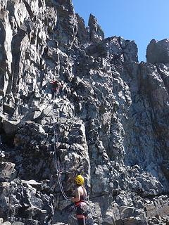
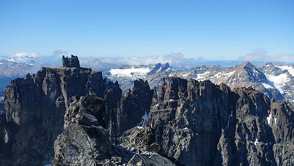
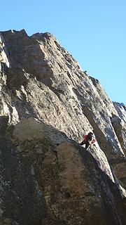
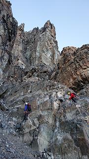
We didn't get a super early start the next morning, and as the sun rose we began hiking up the talus slopes to the south of the lake and up a small ridge until we emerged into the upper basin immediately east of Puntado. We traversed across a very small glacier and crested the long east ridge, and decided to drop down to the shady south side and traverse. We weren't sure if we could regain the ridge if we continued further into the basin. We were able to traverse on the south side however, and after some loose class 4 ledges we dropped onto the next snowfield and made quicker time, aiming straight for the obvious buttress leading up the final section of the east ridge direct. We regained the ridge proper and racked up, where I led a long 5.7 pitch 75% of the way up the steepest part of the step. Once Itai and Elaine made their way up, Itai led a short pitch, but we found ourselves on progressively more difficult terrain as the ridge narrowed and features decreased. I continued on and managed to climb around a gendarme and over to the south side once again, then back to the north side to make a scary hand traverse to a wider saddle where I could breathe easy again. Itai went second on this long horizontal traverse, but cleaned some of the critical gear needed to prevent a big pendulum fall. When Elaine went to make the traverse she took a small swing and ended up having to climb a hard 5.10b crack to regain the ridgecrest and finish the traverse. 


Sunrise over Castillio


Great view of Palo
Great view of Palo
 
 
East face of Puntado. Our route is the steep rise on the left edge of the photo
Cresting the lower east ridge of Puntado
 
 
Class 4 ledges on east ridge
 
More lakes!
More lakes!
 
 
Traversing easy snow
Cerro Puntado
Cerro Puntado
 
 
Our buttress on the right side
 
Elaine taking a break
 
The wild east ridge of Puntado

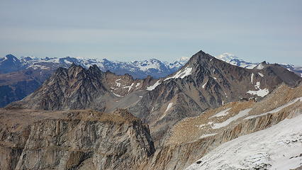
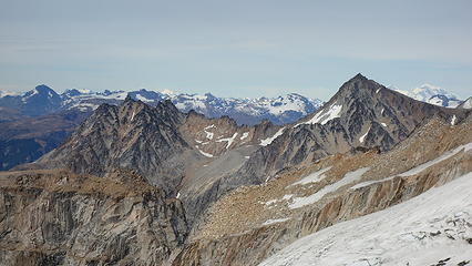
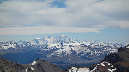
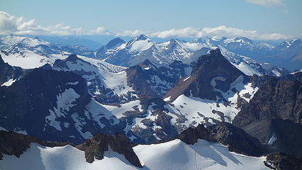
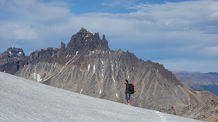
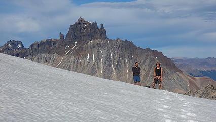
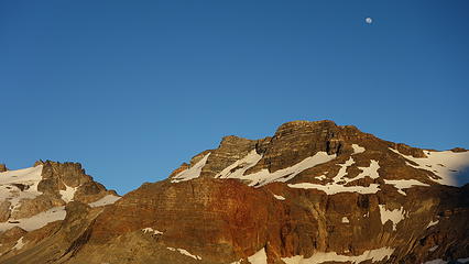
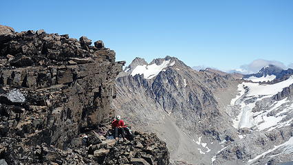
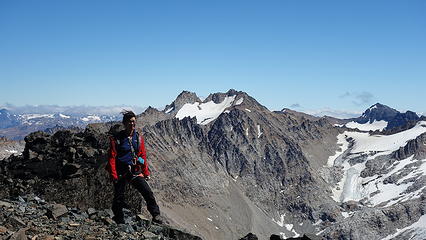
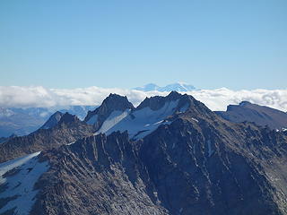
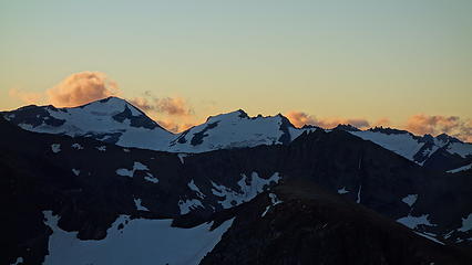
Looking SW towards San Valentine 


Looking back at the traverse pitch with Itai all smiles


Looking back, we would have easily been able to make it to the same small saddle at the base of the buttress we climbed just by continuing up the easy basin towards the east face of Puntado rather than crossing over the east ridge, but hey, we got to see more scenery, and we confirmed exactly which peak was the true summit by doing so (it was quite challenging to determine which peak was highest). 


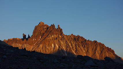
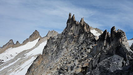
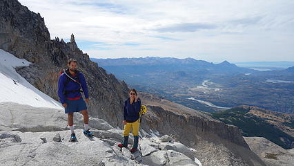
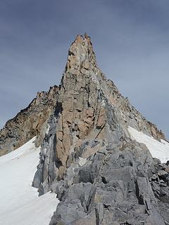
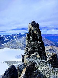
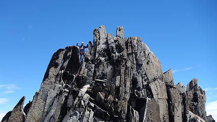
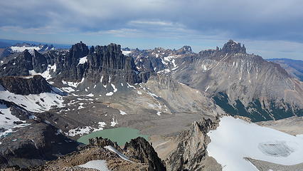
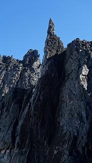
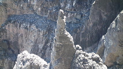
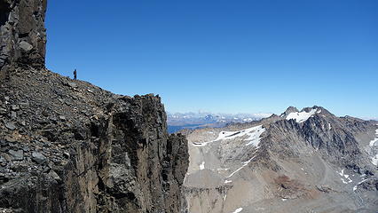
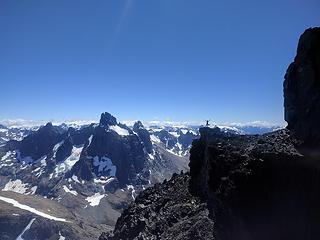
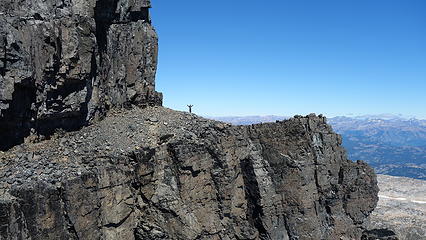
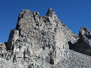
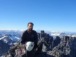
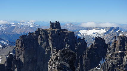
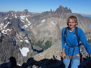
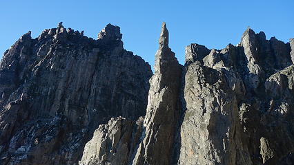
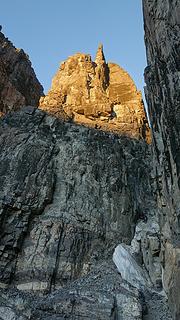
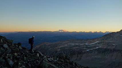
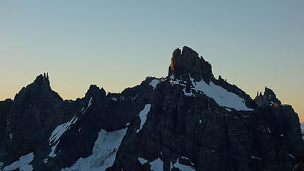
After finishing the traverse pitch, we continued scrambling class 3 and 4 until one last low 5th class section led us right to the summit, which was nothing more than a spike! Views were nothing short of jaw dropping. The beauty of Patagonia gives me life I cannot really describe...we were stoked to be up there. We saw no slings of any kind, and to make a short rappel, I dug out the sling I took off of Mount Terror in the pickets during my Pickets traverse in 2016 (also climbed with Itai), and used it for an anchor on Puntado, moving that sling halfway around the world! We opted to descend directly for the basin that would lead us right back towards camp rather than the way we came. Our descent was mostly a scramble except for the last drop onto the remnants of the glacier, where we did utilize an existing sling wrapped around a huge rock (so someone had at least been up here!). I saw the peak right next to the one we had climbed potentially was a few feet higher, so I scrambled up that one as well, finding a route at class 4 while Elaine and Itai waited in the upper basin. Only took me 30 minutes or so, and we took it easy descending back to the lake and enjoyed the late afternoon lighting. 


The summit
The summit
 
Excellent views across to Palo
Palo and another peak to the left, behind it
 
 
Palo and Castillio
Palo and Castillio
 
Kinda reminds me of Frey


View of the other peak I scrambled up from the last short rappel
Not sure what I'm doing haha
 
I scrambled up the ridge on the right


Cerro Castillio beckons
 
Sunset from camp
Sunset from camp
 

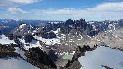
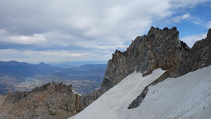
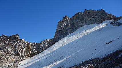
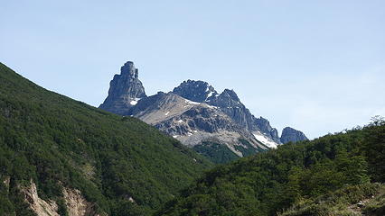
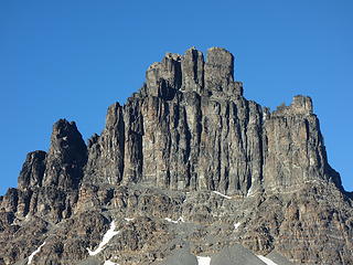
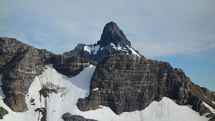
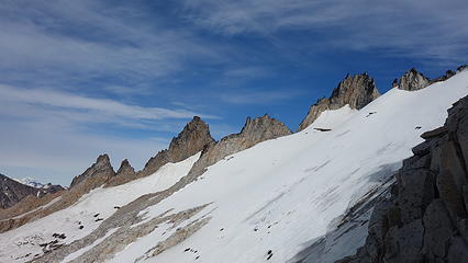
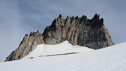
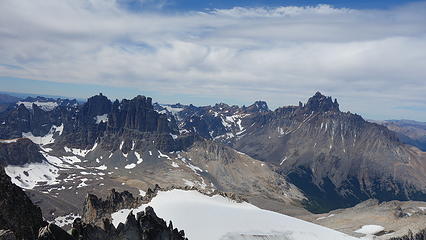
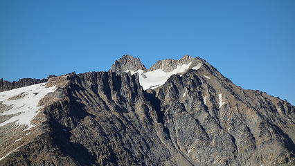
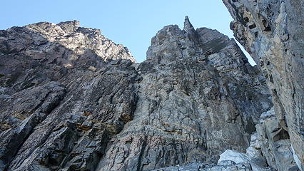
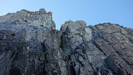
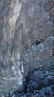
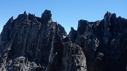
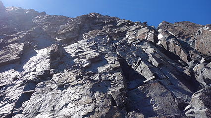
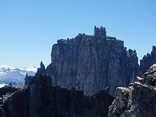
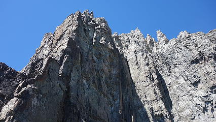
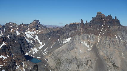
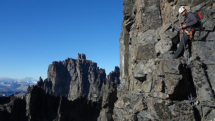
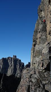
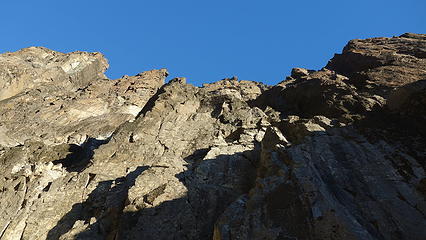
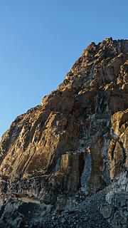
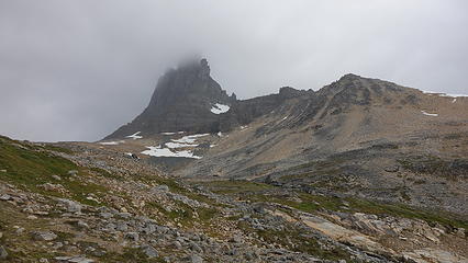
The next morning we went the other way and hiked up the slopes to the north and located a deep gully slicing up towards a deep, narrow notch below the imposing west face of Palo. Lots of loose class 3 and 4 scrambling was done to make our way up this gully. As we neared the notch, we noticed a large detached tower on the opposite side, and we scanned the near vertical walls above us for potential routes. I spotted a series of ramps and cracks that looked promising, and so up we went linking together ledges and ramps interspersed with some more difficult climbing, often on very loose rock. Eventually, after about 4 leads (Itai and I switched off), we reached a long ledge that I initially thought we could traverse right, and round the prominent SW corner of the mountain, but that proved futile. I then looked well off to the left towards the middle of the lower west face and saw a beautiful hand crack splitting the otherwise featureless rock wall. With the sun glaring in my eyes, I couldn't tell much detail about it but figured we were better off traversing left on the ledge. 


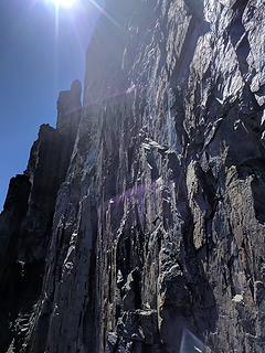
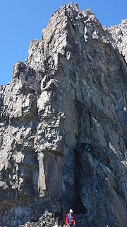
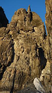
Amazingly, as if this crack was just meant to be climbed, this ledge ended right at the base of the crack, and offered a small cave for a belayer to safely belay from. I then took the lead climbing straight up this beautiful 5.7 crack, sometimes having to wipe off some kitty litter, and 45 meters or so up, the crack dumped me off onto the gigantic ledge encircling the entire upper part of the mountain. I made an anchor and belayed Itai and Elaine up and we were starstruck at where we had landed. We spent over an hour circling around just about all sides of the large summit pinnacle on this ledge that was between 10-50 meters wide. Circling around to the south side was to no avail as that entire side of the upper mountain was overhanging. The west side did look like it had some ramps but after climbing 100 feet up or so we soon realized it was blank up above. Just as we were about to give up, I decided to traverse further around to the left, all the way to the north side of the mountain and I couldn't believe my eyes when I came across some slings! They led right down the north side, and I then assumed the standard way to climb Palo was from the north, approaching by circling around the mountain from our camp to the north side before doing any climbing. 


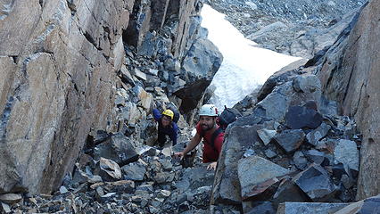
From where I saw the rappel anchor, I turned around and immediately realized the route continued up from there, and I screamed as loud as possible that I had found the route. Itai decided to take lead, since it was his turn. He led up a long winding 5.6 pitch up somewhat more solid rock, then I did another 5.6 pitch, which took us to the base of a short off width 5.8 that Itai then led. The final 200 feet we scrambled to the summit, which we reached around 3pm. We went from just about giving up not being able to find a route to finish the climb to standing on the summit of one of the grander peaks of the area. 


Approaching the south side of Palo
Waking back to Puntado
Scrambling up the narrow gully
 
Our lake (which we had to ourselves for 4 days!)
Arriving at the base of the south face
 
 
Looking for a way up
Elaine climbing through a groove
Detached tower
Detached tower
 
 
Where should we go? It's all vertical! We went up and right, then left and up the long, shaded right facing dihedral/crack at upper left corner
 
Itai leading across the ledge leading to our crack
Another peak to climb one day
Puntado again
Puntado again


Exploring the huge ledge. We crawled under the big rock at upper left
Such an odd place to hang out!
 
Nothing climbable for us on the south side


Found the route on north side
The final scramble up the loose gully at right


I'm happy! Castillio behind me from the summit


We decided to descend the way we ascended rather than descend blindly down the lower north side of the mountain not knowing where it may lead us. I rembered finding a number of good places to make anchors we we climbed. We made two easy double rope raps down the upper pitches back to the big ledge, then traversed back around to the top of the long dihedral/crack, where a very exposed rap brought us back down to the ledge below. Unfortunately our rope wouldn't pull once we were down, so Itai had to traverse back to the cave at the base of the crack and work some magic. 


Two more double rope raps got us back into the narrow gully and we scrambled back down to the talus fan just below the lower south face, making it back to the tent just as it got dark. We were elated, and tired! 


Exposed much?
Exposed much?
Finishing the rappel down the dihedral/crack


Finishing the last rappel


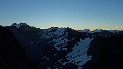
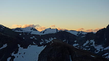
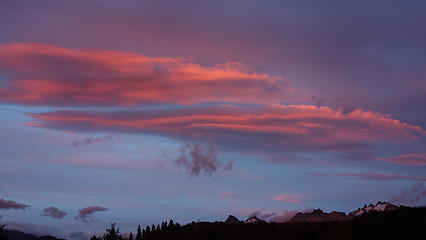
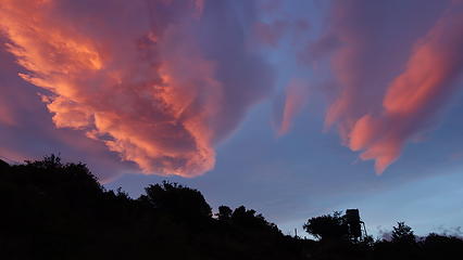
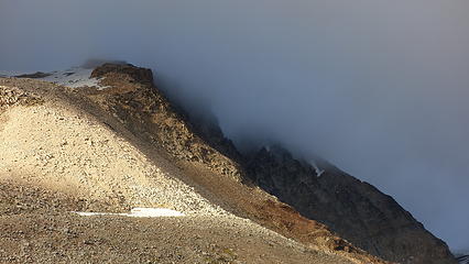
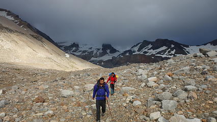
The sunset was beautiful as we hiked back to the lake. Over the course of the night I could tell the weather was changing, and I was just so happy we timed it perfectly. When we emerged from camp the next morning, a deep, dark ominous cloud was just to our west. The sun rising to the east made the scene quite photogenic. We very quickly packed up and started hiking down. The dark cloud mostly missed us bit did give us a little ail and mist. Once back on the trail it was a pleasant hike back to the road along Rio Ibanez. Hitchhiking proved futile initially, but after we walked 4km on the road, we saw a vehicle with climbers heading up, and they were very interested to hear about our ascent however we couldn't talk much because someone else heading down offered to give us a ride! They dropped us off at the same campground we stayed a few nights earlier, where there was a huge festival of sorts going on (Asado I presumed). 


We enjoyed a very nice lunch, then started out way back to Chile Chico via vans, and the ferry. Our next objectives we would embark on climbs of Cerro Puno and Agudo, which I've already written about. Until next time, stay tuned as I continue writing about our travels northward towards Bolivia!


Picture
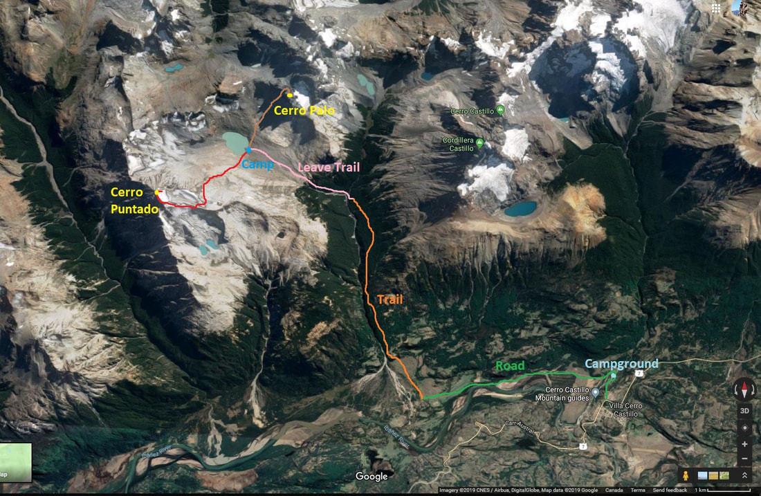
Satellite Overview of our routes
Picture
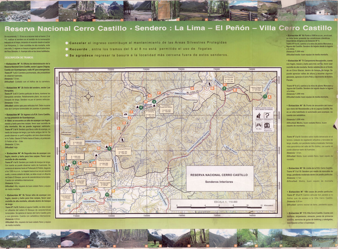
Cerro Castillio Circuit trek map
Proudly powered by Weebly