LEMKE CLIMBS
  • About
    • Whats New
    • 2019 Goals/Wishlist
    • Contact
  • Washington
    • North Cascades >
      • Sahale Peak, Boston Peak
      • Eldorado Peak, Klawatti Peak
      • Black Peak
      • Forbidden Peak West Ridge
      • Primus Peak Attempt
      • Big Snagtooth
      • Liberty Bell Beckey Route
      • Burgundy Spire North Face 5.8
      • Ragged Ridge - Katsuk, Kimtah and Cosho Peaks
      • Colfax Peak
      • South Early Winters Spire via SW Buttress
      • Chilliwack Mini-Slam
      • Mesahchie Peak
      • Inspiration Traverse
      • Mount Shuksan Ski
      • Full Pickets Traverse
      • Mount Goode NE Buttress & Storm King
      • Mount Baker North Ridge WI3
      • Snowfield Peak
      • Lincoln Peak
      • Silver Star Mountain
      • Mount Buckner & Horseshoe Peak
      • Azurite Peak
      • Tower Mountain & Golden Horn
      • Mount Logan
      • Custer Ridge & Easy Mox
      • Mazama Dome
      • Sherman Peak
      • Mount Ballard
      • Southern Pickets Traverse
      • Corteo Peak
    • Glacier Peak Wilderness >
      • Buck Creek Pass, Cloudy Peak, Spider Gap
      • Dome Peak, Spire Point
      • Mt. Maude and Seven Fingered Jack
      • Mount Formidable NE Face 5.6 Second Ascent
      • Dumbell and Greenwood Mountains
      • Glacier Peak Wilderness Mountain Massacre
      • Clark and Luahna Peaks
      • Sinister Peak
      • Chiwawa Mountain
      • Tupshin & Devore Peaks
      • Buck & Fortress Mountains
      • Glacier Peak
    • Olympic Peninsula >
      • Buckhorn Mountain
      • Flapjack Lakes Hike
      • Grey Wolf Peak, High Divide Trail
      • Mount Ellinor
      • Mount Constance West Arete
      • Mount Olympus
    • Alpine Lakes Wilderness >
      • Chikamin Peak
      • PCT - Snoqualmie to Pete Lake
      • Foss Lakes Hike
      • Necklace and Tank Lakes
      • Enchantments Day Hike
      • Granite Mountain (Snoqualmie)
      • Colchuck Peak
      • Cannon, Enchantment and Stuart
      • Ingalls Peaks
      • McClellan Peak
      • Dragontail Peak
      • Web Mountain
      • Mount Index Attempt
      • Snow Creek Wall Orbit 5.8+
      • The Tooth South Face
      • Eightmile Mountain
      • Argonaut Peak NE Couloir
      • Little Annapurna South Face 5.5
      • Snow Creek Wall Outer Space 5.9
      • Cashmere Mountain
      • Sherpa Peak North Ridge 5.8
      • Chair Peak NE Ridge
      • Lichtenburg Mountain
      • Mount Index
      • McClellan Butte
      • Chimney Rock
      • Alpine Lakes High Route
    • Pasayten Wilderness >
      • The Craggies
      • Tiffany Mountain
      • Pasayten Mini-Slam
      • Remmel Group
      • Jack Mountain
      • Robinson Mountain
      • Monument Peak Group
    • Mountain Loop Highway >
      • Vesper Peak
      • Mount Dickerman
      • Sloan Peak West Face 5.8
      • Mount Forgotten
      • Whitehorse Mountain
      • Gothic Peak
    • Lake Chelan Sawtooth Wilderness >
      • Star, Courtney, and Grey Peaks
      • Hoodoo Peak and Raven Ridge
      • Abernathy Peak
      • Mount Bigelow
      • Reynolds Peak
      • Oval Peak
      • Gardner Peaks
      • Chelan Sawtooth Trio
    • Southern WA >
      • Mount Adams
      • Mount Rainier - Emmons Route
      • Mount Saint Helens
      • Goat Peak
      • Lane Peak, Plummer Peak (Tatoosh)
      • The Unicorn (Tatoosh)
      • Little Tahoma
    • WA Rock and Ice Cragging >
      • Index Town Walls
      • Vantage
      • Mount Erie
      • Exit 38
      • Leavenworth
  • Colorado
    • San Juan Mountains >
      • Mount Sneffels Lavender Snow Climb
      • Uncompahgre, Matterhorn Peaks
      • Redcloud, Sunshine Peaks
      • San Luis Peak
      • Vermilion, Fuller Peaks
      • Stewart Peak, Baldy Alto
      • Jones, Niagara, American Peaks
      • Wetterhorn Peak, Handies Peak
      • Wilson Group
      • Arrow Peak
      • Mount Sneffels SW Ridge
      • Jagged Mountain, Chicago Basin
      • Teakettle Mountain
      • Dallas Peak
      • Vestal Peak Wham Ridge, Greystone Peak
      • Organ Mountain
      • Phoenix Peak
      • Half Peak
      • Point 13832 Group
      • Golden Horn
    • Elk Mountains >
      • Four Pass Loop
      • Castle, Conundrum Peaks
      • Snowmass Mountain
      • Cathedral Peak
      • South Maroon Peak
      • The Pyramids
      • North Maroon Peak, Sleeping Sexton
      • Capitol Peak, Mount Daly
      • Malemute Peak
      • Hagerman Peak
    • Sangre de Cristo Mountains >
      • Blanca Peak, Ellingwood Point
      • Challenger Point
      • Mount Adams
      • Spread Eagle Peak
      • Humboldt, Obstruction, Columbia Peaks
      • Mount Lindsey, Huerfano Peak
      • Little Bear Peak
      • Crestone Needle Ellingwood Arete
      • California Peak
      • Crestone Peak North Buttress
      • Operation Dark Snake
      • Kit Carson Mountain
    • Sawatch Mountains >
      • Iowa Peak
      • Point 13,618 - Hunky Dory Lake
      • Gold Dust Peak, Notch Mountain
      • Mount Jackson
      • Mount Belford
      • Shavano, Tabeguache Peaks
      • Mount Antero, Cronin Peak
      • Twining Peak
      • Mount Massive
      • Casco Peak
      • Mount Huron
      • Mount Elbert
      • Mount Oxford
      • Mount Hope
      • Mount Yale
      • Lackawanna Peak
      • Mount Columbia
      • La Plata Peak
      • Rinker and Twin Peaks
      • Bull Hill, Mount Princeton
      • Missouri Mountain
      • Mount Oklahoma
      • French Mountain
      • Mount Ouray
      • Grizzly A, Garfield Peaks
      • Mount Harvard
      • The Three Apostles
      • Emerald Peak
      • Holy Cross
    • Greater Park Range >
      • Kneeknocker Pass, Piney Lake
      • Drift Peak
      • Sherman Peak, Dyer Peak
      • Gore Range Traverse
      • Quandary Peak
      • Pacific, Atlantic Peaks
      • Clark Peak
      • Crystal Peak, Peak 10
      • Fletcher Mountain
      • The DeCaLiBron
      • Loveland Mountain
      • The Mosquito Traverse
      • Mount Arkansas
      • Clinton Group
      • Eagles Nest, Peak C
      • North Star Mountain
      • Peak X
      • Wheeler Mountain
    • Front Range >
      • Mount Evans, Spalding
      • Mount Bierstadt
      • Mount Parnassus, Bard Peak
      • Cupid, Sniktau, Grizzly D Peaks
      • James Peak
      • Mount Silverheels
      • Grays and Torreys Peaks
      • Mount Edwards
      • Mount Flora, Longs Peak
      • Square Top Mountain
      • Petit Grepon South Face 5.8
      • Mount Meeker Dreamweaver Couloir
      • Santa Fe Peak
      • The Citadel & Pettingell
    • Colorado Ice Climbing >
      • Lincoln Ice Falls
      • Ouray Ice Park
      • Avocado Gully and The Drool
      • Hidden Falls
    • Colorado Rock Climbing >
      • Eldorado Canyon
      • The Flatirons
      • North Table Mountain
      • Shelf Road
      • Colorado National Monument >
        • Independence Monument
  • Wyoming
    • Wind River Mountains >
      • Gone With the Winds
      • Union Peak - Solar Eclipse
      • Wind River Peak
      • Wind River Slam
    • Teton Range >
      • Grand Teton Owen Spalding 5.4
      • Mount Owen Attempt
    • Wyoming Absarokas and Gros Ventre Range >
      • Jackson Peak
      • Francs Peak
    • Yellowstone National Park >
      • Top Notch Peak
    • Bighorn Range and Great Divide Basin >
      • Boars Tusk
      • Loaf Mountain
      • Cloud Peak
      • Black Tooth Mountain
    • Devils Tower
    • Cody Rock and Ice Climbing
  • Montana
    • Beartooth Mountains >
      • Whitetail Peak Group
      • Beartooth Mountain
      • Spirit Mountain Group
      • Mount Peal
      • Granite Peak Group
      • Castle Rock Group
      • Castle Mountain NE Couloir
      • Mount Inabnit and Sylvan Peak
      • Mount Hague South Slopes
      • Mount Villard and The Granite Peaks Traverse - 5.4
      • Spirit Mountain NE Ridge - 5.4
      • California Ice WI 4
      • The Ramp 5.8
      • Linea Alba 5.10d
      • Iceberg Peak
      • Metcalf Mountain North Rib 5.8
      • Villard Spires HP West Ramp
      • Cairn Mountain
      • Snowbank Mountain
      • Mount Wood Group
      • Bears Tooth
      • Glacier Peak Catch-a-Sunrise FA
    • Montana Absarokas & Gallatin Range >
      • Black Mountain
    • Southwest Montana Ranges >
      • Sacajawea Peak
      • Arrow Peak
      • Koch Peak
      • Saddle Peak
      • Baldy Mountain
      • Sphinx Mountain
    • Glacier National Park >
      • A Taste of Glacier National Park
      • Divide Mountain
    • MT Rock and Ice Climbing
  • Utah
    • Uinta Mountains >
      • Kings-Emmons Ridge Run
      • Hayden Peak
      • Iron Hayden Wall Rock Climbing
    • Wasatch Range >
      • The Sundial Eleventh Hour 5.8
      • Mount Timpanogos
    • San Rafael Swell >
      • Ramp, Cistern Canyons
      • Salt Wash, Black Mountain, Moroni Slopes
      • Ding, Dang Canyons
      • Little Wild Horse, Bell Canyons
      • Quandary Canyon
      • San Rafael Knob
      • Miners Hollow (Knotted Rope Canyon)
      • Temple Mountain
      • Chimney Rock
      • Bottleneck Mesa
      • Window Blind Peak
      • Lower Baptist Draw & Upper Chute Canyon
    • Capitol Reef National Park >
      • Cathedral Valley Tour
      • Sheets Gulch
      • Halls Creek Narrows
      • Brimhall Canyon and Strike Valley Overlook
      • George Benchmark
    • Moab Area, Canyonlands, Arches >
      • Maze District
      • Needles District
      • Maze District
      • White Rim Trail Biking
      • Elephant Butte, Bullwinkle Tower and Lizard Rock
      • South Six Shooter
      • Elephant Canyon
      • Parriott Mesa
      • Ancient Art
      • Castleton Tower North Chimney 5.8
      • Klondike Bluffs
      • Mount Peale & Tukuhnikivatz
    • Robbers Roost Country >
      • Horseshoe Canyon, Goblin Valley
      • Bluejohn Canyon
      • Happy Canyon Narrows
      • Shenanigans, Leprechaun Slots
      • Larry Canyon
      • Merry Piglet Slot
      • Lower Maidenwater Canyon, Turkey Knob
      • Morocco Canyon
      • Monkey Business Slot
      • Hog Canyon Slots
      • Upper Maidenwater Canyon Slots
      • Mount Ellen
      • Buck Canyon
      • Point 4906
      • Alcatraz Canyon
      • Hard Day Harvey Slot
      • Mount Ellsworth
      • Good Day Jim Canyon
      • White Roost Canyon
      • Upper Stair Canyon
    • Escalante National Monument >
      • Phipps Canyon and Arch
      • Red Breaks Slot
      • Dry Fork Slots, Coyote Gulch
      • Little Death Hollow/Wolverine Canyons
      • Egypt 3 Slot
      • Egypt 1 Canyon
    • Zion/Bryce >
      • Ataxia Tower Ashtar Command 5.9
      • Mount Kinesava Cowboy Ridge
      • Birch Hollow
      • Aires Butte
      • West Temple
      • Mystery Canyon
      • Crazy Streak
    • Cedar Mesa Region/Valley of the Gods >
      • Eagle Plume Tower Eagle Feather 5.10b
  • California
    • High Sierras, Southern CA Ranges >
      • Telescope Peak, Manly Beacon
      • Tahquitz Rock Whodunit 5.9 - June 2016
      • Tahquitz Rock Long Route 5.9 - July 2016
      • Palisade Traverse
      • White Mountain
    • Yosemite National Park, Central CA
    • Northern CA Cascades >
      • Lava Beds National Monument - August 2015
  • Oregon
    • Oregon Volcanoes >
      • Three Fingered Jack
      • Mount Scott
    • Blue Mountains >
      • Twin Peaks
    • Trout Creek Rock Climbing
  • Alaska
    • Eagle Peak and Mount Ewe
    • Jatt Peak and Portage Pass
    • Rainbow Peak
    • Mount Brooks Attempt
    • Arrigetch Peaks Trek
    • Ab Mountain Hike
    • South Suicide Peak
    • Mount Hunter West Ridge Attempt
    • Cantata Peak Attempt
    • East Twin Peak
    • Mount Alice
    • Crow Pass and Hope Point Hikes
    • Indianhouse Mountain Attempt
    • Lynx Peak
    • Harding Icefield Hike
    • Hatcher Pass and Grapefruit Rocks Climbing
    • Mount Sanford
    • Mount Hunter West Ridge
  • Nevada
    • Ginger Cracks 5.8
    • Mescalito Dark Shadows 5.8
    • Birdland and Olive Oil
    • Frogland 5.8
    • Johnny Vegas 5.8
    • Schaeffer's Delight & Triassic Sands
    • Solar Slab - 5.6
  • British Columbia
    • Mount Matier
    • Taiya Peak
    • Bugaboo Spire NE Ridge
    • Mount Sabine Easy Honey 5.10b
    • Mount Sir Donald NW Ridge Attempt
    • Black Tusk
    • Squamish Ticks
    • Slesse Mountain NE Buttress
  • Alberta
    • Mist Ridge Hike
    • Mount Temple Attempt
    • East Wendell Peak
    • Loder Peak
    • Tower Mountain Attempt
    • The Rimwall
    • Mount Yamnuska Directissima 5.9
    • Mount Lawrence Grassi
    • Mount Lorette
    • Roche A Perdrix
    • Mount Edith Cavell East Ridge 5.3
    • Mount Louis Kain Route
    • Eiffel Peak
    • Canadian Rockies Ice Climbing
  • Other States
    • Arizona >
      • Grand Canyon Bright Angel Trail
      • Beanfest at Cochise Stronghold
      • Baboquivari Peak
      • Humphreys Peak
    • New Mexico >
      • Philmont Trek August 2008
    • Yukon >
      • Canyon Peak
  • International
    • Mexico & Central America >
      • Mexico - Pico de Orizaba, Izta - March 2012
      • Guatemala Volcanoes
    • South America >
      • An Introduction to Patagonia
      • Cordillera Blanca - Tocllaraju and Urus
      • Nahuel Huapi National Park & The Frey
      • Exploring Pucon and Lanin Volcano
      • Cordillera Blanca - Ishinca Peak and Artesonraju
      • Cordillera Blanca - Quitaraju & Alpamayo
      • Exploring Southern Peru
      • Cerro Helio Azul & Tronador Attempt
      • Aguja Guillaumet Amy Couloir
      • Cerro Puntado & Palo
      • Cerro Colorado
      • Cerro Puno & Agudo
      • Cerro Trinidad Attempt
      • Volcan Quetrupillan
      • Cerro Placas
      • Nevado de Acay
      • Pequeno Alpamayo
      • Huayna Potosi
      • Illimani
      • Chiaro de Luna
    • Oceania >
      • Exploring New Zealand's South Island
      • Puncak Jaya
      • Mount McPherson and Talbot
      • Single Cone
      • Mount Cook
      • Mount Aspiring
      • Manakau
    • Central Asia >
      • Kyrgyzstan 2021
  • Sorted by Year
    • 2008 Trip Reports
    • 2009 Trip Reports
    • 2010 Trip Reports
    • 2011 Trip Reports
    • 2012 Trip Reports
    • 2013 Trip Reports
    • 2014 Trip Reports
    • 2015 Trip Reports
    • 2016 Trip Reports
    • 2017 Trip Reports
    • 2018 Trip Reports
    • 2019 Trip Reports
    • 2020 Trip Reports
    • 2021 Trip Reports
  • Vanlife
    • Conversion Journal >
      • Floor Installation
      • Folding Bed
      • Coffee Table
      • Thinsulate Installation
      • The Couch
      • The Wardrobe
      • Bookshelf
      • Water System
      • Electrical System
      • The Pantry
      • Refrigerator
      • Tire Upgrade
      • Heating System
      • Composting Toilet
LEMKE CLIMBS

operation dark snake

Mount Maxwell - 13335' / mariquita peak - 13405' / de anza peak - 13333' / beaubien peak - 13184' / francisco peak - 13135' / lomo liso mountain - 13128' / miranda peak - 13468' / culebra peak - 14047' / red mountain - 13908' / class 3
​June 2020

The stars aligned perfectly for me to finally make a go on this ardorous traverse to nab Culebra Peak without having to go through the ranch. I have always known the best time of year for this is June since the days are longest, and the chance for afternoon storms is generally lower than later in the summer. Since I had been back in Colorado for a few weeks by that point, I figured I was acclimated enough to give it a shot. I was certainly worried that since I had not been doing much of any long endurance days in 2020 due to a veriety of factors including the pandemic, needing a break from climbing, and getting a lot of work done. I put a call out for anyone who might be interested and Kelly responded. She was stoked for the long traverse since she is also an ultra runner.

On Friday evening I drove up to pick her up and we were on our way to the Sangres after a stop at the grocery store. It was nearly a 5 hour drive to the top of the Maxwell 4WD road, which turns west and switchbacks steeply up the east ridge of Mount Maxwell leaving FS Road 34 just before the Purgatoire Campground. This road was not really that bad for most of the way, and I thought an AWD SUV could probably make it up about 75% of the way if driven carefully. The last 350 vertical feet though were very steep and much rougher, with the road ending at 11,700 feet elevation. We rolled up to the end of the road shortly after 11pm and I slept in the back seat of the truck while Kelly slept in the bed. We set the alarms for a 4:30am wake up time.

Amazingly I was able to sleep decently well and when the alarm went off, I was up and already eating some breakfast. Kelly rolled out and we both got our bags packed up. We agreed to just carry an ultralight sleeping bag and pad along with our day hiking gear since I was not confident that I could make it all the way out and back in a signle push (and the other reports I read of the people who do are quite harrowing!) The heaviest thing by far that we had to carry was water, with each of us carrying about a gallon knowing there was very little chance for any water high on the ridgecrest. For mid June, the southern Sangres were exceptionally dry, would overall would work to our favor as we only needed to wear trail runners for the whole trip. 

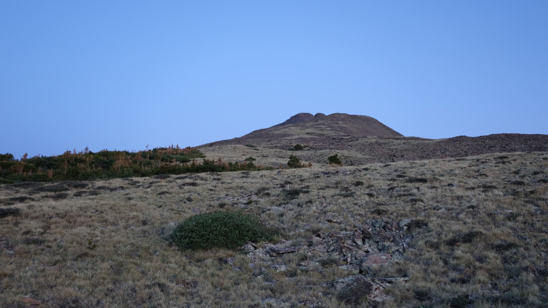
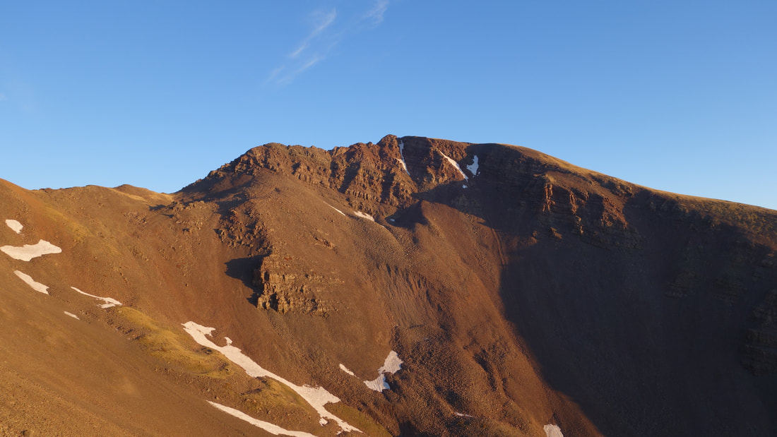
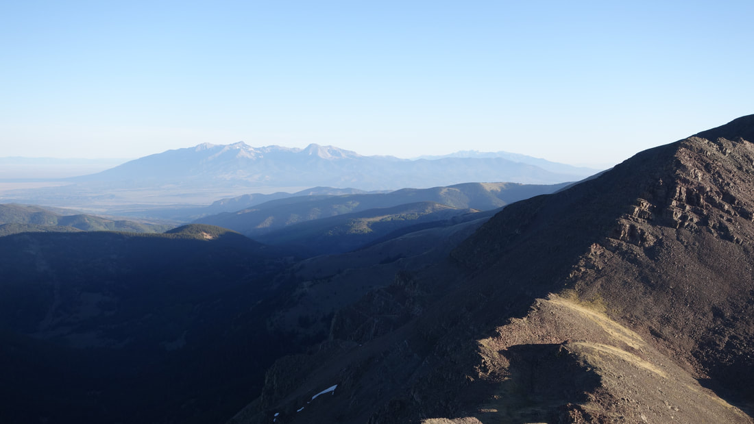
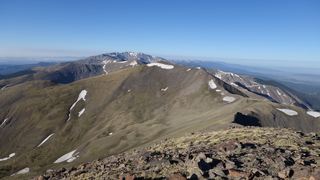
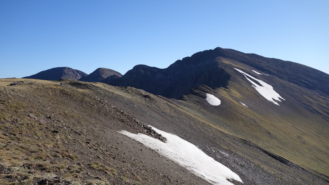
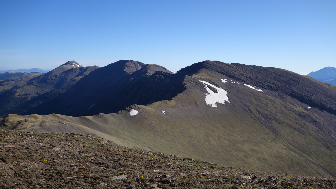
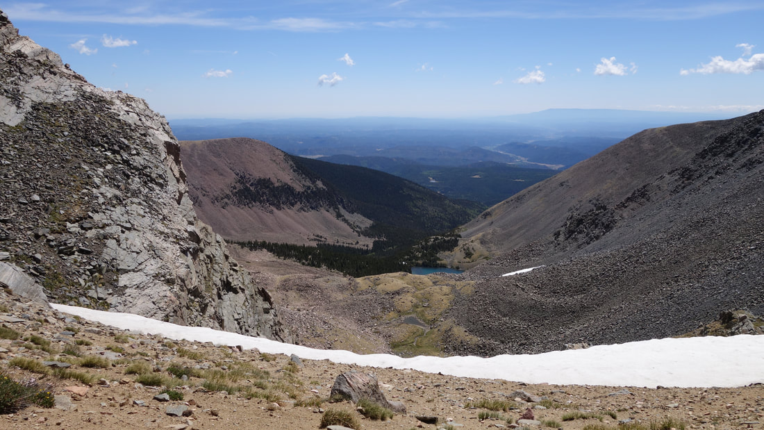
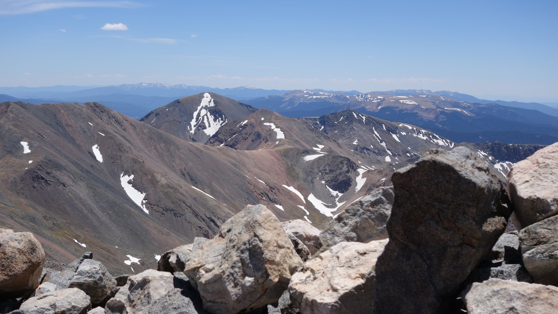
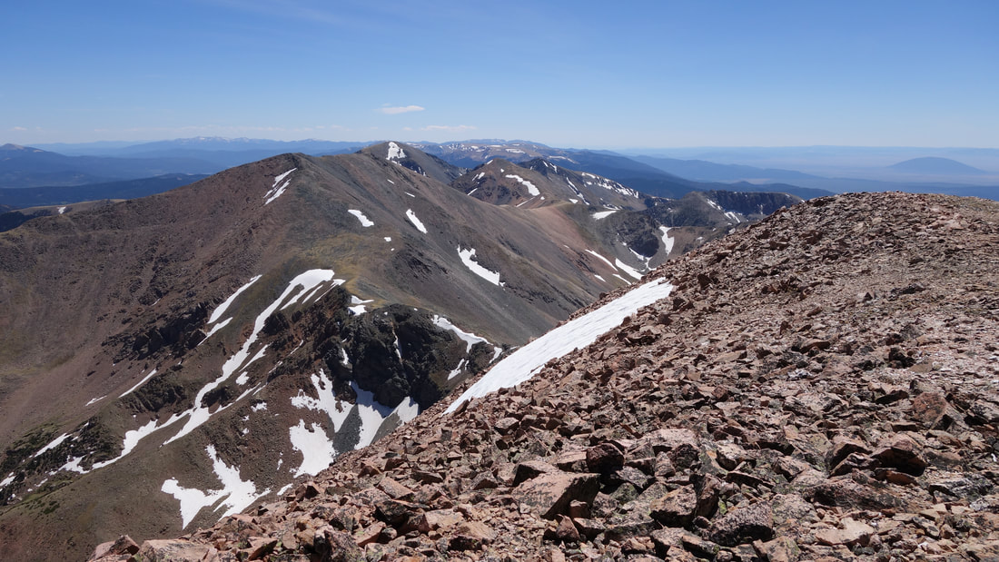
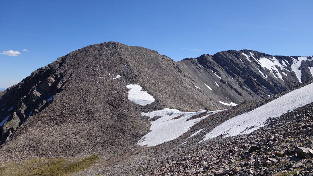
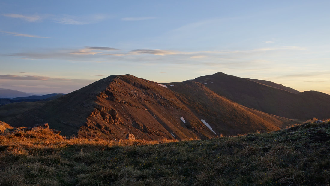
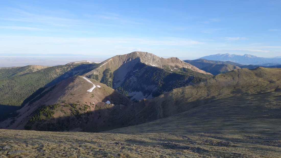
After a big breakfast, and packs ready, we started hiking up at 5:30am. Kelly commented that there was a pair of guys who walked by us around 1am and I thought she was joking! I was amazed to know we wouldn't be the only ones up there. I realized pretty early on that I forgot my trekking pole, and I had no luck finding a suitable stick in the first 10 minutes of walking before we reached treeline at 12000 feet. I would have to do this entire trek without one. As the sun rose behind the Spanish Peaks off to our NE the glow was spectacular, and we could easily see our first couple peaks of the trek. The east ridge of Mount Maxwell narrowed quite a bit ovvering an airy walk in a few places. Just over an hour from leaving the truck we were standing atop Mount Maxwell, where a no trespassing sign promptly greeted us. The view to the west and north was serene in the early morning light, but the breeze was definitely a little chilly. We stood atop the summit for a few minutes, then started walking south. With spirits high we charged on towards Mariquita Peak.
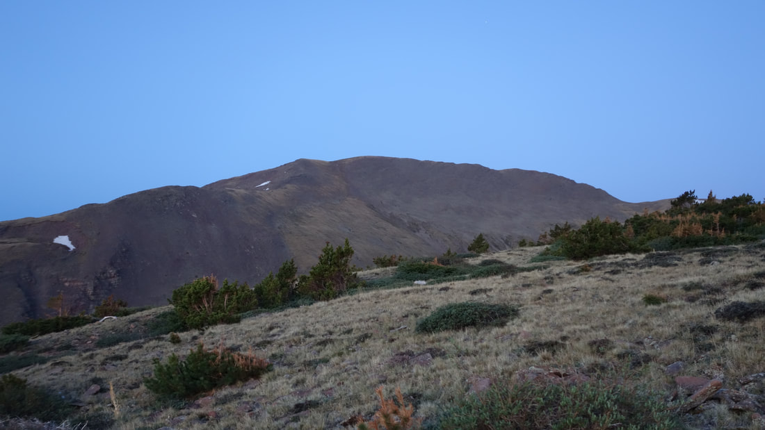
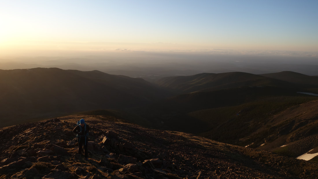
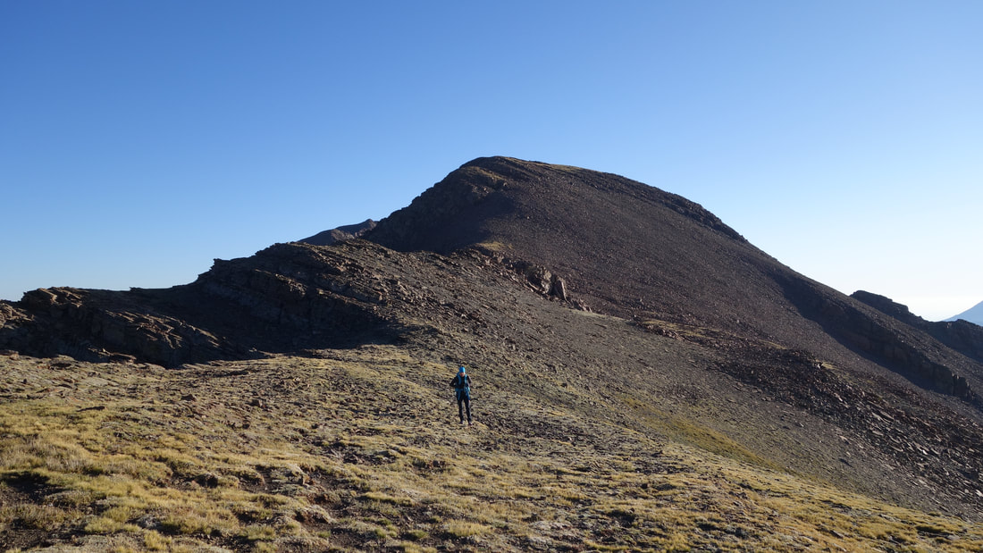
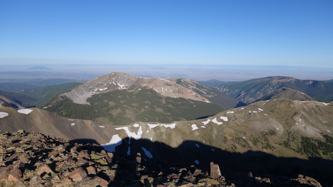
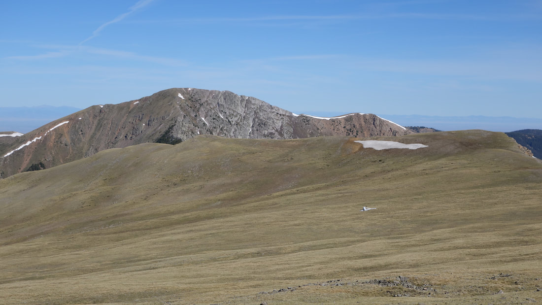
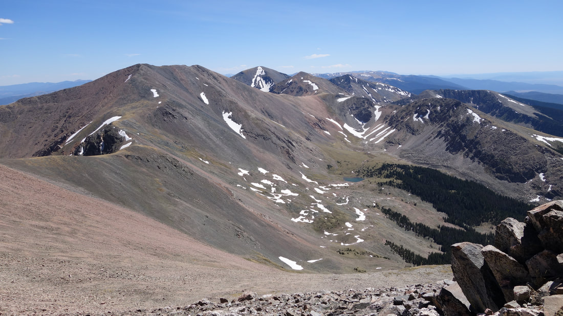
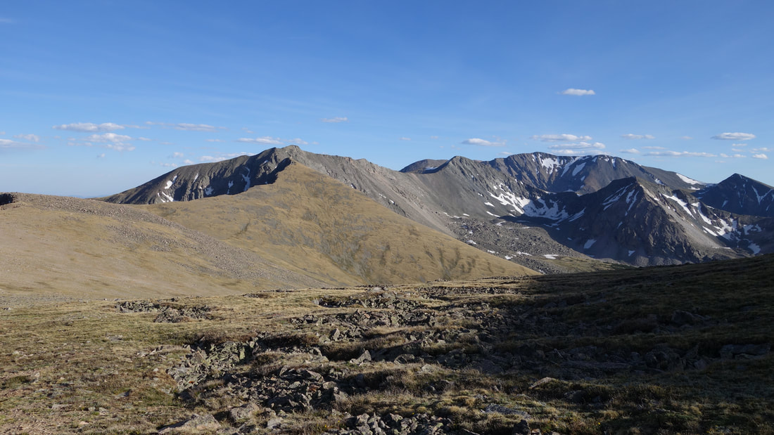
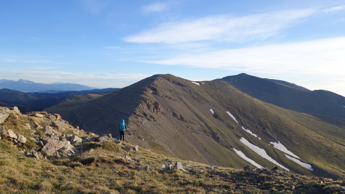
As we traversed over to Mariquita Peak, the red glow transitioned into a yellow glow and we quickly made the summit, and after a short break continued to De Anza Peak. We traversed around the west side of the unnamed 12955 peak separating De Anza from Whiskey Pass. We descended to the lowest points on the whole traverse between Maxwell and Red; 12,550 foot Whiskey Pass. By this point Kelly was really beginning to feel the elevation. I asked if she would feel ok going over the next peak and she said yes. So we continued up Beaubien Peak as the breeze got a little stronger with the mid-morning sun. Thankfully the weather for the day was forecasted to be absolutely perfect since the previous day saw some pretty big storms throughout Colorado. It's typical for there to be a very calm day after a big storm event, and amazingly it fell on a Saturday! At about 12,800 feet on the north ridge of Beaubien, we came across a perfectly sheltered dip that would offer excellent wind protection, and it was filled with soft grass which offered a great comfy place to bivy. Kelly and I discussed since I was skeptical we would find any better place to camp, plus she was feeling very tired from both the elevation, and from not sleeping at all the previous night. She opted to hang out while I continued the additional 7 miles to Red Mountain, and 7 miles back.

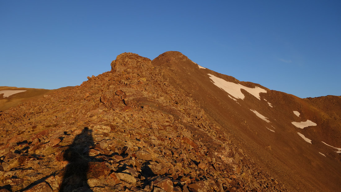
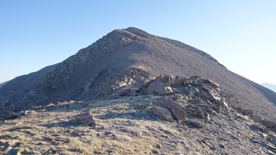
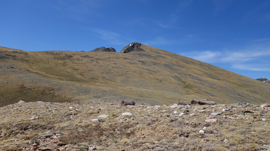
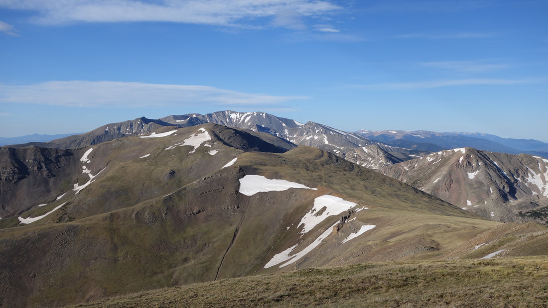
We reorganized some gear and I switched to my smaller day pack, took 2 liters of water and snacks, and ditched everything else I had. At 9:30am I continued on my own heading up and over Beaubien Peak, then through very easy walking terrain over Francisco and Lomo Liso Mountains. I didn't realize the ridge takes a sharp jog to the east at Lomo Liso and ended up making some zig zags adding distance. I made great time though, getting to the 12,600 foot low saddle between Lomo Liso and Miranda just an hour after leaving Kelly. The next 650 feet was also a smooth grassy slope but a bit steeper, which led directly to the false summit of Miranda Peak, where easy terrain would end. I slogged up this slope, pacing myself knowing I still had a long way to go and upon reaching Miranda's false summit it was apparent the terrain turned from Class 1 to Class 3 pretty quick! I had to traverse to the right onto the west side of the ridge and over some loose rocks below a cliffy section before I could continue back up steep terrain to regain the ridge. Once back on the ridge, a short "knife" ridge section (wasn't really anything hard or exposed) was crossed right before the summit of Miranda Peak.
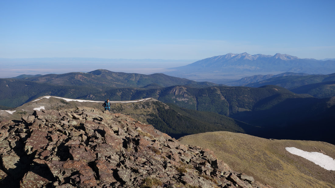
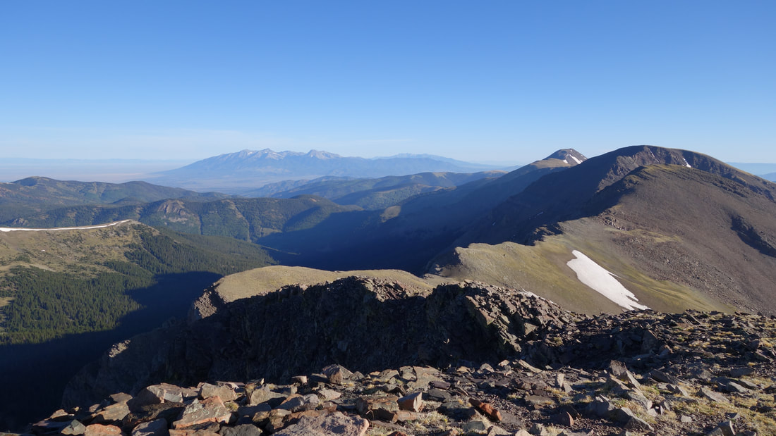
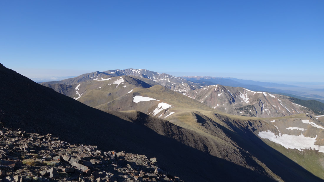
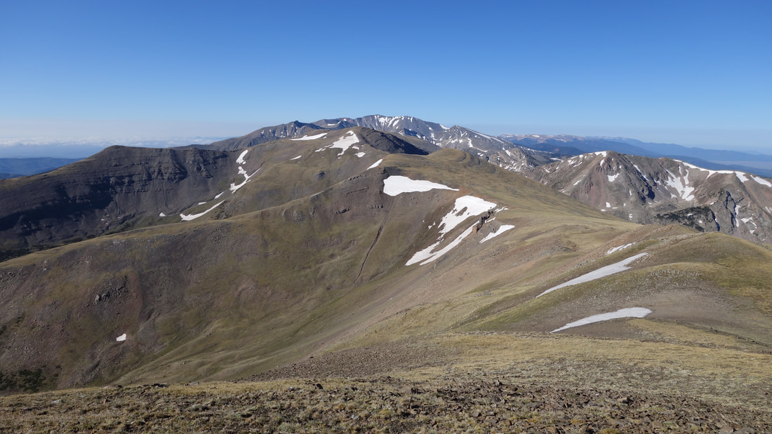
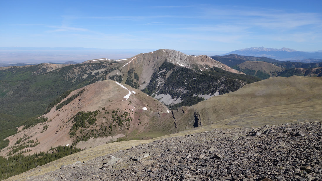
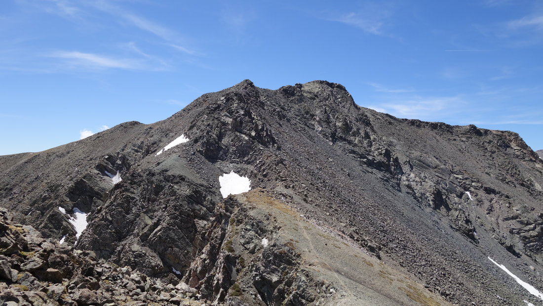
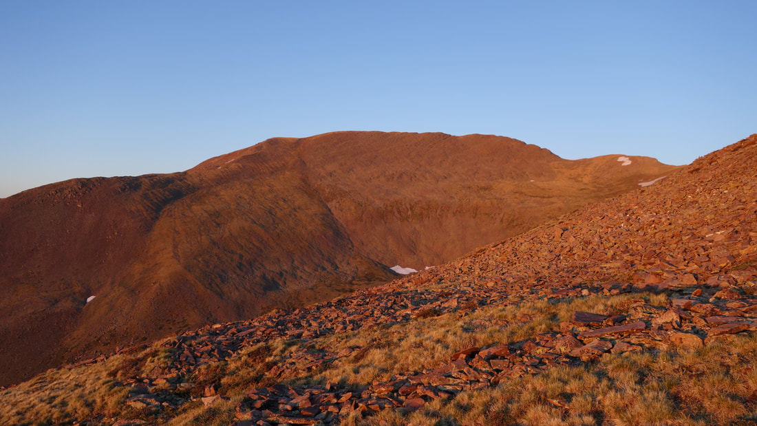
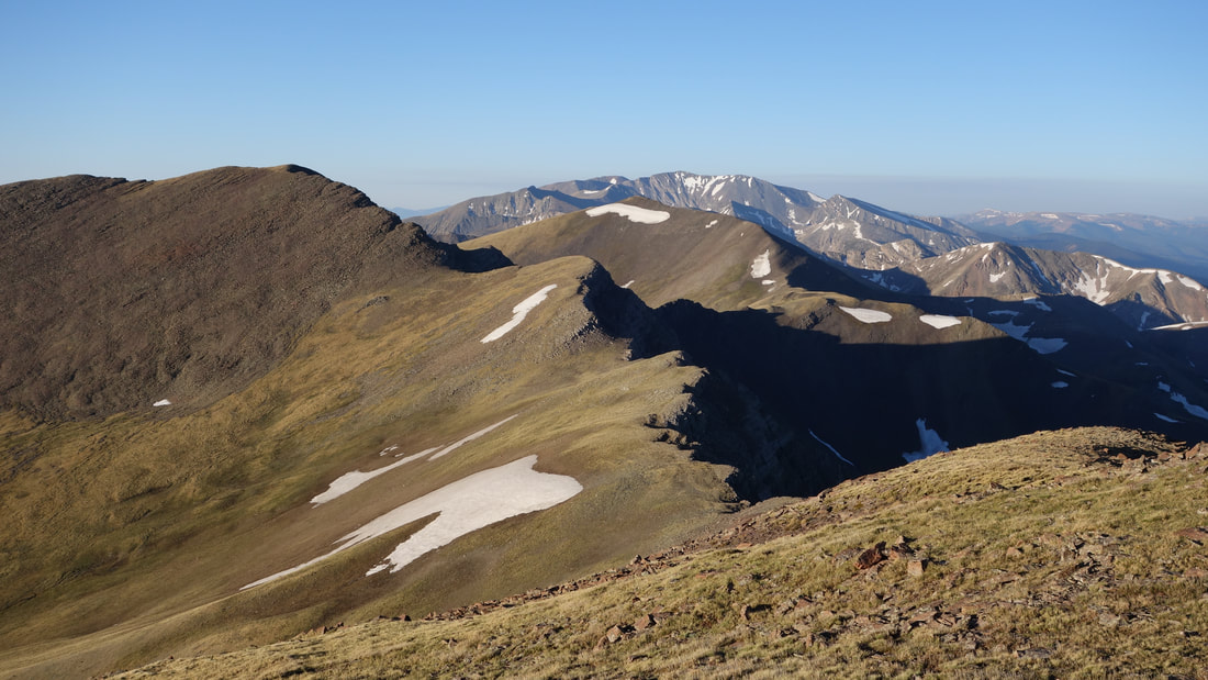
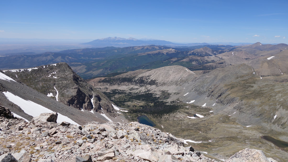
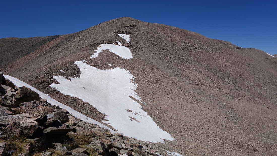
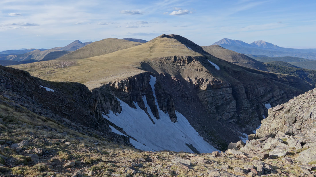
From the summit of Miranda, I could more clearly see the remainder of the traverse to Culebra. There was still a 13565 foot 13er to cross over, however after studying the map, I determined it would be easier to hike around this peak along the east side and traversing the wide open basin at the 13,100 foot level. I descended a short ways on the narrow ridge off Miranda to the next saddle and started traversing left. I crested the borad ridge on the other side at 13140 feet and cut right, descending 200 feet on a downward traverse to the 13,000 foot saddle directly below the 13,701 foot east peak of Culebra. My route around Point 13565 was probably longer but I thought it was easier overall, and I needed to conserve energy if I was going to make it all the way to Red. 

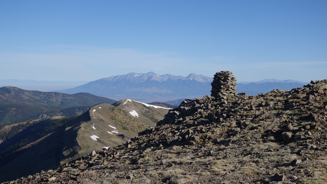
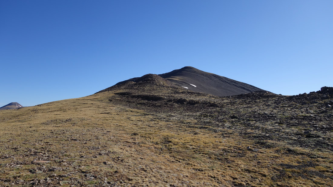
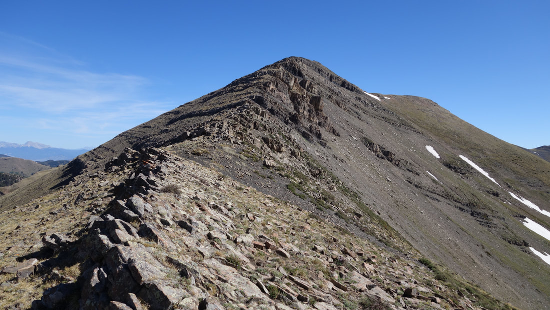
At this 13000 foot saddle is where I ran into the two guys who passed our truck at 1am! They were taking a little rest after having just come down from Culeba. By this point the winds were really picking up and we didn't exchange much, but I wished them a good hike out and I started up the steepest part of the entire traverse. 700 feet of steeper, big boulders took me about 30 minutes to ascend as my legs began to tire, and with the strong west winds I tried to stay off to the east side of the crest as much as possible. Luckily I found a second wind and once I topped out on the east peak of Culebra, it was easier going all the way to the true summit. That final ridge was definitely longer than I was hoping though!

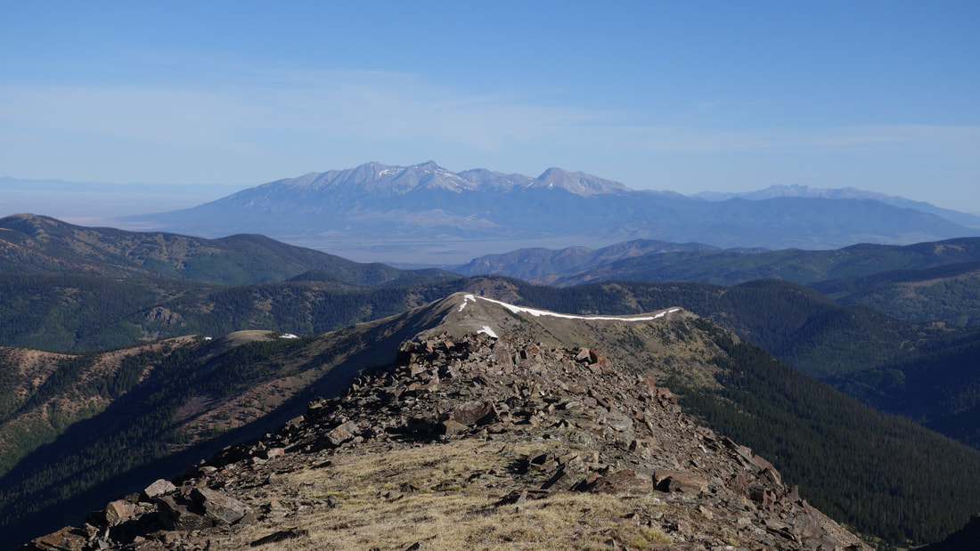
I didn't linger long on Culebra, although I did have the summit to myself since it was now a bit after 2pm. I briefly contemlated whether I would be able to go get Red. I knew I had the time, but for the first time I can ever recall, I doubted if I would have the ability to do it and get all the way back to Beaubien Peak. I was already tired, but knowing I would never forgive myself if I didn't do it, I pressed on, and descended to the next saddle. There ended up being some nice trails up the final scree slopes leading to the summit of Red and I got there just before 3pm, a total of 5.5 hours after leaving Kelly. I was pretty stoked to have made it, but knew I was only halfway done. It was another long 7 miles back with still over 2000 feet of total gain to reach my sleeping bag.
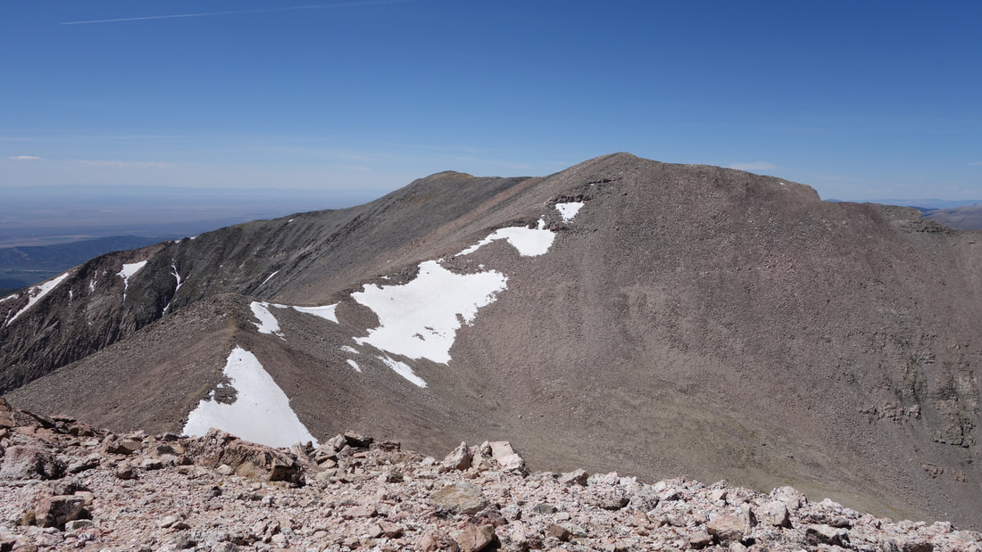
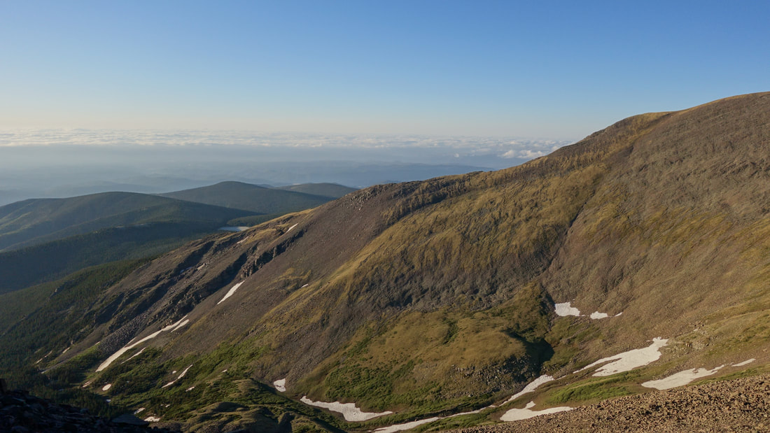
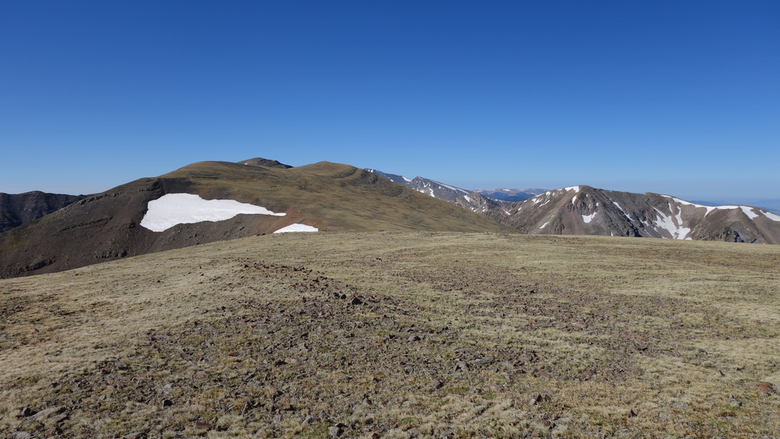
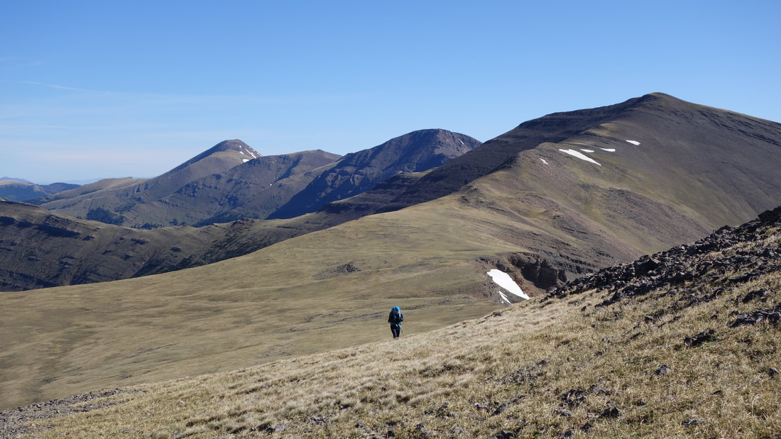
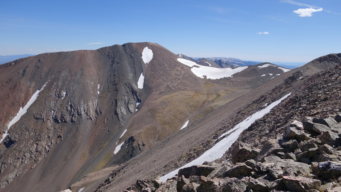
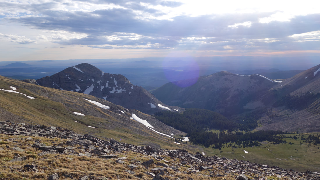
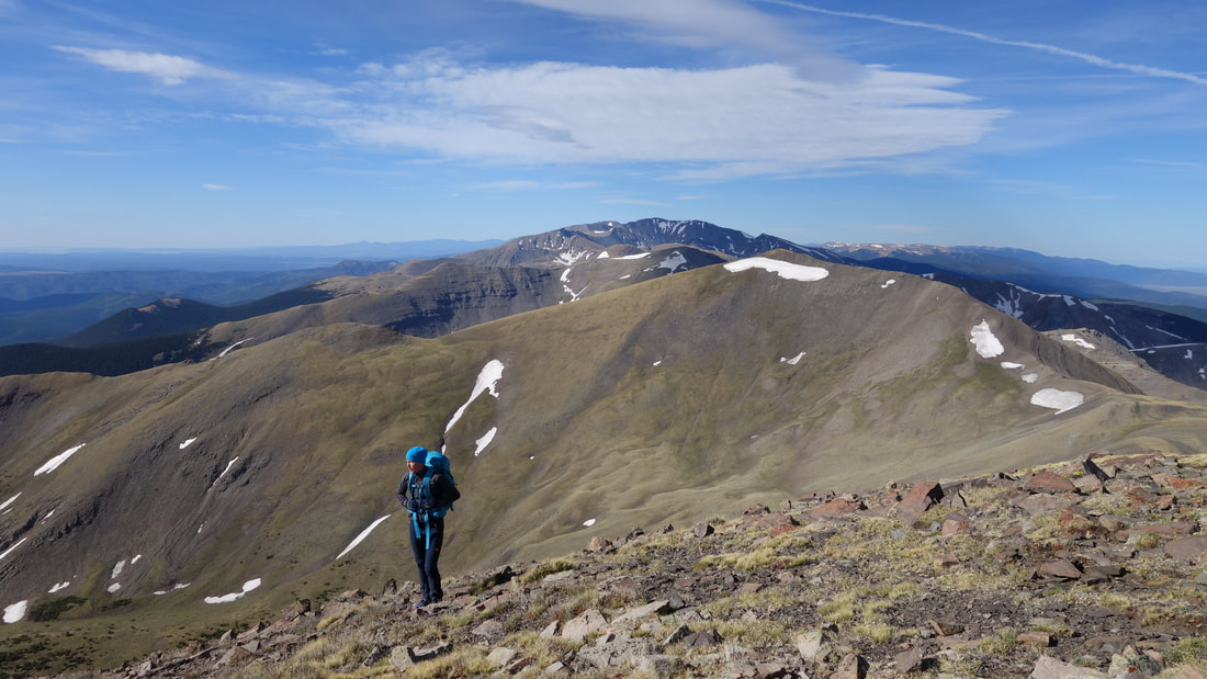
Initially I didn't feel too bad as I began traversing back to Culebra. Amazingly I found a meltwater pool right on the east ridge of Culebra shortly before the 13701 foot east summit. I was thrilled to be able to fill my water bottles as I was definitely out, and needed more! This certainly helped, and I reached the 13,000 foot saddle at the base of the steeper section without too much trouble. Traversing back around Point 13565 was also fairly smooth, however I began to tire significantly as I made my way back up to the summit of Miranda. I had to walk over that annoying little point 13396 which added effort I had forgotten about on the way over. The final 300 feet to the top of Miranda took 20 minutes, then I had to carefully descend very loose boulders. I was definitely happy to get back to the easy grassy terrain at the false summit of Miranda though, and I made better time descending back to the saddle enroute to Lomo Liso. I knew I could circumvent Francisco Peak on the return, so from here I only had two more uphills to go until I could sleep, however I was starting to feel sick. Not super ill, but my body no longer wanted to accept food. I forced some down knowing I would need it for the last two uphill sections.

It then took me over 30 minutes to hike the 400 feet to the eastern edge of the Lomo Liso summit plateau, where I was then able to drop 200 feet and hike way around the east side of Francisco Peak. This made things much easier. As I began forcing myself up the final 500 feet to Beaubien, I stopped for one final rest and forced more food down, and this time I even had to force water down despite being so thirsty. I plodded, one baby step at a time up the gentle, mellow easy grassy slope like I was a total noob and just before 8pm I met back up with Kelly, who was sitting in the sleeping bag enjoying the evening lighting over the mountains. Note that it was windy all day, and my first comment to her when I got back was asking her why she was sitting in the wind and not in our little sheltered area!

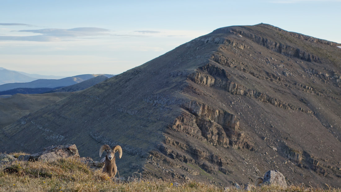
Without any hesitation, and without eating anything I went right into the sleeping bag, as I was totally spent. Within minutes I was sleeping, and didn't wake up for many hours. Later during the night I did wake briefly to see a totally moonless night with millions of stars dazzlying around. It was perfectly calm without a sound to be heard...a magical experience. As twilight began, I was getting more awake, and I was able to watch the sunrise sitting from my sleeping bag. It was not too cold, but cold enough to not want to leave the bag. I snapped a few photos of Kelly sound asleep as the sun rose (lucky her she got to sleep for 18 hours!). Just as she woke up, two bighorn sheep stood less than 50 feet away staring at us. I snapped a photo as Kelly was super excited to see them so close.
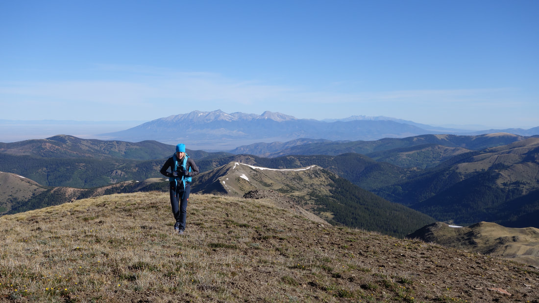
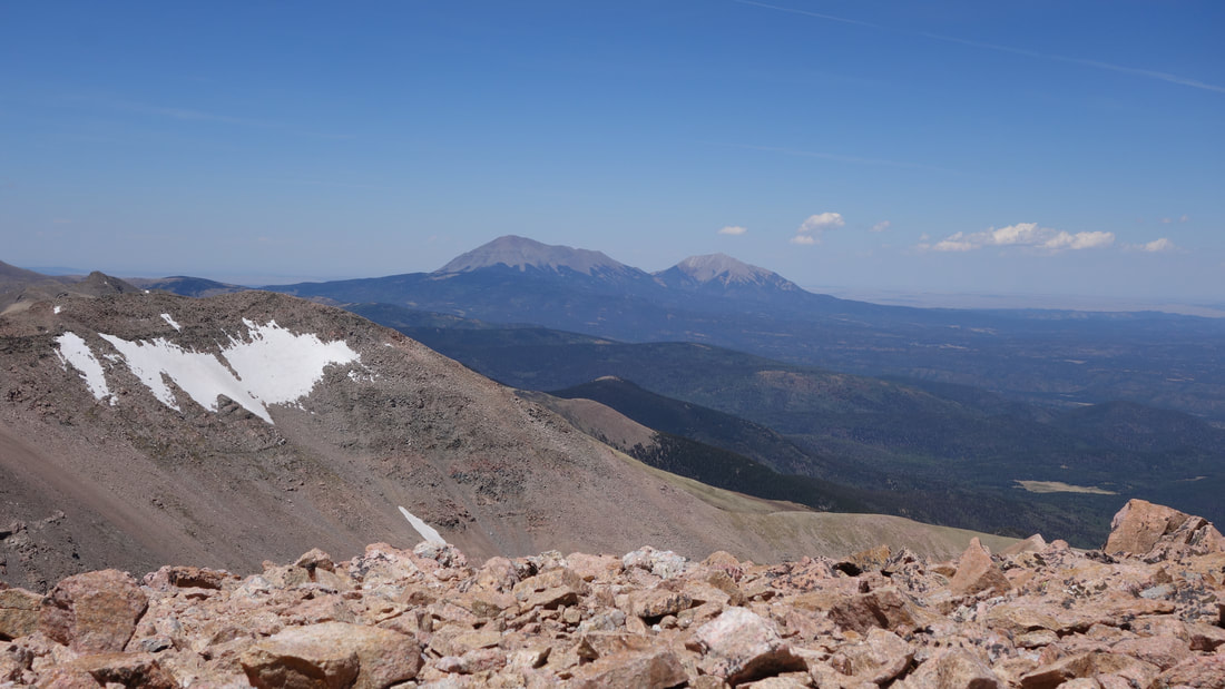
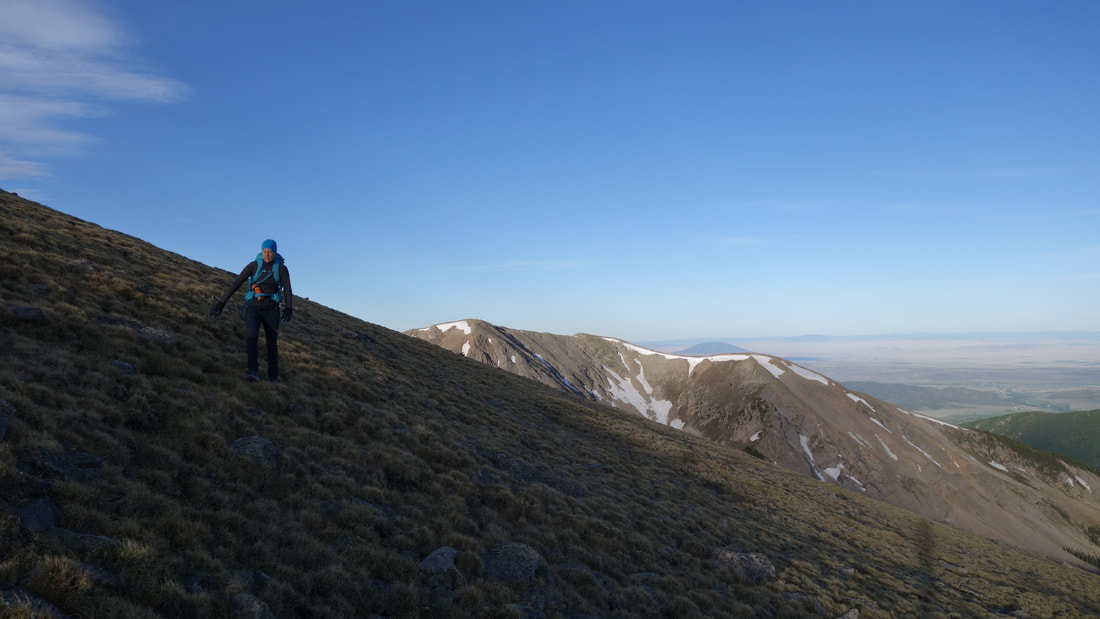
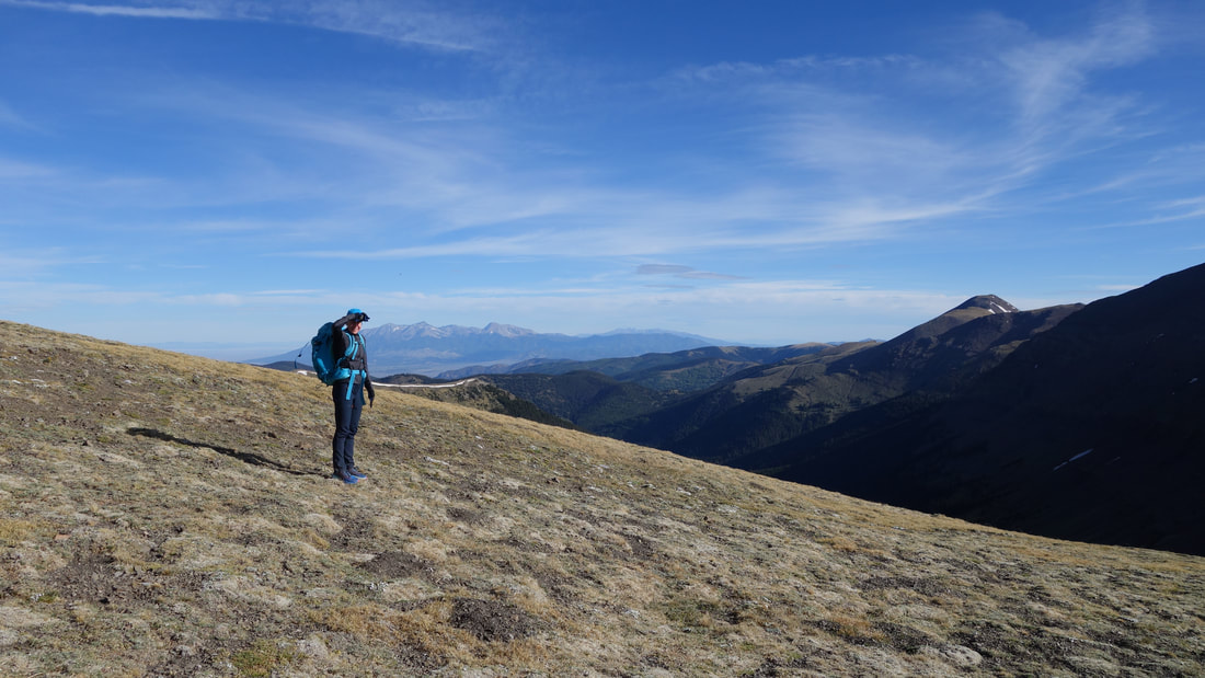
At about 6:15am I believe we were packed up and started back down the short descend to Whiskey Pass. We decided to make a longer round-about traverse around the unnamed 12er on some good game trails, and made our way up De Anza Peak pretty efficiently. Kelly was moving faster than I was this morning as my legs were still very tired, but at least I wasn't feeling terrible anymore. The rest of our hike out was pretty uneventful, albiet the wind picked up merely moments after the sun rose so it was chilly. We got back to the truck at 10am and found a killer mexican resturant to refuel in La Veta for the long drive back. It was so cool to make this happen, after I first heard of the ordeal back in 2011 nearly 9 years ago. It had been on the list ever since, and finally getting it done felt great!
Picture
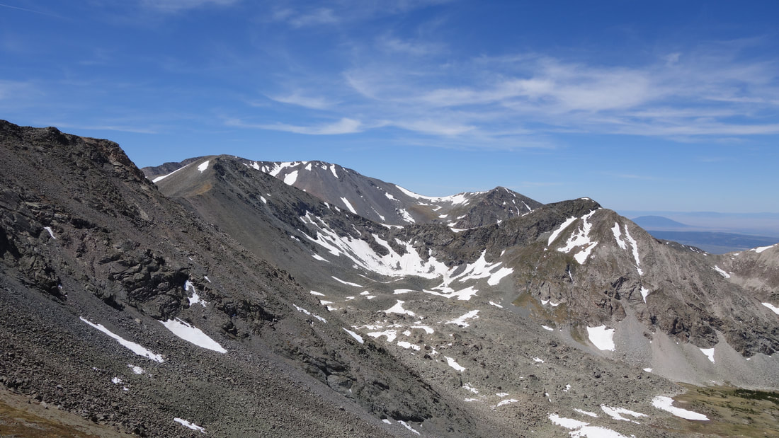
Profile of the Operation Dark Snake Traverse
Powered by Create your own unique website with customizable templates.