Mystic mountain - 12,100' - north ridge class 2
west granite peak - 12,745' - west slopes class 2
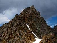
tempest mountain - 12,486' - west ridge class 2+
Granite mountain - 12,799' - east ridge class 4
july 2012
West Rosebud/Granite Peak Group - July 27-31
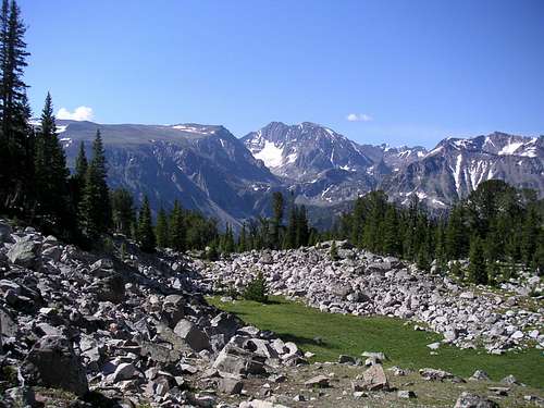
We slept in late and got to the trailhead where I met someone else I knew! The same mountain guide lady who gave me a ride up the Yankee Boy Basin Road the previous summer as my car couldn't make it the whole way was here at the same trailhead in Montana. She was guiding someone up Granite Peak. She recognized me right away and we talked awhile and exchanged plans. They were off on the trail before us and by the time we started hiking towards Mystic Lake another hour had passed and we didn't see them again until the next day. We got to Mystic Lake around 1PM and noticed it was clouding up considerably. Little did we know this was going to be the wettest and stormiest day of the entire trip! We passed by numerous day-hikers at the enormous Mystic Lake, many of which were fishing. As we continued further west towards the other side we saw less people and shortly before reaching Huckleberry Creek we saw dark clouds quickly moving in. Just our luck though we saw a cave in the rocks just off the trail. Stephan and I both thought the same thing..."It's about to downpour!" and without even speaking a word we both made our way to the cave seconds before the rain started. Talk about perfect timing! We took the packs off and waited for over an hour for the heavy rain to stop. When it did we emerged and prepared to continue up the boot path up Huckleberry Creek.
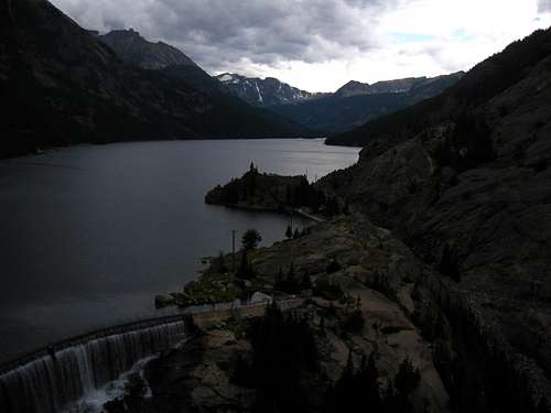 Mystic Lake under clouds
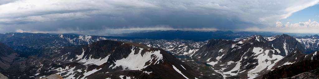
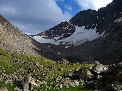
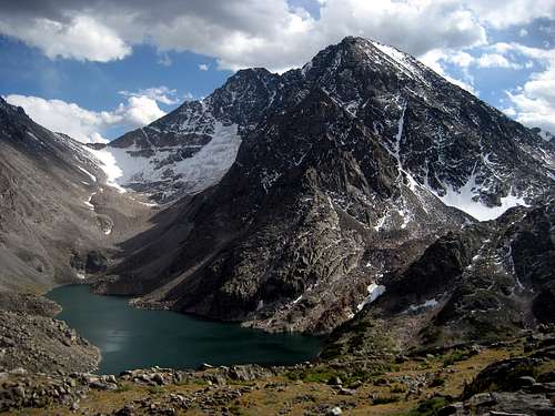
As we hiked up the Huckleberry Creek Valley it began raining again...only this time even harder. We saw lightning strike very close to us on the ridges and peaks above us and the thunder was deadening. This was one of the worst storms I have been in. Staying dry at this point was impossible. We just kept pushing on and we finally reached Huckleberry Lake. We had to walk around it on wet talus and bushes as it continued to rain. This would be the only lake I hate during the whole trip and the only place I have no interest at ever returning. We agreed to pitch the tent at the first large enough place we find. Just as we reach the south end of the lake we find an area just big enough right on the trail so we make quick work of pitching the tent. Everything was soaked but we manged to keep the crucial things like sleeping bags dry and we simply ate a snack and west to sleep. There was nothing else to do even though we still have a couple hours of daylight left. We decided just to finish the approach to Princess Lake the next day. So that is what we did. We woke to sunny skies and brought everything out to dry. The nice thing about the Rockies is that stuff dries fast! Soon enough we continued up to Princess Lake which was a bit steep especially with packs but we got to the lake and decided to just relax the rest of the day. We fished all afternoon and managed to catch lots of great tasting trout. I'll have to say the money we spent on the fishing stuff and the license was well worth it. After another nice filling dinner and a long days rest we went to bed again. Just as it was getting dark we saw the mountain guide and her client coming down Granite Peak. They mentioned it was a great climb but long. My excitement was too much to get much sleep. I remember getting up to go retrieve the food bag to eat more in the middle of the night. The next morning we got up at 3AM and our biggest failure of the whole trip was about to go underway. We would have been just as well off if we got up at 4:30 as we wasted over an hour fumbling around trying to walk around Princess Lake. I walked across the narrow rock band in the middle of the lake after getting fed up whacking through wet bushes. Stephan continued around the lake shore and we never saw one another for the next hour. I reached the other end of the lake and stopped to change a sock as my foot slipped and got wet halfway across. I then continued around the lake too far and completely missed the waterfall way to the climbers left. I was completely turned around and once twilight came I finally was able to locate the inlet stream and waterfall. After thousands of calories burned whacking through bushes and talus I reached the base of the waterfall and found the boot path climbing up the right side of the falls. Stephan managed to go too far right up in the trees. It wasn't until the sun rose when we finally met up again above the waterfall near the first Snowball Lake. I had reached the top slightly before him and wisely stopped myself from going any further knowing he would hear my yells if he was in the large valley above me. Once we met up again we complained a lot and continued up past the Snowball Lakes and on to Avalanche Lake. From here we took a break and we agreed to split up once again. Since I was going to also climb Tempest right before Granite I went on ahead hopping the talus around Avalanche Lake and making great time towards the Granite-Tempest saddle. The remaining snow was nice to climb on since all the talus up this valley was dropped by glaciers and loose as hell.
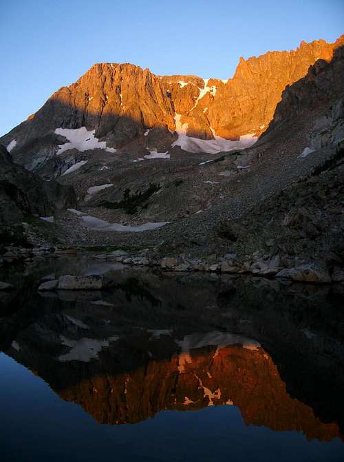
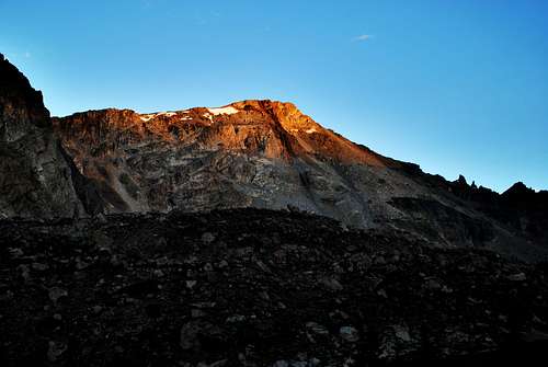
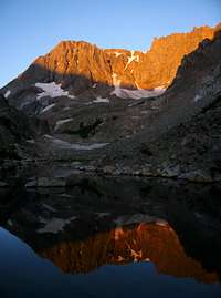 Mystic Mountain Alpenglow Mystic Mountain Alpenglow |
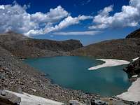 The small tarn The small tarn |
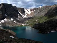 Turgulse Lake Turgulse Lake |
 Tower above Avalanche Lake Tower above Avalanche Lake |
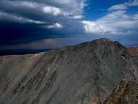
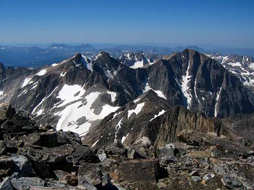
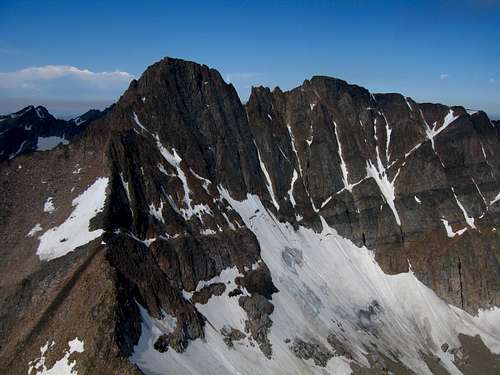 Granite Peak from Tempest
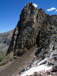
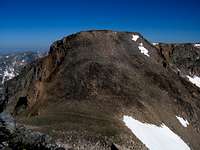
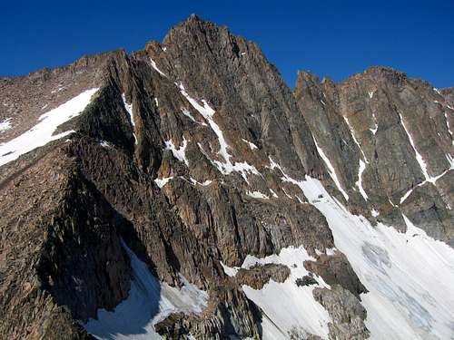
I decided to veer left and mount the west ridge of Tempest Mountain a little bit higher than the saddle. Here I left my pack and finished the ascent up to the Froze-to-Death Plateau and to its high point at Tempest Mountain where I saw only the second summit register of the whole trip. Views of Granite Peak were amazing. I was getting very excited. I descended back to the saddle where I waited for Stephan to finish climbing the snow. At this saddle we ditched some gear and began ascending Granite Peak. Initially the climbing was easy as we just followed the boot path to the "Snowbridge" which was nothing more than a snow crossing at the top of the SE Couloir. Just past this the meat of the climb started. A beautiful 4th class chimney lie just past the snow crossing. We ascended it but right as I got to the top we heard a clap of thunder. Clouds were building very fast and Stephan didn't want to continue so we went back across the snowbridge and waited under a big rock for awhile hoping the weather would improve. An annoying goat pestered us the whole time. I kept thinking to myself "I sure hope the clouds break up I made it all this way; I'm going to be one of the few who summit Granite Peak on the first attempt!" I know that many people going out to climb it get turned around but luckily after about an hour of waiting we noticed a break in the clouds that I thought was just long enough to climb the final 500 feet to the summit. So off we went, back across the snowbridge and up the first chimney.
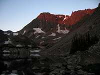 Mystic Mountain Alpenglow Mystic Mountain Alpenglow |
 Granite Peak Granite Peak |
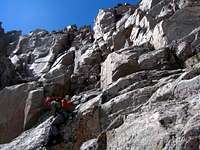 Stephan Scrambling Stephan Scrambling |
 Avalanche Lake Below Avalanche Lake Below |
We continued on fantastic rock up one chimney to the next until we got to the upper part of the climb where it started snowing! A small amount of hail and snow making the rocks just wet enough to make the climbing harder. I kept a keen eye on the clouds and noticed they were not all that bad. The crux of our climb was making an exposed move from one ledge up to another with wet rock just below the final chimney to the summit. The hail stopped just as quick as it came and the rocks were drying quick. Just as we reached the summit we saw a big break in the clouds just to the southwest with blue sky! Confirming the direction the clouds were traveling we had a sigh of relief and was actually able to stay on the summit for about 15 minutes to sign the massive register and take in the beauty of being on top of Montana.
 The East Ridge The East Ridge |
 Upper part of the climb Upper part of the climb |
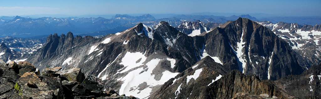
 Tempest from Granite Tempest from Granite |
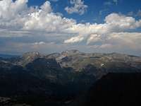 Mount Wood Mount Wood |
We began the descent and made a couple rappels on the bomb proof anchors on the route. We never used any protection climbing but we just felt safer rappelling some areas since the rock was still damp. We got a couple nice sun breaks on the way down which was nice. When we reached the saddle once again we prepared to glissade again and had a blast glissading the snow quite a ways back towards Avalanche Lake. Unfortunately the snow ended 600 feet above the lake and the remaining talus was very loose and sharp making tedious descending. By this point we both were very tired. I had also done Tempest and Granite itself was a long climb. We still had to walk all the way around Avalanche Lake and down back to camp. The afternoon glow was getting very nice and we got one final view of Granite Peak for the day just as the sun set behind the peaks to the west. We reached camp just as it got dark and went right to bed. We decided to take the next day off to rest before I would climb Mystic Mountain and Granite West.
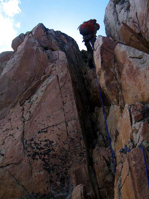 Stephan raps one of the 4th class chimneys Stephan raps one of the 4th class chimneys |
 Looking back towards the saddle Looking back towards the saddle |
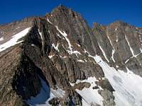
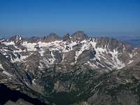
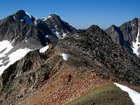
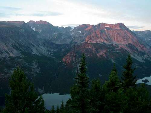
The next morning I knew the way around Princess Lake so getting around was much quicker. I continued the same way as the day before past Snowball Lakes but instead of heading to Avalanche Lake I climbed up the slabs further right towards Storm Lakes and started straight up to the North Ridge of Mystic Mountain. This long talus climb wasn't as loose as it looked. The easy traverse south to the broad summit was a nice morning walk. Once on the summit I had great views of Glacier Peak and Mount Villard across the valley. I looked across the Storm Lakes Basin to Granite West and studied the traverse and was off. The first part of the traverse was an easy descent to the first saddle. The climb up to unnamed point 11,908 was a short scramble but I had to stay to the right to avoid the cliffs dropping into Storm Lakes. From the summit of unnamed 11,908 (which lies halfway between Mystic and Granite West), the next part of the traverse was the crux. Staying just off the ridgecrest to the right towards Glacier Peak there was sustained third class scrambling up and down until the next saddle. Climbing to this saddle from Storm Lake would have been easy to do on moderate angle talus if you aren't interested in the traverse. I continued on the ridge as the terrain eased and I had the final talus climb to the summit of Granite West Peak. The view of the Granite Traverse from here was incredible and I knew I had to do this traverse someday.
 N Ridge of Mystic N Ridge of Mystic |
 Mystic Summit View Mystic Summit View |
 Glacier Peak Glacier Peak |
 Mt Villard from Traverse Mt Villard from Traverse |
 Glacier and Villard from Granite West Glacier and Villard from Granite West |
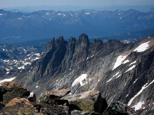 The Cathedral Spires The Cathedral Spires |
I began the long descent down the west face talus slope to Storm Lakes. I was able to fit in a glissade down part of the way on a lingering snowfield to help save my knees. After finally reaching Storm Lakes I hiked along their shores and retraced my steps once again back to camp at Princess Lake. Stephan and I then made the long hike back down Huckleberry Creek and then the Mystic Lake trail to the car which was very painful for me as the Mystic/Granite West climbs was over 10 miles all on rocks and talus. We decided a long break was in order since we had been out for over 2 weeks so we drove back to Red Lodge to meet up with a friend for a night in a house, some good food and a shower.
Granite Peak information
Overview
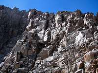
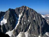
Granite Peak is the highest point in Montana and is considered one of the most difficult of the 50 state high points. Located in the Beartooth Range in the Northern Rocky Mountains, Granite Peak lives up to it’s name as a large chunk of granite towering over southern Montana. Climbing Granite Peak is a time consuming endeavor which should not be taken lightly. Although climbing Granite as a day hike is possible, most climb it as an overnight trip using a high camp at one of a few very scenic places. The standard route to the summit involves a strenuous 10 - 12 mile, 6300 foot, hike followed by sections of exposed class 3 and 4 rock climbing. This mountain is not recommended for the novice climber, however there many nearby peaks that are a bit easier for one to gain experience and comfort on less challenging terrain before tackling Granite. Although people climb Granite Peak without a rope, the exposure on the final 200 ft. of the summit block dictates that most at least use a rope for the descent. If not comfortable with extreme exposure, a rope, harness, slings, and a rappel device is highly recommended.
 Granite Peak from meadow directly east of Mystic Equinox Tower Granite Peak from meadow directly east of Mystic Equinox Tower |
 The north side of Granite Peak, as seen from the summit of Peak 10328 (Princess Lake Peak). The north side of Granite Peak, as seen from the summit of Peak 10328 (Princess Lake Peak). |
 View of Granite Peak east ridge from near the saddle View of Granite Peak east ridge from near the saddle |
Climbing History of Granite Peak
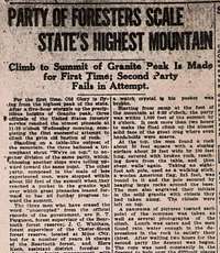
Granite Peak’s first ascent was made by Elers Koch on August 29, 1923 after several failed attempts by others. It was the last of the state highpoints to be climbed.First Women Reaches Summit in 1947: Miriam Underhill was the first women to climb to the top of Granite Peak. Mariam was a pioneer for women montaineers. She was born in 1900 and made the FIRST traverse of the Grepon led by a woman and made the FIRST complete traverse of the Aiguille du Diable. In 1927 in the Torre Grande in the Dolomites she pioneered what became known as the Via Miriam. She made many climbs without men and in 1931 climbed the Jungfrau.Register Box Placed at top in 1964: A year after James Whitman passed away the Forest Service placed a register box on top of Granite Peak. James was an employee of the Forest Service and was a member of the first group of climbers to reach the summit during the 1923 attempt. His initials were engraved into the top of the box.Youngest to reach the Summit, 9 years old: In August 2012, 9 year-old Gavin Morgan of Billings climbed to the summit by the standard route. (Photo submitted) Congratulations Gavin! This information courtesy of and written by Gordon Aycock (edited by Alan Ellis 9-10-12)Here is a recent on-line article from the Helena Independent Record newspaper about rescue history and accidents on Granite Peak. Link provided by SP member Alpinist.Newspaper Article of First Ascent Dated September 1, 1923
Photos of newspaper article courtesy of Gordon Aycock and the Billings Gazette
Getting There
Trailheads
There are two trailheads you can use to access Granite Peak's South Face via East Ridge (Standard Route). These are the West Rosebud and East Rosebud trailheads. West Rosebud is the most popular approach, slighter shorter, and gains less in elevation than the East Rosebud route. From the East Rosebud Trailhead, climbers can use the Phantom Creek Trail #17 to reach Froze-to-Death Plateau, and the base of Tempest Mountain, a common spot used for base camp. From the West Rosebud Trailhead, climbers can either reach the Froze-to-Death Plateau by traveling up the Phantom Creek Trail where it meets Mystic Lake, or up the Huckleberry Creek drainage, located at the far western end of Mystic Lake.
EAST ROSEBUD TRAILHEAD
The East Rosebud Valley is one of the most scenic in the Beartooths, filled with lakes, streams and waterfalls. The trailhead has a campground, toilet facilities nearby, and a small town where people come for the summer to live. The area surrounding East Rosebud Lake is private property so please stay on the road and don't stray off the trailhead parking areas. To reach the trailhead, take the Columbus exit from Interstate 90, and follow Montana Highway 78 south for 29 miles to Roscoe. If coming from Red Lodge, head northward on MT 78 for 20 miles to Roscoe and make a sharp left onto East Rosebud Creek Road and measure from this point. After 0.2 mile, pass by the Grizzly Bar and restaurant and continue another 2.4 miles where the road turns to gravel. At mile 3.7, make a left onto the East Rosebud Lake Road and quickly cross East Rosebud Creek on a bridge. Just after the crossing, make a right on East Rosebud Lake Road and cross a cattle guard. At mile 8.3 enter the Custer National Forest where the road becomes paved again and now becomes FS Road 2177. Pass the Jimmy Joe Campground at mile 11.9 where it turns to dirt once again and turn right into the Phantom Creek trailhead at mile 13.6 with room for around 10 cars. This trailhead is about one mile short from the end of the road where the East Rosebud Creek Trail begins. Make sure you are at the Phantom Creek trailhead (there is a sign).
Follow trail #17, the Phantom Creek Trail which gains about 3,900 feet in just over 7 miles to the saddle between Prairie View Mountain and Froze to Death Mountain. This is the point of departure from the Phantom Creek Trail where you'll head on the Froze-to-Death plateau approach to Granite Peak (see below for details on the Froze-to-Death Plateau route to base camp).
WEST ROSEBUD (MYSTIC LAKE) TRAILHEAD
The West Rosebud Trailhead is located approximately 80 miles southwest of Billings. To reach the trailhead, take the Columbus exit from Interstate 90, and take Montana Highway 78 through Absaroka and turn west (right) toward Fishtail (approximately 17 miles from Columbus). From Fishtail, drive west and south for 1 mile and turn south (left) on West Rosebud Road. Follow this paved road for 6.3 miles until reaching a fork in the road and a large brown Forest Service sign. The sign will indicate West Rosebud Lake Road #2072. Turn left here and follow the dirt road for 14.4 miles until reaching the trailhead. The trailhead has toilet facilities, and a large parking area. Please obey the posted private property signs and do not drive beyond the trailhead parking area.
The trail actually begins up the road about 200 yards, and is reached by walking through the Montana Power Company facilities where the trailhead is clearly marked with a Forest Service sign. From there, the trail leads up toward 7,637 foot Mystic Lake, one of the most popular day hikes in the Custer National Forest. The trail is relatively flat for about the first two miles, leading to switchbacks that eventually bring the hiker to a point looking over Mystic Lake Dam. The total elevation gain is about 1,200 feet over 3 miles. Once at the dam overlook, descend down to Mystic Lake and continue hiking for a half mile until reaching an intersection for the Phantom Creek Trail #17 branching to the left (south). The sign at this intersection is hard to spot so keep a keen eye for the trail junction. It is right before a small meadow. Turn left and follow this trail up through the switchbacks until reaching a huge cairn above treeline. Just past the cairn, leave the trail to the south and head uphill to the plateau. On the plateau, you will see cairns in the distance heading southwest.
 Granite Peak and Mystic Lake as seen from the approach to Mt. Wood
AERO LAKES TRAILHEAD
This trailhead is used to approach Granite Peak from the south which allows one to climb the Southwest Couloir route, or the Southeast Couloir variation of the standard east ridge. From the small town of Cooke City on US Highway 212 (Beartooth Highway), drive east for 2 miles and turn north onto Lulu Pass Road. Go 2.5 miles (mostly gravel) to a large junction (Goose Lake junction) and locate a short road off to the right. Turn right (east) onto this road and continue for a rougher (but still passable for most cars) quarter mile to its end at a small mining cabin with mining relics scattered around. There is room for about 6-8 cars here to park.
Approaches to Granite Peak
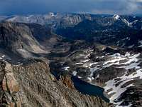
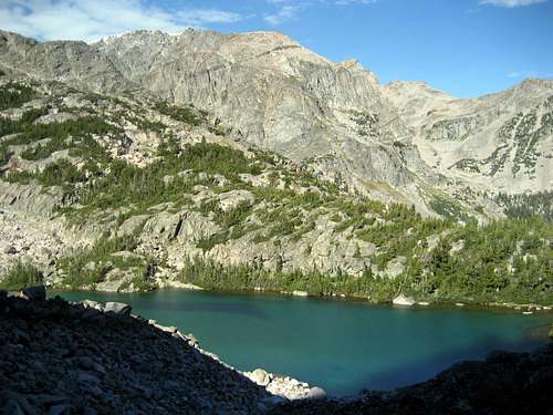
There are basically two approaches to a suitable basecamp from which to launch a bid for the summit of Granite Peak. The first heads across the subalpine meadows and boulder fields of Froze-to-Death Plateau (10,500 to 12,000 feet) to the base of Tempest Mountain. The second heads up the Huckleberry Creek drainage to the col between Tempest Mountain and Granite Peak, passing 10,000 foot Avalanche Lake en-route. Opinions vary, but Huckleberry Creek seems to be the more treacherous route, requiring navigation across massive boulder fields which rise steeply toward the base of Granite Peak. However, the route up from Mystic Lake to the saddle between Froze-to-Death and Prairie View Mountains is also known as "The Switchbacks from Hell" (with a total of 26) by hikers familiar with the steep hike out of the Mystic Lake basin, which rises from 7637 foot Mystic Lake to the 10,000 foot saddle between the two mountains in less than three miles. The primary disadvantage of the approach over the plateau is you are completely exposed to the wrath of summer thunderstorms, which have turned back many parties. Choose your approach based on what type of hike you want, the weather forecast and whether or not you want to do any fishing. I personally prefer the Huckleberry Creek approach with a camp at Princess Lake since I thought the hike up was beautiful and Princess Lake has incredible fishing.
FROZE-TO-DEATH PLATEAU
Whether coming from the East Rosebud side of Phantom Creek Trail, or from the West Rosebud side via Mystic Lake, the jumping off point from Phantom Creek Trail is the same: the saddle between Froze-to-Death and Prairie View Mountains at 10,000 feet. Anyone attempting either of these routes should ensure they have a copy of the USGS Granite Peak Quadrangle map. Navigation across the plateau can be very difficult, even for experienced backcountry travelers. The proliferation of rock cairns across the plateau can make it very confusing for hikers. DO NOT RELY ON THE CAIRNS to find your way across Froze-to-Death Plateau. Route-finding and compass skills are ESSENTIAL for navigation across this route.The basic route leads southwest from the saddle, around the north side of Froze-to-Death mountain. Although the plateau is relatively level, there is plenty of scrambling over talus and boulders, and depending on the time of year, snowfields which require crossing. The goal of most climbers is an 11,900 foot area to the north of Tempest Mountain. There are a few relatively flat areas which are clear of boulders and make a suitable, if not particularly comfortable, base camp. This area is a delicate alpine habitat, so please pay strict attention to minimum impact camping ethics.
From the Tempest Mountain basecamp, a climbing trail leads down and traverses to the west of Tempest to the col between Tempest and Granite. From here, one can see the climbing trail which leads up the knife-edged route toward the summit. Please note that it's a good idea to stock up on water, as availability on the Plateau is limited to run-off from snowfields. There is often no water to be found once near the col, or on the actual climbing route. See the left side-bar for the comprehensive route description which starts from the saddle between Tempest Mountain and Granite Peak.
HUCKLEBERRY CREEK/AVALANCHE LAKE APPROACH
See this page for a detailed description of the Huckleberry Creek approach.
Check out this link for great virtual maps of the Huckleberry Creek/Avalanche Lake approach complete with photos and maps.
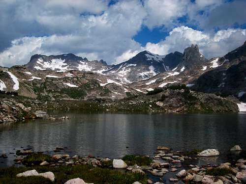
 Cold Lake Cold Lake |
 Snowball Lakes Reflection Snowball Lakes Reflection |
Looking towards the Granite/Tempest saddle |
AERO LAKES APPROACH
From the lower trailhead, there is a large cabin nearby just to the east. Walk around it on the left side (passing an old hot water heater) and cross a small stream on some boards or rocks. Emerge on the trail after a few feet of bushwhacking and walk northeast on the trail passing a large sign for Lady of the Lake. The first part of the trail heads up a short steep section and mellows to a nice undulating hike through sparse forests reaching the south end of Lady of the Lake at 8,750 feet after 1.5 miles. Follow the trail around the west side of this large lake (with great fishing and camping) and reach the junction with the trail coming down from the upper trailhead after another mile. A large cairn marks this junction. Continue straight and pass around a large meadow and cross a small creek which flows back down to Lady of the Lake. Don't follow this creek as it curves back to the south. Utilize rocks and logs to get across, then stay on the trail heading up through some trees and reach an obvious (but unsigned) trail junction 0.5 mile from the creek crossing. A few logs block a trail heading straight, however this trail is the route for the Sky Top Creek Approach described below. I will call this trail junction the Tri-Creek junction since it's where Zimmer Creek, Star Creek, and Sky Top Creek converge to form the Broadwater River. For the Aero Lakes route, you want to take the left trail. Your first views of Mount Zimmer and Iceberg Peak are found here to the north. A few minutes beyond the Tri-Creek junction, cross Star Creek a few feet before it dumps into Zimmer Creek and continue up the trail which follows the west side of Zimmer Creek for another mile. When the trail once again reaches the creek side, cross it on a couple large logs at 9,150 feet and locate the trail heading northeast towards Aero Lakes. This junction is unsigned so don't miss it and continue up Zimmer Creek. The trail quickly begins to climb steeply for 900 feet up what is known as heartbreak hill, reaching Lower Aero Lake after another 1.1 miles at 10,000 feet. The final quarter mile to the lower lake is hard to follow, just follow large talus through an obvious gap and descend 50 feet to the lake shore.
Here at the lower lake, the official trail ends (5.4 miles from the TH) but a boot path heads west around the lake, reaching its southwest corner after 0.3 miles which has a nice calm area making for great fishing. Continue along the northwest shore for another 0.9 miles and reach a small stream coming down from the northwest which drains a small lake above and to the north. Descend 50 feet to the creek, cross to its east side, and follow this drainage up to a very broad 10,160 foot saddle. Descend a short ways to the upper lake outlet stream and find a place to cross it. Wading may be required in early season. Reach the Upper lake at 10,170 feet and hike east around its south shore, then north around the east shore for 1.3 miles from the outlet. Stay close to the shore on the east side to avoid annoying talus traversing. Begin an ascending traverse and cross a small stream reaching a small tarn at 10,330 feet (200 feet above Upper Aero Lake). The camping at this tarn is fantastic and out of the bugs that flock the lake shore below. Views of Glacier, Villard, the Spires and the upper lake below are out of this world! This beautiful spot is 3.3 miles from where the official trail ends making the total distance 8.7 miles from the trailhead with only a 1,500 foot net elevation gain.
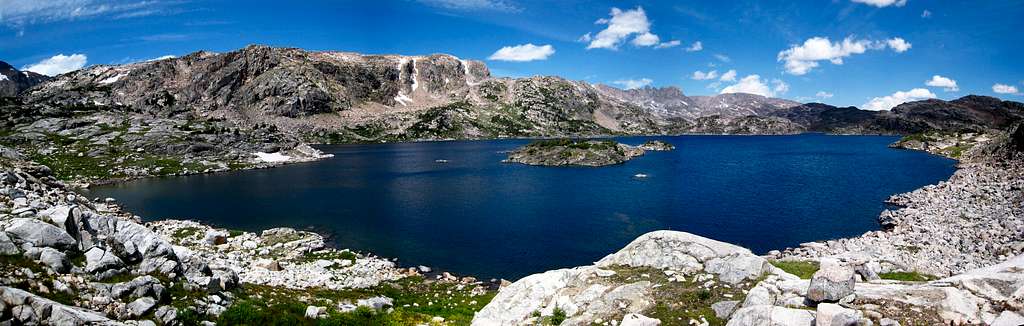 Lower Aero Lake Panorama
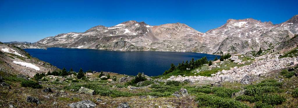 Upper Aero Lake Panorama
SKY TOP CREEK APPROACH
From the Tri-Creek junction (see above), instead of taking the left trail for the Aero Lakes approach, continue straight and follow the trail as it heads along the right (south) side of Star Creek for a few minutes. Locate a place to cross Star Creek on logs or rocks and pick up the trail on the north side. Continue to follow the north side of Star Creek downstream in an eastward direction and descend on the trail about 100 feet to Sky Top Creek. This entire Tri-Creek Junction is confusing since many social trails criss-cross the large meadow where these three creeks converge. Best to avoid trying to find the correct route through here at night. Parties have gone in circles here for hours in the past.
The trail reaches the north/west side of Sky Top Creek and continues near its shore for 0.75 mile to the stream draining Aero Lakes. Cross this barrage of streams and marshland on mainly well placed logs (or wade in early season) and locate the trail on the other side. Continue another 0.75 mile to a large flat meadow at 9,400 feet. The trail follows the left side of this half-mile long meadow. Just before the large cascade at the head of the meadow, the trail heads up to the left, over a small ridge and begins climbing steeply for another mile to Lone Elk Lake at 10,065 feet. Shortly before reaching the lake, the trail crosses a small stream draining Shelter Lake off to the north and passes over a small saddle to bypass the waterfall a few feet below the lake. The first real good views of the Villard Spires can fe found at Lone Elk Lake.
Hike around the left (west) side of the lake and cross the inlet stream above the small cascade. Continue around the right (east) side of Rough Lake which sits at 10,140 feet and hike up the right side of its inlet stream through a narrow gorge. Cross to the north side of this stream when possible (jump across a narrow section) and hike up the hill and reach the top of a broad ridge at 10,450 feet to the left (west) and roughly 100 feet above Lower Sky Top Lakes. Hike around the left side of the Lower Lakes and descend to the west shore of the two-part upper lake. Continue along the west shore of the upper lake (which is divided into two sections by a short stream) and set camp on a small flat patch of grass at the north end of Upper Sky Top Lake just below the 10,840 foot saddle between Point 11,379 and the Villard Spires. Camp is at an elevation of 10,480 feet. This approach is 9 miles each way from the trailhead with a net elevation gain of just over 1,600 feet.
 Rough Lake Views
Red Tape
 Sunrise over Mount Hague
Beartooth Ranger District
6811 U.S. 212, Red Lodge, Mt 59068
(406) 446-2103
When To Climb
Summer climbing season is short in Montana. Late July through early September are the months that are most snow-free. However, expect some snow on the mountain any time of the year. Expect any type of weather any time of the year. Violent thunderstorms are a common daily occurance. Get an early start to avoid afternoon thunderstorms. Storms develop very fast and tend to come from the south or west.
Camping
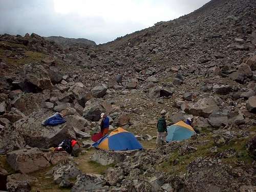 Camping near Avalanche Lake
There are several Forest Service campgrounds near the trailheads. East Rosebud has three campgrounds with 34 sites. East Rosebud has water and an $9.00/night fee (May - Sept). The Jimmy Joe campground is free. Before reaching West Rosebud trailhead, there are two campgrounds with 78 sites, water, and an $8.00/night fee. There are several places to set up base camps. The top of the switchbacks have some potential camp/bivy spots but are exposed to storms and wind. The base of Tempest Mountain is another good base camp site. There are a few clusters of rock shelters on the plateau including west of point 11,792, and just before leaving the plateau down to the Tempest/Granite saddle. Water is sometimes available in the afternoons from snow-melt on the plateau, on the N/NE face of Tempest, and from a field left of the ridge line between the Tempest/Granite saddle and the snow-bridge.
The best camping is found on the Huckleberry Creek approach at Princess Lake, or the north end of Avalanche Lake as water is plentiful, you are somewhat sheltered from storms, fishing is great, and there are nice flat areas to set up a tent.
Mountain Conditions
On the upper part of the route, rock fall is very common. A helmet is recommended for the section beginning between Granite and Tempest before the first ridge climb and the snow bridge. Once on the rock section of the upper route, a snow bridge exists on the south side of Granite. This is a year-round snow bridge which varies in size and shape depending on the year. An ice axe is recommended for this section. Call the Beartooth Ranger Station at (406) 446-2103 for latest conditions. Check here for latest weather conditions from Weather.com.
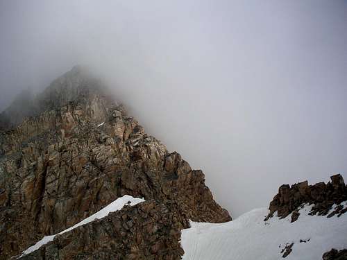 Granite Peak with fog Granite Peak with fog |
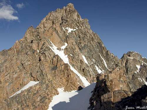 Granite Peak Snow Bridge on a clear day Granite Peak Snow Bridge on a clear day |
Maps
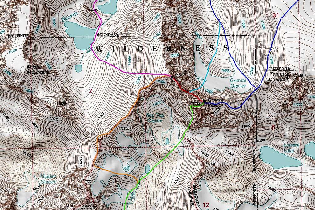
DARK BLUE: Granite Peak East Ridge - Class 4
LIGHT BLUE: Granite Peak Notch Couloir - Class 5.4 and Steep Snow
GREEN: Granite Peak Southwest Ramp - Class 3
RED: West Granite to Granite Peak Traverse - Class 5.4
ORANGE: West Granite Peak Southwest Ridge - Class 2+
PURPLE: West Granite Peak West Face - Class 2
External Links
Excellent report of the south side routes