LEMKE CLIMBS
  • About
    • Whats New
    • 2019 Goals/Wishlist
    • Contact
  • Washington
    • North Cascades >
      • Sahale Peak, Boston Peak
      • Eldorado Peak, Klawatti Peak
      • Black Peak
      • Forbidden Peak West Ridge
      • Primus Peak Attempt
      • Big Snagtooth
      • Liberty Bell Beckey Route
      • Burgundy Spire North Face 5.8
      • Ragged Ridge - Katsuk, Kimtah and Cosho Peaks
      • Colfax Peak
      • South Early Winters Spire via SW Buttress
      • Chilliwack Mini-Slam
      • Mesahchie Peak
      • Inspiration Traverse
      • Mount Shuksan Ski
      • Full Pickets Traverse
      • Mount Goode NE Buttress & Storm King
      • Mount Baker North Ridge WI3
      • Snowfield Peak
      • Lincoln Peak
      • Silver Star Mountain
      • Mount Buckner & Horseshoe Peak
      • Azurite Peak
      • Tower Mountain & Golden Horn
      • Mount Logan
      • Custer Ridge & Easy Mox
      • Mazama Dome
      • Sherman Peak
      • Mount Ballard
      • Southern Pickets Traverse
      • Corteo Peak
      • Whatcom Peak
    • Glacier Peak Wilderness >
      • Buck Creek Pass, Cloudy Peak, Spider Gap
      • Dome Peak, Spire Point
      • Mt. Maude and Seven Fingered Jack
      • Mount Formidable NE Face 5.6 Second Ascent
      • Dumbell and Greenwood Mountains
      • Glacier Peak Wilderness Mountain Massacre
      • Clark and Luahna Peaks
      • Sinister Peak
      • Chiwawa Mountain
      • Tupshin & Devore Peaks
      • Buck & Fortress Mountains
      • Glacier Peak
      • Snowking Mountain
    • Olympic Peninsula >
      • Buckhorn Mountain
      • Flapjack Lakes Hike
      • Grey Wolf Peak, High Divide Trail
      • Mount Ellinor
      • Mount Constance West Arete
      • Mount Olympus
    • Alpine Lakes Wilderness >
      • Chikamin Peak
      • PCT - Snoqualmie to Pete Lake
      • Foss Lakes Hike
      • Necklace and Tank Lakes
      • Enchantments Day Hike
      • Granite Mountain (Snoqualmie)
      • Colchuck Peak
      • Cannon, Enchantment and Stuart
      • Ingalls Peaks
      • McClellan Peak
      • Dragontail Peak
      • Web Mountain
      • Mount Index Attempt
      • Snow Creek Wall Orbit 5.8+
      • The Tooth South Face
      • Eightmile Mountain
      • Argonaut Peak NE Couloir
      • Little Annapurna South Face 5.5
      • Snow Creek Wall Outer Space 5.9
      • Cashmere Mountain
      • Sherpa Peak North Ridge 5.8
      • Chair Peak NE Ridge
      • Lichtenburg Mountain
      • Mount Index
      • McClellan Butte
      • Chimney Rock
      • Alpine Lakes High Route
    • Pasayten Wilderness >
      • The Craggies
      • Tiffany Mountain
      • Pasayten Mini-Slam
      • Remmel Group
      • Jack Mountain
      • Robinson Mountain
      • Monument Peak Group
    • Mountain Loop Highway >
      • Vesper Peak
      • Mount Dickerman
      • Sloan Peak West Face 5.8
      • Mount Forgotten
      • Whitehorse Mountain
      • Gothic Peak
    • Lake Chelan Sawtooth Wilderness >
      • Star, Courtney, and Grey Peaks
      • Hoodoo Peak and Raven Ridge
      • Abernathy Peak
      • Mount Bigelow
      • Reynolds Peak
      • Oval Peak
      • Gardner Peaks
      • Chelan Sawtooth Trio
    • Southern WA >
      • Mount Adams
      • Mount Rainier - Emmons Route
      • Mount Saint Helens
      • Goat Peak
      • Lane Peak, Plummer Peak (Tatoosh)
      • The Unicorn (Tatoosh)
      • Little Tahoma
      • Liberty Cap
    • WA Rock and Ice Cragging >
      • Index Town Walls
      • Vantage
      • Mount Erie
      • Exit 38
      • Leavenworth
  • Colorado
    • San Juan Mountains >
      • Mount Sneffels Lavender Snow Climb
      • Uncompahgre, Matterhorn Peaks
      • Redcloud, Sunshine Peaks
      • San Luis Peak
      • Vermilion, Fuller Peaks
      • Stewart Peak, Baldy Alto
      • Jones, Niagara, American Peaks
      • Wetterhorn Peak, Handies Peak
      • Wilson Group
      • Arrow Peak
      • Mount Sneffels SW Ridge
      • Jagged Mountain, Chicago Basin
      • Teakettle Mountain
      • Dallas Peak
      • Vestal Peak Wham Ridge, Greystone Peak
      • Organ Mountain
      • Phoenix Peak
      • Half Peak
      • Point 13832 Group
      • Golden Horn
      • Mount Sneffels Snake Couloir
      • Pigeon, Turret Peaks
    • Elk Mountains >
      • Four Pass Loop
      • Castle, Conundrum Peaks
      • Snowmass Mountain
      • Cathedral Peak
      • South Maroon Peak
      • The Pyramids
      • North Maroon Peak, Sleeping Sexton
      • Capitol Peak, Mount Daly
      • Malemute Peak
      • Hagerman Peak
    • Sangre de Cristo Mountains >
      • Blanca Peak, Ellingwood Point
      • Challenger Point
      • Mount Adams
      • Spread Eagle Peak
      • Humboldt, Obstruction, Columbia Peaks
      • Mount Lindsey, Huerfano Peak
      • Little Bear Peak
      • Crestone Needle Ellingwood Arete
      • California Peak
      • Crestone Peak North Buttress
      • Operation Dark Snake
      • Kit Carson Mountain
    • Sawatch Mountains >
      • Iowa Peak
      • Point 13,618 - Hunky Dory Lake
      • Gold Dust Peak, Notch Mountain
      • Mount Jackson
      • Mount Belford
      • Shavano, Tabeguache Peaks
      • Mount Antero, Cronin Peak
      • Twining Peak
      • Mount Massive
      • Casco Peak
      • Mount Huron
      • Mount Elbert
      • Mount Oxford
      • Mount Hope
      • Mount Yale
      • Lackawanna Peak
      • Mount Columbia
      • La Plata Peak
      • Rinker and Twin Peaks
      • Bull Hill, Mount Princeton
      • Missouri Mountain
      • Mount Oklahoma
      • French Mountain
      • Mount Ouray
      • Grizzly A, Garfield Peaks
      • Mount Harvard
      • The Three Apostles
      • Emerald Peak
      • Holy Cross
      • Mount Aetna
    • Greater Park Range >
      • Kneeknocker Pass, Piney Lake
      • Drift Peak
      • Sherman Peak, Dyer Peak
      • Gore Range Traverse
      • Quandary Peak
      • Pacific, Atlantic Peaks
      • Clark Peak
      • Crystal Peak, Peak 10
      • Fletcher Mountain
      • The DeCaLiBron
      • Loveland Mountain
      • The Mosquito Traverse
      • Mount Arkansas
      • Clinton Group
      • Eagles Nest, Peak C
      • North Star Mountain
      • Peak X
      • Wheeler Mountain
    • Front Range >
      • Mount Evans, Spalding
      • Mount Bierstadt
      • Mount Parnassus, Bard Peak
      • Cupid, Sniktau, Grizzly D Peaks
      • James Peak
      • Mount Silverheels
      • Grays and Torreys Peaks
      • Mount Edwards
      • Mount Flora, Longs Peak
      • Square Top Mountain
      • Petit Grepon South Face 5.8
      • Mount Meeker Dreamweaver Couloir
      • Santa Fe Peak
      • The Citadel & Pettingell
    • Colorado Ice Climbing >
      • Lincoln Ice Falls
      • Ouray Ice Park
      • Avocado Gully and The Drool
      • Hidden Falls
    • Colorado Rock Climbing >
      • Eldorado Canyon
      • The Flatirons
      • North Table Mountain
      • Shelf Road
      • Colorado National Monument >
        • Independence Monument
  • Wyoming
    • Wind River Mountains >
      • Gone With the Winds
      • Union Peak - Solar Eclipse
      • Wind River Peak
      • Wind River Slam
    • Teton Range >
      • Grand Teton Owen Spalding 5.4
      • Mount Owen Attempt
    • Wyoming Absarokas and Gros Ventre Range >
      • Jackson Peak
      • Francs Peak
    • Yellowstone National Park >
      • Top Notch Peak
    • Bighorn Range and Great Divide Basin >
      • Boars Tusk
      • Loaf Mountain
      • Cloud Peak
      • Black Tooth Mountain
    • Devils Tower
    • Cody Rock and Ice Climbing
  • Montana
    • Beartooth Mountains >
      • Whitetail Peak Group
      • Beartooth Mountain
      • Spirit Mountain Group
      • Mount Peal
      • Granite Peak Group
      • Castle Rock Group
      • Castle Mountain NE Couloir
      • Mount Inabnit and Sylvan Peak
      • Mount Hague South Slopes
      • Mount Villard and The Granite Peaks Traverse - 5.4
      • Spirit Mountain NE Ridge - 5.4
      • California Ice WI 4
      • The Ramp 5.8
      • Linea Alba 5.10d
      • Iceberg Peak
      • Metcalf Mountain North Rib 5.8
      • Villard Spires HP West Ramp
      • Cairn Mountain
      • Snowbank Mountain
      • Mount Wood Group
      • Bears Tooth
      • Glacier Peak Catch-a-Sunrise FA
    • Montana Absarokas & Gallatin Range >
      • Black Mountain
    • Southwest Montana Ranges >
      • Sacajawea Peak
      • Arrow Peak
      • Koch Peak
      • Saddle Peak
      • Baldy Mountain
      • Sphinx Mountain
    • Glacier National Park >
      • A Taste of Glacier National Park
      • Divide Mountain
    • MT Rock and Ice Climbing
  • Utah
    • Uinta Mountains >
      • Kings-Emmons Ridge Run
      • Hayden Peak
      • Iron Hayden Wall Rock Climbing
    • Wasatch Range >
      • The Sundial Eleventh Hour 5.8
      • Mount Timpanogos
    • San Rafael Swell >
      • Ramp, Cistern Canyons
      • Salt Wash, Black Mountain, Moroni Slopes
      • Ding, Dang Canyons
      • Little Wild Horse, Bell Canyons
      • Quandary Canyon
      • San Rafael Knob
      • Miners Hollow (Knotted Rope Canyon)
      • Temple Mountain
      • Chimney Rock
      • Bottleneck Mesa
      • Window Blind Peak
      • Lower Baptist Draw & Upper Chute Canyon
    • Capitol Reef National Park >
      • Cathedral Valley Tour
      • Sheets Gulch
      • Halls Creek Narrows
      • Brimhall Canyon and Strike Valley Overlook
      • George Benchmark
    • Moab Area, Canyonlands, Arches >
      • Maze District
      • Needles District
      • Maze District
      • White Rim Trail Biking
      • Elephant Butte, Bullwinkle Tower and Lizard Rock
      • South Six Shooter
      • Elephant Canyon
      • Parriott Mesa
      • Ancient Art
      • Castleton Tower North Chimney 5.8
      • Klondike Bluffs
      • Mount Peale & Tukuhnikivatz
    • Robbers Roost Country >
      • Horseshoe Canyon, Goblin Valley
      • Bluejohn Canyon
      • Happy Canyon Narrows
      • Shenanigans, Leprechaun Slots
      • Larry Canyon
      • Merry Piglet Slot
      • Lower Maidenwater Canyon, Turkey Knob
      • Morocco Canyon
      • Monkey Business Slot
      • Hog Canyon Slots
      • Upper Maidenwater Canyon Slots
      • Mount Ellen
      • Buck Canyon
      • Point 4906
      • Alcatraz Canyon
      • Hard Day Harvey Slot
      • Mount Ellsworth
      • Good Day Jim Canyon
      • White Roost Canyon
      • Upper Stair Canyon
      • Dragon Canyon
    • Escalante National Monument >
      • Phipps Canyon and Arch
      • Red Breaks Slot
      • Dry Fork Slots, Coyote Gulch
      • Little Death Hollow/Wolverine Canyons
      • Egypt 3 Slot
      • Egypt 1 Canyon
    • Zion/Bryce >
      • Ataxia Tower Ashtar Command 5.9
      • Mount Kinesava Cowboy Ridge
      • Birch Hollow
      • Aires Butte
      • West Temple
      • Mystery Canyon
      • Crazy Streak
    • Cedar Mesa Region/Valley of the Gods >
      • Eagle Plume Tower Eagle Feather 5.10b
  • California
    • High Sierras, Southern CA Ranges >
      • Telescope Peak, Manly Beacon
      • Tahquitz Rock Whodunit 5.9
      • Tahquitz Rock Long Route 5.9
      • Palisade Traverse
      • White Mountain
    • Yosemite National Park, Central CA
    • Northern CA Cascades >
      • Lava Beds National Monument
      • Mount Shasta
  • Oregon
    • Oregon Volcanoes >
      • Three Fingered Jack
      • Mount Scott
    • Blue Mountains >
      • Twin Peaks
    • Trout Creek Rock Climbing
  • Alaska
    • Eagle Peak and Mount Ewe
    • Jatt Peak and Portage Pass
    • Rainbow Peak
    • Mount Brooks Attempt
    • Arrigetch Peaks Trek
    • Ab Mountain Hike
    • South Suicide Peak
    • Mount Hunter West Ridge Attempt
    • Cantata Peak Attempt
    • East Twin Peak
    • Mount Alice
    • Crow Pass and Hope Point Hikes
    • Indianhouse Mountain Attempt
    • Lynx Peak
    • Harding Icefield Hike
    • Hatcher Pass and Grapefruit Rocks Climbing
    • Mount Sanford
    • Mount Hunter West Ridge
  • Nevada
    • Ginger Cracks 5.8
    • Mescalito Dark Shadows 5.8
    • Birdland and Olive Oil
    • Frogland 5.8
    • Johnny Vegas 5.8
    • Schaeffer's Delight & Triassic Sands
    • Solar Slab - 5.6
  • British Columbia
    • Mount Matier
    • Taiya Peak
    • Bugaboo Spire NE Ridge
    • Mount Sabine Easy Honey 5.10b
    • Mount Sir Donald NW Ridge Attempt
    • Black Tusk
    • Squamish Ticks
    • Slesse Mountain NE Buttress
    • Warden Peak
    • Triple Peak
  • Alberta
    • Mist Ridge Hike
    • Mount Temple Attempt
    • East Wendell Peak
    • Loder Peak
    • Tower Mountain Attempt
    • The Rimwall
    • Mount Yamnuska Directissima 5.9
    • Mount Lawrence Grassi
    • Mount Lorette
    • Roche A Perdrix
    • Mount Edith Cavell East Ridge 5.3
    • Mount Louis Kain Route
    • Eiffel Peak
    • Canadian Rockies Ice Climbing
  • Other States
    • Arizona >
      • Grand Canyon Bright Angel Trail
      • Beanfest at Cochise Stronghold
      • Baboquivari Peak
      • Humphreys Peak
    • New Mexico >
      • Philmont Trek August 2008
    • Yukon >
      • Canyon Peak
  • International
    • Mexico & Central America >
      • Mexico - Pico de Orizaba, Izta
      • Guatemala Volcanoes
    • South America >
      • An Introduction to Patagonia
      • Cordillera Blanca - Tocllaraju and Urus
      • Nahuel Huapi National Park & The Frey
      • Exploring Pucon and Lanin Volcano
      • Cordillera Blanca - Ishinca Peak and Artesonraju
      • Cordillera Blanca - Quitaraju & Alpamayo
      • Exploring Southern Peru
      • Cerro Helio Azul & Tronador Attempt
      • Aguja Guillaumet Amy Couloir
      • Cerro Puntado & Palo
      • Cerro Colorado
      • Cerro Puno & Agudo
      • Cerro Trinidad Attempt
      • Volcan Quetrupillan
      • Cerro Placas
      • Nevado de Acay
      • Pequeno Alpamayo
      • Huayna Potosi
      • Illimani
      • Chiaro de Luna
      • Cerro Barros Arana
    • Oceania >
      • Exploring New Zealand's South Island
      • Puncak Jaya
      • Mount McPherson and Talbot
      • Single Cone
      • Mount Cook
      • Mount Aspiring
      • Manakau
    • Central Asia >
      • Kyrgyzstan 2021
  • Sorted by Year
    • 2008 Trip Reports
    • 2009 Trip Reports
    • 2010 Trip Reports
    • 2011 Trip Reports
    • 2012 Trip Reports
    • 2013 Trip Reports
    • 2014 Trip Reports
    • 2015 Trip Reports
    • 2016 Trip Reports
    • 2017 Trip Reports
    • 2018 Trip Reports
    • 2019 Trip Reports
    • 2020 Trip Reports
    • 2021 Trip Reports
    • 2022 Trip Reports
  • Vanlife
    • Conversion Journal >
      • Floor Installation
      • Folding Bed
      • Coffee Table
      • Thinsulate Installation
      • The Couch
      • The Wardrobe
      • Bookshelf
      • Water System
      • Electrical System
      • The Pantry
      • Refrigerator
      • Tire Upgrade
      • Heating System
      • Composting Toilet
LEMKE CLIMBS

liberty cap

liberty cap - 14112' - Ptarmigan Ridge Class 4 AI3
​july 2022

I finally was able to get up Liberty Cap (not a real peak!) by climbing a classic route when conditions, weather, and good partners were all aligned. My friends John and Stephaie both from Colorado came up to the PNW to enjoy the summer out these parts and the timing was just right to give Ptarmigan Ridge a try, and to finally, after 4 years since finishing the Bulgers, get my butt back on Rainier to summit Liberty Cap (again...NOT a real peak). If you couldn't tell by now, it is of my strongest opinion that Liberty Cap is not a real peak haha.

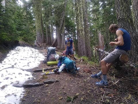
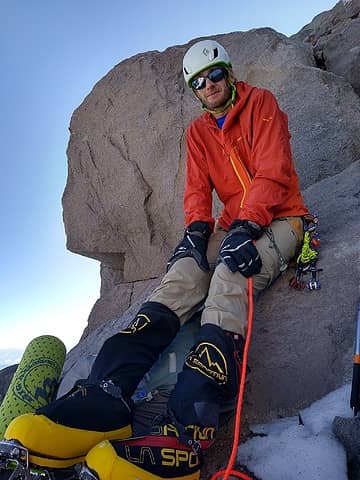
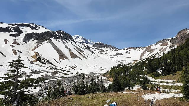
John and I both drove out south towards Rainier, with Stephanie riding with me to the White River ranger station a bit earlier to get our permits. We waited at the ranger station and organized our gear which included numerous items like ice tools, crampons, cams, rope overnight gear etc. After a few hours waiting for John to get through Seattle traffic, he arrived, and we both drove to the White River trailhead where we left my car. We then drove around all the way back to Enumclaw in Johns car, grabbed a huge dinner then proceeded to drive up the Mowich Lake Road up until its closure point shortly past the Spray Park Trailhead nearly 5 miles from Mowich Lake. We ended up just car camping for the night at the OHV parking area a couple miles before the closure gate.

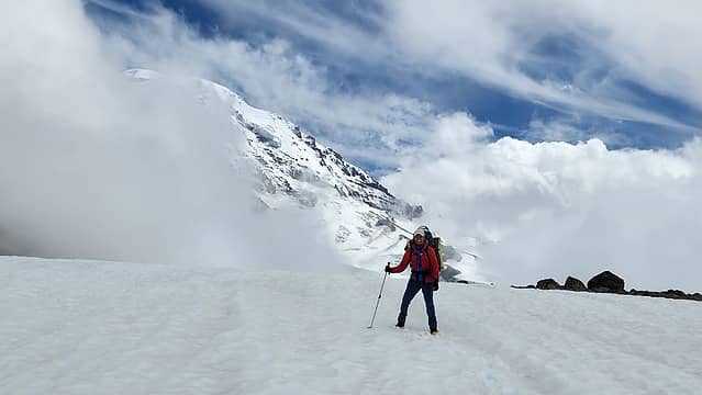
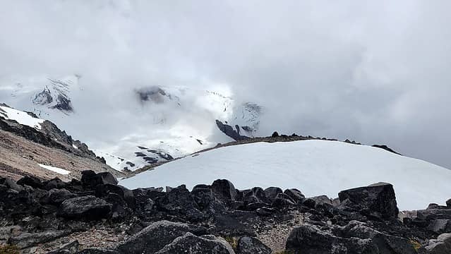
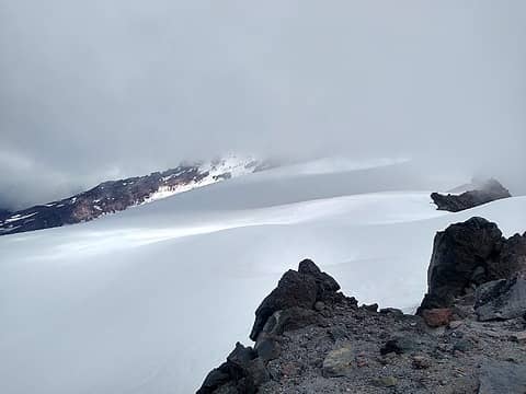
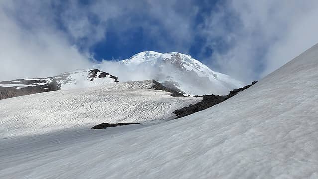
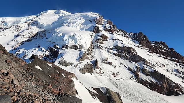
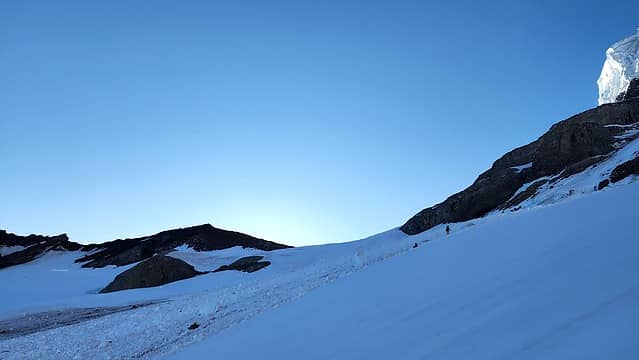
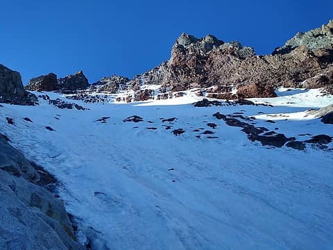
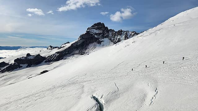
We woke to a large convoy of OHV guys parking and preparing for a day of off roading. We quickly packed up and parked at the closure gate, and under cloudy skies we started walking up the roads. I had my mountain boots in hand with about a 50 pound pack on. Thankfully there is a shortcut trail that bypasses all the long switchbacks in the road and cuts the 5 miles down to about 3.5, so it was barely an hour by the time we reached the lake. We took a quick snack and bathroom break and then started down the WOnderland/Spray Park Trail which to our surprise was quite snow free all the way to about 5500 feet before we started hitting more continuous snowfields. The trail was in good shape and we were really the only ones on it since it was still very early summer. As the trail worked us southward, we reached Eagle Cliff, but had just entered the clouds at this point so did not see any views over the cliff. We continued ascending east, then back northward until about 6000 feet elevation at which point we left the trail and stared cross country walking over firm continuous snow southward towards the base of Ptarmigan Ridge. We walked mellow snow covered slopes for over a mile in a whiteout until we had a couple peak-a-boo views open up and give us a glimpse of the starting slope to Ptarmigan Ridge.

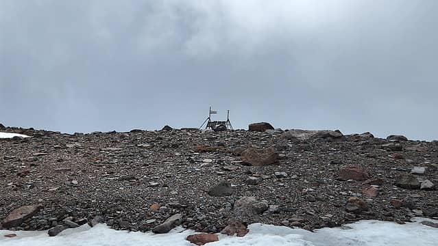
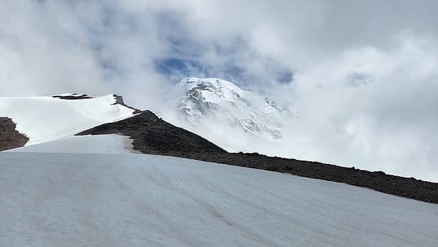
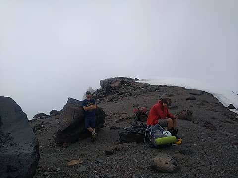
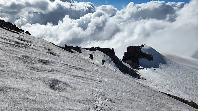
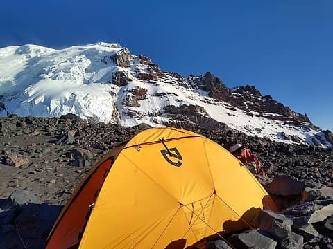
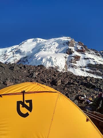
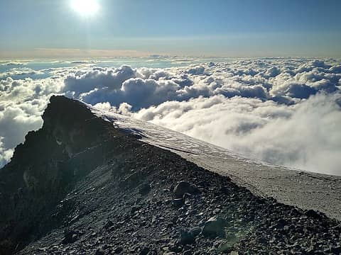
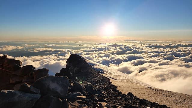
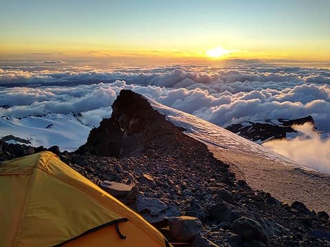
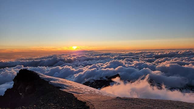
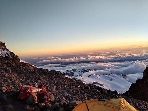
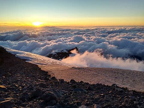
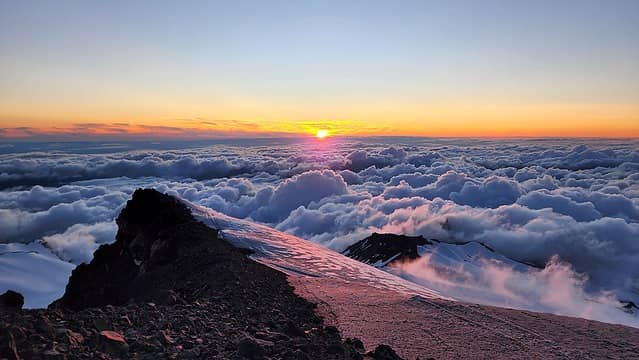
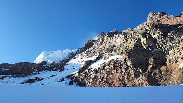
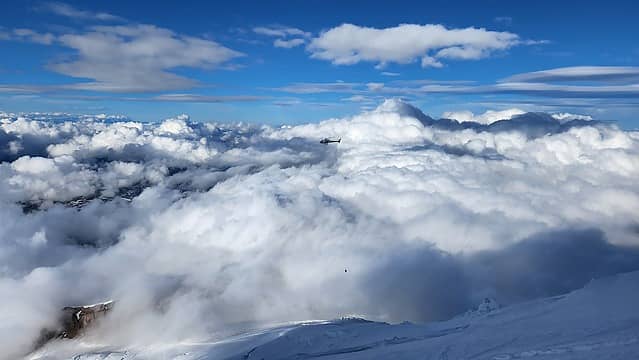
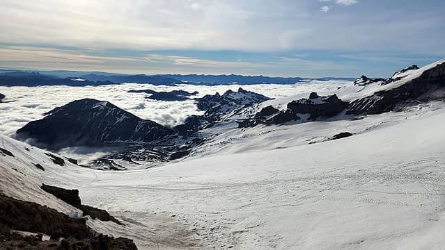
We started ascending steeper slopes from 6000 feet, thankfully the snow was still firm and supportive. Between 7200-7400 feet the slope steepened to about 45 degrees, which was the steepest section of the approach, right before mellowing out as we neared Observation Rock. At this point we passed a weather station, and began to slowly get larger clearings in the whiteout clouds we had been in all morning. We slowly continued up past 8000 feet, then 9000, took a small break on a nice sandy flat spot at 9200 feet, then at aout 9600 feet, we emerged completely above the clouds and saw the final 800 foot slope we needed to ascend to reach our camp. Finally, after a tiring 12 hour day of snow slogging carring 50+ pounds, we reached the flat section of ridge at 10,400 feet where we found a spectacular bivy spot in soft sand. The view of the Seattle/Tacoma metro area was amazing, since we were not under clear skies as we eventually climbed above the clouds. We began excavating the camp spot we found to make it larger to fit all 3 of us. I did not have a tent so I set up my tarp and my sleeping pad right next to the tent John and Stephanie shared and we got started melting snow right away. With the breezy conditions and quickly cooling temperatures, my low efficiency ultralight stove took a long time to melt and boil water. I was also getting sandblasted by the wind which got my sleeping bag and gear all gritty throughout the evening. Eventually, we got about 5 liters of water melted and a couple more boiled for dinner for all of us. About 1000 feet below us, we could see the clouds swiftly flowing over the lower Ptarmigan Ridge which was a cool sight to behold! By dark, we were ready to fall asleep.

Hiking the Spray Park Trail
Ascending towards the lower ridge in whiteout
Heading up
Heading up
Weather station
Weather station
 
 
First glimpse of Rainier near Observation Rock
 
Small gendarme along the ridge
 
Scrambling over the gendarme
 
Ascending Ptarmigan Ridge
Taking a break at about 9200 feet
 
Traversing snow slopes on the ridge
Final slope to reach camp
 
Ascending the final slope
Upper mountain and route coming into view
 
The upper NW face from our camp
Flat section of Ptarmigan Ridge
 
View towards the NW
View towards the NW
 
 
Scenic campsite
Scenic campsite
Sunset over Ptarmigan Ridge
 
 
Final rays of light
Final rays of light

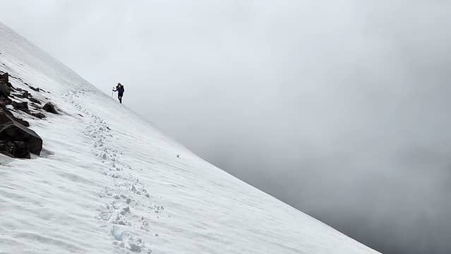
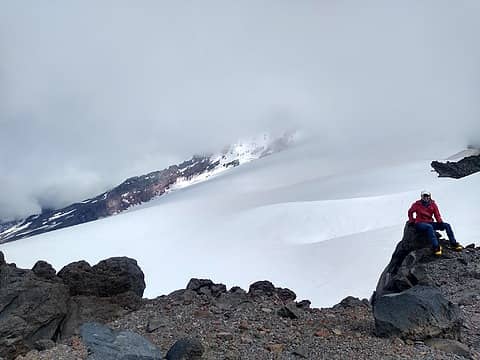
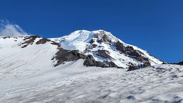
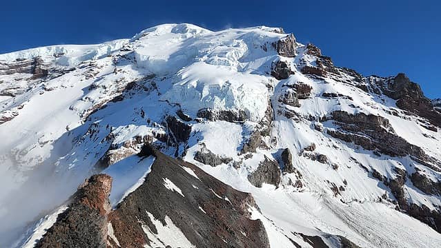
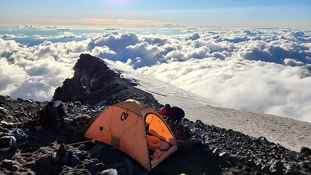
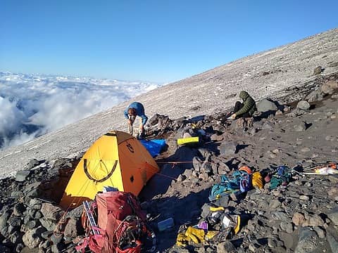
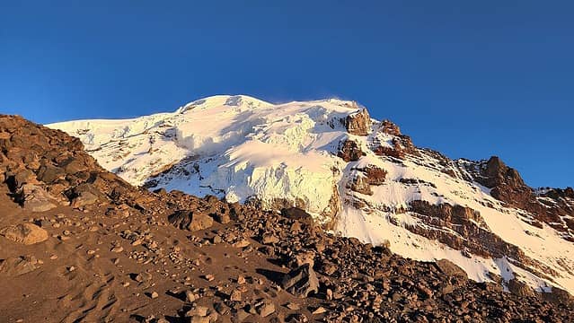
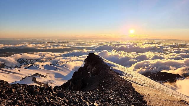
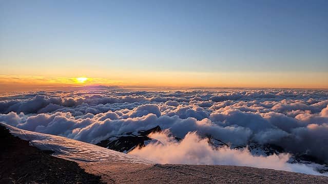
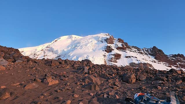
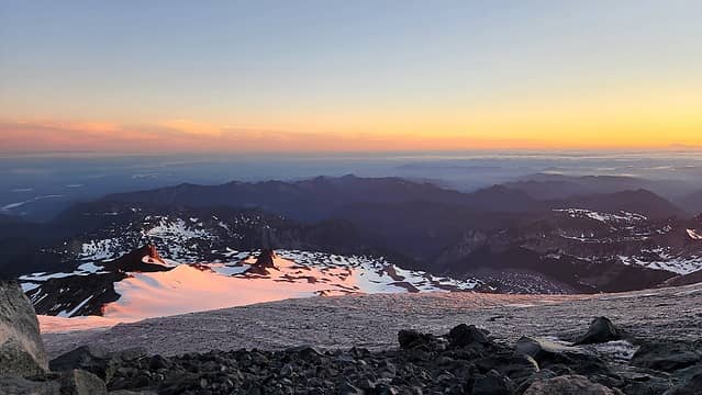
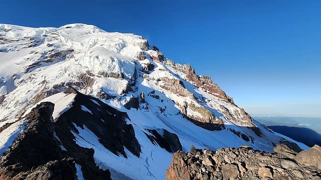
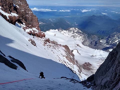
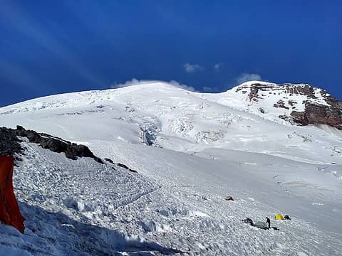
That night the glow of lights from the Seattle/Tacoma area was bright, and the clouds completely cleared out. At dawn the following morning we began packing up to a chilly wind and wasted no time starting up. We walked acrss the flat section of the ridge and passed by a more established campsite with large rock walls, but in a windier location right at the col where we left the ridge proper and made a descending traverse to the west. The route makes this long jog west to avoid the Ptarmigan icefall. We crossed over a serious debris field from avalanches that have come off the icefall throughout the year, and ensured we went at a very brisk pace across this. e reached the start of the steep 45-50 degree snow slopes that mark the start of more serious climbing at about 8am. Very faint ski tracks were visible from a skier who ski the Ptarmigan Ridge route likely a month prior.

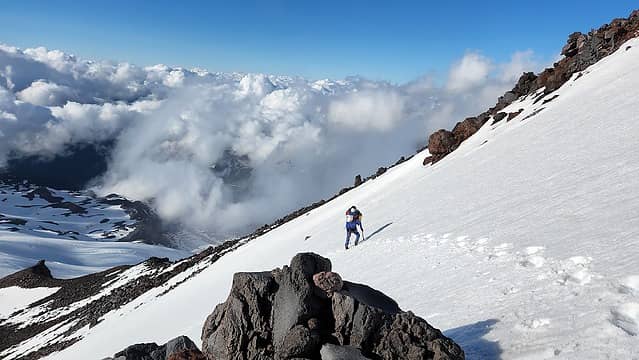
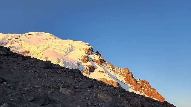
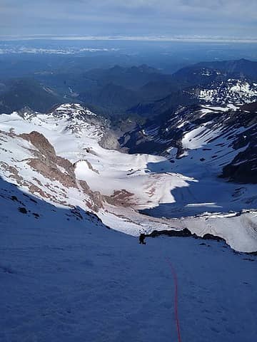
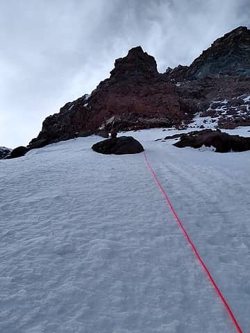
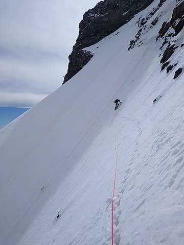
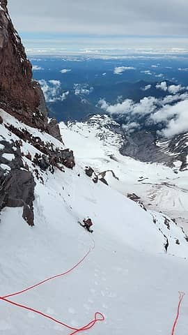
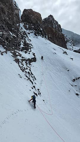
We crossed the bergschrund on a good snow bridge and began ascending the 45 degree snow. It was fairly easy to switchback with side stepping initially from the 10,200 - 10,600 foot levels, but above 10,600 feet the steepness increased and we all began front-pointing up the very firm and somewhat icy snow. A conditions report we got from the weekend before our climb said the entire route was 2000 feet of bomber ice so we were stoked. We started simul climbing as a team of 3, but were not moving very fast due to our heavy packs which we had to carry along since we were going to descend the Emmons Route. I led up and made a single cam anchor at a small rock outcrop and belayed Stephanie and John up for a quick break. Then I led up a short AI3 ice step and continue up more snow above. John took the next simul lead and continued up more 50 degree snow/neve all the way up to another small rock outcrop just below the steep leftward traverse. The route we took is the normal Ptarmigan Ridge route marked by the red line in the following photo. Route Topo

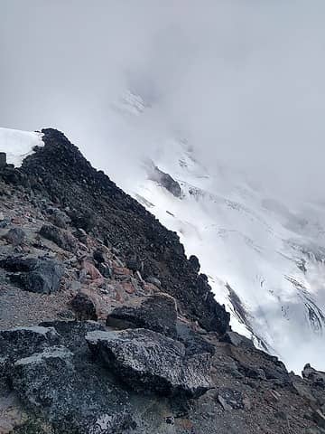
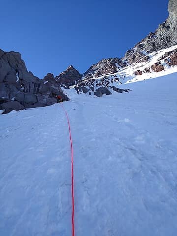
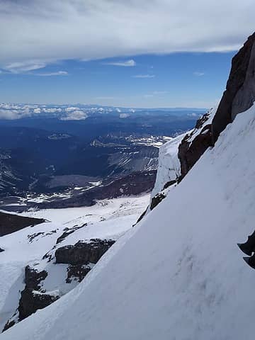
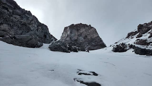
The steep traverse is labelled in this photo. I started up again on lead, breaking trail on this wild traverse on 55 degree snow. A huge cliff dropped off shortly below us on the traverse and this was probably the ost heads up part of the route. Luckily I was able to get one good cam and a few good ice screws in as I made my way left, and to the base of the next snow chute we needed to climb. I made a two screw anchor and belayed them in. By this point the wind had started really picking up, and looking up on the upper mountain there was intense spindrift whipping all over the place. We were not looking forward to the 2000 foot slog to reach the summit of Liberty Cap.

Sunrise from my sleeping bag
Sunrise over our route
John starting up from camp
The rightward traverse off the ridge to begin
Traversing around a small tower on the flat part of ridge
Looking back towards the col from the traverse
 
Me taking a break
Me taking a break
View up the snow slopes
Climbing the initial 45 degree slopes
Simul-climbing
Simul-climbing
 
Nearing the leftward steep traverse
First look at the left traverse
Me forging ahead on the traverse
Looking down after the traverse
View up from the end of the left traverse

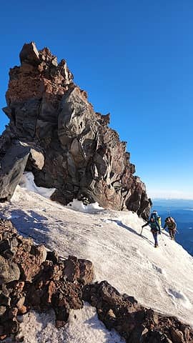
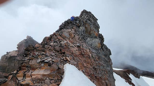
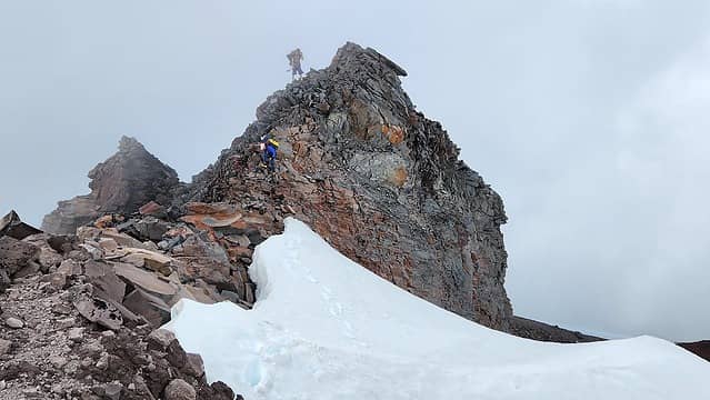
John took the next lead and went up more 45-50 degree slopes towards a large cliff we could see looking straight up from the end of the leftward traverse. This section had a few inches of fresh snow covering ice though, so it was slower going. At the base of the large cliff there was a nice cave to escape the wind for a bit to eat and drink and recover some energy. Our packs were starting to slow us down quite a bit. After a nice break, I started up the next section, which began with a short step right and up a 6 foot vertical ice step, then up deeper snow in a shaded gully to reach a prominent rib with sunshine once again. It was slow going breaking trail up this 300 foot section though and the winds were howling through this funnel. I did manage to get a few good ice screws in though and once back in the sun on the rib I made a good anchor to belay up. The final section of the route was now in view, and it looked like the mixed rock step was completely covered in fat ice! John took this last lead and we slowly made our way up the final gully. To our amazement, a fast moving party of two caught up with us just as John was leading the ice step. I offered to let them pass and we were able to more or less climb the final ice step adjacent to one another.

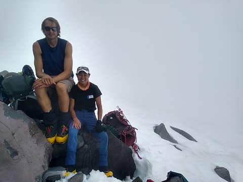
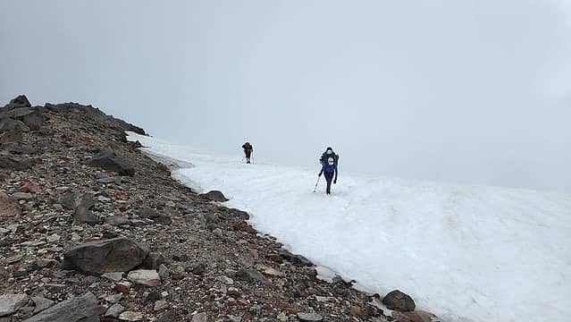
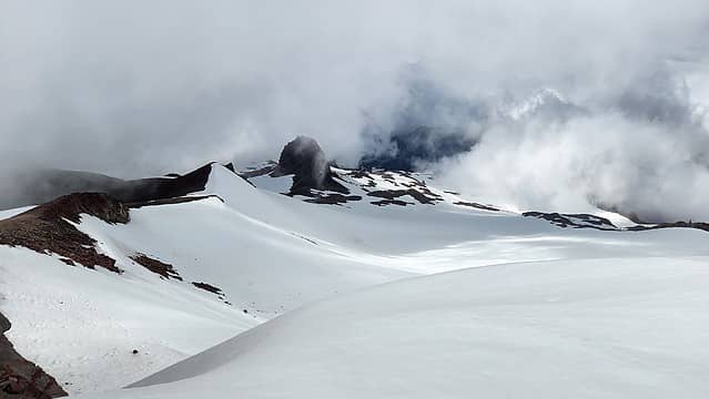
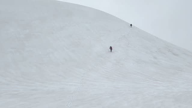
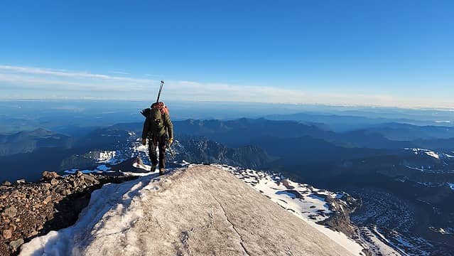
Once atop the ice step, we emerged onto wide open slopes on the Liberty Cap glacier. The winds really were strong now. I started breaking trail up this but we quickly determined the final 2000 feet were going to be miserable. The team of two eventually caught up and passed us, which made it easier to move upwards in the deep snow. I ended up in the lead the entire way up the slopes to the summit of Liberty Cap. It ended up getting very bad though, with winds nearly 60 mph and I did not have quite enough layers to deal with that. I was pushing to continue moving quickly against the desire of my climbing partners as I was getting cold. It took about 4 hours to reach Liberty Cap from the top of the technical climbing...only 500 feet per hour. High clouds were whipping over the summit of Columbia Crest and we climbed into the occational whiteout as we neared the summit. At the time we stood on Liberty Cap though, we had clear visibility however we did not even bother stopping at the top. We walked right over and began the descent down to the broad saddle between Liberty Cap and Clumbia Crest. My second to last P400 highest 100 in WA was very anti-climactic with no celebration whatsoever. We also couldn't capture much of any photos from this section of the day as I didn't want to take my gloves off.

John starting up the final pitch

After that photo I took of John starting the final gully to the mixed/ice step at the top of the technical section of the route, we didn't get a single photo until most of the way down the Emmons. It was certainly a relief when we started walking downhill, however we still had difficulties to surmount. A long horizontal traverse to the east was required to meetup with the flagged path for the Emmons, and a few large crevasses required crossing. Since the Emmons was east facing, it was cold and shady in the late afternoon, and the wind was still whipping down the slopes. It wasn't until we got about 3000 feet down that the winds died off and I warmed up. I was felling pretty ill though from being battered all afternoon and being cold.

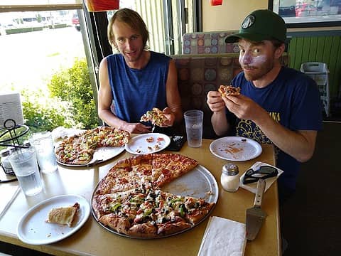
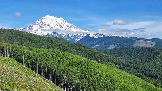
We reached Camp Schruman in the late evening and decided we would just stay another night there. I slept on the wooden latform of a new storage shed the rangers were building adjacent to the bathroom while Stephanie and John put the tent up in an unused platform on the snow. It ended up still being a windy night and I didn't get too much sleep. We were slow to get ready the next morning and didn't start walking down the Interglacier until about 11am, but we made very fast time getting back to my car at the trailhead. We were thrilled to be back and had a relaxing dinner in Enumclaw at a nice pizza place and also grabbed ice cream and beer. The views of the NW face of Rainier on the drive back up the Mowich Lake road was incredible, as we could not see this on our first day due to clouds.

 
Descending Emmons
Descending Emmons
 
 
Last views from Glacier Basin
Pizza in Enumclaw
Pizza in Enumclaw
 
Rainier from Mowich Lake Road

This was a difficult but rewarding trip and I am happy to only have Castle Peal left to finally finish off the P400s. Hopefully I'll have Castle done within the next week!

Proudly powered by Weebly