My Hog Canyon Page on SP
My Hog 1 and hog 2 pages on SP
Overview
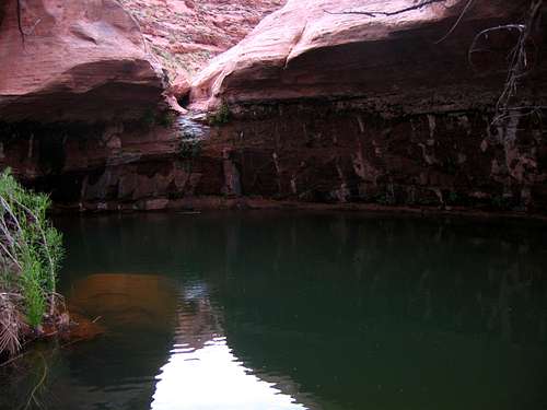
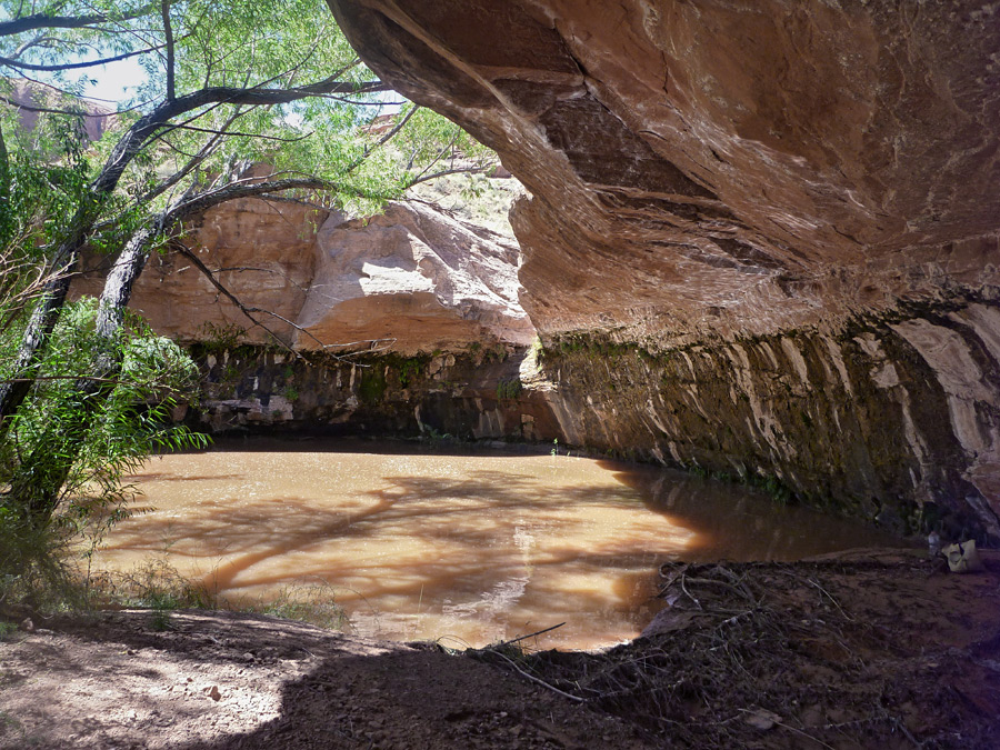
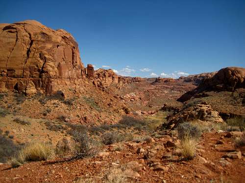
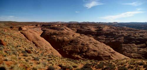
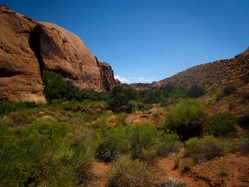
Hog Canyon is a major drainage in the North Wash area of Robbers Roost in Utah. There are a handful of nice upper slots draining into the larger Hog Canyon as well as many places to hike around. There is even a natural cold water spring which is an awesome place to visit in the heat of summertime. One nice thing about this canyon is its easy of access located just off the highway. Despite this, few people venture into the upper parts of the canyon. You will likely find some good solitude in this area along with plenty of beautiful open desert and enough sunshine to fulfill you for weeks. A hidden gem is the canyon contains a permanent stream which is bordered reeds, bamboo, oak and cottonwood trees for 2 miles to the source at the springs. This makes the lower canyon unusually lush for the Utah desert.
Getting There
Lower Access
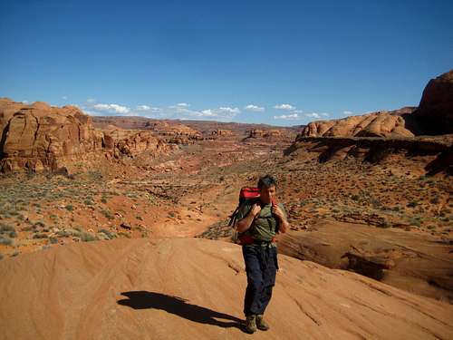
There are two main access points for Hog Canyon. The lower one is located at the Hog Springs Recreation area on Utah Highway 95 on the west side of the road at mile marker 33.5. Here there is a vault toilet restroom, a large parking area and a wooden suspension bridge over the stream leading to some sheltered picnic tables. A trail leads up the canyon for 1 mile through the lush area all the way to the spring at 4,250 feet in elevation. This is 150 feet above the trailhead on the highway so it's a pretty flat trail. At times the trail can be difficult to follow but it's not bad. Continuing further upcanyon will lead you to a few more smaller springs, and eventually to the mouth of the upper Hog Canyon Slots up at 4,460 feet. There may be some short scrambling sections to climb up but nothing hard. Typically people looking to do the upper slots start at the upper access point described below.
Upper Access
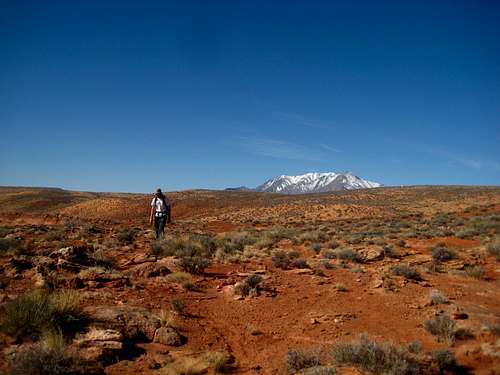
To access Hog Canyon from above, turn right onto Utah Highway 276 towards Bullfrog and continue southwest on this road for 3.6 miles to a small dirt road on the left, across from a yellow warning sign. The road is not at all obvious and it's almost guaranteed you will miss it the first time and have to turn around. Follow this rough high clearance 4WD road (known as the Trachyte Point Road) 2.1 miles to a wide spot at the top of a hill just before the roads turns right and heads down the steep hill. There is a small high point here and parking for three or four vehicles. This place would be a great place to camp. If you have a passenger car with 2WD you can get about a mile up this road until some really deep sand will force you to park along side the road. Walk the last mile to the trailhead.
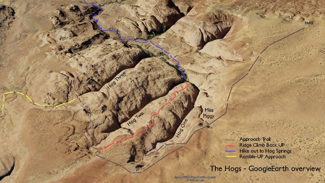
From the trailhead, locate a new boot path that heads to the northeast towards the west rim of Hog 4 and Hog 1 slots. Once you reach the rim follow it north to the head of the upper slots. This approach hike is about 1.5 miles and will take a little less than an hour. The first major drainage is Hog 1 (Boss Hog) with an ACA rating of 3A II. If you continue around to the east and over a small bench you will reach Hog 2 with a rating of 3A II and even further east will get you to Hog 3 (Razorback) with a 3A II R rating. Hog 3 is slightly tougher as some of the descents are more challenging without the opportunity to set up a rappel anchor. Whichever fork you choose, you will end up in Hog Canyon near the upper springs and you have a few exit options which are described below. See attached route pages for descriptions of each fork
Quick Links!
Hog 3 (Razorback)
Northwest Exit
Take this exit when you want to return to the upper trailhead where you are parked after you are finished with the slots. From the mouth of Hog 1 and Hog 2, hike down the main drainage a short ways and locate a prominent side canyon heading northwest (not to be confused with the one heading southwest from the same spot). Hike up this side canyon which is very easy at first with a few scramble sections. At first the upper part looks very intimidating but rest assured it goes. Scramble up loose rocky terrain which never exceeds class 3 and when you get to a steep chimney that appears 4th class, locate a nice ledge to the left and scramble up a short slab with nice holds (moderate exposure) and up the final sandy slope to the rim. Hike southwest across open desert for a quarter mile to your car at the trailhead (See map).
Repeat Exit
Take this exit when you want to do another slot in the group. Most people will do Hog 1 and Hog 2 using this exit hike out which heads up the ridge between the two slots. Start where Hog 2 drains out into Hog 1 and look for a low angle slab, then a steeper slab just above. Carefully climb up both slabs following the easiest way up using holds when you see them. There is a nice ledge between the two slabs and once above the steeper slab, follow the gentler slickrock back up to the top to the head of both slots. This climb is said to be low 5th class and people have used ropes but I have no idea why...placing any protection was scarce at best.

Map
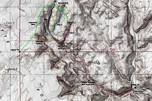
Hog Canyon Map
GREEN: Approach Hike - Class 1
RED: Lower Hog Canyon Main Drainage - Class 1 and 2
DARK BLUE: Hog 1 (Boss Hog) - ACA 3A II
LIGHT BLUE: Hog 2 - ACA 3A II
PURPLE: Hog 3 (Razorback) - ACA 3A II R
ORANGE: Northwest Exit - Class 3
YELLOW: Repeat Exit - Class 5.2
Camping/Red Tape
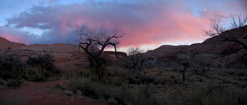
Sunset seen from camp at the base of Sandthrax Canyon
Camp at the upper trailhead, or at any of the camping spots at the base of the Irish Slots (Leprechaun, Blarney, etc.) which are located between mile markers 25-28 on Highway 95. This is all wild BLM lands so there is no red tape. Practice LNT policies and keep in mind, rescue in an emergency is very far away.
| MONTH | HIGH | LOW | PRECIP | SNOWFALL |
| JAN | 41 | 19 | .52" | 5.2” |
| FEB | 47 | 25 | .43" | 2.0” |
| MAR | 58 | 33 | .58" | 2.7” |
| APR | 66 | 39 | .54" | 0.7" |
| MAY | 76 | 48 | .63" | 0.1" |
| JUN | 87 | 57 | .43" | 0 |
| JUL | 92 | 64 | .91” | 0 |
| AUG | 89 | 62 | 1.15” | 0 |
| SEP | 81 | 54 | .80” | 0 |
| OCT | 68 | 43 | .71" | 0.5” |
| NOV | 52 | 30 | .62" | 1.8" |
| DEC | 42 | 21 | .26" | 2.4" |
Gear
These canyons all require rappelling gear (Harness, belay device, rope etc.) Check the longest rappel in each canyon to see how much rope you need. Helmets and pads are also great to have. I tend to wear jeans in slot canyons to protect my legs.
External Links
See Michael Kelsey's book Technical Canyoneering guide to the Colorado Plateau for a great description of the canyon.
Hog 1 Beta (September 2014)
Overview
Hog 1 is the first of of three excellent slot canyons in the upper Hog Canyon drainage in the North Wash area slot canyons in the southern reaches of Robbers Roost Country. Like its counterpart to the east, it features narrow, leaning sections with many friction slides and at least one mandatory rappel. There are many descent sized drops in this canyon but all but one can be down-climbed by experienced canyoneers. With a short approach, this makes an ideal half-day outing or it can be combined with Hog 2 just to the east.
 Hog Canyon Slots - Hog 1 at left center and Hog 2 at right center
Getting There/Route Description
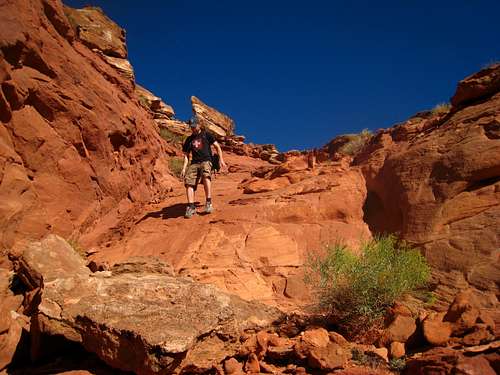
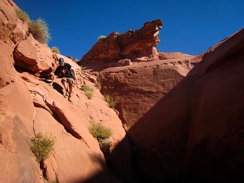
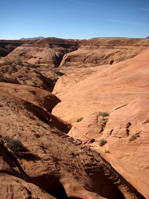
See the main page for directions on how to get here. Start at the upper trailhead and park 2 miles from Highway 276 on the 4WD dirt road where it turns sharply to the right and heads down a big hill. 2WD cars can make it to the start of the hike when the road has been recently graded but later in the summer it becomes too sandy. Follow the approach "trail" northward along the rim to the left of the canyon. This hike starts along the open desert flats on the Carmel Formation. After 10 minutes or so, the rim is reached and views 700 feet down into the main drainage are spectacular. The first, little canyon is Miss Piggy, which is a very short canyon that dumps into Hog 1 you may not even notice. The second canyon is Hog One, which has a large, shallow bowl at the upper end. Hike the rim all the way to this bowl and descend a short Class 3 slab to pass the Page Sandstone and emerge onto the Navajo Sandstone below. In summer, this approach as well as the scramble back up can be dangerously hot.
 Descending the first slab into the canyon Descending the first slab into the canyon |
 Bypassing the first drop on slabs to the right Bypassing the first drop on slabs to the right |
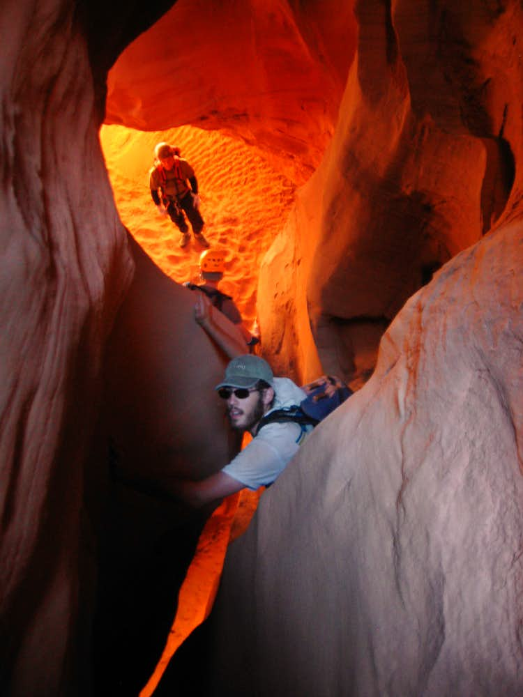
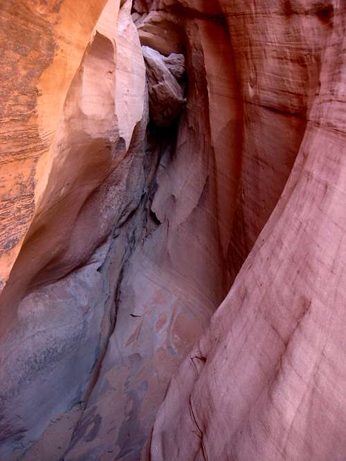
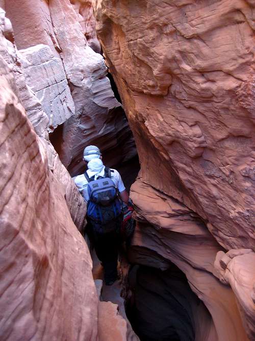
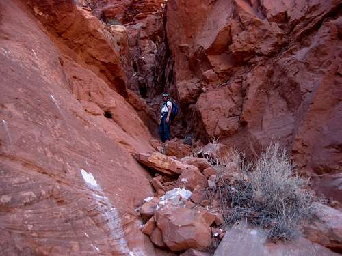
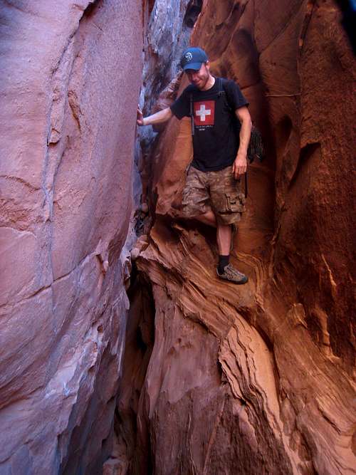
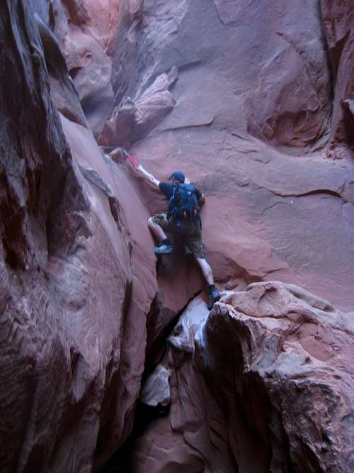
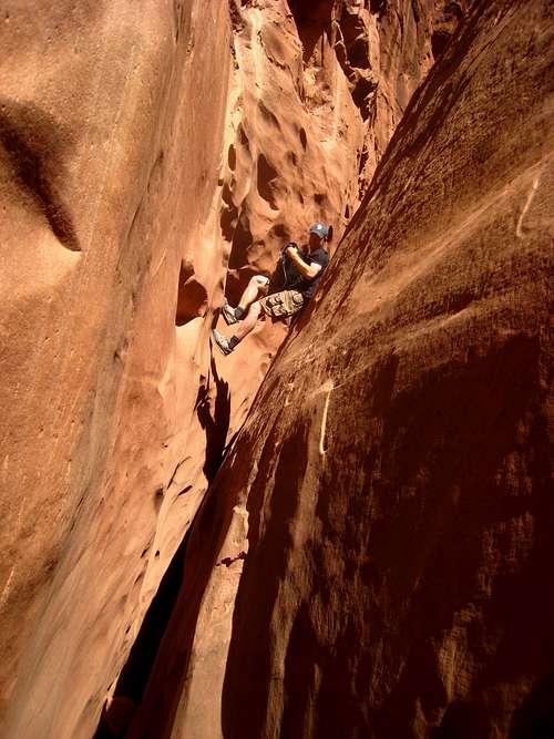
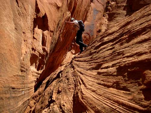
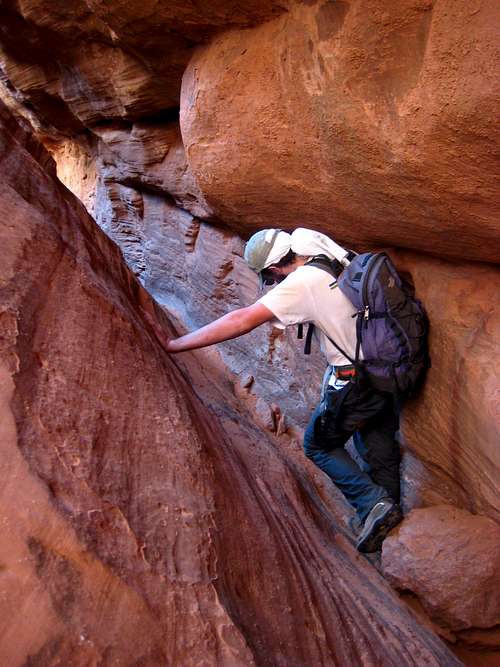
Once in the canyon, bypass the first drop by traversing a slab on the right (LDC) and scramble back down on fairly smooth slabs. Continue down the easy canyon at first, then arrive at a larger drop with a long piece of old webbing. Rappelling this drop is awkward since it goes in steps, it's best just to hop down the first part, then friction slide down the narrow second part. Dealing with a rappel hand on the second part would be tough. Continue down canyon which is narrow and sustained. Even I had to turn sideways and couldn't rotate my body in this canyon and it leaned to the left for a good portion. There are at least 3 friction slide drops meaning you will want led protection. I like old blue jeans while others like knee pads. There is also one 12 meter rappel about 3/4 the way down off a large chalkstone about 7 feet above the canyon floor just as the long left leaning section ends. The section leading up to this rappel requires you to stem about 15 feet above the canyon in order to reach the anchor. A 30 meter rope is plenty for the single mandatory rappel. Continue as the canyon opens slightly and pass by the end of Miss Piggy which comes in from the right, continue over one more friction slide, then emerge into open terrain with cottonwoods and tall grasses and follow down the drainage until you can easily hike up to the right and follow the northwest scramble route out of Hog Canyon.
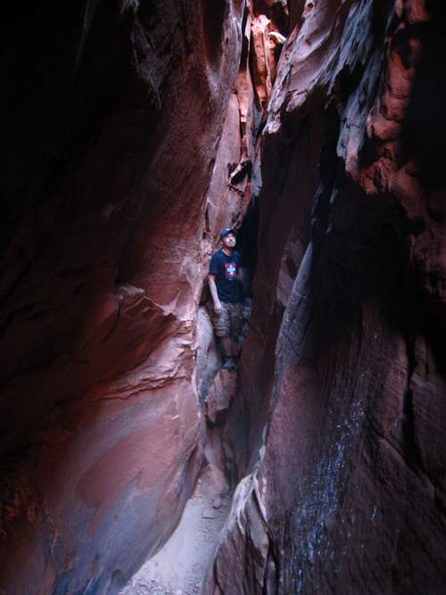 John working through the narrows John working through the narrows |
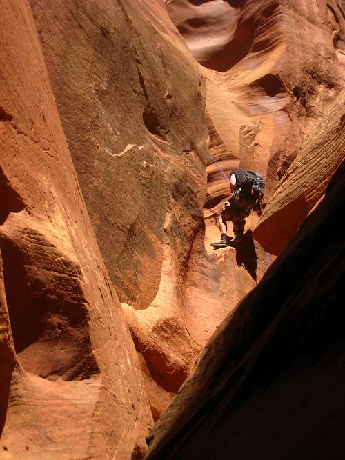 John making the single rappel John making the single rappel |
 Traversing ledges above the narrow canyon floor Traversing ledges above the narrow canyon floor |
 Descending the first major drop Descending the first major drop |
 High stemming just before the rappel High stemming just before the rappel |
 Hog Canyon Hog Canyon |
Essential Gear
This canyon requires rappelling gear which includes a harness, belay device (ATC or Figure-8), locking carabiners, a 30 meter rope, leg protection (I like jeans), helmet and at least 2 quarts of water per person. If you have a large party this canyon can take a full half-day and with the approach and hike out you can expect a full day for this canyon however experienced canyoneers in small groups can do both Hog 1 and Hog 2 in one day with time to spare.
Map
 Hog Canyon Map
GREEN: Approach Hike - Class 1
RED: Lower Hog Canyon Main Drainage - Class 1 and 2
DARK BLUE: Hog 1 (Boss Hog) - ACA 3A II
LIGHT BLUE: Hog 2 - ACA 3A II
PURPLE: Hog 3 (Razorback) - ACA 3A II R
ORANGE: Northwest Exit - Class 3
YELLOW: Repeat Exit - Class 5.2
External Links
See Michael Kelsey's book Technical Canyoneering guide to the Colorado Plateau for a great description of the canyon.
Hog 2 Beta (March 2013)
Overview
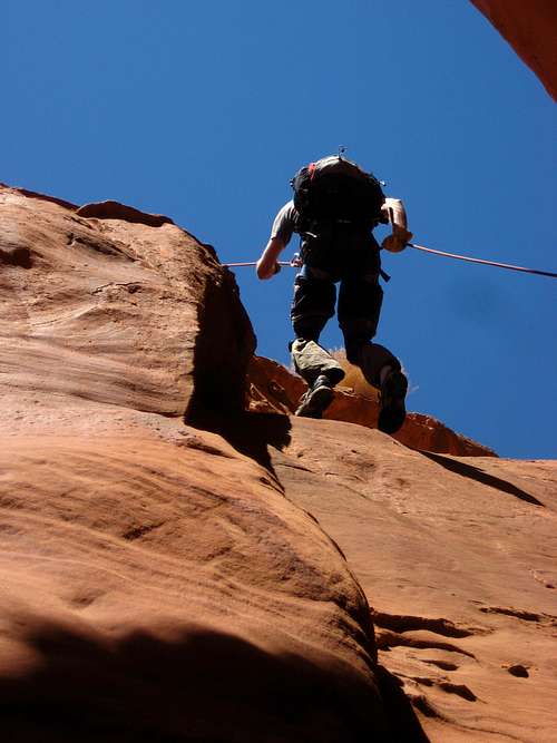
Hog 2 is one of the upper slots in the Hog Canyon drainage of the North Wash area. Many people say it is probably the best of the group due to the large mix of canyoneering moves and scenery found in the canyon. There are many stemming moves, lots of friction sliding, a couple mae west type moves and even a difficult down climb at the end into a glowing cavern if the sun is high in the sky. The feature photo above shows Jacob just about to make the drop into this cavern. Also, there are a handful of long rappels in which to fully do this canyon you will need a 50 meter rope and a 50 meter pull cord.

Getting There/Route Description
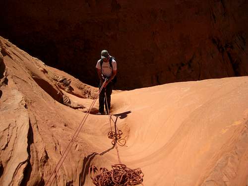
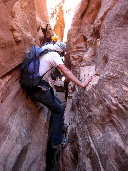
See the main page for directions on how to get here. Start at the upper trailhead and park 2 miles from Highway 276 on the 4WD dirt road where it turns sharply to the right and heads down a big hill. 2WD cars can make it to the start of the hike when the road has been recently graded but later in the summer it becomes too sandy. Follow the approach "trail" along the rim of the canyon. The first canyon is Miss Piggy, which is a very short canyon you may not even notice. The second canyon is Hog One, which has a large, shallow bowl at the upper end. Once you pass around the head of Hog 1 and reach the top of Hog 2, Route-find your way below the Page Sandstone cliff band and onto the sloping Navajo below and work your way into the bottom of the drainage. This should never exceed class 3 down climbing. Once in, start down the easy shallow V-drainage with full exposure to the sun. Stemming works well here as walking in the narrow spots in the very bottom is annoying. You will probably get hot in this section though if you already put your pads or jeans on. You will come to an anchor with a rock wedged into a notch with a long piece of webbing tied to it. This is the first rappel and it starts down some slabs past a couple small potholes and then over an edge down the the bottom of the canyon below. You will finally be in the shade after this 42 meter rappel. You will have to set up a biner block and rappel single strand with a 50+ meter rope and have a pull cord.
Once down this first long rappel, continue down canyon passing by an open section and follow it as it narrows up and you get to a section you must stem over and chimney your way across a 75 foot section about 30 feet above the bottom of the canyon. This may be a mae west type section...if you fell you would likely get squeezed into the very narrow section just below however the very bottom of the slot below that opens up and if you could descend to the bottom from the start you could walk through a tunnel like slot. Most people chimney across from above though and drop down on the other side. Once across and back down you can look back into the tunnel you just went over. Just past this there are some nice short down climb sections and you will then reach another rappel anchor composed of a piece of webbing around a big chalkstone. This rappel is a two-part drop which starts as a short 5 meter drop to a ledge then continues over the edge another 14 meters to the bottom for a total of about 20 meters.
Just past this drop is another 16 meter rappel anchored by a nice chalkstone which has an awkward start and goes over a lip and becomes a free rappel. Once at the bottom of this rappel there is a nice cove you can explore. Continuing down canyon you will work through a straight more open section with some narrows here and there for about 15 minutes then you will get to the final corkscrew drop that this canyon is known for. If you arrive here around noon the cavern at the bottom will be glowing. Start by squeezing your way down into the slot and friction slide your way down to a cove in the right hand wall where you can rest/wait for others. I found it best to throw my pack down first before making this slide. From the cove, finish the descent by sliding down a little further and jumping down the final 5 feet where it quickly opens. The landing is a lot of nice sand. This is the most technical part of the canyon and beginners may need some assistance. From here the canyon opens up very quickly and you will enter the main Hog Canyon drainage in less than 5 minutes at which point you will choose your exit route all of which are described on the main page.


Essential Gear
This canyon requires rappelling gear which includes a harness, belay device (ATC or Figure-8), locking carabiners, at least a 50 meter rope and equal length pull cord, leg protection (I like jeans), helmet and at least 2 quarts of water per person. If you have a large party this canyon can take a full half-day and with the approach and hike out you can expect a full day for this canyon however experiences canyoneers in small groups can do both Hog 1 and Hog 2 in one day with time to spare.
Map
Hog Canyon Overview MapGREEN: Approach Hike - Class 1
RED: Lower Hog Canyon Main Drainage - Class 1 and 2
DARK BLUE: Hog 1 (Boss Hog) - ACA 3A II
LIGHT BLUE: Hog 2 - ACA 3A II
PURPLE: Hog 3 (Razorback) - ACA 3A II R
ORANGE: Northwest Exit - Class 3
YELLOW: Repeat Exit - Class 5.2