Liberty cap - 6780' - class 1
Cloudy Peak - 7915' - class 3
Buck Creek Pass - Cloudy Pass - Spider Gap
August 2010
Starting - Trinity Gate to Buck Creek Pass and Liberty Cap
For my weeklong backpack trip in August of this past summer I was going to do a 50 miler point-to-point backpack from Trinity to Holden Village and act as an adult leader for a local boy scout troop. We made our way in the van to trinity and started the trek. This was going to be a very relaxed trek for me since I was traveling with younder scouts and some of their parents but nenetheless it was going to be a beautiful area to explore.
We got a pretty late start the first day so the plan was to get 5 miles up on the Buck Creek Trail and camp at the large flat area just before the climb to Buck Creek Pass. Didn't really get any photos from the first day as we were in the trees most of the time. Met another nice group of three who were heading the opposite way we were about to finish their trek. The first day started under mostly cloudy skies as a small front was starting to come through.
When we awoke the next morning there was a few clouds hovering over Chiwawa Ridge above us to the west. Short sunbreaks allowed for very clear views of Chiwawa Ridge high above us.
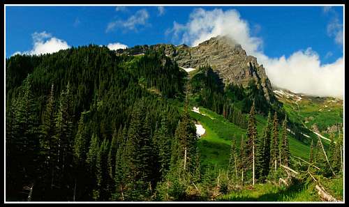 Chiwawa Ridge in the morning |
We grouped up and started the climb to Buck Creek Pass. Due to our larger group this took awhile and we watched as more clouds started to roll in. We moved into the fog just as we got to the pass and shortly afterwards during our lunch break it started to drizzle. This wasn't fun because we were planning to climb Liberty Cap and Flower Dome that afternoon.
We hanged packs to try and keep them dry and started the day hike up Liberty Cap. A nice boot path led up to the crest of Chiwawa Ridge. After about an hour of walking in consistent rain through wet shrubs and muddy slopes we made the summit of Liberty Cap...completely soaked. I had to keep my SLR camera hidden under my clothes and rain jacket to keep it safe. We lucked out and noticed a clearing coming from the west and from the top of Liberty Cap we got a peak-a-boo view to the south.
 View from Liberty Cap through the clouds |
Buck Creek Pass to Middle Ridge
We started back down Chiwawa Ridge heading towards Buck Creek Pass and to our disdain the clouds switched directions on us and the rain that just passed us were coming right back towards us. Once we got back to the pass and collected our packs we got one more sunbreak before the rains started again.
 View from Liberty Chiwawa Ridge from Buck Creek Pass |
We continued down the trail past Buck Creek pass and towards the crossing of Small Creek. By now we were happy to see the sun for a little bit during the quick but slippery descent to the creek.
Upon reaching Small Creek we stopped to snack and fill water bottles. Just as all of us waded across (that was no fun!) since it was too wide to hop across, the rains started again and they were relentless all the way up to Middle Ridge. Since part of our group including myself was a ways ahead of the others we decided to try and wait it out in the trees. I also made the stupid mistake of forgetting to put my rain coat back on so I got pretty wet. To our surprise though the top of Middle Ridge came sooner than we thought and believe it or not the sun came back out right as we got to the top. By now though the sun had almost set so we made camp on the ridge and cooked a quick dinner before heading to bed.
Middle Ridge to Cloudy Pass
We woke up to sunny skies and cooler temperatures the next morning. I took a quick run up the ridge towards sheep herders camp to get a look at Glacier Peak early in the morning. Low fog blanketed the valleys well below us. An abundence of wildflowers, particulairly lupines were everywhere.
 View from Liberty View from the Middle Ridge |
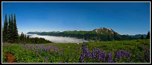 View from Middle Ridge with lupines |
We continued down the trail and made the long descent to the bridge. Nothing special through this part of the trail...just forest walking however after we crossed the river and began climbing up the trail again we got our first views in awhile. After a long break at the trail Junction for Image Lake, we decided to head to Cloudy Pass to camp for the night and take the day hike to Image Lake the next day. The traverse over Suiattle Pass was very nice.
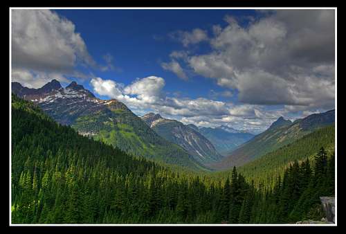 View from Suiattle Pass |
Once we got to Cloudy Pass we set up camp and relaxed the rest of the afternoon watching the clouds and enjoying one of the best views I've seen.
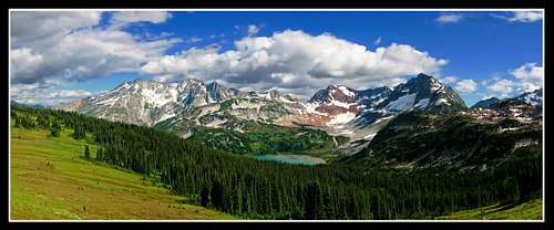 Cloudy Pass panorama |
Image Lake to Lower Lyman Lake
After a long time to get packed we started the day hike to Image Lake. the view from Cloudy Pass was different as some low clouds were "flowing" over the mountains around us.
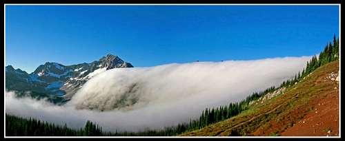 Cloudy Pass flowing clouds |
The Miners Ridge trail was very flat and went by quickly. Upon reaching Image lake around noon we explored around and had a nice lunch.
 Image Lake Panorama |
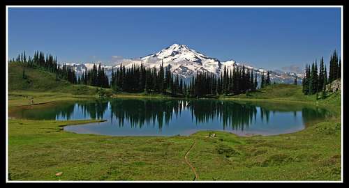 Glacier Peak and Image lake |
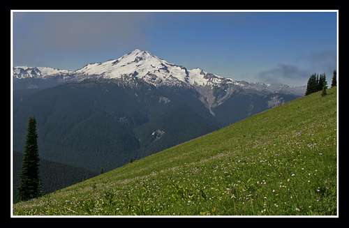 Glacier Peak from Miners Ridge |
After returning to Cloudy Pass we packed up and ran down the trail to Lower Lyman Lake where we met up our re-supply group and started a nice camp fire to get rid of the cloud of bugs that were relentless.
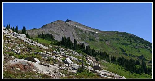 Cloudy Peak from Cloudy Pass |
The Climax - Cloudy Peak and Spider Gap to Hart Lake
After a nice dinner we were fully energized to do a lot of climbing. We (on this side trip it was only me and one of the other adults) headed back to Cloudy Pass early and started up for Cloudy Peak. Generally this was a walk-up but the summit block posed some diffuculties.
 Cloudy peak Summit block |
The elevation of Cloudy peak is 7915 feet. Great views of Glacier Peak, the Lyman Lakes, Bonanza and many other peaks were seen from the summit.
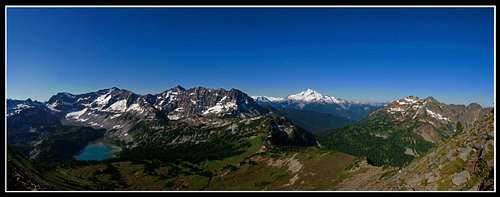 Cloudy peak summit panorama |
This is one of those peaks that anyone can do with the exception of the summit block. I managed to make it up with some class 4 moves but the exposure was pretty minimal which allowed me to make it.
We returned to Lower Lyman Lake and cought up with the rest of the group at Upper Lyman Lakes. Most of the scouts were simply enjoying the area and swimming in the frigid waters. The Lyman glacier is now reduced to a couple pieces of ice and will be gone very soon. T
he two of us along with a few others who wanted to get to the gap quickly made it to the top of Spider Gap and were greeted with great views. Some lingering snow remained but didn't pose any problems.
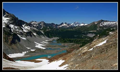 Lyman Lakes from Spider Gap |
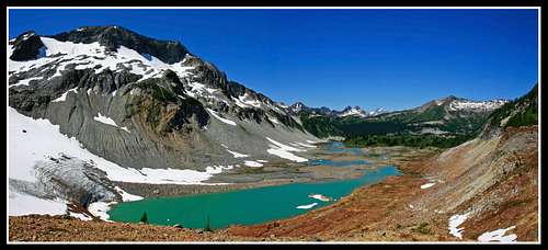 Lyman Lakes from near Spider Gap |
Since we needed to get to Hart Lake that afternoon we made our way back to our camp and packed up.
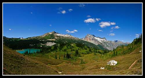 Cloudy and Bonanza Peaks |
This was the last great view we had before dropping back into the trees.
The long descent to Hart Lake was quick and painless. hart Lake was actually very nice and a good evening reflection awaited us at dinner.
 Hart lake evening reflection |
 Panoramic view from the valley |
Set up camp at the campsite near the lake.
Finishing - Holden Village
We woke early and moved quickly on the last stretch of trail out to Holden Village. We wanted to catch the breakfast at the cafe in the village. Saw many people staying there in the cabins. We stood out as the only backpackers there at the time. We found ways to entertain ourselves though until the bus came to take us to Lucerne where we took the lady of the Lake ferry to Chelan.
From there we were picked up and on our way home.
Overall this was a spectacular trip through some gorgeous country. Even though it was pretty easy and solitude was fairly rare, I still had lots of fun and manages some great photos which is always one of my goals.
