Clark Mountain - 8602' / Luahna Peak - 8400'
August 2017
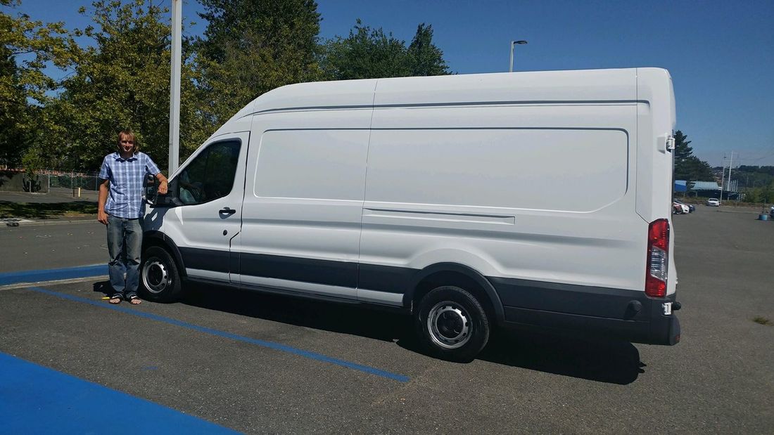
Since the Wind Rivers trip Josh and I had planned after the eclipse didn't quite pan out due to car issues I was having, we drove back to WA, and I bought a 2015 Ford Transit 350 cargo van. I then had one more day before I had to drive back to Edmonton, so Josh and I agreed to do Clark and Luahna since neither of us had done those yet. Since I was helping my dad build their new deck Friday afternoon, I went to pick up Josh late in my new supersized van (which Elaine and I will be converting into our home over the next year or so) and we drove partway out towards Stevens Pass until we found a good place to crash. We both could easily sleep inside the van, with a ton of room to spare!
We planned to wake up at 5:30 but like always, that didn't happen. By 7am we started driving and didn't start hiking until around 8. Unfortunately the final 2 miles of the White River Road were closed! We briefly contemplated whether to do something else or not but agreed it was Clark and Luahna or bust at this point. So we parked and started walking up the road. After 30 minutes or so we reached the trailhead and made our first of a few time consuming mistakes of the day. We started hiking the trail on the west side of White River. We continued all the way until I noticed the trail curve sharply left away from White River and we consulted the map. Low and behold, we were on the wrong side of the river!!
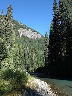
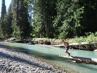
We then proceeded to bushwhack down to the river hoping to find a log, and eventually we did and was able to cross without too much trouble (a little jump was required). But then we wasted 30 minutes bushwhacking through thick slide alder laterally across the valley floor until we reached the actual trail we wanted. Finally we could continue and eventually, by 10:30 or so we reached the Boulder Pass trail junction and turned right.
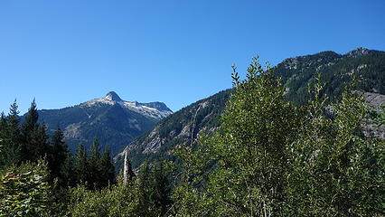
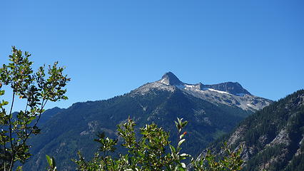
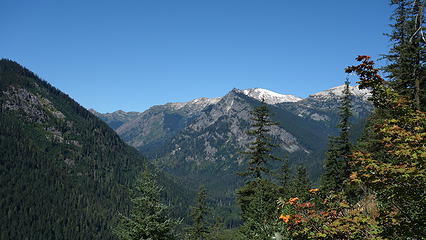
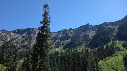
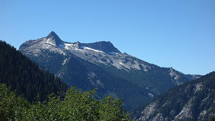
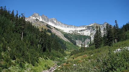
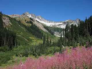
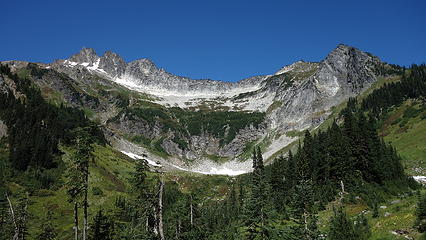
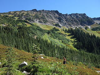
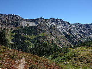
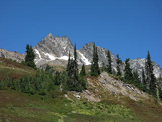
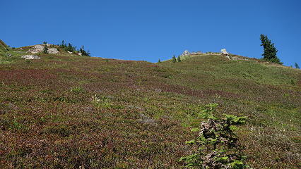
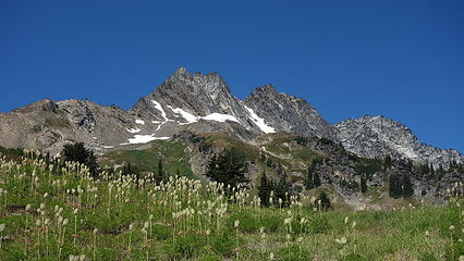
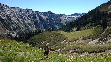
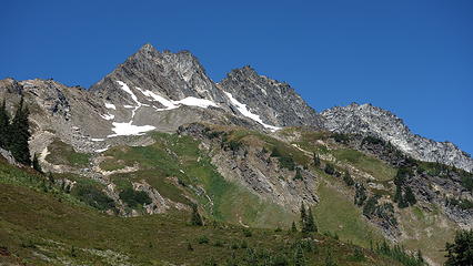
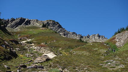
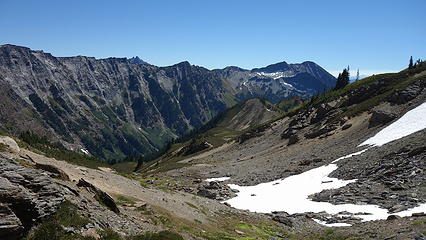
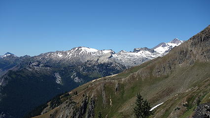
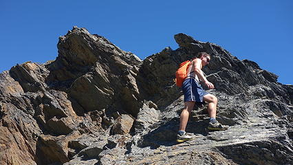
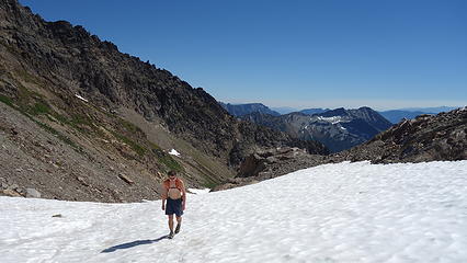
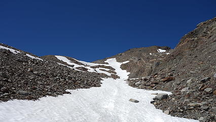
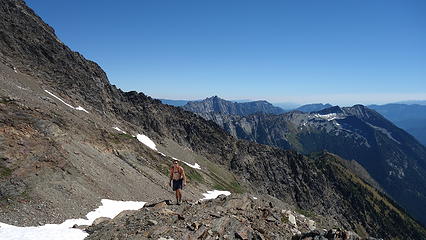
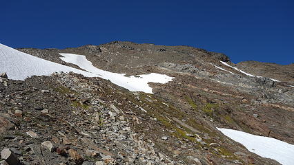
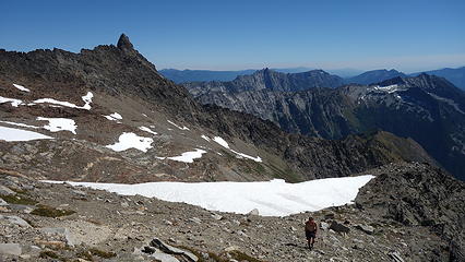
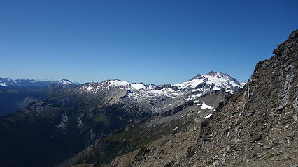
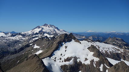
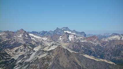
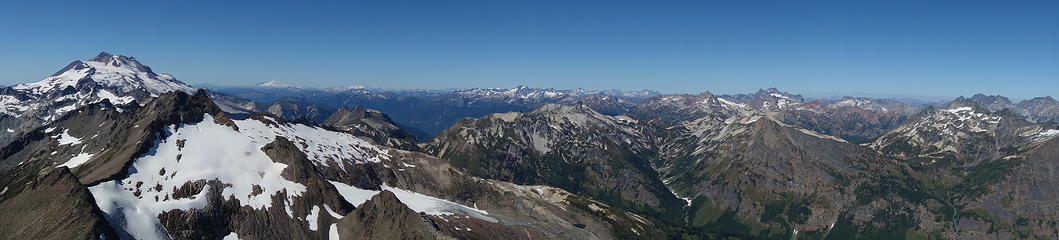
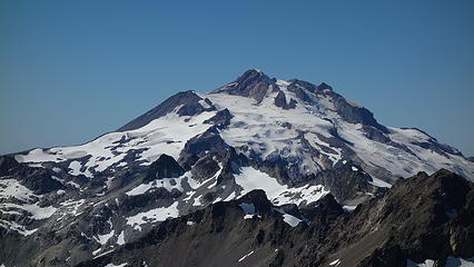
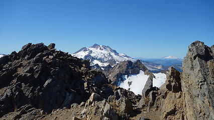
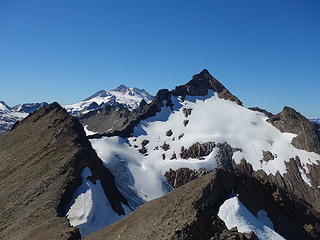
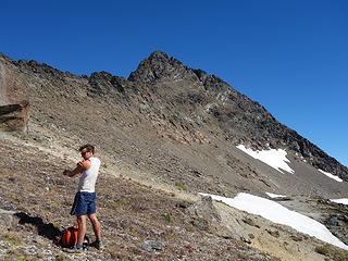
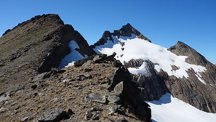
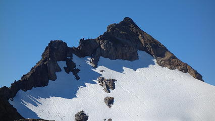
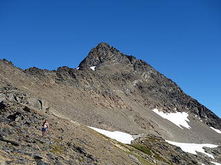
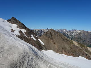
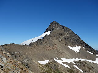
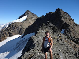
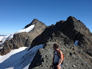
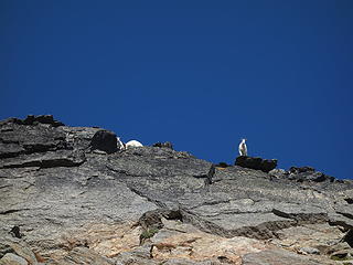
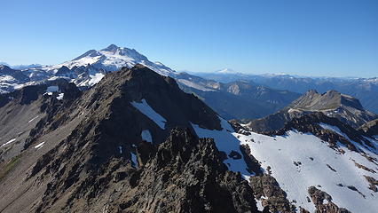
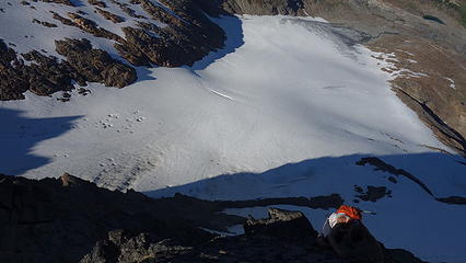
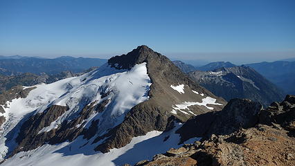
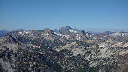
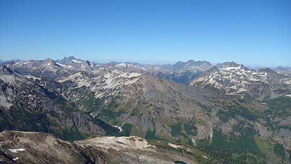
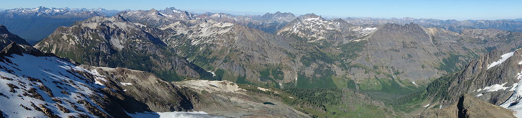
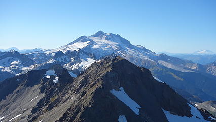
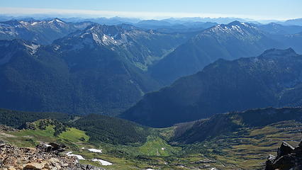
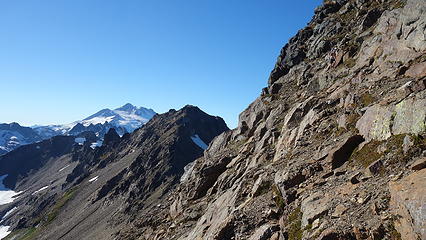
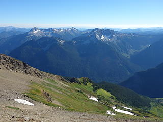
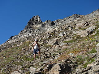
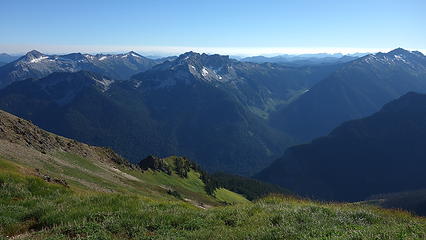
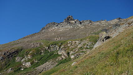
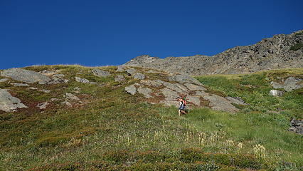
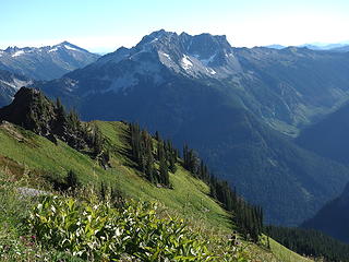
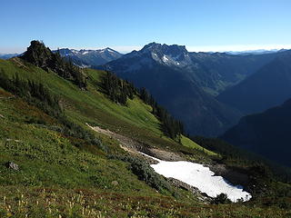
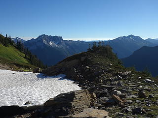
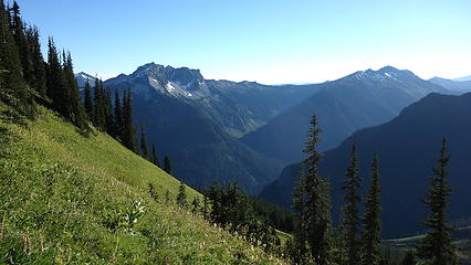
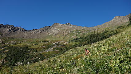
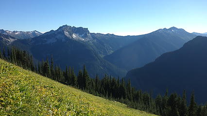
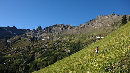
We made excellent time going up the trail towards Boulder Pass and reached the Shepherds Trail junction at about noon. Views of Mount David and Mount Saul were clear and beautiful. Man the upper basin was gorgeous! I was amazed at the beauty, and was thrilled there was NO smoke in the air. The sky was actually vibrantly blue and I loved it. We even saw a tent perched on a nice spot just before the Shepherds trail junction, but never saw its owners. We continued up the better-than-I-expected trail towards the crossover ridge that extends southward from the spire just east of Clark Peak. From the point we crested the ridge (we cut right off the Shepherds trail before it hit the ridge to cut some distance), we followed it a bit north until the 7200 foot contour where we found the class 3 gully that we could take to drop off the west side into the next basin. We utilized a broad snow finger to make quicker pace northwestward towards the summit of Clark. Along the way, we passed by a herd of at least 50 goats. We ended up chasing them the whole way to Luahna. At 2:45pm we topped out and was able to admire the views, rest and eat. We saw smoke both to our north and south, but the GPW and the western N Cascades was totally clear. Views of Glacier Peak, Dome Peak, and the Fernow Group were especially great.
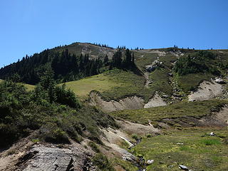
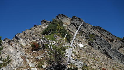

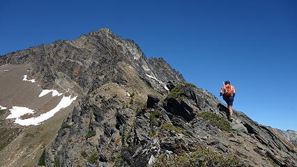
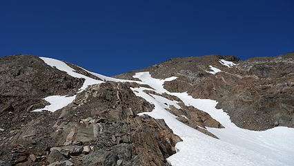
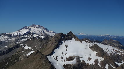
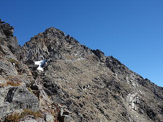
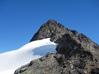
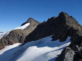
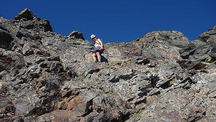
We then dropped only 150 feet or so down the SW ridge of Clark until we could drop towards the ridge connecting it with Luahna. We made quick work of the traverse, traversed more or less over unnamed point 7,940+ and followed a wide ramp up towards the summit of Luahna, bypassing below the south side of the spires on the ridge crest. We then curved all the way around to the NW ridge and eventually finished the scramble up on the west ridge. This was however unnecessary as we found a direct line up the south side of the summit on our way down that went at about 4th class.
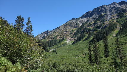
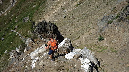
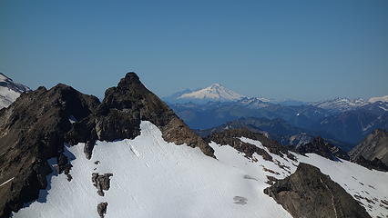
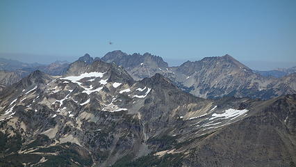
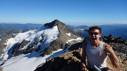
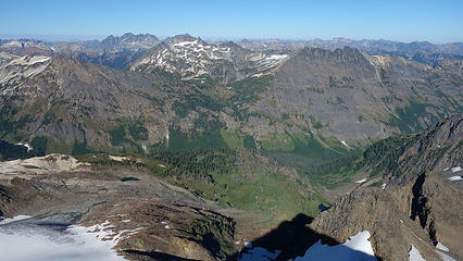
On the summit of Luahna (now about 5pm) we reveled at the Clark Peak massif and had another snack. We were both thirsty at this point so we quickly started down. We made another mistake this day and decided to descend straight down into Thunder Creek, not knowing that the Shepherds trail no longer existed on this side. Initially it was an easy scree ski descent until we hit taller grasses and shrubbery which was very slick underfoot, and almost easier to foot slide down. I even got my axe out for descending this stuff (I actually used my axe a ton on this climb, but not once for any snow!).

We followed the correct ridge down in a SW direction as far as we could, finding faint remnants of the trail at times, but never really having an easy trail to use. At one point we did find a nice trail that traversed horizontally towards the northwest (wrong way) at the 6200 foot contour. To our dismay this was not taking us in the right direction so we abandoned it and continued straight down the broad ridge until we were about 200 feet above Thunder Creek. Up until this point the bushwhacking was somewhat manageable but the final 200 feet was a shitton of blowdown and avalanche debris that took an act of congress to get through. The sun had just set at this point, and I was really hoping the trail on the other side of Thunder Creek was still there. I recall thinking I could see a lineal feature in the brush just across the creek, however getting to the creek was more of the same. Josh and I joked that we are doomed to miserably bushwhack every time we visit the GPW (such as our big GPW trip last month!)
Thankfully, the trail was clear once we finally got across Thunder Creek. We entered a nicer forest and put the headlights on (thank goodness we had them). We made better time down this trail but it strangely disappeared entirely just 5 minutes before reaching the White River Trail, therefore finding it coming up would be next to impossible. We were releived to have a nice trail now and thought we would have an easy, mindless hike out. This wasn't the case though...
We had a nice trail for only 5 minutes until we crossed back over Thunder Creek, but then the trail, for nearly the entire way back to the Boulder Pass junction was so overgrown we could barely walk. We constantly had to push large bushes out of the way for what seemed like hours, and always keep a keen eye out to be careful not to lose it. Without high socks or gaiters, my shins were rubbed raw by the end of this from all the sticks, sharp plants, leaves etc. At midnight, we finally made it to the Boulder Pass junction and had a much better trail out the final 3 miles to the trailhead, then to add insult to injury, another 2 miles down the road to the car (err...VAN) which we reached at 1:30am, 18 hours after we started.
We drove until I could not drive any more and crashed for a few hours, then finished the way back to Renton. To make matters worse, I had to drive back to Edmonton that same day to be at work Monday of this week!