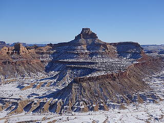
bottleneck mesa - 6403' - north slopes class 3
december 2020
Over the Christmas holiday weekend I went over to the Utah desert from Denver and climbed a handful of peaks, which included Bottleneck Mesa in the San Rafael Swell as well as Aires Butte and West Temple in Zion. The weather was fantastic, and warm enough to make the days super comfortable. So early in the morning on the 24th (at 3:30am) I left denver driving west on I-70. For as much as I have been driving west on 70 recently I am eerily reminded of my college days driving west on that highway every weekend. Some things just don't change...
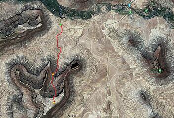
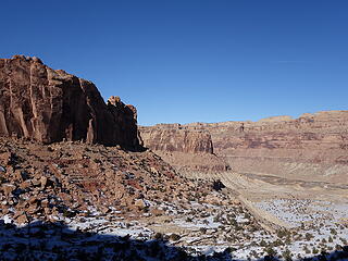
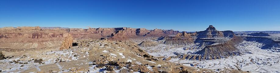
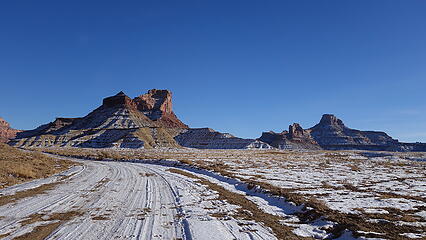
By the time I got to Glenwood Springs it was getting light and I continued on past Grand Junction and Green River. I decided to break up the drive by making a short side trip to scramble up Bottleneck Mesa, which involved a nice detour off the interstate into the central part of the San Rafael Swell (a huge anticline in the middle of the state which I-70 cuts right through). This region has a ton of histroy with outlaws, mining, and lots of petroglyph and pictograph displays from the days of old. 28 miles west of Green River, exit 131 off I-70 gives access to Temple Mountain Road. Heading south from this exit takes you to the large area of the swell south of the interstate such as Temple Mountain, Hidden Splendor, and many awesome technical canyons in the center of the swell such as Chute Canyon and Baptist Draw. These areas are all areas I thouroughly explored while in college, but I never got the chance to go north off this exit towards the San Rafael River in years past so I figured this was a great time for a first visit. Continuing north, the road paralleld the freeway a couple miles then heads north. 19 miles from the exit on a very well graded dirt road you arrive at the San Rafael River Bridge and campground.
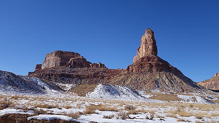
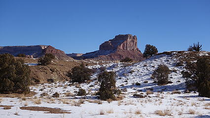
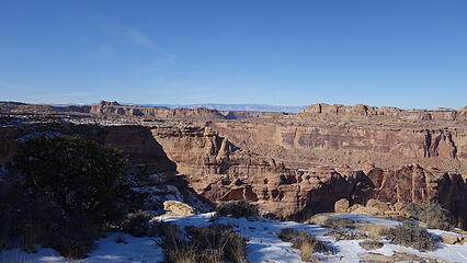
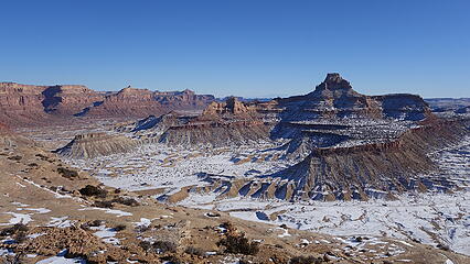
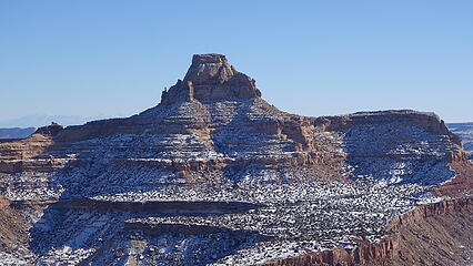
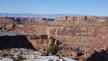
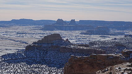
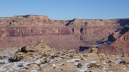
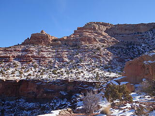
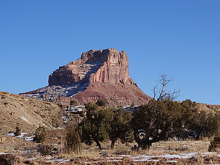
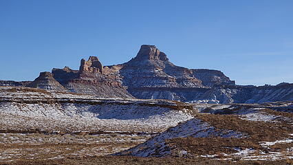
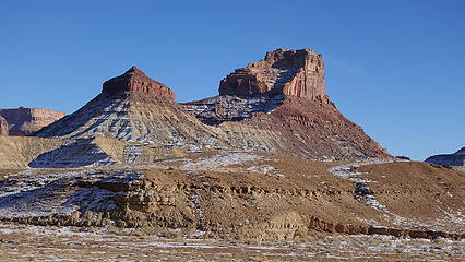
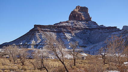
Since this was the day before christmas, and the swell is a little higher elevation and somewhat further north in the desert southwest there was a couple inches of snow covering much of the landscape from a small storm a few days prior. The snow actually made the drive up the dirt road smoother, filling in the washboards which was awesome. As I neared my destination along the way I passed below the west flank of Window Blind Peak on the right, the giant of the immediate area which I will climb later this winter. To the left Bottleneck Mesa and its associated peak (the shorter, but very steep tower just to the north) were directly above the road, but big cliffs gaurd the east side of this formation. A quarter mile or so before reading the bridge over the San Rafael River there is a small unnamed road leading off to the west which I turned onto continuing for perhaps another 800 feet to a small corral and the end of the road which is where I parked (green dot on map below; elevation 5142 feet). Here, I was north of Bottleneck Mesa, as the only weakness in this formation is along its northern flank. Interestingly enough, the only weakness on the majority of the peaks in this part of the Swell are on north sides contrary to what you would expect in the alpine.
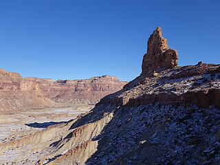
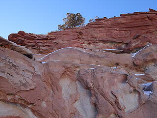
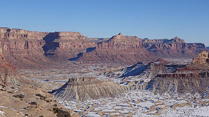
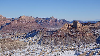
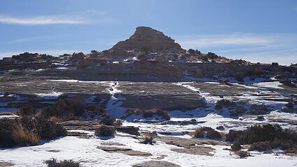
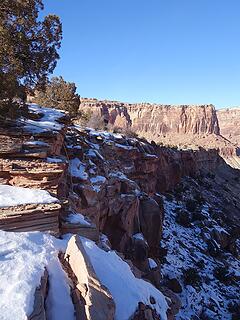
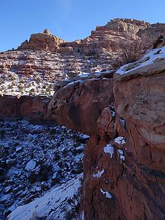
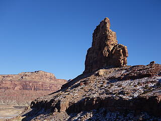
1-2 inches of snow still covered the land all around, but the sun was shining strong and the sky was cloudless...just the way I like it! At about 1pm I began walking along a dry wash southward, then continued left up a smaller wash which descends down from the basin due north of the summit. This wash passes below the west side of the Bottleneck Tower (which by the way involves 5.10 climbing to reach the summit). I was however going for the higher mesa of the same name. After 3/4 of a mile up the wash the terrain began to steepen, and I lost the sun as it went behind the mesa to the south. As soon as I went into the shade the temperature dropped what felt like 20 degrees and the snow depth increased to 3 inches. Good thing I had my high top leather boots with me. The crux of the whole route was surmounting the 15 foot lower cliff band marked with an orange dot in the map below (elevation 5600 feet). There was only one weakness I found in the cliff band which was off to the right (west) of where the apex was (where water would flow over if there was any). Much of the cliff band was overhanging and about 30-40 feet tall actually, but a pile of debris allowed easy passage over to the west a bit, with the final 15 feet requiring a committing class 3 move with a traverse on a narrow ledge to the left above increasing exposure. Someone put a handline here to grasp just in case. With the snow cover I had to brush off a couple of the footholds to make it secure but otherwise not an issue at all.
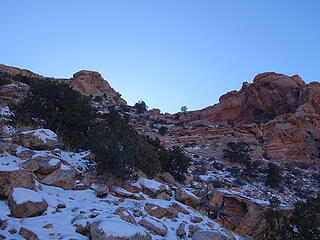
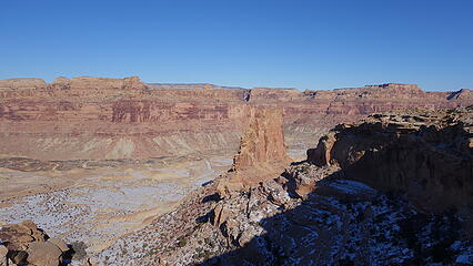
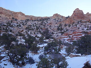
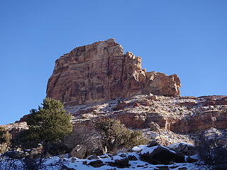
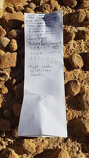
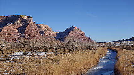
Once above the cliff band, I continued south on another flat section, briefly in the sun again, but quickly crossed over to the left side of the wash and scrambled up a loose slope to the east of a small cliff band that bisected the basin into two halves. This ascent was the majority of the elevation gain to reach the summit plateau. It was lots of class 2 romping with 3 inches of snow cover and the final 30 feet to the plateau involved an east class 2+ scramble up a right trending ramp. Once on the summit plateau, and back in the sun it was an easy walk to the highest point, which was most easily reached from its southeast side (class 2). The summit elevation is at 6403 feet making the total gain only about 1300 feet so despite the snow it only took 75 minutes to reach the summit. Amazingly there was a summit register, which after inspecting I realized this is rarely climbed. My friend Jamie and his friends were the last to climb it over two years earlier. Since there was service, I texted him a photo of the register entry since I was suprised to see that. After a 30 minute summit stay I retraced my steps back down to the car and continued driving towards Zion, but I hung around the San Rafael Bridge a bit to take some more photos of impressive Window Blind Peak, and of the river.