Beartooth mountain - 12,351' - SW ridge class 3
july 2012
Lake Fork Rock Creek: July 19 - July 21
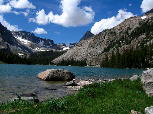
The next morning we got up late and went to the Beartooth Market (one of many stops here) to pick up some food and drive to the Lake Fork Rock Creek Trailhead where we saw a lot of cars parked. Since we only had planned to climb one peak from this approach we started late and hiked the 5 easy miles to Lost Lake where we set up camp. This trail follows along the south side of the Silver Run Plateau while the West Fork Trail follows the north side. These two trails meet at Sundance Pass. We tried fishing for our first time at Lost Lake but since it is so close to the trailhead we didn't have much luck. We fished until it got too dark then cooked dinner and hit the sack. We had another very long day ahead. We got up early and worked our way up to the large Black Canyon Lake by leaving the main trail just before the big bridge over Lake Fork Rock Creek and onto a small boot path heading southwest. After wandering for awhile we eventually found the correct path through the trees and made our way to the northern end of the lake. Upon first glance I was stunned at the beauty of the place.
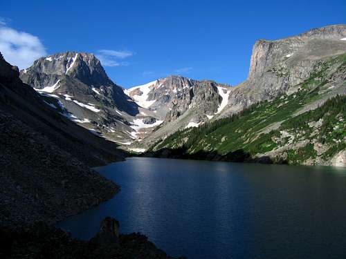 Black Canyon Lake Black Canyon Lake |
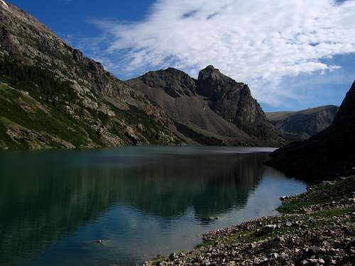 Black Canyon Lake Black Canyon Lake |
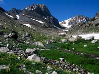
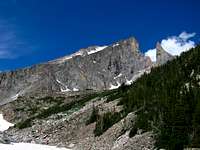
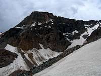
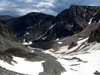
We descended slightly to the shore and realized it was going to take quite a long time to walk around this lake. We were wishing there was a canoe or something there as this lake is over a mile long and lined with rough talus the entire way across. After finally getting to the other end after over an hour of talus hopping and ankle breaking car sized rocks, we followed the inlet creek up and we finally got our first views of the Bears Tooth. Although we weren't climbing this I knew someday I will. Our objective was Beartooth Mountain which sits 400 feet higher than the namesake spire. Views of the north faces of Forget Me Not Mountain and Spirit Mountain were awe inspiring as we continued up the valley on a very nice band of snow which made travel much easier. This valley is one giant pile of rocks when all the snow is gone so we were lucky to have this continuous band of snow both up and down. We continued up along a flat bench on the left of the valley bottom and located our target, the false summit just southwest of Beartooth Mountain. We climbed a nice steep snow couloir leading directly to the flat top of this sub-peak.
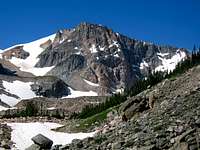 NF of Forget Me Not NF of Forget Me Not |
 Spirit Mountain Spirit Mountain |
 The Bears Tooth The Bears Tooth |
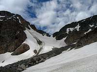 Hiking up the snow band Hiking up the snow band |
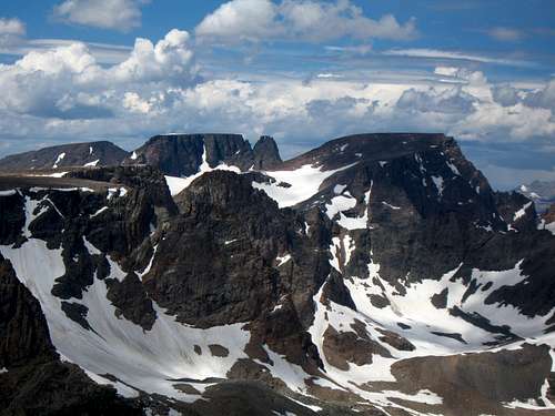
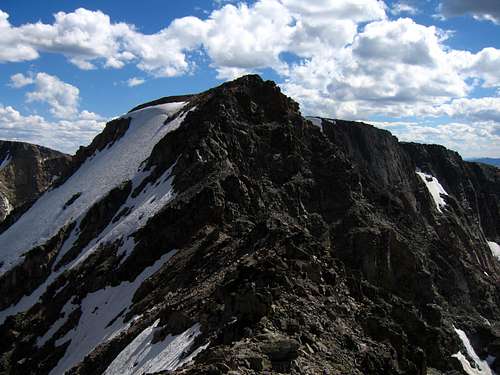
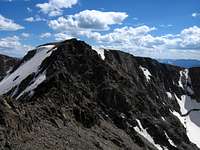
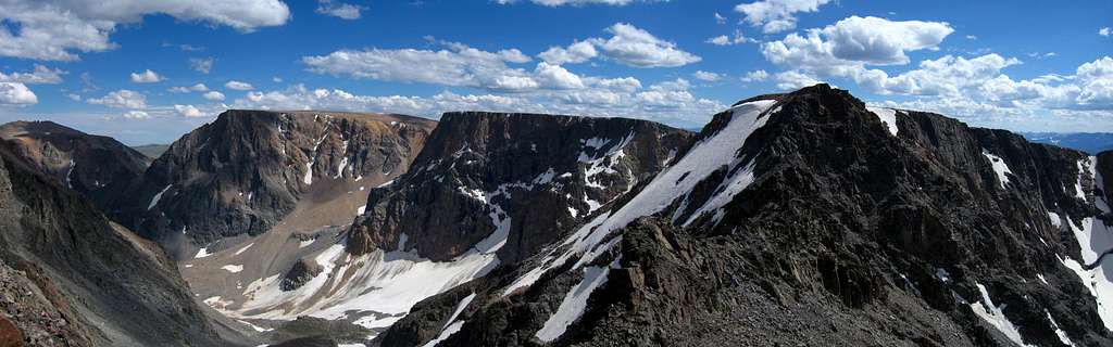
We took a nice break on the false summit and then dropped off and onto the third class southwest ridge. We dropped a little less than 200 feet on 4 or 5 large steps with decent exposure. The scenery to the south was incredible with all the high Beartooth Lakes and the massive Beartooth Plateau. We knew we were headed there soon. Once we reached the saddle we continued across the ridge and crossed over a black dike then ascended loose orange colored rocks to the summit plateau of Beartooth Mountain. Another half mile walk over easy terrain got us to the summit with superb views overlooking the Bears Tooth and nearly every 12er in the range. The weather was perfect with just the right amount of clouds and nice crisp air. We wondered if anyone had been up there this year but with no register and no signs of people we felt truly alone in a perfect alpine wilderness.
 Castle Group from Beartooth Castle Group from Beartooth |
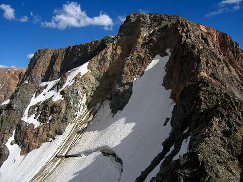
 On the SW Ridge traverse On the SW Ridge traverse |
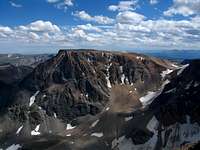
 Forget Me Not Mountain Forget Me Not Mountain |
 Mount Rearguard Mount Rearguard |
 Beartooth SW Ridge traverse Beartooth SW Ridge traverse |
 Spirit from Beartooth summit Spirit from Beartooth summit |
 Beartooth Mountain Summit Panorama
After not enough time on the summit we started reversing our long long ascent route. We decided to descend all the way back to the saddle between Beartooth Mountain and Forget Me Not Mountain instead of descending our steep snow couloir shortcut from the false summit. Since the climb up to Forget Me Not would have been 4th and 5th class on what looked to be horrible rock we would climb those from the other side later. We we glissaded part of the nearly dead grasshopper glacier and ran back down our snow finger back to Black Canyon Lake. Going down was a hell of a lot quicker! We made better time hiking around Black Canyon Lake on the return since we didn't have to conserve energy. Once we reached the trail and made the short half mile back to the tent we were exhausted but sure felt accomplished. Our 5th Montana 14er was in the books and we went straight to sleep.
 Forget Me Not from the low saddle
Waking the next morning I decided I would take a short hike over to First and Second Rock Lake to see what was up there. I hiked over the bridge and up to the trail junction with the side trail heading towards First Rock Lake. At first this trail was nice but after rounding the first lake it quickly disappeared and the hike to First Rock Lake was a bushwhack. The water in this lake was so green and I saw lots of small fish. Hiking around this lake on large talus took me even deeper into bushes but I was able to pick up a game trail all the way to Second Rock Lake where I decided to stop since I noticed black clouds forming quickly and it didn't feel right to continue. I was initially trying to get all the way to Sky Top Lake but I soon realized this wasn't necessary to get the notes I needed. After a nice lunch at the lake I returned to camp, getting wet a couple times from a couple showers and Stephan and I packed up and made the uneventful 5 mile hike back to the car. We headed back into Red Lodge for a nice dinner at an Italian restaurant and to our surprise it was bike week so we saw likely well over 1000 motorcycles parked everywhere one could be placed and the whole bike crowd walking the main drag. We picked up some supplies for fishing and drove up the long rough road to the Main Fork Rock Creek Trailhead. Funny thing about this road is that is actually dips south into Wyoming and ends right at the boundary. The small bathroom facility is cut in half by the Wyoming and Montana state line! We just camped at the trailhead.
 Second Rock Lake