Southern Pickets Traverse - Class 5.9 - August 2019
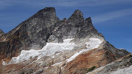
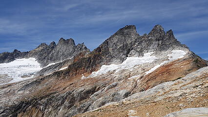
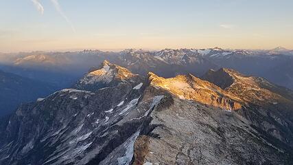
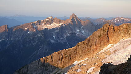
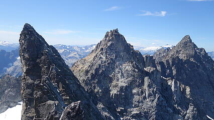
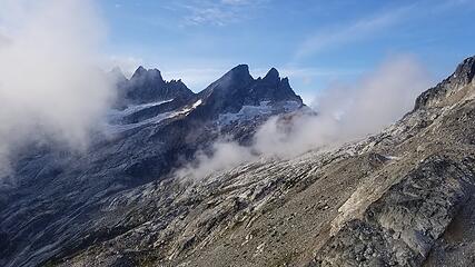
East McMillan Spire - 7992'
West McMillan Spire - 8020'
Inspiration Peak - 7880'
Pyramid Peak - 8000'
Mount Degenhardt - 8020
My friend from Israel was back in WA for some alpine trips in the North Cascades in the summer of 2019, and one of the main objectives he was interested in was a full scale traverse of the southern Pickets. This is something that has only been done a few times, and given the excellent beta provided by Jeff and Priti in their Cascades Climbers trip report, we figured it was within our ability. So we scheduled for 3 nights to do the traverse in late August, although a questionable weather forecast on the third day gave up a little bit of concern. We decided to go for it anyway and if we had to bail we would just cut down halfway through the traverse.
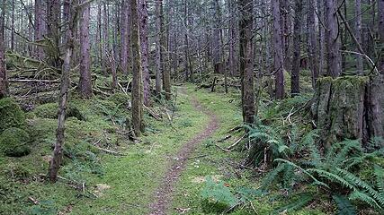
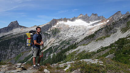
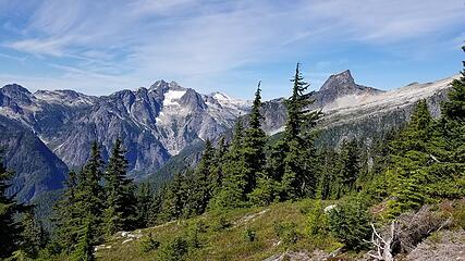
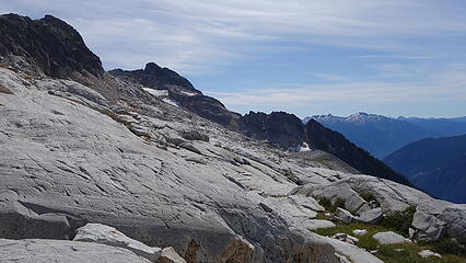
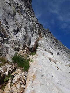
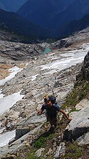
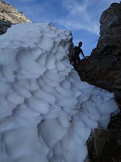
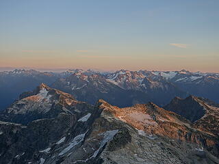
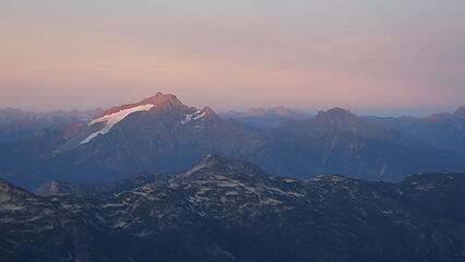
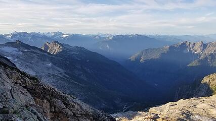
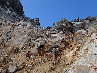
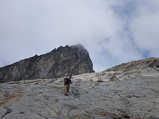
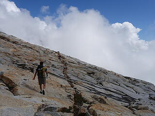
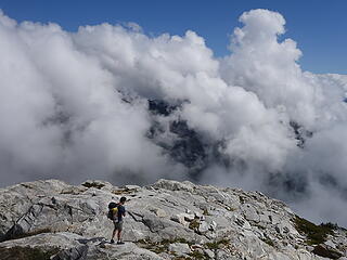
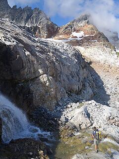
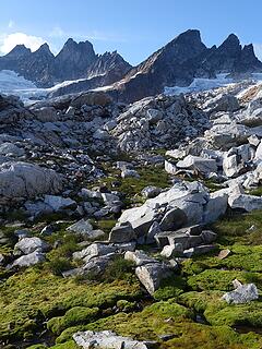
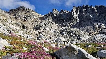
We drove up to the Goodell Creek Trailhead early on the first day and got started up the not easily followed trail up Goodell Creek at 8am. This trailhead is all the way down at 600 feet of elevation so we wanted to beat the heat. After just over an hour or so we crossed the small stream shortly before the trail begins the steep ascent towards Terror Basin, which begins where the old logging road abruptly ends and a cairn marks the start of the trail. This is the only approach into the Pickets that has a reasonable trail leading to treeline, however it is by no means a cakewalk. Over 4500 feet of elevation is gained very quickly as the trail relentlessly rises through the trees, eventually reaching the alpine blueberry paradise around the 5500 foot level. Once at treeline, the trail continues north crossing minor talus slopes and through low level schrubs and wildflower tundra. The trail then crosses a minor ridgecrest at 6600 feet, then drops 500 feet down loose talus and scree before continuing a horizontal traverse into Terror Basin. We continued northward crossing endless granite rock slabs criss-crossed by hundreds of straiations and small gashes/cracks, none of which really posed an issue scrambling across.
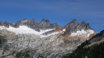
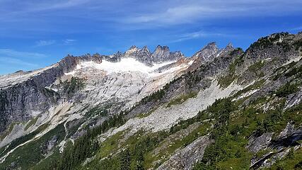
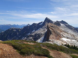
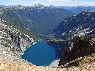
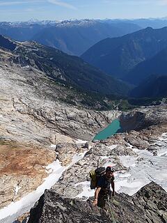
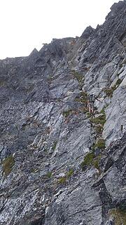
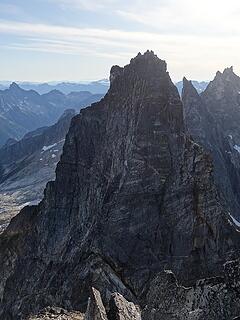
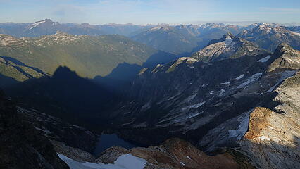
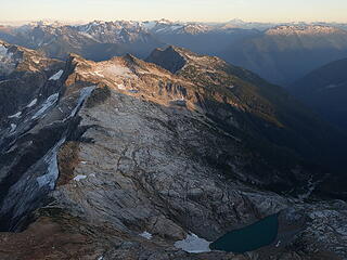
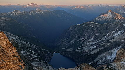
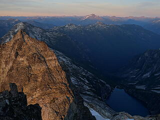
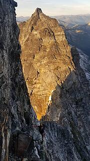
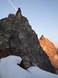
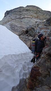
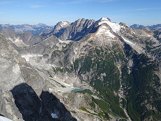
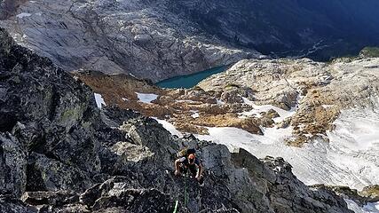
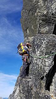
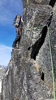
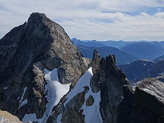
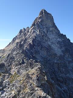
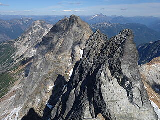
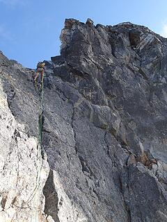
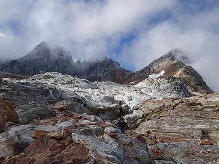
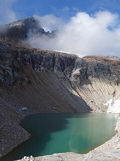
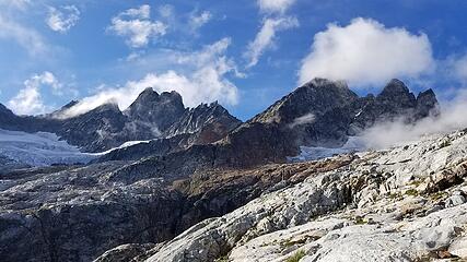
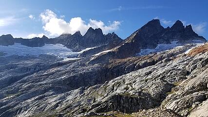
Instead of curving in a northwest direction towards the outlet of the lake at 5480 feet as if headed for Terror Basin, we continued closer to the ridgecrest at the far east end of the basin, and ascended above this lake to the east. At about 6000 feet we hit the crest of this ridge (which more or less drops off to he south from East McMillian Spire). Looking to the east from this crest, Azure Lake was vibrant 2000 feet down. We crossed the last tundra grass on a wide flat perch at 6300 feet, before continuing on the final slopes towards the start of more technical climbing. We crossed a narrow snowfield clinging to the uppermost part of the basin right up againt where the McMillian Spires south faces abruptly steepen, and started the scrambling by following a rightward ascending ramp. There is a very large gash/gully cutting up between Little Mac Spire and East Mac Spire, and the route begins on the right side of this gash, actually climbing rock on the south face of Little Mac to begin the traverse. We followed ramps/ledges upwards as exposure and difficulty increased. Once we started getting into more sustained 5th class terrain, we roped up and I led an easy 5.4 pitch up on a prominent rib just east of the gash to a flat ledge. We then traversed this ledge maybe 60 feet to the east and Itai led up a 45 meter 5.7 pitch with good cracks to where it looked like a ledge would allow easy passage into the upper part of the gash just to our west.
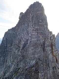
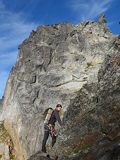
It worked, and we found a class 3 scramble across this ledge into the gully, and since it was getting later in the day we decided it was best just to cross the gully right away and skip summitting Little Mac, and avoided the 30 meter rappel described by Jeff and Priti in their trip report (linked above). We crossed the gully, and continued on class 4 scrambling a fair ways up grassy ledges and ramps until we reached where the steep upper south face of East Mac really began. We ended up soloing a good chunk of the route up East Mac even from where the terrain steepened, only pitching out one long pitch of low 5th terrain or so. The route met a rib dropping off from the summit ridge that took us right to the upper ridge and to the summit.
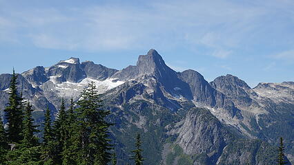
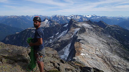
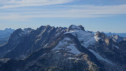
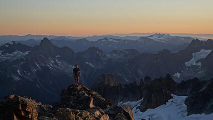
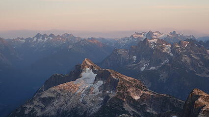
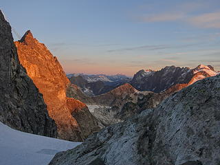
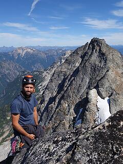
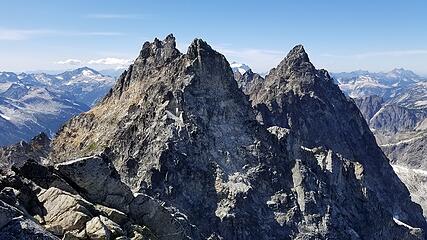
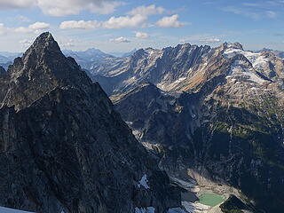
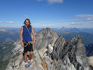
It was an incredible sight, to be in the heart of the southern pickets standing on top of one of the towers after completing a technical route, only 9 hours after leaving the car. Knowing we still needed to get up and over the southeast face of West Mac to where we could bivy at the next col between West Max and the East Towers, we continued onwards right away, making the straightforward class 3 descent down East Macs west ridge. We rounded a small tower near the saddle on its north side (very loose trash) and started up a long grassy ramp traversing across the SE face of West Mac. We continued as far up and west as we could on this ramp until nothing but vertical air was beow us and I made an anchor where the ramp ended.
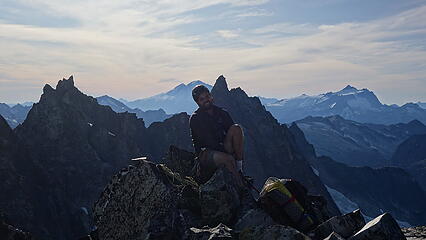
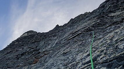
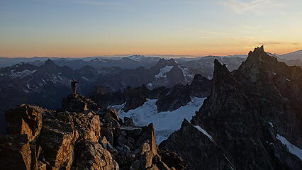
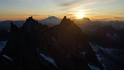
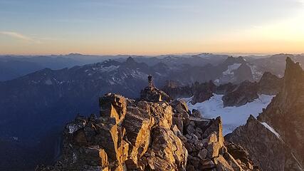
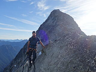
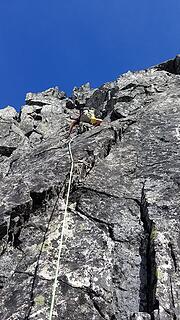
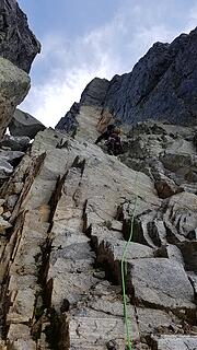
Itai led up a zig-zagging 5.7 pitch of somewhat quentionable blocks and flakes to a large ledge at the start of the veggie ramp Jeff describes. I then led up this long leftward ascending ramp on mostly class 4 terrain until near its end, where it narrowed considerably and required a steep narrow step around a protruding boulder with insane exposure. Just beyond that it eased again to 4th and low 5th class which we were able to solo the final 100 feet or so to the summit of West Mac. We met the crest just a few feet from the summit, slightly on its west side which was exactly as advertised in Jeffs topo, and the final 15 feet to the highest point was 3rd class. By this time the sun was just 30 minutes away from setting, so we snapped a few photos...and then a few more since it was so beautiful and at the last minute ran down the class 3 west ridge to the established bivy spot at the col, arriving just 20 minutes before dark. Luckily, no one was there. We threw the sleeping bags and pads down, cooked dinner and went right to sleep to a gorgeous colorful tiwlight sky.
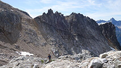


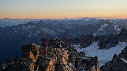
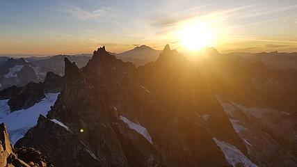
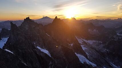
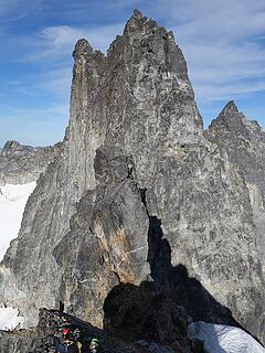
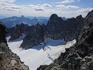
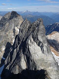
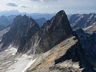
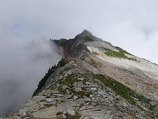
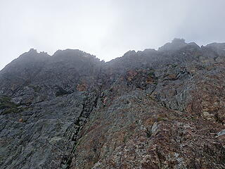
The next morning we awoke right at sunrise and were quickly moving. We had to traverse around the East Towers before we could start the crux of the first half of the southern Pickets Traverse. The day started by first climbing up near the crest to the top of the first (Dons) tower. A short low 5th class pitch was needed to get up, and then it was a slabby class 4 descent down the west side to the next notch. Tower 2 we traversed a snow moat on its north side (garbage) and to the narrow notch between Towers 2 and 3. Tower 3 we traversed back on the south side, and cut under the overhang bypassing around via a very exposed crawl. We then continued on the south side and dropped down a gully traversing well below Tower 4, then began two pitches of climbing up to Tower 5 which needed to be ascended to very near its summit. There was some 5.8 climbing near the top to reach the horn mentioned in Jeffs report. This horn had an existing anchor that we used to rappelk 30m down the other side to reach the deep col at the base of Inspiration East Ridge.
Here's the link to Jeffs report again since it has all the beta and topos anyone could ever need.
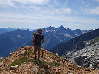
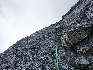
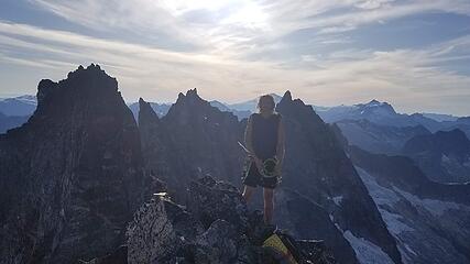
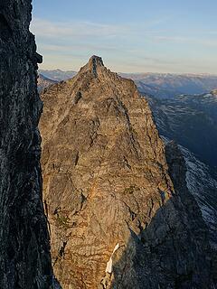
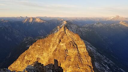
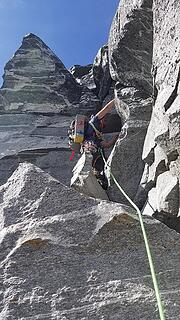
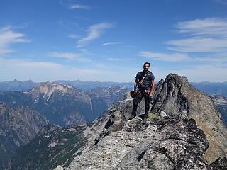
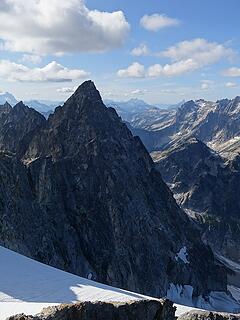
We then started climbing Inspiration. We scrambled up a ways (solod some 5.5 stuff), and Itai led the first of the two main pitches, a 5.8 that weaved around and throguh a couple overhangs initially, then up cracks to a big ledge at the base of the 5.9 wide crack. I then led the 5.9 but had not been trad climbing very much, so I placed quite a bit of gear. Just as we topped out this crux pitch, we saw a couple guys running up West Mac, who appeared to be doing the scramble route in a day. We shouted across to them and said hi, then finished the low angle pitches up the remainder of the east ridge to the summit of Inspiration. This was the peak I wanted the most, since it's on the Difficult 10 list.
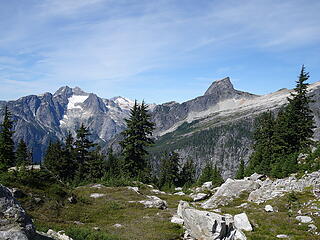
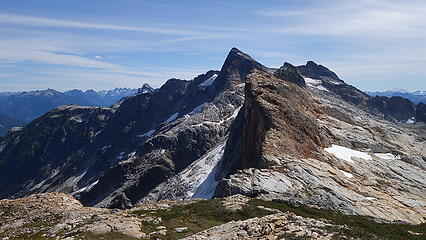
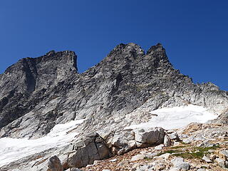
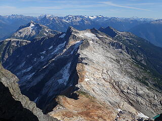
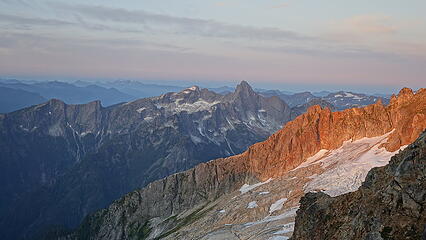
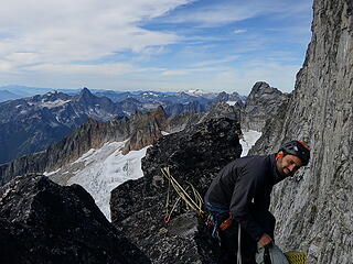
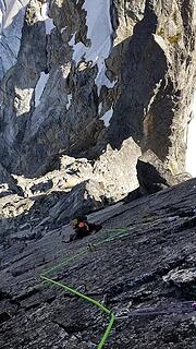
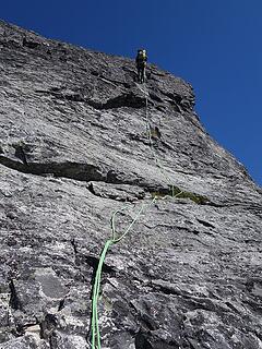
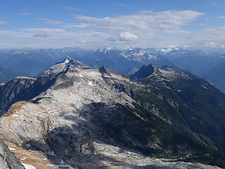
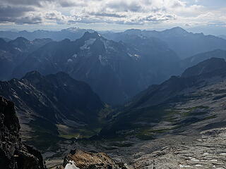
After a brief summit stay, we started down the west side, making a few 30m rappels. The existing anchors were decently setup for a single rope, you'll just have to make a couple real short raps to various intermediate anchors. We made it down in good time to the next col right below Pyramid. Climbing up Pyramid we deviated a little bit from the route than Jeff and Priti took, and traversed onto easier 4th class terrain to the left and onto the south side of Pyramid to avoid the 5.8 chimney they did. We solod the south side to the summit, then continued onto the next col below Degenhardt, traversed below the ridge again on the south side and entered the obvious larger gully leading to the notch just below the summit tower. An exposed 4th class climb dumped us on the summit, which is the highpoint of the Barrier. Looking south from this peak, it really does look like a barrier.
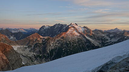
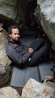
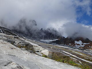
We descended the summit block, and as the sun was getting lower in the sky, we noticed some clouds rapidly closing in! We made the 30 meter rappel down onto the boulderfield to the west, and were now in the uppermost reaches of the Crescent Creek basin. Looked like rain was coming in quick and we did not have a tent. So we scoured the large boulders on the slope between Degenhart and Terror that would suffice for a shelter for the night for us to keep dry. After 30 minutes of roaming around we found a beautiful huge overhanging rock leaning up against some other large boulders that you would never see unless you were standing right next to it. A small opening on the west side was just big enoguh to crawl into and under the overhang. We doctored it up by removing a ton of rocks from the inside flattening it out so it was suitable for two people to lay down. We got it to be perfect, with the only tiny opening to the sky we were able to cover with the space blanket fully isolating any rain we might get from us. If you are ever in need of an excellent shelter up by the north face of Terror, its located near the crest of the ridge (maybe 40 feet below it) about a third the way to Terror from Degenhardt.
By the time we finished doctoring up our shelter for the night, it was close to 8pm, so we had dinner and started drifting to sleep. The light rain began shortly after dark.
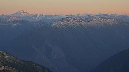
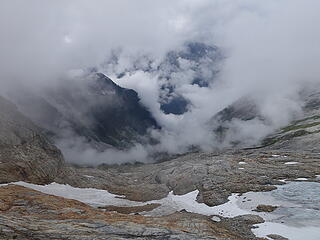
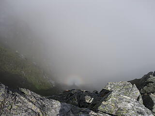
It rained all night and all the next morning. We scrapped our plans to continue on the traverse, but since we had already at least done Terror before on our previous Pickets traverse back in 2016, I wasn't too bummed. The rest of the towers further west (Twin Spires, Otto, Himmel etc) can wait. We were however forced to wait all the way until 11:30am before the rain stopped, however we were still in a whiteout. We didn't want to wait any more and we started descending the steep slabby terrain down into Crescent Creek Basin. Eventually, after much routefinding, we got down off the upper slabs and onto the talus/grassy terrain and dropped below the clouds. Not wanting a repeat of our hideous bushwhack down Crescent Creek that we did to exit the Pickets last time, we opted to try and find the route off the Barrier.
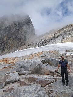
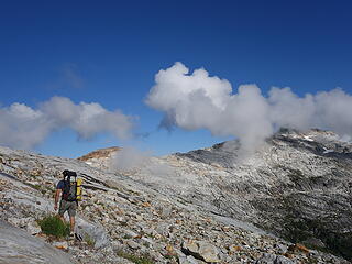
We traversed towards the Chopping Block saddle, crossed it then continued across the open slabs, with decreasing clouds to the top of the Barrier. We looked for over 30 minutes but could not find a class 3 route down, so we scrambed down as far as we could and found a slung tree. We rapped soaking wet 5th class downward sloping slabby rocks to a steep grassy "ledge" 30 meters down, then I built a second anchor on a tiny rock horn so we could rap a full 30 more meters down a vertical drop. Thankfully the rope was long enough to reach the low angle talus below (barely). It was after 2pm by this point and we had a long hike back, which went quick though. I looked back at the Barrier just after we finished the two rappels we did and tried to find the class 3 route, but with everything so wet from the rain I could only see something that looked 4th or like 5.2. I guess Steph Abegg did mention that if its wet, the Barrier can be a skirmish with death! I agreed with myself never to bother with the Barrier again.

I find it amazing that both of my crazy Pickets Traverses have been done with someone who lives in Tel Aviv, and not a fellow local Cascades climber.