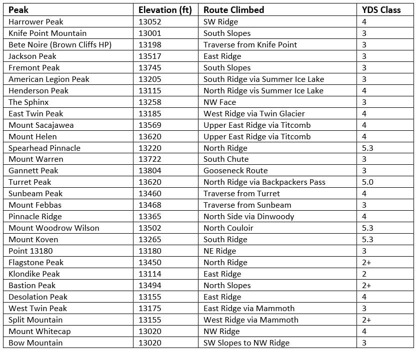
Wind river slam - finishing the wyoming 13ers
july-august 2020
After hiking Francs Peak, which completed all the Wyoming 13ers outside of the core Wind River Range for me, I took another couple rest days and relaxed in Cody and slowly made my way around to Pinedale, where I would meet Eric on the afternoon of the 20th to finalize packing, food and to go over our route once more. The following text is copied from my Black Tooth Mountain trip report for clarity, since this is the beginning of the big two week slam where I climbed the remaining 28 13ers to finish off the list.
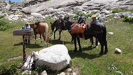
Over the course of the past month or so (July 11th through August 3rd to be exact), I completed the Wyoming 13ers, which took a pretty big effort to climb 31 of the 35 total peaks on that list in such a short period of time. With my month vacation I took in the summer of 2020, due to Covid all my big international climbing trips had to be postponed to at least the next year, therefore I had to stay in the US for the summer. I had been milling the Wyoming 13ers for many years, but never put them high on the priority and for over 5 years had deferred the project in favor of bigger and better things. However, given the circumstances, 2020 seemed like an excellent year to finally finish these peaks off. I had completed 4 of the 35 Wyoming 13ers many years ago (Downs Mountain, Point 13,062, Grand Teton and Cloud Peak), and back in May, Eric Gilbertson who was also looking for something to do in the summer this year due to his international trips also having to be postponed, sent me an email and asked if I wanted to join him for a full Wyoming 13er slam. Since I had already been thinking about doing just that, the trip was spearheaded! He spent most of June and the first half of July in Colorado climbing all the Centennial peaks in a new FKT of 32ish days, so we agreed on a start date of July 21st to hike into the Wind Rivers. My vacation began on July 11th, so I drove up to Wyoming that morning and would take the 9 days before our scheduled start date for the Wind Rivers to climb the remaining 3 peaks I hadn't yet done outside of the core Wind River Range. These three peaks included Black Tooth, Wind River Peak, and Francs Peak.
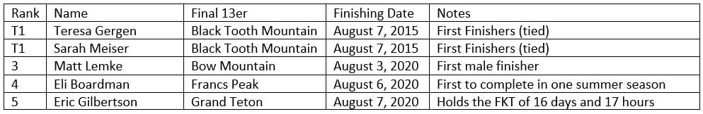
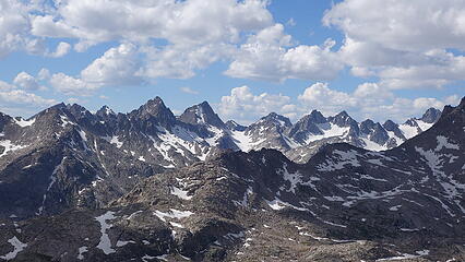
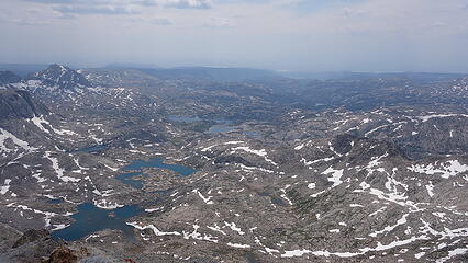
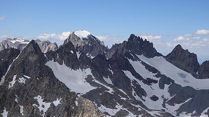
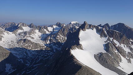
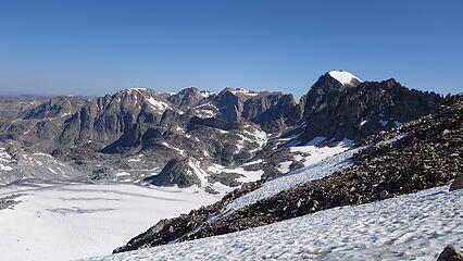
First, I'll start with a little bit more background and historical information about the Wyoming 13ers. Before this year, only two people had publicly reported completing them (although I have no doubt others have quietly completed them, as I have heard stories of old timers climbing every visible peak in both the Winds and throughout the state back in the day). There are 35 peaks on this list using the 300 foot prominence cutoff rule (see the list here) and all but 5 of them are in the core northern Wind River Range. The remaining 5 peaks are scattered around the state, one of which is in the southern Wind River Range (making a total of 31 peaks in the Winds), one is in the Absaroka Mountains just southwest of Cody (Francs Peak), one is in the Tetons (Grand Teton), and the last two are in the Bighorn Range (Cloud Peak and Black Tooth Mountain), which is another fault block mountain range further east close to the city of Sheridan. Fun fact: the Bighorn Range has some of the best kept alpine climbing secrets in all of the lower 48, but you didn't hear that from me! As of this writing, there are now 5 reported finishers of the 35 Wyoming 13ers, as there was another young climber who coincidentelly was also climbing them this summer (who we actually ran into out there...pretty cool). The current list of finishers is described in the table below.
A summary of our base camps follows:
- Nights 1-2 we stayed near the Indian Pass/Titcomb Basin trail junction, very close to where the horse packer dropped off our gear
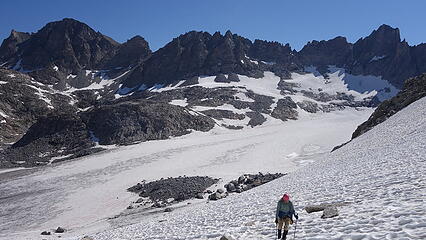
- Nights 3-5 we stayed about 0.5 mile above the Upper Titcomb Lake, just a few minutes past where all the Gannett Peak climbers made a tent city.
- Nights 6-9 we stayed on the Dinwoody Glacier moraine just below the lowest point on the traverse to the standard route on Gannett from Bonney Pass
- Night 10 we stayed at the small col at 11,875 feet on the north edge of the Gannett Glacier, just west of unnamed Point 12,025
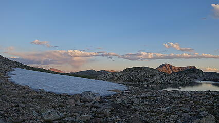
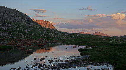
- Night 11 we stayed just south of two unnamed lakes on the south end of the melting Grasshopper Glacier, near the top of a broad hill at 12,360 feet. This spot was immediately below and east of the East Peak of Bastion.
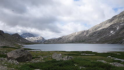
- Night 12 we stayed at the east end of the long skinny lake up the valley and east of Scott Lake, at the head of Wells Creek with an elevation of 10,800 feet
- Night 13 we stayed at Shannon Pass, just above Peak Lake
A short summary of our day by day activities follows:
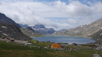
Day 1 - Hiked in to Island Lake, met the mule packers at the junction with the Titcomb Basin Trail just beyond the lake and set up first base camp. Climbed **Harrower (AKA Ellingwood) Peak via the Class 4 SW Ridge**. 5000 feet gain; 17.5 miles
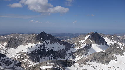
Day 2 - Climbed Knife Point via the South Slopes (Class 3), and traversed to Bete Noire Peak (AKA Brown Cliffs) via the class 2 west ridge. Then traversed across the Knife Point Glacier to Indian Pass and climbed Jackson Peak via the class 3 east ridge. Descended back towards Indian Pass and ascended Fremont Peak via the class 3 south slopes. 8500 feet gain; 16 miles
Day 3 - Packed up camp and moved 3.5 miles to upper Titcomb Basin (carrying nearly all our food still). Climbed American Legion Peak via the class 3 south ridge, and **Henderson Peak via the class 4 north ridge** 3900 feet gain; 8 miles
Day 4 - Climbed the Sphinx via the class 4 NE ridge and East Twin via the class 4 west ridge (class 4 only encountered climbing to the saddle from the south). 3700 feet gain; 6.3 miles
Day 5 - Climbed **Sacajawea via the class 4 east ridge** and traversed to Mount Helen, ascending via its class 4 east ridge which we accessed from one of the south gullies. 4100 feet gain; 5.5 miles
Day 6 - Climbed Spearhead Pinnacle via the class 5.3 north ridge, and traversed to Warren and ascended it via the class 3 SW Chute. Packed up camp and hauled over Bonney Pass to the Dinwoody Glacier moraine and camped at 11,300 feet 5600 feet gain; 8 miles
Day 7 - Climbed Gannett Peak via the class 3 Gooseneck standard route. 2500 feet gain; 3 miles
Day 8 - Bad weather day; rested
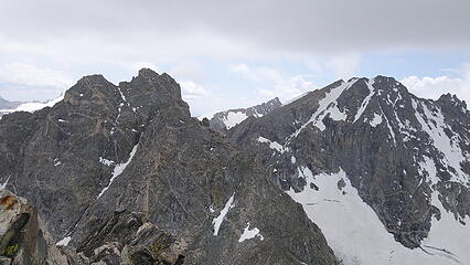
Day 9 - Climbed Turret Peak via the class 4 north ridge assessed from Backpackers Pass, traversed to Sunbeam Peak via the direct class 4 ridge and continued on the class 3 ridge to Febbas Peak. 3500 feet gain; 5.8 miles
Day 10 - Climbed Pinnacle Ridge via the class 4 north side and Mount Woodrow Wilson via the class 5.2 north couloir. Packed up camp and moved camp north, through the pass between West Sentinel and Gannett and across the Gannett Glacier and camped at the small 11,875 foot col at the north edge of the glacier. 4000 feet gain; 5.6 miles
Day 11 - Climbed Mount Koven via the class 5.3 south ridge and moved camp northward to a spot just south of two unnamed lakes on the south end of the melting Grasshopper Glacier, near the top of a broad hill at 12,360 feet. Climbed Point 13,180 (South Flagstone) and Flagstone Peak, both at low class 3 in the afternoon. 3800 feet gain; 3.8 miles
Day 12 - Climbed Klondike Peak via the class 2 east ridge. Eric continued the long walk on the divide to Point 13,062 and Downs Mountain while I rested and relaxed for the rest of the morning. Once he returned, we packed up camp and ascended the class 2+ north slopes of Bastion Peak, packed over the divide and descended the talus on the west flank of Rampart Peak to Desolation Col. Climbed **Desolation Peak via the class 4 east ridge** and camped at the east end of the 10800 foot long skinny lake just east of Scott Lake, at the head of Wells Creek. 3700 feet gain; 9.7 miles
Day 13 - Packed up camp and packed to the Mammoth Glacier. Dropped packs and climbed West Twin via the class 3 east ridge, Split Mountain via the class 2 west ridge, then packed to Stone Pillar Pass. Dropped packs and climbed Mount Whitecap via the class 4 NW ridge. Packed down to Stonehammer Lake, and continued past Peak Lake to Shannon Pass. Ran into Doug Walsh, and a friend of his at Peak Lake both of which had also finished the Bulgers. For a brief moment, all 4 of us chatted and there were 4 Bulger finishers in the same place deep in the Winds! 6500 feet gain; 10.3 miles
Day 14 - Climbed Bow Mountain (my last one), packed up camp and hiked back to the cars at the Elkhart Park Trailhead. 3000 feet gain; 20 miles
Totals: 57,800 feet gain; 119.5 miles
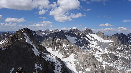
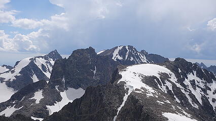
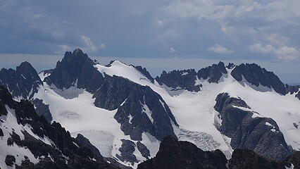
Below is a detailed map of everything we did. Note the full approach hike in from Elkhart to Island Lake, and the full hike back out from Shannon Pass to the trailhead are not included. These route lines are hand drawn from Google Earth, not GPX tracks, however they are an accurate representation of where we went. Note that both American Legion and Henderson Peaks are extremely poorly represented on Google Earth.
You can also view this map on the CalTopo website for different base maps such as USGS topos, aerial imagery and other options:
Wind River Slam Map
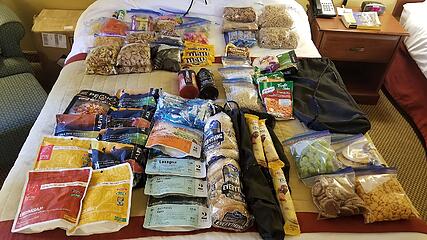
A summary of the gear we brought follows:
Gear for this trip was a difficult task to get right. We knew there would be at least three 5th class peaks requiring pitched or simul climbing, and we knew there would be a lot of snow, but wasn't sure exactly how steep of snow we would encounter. I also wasn't sure which sleeping bag to bring and how many layers I'd need. After much thought and discussion, I brought key items that I listed below, and provided a comment for each item indicating how useful it was.
Packs & Footwear
- Mountain Hardware Directissima 46L pack: I opted for my smaller overnight pack knowing it was going to be interesting getting everything attached during camp moves, but I just didn't want to have the extra weight of my larger one. I ended up wearing my harness hanging a bunch of stuff from it when we moved camp despite all the external straps on this climbing oriented pack, with three large bags of food I couldn't fit it all on.
- REI Flash 18 day pack with Camelback water bladder: I was very happy to have this day pack for all the peaks, as it has a small profile and doesn't cover as much area on my back which really kept me from sweating as much. The bladder kept me sipping water, which I normally never do but on this long of a trip I needed to.
- Lowa Renegade Leather hiking boots: Footwear was a tough choice, but I decided on these boots since they do great in snow, scree and low 5th class climbing without sacreficing much comfort or flexibility. These boots worked perfect.
- UL pair of trail runners: Eric and I both brought a second pair of light shoes for the approaches, around camp, and for some of the peaks that had less snow to deal with. These were a life saver
Camping Gear
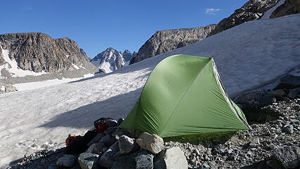
- Exped 1 man UL tent: Eric and I decided to each have our own tent for a trip this long which was really nice. I bought this lightweight single man tent right before the trip.
- REI Magma 15 degree down sleeping bag: This is probably a place I could have saved weight. Nighttime temps were a little warmer than I expected although Wyoming ended up having a hotter summer than usual. Either way, I was too warm on many nights. However the only other bag I have is the Aegismax UL 40 degree down bag and that may not have been enough.
- Thermarest Neoair sleeping pad: Another key decision was whether to bring an air pad or just a foam pad which would have been bulkier but lighter. I was very glad I brought this air pad as it expanded to a 2 inch thickness and folded down super small, which was more important than saving a few ounces by goung with the big bilky foam pads. Plus I was much more comfortable and able to sleep more which was crucial.
- BRS "Lightest camp stove to ever exist" with two medium size fuel canisters: If you have not heard of this stove (I linked it) you need to buy it now if you're an UL enthusiast. Also, I only used one of the medium canisters. Since we never needed to melt snow I did not need the second one. It isn't as efficient as a Jetboil but I like being able to simmer while cooking so the inefficiency really helps there, plus you can use it with any pot.
- 1.5L aluminum cooking pot: Works great
- Two 1L plastic Gatorade Bottles: Much lighter than Nalgenes! I used these mainly for grabbing and drinking water at camps, and never brought them up the peaks since I had my bladder/daypack for that.
Climbing Gear
- Camp aluminum strap on crampons: These were the perfect traction for this trip. I debated microspikes but was glad I didn't go that route. We hit 40-45 degree snow more often than I expected and I was glad to have actual crampons. With my large feet I used the steel BD crampon extension bars, which also work for Camp brand crampons.
- Two 30 meter 8mm ropes: we each carried one 30m rope, to allow us to make full rappels. We figured we would rarely ever have a chance to make 60 meter pitches of climbing due to winding and alpine terrain and this assumption proved correct, so we only ever climbed with one rope and just used the other when we needed to rappel.
- BD Couloir alpine harness (or as I like to call a G-String harness): No questions here...light and fast to put on is key.
- 1 rack of cams from 0.2 - 2 inches, 1 set of DMM Walnuts, 8 single length alpine runners: We decided one rack would suffice for any technical rock we encountered and this estimate was spot on.
- 15 meters of rappel cord and handful of extra meters for anchors: The only time we placed any rappel cord was for descending Mount Koven.
- BD Raven Mountaineering Ice Axe: I probably could have saved weight here as well, but I must be old school and like having a straight, longer standard axe. Eric brought his Whippet, which I probably would not have liked using but it definitely worked for him.
- BD Vector Climbing Helmet: No questions here
- One BD Alpine cork carbon trekking pole: A total lifesaver when my right knee started hurting halfway through the trip.
Clothing/Layers
- North Face synthetic alpine cut insulating layer: Used often both at camp and early mornings on peaks.
- North Face Gore Tex rain coat: Used occationally when caught out of the tent when light rain occurred.
- Salewa Soft Shell Jacket: Never used...it was not necessary for me and stayed in the text as part of my pillow every day.
- Adidas sweat pants: Used only at camps when cooking later in the evenings for bug protection. Arguably not needed since I never once wore pants while moving.
- 6 Pairs of Socks: Lifesaver.
- I also had a pair of thicker gloves and a long sleeve polyester shirt that were used all the time (my hands are the only part of me that easily gets cold).
Assesories
- Goal Zero Solar Charger: This was incredibly useful to charge our phones, which I had saved photos of the guidebook pages, had maps, and used for alarms. Eric was also using his phone for GPX tracks on each peak.
- Beartooth Publishing Wind River North foldable map: During times when weather was bad and we were stuck in the tent, this was my reading material!
- Sony RX 100 Mark 2 with extra battery: Absolutely mandatory
Now for the long version!!
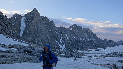
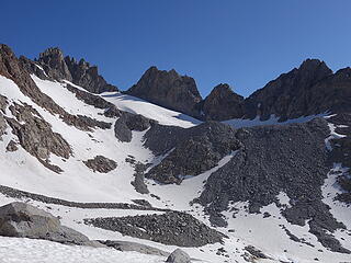
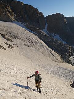
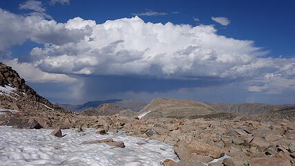
July 21 - Hike in and climb Harrower Peak
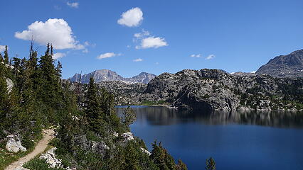
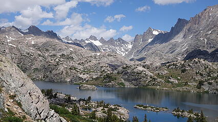
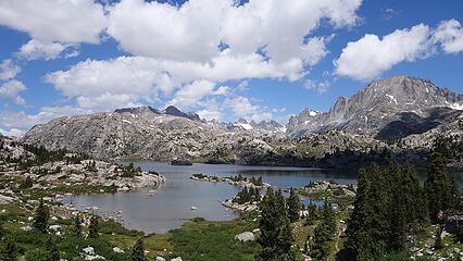
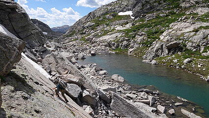
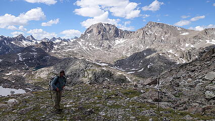
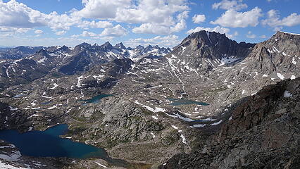
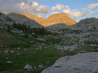
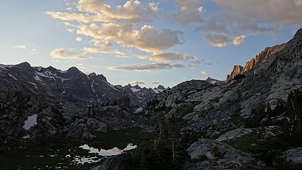
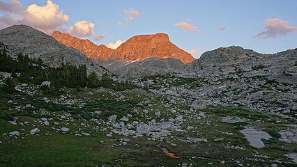
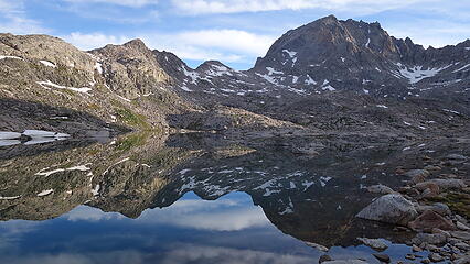
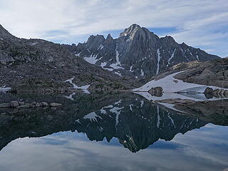
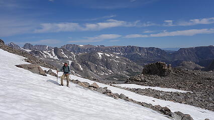
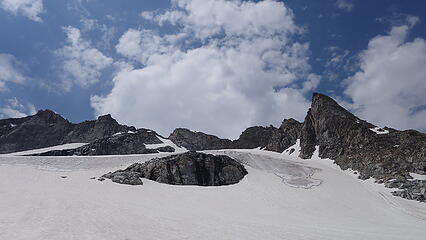
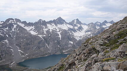
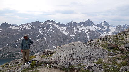
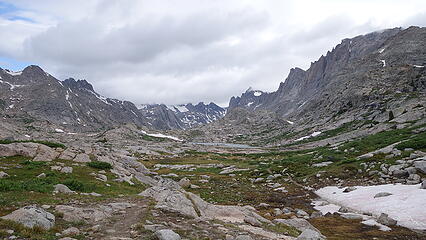
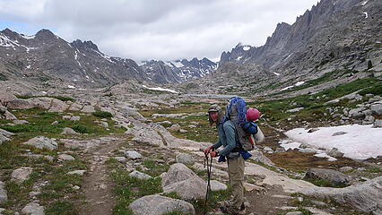
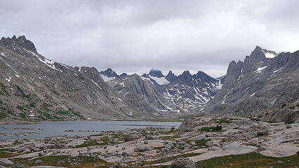
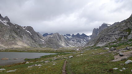
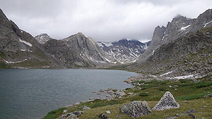
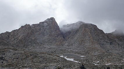
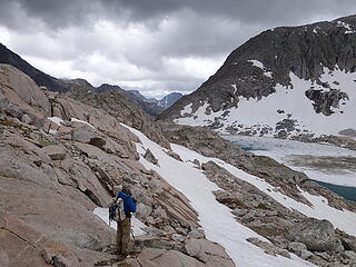
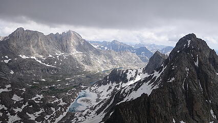
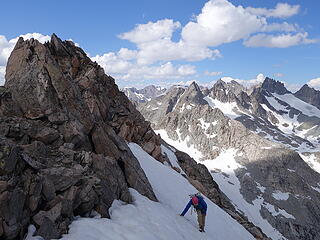
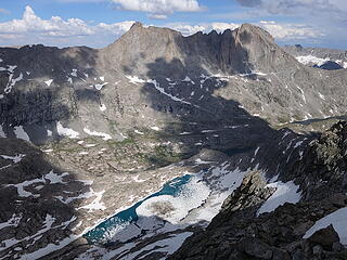
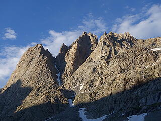
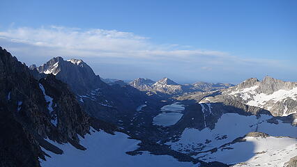
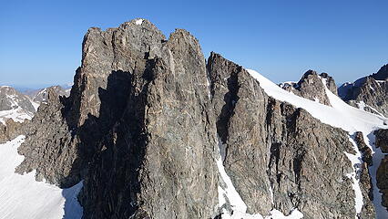
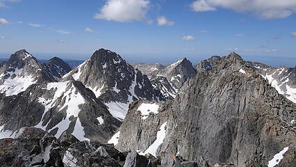
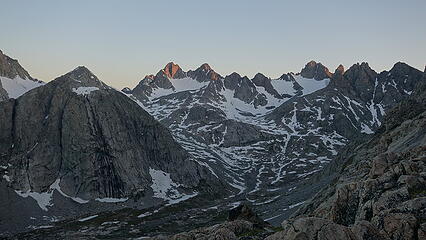
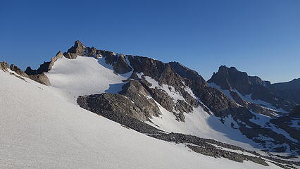
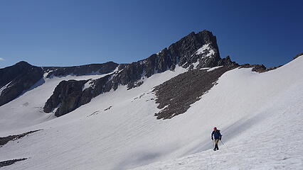
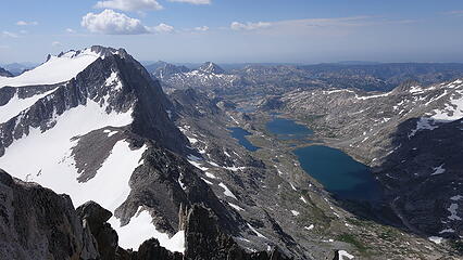
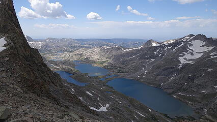
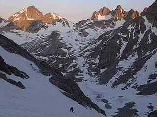
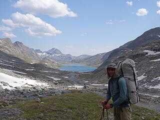
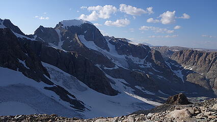
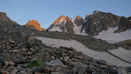
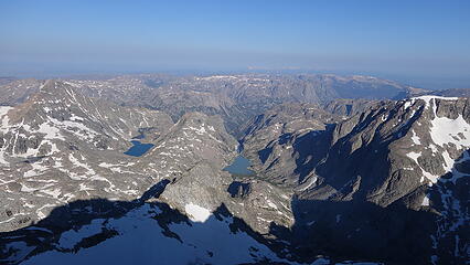
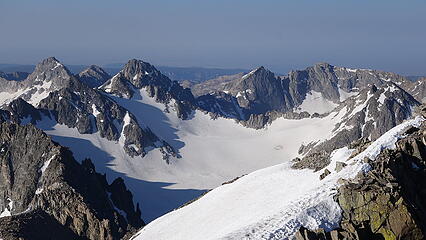
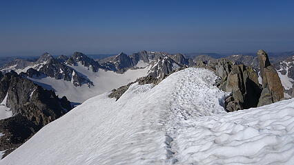
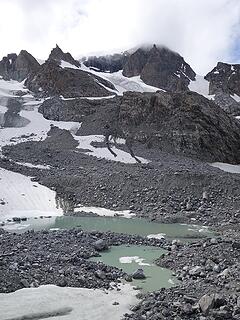
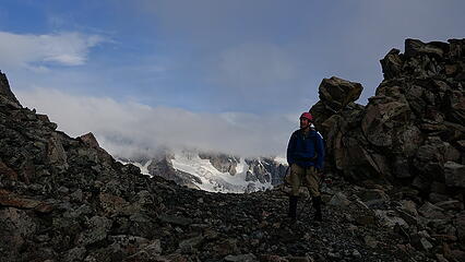
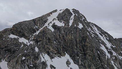
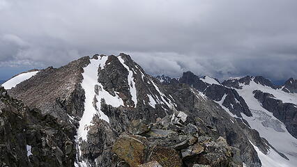
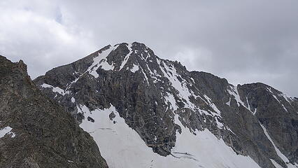
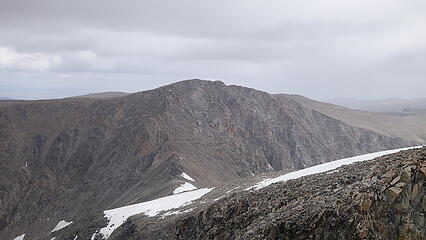
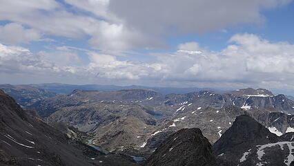
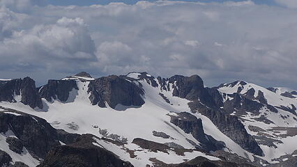
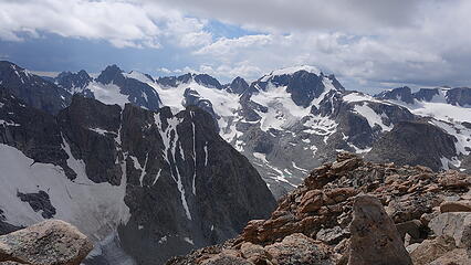
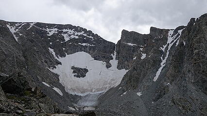
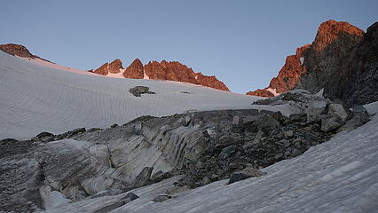
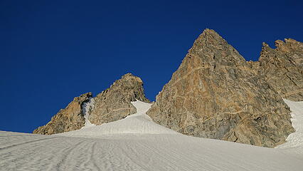
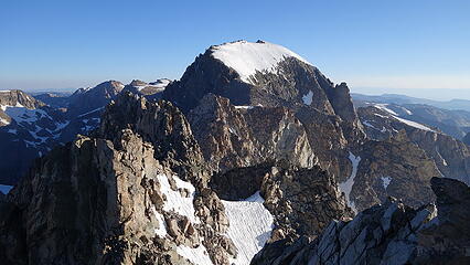
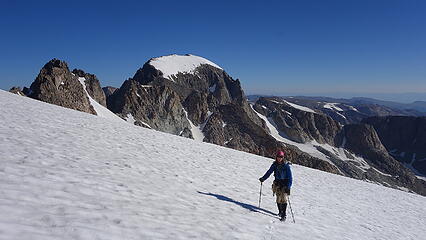
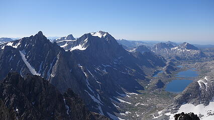
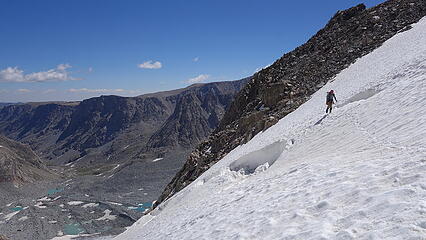
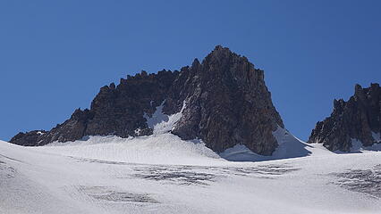
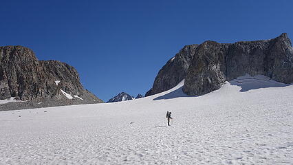
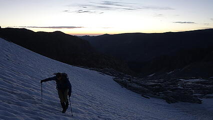
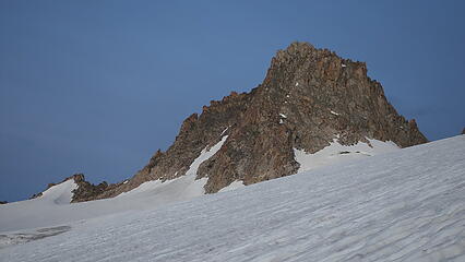
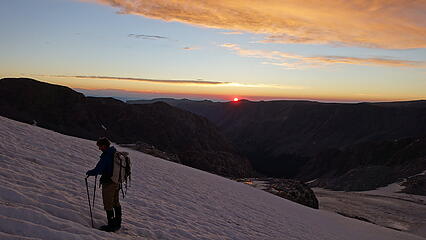
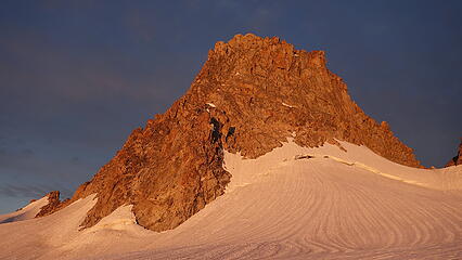
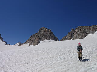
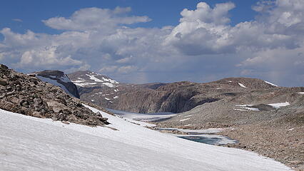
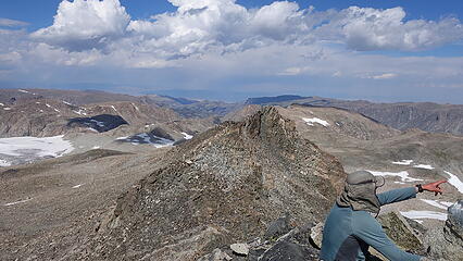
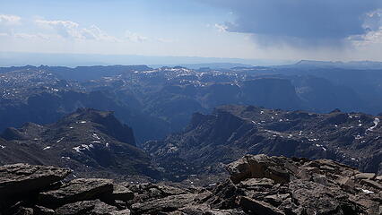
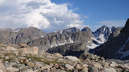
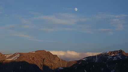
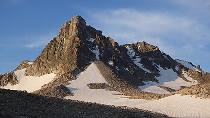
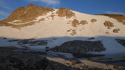
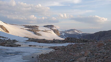
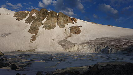
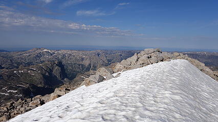
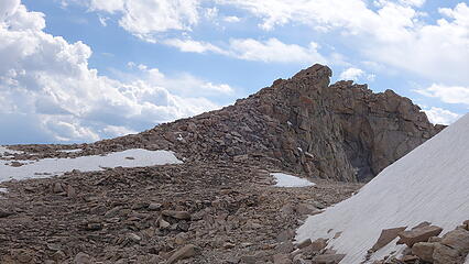
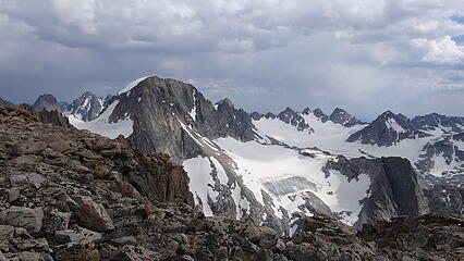
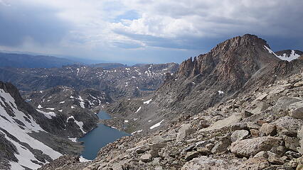
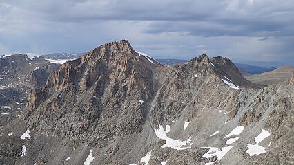
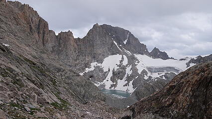
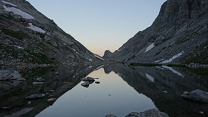
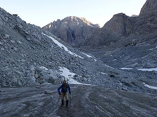
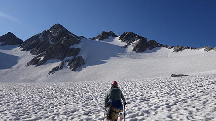
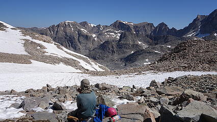
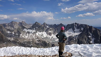
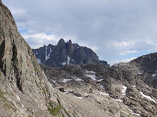
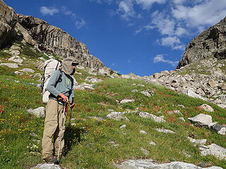
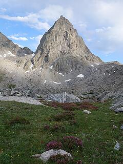
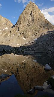
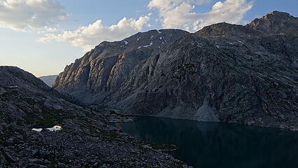
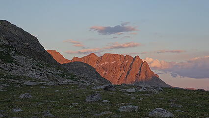
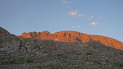
As Eric and I hiked in we enjoyed the gentle meadowlands and open forests with our super light packs. The 15 mile hike seemed to blow by with little effort, which was a pleasant change from long approaches I have done on previous trips. The trail passes by Photographers Point (common day hike destination), Seneca Lake, and over a small divide enroute to Island Lake passing many small lakes and ponds along the way. We were hoping to make it to the junction of the Indian Basin and Titcomb Basin trails in 5 hours, which is the timeframe the packers said it normally takes them to reach that location. Lo and behold, exactly 5 hours later at 2:15pm we arrived and sat by the junction sign for the mules to arrive. About 45 minutes later they joined us and offloaded our gear. We found a somewhat hidden from view grassy spot behind a large rocky outcrop to camp for the first couple nights that required us to carry everything just a few minutes from where the mules dropped off. We set up the tents and secured our gear and started hiking towards Harrower Peak. We followed the stream coming in from the east to an unnamed but large lake at 10850 feet. The view looking up at the steep NE face of Harrower were amazing, and I immediately thought about the great climbing opportunities on the face.
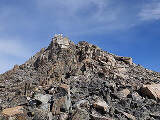
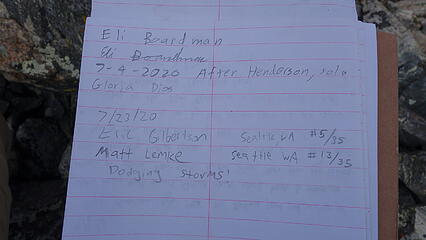
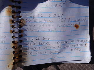
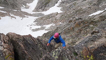
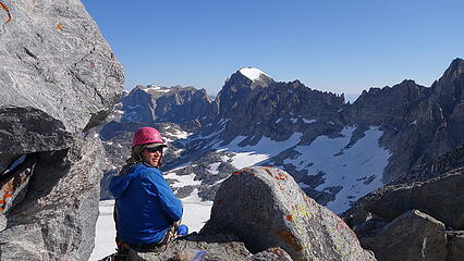
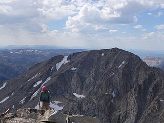
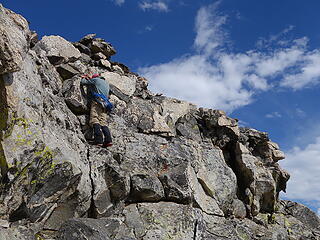
Rounding around the SW edge of this lake was not trivial unless you were ok getting your feet wet, so we had to climb up a 40 foot class 4 slab to go above a small cliff dropping right into the water. Then we made a gentle ascending traverse about 100 feet above the south side of the lake and entered the upper basin north of ELephant Head and hit the saddle. Climbing the SW ridge of Harrower was mostly straightforward staying on or just to the south side of the crest to avoid a couple steps or small peaks along the way. Near the summit, some class 4 traverses, ups and downs were required none of which were very exposed. The summit register was in a large aluminum milk barrel to my amazement, and this peak sees slightly more ascents than I expected, and Eli was recently here which would start a recurring theme of us signing in on each peak and seeing his name just a couple weeks before us on every one!
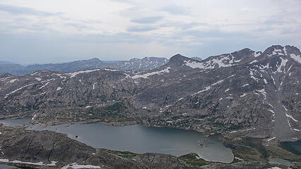
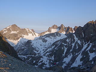
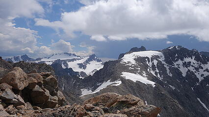
The view from the summit of Indian Basin in the late afternoon light was gorgeous, and the core peaks off to the north beckoned at us. We knew we were going to have a long trip ahead to climb every one. We descended the same route and made it back to camp with over an hour of daylight to spare to cook dinner. I put my long pants and long sleeve shirt that I coated in permethrin on while hanging out at camp and it worked quite well to keep the mosquitos from biting. Our first camp was down at 10,600 feet surrounded by grass and flowers so the bugs were certainly present, but nowhere near as bad as I thought they'd be. Eric turned in early, but the sunset was actually very vibrant so I stayed up later to take photographs.
July 22 - Knife Point, Bete Noire, Jackson and Fremont
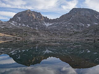
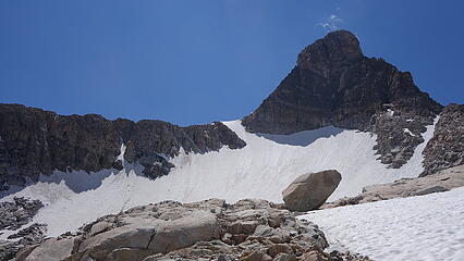
This ended up being the most elevation gain we did on any of the days, and the longest mileage day outside of approach days. We both wore our trail runners for this link-up due to the extra mileage even though we knew there would be snow involved. We started by hiking up the Indian Basin Trail, passing by the upper lakes early enough for them to be perfectly still and offer a mirror reflection of Harrower Peak. We didn't go all the way to Indian Pass, but continued southeast, over a small hill and up the remnant glacier west of Knife Point (crampons needed early in the morning) to the obvious 12340 foot saddle just west of Knife Point Mountain. We crossed this saddle and traversed to the upper south slopes of Knife Point Mountain and slogged up the loose class 2 slope. The final walk to the summit pinnacle on the SE ridge was easier, and the final 15 foot pinnacle involved a mildly exposed class 3 move or two. Someone had carried a ram skull up there, as there was not a register. It's important to note that the USGS maps have Knife Point mislabelled as the slightly lower 12er 0.2 miles to the SE. This peak is not the true summit.
After a quick rest on Knife Point, we began walking northeast along the gentle boulder strewn ridge to the 12140 foot saddle between Knife Point and Bete Noire (we called this peak Brown Cliffs HP, but Lists of John uses the French name). It was an easy class 2-3 romp to this summit, which was the furthest one away from our camp, so we were happy to have reached this point. The summit plateau of this peak consists of two broad mounds, of which the southern one is higher and correctly labelled on the USGS map. There were a few small pedestal shaped rock outcrops on the southern peak, a couple of which were very close in height so we stood atop of a few of them, had another rest to eat then returned to the saddle, where we began descending NW onto the Knife Point Glacier (which wasn't much more than a snowfield). We made quick work traversing west across this dying glacier at the 11700 foot level and re-ascended a bit to Jackson Pass. I commented we were probably the only people to ever reach Jackson Pass from the north without first reaching it from the trail on the south side (maybe Eli did too...haha). We debated trying to ascend the steep lower buttress of Jackson via its northeast side, but agreed it would probably not save us much time and decided to cross through the pass and scramble up the best looking gully we saw on the south side of the buttress. A class 3 gully/blocky climb brought us to the wide open flat basin just below the upper broad east ridge. From here it was a simple boulder hop to the top.
We made another weather check on the top of Jackson, since I had service and the updated forecast now called for no storms until after 8pm. I took a deep breath and prepared myself for tagging Fremont during the evening as well so we wouldn't have to walk back up the Indian Pass trail the following morning. I peered over the west face of Jackson and wished I could just find a way to traverse directly to Fremont, but the terrain was very much so 5th class. So back down the gentle ridge we went, and more or less retraced our steps back to the trail, and walked below the gendarme laden ridge between Jackson and Fremont and started up the standard south slopes. An additional 2600 feet later we were on the summit of Fremont, at about 6pm with clouds slowly building. Another large milk barrel register greeted os on the summit, which was actually difficult to find the highest rock since it was a long east-west oriented knife edge ridge. To my surprise, someone else had been up Fremont merely hours before we were...being the second highest peak in the Wind Rivers and considerably more accessible than Gannett it's no wonder why. I wanted to get back to the tents before dark so we didn't stay long and returned to camp, where we had about an hour and a half of daylight left to cook dinner. That night, there was a wicked thunderstorm that dropped large amounts of rain and hail, with plenty of lightning. Oddly enough, this would be the only large scale thunderstorm we would encounter on the whole trip and I was thankful it was during the middle of the night.


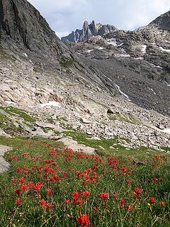
July 23 - American Legion and Henderson Peaks
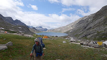
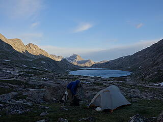
The next morning we woke up to extensive low cloudcover with most peaks in a whiteout. Everything was wet and since we were already a potential day ahead of schedule we slept in. We needed to move our camp to upper Titcomb basin which was 3.5 miles to the north, but luckily very flat walking on a decent trail. It took me quite some time to figure out how to get all my gear and three still full Ursacks of food on my 46L pack. I ended up putting one of the food pags strapped to the front, and just carried the other two, one in each arm up the Titcomb basin trail. It was just my luck that we passed a handful of other backpackers who glanced at my pack in horror and had one guy comment to his bud that he no longer could complain about his pack ever again after seeing mine 
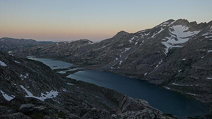
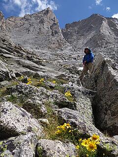
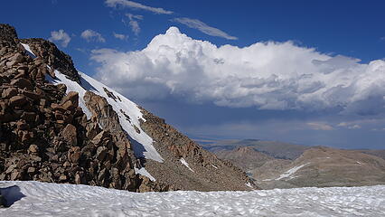
About a half mile past the end of the upper lake, we found a nice secluded spot a little bit past the Gannett Peak tent city and set up camp. We were able to avoid the Gannett crowds for the most part the whole trip. My back did hurt after carrying what I believed to be about 65 pounds, but as soon as I had it off I recovered pretty quick. As the morning continued on, the clouds began to slowly rise and Eric and I agreed to give American Legion and Henderson a shot, and hope we can catch a break from the forecasted afternoon storms. So we crossed the river to the west side, which proved difficult to find suitable boulders to hop across but we managed to keep the feet dry, and ascend up to a small 11360 foot saddle just above Summer Ice Lake, and continued into the basin above this aptly named lake. The snow slopes leading up to the saddle between Henderson and American Legion reached about 40 degrees at the uppermost part so we were thankful for the snow to be on the softer side. Upon reaching the saddle, we got a clear view to the west and saw storms rolling closer. We agreed to do the easier, class 3 south ridge of Henderson first in hopes we could catch some sun later in the afternoon to dry out the much more difficult looking 4th class north ridge of Henderson. The talus going up American Legion was easy, and at about 12850 feet near the top of the talus cone just before it narrowed into a steep ridge we got rained and hailed on. We were able to find a decent enough rock to hide under for the next 20 minutes, however the rain made all the rocks very wet and didn't bode well for our Henderson attempt...however I had a hunch that we would get some sun.
The final scramble to the summit of American Legion had us cross up and over two small ribs before the final short gully to the highest point presented itself. The summit view was super cool, especially with rolling clouds and showers in other parts of the range. A large world war 2 ammo box housed the summit register and we signed in, again only seeing Eli's name from this year. Looking off to the west it started to look a bit brighter so I had high hopes the rock would dry out. Sure enough, just as we reached the saddle the sun came out and we had our chance to make the more difficult scramble up Henderson. It started by traversing below the crest on the west side, then climbing a 4th class gully/dihedral back to the crest to avoid some of the initial gendarmes, then we followed right on the crest for a bit. Once we reached a spot where the ridge narrowed to a very steep knife, we traversed a series of ledges on the east side until we could climb up above the very difficult portion of the crest, and actually crossed back over to the west side to enter a more broad gully that led to a small notch shortly before the summit. A short snow traverse back on the east side led us to the final few feet of walking to the top. This route actually ended up being my favorite route of the entire trip, and featured near continuous class 3 and 4 scrambling with mild exposure the whole way on solid rock. Definitely a classic as stated in the guidebook, plus, the entire afternoon was sunny and calm despite the weather forecast. We discussed at how Sarah and her party took the south ridge and took them a very long day to climb and descend Henderson via the south ridge...which sounded like an awesome trip but we were happy to have been able to tag both of these peaks in just a few hours and couldn't have asked for anything better. By 6pm or so we had returned to camp and enjoyed a bug free evening in Titcomb basin for dinner, although we did have to remove our shoes to re-cross the river which was downright frigid. Completely numb feet after that but the smooth slabs around camp allowed me to remain barefoot all evening.
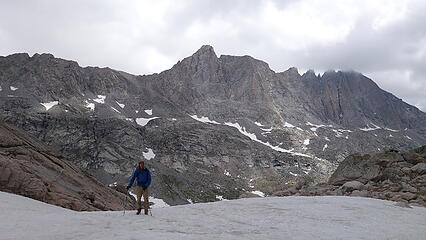
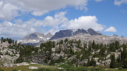
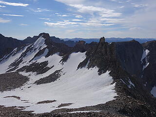
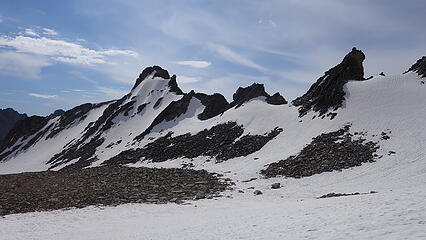
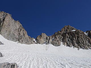
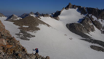
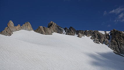
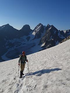
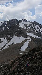
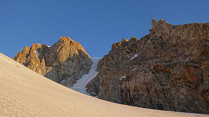
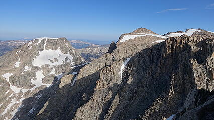
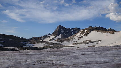
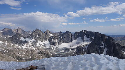
July 24 - The Sphinx and East Twin
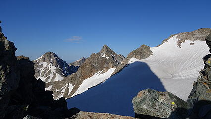
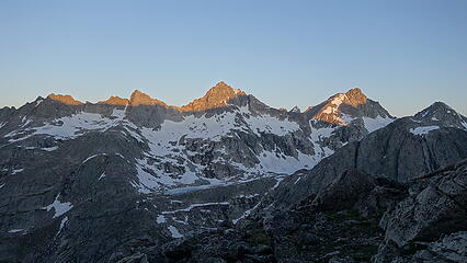
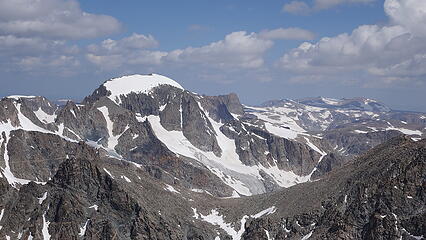
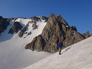
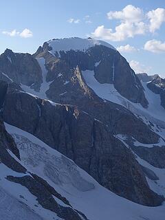
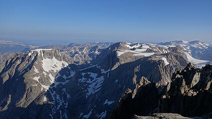
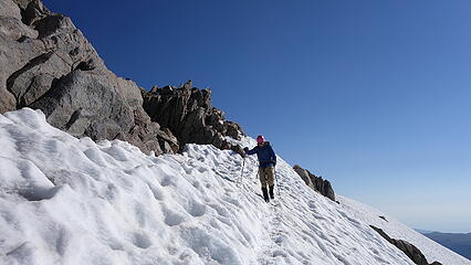
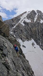
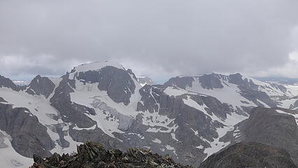
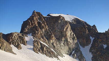
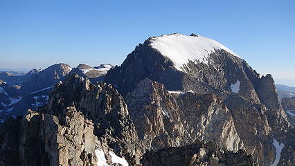
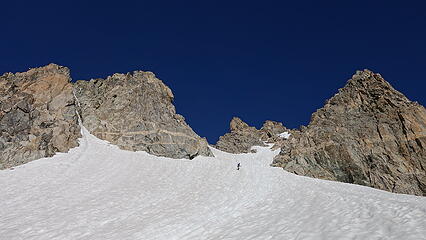
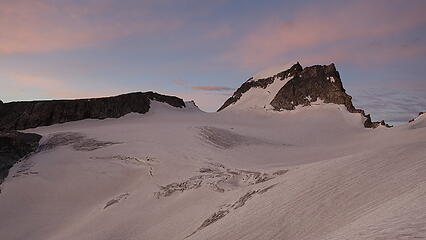
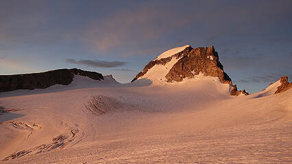
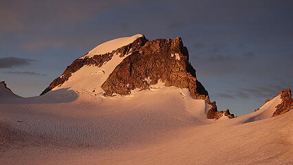
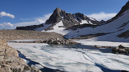
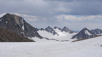
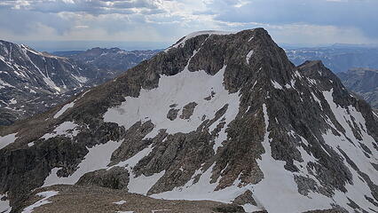
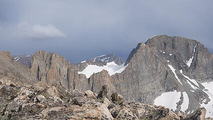
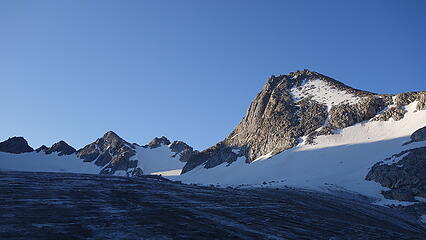
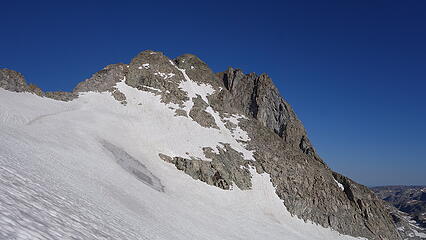
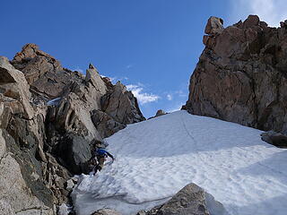
The following morning we woke to completely clear skies, and started a 5:30am normal start time that we would follow much of the trip. We walked up the valley and entered the snow covered basin to the south of Woodrow Wilson and Sphinx, continuing onwards to the saddle between the two peaks using our crampons all morning due to very firm snow. It was a very mellow snow walk to this 12920 foot saddle with the steepest being about 35 degrees for a short stretch. We took a good look at the south couloir of Woodrow Wilson as we were at this point right near its base, and almost kicked ourself for not bringing the rope, but we had heard of plenty enough reports of that route being total garbage, so we agreed to ascend Woodrow Wilson from the Dinwoody side via the north couloir together with Pinnacle Ridge later in the trip.
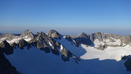
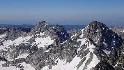
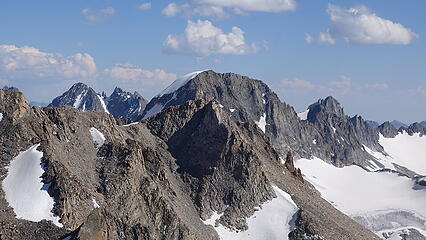
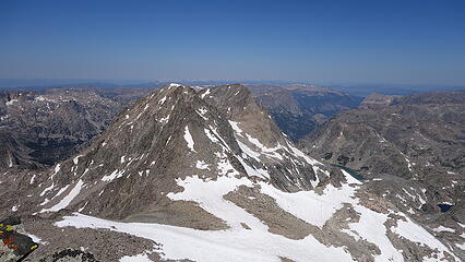
At the saddle just below Sphinx we took a snack break as it was still quite early and chilly. The scramble up Sphinx was only 300 feet up from here and it looked pretty eazy, and indeed it really did not surpass class 3 in difficulty if you took the easiest line up the NW face. Mostly blocky steps, but if you veer too far to the left and get closer to the north ridge, there is more 4th class and a much higher exposure level! I took this harder route both up and down and certainly got the heart going a little. Definitely an enjoyable, albiet short little scramble. We then descended and traversed south, then west across the basin we came from and around the lower SE ridge of East Twin. We then ascended snow up the Twins Glacier (again, not really a glacier anymore) to the saddle between East and West Twin. Getting to this saddle was definitely the crux of the route, as the snow was 45 degrees, which we were glad to be here later in the morning when it was softer. At the top of the snow we then had to climb a 30 foot class 4 loose chimney to attain the saddle. Once there, it was an easy class 2 romp up the west ridge to the top. From this summit, I glanced over to West Twin, which looked lower visually and didn't think much of it, but we would later go back for West Twin...more on that further down much later in the trip.
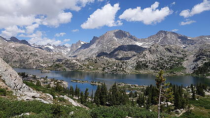
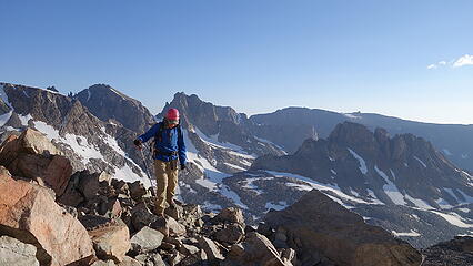
The best part about East Twin was the summit register, which was placed in 1930, and is still there in its original form! This was a new record for me for the oldest summit register I have ever seen, and it was on one of the more popular peaks oddly enough. Surprisingly East Twin sees about 5-10 people each year. We rested and enjoyed the views of the Gannett Group and Desolation Peak off to the north, and studied peaks we would be climbing later in the trip. We started down, and saw a couple backpackers trying to get over Knapsack Col, struggling to get down the cornice that blocked the east side of the pass. We ran down the gentle snow back into Titcomb Basin and reached camp shortly after noon and relaxed the rest of the afternoon. A small rainstorm came in about 2pm and it rained off and on the rest of the afternoon before we cooked dinner.
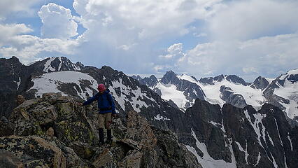
July 25 - Sacajawea and Helen
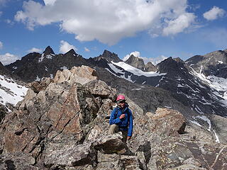
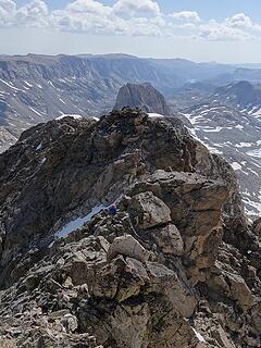
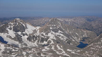
Another 5:30am start time, this time we started walking towards the east side of Titcomb basin and ascended the class 2 access ramp leading to the ridge between Sacajawea and Helen, meeting it right at the base of where the north ridge of Sacajawea steepens. It took us 90 minutes to ascend the talus to this 12800 foot saddle. We had previously discussed climbing the north ridge route that went at low 5th class, and we brought one of the ropes to do so, but after seeing it still covered in a decent amount of snow, with slabby looking rock underneath it, we opted to traverse around to the lower east ridge, utilizing a north facing gully to access the gentle SE facing snowfield to the east of the peak. This gully was actually very loose and not enjoyable. Once on the gentle snow we walked west to the top of the talus cone, which was a false summit, to where the real difficulty of this peak presented itself. A short class 4 descent to a notch between the two summits was followed by a very exposed traverse around the base of a couple vertical/overhanging gendarmes on the north side of the east-west oriented summit traverse. We had to carefully string together some ledges, and reasonable 5-10 foot ups and downs to pass this obstacle. To our surprise, the difficulty wasn't over after this as we then were presented with a delicate downclimb of a few feet onto a slab, followed by a committing mandatory jump onto a large chockstone wedged into the deep notch. If you missed it was a 2000 foot drop! The downclimb on the slab to the jump was the scariest part as there were only two small ledges for a foot and a hand that could be used. Once on the chockstone it was a narrow traverse left around a steep, large boulder with tons of air below you, then it eased to the highest point.
As we rested on the summit, we saw a solo hiker moving towards Sacajawea on the large glacier north of Fremont. We wondered who it could be because Eli had already done these peaks. Anyway, we repeated the traverse back to the false summit, which was easier going back since up-climbing that slab was much more secure. Just as we crossed back over the false summit we ran into this solo hiker. He was not carrying much of any gear and was moving fast. We only chatted enough to say hello but we would end up seeing him again.
We continued back down the hideous gully and then made a long snow traverse north aiming for Helen whie dropping as little elevation as possible. As we made the ascent up the final snow slope to the south facing gullies that provided access to the uppr east ridge of Helen, we saw the same guy running on the rock ridge crest, climbing what looked like hard 5th class terrain solo, and very quickly. I couldn't believe it...he had to have solo downclimbed the north ridge of Sacajawea and ridgeran on the crest to have caught up to us. We met the east ridge and dropped our packs before finishing the final 100 foot class 4 scramble to the summit which we reached at about 11am. As we broke out some snacks, free soloist arrives at the summit and is spooked at first, thinking for sure he would have beat us to the top of Helen. We chatted with him for quite awhile on the summit, since it isn't often we run into anyone on these summits. Turns out he started at Island Lake early in the morning and climbed over Jackson, nearly made the 5th class traverse to Fremont, then to Sacajawea and Helen all solo. He was from Bozeman and knew of a few friends of mine who also live there...pretty badass! He would be the only person we saw on or near any summit during the entire trip except for Gannett.
We all started down the east ridge, which he then continued down some steep loose looking rocky ribs on the north face of Helen while we dropped back south to descend the way we came. He was easily the fastest person I ever saw on 4th and low 5th class terrain...almost in a slow motion fall as he leaped, jumped and dropped down the north face of Helen. We traversed closer to the rocky ridge on our way back to the saddle and we were happy to cross back over because clouds were building very quickly. We descended the ramp and made it back to camp about 1:30pm and 30 minutes later it started raining. It continued on and off all afternoon while we rested in the tents, breaking just long enough in the evening for dinner before raining again shortly after sunset.
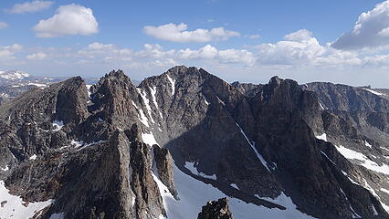
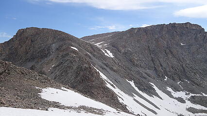
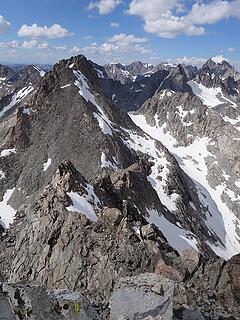
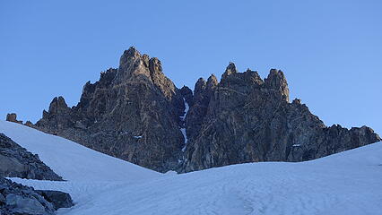
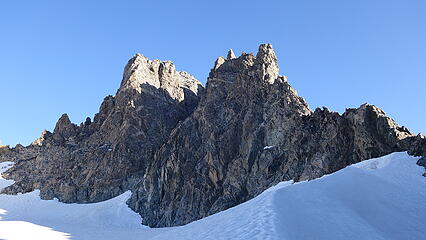
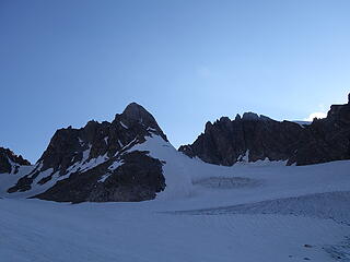
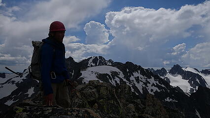
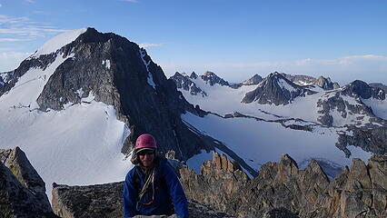
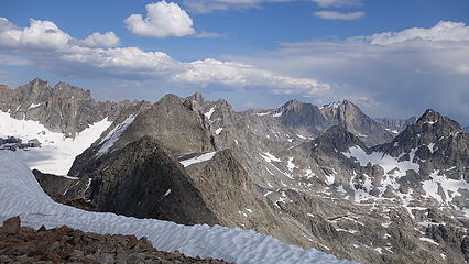
July 26 - Spearhead and Warren; move camp over Bonney Pass
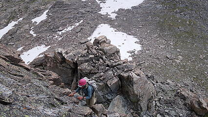
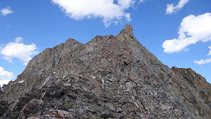
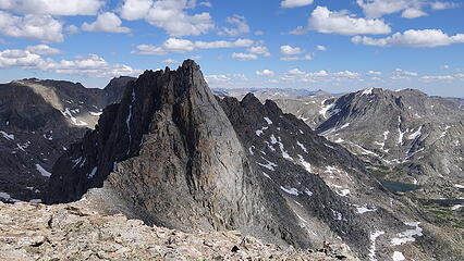
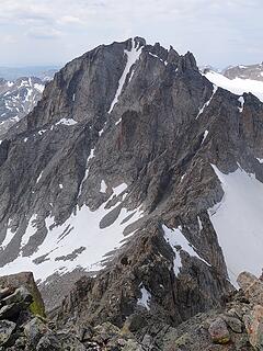
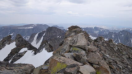
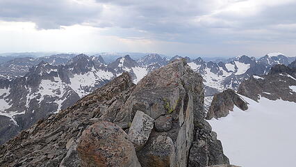
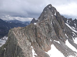
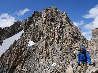
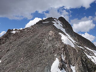
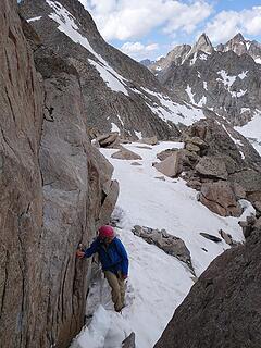
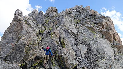
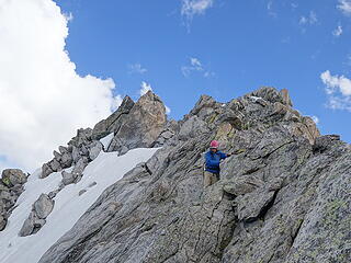
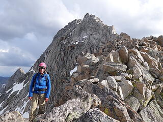
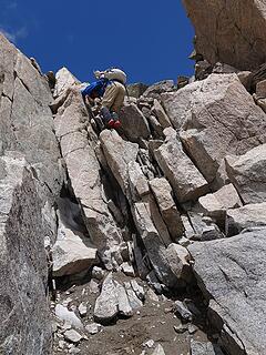
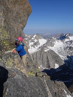
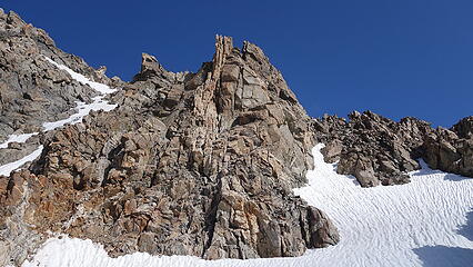
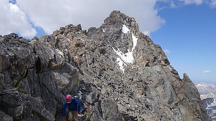
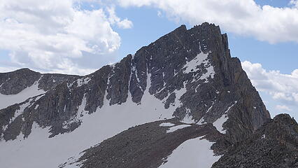
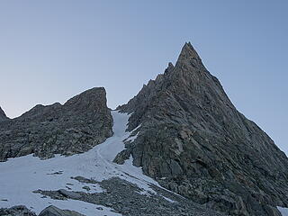
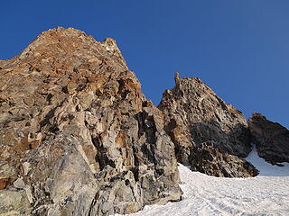
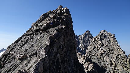
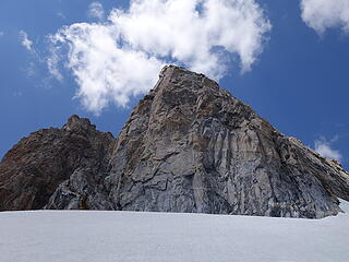
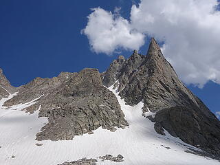
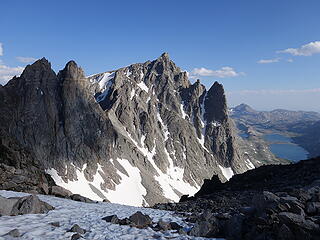
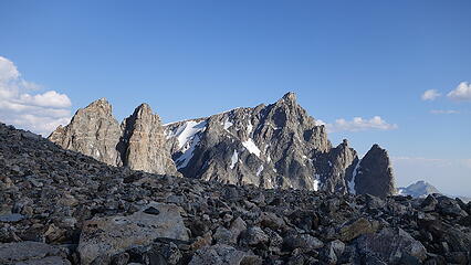
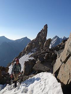
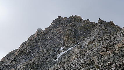
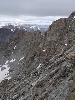
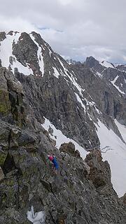
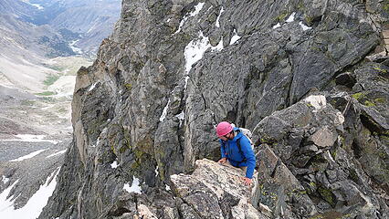
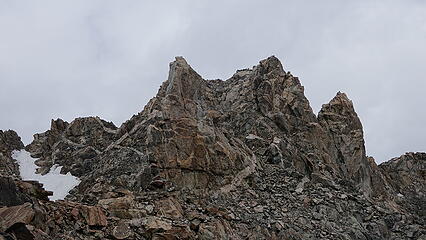
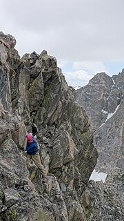
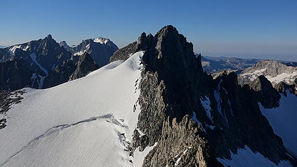
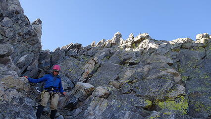
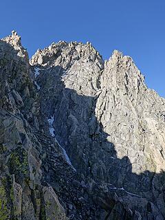
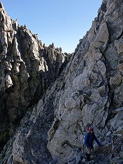
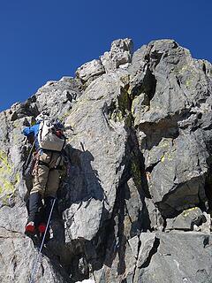
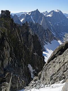
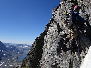
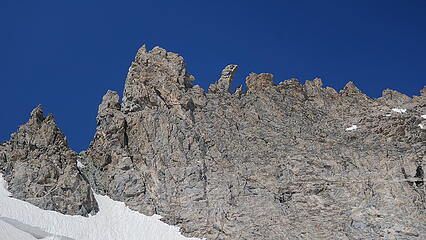
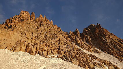
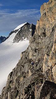
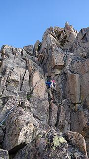
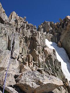
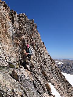
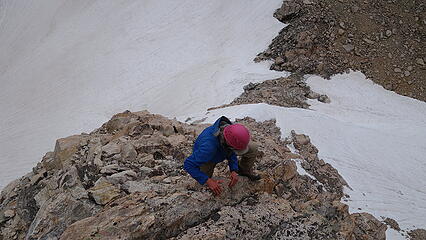
This would be the day we did the first 5th class 13er. We were moving at 5:30am again and hiked back up the valley, rounding the base of Helens very steep impressive west face following generally the same route as for Bonney Pass, but turning sharply east up the gully leading to the low 12580 foot saddle between Helen and Forked Tongue (the slightly lower tower just south of Spearhead Pinnacle). This gully is immediately north of the steeper NE snow couloir on Helen, however the snow in the gully we used still approached 40 degrees and since it was early, it was still firm. I was happy to have the crampons. It took us about 90 minutes again to reach the saddle and we made a circling traverse around the east side of Forked Tongue and Spearhead, and ascended to the saddle between Spearhead and Doublet Peak (an unranked, rugged 13er that no one climbs). This higher saddle required some very loose rock to reach, and once there we scrambled south on the initial class 3 part of the north ridge of Spearhead until the ridge steepened considerably. Here we racked up and decided to simul-climb the ridge, where I would place a microtraxion on one of the cams once every 30 meters for extra safety. We managed to get two ropelengths (using one of our 30m ropes) of simul climbing before I just about ran out of cams. There was one short vertical 5.3 step followed by a horizontal knife edge ridge requiring hands grabbing the sharp crest with feet smeared on steep slabby rock while side-stepping across. That was fun, and made the knife edge on Colorado's Capital Peak look like a cakewalk.
Just beyond the knife edge, I built an anchor and belayed Eric up to me, which he then continued to the final summit pinnacle. This was only big enough for one of us to climb at a time and required a very exposed 10 foot ascent of class 4 to reach...Eric topped out first and I followed. I found a tiny glass jar under the summit cairn with one piece of paper that was placed by Sarah, Dominic and Teresa. Since their visit years ago, no one signed it except for Eli just a couple weeks prior. The fact that there was no pencil or pen may have contributed, and Eli actually improvised using some tape to the paper for his name. Luckily we had pencils so I signed it and we started the descent. We simul descended the knife edge and the single 30 meter rope was the perfect length for a 15 meter rappel from an existing sling around a large block to a ledge below the 5.3 step. From there we simul-descended one more rope length back to where we racked up and left the packs. It was just after 9am when we reached the saddle again, and during our ascent of Spearhead, I scouted a gully route that looked reasonable on the SW face of Warren directly across from us. If this route would work (which was not in the guidebook) it would be WAY shorter than our original plan of dropping all the way to 12000 feet and re-ascending to Elsie Col to climb the full east ridge of Warren, then returning that way.
So we decided to try it, and only dropped a few hundred feet from the saddle to 12600 feet and continued in a northerly direction towards a series of gullies on the south face of Warren. We spotted one that looked to continue almost directly to the summit and had minimal snow. We cut to the right and crossed the base of three SE facing snow gullies leading up towards Doublet Peak, and started ascending the 4th major one that curved leftward higher up and terminated on the upper west ridge of Warren above all the towers and gendarmes between Doublet and Warren. We figured if we could get to the notch there, the upper west ridge shouldn't be more than 4th class and if it was we had a rope. The lower part of this gully began with some class 3 scrambling on fairly solid rock for about 100 feet next to a small meltwater stream, then turned to loose scree and talus. We stayed on the left side of the gully proper for more solid rock, eventually climbing alongside the edge of the narrow band of steep snow remaining in the gully. At 13460 feet, where the gully begins to curve left we spotted a less conspicous gully/ledge system that cut to the right appearing to terminate right next to the summit. We opted to try this since it seemed easier (think drier) than ascending the 45 degree snow up the remainder of the gully to the notch in the upper west ridge. We did have to put the crampons on to traverse across the 30 foot wide snow to the other side which was annoying, but overall it turned out to be the right call as it was easy class 3 scrambling which ended right on the east ridge only 20 feet below the summit. We felt confident this is most likely the easiest route on Warren as we encountered no class 4 on this route. Overall it was not as loose as other routes either, so if anyone is looking for a new standard route on Warren this is probably it.
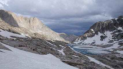
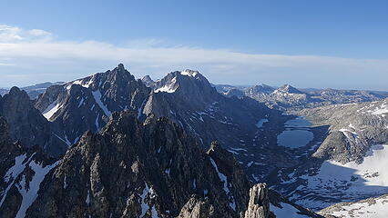
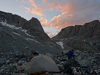
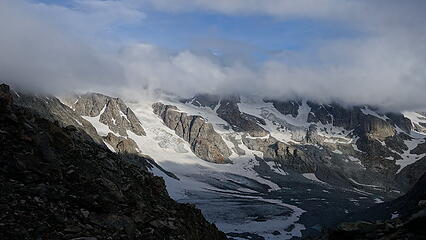
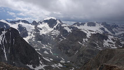
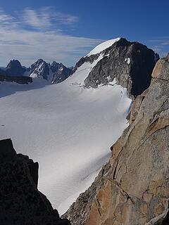
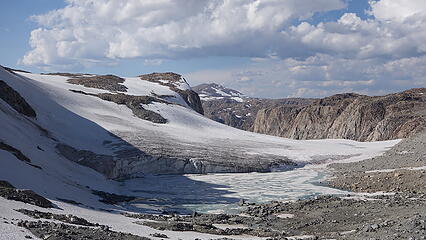
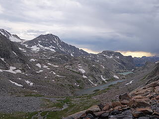
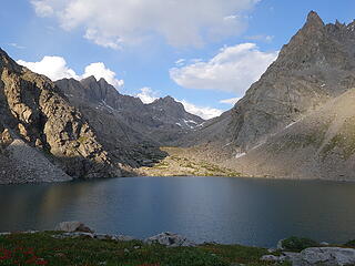
On the summit we enjoyed a long relaxed warm snack break, with no clouds in sight. A check of the weather forecast once again informed us there would be no storms in the afternoon, so we figured we would return to camp, pack up and hike over Bonney Pass that evening enabling us to cut another day off of our planned schedule. The descent all the way back to camp was smooth, and just as we reached the base of the gully back in upper Titcomb Basin we left everything we were carrying under some rocks at about 11500 feet so we didn't have to re-carry it back to that point enroute to Bonney Pass. We returned to our camp, ate a dinner (since we figured with how ahead of schedule we were we would have extras) and packed up. The packs were still very heavy and I was kind of dreading carrying over 50 pounds up and over Bonney Pass but we made good time getting back to our gear cache, took another break and then continued up the steepening snow slope to the pass. It was hot, slow and miserable getting up there in the afternoon sun, but at least the snow was soft, making the ascent much easier with the packs on. We actually thought about it more, and doubted we could have even made it up early when the snow would be hard with that much weight. Upon reaching the pass, now after 6pm, we ran into a large group of people headed back from Gannett, however they didn't make the summit. Eric and I just wanted to get to our next camp to remove these heavy packs so we didn't stay long at the 12820 foot pass (2000 feet above our camp in Titcomb!) and started down, however I really had to admire this vantage of Helen, which looked absolutely insane from this angle! A short talus boulder hop down led us to the snow of the upper southern arm of the Dinwoody Glacier, one of only 3 "real" glaciers that remain in the Winds. We descended north now in the shade down to the small lakes on the exposed rocky moraine and found a sandy place to camp next to a tiny teardrop shaped blue pond at 11330 feet. No one else was camped around us, although we did see a huge tent city off on the far north end of the moraine right below West Sentinel. We cooked another dinner and planned to just hike Gannett Peak the following morning as a rest day and enjoyed the beautiful sunset over the impressive north face of Warren and Turret Peak.

July 27 - Gannett Peak
After we successfully packed well over 50 pounds of stuff up and over Bonney Pass, we woke the following morning and wanted an easier day. Just doing Gannett Peak sounded like a good plan to keep things light. So at 5:30am we were up and starting on the standard Gooseneck Glacier route. We saw a few other parties already starting up the route who were camped at the standard Dinwoody Moraine camp just north of ours. We quickly caught up with them and passed about 8 people within an hour of leaving camp. As we started to get closer to the infamous crux bergschrund crossing, we caught up to a group of 12 from the Central Wyoming College all hanging out in the bergschrund wait their tunrs to climb up on a fixed line. We were able to cut around them to the left and easily walk up snow that filled the whole left half of the bergschrund in. It appeared to likely stay completely filled for at least another couple weeks. Just above the schrund, we passed right by Gooseneck Pinnacle, and even saw slings around it from past parties who decided it was a worthwhile side trip (it involved about 15-20 feet of easy climbing up to I guessed 5.4).
We then scrambled on the rocky ridge for a bit to take a break from the snow, occationally making a class 3 move. As we neared the upper summit snowfield, we passed one final party and made quick time traversing the summit ridge, which went at an easy and low angle snow walk at the snow/rock ridge interface just a few feet below the crest following many other footprints. We saw a solo hiker below us to the south quickly ascending the upper part of the northern arm of Dinwoody Glacier, aiming directly for Pinnacle Ridge. We both immediately knew who it was as the guy we had been following on all the Wyoming 13ers. Considering it was a Sunday, which he only had weekends available and the fact that literally no one climbs Pinnacle Ridge we knew it was him. We wondered if he would be coming up Gannett next, and it didn't take long for us to get our answer.
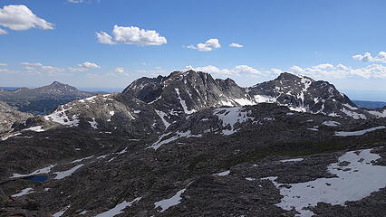
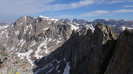
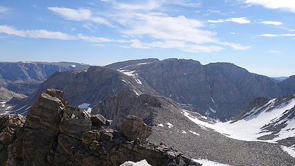
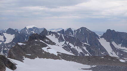
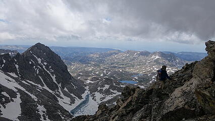
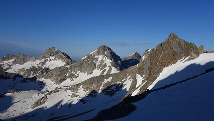
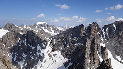
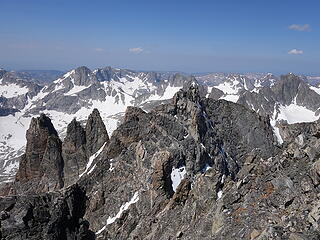
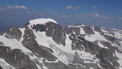
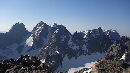
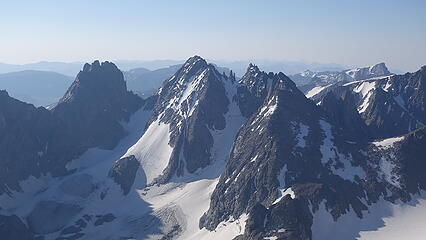
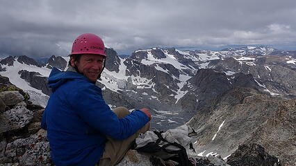
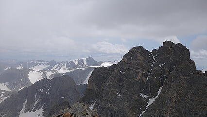
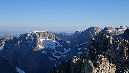
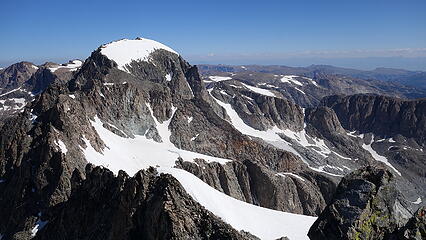
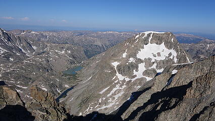
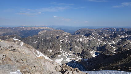
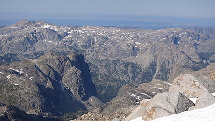
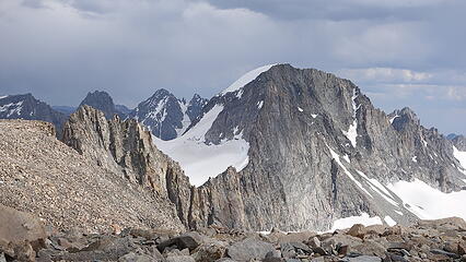
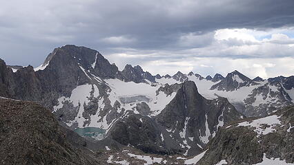
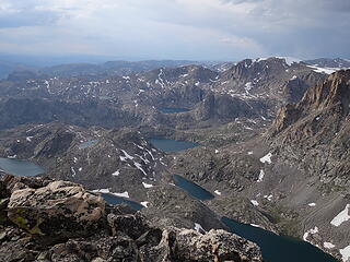
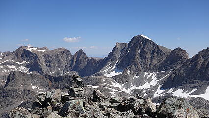
We reached the summit shortly before 8am and were the first ones up for the day, despite being one of the last ones to leave the Dinwoody Moraine. We both relaxed on the summit for 45 minutes since we didn't have any other objectives planned for the day and admired the view of all the peaks we had already climbed well off to the south, and scouted out the remaining ones we still had left. Eric had actually already climbed Gannett but he repeated it in order to get the FKT for them all. To my astonishment, Koven was still not visible from the summit of Gannett, leaving us still wondering about this elusive peak. Gannett does a spectacular job of hiding it! Directly below us to the west, over 2000 feet down lay the upper Wells Creek basin, and we were able to see our future route on Desolation Peak and the descent to Long Skinny Lake.
We started down just as another party of two was about to summit and we traded spots. 10 minutes later we ran into Eli, who was headed up Gannett which his dad had joined him for as well which was super awesome. We briefly chatted about our current progress and continued on. It sounded like I would probably be able to finish the list as the 3rd completer, since I had already completed all the remaining outlier 13ers. The race was on lol. Unfortunately on the way down from Gannett, my right knee decided it was time to start hurting, something I really had never experienced before. Basically a dull pain when pulling the leg forward, or when lowering myself on the right leg when going down steep terrain. Luckily simply weighting it never was an issue, nor was weighting it to go uphill. We knew the following day was going to be a bad weather rest day so I hoped that would take care of it.
It was a relaxing afternoon enjoying looking up at the towering walls all around us and eating copious amounts of food. It did rain briefly in the evening, and our weather forecast arrived right on time and was slated to be even worse than we had been informed before. Rain all day during the night and all the next day! We braced ourselves for 36 hours of being tent bound. Overall, it was ironic that the Wyomings highest peak ended up being the easiest day on our trip other than the rest day. We were up and down at a leisurly pace with a 45 minute summit stay in less than 5 hours, and we still passed everyone on the route.
July 28 - Rest day (Bad weather)
It quite literally rained all that night and apart from two short breaks, it rained all day as well. We were worried about any snowfall that would coat the top of Turret which would make the ascent of Turret the following day even harder than we were already anticipating it to be. We got a break in the rain to emerge for both lunch and dinner, and just hoped for the best the next morning for no snow since all the summits were socked in all day and not visible.
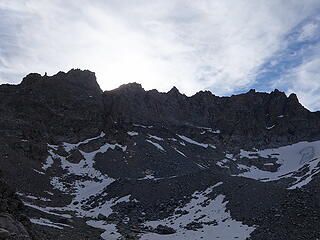
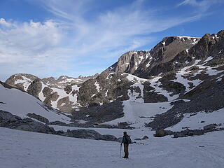
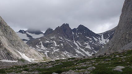
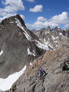
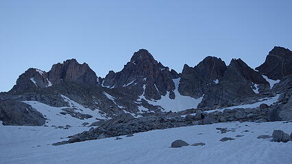
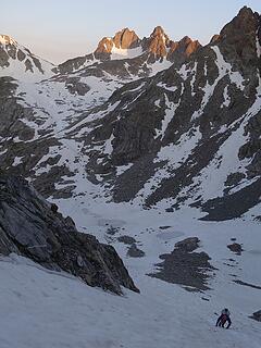
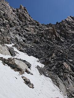
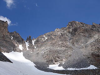
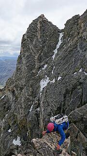
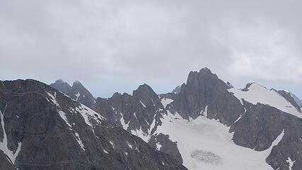
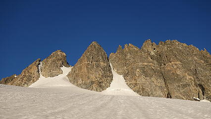
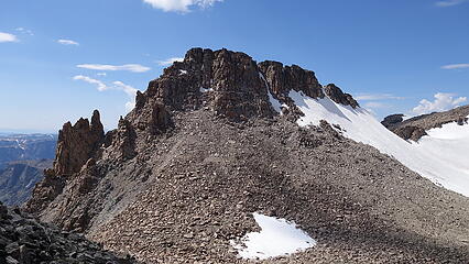
July 29 - Turret, Sunbeam and Febbas
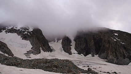
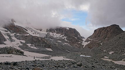
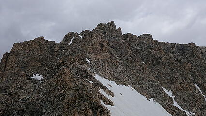
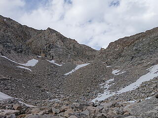
At 5:30am we were off once again under a low cloud cover. Our forecast from the previous evening still called for afternoon thunderstorms and morning clouds, which didn't really help our bid for one of the longer days we would have on the whole trip. We decided to try it anyway, and started up towards Backpackers Pass. Getting to this pass is trivial enough, except that the 900 foot narrow talus gully was probably the worst talus we encountered on the trip. Large microwave sized rounded rocks were all very unstable and seemed ready to slide on top of you at any moment. We never strayed below one another and each ascended one side of the gully. Thinking light...even levitating thoughts were cricial not to have one of these boulders roll on top of me as soon as I would touch it. By 7am we made it to the pass though, and were less than 100 feet below the bottom of the cloud deck. We were unsure what lie in the clouds, however we were thrilled that it was fairly warm and humid given the situation, so we had a good feeling the summits did not receive snow.
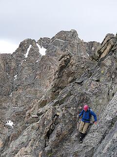
We decided to give it a try up the north ridge of Turret, and pretty quickly entered the whiteout. This route is the easiest route on Turret and also allows you to combine it with Sunbeam and Febbas, so obviously it was our route of choice. The lower end of the north ridge however was guarded by an impressive cliff that we somehow had to ascend around. We spotted a pretty wide ledge leading towards the base of this cliff, and figured we would scout to find a potential way around its west side. Keep in mind we had virtually no beta for this route, and we were going to try and climb it in a whiteout, which may have been possible if not for the slabby, lichen covered rock that was still wet making the climbing nearly death defying given how much exposure we started to find ourselves above. In addition to that we could only see about 30 feet away in the thick low clouds...Eric and I both commented "oh great, we are back in the Cascades!"
After making an attempt to find a route around the west side of the lower cliff (which is about 120 feet tall I'll add), I ended up on downward sloping, lichen covered wet slabs that were as bad as being covered in black ice with huge cliffs below me. I did not want to go any further and we bailed back to Backpackers Pass for the time being, dropping just barely out of the clouds as we descended 200 feet back to the pass. We discussed what to do, and considering the past experiences I've had in the mountains, I suggested we simply wait at the pass as long as it takes until Turret becomes climbable, or it starts getting dark since neither of us wanted to have to repeat coming up Backpackers Pass (it was kind of THAT bad). After all it wasn't even 8am yet, and the days are long. Eric agreed, and we found comfy spots to lie down out of the wind and wait.
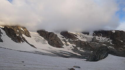
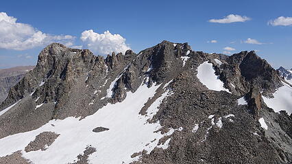
Slowly, the clouds thinned out, and rose in altitude, and by 10am they were above the summit of Turret. The sun popped out for brief moments and was able to shine some warm light on the rocks...as some water vapor was visibally coming off the cliff faces we cheered! At 10:30am we decided to try again. This time, we would try going up the steep looking gully that was just to the left (east) side of the cliff and appeared to meet the north ridge just at its top. I started up, scrambling into the gully, which quickly turned into 4th class climbing. A narrow snow and ice finger remained in the gully and required me to remain climbing on the right side of the gully on slabby terrain. The crux of the gully was a single low 5th class large step across on a wet narrow downsloping ledge to bypass and get above a big chockstone in the gully. Below this committing step was the steep ice 30 feet down. I managed to make the step but Eric didn't like it so he returned to our original path trying to go around the west side. I yelled down from the top of the gully which did indeed reach the north ridge and successfully got above the low cliff and that the route eased up considerably from there. I descended some lower angle class 2 talus on the backside of the cliff to its west edge to help Eric routefind. Right before the terrain dropped very steeply down the big NW face, I cut around a small rib and saw Eric pop around along the base of the cliff.
I spotted the best way for him to traverse to where I was standing which involved stringing together a series of narrow ledges providing just barely enough passage on the downward sloping slabs, which had dried somewhat but not completely from our earlier attempt. The crux was again, a one move wonder of low 5th class up a five foot step requiring a handjam to surmount with deathly exposure. Once he got up it was smooth sailing as we walked up easy boulders on the upper west face, keeping 10-25 feet below the crest of the north ridge. We reached the ridgecrest where it narrowed in a 50 foot long horizontal narrow section which ended in a small notch. From this small notch just 140 feet below the summit, we finished the ascent on the left (east) side of the ridge scrambling class 3 terrain to the top. We were pretty elated to have made it up, but there was still a lot of clouds above us, and the thunderstorm chances were high for the day. We admired the view looking at the sub-summits just south of us which looked tricky to navigate around, and would definitely make me pretty frustrated to have to finish the ascent having to traverse around these towers when I wasn't expected to like Sarah had to do after climbing the SW buttress.
We opened the register (there were 3 actually, but only one is in decent condition and active) and saw a very low list of climbers reach this peak. We didn't stay long and opted to get down as fast as possible in case it started raining. Luckily though, it cleared out a little and we actually got some sun on the descent back to Backpackers Pass. We both opted to take the original option to get back below the low cliff, downclimbing the 5 foot step. The slabby rocks had mostly dried by this point making it way easier. DOwnclimbing that large step I ascended in the other gully would have been much harder.
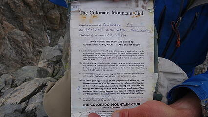
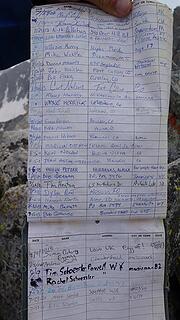
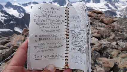
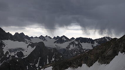
While we had the weather on our side, we wasted no time starting up the other side of Backpackers Pass and scrambling the south ridge towards Sunbeam. This route had too many back and forths to describe in full detail here, but the idea is that when in doubt, stay as close to the ridgecrest as you can. There were lots of inviting looking traverses that led well off of the crest, but it was best to make the class 3 and 4 scrambles to stay as close as possible, only deviating slightly to avoid 5th class towers or steps. The crux of the ridge is the final 150 feet, where a headwall guards the summit. We spotted what looked like a viable 3rd class bypass well off to the left by descending 50 feet into a loose looking gully, but I didn't want to do that, and was able to climb directly up the headwall, terminating directly on top. There may have been a move or two of low 5th climbing up but it was mainly 4th class. AMazingly we stayed dry the whole scramble up Sunbeam, however we could see a big thunderstorm coming our way as we took our snack break on the summit. It was already dumping on the northern peaks on Downs Mountain. We didn't stay long as we knew we were going to have to find a place to wait it out, ideally as close to Blaurock Pass as possible. The summit register on Sunbeam ended up being one of the more complete ones we saw, and over the course of just a page and a half showed 20 years of sign-ins.
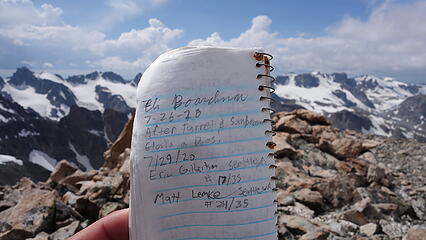
We wasted no time starting down the gentle easy east ridge to the saddle with Febbas. Just before we reached the saddle, the rain was almost on top of us, and we found a place to take shelter just a few feet down the steep east side of the ridge where it drops into the trailless North Fork Bull Lake Creek drainage. Here we were out of the wind and somewhat protected from lightning. It began to rain and thunder...
As the storm passed through, the rain came down hard, but we were hiding next to a wall on the leeward side so must of the rain was blowing sideways and not hitting us given our protected location. However a bolt of lightning struck the summit of Febbas just 0.4 miles away from us...good thing we were not up there at the time! About 25 minutes of waiting and the storm passed, and we had what appeared to be a 45 minute window to summit, and get off the wide summit plateau before the next storm in the distance would approach. So we raced up the final 700 feet to Febbas, which had an occational class 3 move. We actually followed a herd of mountain goats up the ridge, which left a lovely odor for us to inhale as we huffed our way up. We arrived on Febbas as the middle of the sun break between storms hit and we actually felt some warmpth. We enjoyed tis summit a little more since we were quick to tag and leave the other two. Another well cared for register greeted us, along with views of a large looking tower on Horse Ridge called Chimney Rock just a short ways off to the east. There's some interesting info about this rugged unranked 13er in my Febbas page on SP.
We started down, and took a technically easier route down to the north aiming for the west facing scree that drops down into the valley just west of Febbas and north of Sunbeam. It was a loose scree ski descent, which is where my knee really started to hurt the most, and slowed me down considerably. We eventually made the descent back down though, passed by a small tarn just before reaching the edge of the Dinwoody moraine, then re-ascended a few hundred feet up the moraine back to camp, completing the loop. We ended up getting hit by that next storm as we scrambled the moraine back to the tents. Dinner on this day was well earned, and we felt lucky to have snuck those ascents in between storms after having to wait for 2.5 hours early in the morning.
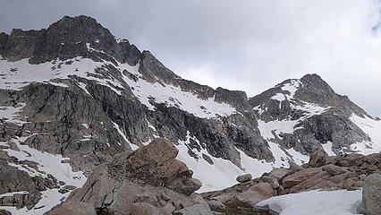
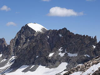
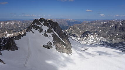
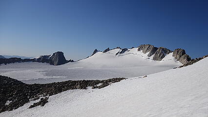
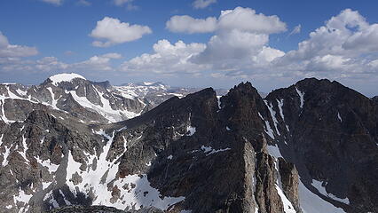
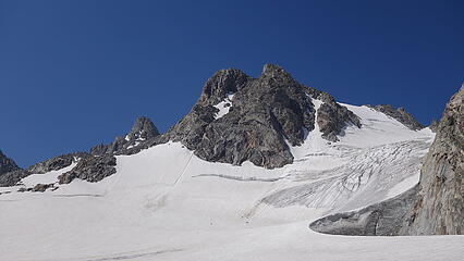
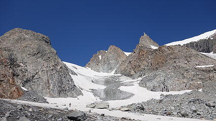
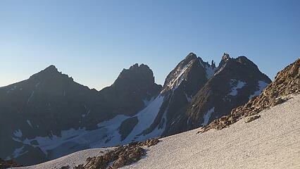
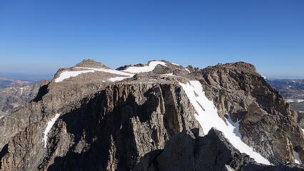
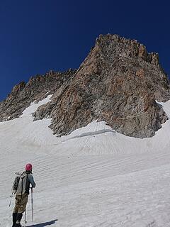
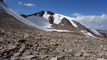
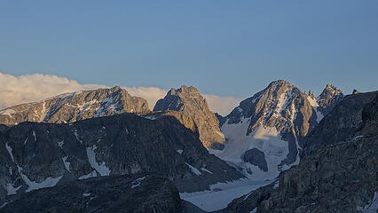
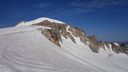
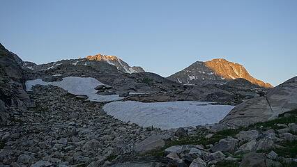
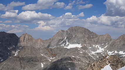
July 30 - Woodrow Wilson and Pinnacle Ridge; Move camp to edge of Gannett Glacier
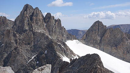
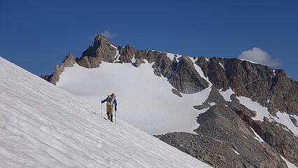
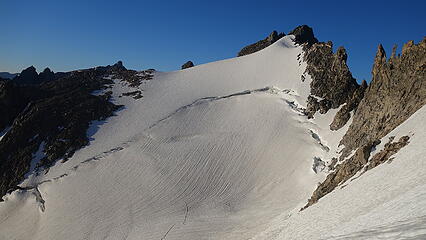
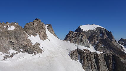
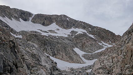
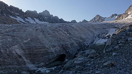
The following day, we got another 5:30am start and started hiking up the northern arm of the Dinwoody Glacier towards Pinnacle Ridge, the same way we saw Eli heading a few days prior. We had to navigate some bare ice and a couple cracks on the far right edge of the glacier where the snowpack had already completely melted, but it was just a short section, and soon enough we were cruising up moderate snow towards Pinnacle Ridge. This peak is barely a peak really, and is another one of the "barely has 300 feet of prominence" Wyoming 13ers, and sits about halfway between Woodrow Wilson and Gannett on the divide. Many smaller gendarmes and wicked looking towers line this part of the ridge, of which Pinnacle Ridge is the highest one.
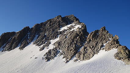
We ascended the snow finger that bisected the two high towers of Pinnacle Ridge, the left one being the true summit. The snow steepened to about 40 degrees on the final 100 feet or so, and once we reached this high 13290 foot notch, the remainder of the route presented itself as a 4th class scramble on the north facing short wall leading directly to the summit. A steep buttress blocks the view of this final 100 foot scramble from Dinwoody Glacier, and it only becomes visible just as you reach the notch. The final boulder on the summit is an 8 foot exosed slab that terminates at a singular point just big enough for one person to climb up and touch at a time. There was no register, so we didn't waste any time and descended back to the notch and began traversing down to the south over the top of the large rock buttress bisecting the north and the middle fingers of the Dinwoody. We descended down to the 12650 foot level on 35-40 degree snow and traversed across to the large bergschrund, which we rounded on the far left (east) side. The rest of the snow walk was now on very mellow 20 degree slopes all the way up to 13300 feet.
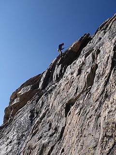
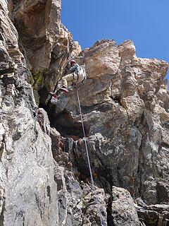
From the end of snow, a short boulder hop brought us to a small notch on the divide that allowed us to make a 50 foot descent down a sloping ledge to the north couloir. Once in the couloir proper we began scrambling left and up, entering class 4 terrain, then when we hit bare ice that was clinging in the upper couloir we decided to rope up since the ice made the climbing 5th class. I led one full 30 meter pitch from where we first hit the ice which took me all the way to the notch at the top of the north couloir, which is also where the south couloir ends as well. This was so far only the second peak we brought the rope out for and actually used. I thought the pitch was about 5.3 due to the ice. If it were dry it would have been 4th class. Eric followed and once at the notch, he led up the short one move wonder 5.0 section right above the notch, belayed me up the short step and we then scrambled the final 30 feet to the top.
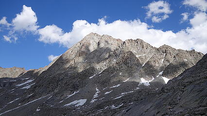
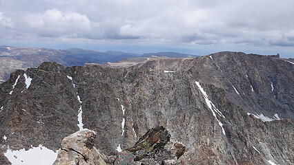
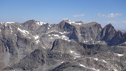
The summit of Woodrow Wilson sits in one of the best spots in the Winds, and I thought it was the best vantage to see the most epic scenery. Titcomb Basin was fully visible due south of us, and so many peaks north along the divide were clearly seen, as well as the Turret group we had just climbed the previous day. For me personally, Woodrow WIlson was my favorite WY 13er.
The time came to descend, and we downclimbed on belay the little 5.0 step back to the notch, then utilized an existing rap anchor at the notch to rappel 30 meters down the ice covered pitch I led (we brought out the second rope to make the full 30 meter rappel). After the rappel we scrambled the rest of the way back down, then back up to the notch in the divide where easy snow descending awaited us. Again though, the descending began to hurt my knee, and I had to walk like a penguin keeping my right leg straight as I pulled it forward with each step, and leading each step with it so it was bearing weight on the bones, rather than lowering me with a bent knee. My left leg ended up doing all the soft tissue weight bearing on descents for the majority of the rest of the trip. By the end of it, I learned how I could completely change my walk on descents to minimize the pain.
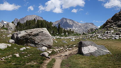
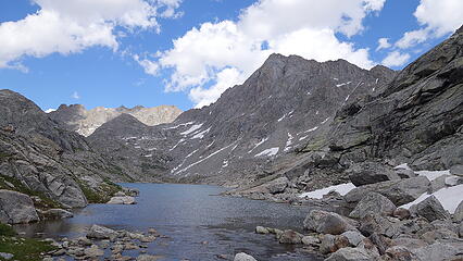
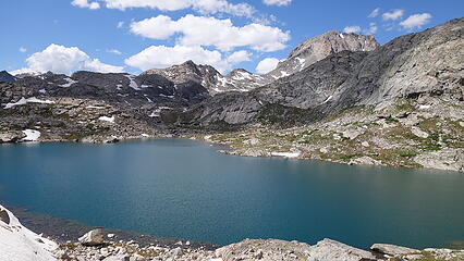
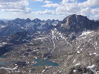
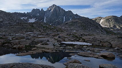
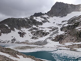
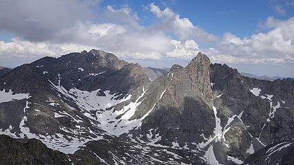
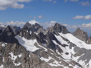
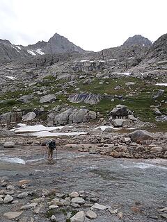
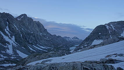
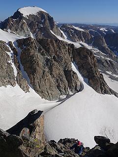
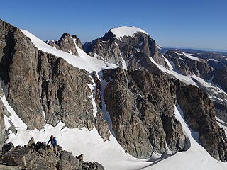
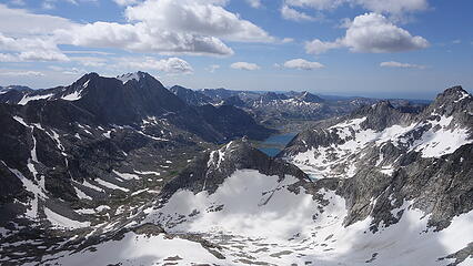
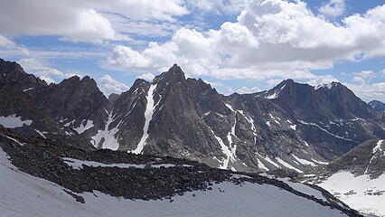
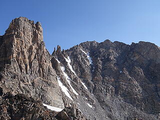
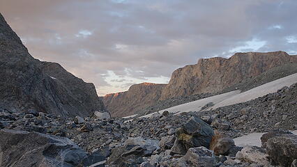
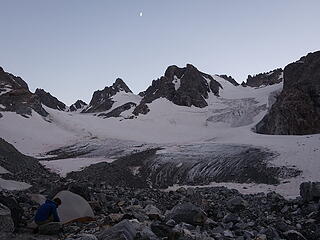
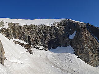
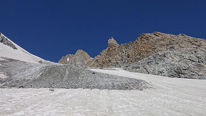
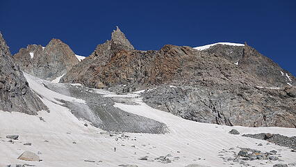
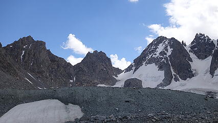
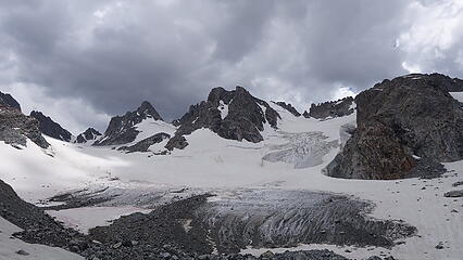
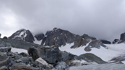
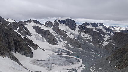
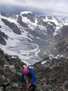
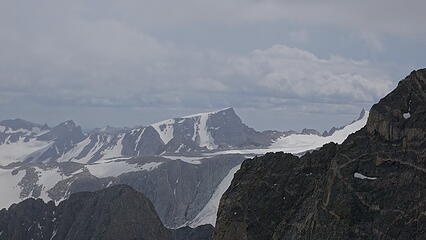
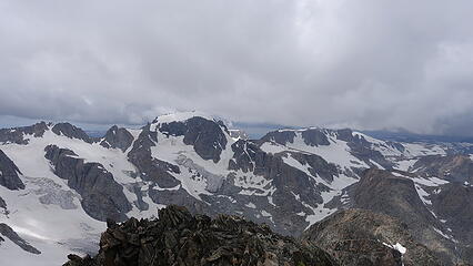
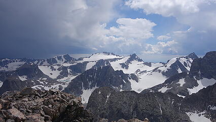
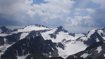
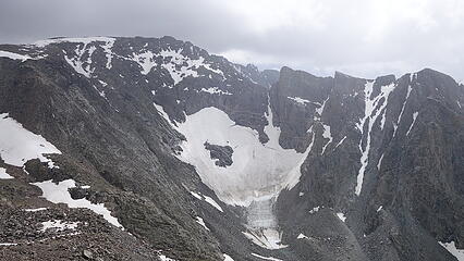
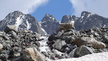
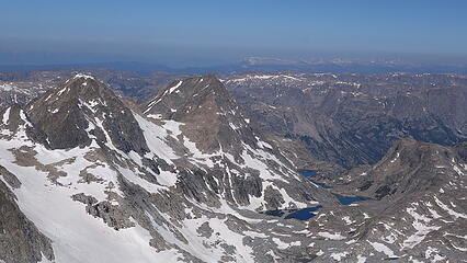
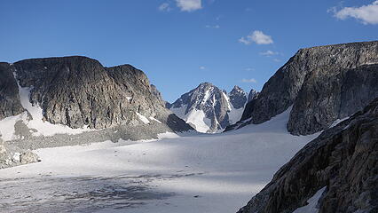
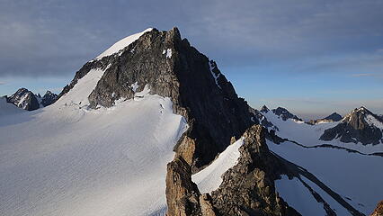
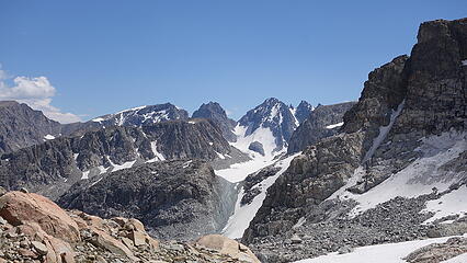
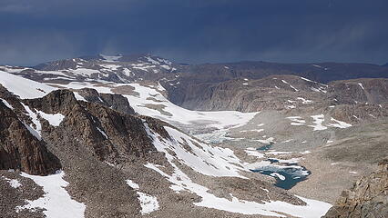
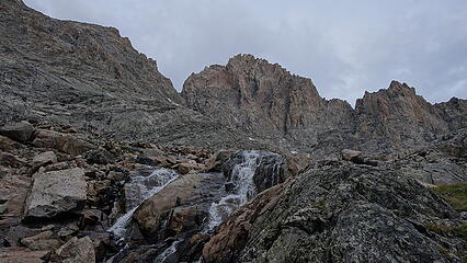
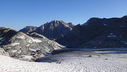
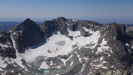
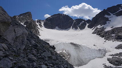
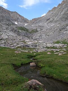
Once back at camp, the weather was still perfect, we we decided to move camp, since we had completed the six peaks surrounding the Dinwoody Glacier. We ate a meal, packed up and began walking towards West Sentinel and crossed over to the Gannett Glacier. I was hoping we would find a snow free place to camp at this pass between West Sentinel and Gannett but had no such luck, so we continued traversing across the Gannett Glacier on a gentle descending traverse towards the next saddle on the glaciers north edge. As we crossed this glacier at about the 11850 foot level, we finally got a profile view of Koven, our next objective and the crux peak of the whole trip. Here we managed to find some dry, easily maneuvered sandy ground, and even had a small running water stream coming off the snow to the west, so we made camp and cooked another dinner, since by this point we were at least 3 days ahead of my original estimated schedule.
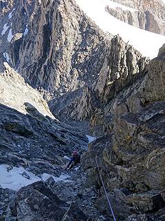
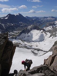
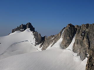
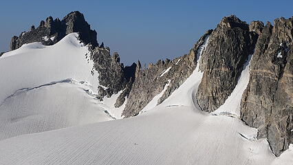
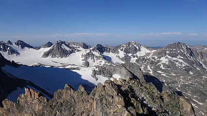
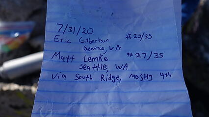
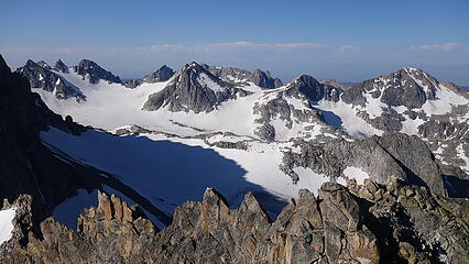
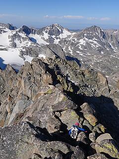
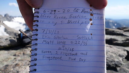
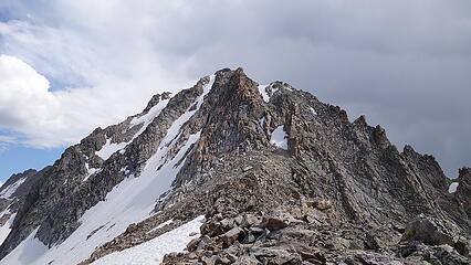
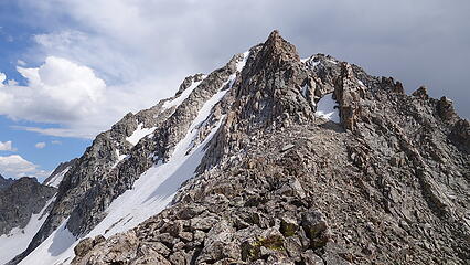
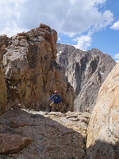
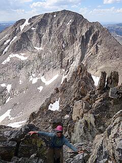
July 31 - Mount Koven, Point 13180 and Flagstone Peak
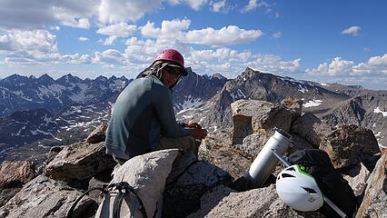
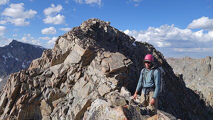
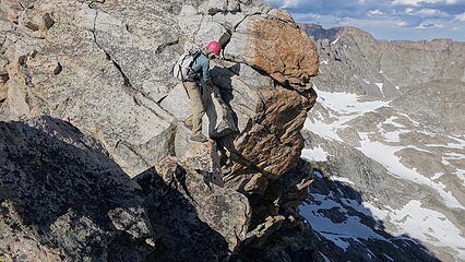
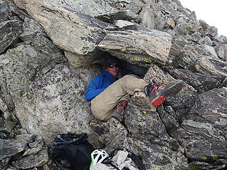
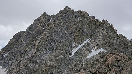
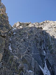
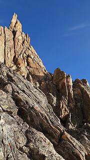
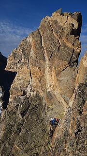
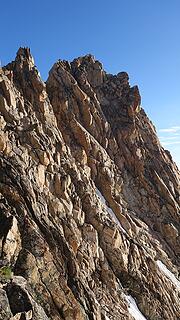
The time had come for the crux peak of the whole trip. The granddaddy of them all; the one with the most technical climbing, and the one with just about the longest approach distance of any of the 13ers. In an effort to keep step-by-step beta for this peak from appearing on too many computer screens, I am going to take a Mox Peaks approach and just post some photos, leaving the mystery in the eye of the next person who finds themselves up there to solve (I am also getting tired of writing this monster of a report  ) . I will say we climbed the south ridge/east face ledges route
If you really want some detailed beta, I posted a good route description on Summitpost for this, although I urge you to not spoil yourself before you go. If you're wondering why I even posted the SP page, it's because it provides the option for other climbers who can feel substantially less stressed by having the extra beta, and for those that don't want it they don't have to look.
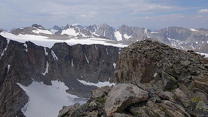
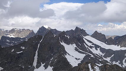
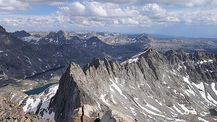
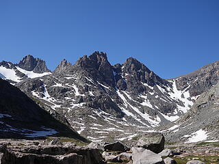
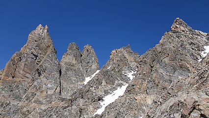
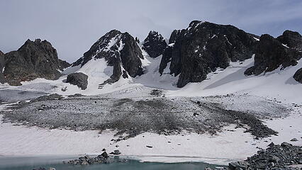
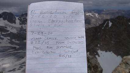
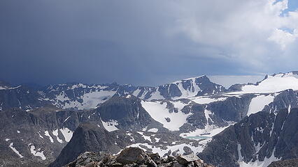
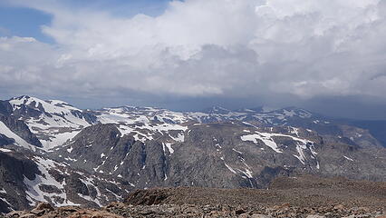
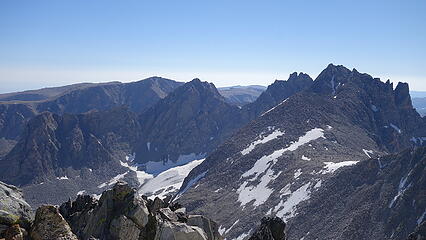
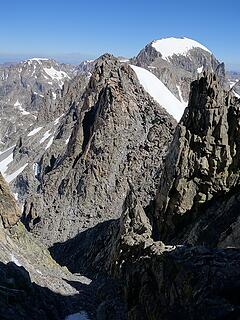
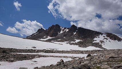
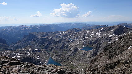
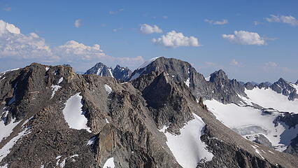
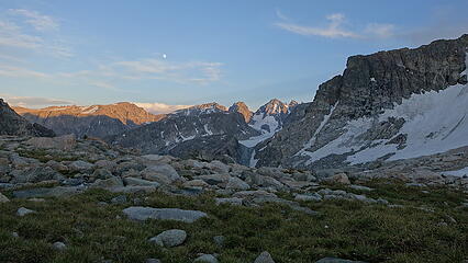
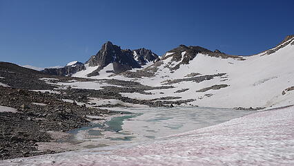
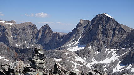
We topped out by mid-morning having completed the last technical Wyoming 13er, and we still had plenty of daylight left. We enjoyed the views from this lowly perch with both Gannett to the south and Bastion to the north towering high above us. The summit register hadn't been signed in years, except for Eli just a few weeks before us. We made the descent and headed back to camp, packing up and continuing north towards the Grasshopper Glacier along what is part of the Wind River High Route, hiking around the east side of Bastion Peak. We found a flat place to camp just below the NE peak of Bastion, which has a very impressive wall. This camp would be the northernmost campsite for the trip.
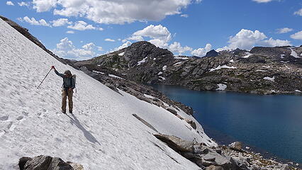
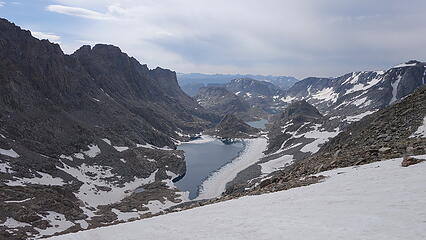
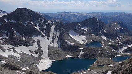
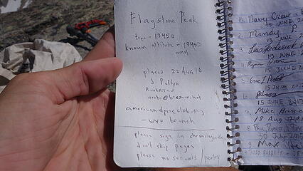
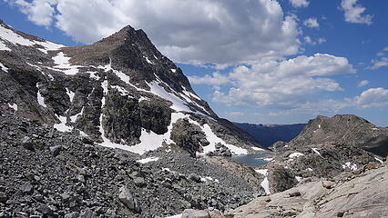
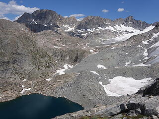
We then loaded the day packs again and headed west into the wide basin north of Bastion Peak, and aimed for the small notch in the east ridge of Point 13,180 (AKA South Downs) ascending stable talus for about 600 feet from the basin. The final 50 feet or so along the ridgecrest to the summit had a few class 3 moves, but man we had really emerged into exceptionally more gentle terrain as soon as we left Koven. By mid afternoon we stood on top of my 28th 13er on the trip, and we weren't done for the day yet. We descended north into the next basin and traversed to the Flagstone/Pedestal saddle, and made the easy walk to the summit of Flagstone Peak via it's class 2 north ridge. The summit of this peak had the last summit register we would find on the trip. Eric continued up to tag Pedestal while I started down, since I had climbed Pedestal 9 years ago back in 2011 as part of this trip.
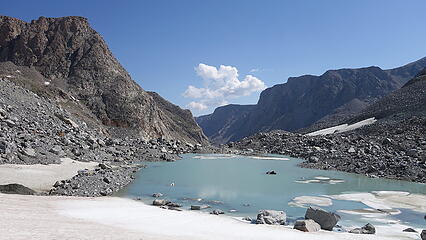
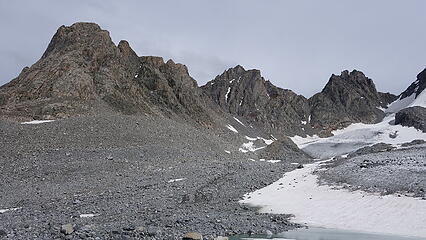
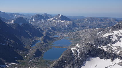
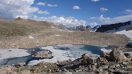
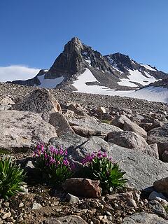
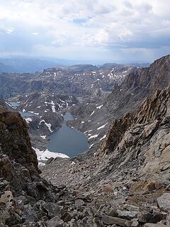
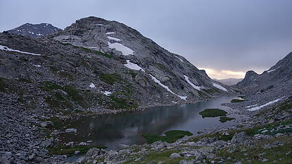
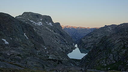
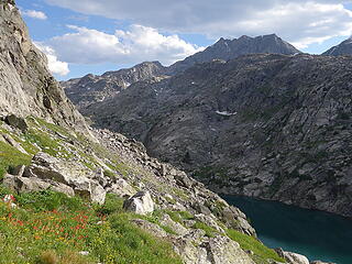
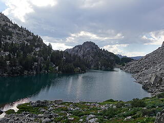
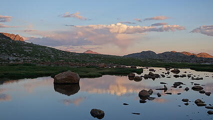
Instead of hiking back over Point 13180 on the way back, we just hiked down the second basin to the east, and down the ridge separating the two basins to one of two large lakes at the south terminus of the Grasshopper Glacier. The southern of these two lakes has deep blue water, and is where the ridge I descended dumped me, however there is also a northen lake that has aqua, milky green colored water, where a 50 foot high ice cliff towers above the north edge of the lake. Once I reached the lake, it was a short walk south back to the tents. Just before reaching the tent, I stopped to take some awesome photos of the NE peak of Bastion with the wildflowers that were framed so perfectly.

August 1 - Klondike Peak, Pack over Bastion Peak and Desolation Peak
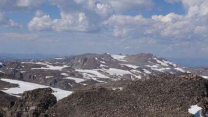
I slept in while Eric got a 4am start since he had to hike ALL the way north to Downs Mountain and Point 13062, peaks I thankfully tagged on my 2011 trip. It was a 19 mile round trip for him from our camp to summit these two easy class 2 talus heaps. I started at 7am and since I missed Klondike 9 years earlier, I still had to walk north a smaller distance and slog up this peak. This particular morning my knee was hurting the most, and I made slow progress on the mellow slopes to the summit, which was covered in a large snow cornice/wall thing. As I approached the upper slopes I saw Eric's crampon steps from a few hours earlier. I tagged every rock outcrop I could find on the summit plateau just in case, and really enjoyed reminiscing from my trip 9 years ago. From Klondike I was able to see almost all of the backcountry route we traversed back then, and had an excellent view down Tourist Creek, where we descended.
By noon I was back at the tents and sat on a cozy rock, ate some food and waited for Eric to get back. Around 2:30pm he arrived, and since clouds weren't building up that much we decided to keep going; packed up our big packs and started up towards Bastion. By this point the packs were less than 50 pounds, and getting more manageable, but it was still no picnic hiking up the steep talus on the north side of Bastion for just over 1000 feet. Luckily the little bit of cloud cover we had made the ascent up not super hot, and it even drizzled a little which was somewhat pleasant.
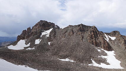
We dropped the packs just a few dozen feet below the highest point and tagged the summit. It was an interesting place up there, a large gentle summit plateau with a maybe 10 little rocky mounds almost making it maze-like. Adding to the allure of this high plateau is the fact that it's surrounded by huge cliffs on all sides, with only a couple small weaknesses allowing easy passage, one of which we had just ascended. The other main weak point allowing access to the Bastion summit plateau (which also includes unranked 13er Rampart) is the gully dropping to the west. This was our ticket back to the west side of the crest, and we were able to locate it after rounding all around the southern side of Rampart Peak (which isn't much more than a knob).
A narrow at first talus gully presented itself, which is not super visible from vantages to the north or south (we actually had some doubt it would exist since it wasn't visible from Gannett, or Flagstone), however a steep buttress hides this gully from view on both north and south sides. We began descending down, moving pretty slow due to my knee, but I knew if I got down this, there would be only one more hideous gully to descend with the packs before we hit trails again. We made it down 1000 feet to the 12260 foot Desolation Col, which involved plenty of loose crap. At the col, which few people ever venture to, the east ridge of Desolation was right above us. There was no beta for this route in the guidebook, but it looked very reasonable, and actually also looked super fun!
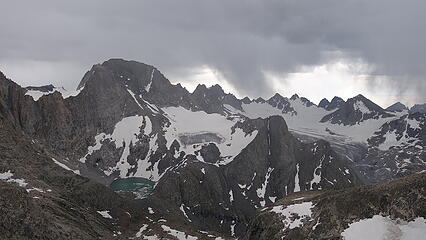
We dropped packs and started up, which immediately was an enjoyable solid scramble with airy exposure on both sides. The difficulty never exceeded class 4 on this ridge that rose 900 feet, and any time we ran into a more difficult section, it was a simple traverse slightly to the south side to bypass. About 2/3 of the way up the ridge, a thunderstorm was passing just south of us, dropping lots of rain on Gannett, Mamoth Glacier and Koven. We decided to sit under a small overhang on the east ridge for a few minutes just in case, but we never really got rained on, as the storm just barely missed us. It was soooo cool watching the lightning, and the storm from up close slowly glide over the crest and diminishing from view to the east. We commented how few people probably ever get to watch an alpine storm from high on an undocumented ridge on a very remote peak. It was a cool experience. After sitting for about 15 minutes we finished the scramble to the top.
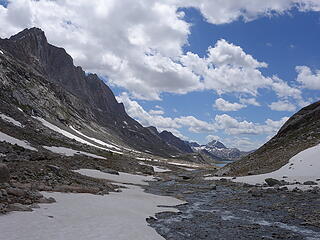
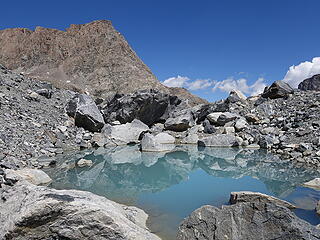
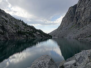
The summit of Desolation Peak is also flat topped and square shaped, and has narrow ridges dropping on each of the 4 corners of the square. This gives the peak the appearance of a chopped off pyramid when viewed from Google Earth. We got some sunny weather return as we admired the view of the crest from Desolation, which is slightly removed from the divide to the west. There was again, no register. The scramble back down was efficient, and we saddled back up and descended south from the col down a narrow valley between Desolation and the west face of Rampart. We reached a tiny pond at 11400 feet, just below the milky glacial lake below the west face of Koven. We scouted a route down the south side of the waterfall draining the small pond, and about halfway down we crossed the stream to the north and was able to string together grassy ledges and slopes down to the long skinny lake at 10800 feet. We camped at the far east end of this amazing lake that was reminiscent of a Norwegian fjord! Just as we started to put the tents up, as it was getting dark and the sun had set it started raining, forcing us to scramble to get them up and race inside that we both had to cook dinner from the tents; the only night on the whole trip we did that.


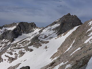
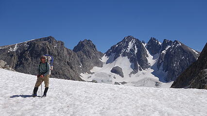
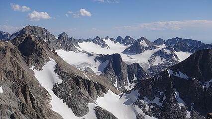
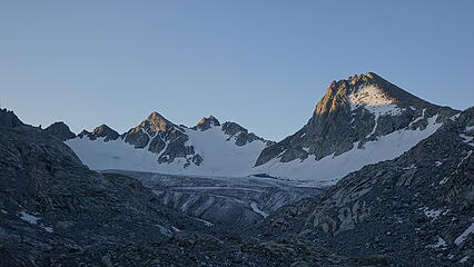
August 2 - West Twin, Split, and Whitecap; Pack all the way to Shannon Pass
The next morning, since we didn't get to sleep until after dark we agreed to start 30 minutes later at 6am to catch some extra sleep, plus we were beginning to slightly notice the shorter days beginning at 5:30 every day. We continued hiking cross country southward, over a small ridge and to the icy toe of the Massive Mammoth Glacier. We continued right, bypassing the bare ice where the edge of the glacier met the moraine and rocky slabs until we were more or less level with the main body of the glacier, and found a nice rocky perch to store the packs for awhile. We took a quick rest to snack and for me to fill water (since I certainly wasn't carrying any when we had the packs), and put our day packs together. We continued walking up the very low angle Mammoth Glacier, all the way back to the saddle between the Twin Peaks. Since we were informed that West Twin could possibly be higher than East Twin, we decided we might as well tag it as well, since it didn't add much time to go back to that saddle from the north and scramble the 150 foot class 3 ridge.
While we were there, I did some rudimentary tests to try and determine which of the two was taller, and couldn't make a difinitive solution. I described my tests on my Twin Peaks page on Summitpost that I wrote if you're curious.
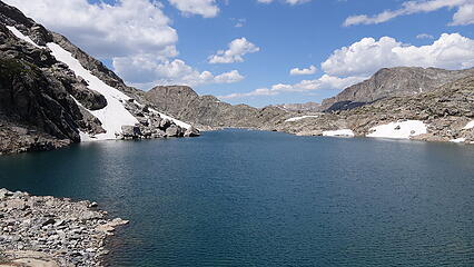
We descended back from the saddle onto the Mammoth once again, and circled around and made an ascending traverse heading up lower angle snow to the west side of Split Mountain to the broad saddle at the base of Split's class 2 west ridge. This saddle can apparently also be accessed from the south via Peak Lake up that basin as well. On both of my big Wind River trips, we never found made it in that valley above Peak Lake nor did we ever head over Knapsack Col...we didn't really find it as a useful pass despite how popular, and simple it is to use it to connect back to Titcomb Basin.
From the broad saddle, it was easy talus hopping up the somewhat steep west ridge to the summit. This was was nice because there were no false summits...the west ridge went from steep, to summit with no BS. Knowing we still had a long way to go, we didn't stay long and ran/glissaded back to our pack stash, ate a lunch (I cooked some of my extra oatmeal) and continued packing west over three lateral moraines. The first was one from the Mammoth Glacier while the next two were dumped from the now mostly gone Baby Glacier. We rounded the south side of the unnamed lake at 11260 feet, then ascended steeply up the initial slopes towards Stone Pillar Pass. I actually had to climb a class 4 chimney to get up a small cliff band onto steep grassy slopes above, since we didn't want to ascend the 45 degree rotting snow just to the left. We then followed ledges, switchbacking up to the north of the slabby terrain that guards the lower slopes below Stone Pillar Pass. We found quite a few cairns as well, but it would be hard to routefind your way down this route without having done it before.
At 11900 feet, the terrain eased up considerably, and we finally reached the pass, dropped packs again, and started up the NW ridge of Mount Whitecap. This route was actually one of the more interesting ridges of the trip, but was not super high quality. The crux was climbing the 40 foot icy snow patch on the very first part of the route, which ascended up to a wide, open-top tunnel like feature with a short towering cliff on both sides. Once through this, we continued scrambling on the right (south) side of the crest bypassing some towers/cliffs on the ridge. The route was kind of a pick your own adventure for most of it, with difficulty ranging from class 2+ to class 4, with better rock on the class 4 options. A subsiduary ridge dropped off to the right (southeast), and just above that we regained the main crest of the NW ridge. Here a couple mandatory 4th class moves were required to reach the small summit area, which included a small crack filled slab with a notch descent, then a 9-10 foot near vertical step, but with good holds. After those two obstacles it was an easy stroll to the top.
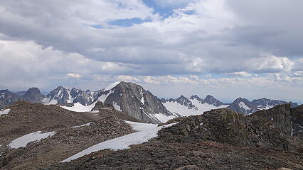
From this vantage, we had an excellent view of Bow Mountain; my only remaining 13er! I was getting pretty stoked to be nearly done, and in just over 12 hours I would become the 3rd public finisher of the WY 13ers. I snapped some good photos since the mid afternoon light was getting pretty good, but we still had a long way to go, having to descend all the way to Stonehammer Lake, then back up to Shannon Pass before we could camp.
Descending back to the packs was a breeze, but descending down the west side of Stone Pillar Pass with the packs was again slow going with my knee, plus the rock and scree was real loose. A flat grassy basin was reached down at 11050 feet which would have been a gorgeous place to camp, but we continued on, descending steepening talus which increased in boulder size as we dropped to Stone Hammer Lake. We even ran into some Cascades-type bushwhacking down a steep, narrow wet vegetation filled gully using veggie belays and getting swarmed by mosquitos for about 150 feet. This would be the only bushwhacking we did on the trip...and arriving at Stonehammer Lake we saw the first trees we had seen since day 3!
An unexpected difficulty followed after we reached the lakeshore, which was the rediculous house sized boulders we had to navigate through as we traversed around the east side of Stonehammer Lake. This was very slow going, and often requiring more class 3 scrambling with exposure in the form of death holes with dark bottoms that could not be seen  We were happy to be through that when we reached more grassy terrain on the final hike back up to Peak Lake, where we saw a handful of parties camped. One such party was no ne other than Doug Walsh, and another past Bulger finisher. They too were out in the Winds climbing some 13ers, although not quite doing them all. What were the odds at having 4 Bulger finishers run into each other inthe middle of the Winds! It was super cool running into them, and we chatted a bit about our respective trips.
Since the sun was close to setting, and we still had to hike over Shannon Pass we continued on, now reaching an actual trail! We felt like we just entered a major city haha. The trail up to Shannon Pass was quick, and just a half mile or so on the south side, where a wide expanse of open terrain was found just below Bow Mountain we set up camp in twilight. By the time I had dinner cooked it was dark, however we still wanted to start at 5:30 the last morning to ensure we could hike all the way out and make it to Burger Barn in Pinedale before they closed. This ended up being one of the longest days, and the most mileage we did with the packs other than the deproach the following day.
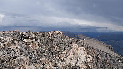
August 3 - Bow Mountain, hike out
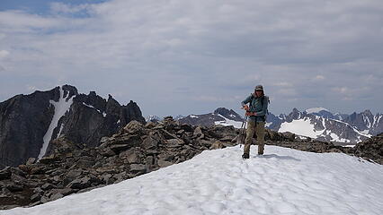
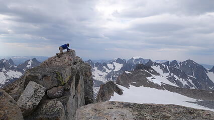
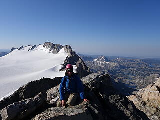
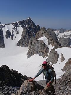
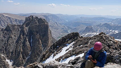
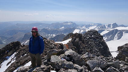
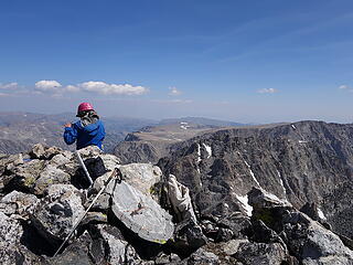
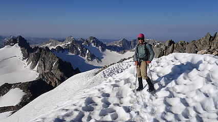
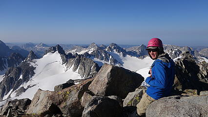
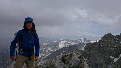
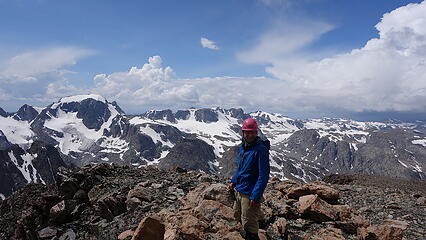
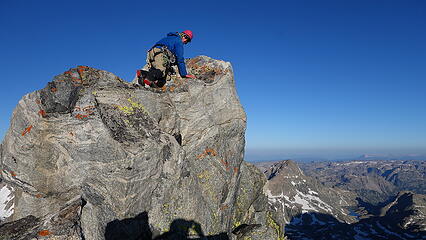
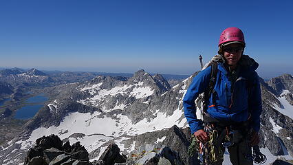
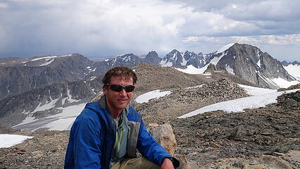
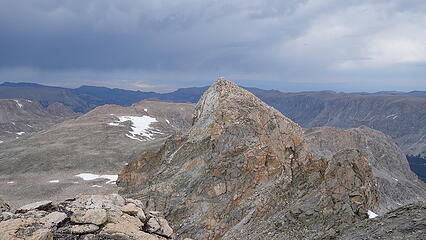
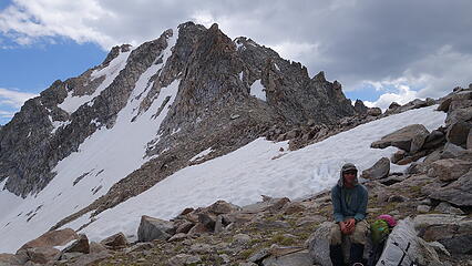
The last morning was upon us! At 5:30am again we started the short ascent up the SW slopes of Bow Mountain which was only a 2000 feet above. Another talus gully was ascended to the west ridge, intersecting it at a notch directly to the SE of Brinstone Mountain. Then a short class 3 zone on the ridge opened up to a third of a mile or so boulder hop to the summit which we reached around 7am. I stood on top of Bow Mountain at 7:04am on August 3rd to finish the Wyoming 13ers, and had Eric take a photo of me...the only photo showing my ugly face in this whole report 
We enjoyed the early morning light, and admired the gnarly looking traverse to Arrowhead from Bow, which actually looked like an incredible alpine traverse perhaps mid 5th class...something to maybe come back to! Unfortunately my second camera battery died right before we reached the summit, so I didn't get any camera photos from the very top but Eric grabbed a few for me.
By 9:20am after descending back, we were packed up and started hiking out...ok I lied, there's one more photo of me jumping across a creek on the hike out on Jean Lakes Trail, because I was far too lazy to take my shoes off. Even more maddening was that 5 minutes later the trail crossed back to the other side of the creek with seemingly no reason whatsoever to even have bothered to cross at all. Some cloudcover made the first third of the hike out enjoyable, but once we reached Fremont Crossing the sun burned through and we had a hot hike back. We really entered the city now as we passed quite a few groups headed in. We made it back to Burger Barn by 6pm ad I ate a triple cheeseburger and two large Oreo ice cream shakes in virtually no time at all, and left the place still hungry! Eric got a motel in Pinedale and was nice enough to let me shower before I started back. He continued on to Montana and finished the Montana 12ers while I hung up the boots to let my knee recover.
Upon returning home, I weighed myself and was aghast to find out I had lost 20 pounds 
It took me 8 years to be able to maintain my 205 pound weight, and in 3 weeks I was down to 184 (and I cannot aford to ever lose weight!).
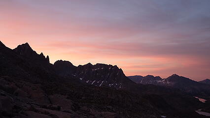
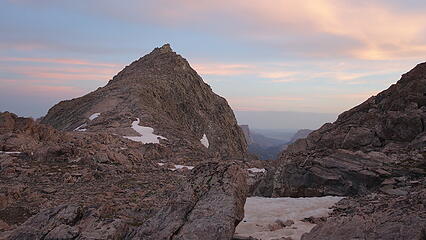
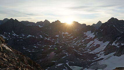
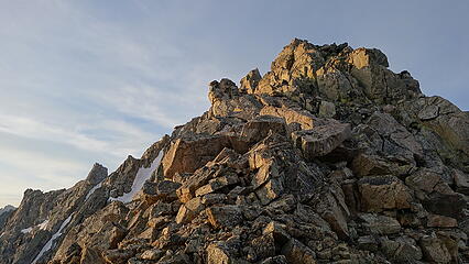
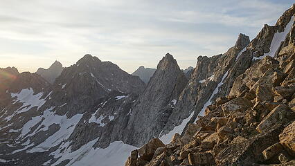
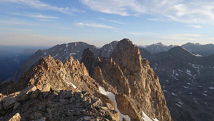
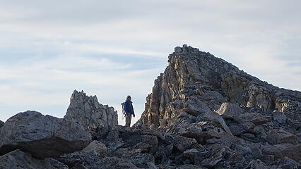
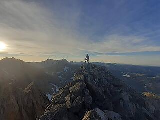
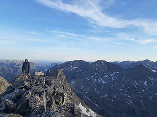
Some final notes for the trip:
This was a new record for me for the longest amount of time I was in the backcountry without returneing to my car or any form of civilization. Previously, that record was held by my 12.5 day trip into the Gates of the Arctic in Alaska, exploring the Arrigetch Peaks area.
We only used ropes for 3 of the peaks; Spearhead, Woodrow Wilson and Koven.
We collectively agreed that the hardest 5 Wyoming 13ers, in the conditions we encountered were in this order:
1. Mount Koven - Class 5.3
2. Spearhead Pinnacle - Class 5.3
3. Mount Woodrow Wilson - Class 5.1-5.3
4. Turret Peak - Class 5.0
5. Sacajawea Peak - Class 4