LEMKE CLIMBS
  • About
    • Whats New
    • 2019 Goals/Wishlist
    • Contact
  • Washington
    • North Cascades >
      • Sahale Peak, Boston Peak
      • Eldorado Peak, Klawatti Peak
      • Black Peak
      • Forbidden Peak West Ridge
      • Primus Peak Attempt
      • Big Snagtooth
      • Liberty Bell Beckey Route
      • Burgundy Spire North Face 5.8
      • Ragged Ridge - Katsuk, Kimtah and Cosho Peaks
      • Colfax Peak
      • South Early Winters Spire via SW Buttress
      • Chilliwack Mini-Slam
      • Mesahchie Peak
      • Inspiration Traverse
      • Mount Shuksan Ski
      • Full Pickets Traverse
      • Mount Goode NE Buttress & Storm King
      • Mount Baker North Ridge WI3
      • Snowfield Peak
      • Lincoln Peak
      • Silver Star Mountain
      • Mount Buckner & Horseshoe Peak
      • Azurite Peak
      • Tower Mountain & Golden Horn
      • Mount Logan
      • Custer Ridge & Easy Mox
      • Mazama Dome
      • Sherman Peak
      • Mount Ballard
      • Southern Pickets Traverse
      • Corteo Peak
      • Whatcom Peak
      • Castle Peak
    • Glacier Peak Wilderness >
      • Buck Creek Pass, Cloudy Peak, Spider Gap
      • Dome Peak, Spire Point
      • Mt. Maude and Seven Fingered Jack
      • Mount Formidable NE Face 5.6 Second Ascent
      • Dumbell and Greenwood Mountains
      • Glacier Peak Wilderness Mountain Massacre
      • Clark and Luahna Peaks
      • Sinister Peak
      • Chiwawa Mountain
      • Tupshin & Devore Peaks
      • Buck & Fortress Mountains
      • Glacier Peak
      • Snowking Mountain
    • Olympic Peninsula >
      • Buckhorn Mountain
      • Flapjack Lakes Hike
      • Grey Wolf Peak, High Divide Trail
      • Mount Ellinor
      • Mount Constance West Arete
      • Mount Olympus
    • Alpine Lakes Wilderness >
      • Chikamin Peak
      • PCT - Snoqualmie to Pete Lake
      • Necklace and Tank Lakes
      • Enchantments Day Hike
      • Granite Mountain (Snoqualmie)
      • Colchuck Peak
      • Cannon, Enchantment and Stuart
      • Ingalls Peaks
      • McClellan Peak
      • Dragontail Peak
      • Web Mountain
      • Mount Index Attempt
      • Snow Creek Wall Orbit 5.8+
      • The Tooth South Face
      • Eightmile Mountain
      • Argonaut Peak NE Couloir
      • Little Annapurna South Face 5.5
      • Snow Creek Wall Outer Space 5.9
      • Cashmere Mountain
      • Sherpa Peak North Ridge 5.8
      • Chair Peak NE Ridge
      • Lichtenburg Mountain
      • Mount Index
      • McClellan Butte
      • Chimney Rock
      • Alpine Lakes High Route
    • Pasayten Wilderness >
      • The Craggies
      • Tiffany Mountain
      • Pasayten Mini-Slam
      • Remmel Group
      • Jack Mountain
      • Robinson Mountain
      • Monument Peak Group
    • Mountain Loop Highway >
      • Vesper Peak
      • Mount Dickerman
      • Sloan Peak West Face 5.8
      • Mount Forgotten
      • Whitehorse Mountain
      • Gothic Peak
    • Lake Chelan Sawtooth Wilderness >
      • Star, Courtney, and Grey Peaks
      • Hoodoo Peak and Raven Ridge
      • Abernathy Peak
      • Mount Bigelow
      • Reynolds Peak
      • Oval Peak
      • Gardner Peaks
      • Chelan Sawtooth Trio
    • Southern WA >
      • Mount Adams
      • Mount Rainier - Emmons Route
      • Mount Saint Helens
      • Goat Peak
      • Lane Peak, Plummer Peak (Tatoosh)
      • The Unicorn (Tatoosh)
      • Little Tahoma
      • Liberty Cap
    • WA Rock and Ice Cragging >
      • Index Town Walls
      • Vantage
      • Mount Erie
      • Exit 38
      • Leavenworth
  • Colorado
    • San Juan Mountains >
      • Mount Sneffels Lavender Snow Climb
      • Uncompahgre, Matterhorn Peaks
      • Redcloud, Sunshine Peaks
      • San Luis Peak
      • Vermilion, Fuller Peaks
      • Stewart Peak, Baldy Alto
      • Jones, Niagara, American Peaks
      • Wetterhorn Peak, Handies Peak
      • Wilson Group
      • Arrow Peak
      • Mount Sneffels SW Ridge
      • Jagged Mountain, Chicago Basin
      • Teakettle Mountain
      • Dallas Peak
      • Vestal Peak Wham Ridge, Greystone Peak
      • Organ Mountain
      • Phoenix Peak
      • Half Peak
      • Point 13832 Group
      • Golden Horn
      • Mount Sneffels Snake Couloir
      • Pigeon, Turret Peaks
      • Trinity Peaks
    • Elk Mountains >
      • Four Pass Loop
      • Castle, Conundrum Peaks
      • Snowmass Mountain
      • Cathedral Peak
      • South Maroon Peak
      • The Pyramids
      • North Maroon Peak, Sleeping Sexton
      • Capitol Peak, Mount Daly
      • Malemute Peak
      • Hagerman Peak
    • Sangre de Cristo Mountains >
      • Blanca Peak, Ellingwood Point
      • Challenger Point
      • Mount Adams
      • Spread Eagle Peak
      • Humboldt, Obstruction, Columbia Peaks
      • Mount Lindsey, Huerfano Peak
      • Little Bear Peak
      • Crestone Needle Ellingwood Arete
      • California Peak
      • Crestone Peak North Buttress
      • Operation Dark Snake
      • Kit Carson Mountain
    • Sawatch Mountains >
      • Iowa Peak
      • Point 13,618 - Hunky Dory Lake
      • Gold Dust Peak, Notch Mountain
      • Mount Jackson
      • Mount Belford
      • Shavano, Tabeguache Peaks
      • Mount Antero, Cronin Peak
      • Twining Peak
      • Mount Massive
      • Casco Peak
      • Mount Huron
      • Mount Elbert
      • Mount Oxford
      • Mount Hope
      • Mount Yale
      • Lackawanna Peak
      • Mount Columbia
      • La Plata Peak
      • Rinker and Twin Peaks
      • Bull Hill, Mount Princeton
      • Missouri Mountain
      • Mount Oklahoma
      • French Mountain
      • Mount Ouray
      • Grizzly A, Garfield Peaks
      • Mount Harvard
      • The Three Apostles
      • Emerald Peak
      • Holy Cross
      • Mount Aetna
      • Deer Mountain
    • Greater Park Range >
      • Kneeknocker Pass, Piney Lake
      • Drift Peak
      • Sherman Peak, Dyer Peak
      • Gore Range Traverse
      • Quandary Peak
      • Pacific, Atlantic Peaks
      • Clark Peak
      • Crystal Peak, Peak 10
      • Fletcher Mountain
      • The DeCaLiBron
      • Loveland Mountain
      • The Mosquito Traverse
      • Mount Arkansas
      • Clinton Group
      • Eagles Nest, Peak C
      • North Star Mountain
      • Peak X
      • Wheeler Mountain
    • Front Range >
      • Mount Evans, Spalding
      • Mount Bierstadt
      • Mount Parnassus, Bard Peak
      • Cupid, Sniktau, Grizzly D Peaks
      • James Peak
      • Mount Silverheels
      • Grays and Torreys Peaks
      • Mount Edwards
      • Mount Flora, Longs Peak
      • Square Top Mountain
      • Petit Grepon South Face 5.8
      • Mount Meeker Dreamweaver Couloir
      • Santa Fe Peak
      • The Citadel & Pettingell
    • Colorado Ice Climbing >
      • Lincoln Ice Falls
      • Ouray Ice Park
      • Avocado Gully and The Drool
      • Hidden Falls
    • Colorado Rock Climbing >
      • Eldorado Canyon
      • The Flatirons
      • North Table Mountain
      • Colorado National Monument >
        • Independence Monument
  • Wyoming
    • Wind River Mountains >
      • Gone With the Winds
      • Union Peak - Solar Eclipse
      • Wind River Peak
      • Wind River Slam
    • Teton Range >
      • Grand Teton Owen Spalding 5.4
      • Mount Owen Attempt
    • Wyoming Absarokas and Gros Ventre Range >
      • Jackson Peak
      • Francs Peak
    • Yellowstone National Park >
      • Top Notch Peak
    • Bighorn Range and Great Divide Basin >
      • Boars Tusk
      • Loaf Mountain
      • Cloud Peak
      • Black Tooth Mountain
    • Devils Tower
    • Cody Rock and Ice Climbing
  • Montana
    • Beartooth Mountains >
      • Whitetail Peak Group
      • Beartooth Mountain
      • Spirit Mountain Group
      • Mount Peal
      • Granite Peak Group
      • Castle Rock Group
      • Castle Mountain NE Couloir
      • Mount Inabnit and Sylvan Peak
      • Mount Hague South Slopes
      • Mount Villard and The Granite Peaks Traverse - 5.4
      • Spirit Mountain NE Ridge - 5.4
      • California Ice WI 4
      • The Ramp 5.8
      • Linea Alba 5.10d
      • Iceberg Peak
      • Metcalf Mountain North Rib 5.8
      • Villard Spires HP West Ramp
      • Cairn Mountain
      • Snowbank Mountain
      • Mount Wood Group
      • Bears Tooth
      • Glacier Peak Catch-a-Sunrise FA
    • Southwest Montana Ranges >
      • Madison Range >
        • Koch Peak
        • Sphinx Mountain
        • Beehive Peak
        • South Sheep Mountain
      • Gallatin Range
      • Bridger Range >
        • Sacajawea Peak
        • Saddle Peak
        • Baldy Mountain
        • Ross Peak
      • Montana Absorakas >
        • Arrow Peak
        • Black Mountain
        • Mount Cowen
      • Tobacco Root Mountains >
        • Hollowtop Mountain
        • Belle Point
        • Noble Peak
        • Leggat Mountain
      • Crazy Mountains >
        • Crazy Peak
    • Glacier National Park >
      • A Taste of Glacier National Park
      • Divide Mountain
    • MT Rock and Ice Climbing
  • Utah
    • Uinta Mountains >
      • Kings-Emmons Ridge Run
      • Hayden Peak
      • Iron Hayden Wall Rock Climbing
    • Wasatch Range >
      • The Sundial Eleventh Hour 5.8
      • Mount Timpanogos
    • San Rafael Swell >
      • Ramp, Cistern Canyons
      • Salt Wash, Black Mountain, Moroni Slopes
      • Ding, Dang Canyons
      • Little Wild Horse, Bell Canyons
      • Quandary Canyon
      • San Rafael Knob
      • Miners Hollow (Knotted Rope Canyon)
      • Temple Mountain
      • Chimney Rock
      • Bottleneck Mesa
      • Window Blind Peak
      • Lower Baptist Draw & Upper Chute Canyon
    • Capitol Reef National Park >
      • Cathedral Valley Tour
      • Sheets Gulch
      • Halls Creek Narrows
      • Brimhall Canyon and Strike Valley Overlook
      • George Benchmark
    • Moab Area, Canyonlands, Arches >
      • Maze District
      • Needles District
      • Maze District
      • White Rim Trail Biking
      • Elephant Butte, Bullwinkle Tower and Lizard Rock
      • South Six Shooter
      • Elephant Canyon
      • Parriott Mesa
      • Ancient Art
      • Castleton Tower North Chimney 5.8
      • Klondike Bluffs
      • Mount Peale & Tukuhnikivatz
    • Robbers Roost Country >
      • Horseshoe Canyon, Goblin Valley
      • Bluejohn Canyon
      • Happy Canyon Narrows
      • Shenanigans, Leprechaun Slots
      • Larry Canyon
      • Merry Piglet Slot
      • Lower Maidenwater Canyon, Turkey Knob
      • Morocco Canyon
      • Monkey Business Slot
      • Hog Canyon Slots
      • Upper Maidenwater Canyon Slots
      • Mount Ellen
      • Buck Canyon
      • Point 4906
      • Alcatraz Canyon
      • Hard Day Harvey Slot
      • Mount Ellsworth
      • Good Day Jim Canyon
      • White Roost Canyon
      • Upper Stair Canyon
      • Dragon Canyon
    • Escalante National Monument >
      • Phipps Canyon and Arch
      • Red Breaks Slot
      • Dry Fork Slots, Coyote Gulch
      • Little Death Hollow/Wolverine Canyons
      • Egypt 3 Slot
      • Egypt 1 Canyon
    • Zion/Bryce >
      • Ataxia Tower Ashtar Command 5.9
      • Mount Kinesava Cowboy Ridge
      • Birch Hollow
      • Aires Butte
      • West Temple
      • Mystery Canyon
      • Crazy Streak
    • Cedar Mesa Region/Valley of the Gods >
      • Eagle Plume Tower Eagle Feather 5.10b
  • California
    • High Sierras, Southern CA Ranges >
      • Telescope Peak, Manly Beacon
      • Tahquitz Rock Whodunit 5.9
      • Tahquitz Rock Long Route 5.9
      • Palisade Traverse
      • White Mountain
    • Yosemite National Park, Central CA
    • Northern CA Cascades >
      • Lava Beds National Monument
      • Mount Shasta
  • Oregon
    • Oregon Volcanoes >
      • Three Fingered Jack
      • Mount Scott
    • Blue Mountains >
      • Twin Peaks
    • Trout Creek Rock Climbing
  • Alaska
    • Eagle Peak and Mount Ewe
    • Jatt Peak and Portage Pass
    • Rainbow Peak
    • Mount Brooks Attempt
    • Arrigetch Peaks Trek
    • Ab Mountain Hike
    • South Suicide Peak
    • Mount Hunter West Ridge Attempt
    • Cantata Peak Attempt
    • East Twin Peak
    • Mount Alice
    • Crow Pass and Hope Point Hikes
    • Indianhouse Mountain Attempt
    • Lynx Peak
    • Harding Icefield Hike
    • Hatcher Pass and Grapefruit Rocks Climbing
    • Mount Sanford
    • Mount Hunter West Ridge
    • Mount Fairweather
  • Nevada
    • Ginger Cracks 5.8
    • Mescalito Dark Shadows 5.8
    • Birdland and Olive Oil
    • Frogland 5.8
    • Johnny Vegas 5.8
    • Schaeffer's Delight & Triassic Sands
    • Solar Slab - 5.6
  • British Columbia
    • Mount Matier
    • Taiya Peak
    • Bugaboo Spire NE Ridge
    • Mount Sabine Easy Honey 5.10b
    • Mount Sir Donald NW Ridge Attempt
    • Black Tusk
    • Slesse Mountain NE Buttress
    • Warden Peak
    • Triple Peak
    • Gimli Peak
    • Mount Waddington
  • Alberta
    • Mist Ridge Hike
    • Mount Temple Attempt
    • East Wendell Peak
    • Loder Peak
    • Tower Mountain Attempt
    • The Rimwall
    • Mount Yamnuska Directissima 5.9
    • Mount Lawrence Grassi
    • Mount Lorette
    • Roche A Perdrix
    • Mount Edith Cavell East Ridge 5.3
    • Mount Louis Kain Route
    • Eiffel Peak
    • Mount Alberta
    • Canadian Rockies Ice Climbing
  • Other States
    • Arizona >
      • Grand Canyon Bright Angel Trail
      • Beanfest at Cochise Stronghold
      • Baboquivari Peak
      • Humphreys Peak
    • New Mexico >
      • Philmont Trek August 2008
    • Yukon >
      • Canyon Peak
  • International
    • Mexico & Central America >
      • Mexico - Pico de Orizaba, Izta
      • Guatemala Volcanoes
    • South America >
      • Chile >
        • An Introduction to Patagonia
        • Exploring Pucon and Lanin Volcano
        • Cerro Puntado & Palo
        • Cerro Colorado
        • Cerro Puno & Agudo
        • Cerro Trinidad Attempt
        • Volcan Quetrupillan
        • Cerro Placas
        • Volcan Puyehue
        • Cerro Conico
        • Cerro Barros Arana
        • Cerro Cordillerano
        • Ojos del Salado
      • Argentina >
        • Nahuel Huapi National Park & The Frey
        • Cerro Helio Azul & Tronador Attempt
        • Aguja Guillaumet Amy Couloir
        • Nevado de Acay
        • Chiaro de Luna
      • Peru >
        • Cordillera Blanca - Tocllaraju and Urus
        • Cordillera Blanca - Ishinca Peak and Artesonraju
        • Cordillera Blanca - Quitaraju & Alpamayo
        • Exploring Southern Peru
      • Bolivia >
        • Pequeno Alpamayo
        • Huayna Potosi
        • Illimani
    • Oceania >
      • Exploring New Zealand's South Island
      • Puncak Jaya
      • Mount McPherson and Talbot
      • Single Cone
      • Mount Cook
      • Mount Aspiring
      • Manakau
      • Mount Wilhelm
    • Central Asia >
      • Kyrgyzstan 2021
    • Europe >
      • Iceland & Faroe >
        • Snaefellsjokull
        • Kaldbakur
        • Slaettaratindur
  • Sorted by Year
    • 2008 Trip Reports
    • 2009 Trip Reports
    • 2010 Trip Reports
    • 2011 Trip Reports
    • 2012 Trip Reports
    • 2013 Trip Reports
    • 2014 Trip Reports
    • 2015 Trip Reports
    • 2016 Trip Reports
    • 2017 Trip Reports
    • 2018 Trip Reports
    • 2019 Trip Reports
    • 2020 Trip Reports
    • 2021 Trip Reports
    • 2022 Trip Reports
    • 2023 Trip Reports
  • Vanlife
    • Conversion Journal >
      • Floor Installation
      • Folding Bed
      • Coffee Table
      • Thinsulate Installation
      • The Couch
      • The Wardrobe
      • Bookshelf
      • Water System
      • Electrical System
      • The Pantry
      • Refrigerator
      • Tire Upgrade
      • Heating System
      • Composting Toilet
LEMKE CLIMBS

Pequeno alpamayo

pequenyo alpamayo - 17618' - sw ridge class 4 / ai 2
​april 2018

Continuing on in South America from last spring, the two of us went on yet another long bus ride to the border town of La Quiaca in extreme northern Arizona after climbing Nevado de Acay in the Puna de Atacama region of northern Argentina. It was in this town that for some reason my bank card stopped working, and I had to go to a cafe with wifi and call my bank using Skype and try to resolve the issue so I could withdraw a bunch of Argentine Pesos. I knew I would have to pay USD$160 to get a Bolivian tourist visa as an American citizen. Eventually I was able to get it working and sucessfully got money from the ATM. Elaine and I had met up with a couple from Germany and England who travelled with us as we crossed the border into Villazon. Getting my visa for the most part was painless, however I had to leave my passport with the Bolivian officer while I went next door to the casa de cambio to exchange my Argentine pesos for US dollars (thank god they had some), and pay my 160 dollar fee. Once I got my visa approved, the 4 of us got some food, and took a taxi to the central station.

Villazon was actually a bustling, and much larger town than I expected. Great food, a lively atmosphere and filled with travelers. I can only imagine this town isn't typically what Bolivians are used to. We boarded a bus heading north to Tupiza. Our plan was more or less going to follow the typical tourist track through western Bolivia, staying high in elevation and hitting up all the main attractions, such as the Uyuni salt flats before arriving in the capitol city of La Paz, where we would spend a few weeks and climb in the Cordillera Real.

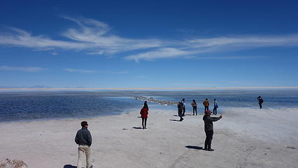
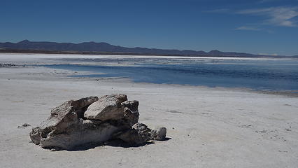
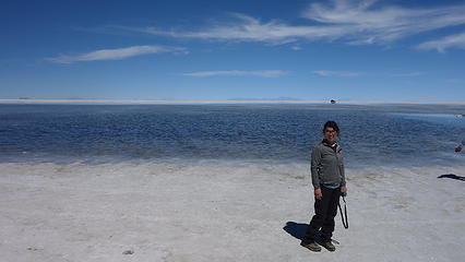
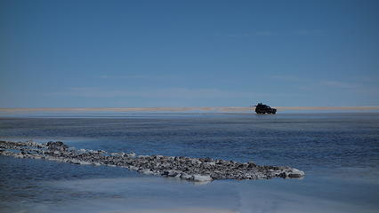
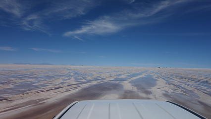
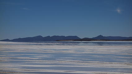
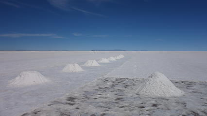
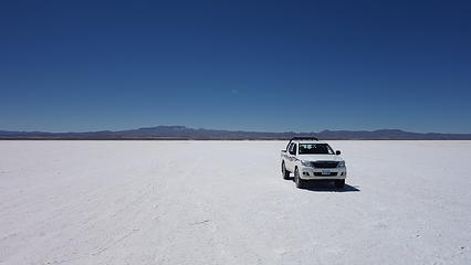
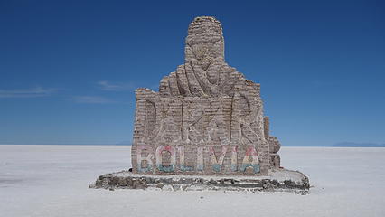
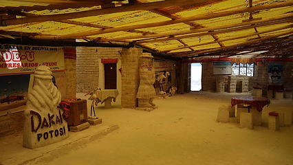
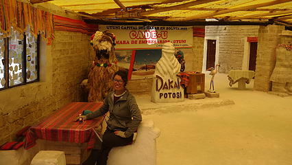
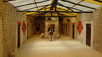
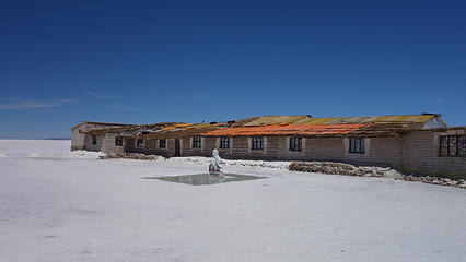
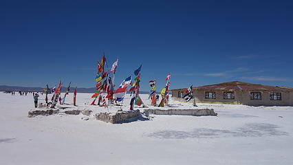
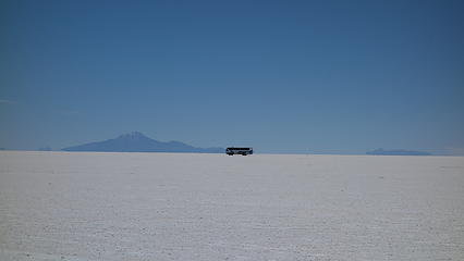
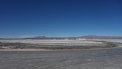
We arrived in Tupiza late in the evening, and managed to find a bed and breakfast type place for us to stay the night. We decided to continue to Uyuni the next day and once there (another 6+ hour bus ride) and rather than join an overpriced excursion to the salt flats we simply took a taxi from Uyuni to Colchani, a small town 15 minutes north where most parties access the salt flats from. We explored the nice museum at the edge of the salt flat which was actually very informative, and hitchhiked onto the salt flat catching a ride with a nice Russian couple who had a pickup. They took us as far as the salt hotel a few miles onto the flats where we could really experience the vastness of the landscape. The Uyuni salt flats are the largest in the world, over 4 times bigger than the Salt flats west of Salt Lake City. The landscape seemed to go on forever. We played around with some crazy perspective photos, but since water on the flats had only very recently dried up, the surface wasn't as flat as it could be. There were salt crystals making the salt surface very undulating.

The lighting for photography was also harsh, with the sun at midday high, the brightness was overwhelming and without sunglasses, snow blindness was certain. The temperatures were pleasant though since the elevation was so high (over 4000 meters).

Arriving at the Salt Flats
Still a little water on the edge of the salt flat
Elaine enjoying the sun
Cars are very easy to see
Hitchhiking in the back of the truck
Tijtin Mountains off to the SW
Miners pile the salt up and take it for various uses
The salt hotel
The salt hotel
World flags at the salt hotel
Busload of tourists likely miles away


We weren't successful getting a ride back out that afternoon, so we had to walk the entire way back to Colchani, and through town back to the main Highway 30 and wait for a bus heading back to Uyuni. Luckily, in speaking with a few of the locals they told us one would come by around 4:30. Amazingly we got back to our hostel with daylight to spare. The next day we continued north on the night train to Oruro, which was interesting, however very slow and fairly noisy. The beautiful views we had at sunrise the next morning though were incredible, as there were expansive swamps and ponds with thousands of pink flamingos flying all around. When we arrived in Oruro, we didn't stay in this grungy town more than a few hours and got on a late morning bus to La Paz, which we arrived in mid afternoon. As we got closer on the bus, the Cordillera Real came into view and our excitement began to grow. Since it had been nearly a week since we had climbed anything at this point we were itching to get back into the mountains.

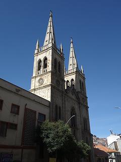
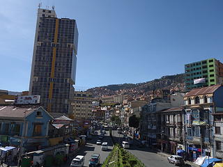
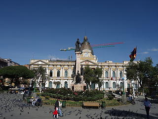
I will never forget first coming into La Paz though...we spent over 30 minutes driving through what I thought was La Paz, but was only the suburb of El Alto. Right when we reached the rim of the bowl where the main city of La Paz sits, and looking down, I realized just how expansive La Paz was, and was just blown away how many people live in such a high and challenging place. When I noticed one of the many gondolas around the city I was told they are one of the primary methods of public transportation in the city! I was amazed. We explored around the heart of La Paz starting from where the bus dropped us off at the Estacion Central on the NW portion of the bowl. It was suggested we go to Av Sagarnaga where we could find other climbers, agencies and good hostels. We decided to stay at a lovely, quiet hostal at the intersection of Av Sagarnaga and Av Illampu just a short walk away from anything we needed.

La Paz architecture
La Paz architecture
Bolivian Capitol Building


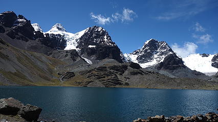
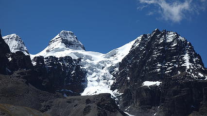
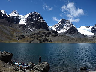
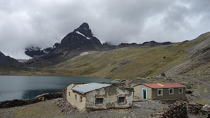
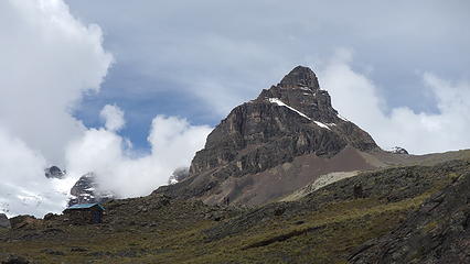
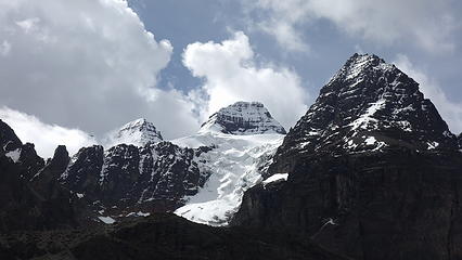
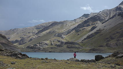
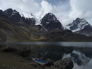
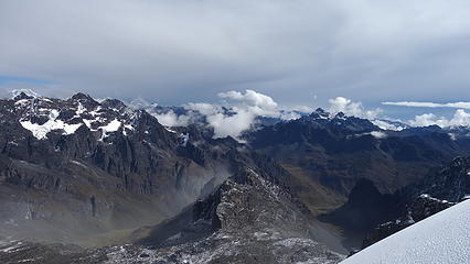
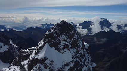
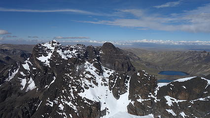
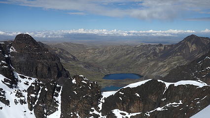
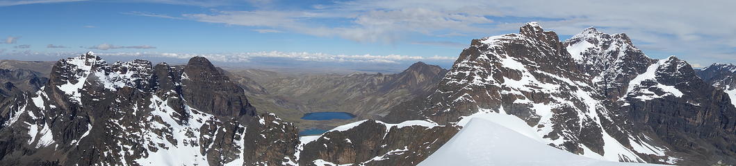
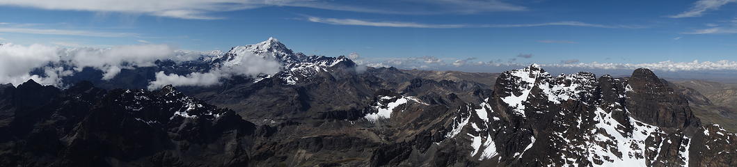
We checked around at a few different agencies inquiring about costs for just a ride to the trailhead for Pequenyo Alpamayo. To my surprise, prices varied considerably but after we started chatting with one agency, and getting some conditions reports from a couple of their guides, we decided to utilize their service since they were so helpful. We agreed to leave the next morning. It was amazing how long it took us to get out of La Paz (well over an hour to go a few miles), back on the Altiplano above the bowl, then another hour to get through El Alto. Traffic in La Paz is legendary, and there are no rules on the road! As we got closer to the mountains, the pavement ended and we continued up past the foothills, then into a beautiful valley filled with Alpaca, Llama, green grass, and blue tarns. Pequenyo Alpamayo itself sits in the group of peaks called the Condoriri, because when viewed from the Chiar Khota lake, and the Refugio Condoriri the peaks make a profile that looks like a flying condor. The hike to the lake only took an hour and a half, so we didn't bother hiring mules. At 4600 meters, the lake is a great place to acclimate, however since we had already been acclimating for nearly a month at this point, it was an easy walk to get there.

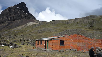
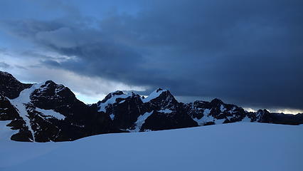
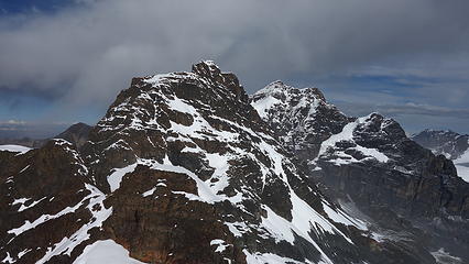
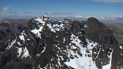
As we were climbing unguided and independently, we stayed in one of the small huts at the south end of the lake, which only cost a few dollars per night which we happily gave to the owners of the place. It wasn't much more than a couple rooms with hay bags for a soft place to sleep. We laid out the hay bags and threw our sleeping bags down upon arrival to the hut and chatted with another party who was headed to the refugio on the opposite end of the lake where the guides typically bring clients. The view from our little perch was gorgeous as the afternoon glow lit up the mountains above, which were still clad in snow and ice. Off to the right, there is a dark colored tower called Aguja Negra, which has decent adventurous rock climbing on it that the guides in La Paz told me about. It would have been awesome to try them out, but the weather wasn't too conducive for rock climbing.

Cabeza de Condor (The Head) poking through the clouds
Aguja Negra standing proud with our home by the lake
Hiking towards the glacier
Aguja Negra
Aguja Negra
Refugio Condoriri at the base of Aguja Negra
Lago Chiar Khota
Lago Chiar Khota
Head of the condor at center
Profile view of the condor from our hut


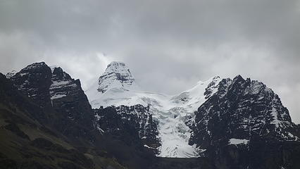
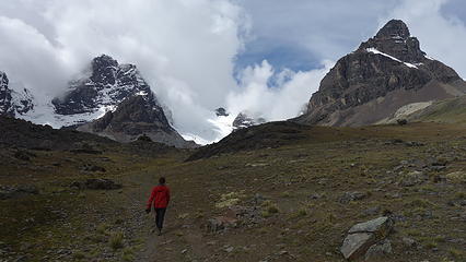
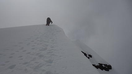
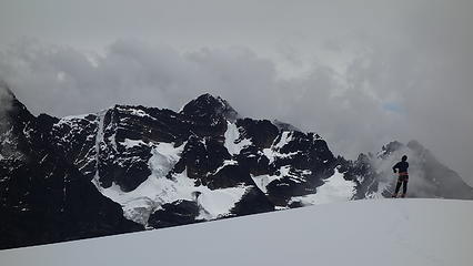
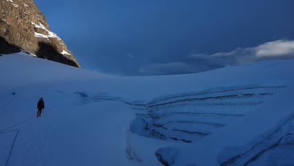
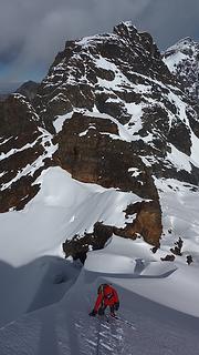
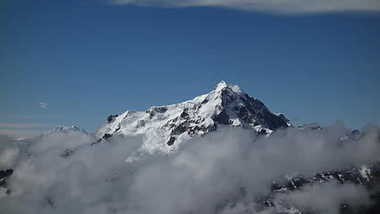
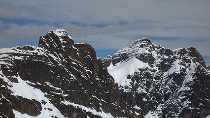
We got an early start, leaving our room well before twilight. We hiked back around to the north end of the lake and passed the refugio. We noticed headlights from the guided party nearly reaching the toe of the glacier about a mile ahead of us. We continued up the valley following a good trail, slowly catching up to them. When we reached the glacier, we donned out mountaineering boots, and left our approach shoes at the edge of the ice and took a good break to eat. It was still dark, however shortly after we got in a good rhythm on the glacier we started to see some twilight. We made an ascending traverse leftward up the glacier towards the saddle between the right wing of the condor, and the false summit of Pequenyo Alpamayo known as Tarija. Just as we reached this saddle, a fast moving snowstorm engulfed us into a whiteout, and we took shelter in a small snow cove shortly below the summit of Tarija. After waiting out the storm for 45 minutes, we heard the guided party on the upper ridge not far from us, so we decided to continue in hopes the storm would pass.

Working our way up the lower glacier
Nearing the saddle below Tarija with sunrise on the right wing
Ascending around a huge crevasse
Clouds rolling in fast as viewed from the saddle
Elaine ascending to the summit of Tarija as clouds engulf us


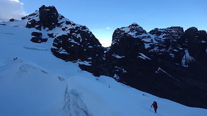
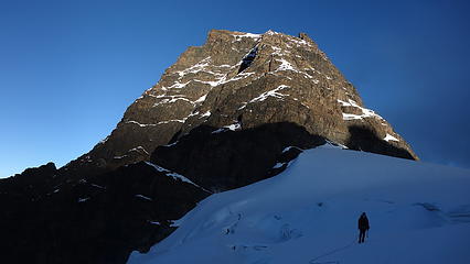
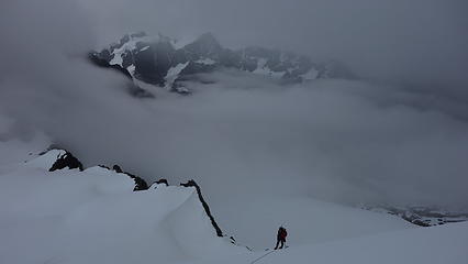
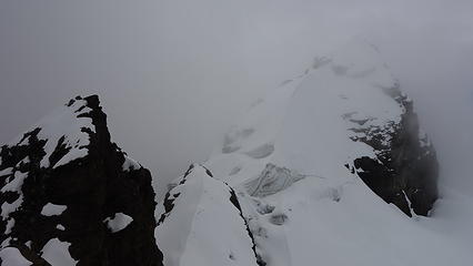
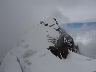
Just as we crested the summit of Tarija, and started descending the class 3 rock on the opposite side, the clouds began to part. We traversed the glacier clad ridge, weaving around large crevasses more or less following the footprints from the guided party just ahead of us. Once we reached the low point on the ridge between Tarija, we climbed a short 55 degree slope on the exposed ridge to a nice small flat perch 100 feet below the summit where we crossed paths with the guided group on their way down. The final little bit of the climb involved some steep class 4 rock covered in snow. When we reached the summit the weather had completely cleared!

Elaine climbing the 55 degree spot on the ridge
Head of the condor from the summit
View to the northeast from the summit
Huayna Potosi poking above the clouds
Lago Chiar Khota and Aguja Negra from summit
Panorama from the summit
Huayna Potosi
Huayna Potosi
Snow lingering on other peaks
Summit shot
Summit shot


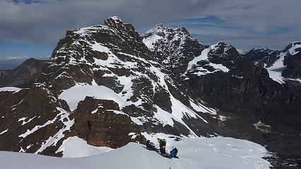
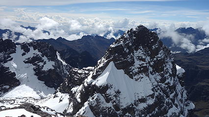
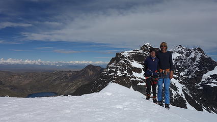
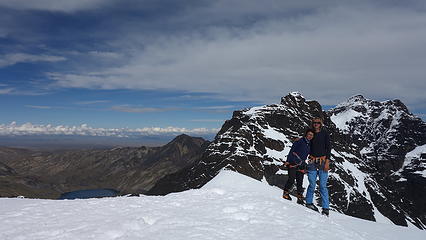
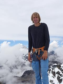
We enjoyed our first Cordillera Real summit and were so amazed how much the weather improved just as quickly as it turned earlier. On the descent, we were able to comfortable downclimb the class 4 snow covered rock just below the summit, and traversed safely back to Tarija, and had an uneventful descent back to the lake, where we were able to chat a bit more with the guided party. They were fairly amazed at our speed. Upon packing up and hiking back to the trailhead, where our pre-arranged ride will be there at 4pm to pick us up, we got back early and had to wait for 3 hours in the meadow! A group of Israelis joined us and was in need of a ride so we allowed them to join in with us, since we would have an entire van for just Elaine and I. Our first of three planned climbs we intended to do in Bolivia was a success, and we were excited already for the next one, where we were hoping to climb the French route on Huayna Potosi.

Downclimbing the ridge
Clouds rolling back in as we descend
Back at the lake
Back at the lake
Condoriri
Condoriri
Proudly powered by Weebly